Where are the best hiking trails near Denver? We’ve put together a list of 30 hikes all within about a 30-minute drive from the city center. These hikes offer a variety of landscapes, from the red rocks of South Valley Park, to the enormous cottonwood trees that line the Highline Canal, you can experience the broad vistas of the Flatirons, or the aspen-laden meadows near Evergreen. There are even a few trails that lead hikers above the city to gain views of the distant snowcapped Rocky Mountains or down to the city of Denver below. Explore this page for an overview. But there is more, as each hike has a detailed page with trail maps, driving directions, and photos.
-
Bear Creek Trail at Lair O The Bear
-
Bergen Peak Hike Near Evergreen
-
The Bluffs Loop
-
Castle Rock Trail
-
Chimney Gulch Trail at Windy Saddle
-
Clear Creek Trail in Golden
-
Deer Creek Canyon Loop Hike
-
East Plum Creek Trail
-
Elk Meadow Park – South Loop
-
Flatirons Vista
-
Glendale Farm Open Space
-
Highline Canal: County Line to Fly’n B Park
-
Incline Challenge Hill in Castle Rock
-
Lakes Loop Hike at Rocky Mountain Arsenal
-
Meadow and Forest Loops at Lookout Mountain
-
Meyer Ranch Open Space
-
Mt. Galbraith Loop Hike
-
North Table Mountain
-
O Fallon Park Hikes
-
Panorama Point
-
Red Rocks Trail at Red Rocks
-
South Valley Park Hikes
-
Trading Post Loop at Red Rocks
-
Waterton Canyon
-
Crown Hill Lake Trails
-
Daniels Park
-
Alderefer Three Sisters Park
-
Bear Canyon Loop
-
Bear Peak Hike
-
South Boulder Peak
-
Elk Range Trail at Centennial Cone
-
Enchanted Mesa
-
Evergreen Lake Trail
Distance: 1.6 Miles
Difficulty: Easy
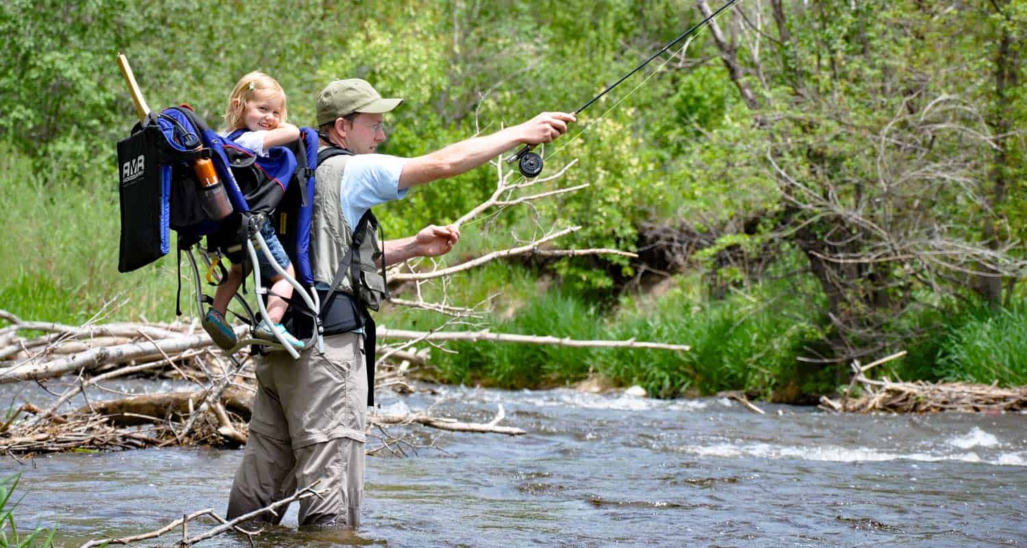
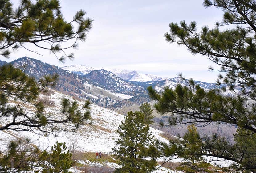
Let’s start with a family favorite. Lair O the Bear has the best name of any park near Denver. Our family has found it a quick escape from the city and a great place to have an afternoon picnic in the shade of the aspens along Bear Creek. The short drive up Bear Creek Canyon is beautiful. The trail runs alongside Bear Creek, so keep your eyes peeled for Ouzels, little birds also known as Dippers that dive under water to feed.
![]()
Distance: 9.2 Miles
Difficulty: Difficult
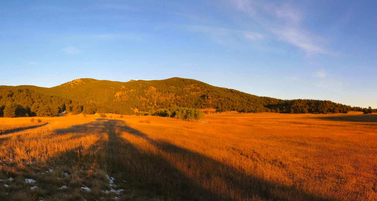
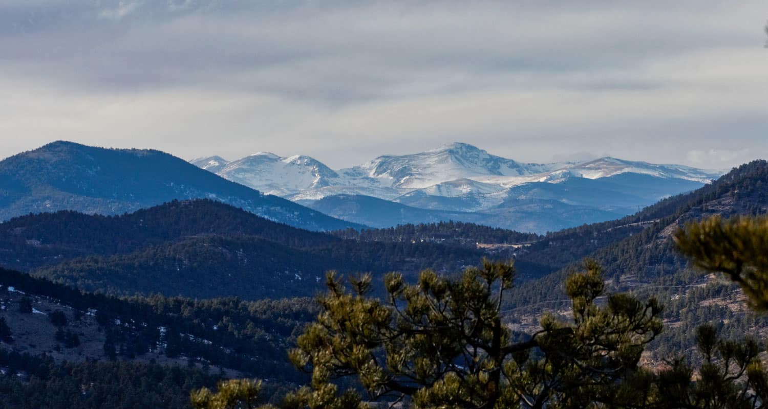
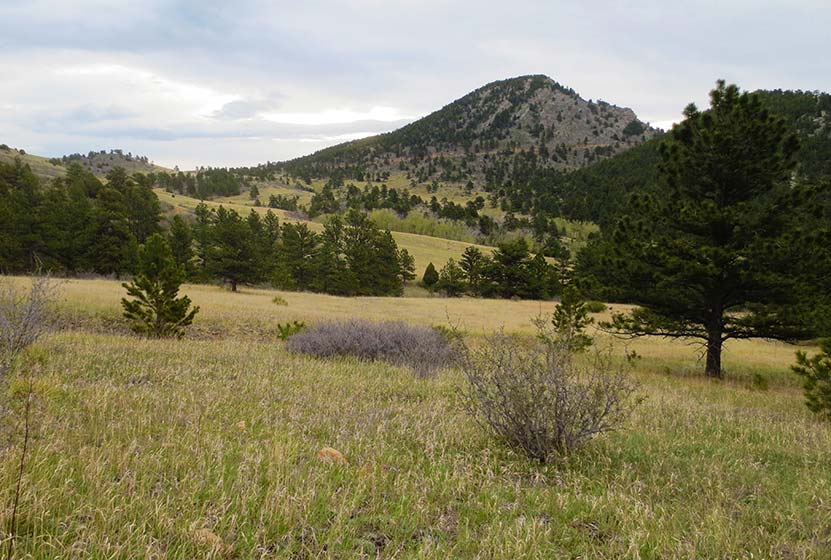
If you are looking for a challenging peak hike that’s just a 35 minute drive from downtown Denver, then Bergen Peak is a great option. Bergen Peak is situated in the western edge of Elk Meadows just outside of the quaint foothills town of Evergreen. It’s a great quick escape from the heat of summer and the summit offers great panoramic views of the meadows below and the mountains to the west. There are seasonal closures to dogs on the trail, so be sure to read all the details on the full trail profile page.
![]()
Distance: 2.7 Mile Loop
Difficulty: Easy
The Bluffs Regional Park is located in the town of Lone Tree on the South End of Denver. If you’re in town on business this hike is located just minutes from the Denver Tech center near Cabelas. Within a few hundred yards of trail you’ll begin to realize great views down into Denver and out to the Western foothills. It’s a broad dirt trail that eventually winds its way up to a broad mesa with incredible views of the Front Range Mountains. Look for meadowlarks feeding, especially in the late afternoon and early evenings.
![]()
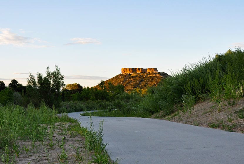
Distance: 1.4 Mile Loop
Difficulty: Easy to Moderate
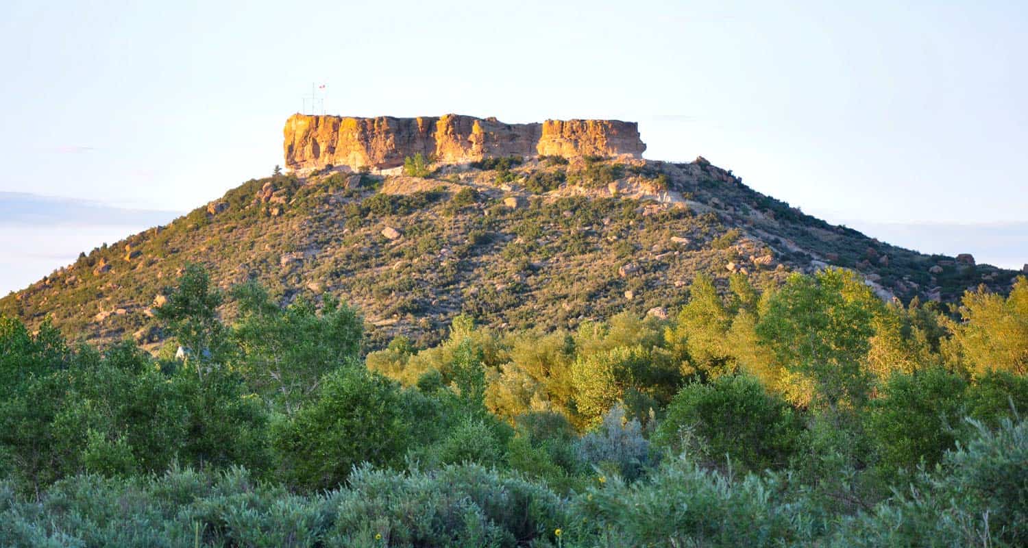
Located in downtown Castle Rock, about 30 minutes South of the city center, the Castle Rock Trail at Rock Park winds up to the base of the rock for which the town is named. Stop and study the conglomerate rocks embedded in this massive rock formation and take in the views to the West of town, out to Devils Head and the Front Range beyond it.
![]()
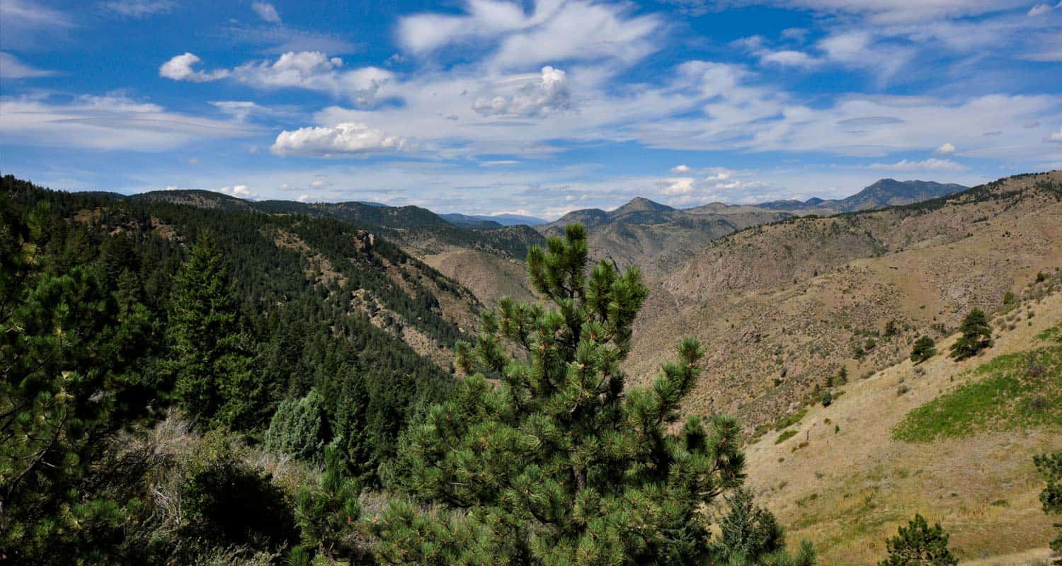
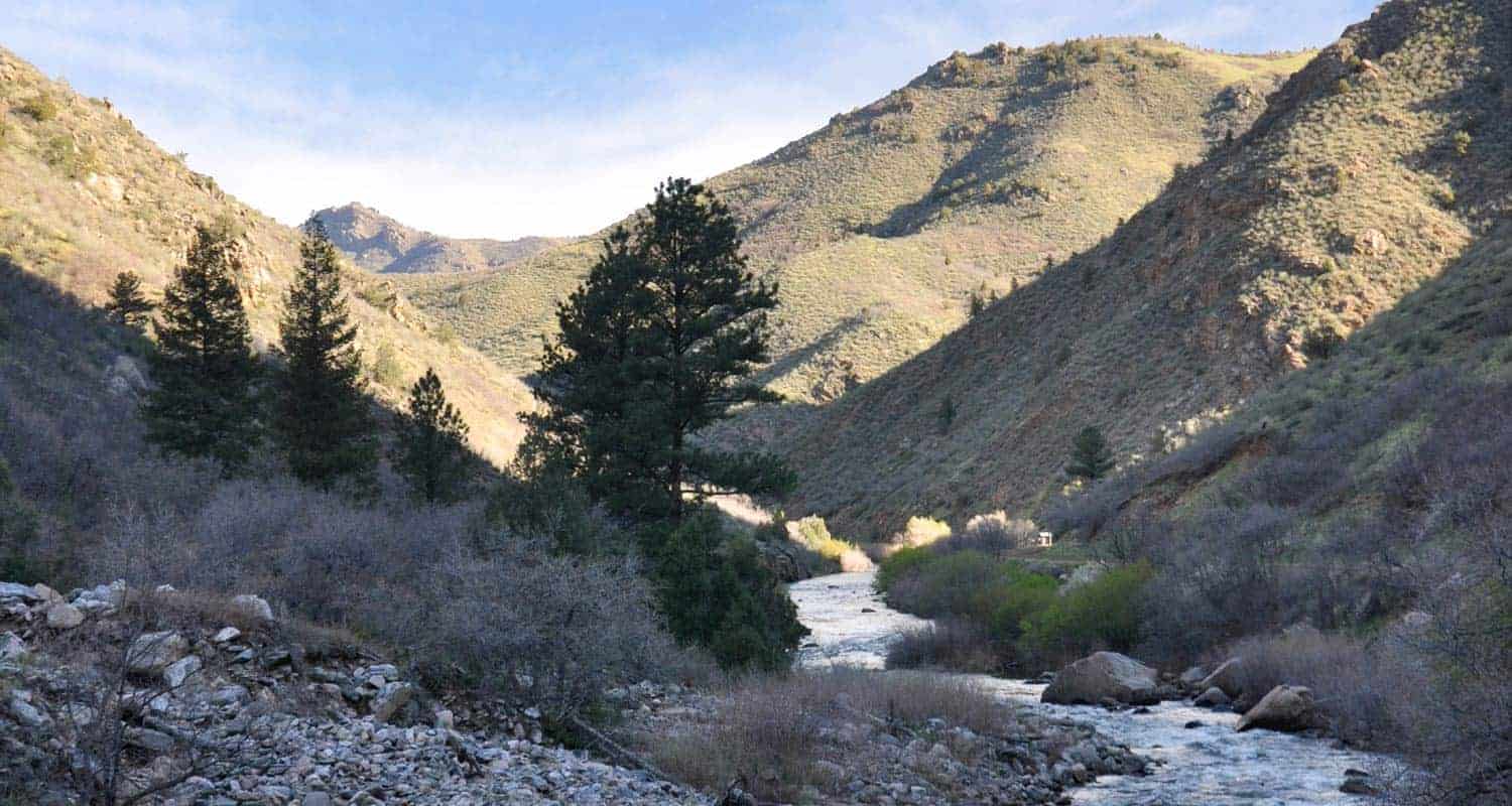
Distance: 5 Miles Round Trip
Difficulty: Moderate to Difficult
If you’re up for a real workout of a hike, then Chimney Gulch, located near the town of Golden, is just a 25 minute drive from downtown Denver. Watch paragliders launch from the top of Mt. Zion and catch the winds along the foothills.
![]()

Looking for more waterfalls near Denver? Explore our more than 50 Colorado Waterfall Hikes, our favorite Waterfall Hikes in Rocky Mountain National Park, or 7 Waterfalls within One Hour of Denver.
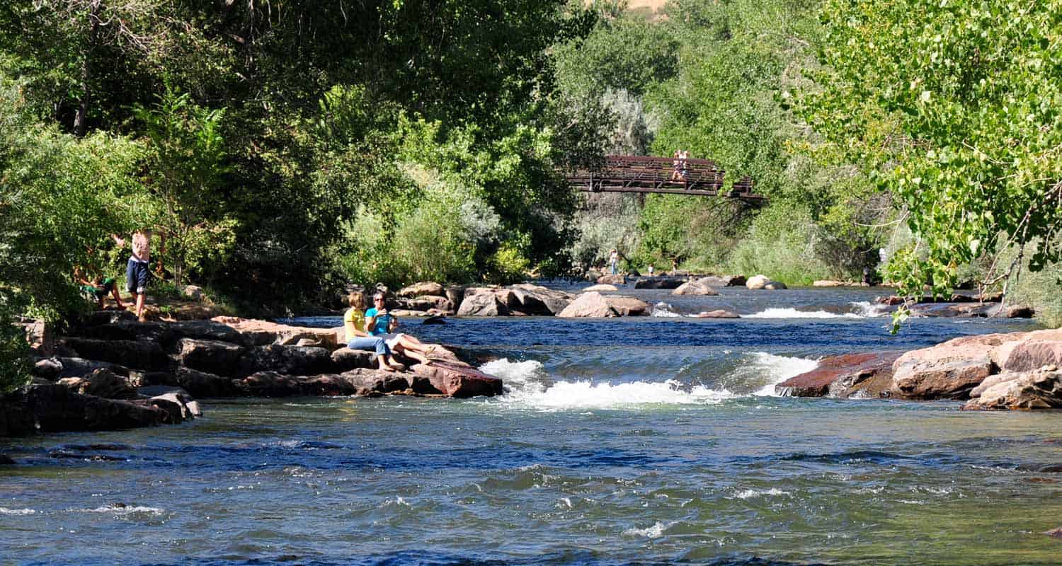
Distance: 1.8 Round Trip
Difficulty: Easy
The Clear Creek trail was a favorite with our young kids. The first segment, in downtown Golden, is paved, then turns to a dirt trail after going 470. The county has plans to keep expanding the trail into Clear Creek Canyon. You can soak your feet in the cool water of Clear Creek and watch kayakers run through the chutes. If you’re lucky, you might get a chance to witness swift water rescue trainings hosted here every year.
![]()
Distance: 2.7 Miles
Difficulty: Easy
Deer Creek Canyon is tucked away in the foothills just south of Ken Caryl in Littleton. Combine the Meadowlark and Plymouth trails to form a short loop hike. If you live in the suburbs south of Denver, this loop is a great place to walk the dog after work.
![]()
Distance: 6 Miles
Difficulty: Easy
The Plum Creek trail winds alongside its namesake for 6 miles through the town of Castle Rock. Our family will often pick up the Plum Creek trail from the small trailhead along Meadows Parkway for an after work and school stroll or bike ride. The trail acts as artery connecting the East and West sides of the town. Tall cottonwoods and lone pines stretch above the meadows surrounding the creek.
![]()
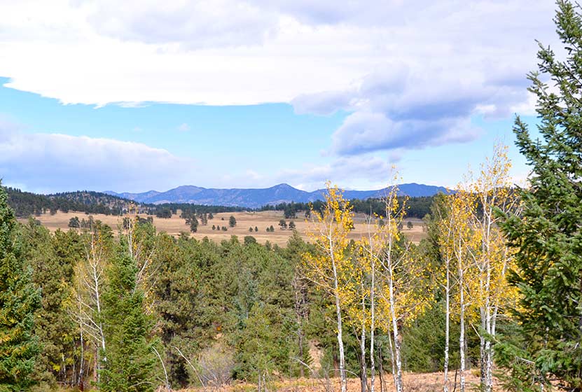
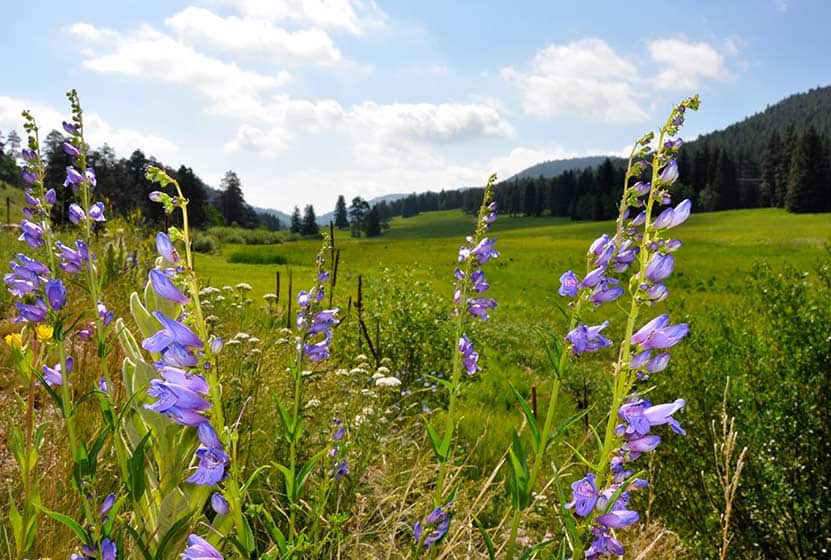
Distance: 2.6 Mile Loop
Difficulty: Easy
Just outside the town of Evergreen are miles of meadows situated at the base of Bergen Peak. Elk Meadows is aptly named, so scan the fields from time to time to see if you can spot grazing elk. A great hike to see the changing colors and one of our favorite dog friendly hikes near Denver.
![]()
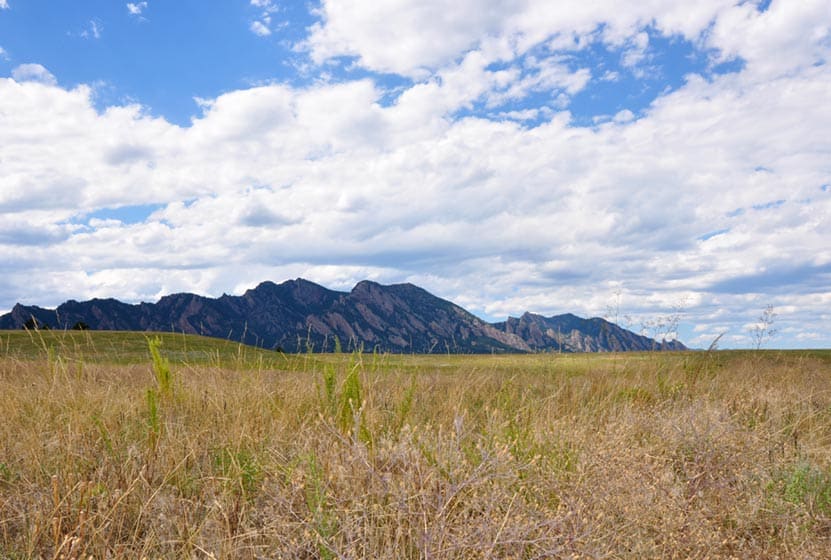
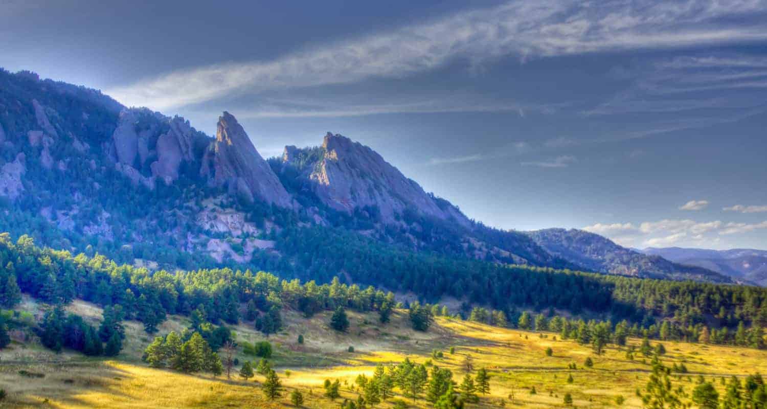
Distance: 1.9 to 3.3 Miles
Difficulty: Easy
If you’re looking for Wide Open Spaces, then you’ll find them at Flatirons Vista just south of Boulder. The views of the distant Flatirons formation that rises from these meadows is breathtaking. We profile just a couple of the many trail options that make their way out from the Flatirons Vista Trailhead. There is a trailhead parking fee and absolutely no shade–so don’t forget the sunscreen.
![]()
Distance: 1.6 Mile Loop
Difficulty: Easy
One of our top dog-friendly hikes because it’s not far off the interstate, it’s short, and has a 17-acre off-leash dog area next door. Take in views of Devils Head in the west, Longs Peak in the north, and Pikes Peak to the south.
![]()
Distance: 3.7 Round Trip
Difficulty: Easy
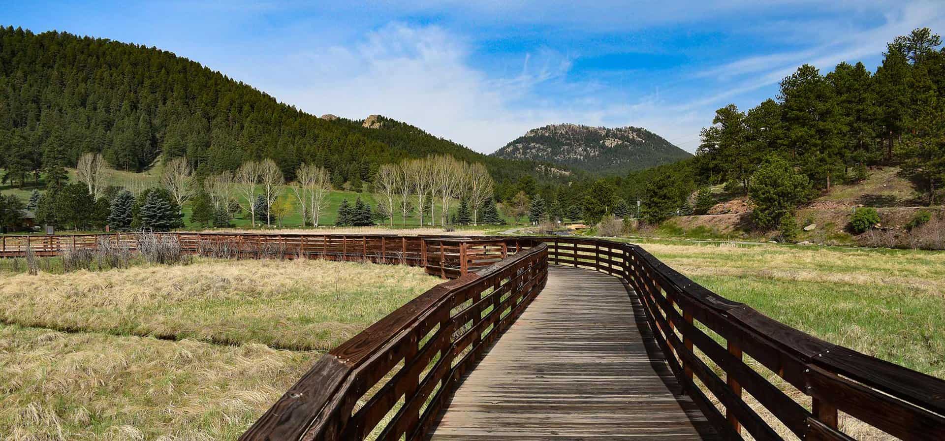
The Highline Canal Trail winds 66 miles through Denver and out of town both to the south and the north, providing a riparian zone right through the heart of the city. This segment of the Highline is located in the Highlands Ranch area and can be accessed from a trailhead along County Line Road. Traveling just under two miles southwest leads to a the historic Fly’n B Park, an old refurbished homestead complete with fishing pond and picnic shelter.
![]()
Get our Dayhikes Near Denver Hiking Guide. It includes our favorite hikes near Denver, packing lists, hiking food and snack ideas, and tips for hiking the Front Range of Colorado.
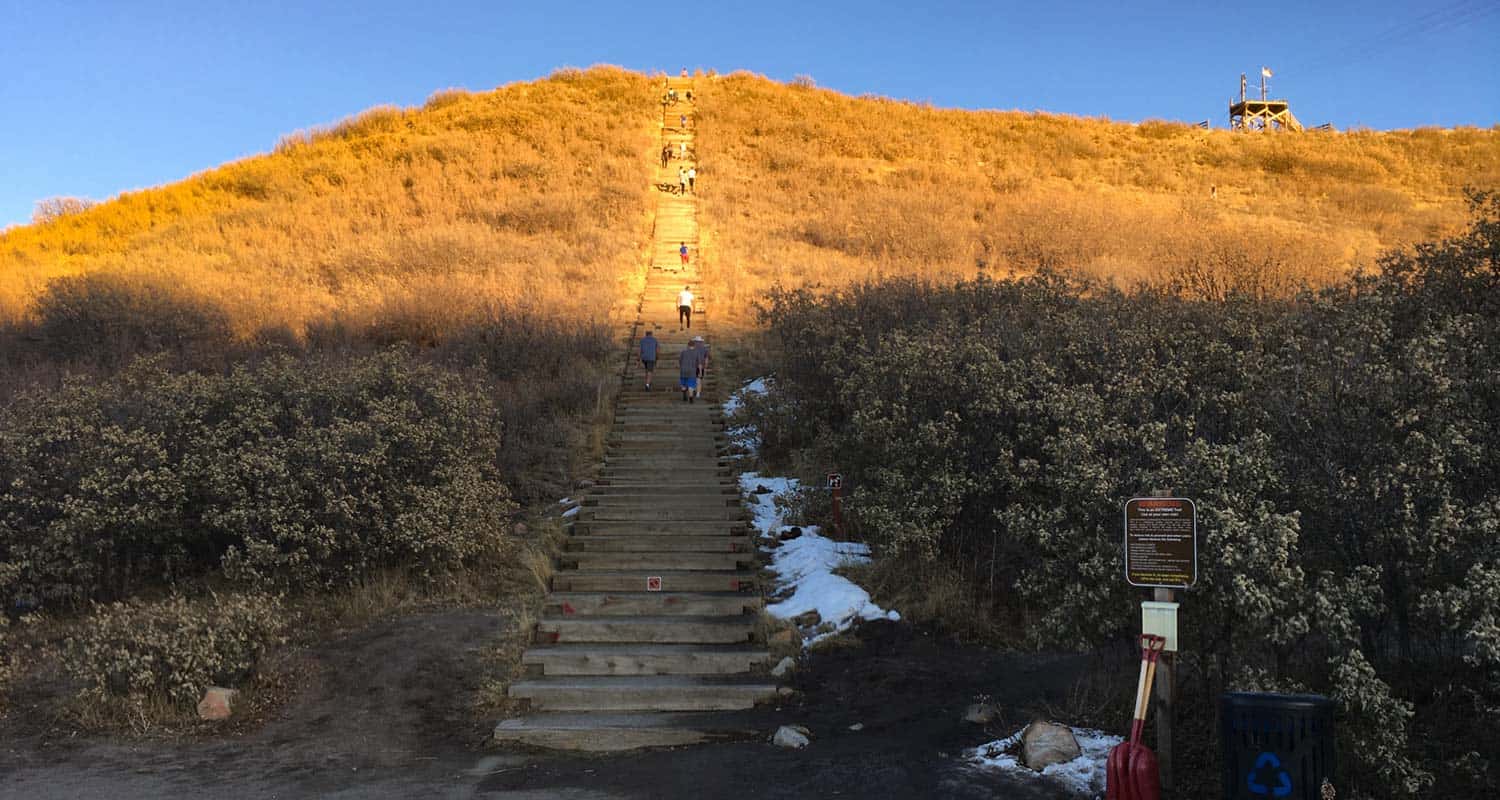
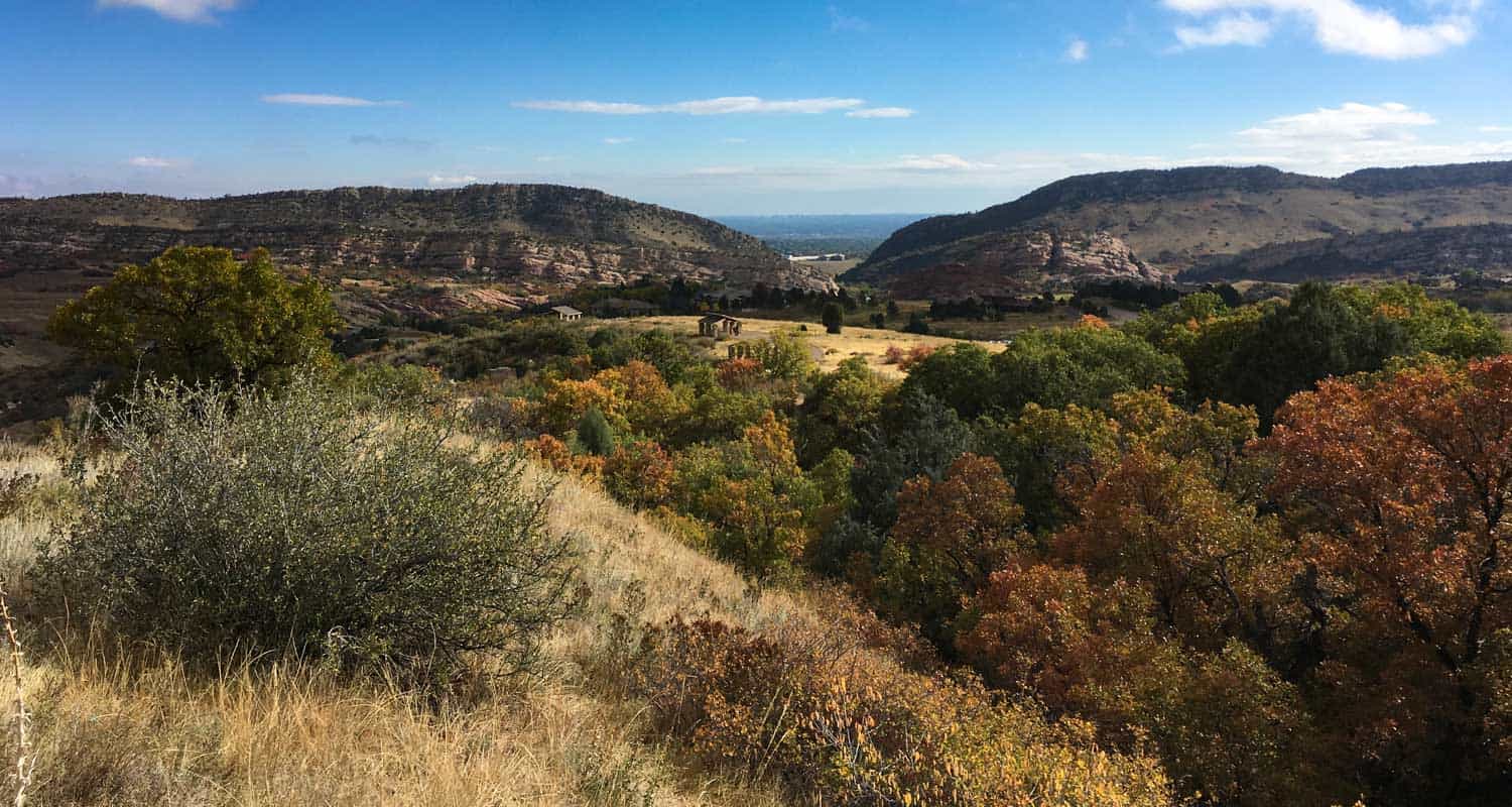
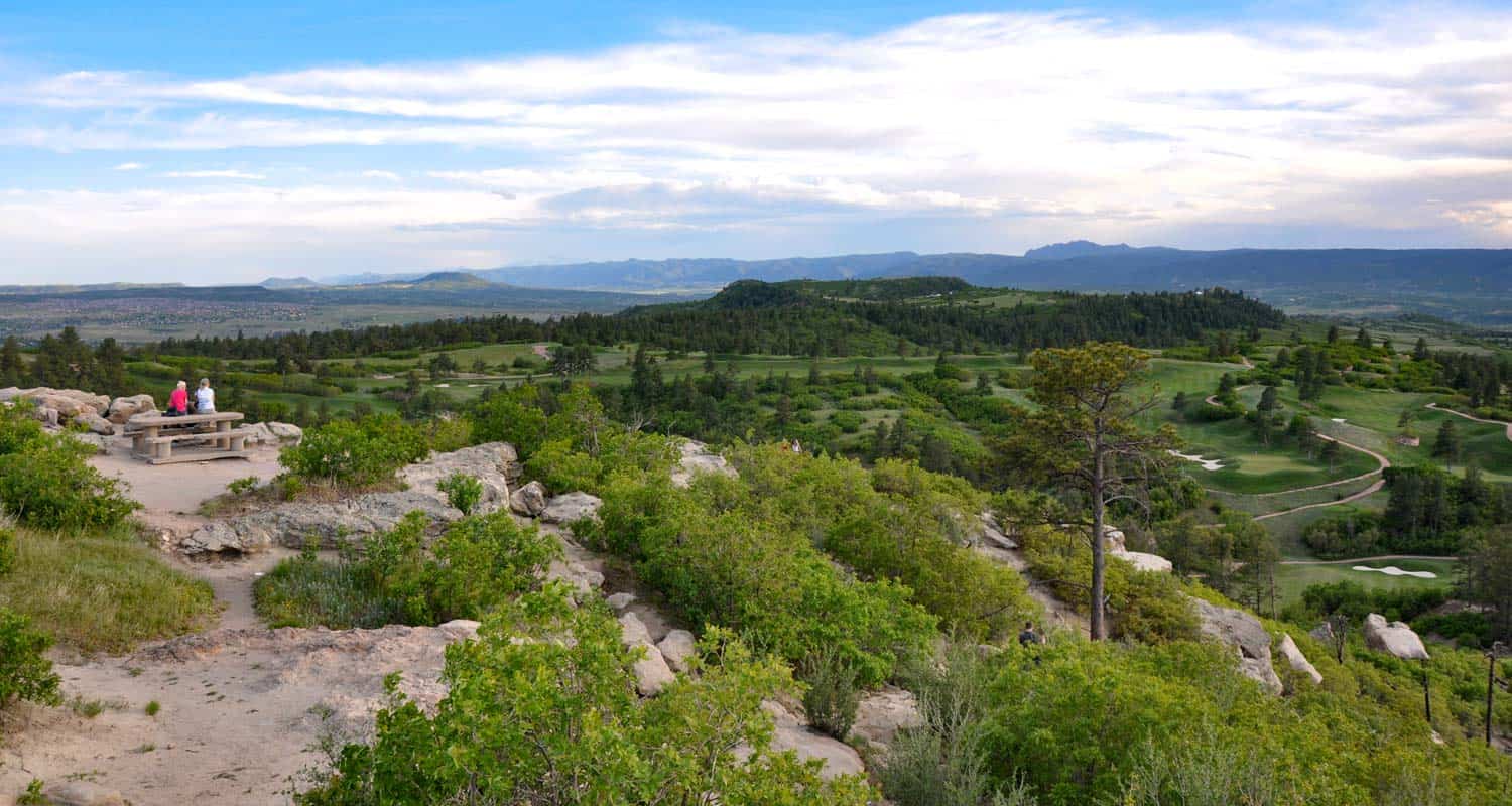
Distance: 0.6 Mile Loop
Difficulty: Moderate
Just off of insterstate 25 in the Town of Castle Rock, you’ll find the Challenge Hill loop, part of the Phillip S Miller park. Inspired by the Manitou Incline, the town built over 200 steps up the side of a bluff with railroad ties. Hike to the top and trail run to the bottom, making as many curcuits as you want to fill your workout.
![]()
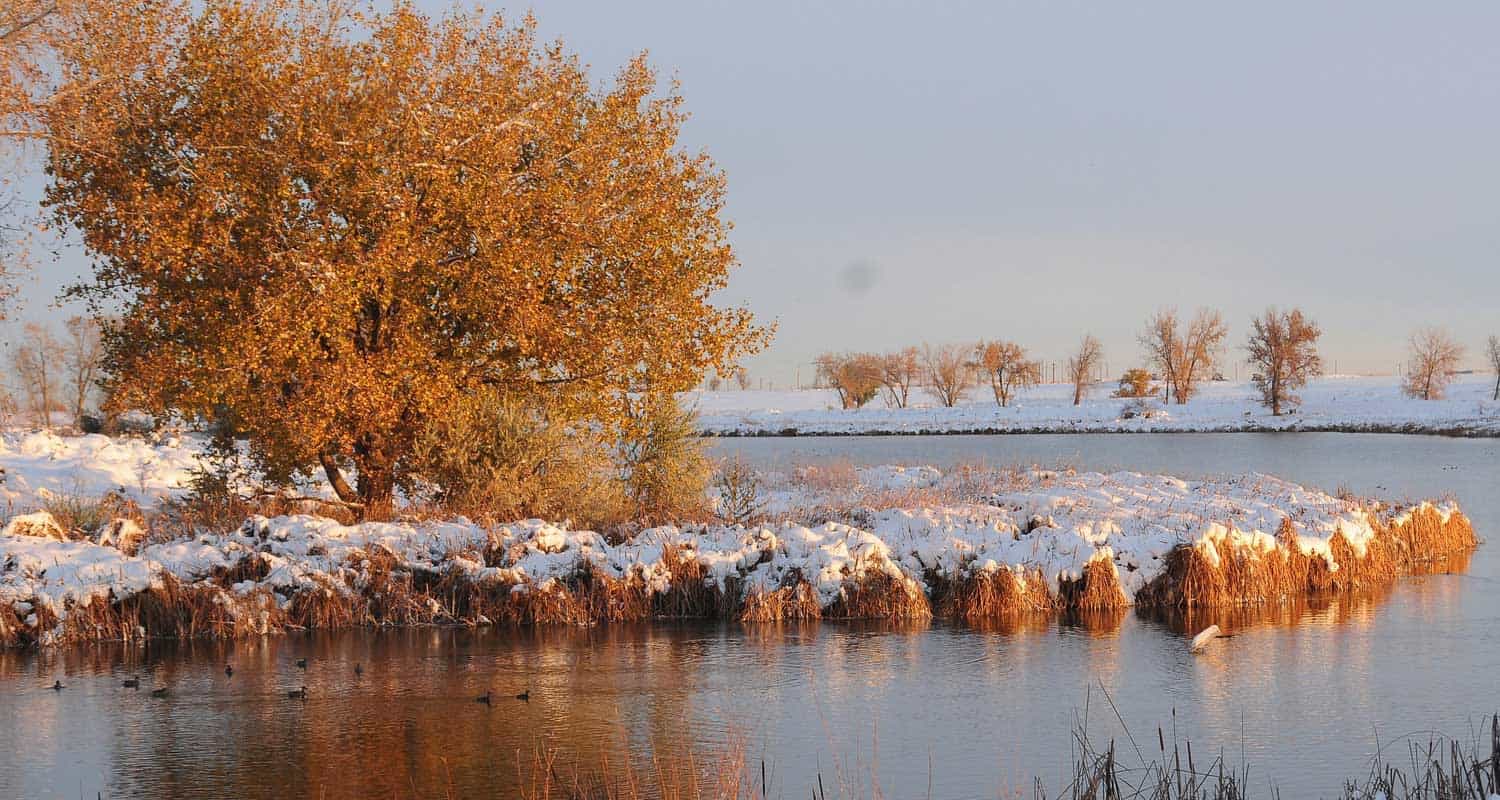
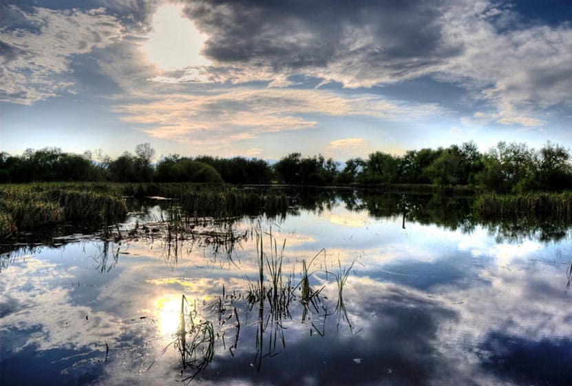
Distance: 1.8 Mile Loop
Difficulty: Easy
The Rocky Mountain Arsenal is a 15,000 acre wildlife refuge located just 30 minutes northeast of Denver. This 1.8 mile loop trail takes you along the shoreline of Lake Ladora and Lake Mary on the southern end of the park. Go early in the morning for your best chances to view wildlife.
![]()
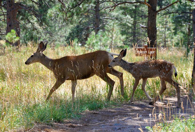
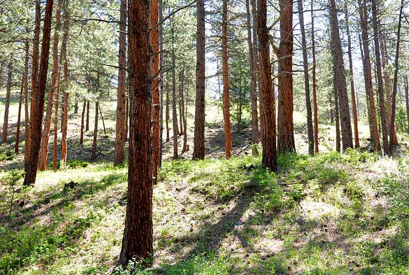
Distance: 0.6 and 0.8 Mile
Difficulty: Easy
These are our favorite hikes for kids near Denver. Abert’s Squirrels romp through the trees and deer graze in the shade of tall ponderosa pines in this idyllic spot atop Lookout Mountain in the foothills above Golden, Colorado. It’s about a 25-minute drive to the trailhead. The nature center is one of the best in the Jefferson County parks system.
![]()
Distance: 2.4 to 4.8 Miles
Difficulty: Easy & Moderate
At Meyer Ranch open space you’ll find a loop trail and an out-and-back options that take your across meadows and lodgepole and ponderosa forest. Explore our three trail profiles to pick the hike or hikes that best fit your plans.
![]()
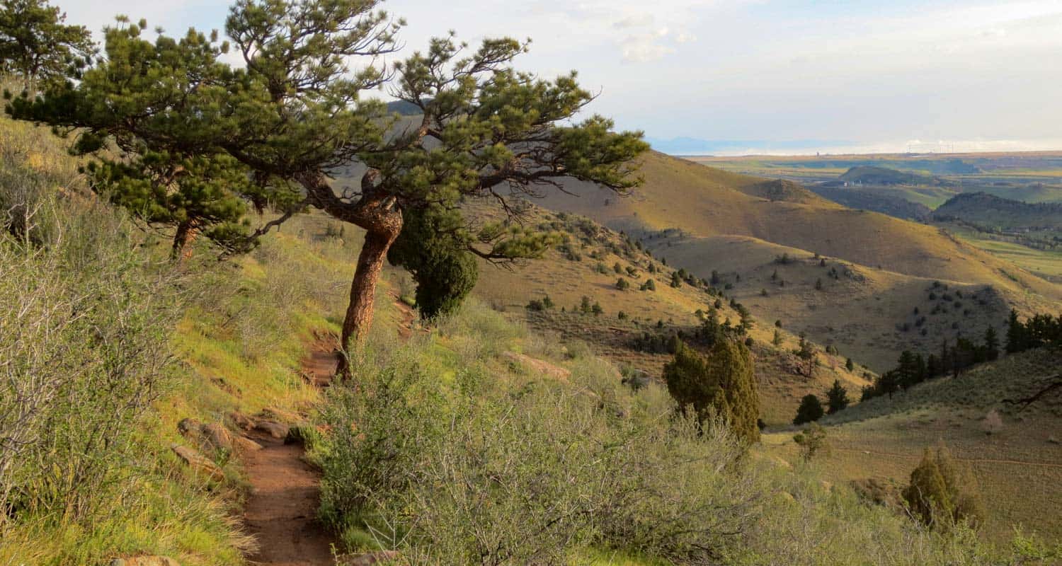
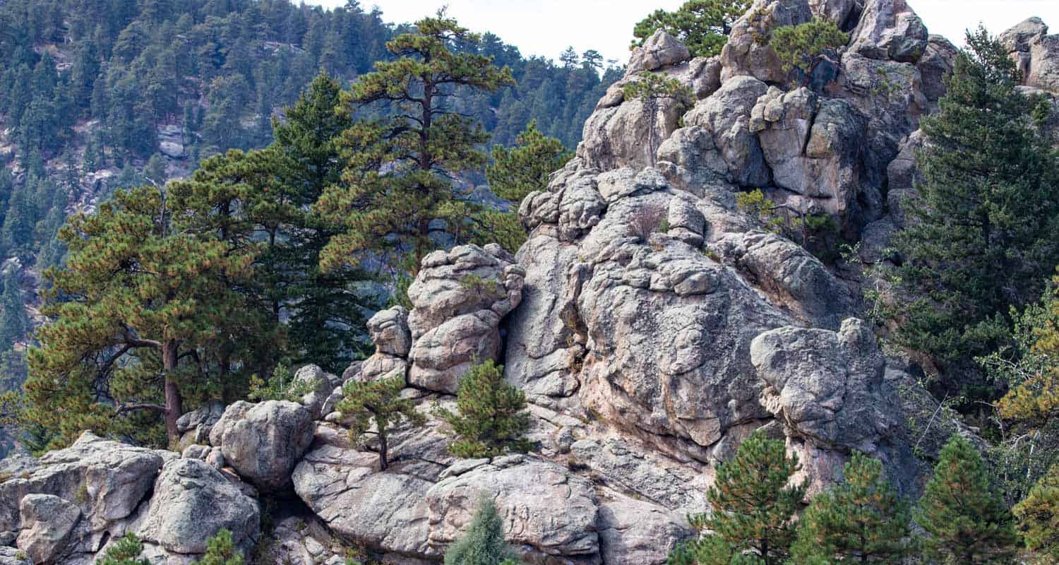
Distance: 4.9 Mile Loop
Difficulty: Moderate
A couple years back Mt. Galbraith was a hidden gym, but because of its proximity to Denver, it’s gained in popularity. We recommend that you go in the early morning or during the weekdays. Mt. Galbraith offers great views down into Golden and Denver. On the back side of the loop, you can gain views to the west down into Clear Creek Canyon.
![]()
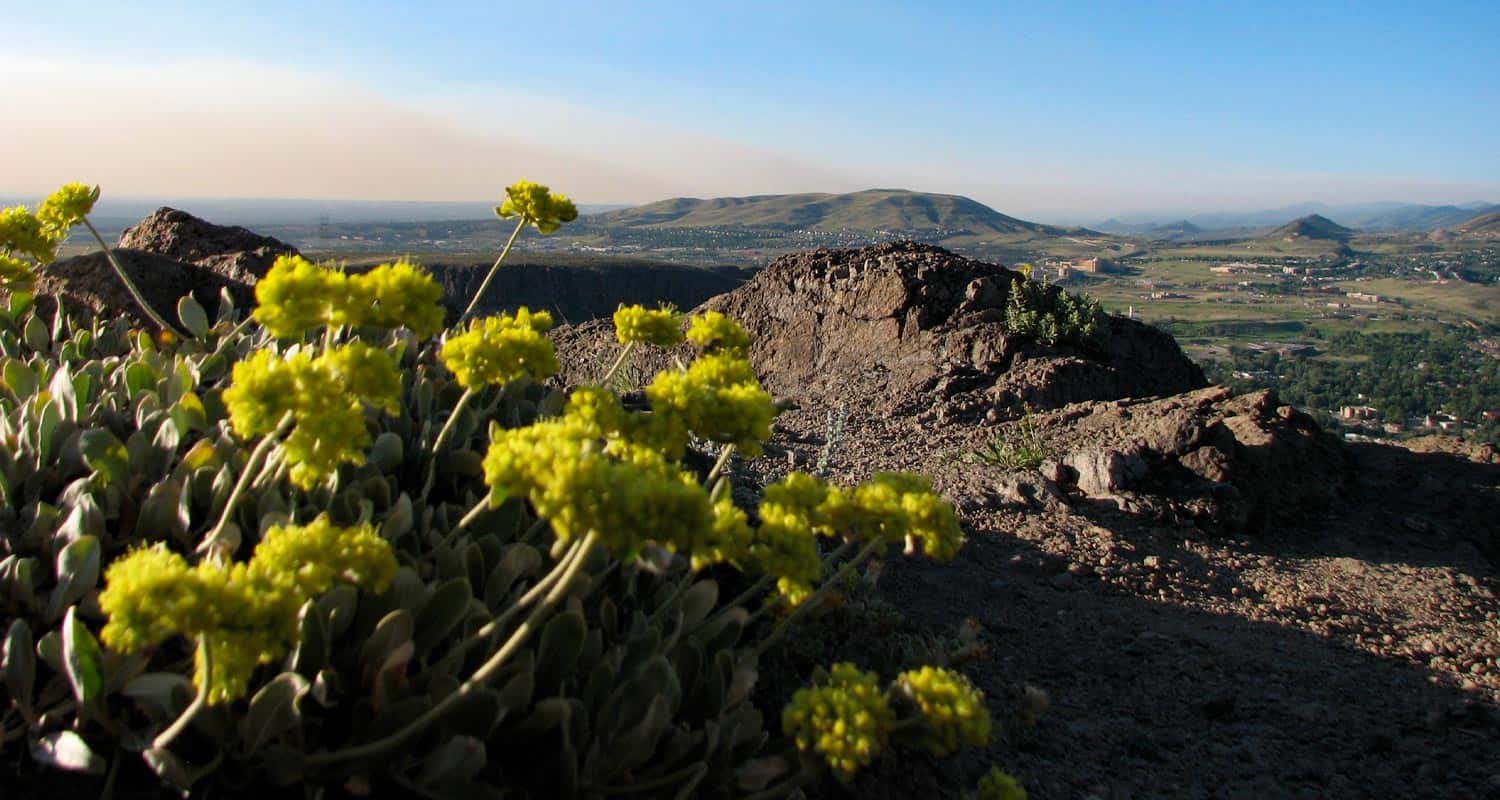
Distance: 2.7 to 7.7 miles
Difficulty: Moderate
I love the initial hike up the north side of North Table Mountain. It’s an old access road, like a giant ramp built into the mountainside. When you gain the top of this massive butte (we call buttes “mountains” for some reason in Colorado), you’ll see a broad tableland of windswept grasses and have access to a whole host of trail options. Explore the full trail profile for several loop hikes options on North Table Mountain.
![]()
Distance: 1.3 to 7 Miles
Difficulty: Easy to Moderate
O’Fallon Park offers three different loop trails and a longer out-and-back option on the Bear Creek Trail. Our favorite is the meadow view loop where, at the top you can take in the distant snowcapped peaks in the West.
![]()
Distance: 2.7 Mile Out-and-Back
Difficulty: Moderate
Panorama Point may be the quickest drive and hike to gain these kind of views of the Front Range. Mt. Falcon probably gives it a run for it’s money, but it definitely lives up to its name. We recommend beginning at the West lot for a shorter hike to the point.
![]()
Distance: 6-Miles+ Out-and-Back
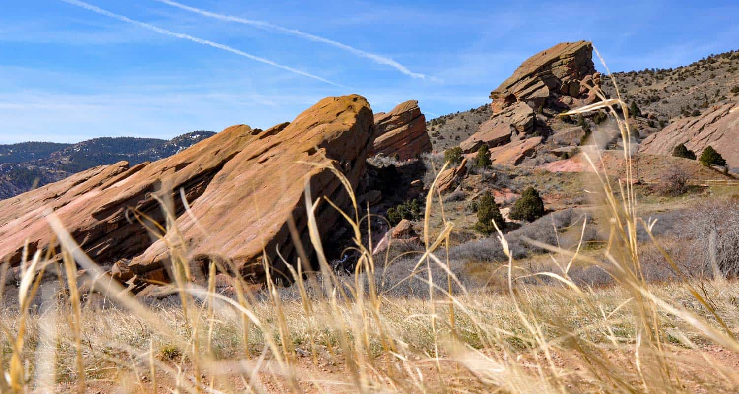
Difficulty: Easy
A classic hike right in the heart of historic Red Rocks Park in Morrison Colorado. The Red Rocks trail takes you through the meadows surrounding the giant monoliths that make this park famous. Be sure to tour the Red Rocks Amphitheater during your visit and climb the steps to the top for views down into the City of Denver.
![]()
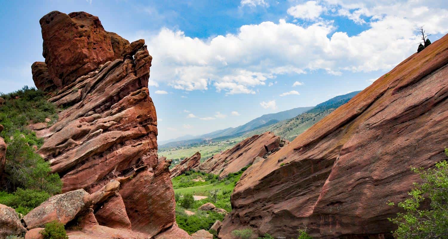
Distance: 0.5 mile to 3 miles
Difficulty: Easy
This may be my favorite spot to hike that’s close to Denver. It’s as if someone secreted away a bunch of red rock formations in a meadow behind the hogbacks–those angled foothills you see when you drive along the southwestern curcuit of 470. It’s quiet enough to hear an acorn fall from the scrub oaks along the trail. And winter snows create a beautiful contrast of orange and pink on white./p>
![]()
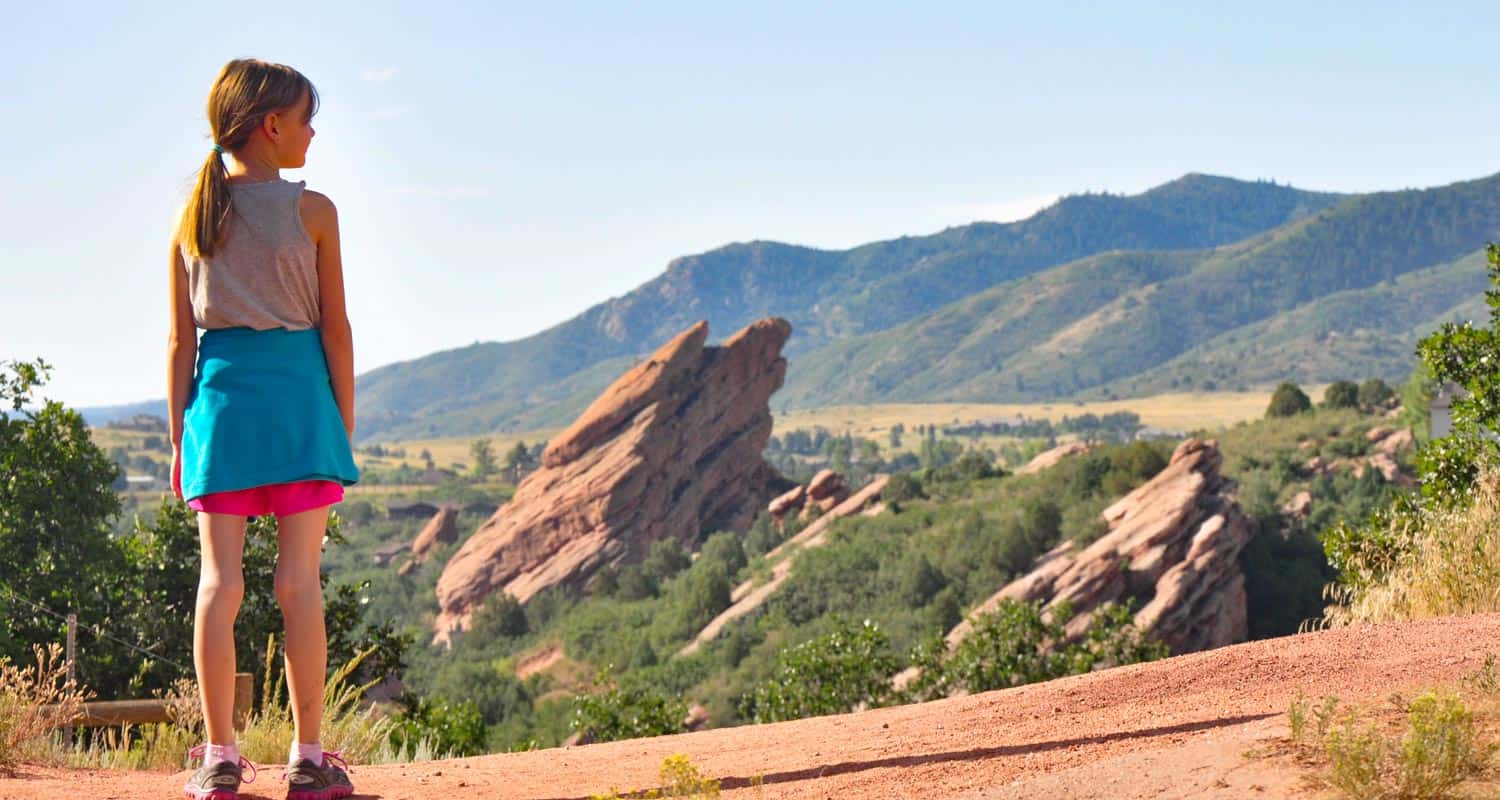
Distance: 1/2-Mile Round Trip
Difficulty: Easy
The Trading Post Trail is our go-to hike near Denver! It’s the perfect hike for visiting friends and family because it’s relatively easy and short. No snowcapped peaks here, but your surrounded by towering red rock. If you have limited time in Denver, this is your best option. The Trading Post trail also makes for a great early morning hike before the trails get busy and the sun heats things up.
![]()
Distance: Up to 12.4 Miles
Difficulty: Easy to Moderate
If you’re looking for a breathtaking hike with abundant wildlife sightings, look no further than Waterton Canyon in Colorado. This scenic canyon is home to a diverse array of animals, including the majestic Bighorn Sheep, which we’ve encountered on every hike we’ve taken in the area. To preserve the natural habitat of these animals, pets are prohibited in the canyon.
In addition to the Bighorn Sheep, you can also spot Golden Eagles soaring high above the orange canyon walls, and trout feeding in the currents of the South Platte river. Whether you’re an avid bird-watcher or just love immersing yourself in nature, Waterton Canyon is sure to impress.
The canyon is also a favorite destination for mountain bikers and hikers alike. With a variety of trails to choose from, there’s something for everyone. And if you’re looking for a picturesque spot for an evening picnic, Waterton Canyon is the perfect place to spread out a blanket and enjoy the stunning views.
![]()
Distance: 1.2 to 2 Miles
Difficulty: Easy
Looking for a peaceful getaway in the heart of Denver? Look no further than Crown Hill Lake Park in Jefferson County. This stunning park boasts breathtaking views of the Front Range mountains, including the famous Flatirons in Boulder. With three miles of paved trails, including 0.7 miles that are ADA accessible, Crown Hill Lake Park is the perfect place for a relaxing walk or jog. Nature lovers will delight in the park’s northwest side, which features a wildlife sanctuary for migratory birds. Whether you’re a bird-watcher or just looking to escape the hustle and bustle of city life, Crown Hill Lake Park is sure to impress.
![]()
Distance: .5 to 5.4 Miles
Difficulty: Easy
Daniels Park offers perhaps the best sunsets near Denver. If you’re looking for the best sunset views in Denver, head to Daniels Park. This stunning park offers sweeping vistas of Colorado’s Front Range, with mountains upon mountains stretching as far as the eye can see. To make the most of your visit, we recommend packing a picnic dinner and pulling off at one of the many picnic areas along Daniels Park Road. There’s no better way to enjoy the sunset than with good food and great company.
![]()
Distance: 15 Trails: .2 to 10+ Miles
Difficulty: Easy to Moderate
Alderfer Three Sisters Park is a hiker’s dream with stunning views and over 15 miles of hiking trails. The 6.4-mile Three Sisters Trail is a challenging loop that takes you through forests and over rocky terrain. If you’re looking for something shorter, the 4.8-mile Evergreen Mountain Trail is an excellent option. Both trails offer beautiful views of the surrounding mountains and are sure to satisfy your adventurous spirit.
![]()
Distance: 3.5 Miles
Difficulty: Easy
The Bear Canyon Loop Hike in NCAR (National Center for Atmospheric Research) is a 3.3-mile trail takes you through a beautiful canyon filled with wildflowers, towering trees, and stunning views of the surrounding mountains.
The hike begins at the NCAR parking lot and takes you along the Mesa Trail before descending into the Bear Canyon. From there, you’ll traverse a gentle incline before ascending a set of steep switchbacks. As you make your way back up, you’ll be rewarded with breathtaking views of the Flatirons and the city of Boulder.
![]()
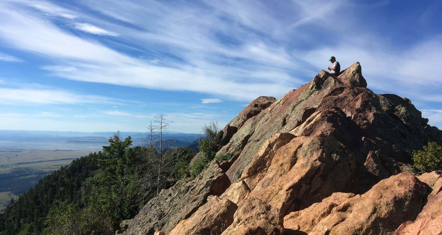
Distance: 7.4 Miles
Difficulty: Difficult
The Bear Peak Hike near Boulder, Colorado is a challenging 7.4-mile trail that rewards hikers with stunning views of the Rocky Mountains. The trail begins at the South Mesa Trailhead and climbs steadily through meadows and forests before reaching the summit of Bear Peak. From the top, hikers can take in panoramic views of the Front Range and the city of Boulder. This hike is considered difficult due to its steep incline and rocky terrain, making it best suited for experienced hikers. However, the stunning views and sense of accomplishment make the effort well worth it.
![]()
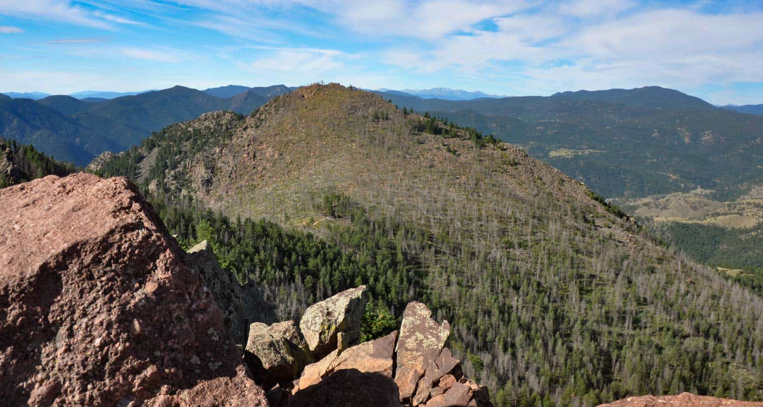
Distance: 7.4 Miles
Difficulty: Difficult
The South Boulder Peak Hike near Boulder, Colorado is a challenging 7.4-mile hike (round trip) that offers hikers stunning panoramic views of the Front Range. The hike begins at the South Boulder Trailhead and climbs steadily through rocky terrain and mountain forests before reaching the summit of South Boulder Peak. From the top, hikers can take in breathtaking views of the Indian Peaks Wilderness, the Flatirons, and the Continental Divide. This hike is best suited for experienced hikers due to its steep incline and rocky terrain.
![]()
Distance: 6.6 Miles
Difficulty: Easy
The Elk Range Trail at Centennial Cone offers a captivating outdoor experience in the Colorado foothills about 35 minutes outside of Denver. This trail is perfect for hikers, bikers, and birdwatchers. Winding through picturesque forests, meadows, and rocky terrain, the hike provides breathtaking views. Keep an eye out for elk, deer, and other wildlife that call this area home. I’ve found this to be a less populated hike, especially on the weekdays. Whether you hike or bike, the well-maintained path and clear signage make it accessible for all skill levels.
![]()
Distance: 1.8 to 2 Miles Miles
Difficulty: Easy
Beginning at the Chautauqua Park, the trail takes hikers on a gradual ascent through a forested area, where they can immerse themselves in the tranquility of towering trees and the melodic sounds of nature. Along the way, you’ll get glimpses of the majestic Flatirons rock formations. I enjoy this trail for two reasons: It’s a lesiurely hike, and it gives you additional options if you want to wander in the woods. This is because the Enchanted Mesa Trail intersects with other popular trails, such as the McClintock Trail and the Baseline Trail, allowing for extended exploration and the opportunity to tailor the hike your liking.
![]()
Distance: 1.3 Miles
Difficulty: Easy
Looking for a super-easy hike in a quaint mountain town near Denver? If that’s your order, then this 1.3-mile loop around Evergreen Lake is perfect and picturesque. Make a short day of it visiting shop, having lunch, or grabbing a coffee downtown. Elk often graze near the lake. And in the winter, the lake freezes over and makes a perfect place to ice skate.
![]()