The hike up Bergen Peak follows a challenging 4.6 mile trail in the Elk Meadows near Evergreen, Colorado. With both loop hike and out-and-back options, you’ll take in views from Bergen’s summit of the surrounding Colorado foothills, western mountains, and eastern plains. This makes a great adventure in the Fall to take in the changing colors of the aspen trees. Explore the full trail profile below for the trail map, driving directions to the trailhead, and more details you’ll want to know before hitting the trail.
Trail Snapshot: Bergen Peak Hike
| Hike Distance | 9.2 miles Round Trip |
|---|---|
| Difficulty | Difficult |
| Duration | Approx 4-5 |
| Trail Type | Out-and-Back |
| Starting Elevation | 7600′ |
| Elevation Gain | Approx +2100′ |
| Seasons | Best Spring to Fall |
| Dogs | Allowed On Leash; Prohibited during Seasonal Closures |
| Hike Trail Map | Map of Bergen Peak Trail |
| Denver Drive Time | 35 min |
| Driving Directions to Bergen Peak, Stagecoach Trailhead | Click for Google Map |
| Town Nearest Hike | Evergreen, Colorado |
| Beauty | Aspen trees, Meadows, Peak-top views |
| Activities | Hiking, Birdwatching, Picnic Areas, Mountain Biking on the lower trails |
Parking & Trailhead Information for Bergen Peak
From Denver, take Interstate 70 West, and exit onto CO74 South toward Bergen Park and Evergreen. After passing CO 103, keep your eyes peeled for the signs for Elk Meadow Park. Go past Lewis Ridge Road, then take a right onto Stagecoach road. The Stagecoach Trailhead will be up on your right. Please park only in designated areas. There has been a lot of erosion damaged caused by visitors parking alongside the road. If parking is full, park at thew Lewis Ridge Trailhead to the east. If the lot is full, you can turn back around and look for parking at the Lewis Ridge Road parking area and trailhead.
The Hike: Bergen Peak
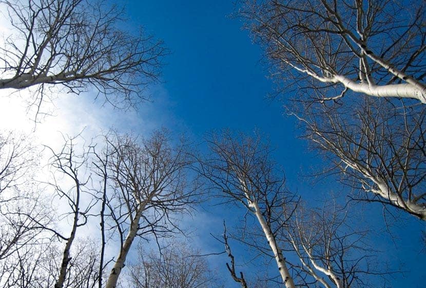
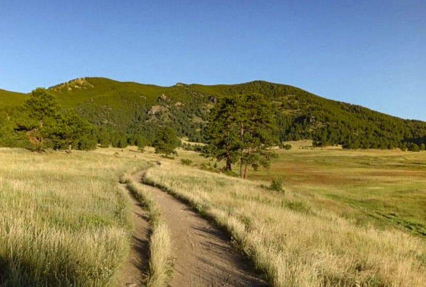
The hike to Bergen Peak begins at the north end of the parking area on a trail that leads into a broad meadow. This inital 0.3 mile segment heads east, away from Bergen Peak, but it does take you to the correct trail. At the first junction, take a left (west) onto the Meadow View trail. This 0.7 mile segment bends west where aspen and pines meet this high country prairie and gives you views down into the Elk Meadows (and maybe some elk) below.
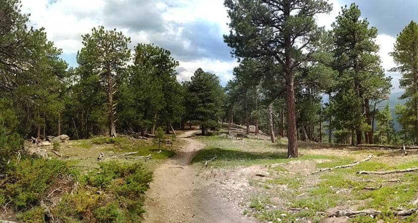
At 1 mile into the hike, you’ll find the signage for the Bergen Peak Trail (on your left, when facing north). This is where the hike goes from easy to challenging. You’ll traverse a broad ridge of ponderosa pine forest as the trail winds through over a dozen switchbacks making its way up the mountainside. Be sure to stay the trail and not cut through on these as the erosion caused by the cut-throughs can be substantial and requires a lot of work to repair.
This ridge segment is a total of 2.7 miles and at around 8900′ in elevation crosses through a wildlife area managed by the State of Colorado. During the Spring, this area is off-limits to dogs so as not to disturb the mating season of local wildlife. If you are considering this hike with your dog in the Spring, reach out to the Colorado Division of Wildlife to get the correct dates.
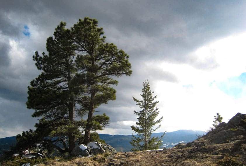
At 3.6 miles into the hike, you’ll find the summit trail on your left. This trail ascends via another set of switchbacks on what you’ll discover is the steepest segment of the hike up Bergen Peak. Still, douglas fir and lodgepole pine grow at this higher altitude and provide some dappled shade. The trail wraps around the peak to the south, then switches back again north to the summit.
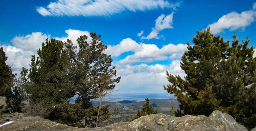
Bergen Peak is uniquely situated in the middle of the Colorado foothills. Because of this, the summit you can view mountains to the west and the unique features of the foothill canyons running down toward the plains.
To return, hike the same way you hiked in for a total of 9.4 miles.
Alternatively, you can make this a loop hike by descending the 1 mile summit trail and taking a left on the Too Long Trail (think about it’s name before going this way and make sure you have plenty of water). This makes a steep, 2.4 mile, switchbacked descent back down to the Meadow View Trail. Take a right (south) onto the Meadow View Trail, hiking for 1 mile until you come to the intersection. here, go right again onto the Meadow View Trail, taking it back to the trail leading to the Stagecoach Trailhead. This loop hike up Bergen Peak totals approximately 9.1 miles.

Tips & Resources for Hiking Bergen Peak
- Sunscreen: It’s a long hike and the shade is dappled, so be sure to still bring the sunscreen.
- Trail Map: Trail Map for Bergen Peak Near Evergreen, Colorado
- Packing List: Always pack the 10 Essentials. Download our Hiking Guide to get the list and dayhiking packing checklist.
- Colorado Road Conditions: Colorado Road Conditions
- Photo: We would like to express our gratitude to John and Belinda Bosley, UnMundane, and I’m Mefor sharing such an amazing photographs of this hike up Bergen Peak.
- After the Hike: Beau Jo’s Pizza
Weather
Map & Driving Directions
Click for Driving Directions


