The Mesa Trail south of Boulder, Colorado, rambles across wild open country at the base of the iconic Flatirons. Hike a 4.1 mile loop or an 8.4 mile out-and-back option through pine woods, verdant creek draws, and flowering meadows. Explore the full Mesa Trail profile for this southern segment of one of our favorite dog-friendly hikes near Denver.
Trail Snapshot: Mesa Trail South
| Hike Distance | 8.4 miles Round Trip |
|---|---|
| Difficulty | Easy to Moderate |
| Duration | Approx 4 hours |
| Trail Type | Out-And-Back |
| Starting Elevation | 5650′ |
| Elevation Gain | Approx +900′ |
| Seasons | Year Round |
| For Closure Updates: | Boulder Open Space Closures |
| Dogs | Allowed On Leash |
| Hike Trail Map | Click for Trail Map of the Mesa Trail near Boulder |
| Denver Drive Time | 45 min |
| Driving Directions to South Mesa Trailhead | Click for Google Map |
| Town Nearest Hike | Boulder, Colorado |
| Beauty | Wildflowers, Sunrise, Meadows, Rock Formations, Wildlife: Deer, Bear, Birding. |
| Activities | Hiking, Trail Running, Photography |
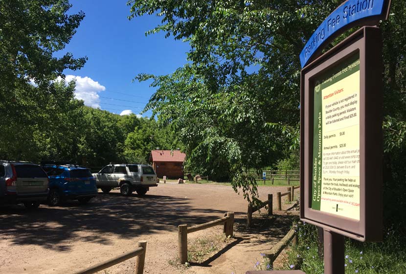
Parking & Trailhead Information for the South Mesa Trailhead
Access to South Mesa is from the South Mesa Trailhead off of Eldorado Springs Drive just South of Boulder. From Denver, drive North on interstate 25 to 36 toward Boulder. Take the McCaslin Blvd exit and then go south/west onto McCaslin. At the intersection of McCaslin and Marshall, take a right onto Marshall Road. Marshall will intersect with Eldorado Springs Drive. Here, take a left onto Eldorado Springs Drive. About two miles down the road, you’ll find the South Mesa Trailhead on your right. The South Mesa Trailhead is a part of the Boulder County Open Space and requires a daily parking fee, or an annual pass. I went online and bought an annual parking pass through the Open Space website. This gives you access to all the southern fee parking areas as well as the parking areas on Flagstaff Mountain. There are restrooms at the trailhead.
Alternatively, you can park at NCAR and hike south to the South Mesa Trailhead. If you want to hike this one-way without a return, you can park a car at NCAR or the South Mesa Trailhead. The National Center for Atmospheric Research (NCAR) Trailhead is located about 40 minutes North of Denver. From Denver, follow U.S. Route 36 to Boulder. Take the exit for Table Mesa Drive and follow it west. It will wind through a neighborhood to the end as it winds through the neighborhood and past Bear Creek Elementary School. The road will turn into the Drive for NCAR which winds up and around to a large parking area at the lab.
Waypoints and Hike Options for the South Mesa Hike
- South Mesa Trailhead to NCAR Trailhead 4.7 Miles – One-Way
- South Mesa Trailhead to Bear Canyon Creek and Back – 8.4 Miles
- South Mesa to Bluestem Loop 4.1 Miles – One-Way
- South Mesa to Chautauqua Park 6.75 Miles – One-Way
The Hike: Mesa Trail to Bear Canyon Creek
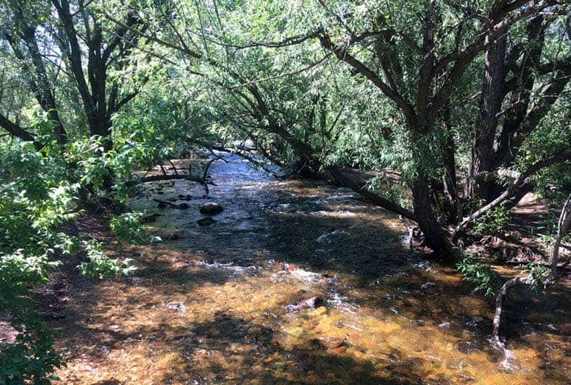
From the South Mesa Trailhead just East of Eldorado Springs, this hike begins along the banks of Boulder Creek (pictured above). Cross the bridge and pause to take in the willow trees bending over the creek and creating a tunnel of green above the silver waters. You’ll cross another footbridge and emerge onto a broad trail. Soon, you’ll come to the first trail junction with the Towhee and Homestead Trails. The Towhee cuts off a bit of distance and will take you back to the Mesa Trail, or just keep following the signs for the Mesa Trail as it wraps around to the west. Either way, the trails will both merge back onto the main Mesa Trail.
The Homestead trail heads west to Shadow Canyon and takes hikers up toward South Boulder and Bear Peaks. Both are more challenging hikes and provide incredible views out to the plains and west to snowcapped peaks.
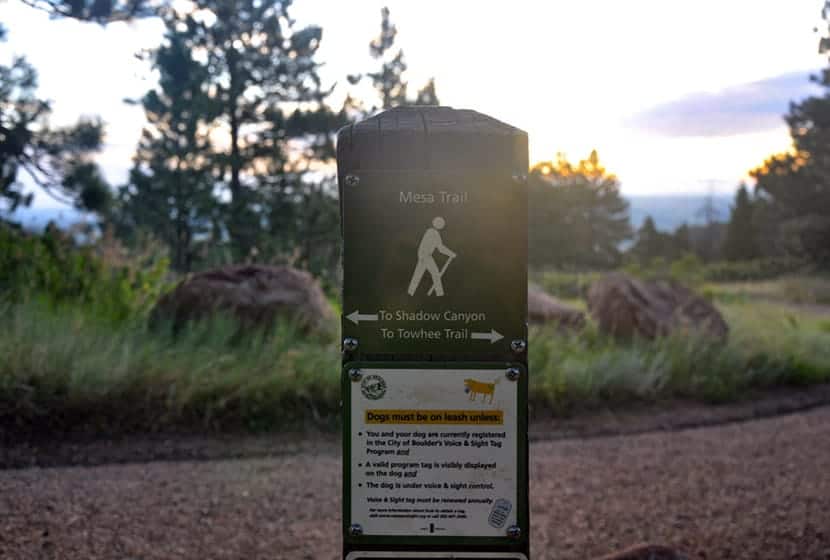
This area of the South Mesa has a lot of side trails and options, so the most important thing to keep in mind is that the Mesa Trail, over its course runs north/south all the way up to Chautauqua Park.
Before you hike, be sure to review the map to get a feel for the area. The trails weave round, so it’s easy to just meander around and take in the meadows and surrounding peaks. The trails are all well-marked, so when in doubt, just look for signs indicating the Mesa Trail and continue hiking north (with the foothills on your left). There are a lot of options for shorter hikes, but we will detail the journey up the Bear Creek Canyon and back.
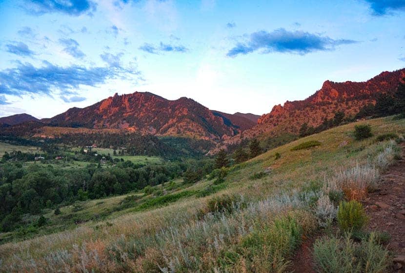
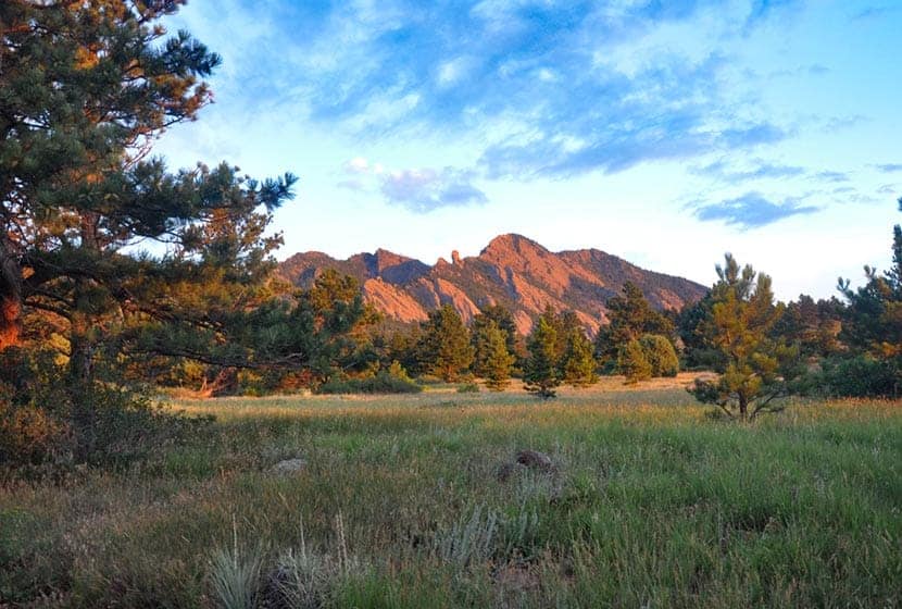
Early on, you’ll gain a great view down into the entrance to Eldorado Canyon. The morning light brings out the pink granite of this range of sharp and angular foothill rock.
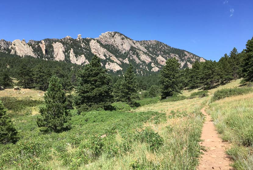
The Mesa trail then heads west and up along a gentle slope, then bends north to run parallel with the eastern flanks of the Flatiron range. Along the foothills to the left, you’ll see Devils Thumb and the summit of Bear Peak.
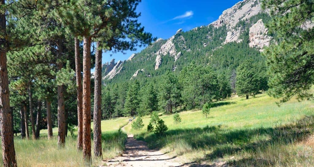
As the Mesa Trail continues north, open sky gives way to the shade and scents of ponderosa pine trees then opens back to meadows again. In the Spring, wildflowers push up through the meadow grasses and unique fuana thrives in the unique zone where the foothills of the Front range meet the meadows. It feels humind in verdant creeks draws and dry when you emerge back onto the open Mesa.
If you would like to shorten your hike and make this into a loop hike, at around mile 2, you can take the Bluestem Trail back toward the trailhead. Otherwise, continue north on the Mesa Trail.
This is one of our favorite dog-friendly hikes near Boulder, and it’s quite popular with dog owners on the weekends. In fact, just south of the intersection with the Bluestem, just shy of mile 2, there is a spring you’ll find a small spring. It’s a great place for your pup to get a drink to refuel for the rest of the hike. These trails also allow you to hike with your dog off-leash, if you’ve taken the Voice and Sight class and have a current Voice and Sight tag issued by Boulder county. You can get more info on this at the Boulder County Open Space site.
The trail will go up and down through several draws, then eventually cross Bear Creek. Here you are about a mile from the NCAR parking lot. If you’ve parked a car at NCAR, you can then shuttle back for your other vehicle, making this a 4.7 mile hike.
Bear Creek is the turn around point for this trail profile, making it an 8.4 mile out-and-back journey. However, if you want to add a cave to your adventure, continue north, then west for about 1.2 miles following the signs to Mallory Cave. If you have your dog with you, I would not recommend this extra jaunt as the terrain is rocky and steep.
Return south on the Mesa Trail and take the Bluestem Trail to cut off a bit of extra hiking.
Tips & Resources for Hiking the Mesa Trail
- Sunscreen: We added this hike to our list of hikes with shade, but there are still open segments, so sunscreen is still needed.
- Go on a Weekday: The South Mesa Trail system is busy on the weekends. So, if you are looking for some solitude, try a weekday
- Trail Map: South Mesa Trail System Map
- Packing List: Always pack the 10 Essentials. Download our Hiking Guide to get the list and dayhiking packing checklist.
- Colorado Road Conditions: Colorado Road Conditions
- After the Hike Cafe: Walnut Cafe in Boulder
- After the Hike Brewery: Sanitas Brewing Company
Weather
Map & Driving Directions
Click for Driving Directions


