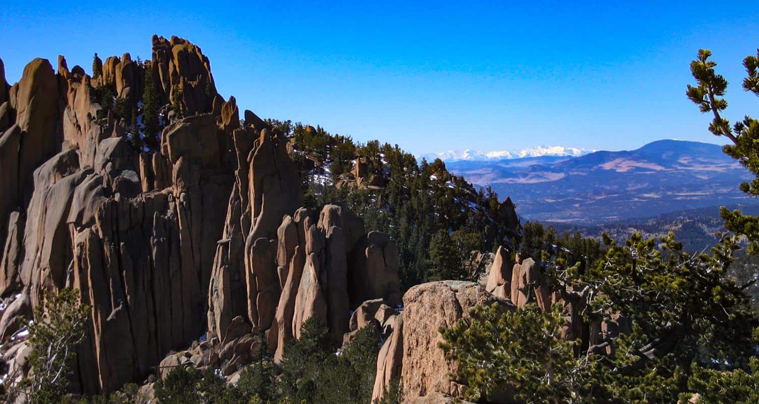
Crags Hike Near Colorado Springs
The Crags Trail takes hikers up a 2-mile gradual hike to the the dramatic granite pinnacles on the shoulders of Pikes Peak to take in views of snowcapped peaks. A shaded creekside hike great for families and out-of-town guests, the Crags shows off summer wildflowers in mountain meadows. Explore the full Crags hike profile below for trail map, driving directions, and more tips and details to help you enjoy this adventure in the Pikes Peak region.
Trail Snapshot: The Crags near Colorado Springs
| Hike Distance | 4.5 miles Round Trip |
|---|---|
| Difficulty | Moderate |
| Duration | Approx 2 hours |
| Trail Type | Out and Back |
| Starting Elevation | 10,900′ |
| Elevation Gain | Approx +800′ |
| Seasons | Year Round/Snow in Winter |
| Dogs | Allowed On Leash |
| Hike Trail Map | Click for a Map of The Crags |
| Denver Drive Time | 2 hr |
| Driving Directions to The Crags Trailhead | Click for Google Map </a |
| Town Nearest Hike | Divide, Colorado |
| Beauty | Rock Formations, Views to Snowcapped Mountains, Vistas, Wildflowers, and Creek. |
| Activities | Hiking, trail running, snowshoeing, photography |
Parking & Trailhead Information for The Crags
From Denver, you can get to the Crags by driving a direct route via I25 and HWY 24 or you can take a more Scenic Route through the foothills on 67.
The Direct Route
Take interstate 25 south to Colorado Springs, exit at 141 onto US 24 West. You'll drive for about 25 miles into the mountains and through the small town of Divide. Turn left/south onto Hwy 67. Signs should point the way to Mueller State park, which is also on this stretch of road. Just after the entrance to Mueller (on the left), the road you need for the Crags is on the left, CO RD 62. Taking a left onto 62, and drive for about 3 miles. The parking area for the Crags will be on the right side of the road and the trail will start on the left side of the road. Note that this last segment of road is improved dirt road, so the quality of the drive will depend on the current conditions, and may require 4WD in the Winter months.
The Scenic Route
From Denver, take Hwy 285 South toward Pine Junction. Take a left onto Pine Valley road. Here your journey becomes scenic and the roads curvy. Pay close attention while driving and be prepared for the drive to take longer than the 2 hours and 15 minutes posted by mapping software. You'll have some beautiful segments in here, especially the drive along the South Platte River. Cell service is spotty out here, so I always recommend having on hand the Colorado Gazetteer Map printed by DeLorme. The Road changes names to Deckers Road when it passes through the Buffalo Creek area. Eventually, it Deckers road will weave its way down into Deckers. There is a small restaurant here where we've stopped for ice cream. In Deckers, you'll continue straight (south) on 67, passing through Westcreek, until it ends at a stoplight in Woodland Park. Go right at the light, West on 24, until you come again to Hwy 67 just outside of Divide. Then follow the directions above on 67 to the Crags Trailhead.
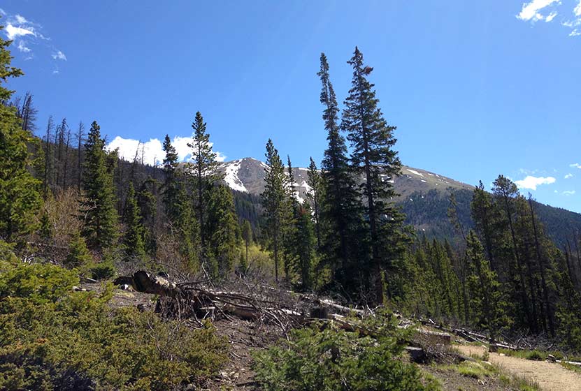
The Hike: The Crags
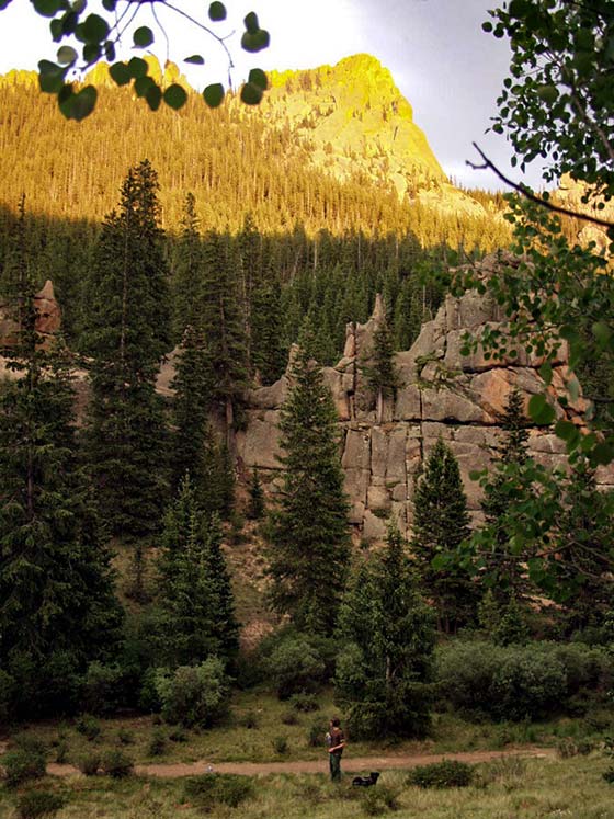
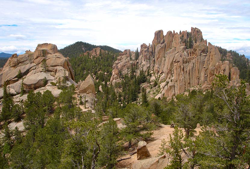
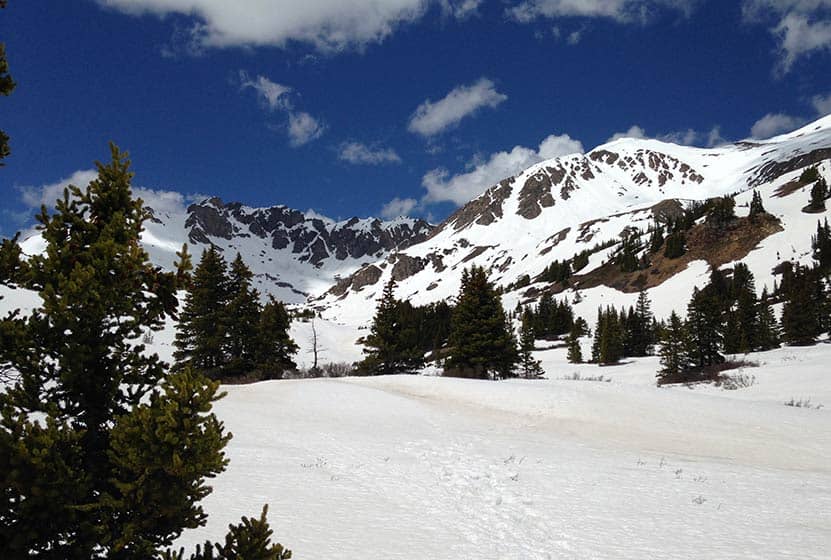
This is my favorite hike in the Pikes Peak Region because it's relatively easy, shows off a variety of landscapes, and has incredible views at the top. The trail starts off at the end of the Crags Campground loop and follows the drainage of Fourmile creek. Early on, hikers will come to a fork in the trail. The left-side branch is a more demanding hike, gaining elevation more quickly and has less shade. This trail profile will follow the right-branch, which is more gradual and offers more shade than the left branch. The left branch and right branch can be connected via a scramble at the top to form a loop trail. If taking this route, be aware of the conditions (snow and ice accumulate October through June). Scrambling is fun, but it's also easy to find yourself in a difficult and dangerous circumstance.
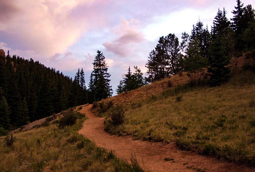
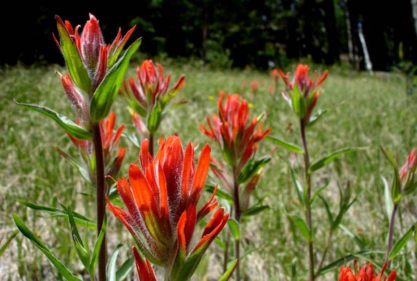
Taking the right branch, the trail will follow alongside Fourmile creek through evergreens and aspens until it opens out into a broad valley surrounded by orange and pink granite cliffs. Wildflowers, like the Indian Paintbrush, bloom in these meadows during the summer months. An interesting fact about Indian Paintbrush: the "flowers" are actually its leaves and there are oranges, reds, and even yellow types of this plant in Colorado.
In the valley, the trail will come to another fork. The main route goes straight up a gradual ascent to the crags and the right-branch is more steep, leading to another vista point. Continuing on the main route, the trail makes its way up gentle slopes, the grassy terrain giving way to cubic granite rock.
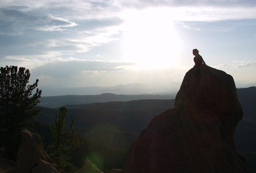
The pink and orange granite pinnacles come into view and the ground eventually opens up to a broad area where hikers gain views of the Sangre De Cristo Mountains in the south, of Pikes Peak, and Mueller State Park. This hike is great for families, but do keep a close eye on children as the rock gives way to steep segments of cliffs at the edges.
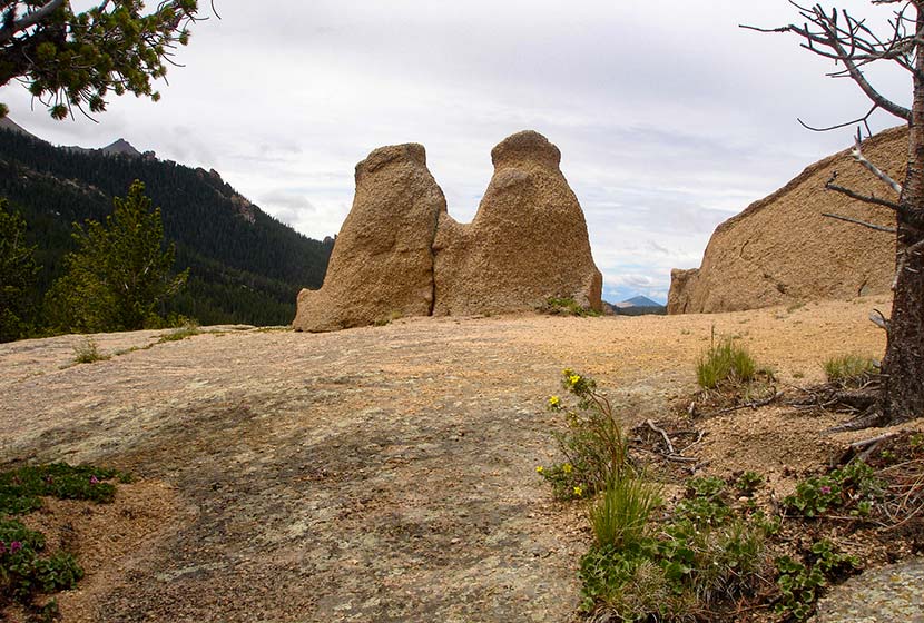
I'm not sure what the locals have named this formation pictured below, but I think of it as the Twin Bears, because it looks like a couple bears sitting on their haunches taking in the views.
I considered grading this an easy hike because the trail is so gradual, the total elevation gain is under 1000 feet. However, those who are hiking with kids or out-of-town guests, should consider it more moderate because it's almost 5 miles total and does gain 800 feet. It makes for a perfect picnic hike with friends.
If hiking in the later hours of the day, it's important to know that because most of the hike is in the folds of the mountain, it gets dark quickly. I always pack my headlamp, but it's especially relevant if you are hiking during these hours.


Tips & Resources for Hiking The Crags
- Dogs: While a dog friendly hike, the granite rock up top is jagged and can impact your dogs padded feet.
- Options: See the different trail options above to take in different unique views of the surrounding landscapes.
- Trail Map: The Crags Trail Map
- Packing List: Always pack the 10 Essentials. Download our Hiking Guide to get the list and dayhiking packing checklist.
- Colorado Road Conditions: Colorado Road Conditions
- After the Hike: Swirl Wine Bar in Manitou Springs
Weather
Map & Driving Directions
Click for Driving Directions
November Hikes
Where are the best places to hike near Denver in November?
November hiking on the Front Range of Colorado can be cold and snowy or 70 degrees and sunny. It can feel like the continuation of Fall or the depths of winter. And so much depend on where you want to hike. Travel an hour West into the mountains, and it's like you've been transported into a different country--because you have. So, you can see the answer to "Where do I hike this weekend?" in November depends a lot on location and the weather forecast.
Because of this, I think in terms of hike purpose: A) Just Enjoying the Outdoors or B) Adventure. If your goal is to hike alongside a friend and enjoy the beauty of Colorado, or get the dog out for a long walk, then you're probably staying within about 45 minutes of Denver. If you're looking for some adventure, you're driving further and stepping into a whole different and sometimes higher risk landscape. In the rest of this post, I'll recommend a series of trails in both categories.
Just Enjoying the Outdoors
In November, there are three go-to places I'd recommend hiking that are closer in to the Denver metro area and have a lot of options.
-
Hikes in Staunton State Park:
-
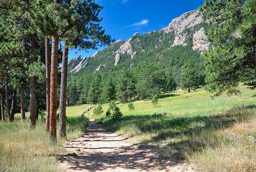
Hikes in Chautauqua Park in Boulder:
-
St. Mary's Glacier Trail:
-
Just South of Boulder:
Less than an hour from Denver, this newest of our State Parks has miles upon miles of sunny trails. If you want sun and a great hike with your dog, Staunton is a great go-to. The Staunton Ranch Trail runs right through the middle of the park through ponderosa pines and with great views of Staunton Rocks to the North. Our kids loved hiking the loop hike to Davis Ponds. And for those of you looking for a longer more demanding hike, check out our hike profile for Elk Falls overlook. A CO State Parks pass is required. See the hike profiles above for details.
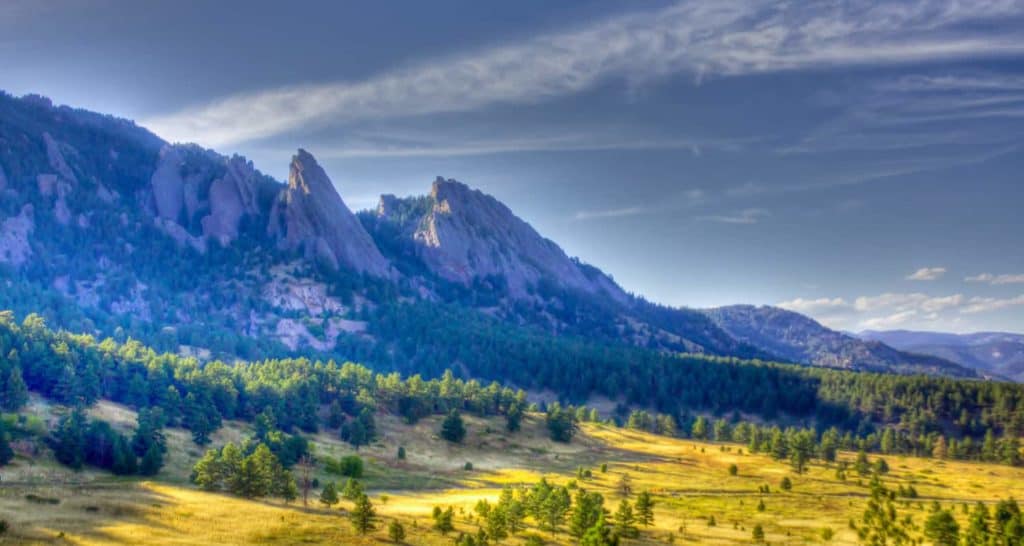
Flatirons at the entrance of Chautauqua Park in Boulder, Colorado
I love hiking Chautauqua Park because it's right down in the city of Boulder and the park provides access to all kinds of hiking options. Like Staunton, dogs are allowed in most areas of the park. You can grab good coffee or lunch after an early morning hike, or enjoy a sunset at places like Realization Point. My favorite is the hike up to the alcove behind the First and Second Flatiron. The trail to Royal Arch is a local favorite. If you are looking for something less demanding, consider Shanahan Ridge or the Enchanted Mesa Loop. There are a labyrinth of trails, so you can always just grab a map and explore. Remember, the sun goes down early and fast behind the mountains, so plan out your return. When hiking during these winter months, I always pack the 10 Essentials, my down coat, and have my headlamp in the top of my pack. Sign up for our Trail Dispatch email and get a download of our recommended packing list, trail meals ideas, and more hike recommendations.
St. Mary's Glacier is a favorite destination year round. The photo at the top of this post is of St. Mary's Lake and you can see the glacier, complete with ski trail marks, on the glacier just above the lake. It's just a 1.7 mile round-trip hike, but don't let the short distance deceive you. You're back in the high country of Colorado and weather conditions can change super fast. So, be prepared. Get to the trailhead early on the weekends, and by early, I mean before 7AM, and have cash for the parking fee. See our St. Mary's Glacier trail profile for more details.
Along the Mesa Trail South of Boulder, Colorado
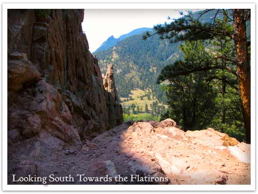
I love the Marshal Mesa area on the South end of the Flatirons. The Marshall Mesa trail runs along the base of the flatirons below Bear Peak and offers some beautiful scenery without the demand of steep grades. The parking area is along the same road that leads into Eldorado Canyon, which is another wonderful place to visit this time of year. The trails in the Canyon because of the topography are going to have snow and mud patches, so bring your trekking poles or pack some traction devices for your backpack. See our Eldorado Canyon hikes page for several trails to explore.
The Walker Ranch Loop, or just the top end of it at Eldorado Falls, is a great option for hiking with the dog and friends. The loop is longer and more demanding, but a wonderful way to spend the day with a companion just talking and taking in the beauty of Colorado. North from the Marshall Mesa Traihead along 93 is the Flatirons Vista Trailhead. We have profiled a 1.9-mile and 3.3 mile set of loop hikes that give you the grand views of the Flatirons on these broad rolling meadows of this area North of Denver.
A CO State Parks pass is required for Eldorado Canyon and there are access fees at the Marshall Mesa and Flatirons Vista Trailheads. See the hike profiles above for details.
More Adventurous Hikes
If you are looking for a more demanding workout and possibly some peak-top views or destination hikes, then here are a few trails I'd recommend for this time of year. Before taking off into the woods though, be sure to review our 10 Winter Hiking tips. Safety and smarts are always important--they are critical during these Winter months however because of the cold and the unpredictable weather.
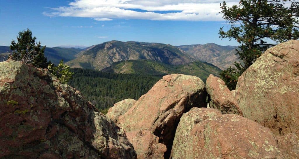
View from the peak of Carpenter Peak
-
Carpenter Peak in Roxborough State Park:
This is a great 6.2 mile, out-and-back trail South of Littleton, Colorado. I like this trail because you get views to the West of the Front Range, and you get to look down on the beauty of Roxborough State Park and it's gigantic fins of red rock. The only drawback is that dogs are not allowed in the park.
-
Windy Peak in Golden Gate Canyon State Park:
-
South Boulder and Bear Peaks:
-
Rocky Mountain National Park:
You can bring your dog on this one. The hike up to Windy Peak is a 6.4 mile loop hike to views out to the snow-capped peaks in the West. There are lot of other hike options in Golden Gate Canyon State Park, so check out our trails page for the park for more ideas.
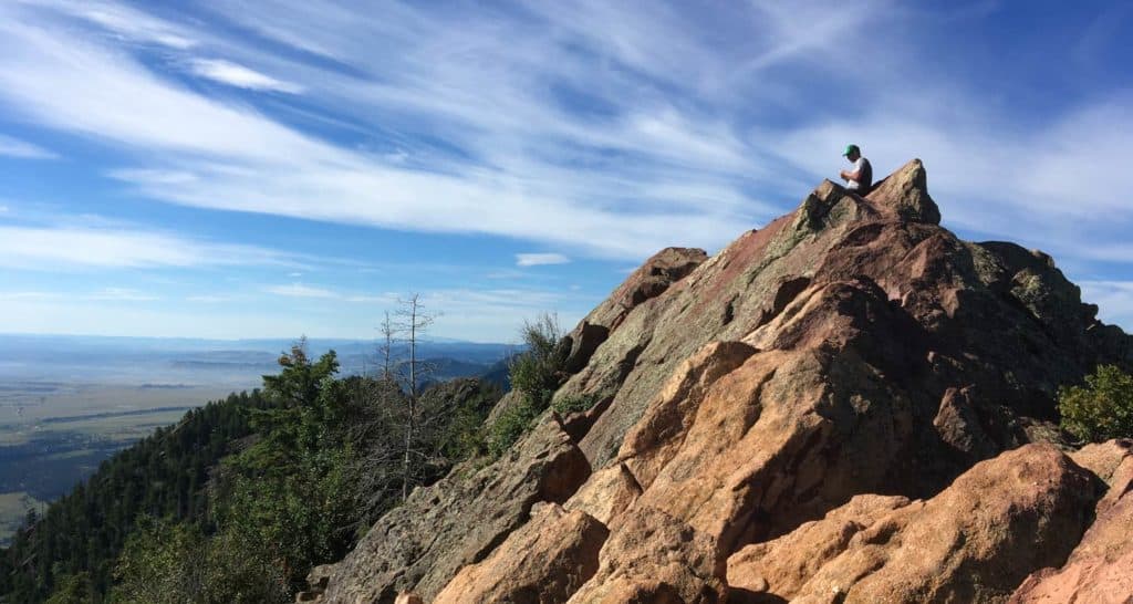
Hiker at the top of Bear Peak
These two hikes are more demanding and can be made into a 9-mile loop hike where you bag both peaks on the same hike. Bear Peak has a little knife edge that requires a few moments of hand-over-hand, and the summit of South Boulder Peak requires a bit of scrambling, but most of the hike is moderate. Bring plenty of water as you'll need it.
Ouzel Falls in the Wild Basin of RMNP
This shoulder season can be a perfect time to visit RMNP because the crowds have subsided. Be ready for muddy trails and snow, but on those sunny warm weekends, the Wild Basin and Bear Lake areas will be quiet escapes from the city. I'd recommend giving the RMNP ranger offices a call to get a feel for the weather or checking out the RMNP Trail Conditions page Traction devices and trekking poles will make your hike in these winter conditions way more enjoyable. I'd recommend checking Calypso Cascades and Ouzel Falls in the Wild Basin area. The trailhead changes in winter months for the Wild Basin, so be sure to add the additional mileage to your hike because you'll be starting from the Winter Trailhead. In the Bear Lake and Moraine Park area, I'd recommend Fern Falls, an easier hike to Alberta Falls or Emerald Lake, and the more demanding hike up to The Loch.
Waterfall Hikes in November
The best time of year to explore the waterfalls near Denver is during the early Summer months of May, June, and July. However, the waterfalls wills surge over sheets of ice during those warm days following a good snow. It's going to be pretty hit or miss, but if you are looking for a waterfall hike near Denver during these early winter months, I'd recommend a few.
-
Boulder Falls:
-
Elk Falls:
-
Alberta Falls:
Right off of the road, so really no hike at all. This is a great year-round waterfall just 50 minutes North of Denver. Pictured above.
A longer hike in Staunton State Park to the tallest waterfall near Denver.
A short 1.6 mile hike from Bear lake in Rocky Mountain National Park.
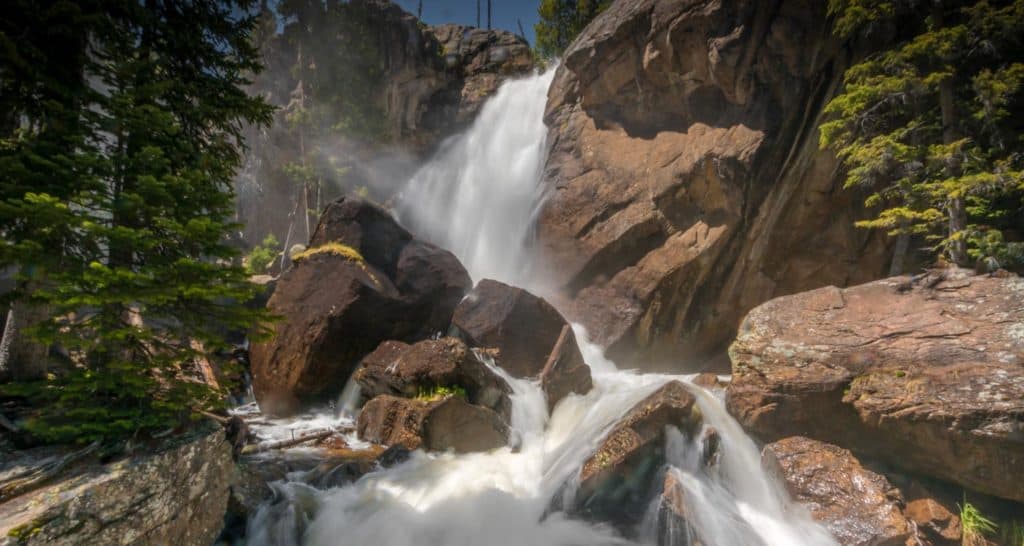
Lost Lake Hike Near Nederland
Lost Lake is an accessible 4-mile round-trip hike to a beautiful alpine lake surrounded by the mountains of Indian Peaks. Just over one hour northwest of Denver, the trail up to lost lake takes you along the course of Middle Boulder Creek, a slide waterfall, a set of tumbling cascades, and a variety of wildflowers that decorate the borders of the trail, the creeksides, and the small meadows that open up along the trail. In the winter months, the trail up to Lost Lake makes for a good snowshoeing route and cross-country trail. trail (though it's a bit steep on the way up
While we categorize Lost Lake as a family-friendly hike and a great trail to take in the changing colors of Fall, it's important to know that the hike is uphill and demanding up to its destination. Explore the full Lost Lake hike profile below for trail map, driving directions, and more tips and details to help you enjoy this adventure in Indian Peaks Wilderness.
Trail Snapshot: Lost Lake Trail near Nederland, Colorado
| Hike Distance | Approx. 4 miles Round Trip |
|---|---|
| Difficulty | Moderate |
| Duration | Approx 2-3 hrs |
| Trail Type | Out and Back |
| Starting Elevation | 8642′ |
| Elevation Gain | Approx +1144′ |
| Seasons | Year Round |
| Dogs | Allowed On Leash |
| Hike Trail Map | Click for a Map of Lost Lake in Indian Peaks Wilderness |
| Denver Drive Time | 1 hr 15min |
| Driving Directions to Hessie Trailhead | Click for Google Map |
| Driving Directions to Shuttle Parking in Nederland | Click for Google Map |
| Hessie Shuttle Details | @ Boulder County Hessie Page |
| Town Nearest Hike | Nederland, Colorado |
| Beauty | alpine lake, creek, waterfalls, wildflowers, columbine, Indian paintbrush, aspen groves, fall colors |
| Activities | Hiking, snowshoeing, cross-country skiing, camping, fishing, lunch |
Parking & Trailhead Information for Lost Lake Hike
Parking is very limited at the Hessie Trailhead, so be sure to take some time to review these details before departing for your hike. Because the Hessie trailhead is one of the most popular in the state, Boulder County offers a shuttle that runs from Nederland every 15-20 minutes on weekends during the Summer months and on some holidays. For full details on the Hessie Trailhead Shuttle, please see the Boulder County page for the shuttle service. This shuttle departs from the RTD Park-n-Ride in Nederland.
Directions to Hessie Trailhead
At the roundabout in Nederland, Colorado, drive south onto CO-119/South Bridge St. Take a right onto Eldora Road which will take you to Elodora Colorado. The road continues through Eldora, and changes to Eldorado Road. It proceeds out of town and changes its name to Hessie Road. About 3/4 of a mile outside of Eldora, the road will split, 4th of July Road goes to the right, and Hessie will turn to the left. The 2WD Hessie Trailhead Parking area is at this split. Do not park alongside the road, as you will likely be fined. If the parking area is full, then go back to Nederland for the shuttle (weekends and holidays). There is parking for 4WD vehicles further up the dirt road and closer to the beginning of the official trail. It's important to know that rains can quickly flood this segment of Hessie Road.
Trail Map for Lost Lake Hike
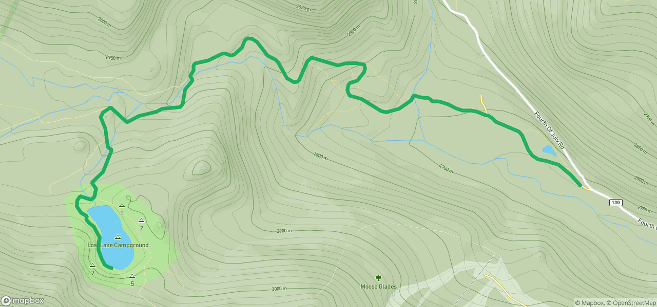
The Hike: Lost Lake Trail
If taking the shuttle, it will drop you off at the 2WD parking area. From here, hikers will follow a trail for that runs along the north side of the 4WD dirt road. The trail runs past a small pond and will keep to the right-side of the 4WD Hessie Trailhead road until it arrives at the official trailhead. Keep your eyes peeled for Moose who frequent these waterlogged meadows along this lowland segment of the trail. At approximately 1/2 mile from the shuttle drop, a sign marks the site of the old mining town of Hessie, Colorado.
Soon, the trail will cross the North Fork of Middle Boulder Creek via a footbridge and a large sign will map and describe the several trails and destinations that can be accessed from this point. Hikers will continue on this old mining road as it leads uphill towards both Lost Lake and the intersection for the trails that lead to Devil's Thumb Lake, Jasper Lake, Woodland Lake, King Lake, and Bob and Betty Lakes. This trail profile will describe the route to Lost Lake only.
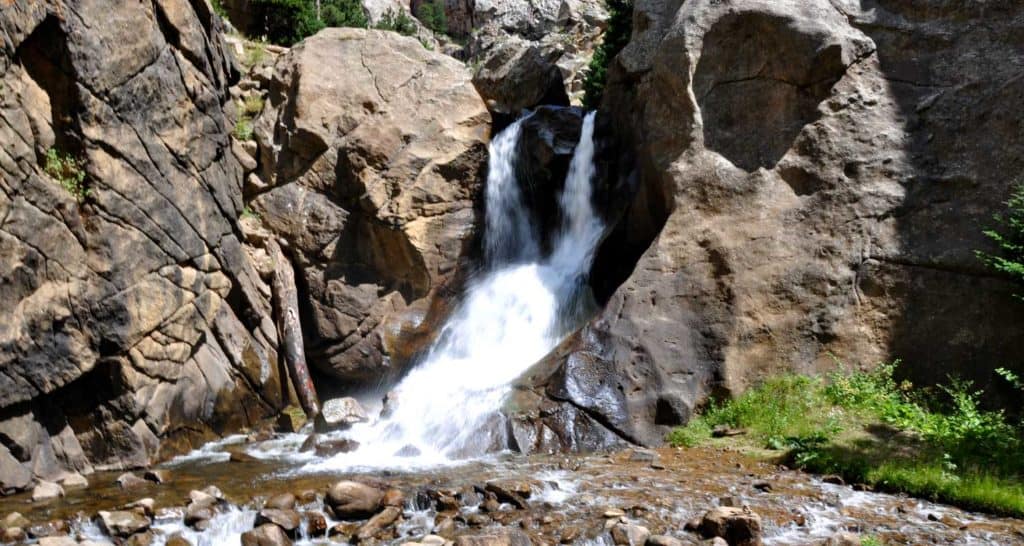
The next 1.2 miles climbs by way of switchbacks over rocky and steep terrain. Wildflowers pepper the trailsides and the riparian zone along Middle Boulder Creek. At the first trail intersection (Devils Thumb and Devils Thumb Bypass Trails), a sign will mark the way to Lost Lake and give distances and point the direction to the other destinations. Here the trail to Lost Lake will go left and cross another footbridge. Soon, a waterfall and set of cascades will come into view. The trail will make its way to a second intersection and sign. Here, the trail for Lost Lake departs, once again, to the left.
From this point, Lost Lake is just 1/2 mile away. It's a steep segment but worth the views when you arrive. At Lost Lake, hikers can explore the outside circuit of its shores (this will add both time and distance to the hike). Return via the same trails for a total of 4 miles.
Related Hikes
- Diamond Lake Hike in Indian Peaks
- Changing Aspens Hikes Near Denver
- Mt. St. Vrain Hike Near Allenspark, Colorado
Tips & Resources for Hiking the Lost Lake Trail
- TIP: Parking is very limited at the trailhead, so try to arrive before 7am. Review trailhead information above for seasonal weekend and holiday shuttle from Nederland.
- CAMPING: Camping is allowed by permit only and in designated spots. See the Indian Peaks Alliance page for details.
- USFS Indian Peaks: Camping is allowed by permit only and in designated spots. See the Indian Peaks USFS Page page for details.
- TIP: The trail is rocky so it would be a good idea to bring trekking poles.
- Trail Map for Lost Lake Trail: Trail Map Link
- Packing List: Always pack the 10 Essentials. Download our Hiking Guide to get the list and dayhiking packing checklist.
- Colorado Road Conditions: Colorado Road Conditions
- Photo: We would like to express our gratitude to Tim and Brad Fagan and Eric Frazier for sharing photographs of this hike on Lost Lake.
- After the Hike: Sundance Cafe, Nederland
Weather
Map & Driving Directions
Click for Driving Directions

Herman Gulch to Herman Lake Hike
The Herman Gulch Trail is one of the best summer wildflower hikes near Denver. It's also a challenging winter snowshoe and is often used for cross-country skiing. The Herman Gulch Trail is a 2.5 mile (one-way), out-and-back adventure into snowcapped mountain country and provides access to many more trails in Arapaho National Forest. Explore the full Herman Gulch hike profile below for trail map, driving directions, and more tips and details to help you enjoy this adventure in the Rocky Mountains of Colorado.
Trail Snapshot: Herman Gulch Hike, Colorado
| Hike Distance | Approx 5 Miles Round Trip |
|---|---|
| Difficulty | Moderate (Difficult in Winter) |
| Duration | Approx 3.5 hrs |
| Trail Type | Out and Back |
| Starting Elevation | 10,400′ |
| Elevation Gain | Approx +1600+′ |
| Seasons | June to September; October to May for Winter Trail Conditions |
| Dogs | Allowed On Leash |
| Hike Trail Map: Summer | Click for a Map of Herman Gulch Trail |
| Hike Trail Map: Winter | Click for a Map of Herman Gulch Trail |
| Denver Drive Time | 1 hr |
| Driving Directions to Herman Gulch Trailhead | Click for Google Map |
| Town Nearest Hike | Silver Plume, Colorado |
| Beauty | Summer Wildflowers, lake, cascades, meadow, mountain stream, aspen trees, wildlife: mountain goats |
| Activities | Hiking, photography, snowshoeing, cross-country skiing |
Parking & Trailhead Information for Herman Gulch
The Herman Gulch Trailhead is located about 20 miles west of Idaho Springs via I-70. From Denver, it's about a 60-minute drive but can take around 1.5 hours in winter ski traffic. The trailhead is located right off Exit 218 by taking a right onto Watrous Way. There are restrooms available at the trailhead. As with all trailheads, but especially those right off the interstate, be sure that your valuables are out of site and locked up. The trail is located in the middle of the parking area, just to the left of the restroom.
The Hike: Herman Gulch to Herman Lake
From the parking lot, the initial trail segment is steep. But be encouraged, while it's not an easy hike, the trail becomes more gradual as it gains elevation into the widening valley of Herman Gulch. At the trail intersection early in the hike, the trail to Herman Gulch will bear to the left, and a trail that leads to Waterous Gulch will lead to the right. Staying on the Herman Gulch Trail, it will weave in and out of the trees into small meadows with Herman Creek and many meltwater rivulets cascading across the landscape.

Winter may not release its grip on Herman Gulch until mid-summer. For example, all the photos in this trail profile were taken during the first week of June, so prepare for the snow to get increasingly deeper as you progress further on the trail. For this reason, we recommend trekking poles and traction devices for your boots. Also, be aware that at this elevation, thunderstorms often come up quickly on Summer afternoons, bringing dangerous lightning, especially in the open areas of the higher elevations. For this reason, and in order to avoid crowds, it's wise to begin your hike early in the day.
The trail eventually emerges from the trees into a broad alpine landscape where a series of rock cairns leads the way to Herman Lake. This final segment is steep and demanding. The lake is located in a wide bowl beneath the lofty reaches of Pettingell Peak. The lake may be snow-covered through much of June, depending on late-season snowfall. In the early and mid-summer, a series of small meltwater cascades make their way down along the western mountainside into the lake. Be sure to stay the trail as you will be in a fragile alpine ecosystem.
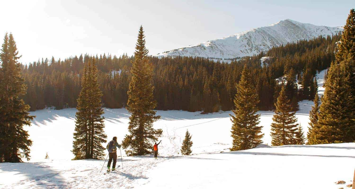
Hiking Herman Gulch in the Winter
Herman Gulch is also a popular snowshoeing and cross-country skiing destination. December to March offer the best snowpack for these activities. It's a very different experience when snow has piled up in Herman Gulch and it's even more critical that those venturing into this area have packed their 10 essentials and are dressed appropriately. There are two avalanche chutes on the right-hand side of the trail about 1 mile into the hike that hikers should keep in mind (see ORIC winter map). During this season, do not go above treeline into the higher reaches as these are very much prone to avalanches. It's also important to bear in mind that snowstorms can come up very quickly, even in Spring and Fall, reducing and even eliminating visibility. So be aware and be prepared. Snowshoeing travel speeds are about 1 mile per hour, depending on the person, which is half of hiking speeds. Adjust your travel times accordingly and for early darkness of winter.
Tips & Resources for Hiking Herman Gulch Hike
- TIP: As you ascend the valley in snow conditions, be cautious of 2 avalanche paths on the right.
- TIP: Before starting the a winter hike here, contact the Clear Creek Ranger District to inquire about snow conditions and trail updates.
- Trail Map - Summer: Herman Gulch Trail Summer
- Trail Map - Winter: Herman Gulch Trail Winter
- Packing List: Always pack the 10 Essentials. Download our Hiking Guide to get the list and dayhiking packing checklist.
- Colorado Road Conditions: Colorado Road Conditions
- After the Hike: Beaujos Pizza in Idaho Springs
Weather
Map & Driving Directions
Click for Driving Directions

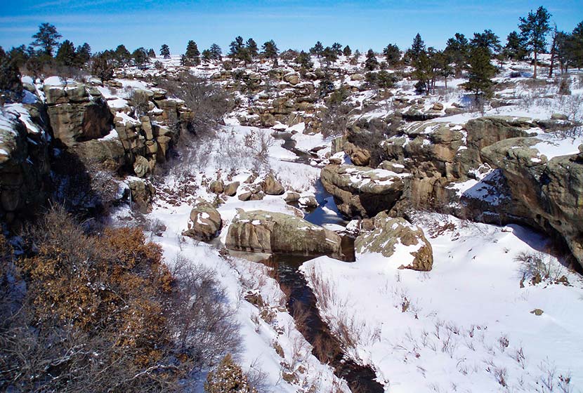
Top 10 Winter Hikes Near Denver
Where are the best places to hike in the winter months near Denver? Snow-covered trails and blue skies that seem to stretch into forever, that's winter hiking in Colorado. Winter sets in from November through most of March along the Front Range, and some years we've had snow as late as May--later back in the nearby mountains. The trails we've chosen for this set of top 10 winter hikes keep you close to Denver, are easy or moderately demanding, and explore a variety of landscapes. Because Winter weather in Colorado is both breathtaking and unpredictable, it's critical that hikers embark on their adventures well-prepared. So, before you lace up your boots and hit the trail, be sure to download and review our Free Hiking Guide to help you prepare and pack smart for your dayhikes. Additionally, take some time to review our 10 Winter Hiking Tips.
-
Spruce Mountain Hikes Near Larkspur
-
Elk Meadow Park – South Loop Hike
-
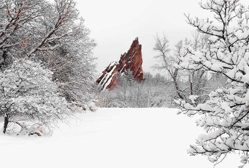
Hikes at Red Rocks Park
-
Mount Falcon Castle & Tower Hike
-
South Valley Park Trails
-
Castlewood Canyon State Park Trails
- Waterfall Hike at Castlewood Canyon State Park
- Cliff & Climbers Trail at Castlewood Canyon State Park
- Homestead Trail at Castlewood Canyon State Park
- Cave Trail at Castlewood Canyon State Park
- Canyon View Nature Trail at Castlewood Canyon State Park
-
Emerald Lake Hike in Rocky Mountain National Park
-
Hikes in Roxborough State Park
- Carpenter Peak Trail
- Elk Valley Trail
- Fountain Valley Trail
- South Rim Loop Trail
- Willow Creek Trail at Roxborough State Park
-
Mt. Galbraith Loop via the Cedar Gulch Trail
-
Dream Lake Hike in Rocky Mountain National Park
Distance: 1.5-Mile Round Trip & 4-Mile Loop
Difficulty: Moderate
Drive Time from Denver: 50 Minutes
Why We Love this Winter Hike:
Spruce Mountain is easy to access off of interstate 25 but far enough away from the hustle and bustle of things that you feel enveloped by the landscape. You have out-and-back and a loop trail option that traces the outer rim so that you can take in the panoramas of rolling green hills south of Larkspur, Colorado. The best part about this hike are the views of Pikes Peak in the south. Most of Winter, this area of Douglas County is fairly mild. There will be cold days, but the snow melts fast and the trail is rarely muddy.
![]()
Distance: 2.6 Miles
Difficulty: Easy
Drive Time from Denver: 35 Minutes
Why We Love this Winter Hike:
Elk Meadow Park is a family friendly place to hike just outside of beautiful Evergreen, Colorado. This short loop hike takes you through some beautiful winter landscapes, by huge ponderosa pines, and a chance to see the elk that gather and browse in the valley. We love just how close these trails at Elk Meadow Park are to Denver and visiting the quaint town of Evergreen afterwards to grab some pizza or a coffee. You can add a walk along the edges of Evergreen Lake to fill out your day to watching or joining the locals ice skating. Pack your hat and gloves and a thermos full of hot chocolate for a great winter day trip.
![]()
Distance: 6 Miles Round Trip and 1.4-Mile Loop
Difficulty: Moderate to Difficult
Drive Time from Denver: 25 to 30 Minutes
Why We Love this Winter Hike:
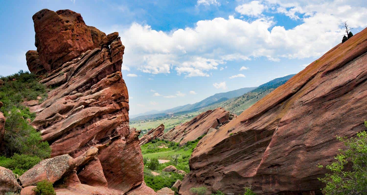
We love these trails for two reasons: 1) they are just 25 minutes from Denver, and 2) the rock formations are absolutely beautiful--especillay when the winter white of snow sets in contrast with the pink and orange hues of the surrounding rock formations. Red Rocks Park can be hiked on two different trails. Wander through the meadows of the Red Rocks Trail for more expansive views of this unique area, or take the Trading Post trail through a valley of impressive Red Rock formations. You can't beat the proximity to Denver at this historic landmark just west of the city.
Distance: 2.3-Mile Loop
Difficulty: Easy
Drive Time from Denver: 40 Minutes
Why We Love this Winter Hike:
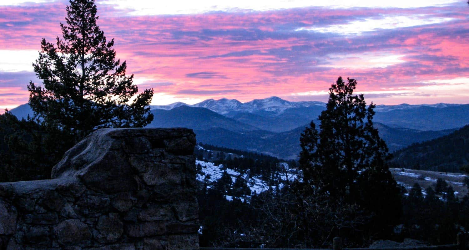
There are ruins of an old castle--need we say more. This is one of my favorite places to take a photo of the front range mountains. Set the castle ruins in the foreground and the snowcapped range of Indians Peaks and James Peak Wilderness in the background (see photo above). This winter hike is just a short drive from Denver and will offer you views from one of Denver's most famous foothill mountains. From up on Mt. Falcon, you can also take in views of the city of Denver stretched out below. Be sure to read our full trail profile so that you take this hike from the upper trailhead, otherwise you'll have a a steep hike accessing the main trails.
![]()
Distance: 0.5 mile to 3 Miles
Difficulty: Easy
Drive Time from Denver: 30 Minutes
Why We Love this Winter Hike:
When the snow falls, the surrounding sounds of the city soften and this valley transforms into a walk back in time, making South Valley Park another great choice for hiking during winter in South Denver. The valley is located near the Ken Caryl neighborhood, tucked away behind the hogbacks and enclosed by red rock formations. When we lived in Littleton, this was my favorite after-work and early-morning escape. The trails here get a lot of sun and are mostly a gravel base, so they dry quickly and are a more reliable choice for those who want to avoid a muddy adventure.
![]()
Distance: 1/4 Mile to 4 Miles
Difficulty: Easy to Moderate
Drive Time from Denver: 50 Minutes
Why We Love this Winter Hike:
Quiet. That's why we like hiking Castlewood Canyon in the winter, especially after a fresh snowfall. Castlewood Canyon State Park is hidden away in the plains near Castle Rock and Parker. Because it's out east and off the beaten path, it's an often overlooked even though it's a Colorado State Park. When it snows, the canyon becomes a great place to look for animal tracks and to take in the sounds of snow-covered Cherry Creek as it trickles alongside the path. The trails feature: a waterfall, stream, homestead ruins, caves and clefts. Explore the different trails we've profiled in Castlewood Canyon State Park:
![]()
Distance: 3.6 Miles Round Trip
Difficulty: Easy to Moderate
Drive Time from Denver: 2 Hours
Why We Love this Winter Hike:
First of all, we love this winter hike because it's in one of most favorite places on earth, Rocky Mountain National Park. The second reason is the trail weaves past a set of lakes to a jaw-dropping view of frozen Emerald Lake and Hallet Peak in the background. This hike is a classic, and short, but it's going to be more challenging in the winter. You're likely going to need snowshoes for this, and the best place to rent snowshoes is at the Estes Park Mountain Shop. If you have more fuel in your tank, then consider adding frozen Alberta Falls to your adventure.
![]()
Distance: 2.3 to 6.2 Miles
Difficulty: Easy to Moderate
Drive Time from Denver: 45 Minutes
Why We Love this Winter Hike:
The contrast of massive red rock formations against the soft, white snow makes winter hikes in Roxborough feel like a walk through a enchanted wonderland. Scan the skies for Golden Eagles and Red Tail Hawks catching thermals above the valley floor. It's important to note before you make the drive that, like nearby Waterton Canyon, no dogs are allowed in Roxborough State Park. A Colorado State Parks pass or fee is required to access the park. We've profiled five different hikes in Roxborough State Park and you can explore all the links below. I'd recommend starting with the Fountain Valley Trail to get teh best views of the park's most beautiful features.
Distance: 4.9-Mile Lollipop Loop
Difficulty: Moderate
Drive Time from Denver: 25 Minutes
Why We Love this Winter Hike:
Mt. Galbraith near Golden, Colorado has spectacular views into two canyons and into the city of Golden. The trail is about a 25-minute drive from Denver, and it makes for a quick escape from the busyness of urban life to breathe in the fresh air of the foothills. This trail is another great hike for winter and is perfect for avid hikers but still accessible to beginners. It's gotten quite popular, so we suggest you hike this trail early in the morning or on a weekday. Note that it has a northern side that doesn't see as much sunshine, so this trail can get icy during certain times of winter. I've not needed Traction Devices, but they are always smart to carry when negotiating winter trails. And I almost always bring Trekking Poles with me to take the pressure off my knees and to help me hike over slick and muddy terrain. Traction Devices
![]()
Distance: 2.2 Miles Round Trip
Difficulty: Easy
Drive Time from Denver: 2 Hours
Why We Love this Winter Hike:
With scenery straight out of a storybook, the hike to Dream Lake is one of the best known hikes in RMNP. Because it gets a lot of foot traffic, the path from Bear Lake to Dream Lake is packed down and easily discernible, but be sure to check with a ranger at Bear Lake before making this short hike. You can also check trail conditions page for RMNP which is updated on a regular basis for the most travelled trails in the park.because after even a moderate snowfall, you may need snowshoes. We recommend renting snowshoes at the Estes Park Mountain Shop.
![]()
Photo Credits: Thanks goes out to Adam Meek for his winter photo of Roxborough State Park. And to Jack for his photo of Castlewood Canyon.
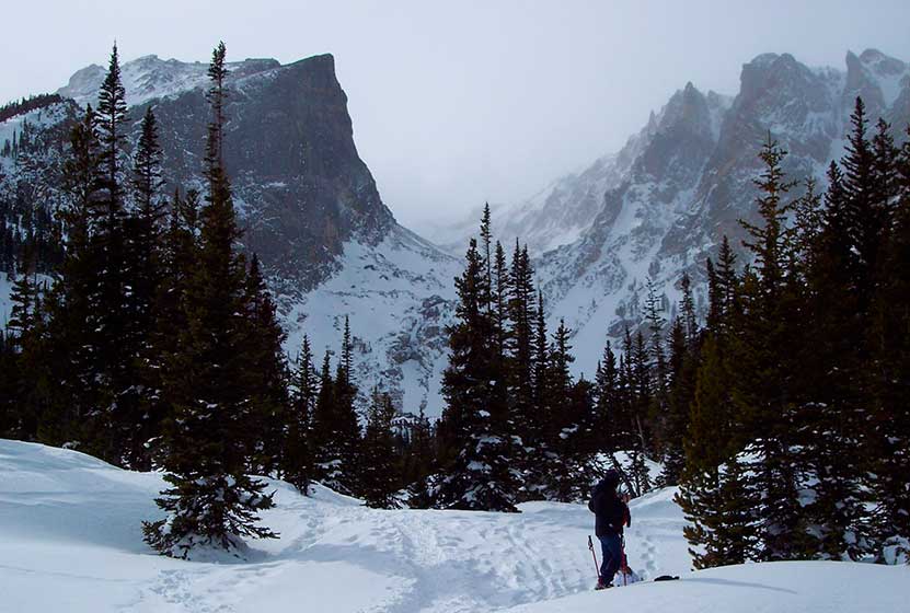
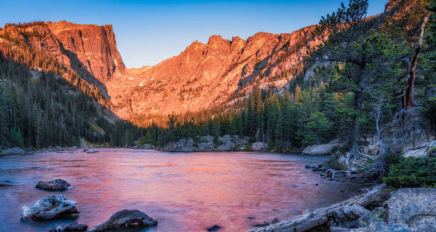
Dream Lake in Rocky Mountain National Park
The hike to Dream Lake is one of the popular destination hikes in Rocky Mountain National Park--and for good reason. In the early morning hours, Dream Lake is a vision straight out of a fairy tale. This 2.2-mile, out-and-back hike begins at the Bear Lake trailhead and passes Nymph Lake along the way. Explore the full Dream Lake hike profile below for trail map, driving directions, and all the details you need to enjoy this Colorado adventure.
Note: Rocky Mountain National Park now requires timed entry permits from May 27th through October 10th. See the RMNP permits page for more information.
Trail Snapshot: Dream Lake in Rocky Mountain National Park
| Hike Distance | 2.2 mile Round Trip |
|---|---|
| Difficulty | Easy |
| Duration | Approx 1.5hr Round Trip |
| Trail Type | Out and Back |
| Starting Elevation | 9475' at Trailhead |
| Elevation Gain | Approx. +425' |
| Seasons | Spring through Fall, Winter Snowshoeing |
| Dogs | Prohibited in RMNP |
| Hike Trail Map | Click for a Map of Dream Lake in RMNP |
| Denver Drive Time | 2 hr |
| Driving Directions to Bear Lake Trailhead | Click for Google Map |
| Town Nearest Hike | Estes Park, Colorado |
| Beauty | Sub-alpine lakes, mountain views, wildlife: Abert's squirrel, elk, bear |
| Activities | Picnicking, hiking trails, photography, snowshoeing |
| Conditions at Bear Lake Trailhead | Click Here |
| Fee | Park Pass Required |
Parking & Trailhead Information for Dream Lake:
The trail up to Dream Lake begins at the Bear Lake Trailhead (driving directions).In the event that parking lot at Bear Lake is full, you'll then need to park at the Park & Ride near the Bierstadt Trailhead and take the bus into the trailhead. This service runs 7am to 7PM and more information on the RMNP shuttle bus routes can be found at this link. The trail to Dream Lake is located on your way to Bear Lake, off to the left, just before reaching the shore viewing area of Bear Lake.
The trail to Dream Lake is paved for the first half mile. The path was surfaced to deal with the erosion caused by the heavy foot traffic, and is not considered handicap accessible. After visiting the lily pad-laden Nymph Lake, the trail becomes a dirt path and begins a gentle climb towards Dream Lake. For a short stint the trail becomes more steep and demanding. On the way up, hikers will gain views of a vast landscape featuring the Keyboard of the Winds in Glacier Gorge and Longs Peak looming over everything but the distant sky.
Just before reaching Dream Lake, the trail splits. The trail to the left takes hikers to Lake Haiyaha and the trail to the right leads to Dream Lake. Dream Lake, with the beautiful backdrop of Hallet Peak, is one of the most photographed scenes in Rocky Mountain National Park. At daybreak, light from the east illuminates the stone face and crags of Hallet, and Dream Lake returns the favor by mirroring its image in her waters.
List and Links of Destinations From Bear Lake to Emerald Lake
Tips & Resources for Hiking to Dream Lake:
- Explore More: Adventure beyond Dream Lake is Emerald Lake (+.6 mile from Dream Lake).
- Trail Map for Bear Lake Corridor: Trail Map Link
- Colorado Road Conditions: Colorado Road Conditions
- After the Hike: Poppy's Pizza
- Photo: We would like to express our gratitude to Brendan Bombaci for sharing such an amazing photograph of this hike to Dream Lake.
Weather
Map & Driving Directions
Click for Driving Directions
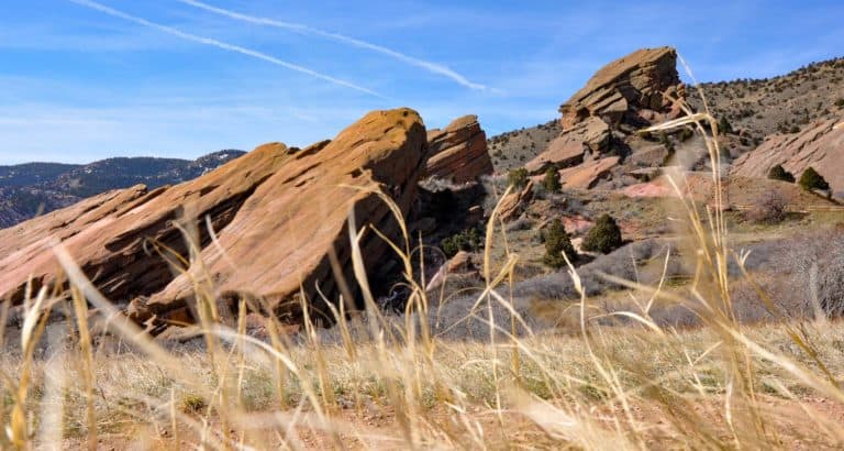
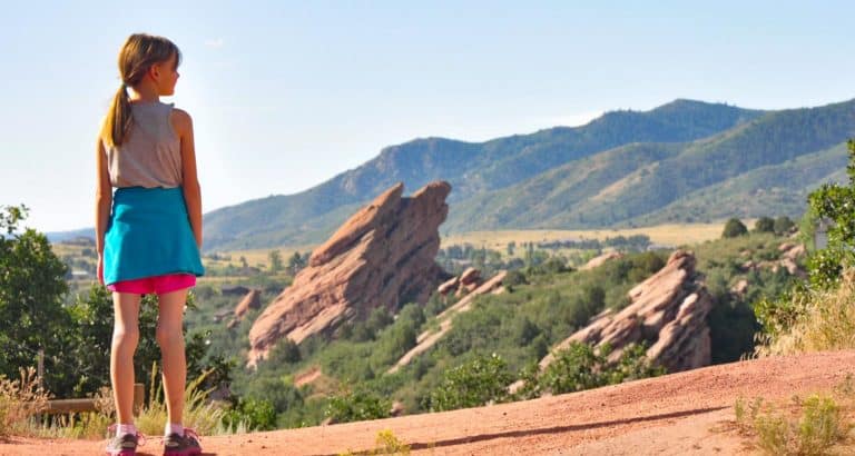
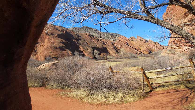
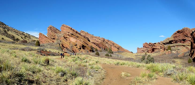
Trading Post Trail at Red Rocks Park
Ready for a hike around Colorado's Red Rocks Park and famous amphitheater? The Trading Post trail at Red Rocks takes you around 10 of the park's giant red rock formations. It's a short, 1.4-mile loop hike just 25 minutes from downtown Denver. Check out our full hiking trail profile below for all the details.
Trail Snapshot: Trading Post Loop Trail
| Hike Distance | 1.4 Mile |
|---|---|
| Difficulty | Easy |
| Duration | 1 hr |
| Trail Type | Loop |
| Elevation Gain | +500′ |
| Seasons | Year Round |
| Dogs | Allowed on Leash |
| Hike Trail Map | Click for a Trail Map |
| Denver Drive Time | 30 min |
| Directions | Click for Google Map |
| Town Nearest Hike | Morrison, Colorado |
| Beauty | Red rocks, meadows, Front Range views, Bluff Overlooks, wildlife: red fox, and mule deer |
| Activities | Picnic areas, hiking trails |
If you are looking for a family adventure that's quick to get to, this hiking trail at Red Rocks is a great option. The Trading Post trail weaves through some of Colorado's most majestic red rock formations, into meadows, and great views of Red Rocks park. Because the trail is narrow and has some steep areas, keep a good eye on the kiddos.
We hiked the Trading Post Trail on a sunny Saturday in February with our children, ages 7 and 4. They loved it, but were definitely tired at the end. However, after we finished the 1.4 mile loop, it was their idea to hike up to the amphitheater, then all the way to the top.
Trail Map for Trading Post Trail
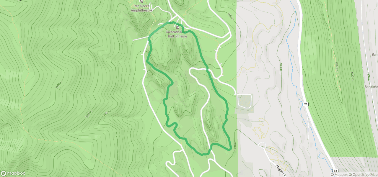
The Hike: The Trading Post Trail at Red Rocks
We started at the trading post, and hiked the loop counter-clockwise. I'd recommend hiking it this way because it gives you the move favorable views, and offers a bit of shade about 3/4 of the way through the hike--right when you need it the most. The sand and grave on the rock surface of the trail can cause your feet to slip, but as long as you are aware and take your time, it makes for a perfect leisurely hike.
You can bring your dog on this hike, however, we haven't added this trail to our list of best trails for hiking with your dog near Denver because the trail can be narrow and can be high traffic. So, if you are bringing Fido, we recommend going early in the morning, or taking the Red Rocks trail, which is more open and has fewer people on it.
I get a lot of emails from people who are only in Denver for a few days, limited when it comes to their transportation, and want to experience the outdoors. This is the hike I send them to. Why?
- The Trading Post is gorgeous year-round.
- Red Rocks is super close to Denver, and while it's still expensive, you could take a Lyft or Uber there from downtown. Get a group of friends to share the cost and you're golden.
- The elevation is less of an issue for out-of-towners, and it's a relatively easy hike. It's short, but long still long enough to get a workout.
Tips & Resources for Hiking the Trading Post Trail at Red Rocks :
- Sunscreen: There's not much shade on this hike, so bring the sunscreen
- Rattlesnakes: There are rattlesnakes in Red Rocks, as there are in many parks along the front range. Like us, they love to sunbathe, but on rocks and other warm areas. Don't let their presence deter you from enjoying this hike, but keep an eye out for the varmints.
- Climbing: Rock Climbing is Prohibited at Red Rocks
- View of Denver: After your hike around the Trading Post loop, walk up into the Red Rocks Amphitheater. It's worth climbing all the stairs to the top for a great view of Denver.
- Hours: The hiking trails at Red Rocks open one hour before sunrise and close one hour after sunset
- After the Hike: Ice Cream @ The Blue Cow
- Trail Map for Red Rocks Park: Trail Map Link
- Colorado Road Conditions: Colorado Road Conditions
Weather
Map & Driving Directions to the Trading Post Trail at Red Rocks
Click for Driving Directions
25+ Winter Hikes Near Denver
Are you ready for the winter hiking near Denver? Much of Colorado is winter wonderland from November to April, that’s why we are the best skiing destination in the world–well, we think so. I think we are also the best winter hiking destination in the world. We have over 140 hikes on Dayhikes Near Denver, but not all are as easily hiked in the winter season, so we've identified about 20 different great winter hiking trails that are easier to access and great for families looking for winter hikes.
Our Criteria for Choosing The Best Winter Hiking Trails Near Denver
- These trails are generally easy to get to. Snow and weather can make the drive to the trailhead an adventure in and of itself, so I tried to identify hikes that were more accessible.
- Most of these hiking trails have areas where you are a bit more protected from the wind. I avoided hikes like the Flatirons Vista near Boulder because, while easy to access, you're exposed to the wind the entire time.
- Beginners and families should be able to hike these together.
Hike Smart this Winter
An easy hike can turn into a difficult one when weather comes in so be sure to hike smart this winter.
- Always pack the 10 Essentials. If you need a packing list, then be sure to download our Free Hiking Guide to help you prepare and pack smart for your dayhikes.
- Before you head out on the trail, review our 10 Winter Hiking Tips to get you prepared for this season.
Explore Our 25+ Winter Hikes Near Denver Colorado

Bear Creek Trail at Lair o’ the Bear Park
Willow Creek Trail at Roxborough State Park
Fountain Valley Trail at Roxborough State Park
Emerald Lake Hike Rocky Mountain National Park
Castlewood Canyon State Park Trails
Alderfer and Three Sisters Park
South Valley Park Trails
Map of Best Winter Hikes Near Denver Colorado
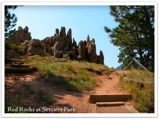
Red Rocks Trail at Settlers Park in Boulder
A giant underground sandstone formation runs from Ft. Collins all the way through Garden of the Gods in Colorado Springs. Here at Red Rocks Trail in Boulder, the rock juts out of the ground to transform the landscape. It makes for an inspiring short hike. Explore the hike snapshot and detailed trail profile below to get a feel for this great hike near Boulder.
Trail Snapshot: Red Rocks Trail at Settlers Park
| Hike Distance | 1 mile Loop + 0.4 mile spur |
|---|---|
| Difficulty | Easy |
| Duration | 45 min |
| Trail Type | Loop with Spur |
| Elevation Gain | +300′ |
| Seasons | All Year |
| Dogs | Allowed on Leash |
| Hike Trail Map | Click for a Map of Red Rocks & Anemone Trail |
| Denver Drive Time | 45 min |
| Directions | Click for Google Map |
| Town Nearest Hike | Boulder, Colorado |
| Beauty | Red Rock Formations |
| Activities | Picnic area, no bikes, hiking trails, rock climbing |
The trails of Red Rocks at Settlers Park in Boulder interconnect to form more of a labyrinth than a straightforward hike. But there is a way around all that---literally. Pull up the Boulder Open Space & Parks Map and follow the outer perimeter trail to form an approximately 1 mile loop around the sandstone red rock formations that jut out of the ground in the center of the park.
You can add an additional .8 mile to your hike by taking the Anemone trail to the west, rising another 400ft where it tops out on a hill to give you views of the City of Boulder, the Red Rocks Park, and the Colorado Front Range. Even with the Anemone trail spur, it's a short hike, so you might want to add one of the Mt. Sanitas hiking trail options to your adventure. The Mt. Sanitas trail is just North of the Centennial Trailhead.
Tips & Resources for Hiking the Red Rocks Trail at Settlers Park :
- This trail is not to be confused with Red Rocks in Denver. If you are interested in hiking at Red Rocks in Denver, you can access a trail profile for the Trading Post Trail here.
- Getting There: You can access Boulder's Red Rocks Trails from either the Centennial Trailhead or Settlers Park Trailhead parking areas.
- For information on rock climbing the rock formations in Settlers Park see the Mountain Project's page.
- Trail Map for Settlers Park Boulder: Trail Map Link
- Colorado Road Conditions: Colorado Road Conditions
- After the Hike: Ozo Coffee
Weather
Map & Driving Directions
Click for Driving Directions
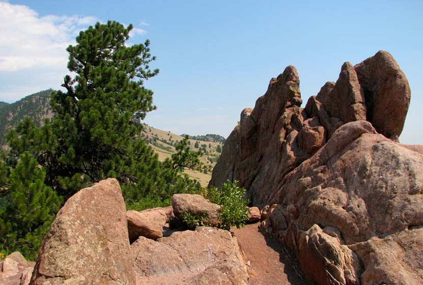
Mt. Sanitas Hike Near Boulder
If you are visiting Boulder, this is a great Colorado hike. Mt. Sanitas gives you several trail options ranging from an easy stroll along a meandering brook to a demanding trail up the mountainside. Explore the trail profile below for all the info you need on this hike near Boulder.
Trail Snapshot: Mt. Sanitas Hike in Boulder
| Hike Distance | 3.1 miles or 2 miles |
|---|---|
| Difficulty | Medium+ with Easier Options |
| Duration | Approx 2 hr |
| Trail Type | Loop |
| Elevation Gain | Approx +1343′ |
| Seasons | Year Round |
| Dogs | Allowed on Leash |
| Hike Trail Map | Click for a Trail Map |
| Denver Drive Time | 45 min |
| Directions | Click for Google Map |
| Town Nearest Hike | Boulder, Colorado |
| Beauty | Front Range mountain views, views of Boulder, wildlife: mule deer, raptors, foxes, and coyotes |
| Activities | Picnic area, horseback riding, hiking trails, climbing, No Bikes Allowed |
Mt. Sanitas offers three different hike options, ranging from the more difficult climb up the mountain, to an easy walk through a peaceful valley. Sanitas is Latin for "health", and this hike may either get you in better shape (the 3.1 mile loop), or restore your sanity (the easier options). If you are visiting Boulder, this is a great Colorado hike.
3 Hike Options at Mt. Sanitas in Boulder, Colorado
1 - The Mt. Sanitas Loop - 3.1 Mile Loop - Medium+
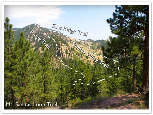
This is the classic hike at Boulder's Mt. Sanitas, and it's the most difficult of the three hike options because it involves a series of log and rock steps that will leave your quads and knees either thanking your for the workout or aching for a couple days afterwards. Because of this, we would give it a Medium+ difficulty rating. The prize of this Front Range Hike are the views at the top. You'll be able to look down into Boulder and get some great views of Colorado's Front Range.
2 - Mt. Sanitas Valley Hike - 2 Mile Out-and-Back - Easy
Here's the easiest option; 1 mile straight up the valley and back. The two words that best describe the Sanitas Valley trail: idyllic and busy. Dogs run about and jump in the creek that runs along the beginning of the path, runners fly by, and families talk and stroll together. The trail rises gently at first, then goes into more of an incline. We took our stroller; it worked fine, but was tough pushing the kids up the last 1/4 mile uphill. We turned around just after the Dakota Ridge Trail junction, making it a 2 mile out-and-back hike.
3 - Dakota Ridge Trail at Mt. Sanitas - 2 Mile Loop - Easy to Medium
You'll find side trails running East/West off of the Sanitas Valley trail which will take you up onto the Dakota ridge, a hogback that boxes in the Sanitas Valley. You can make this an out-and-back hike, or turn it into a loop by hiking back through the valley (see photo above and the Mt. Sanitas Trail Map for the route).
Tips & Resources for Hiking Mt. Sanitas in Boulder:
- Parking: This is kind of a no-brainer, but get to the trailhead early. I think we arrived around 8am on a Saturday and grabbed the last parking spot. However, we noticed that many people were walking to the trailhead from town, so there are other parking options.
- No Shade: Bring your sunscreen; the trail is mostly exposed.
- Lots of People: If you are looking for solitude, I'd recommend trying another hike. The Mt. Sanitas trail is essentially in Boulder, and its great location means that it's quite busy.
- Trail Map for Mt. Sanitas Trail: Trail Map Link
- Colorado Road Conditions: Colorado Road Conditions
- After the Hike: Ozo Coffee
Weather
Map & Driving Directions
Click for Driving Directions
