The Elk Valley Trail in Roxborough State Park climbs to a lesser visited valley in the park. Incredible views of the red rock formations of Roxborough make this a great moderate hike near Denver. The hike to Elk Valley is a 4.8 mile out-and-back journey, but can be turned into one of two more strenuous loop hikes. Explore all the details below for trail map, driving directions, trailhead info, and photos of this hike near Littleton, Colorado.
Trail Snapshot: Elk Valley Trail at Roxborough State Park
| Hike Distance | 4.8 Mile with options |
|---|---|
| Difficulty | Moderate |
| Duration | 2-3hrs |
| Trail Type | Out-and-Back with Loop Options |
| Starting Elevation | 6200′ |
| Elevation Gain | +640′ |
| Seasons | Year Round |
| Dogs | Prohibited in the Park |
| Hike Trail Map | Click for a Trail Map |
| Denver Drive Time | 45 min |
| Driving Directions to Roxborough State Park | Click for Google Map |
| Town Nearest Hike | Littleton, Colorado |
| Beauty | Red rock formations, meadows, wildlife: mule deer, eagles, foxes, birds |
| Activities | Hiking, birdwatching, Visitors’ Center |
| Fee | Entrance Fee or State Parks Pass Required |
Roxborough State Park Parking Trailhead Information
Roxborough State Park is located south of Littleton, Colorado, at the base of the foothills near Pike National Forest. The last two miles of access road into Roxborough State Park are a maintained dirt road. This segment of road can get washboarded and can be tough on the car. Undulating green hills can be seen to the east where deer and antelope graze. Roxborough can fill up during the busy weekend hours. If that’s the case, you can wait in line at the gatehouse until vehicles and a ranger gives you the signal to drive in. My guess is that the peak times are around 10AM-2PM. If the line looks long, you can always turn around and head over to Waterton Canyon or to South Valley Park–both are great options.
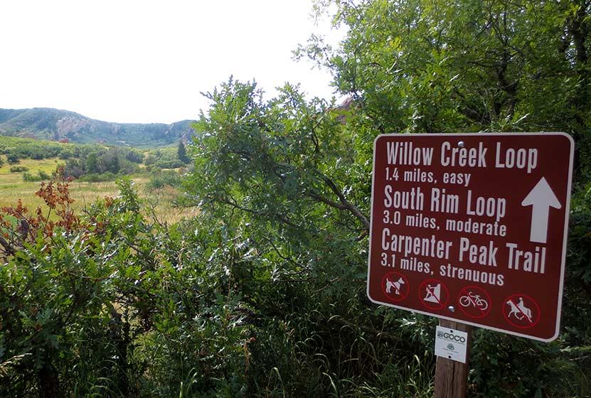
The 2.4 mile, one-way hike up to Elk Valley in Roxborough State Park begins at the main connector trail that runs south from the visitor center. Pictured above, this nearly 1/2 mile connector takes hikers through a passageway created by the scrub oak trees overarching the trail. The undergrowth in this segment of the hike contains a lot of poison ivy. While the poison ivy is off to the side of the trail, it’s still easy to brush up against. So, be aware as you make your way through this part of your hike. Also, keep alert for the many birds that make this thicket their home, especially the Western Tanagers that visit in the Spring.
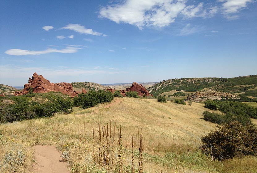
The trail emerges from the shade of the scrub oak into a meadow framed by red rock and yellow cliff bands. A lone cottonwood with a bench stands in the open field of tall grass. One of the great things about Roxborough State Park is the strategic placement of benches, many of them offering shade and wonderful views into the park. At the meadow, the trail will pass through a junction with the South Rim trail and cross a dirt service road. At this point, the trail becomes more demanding, working up a series of switchbacks that lead in and out of the forested sides of the foothills.
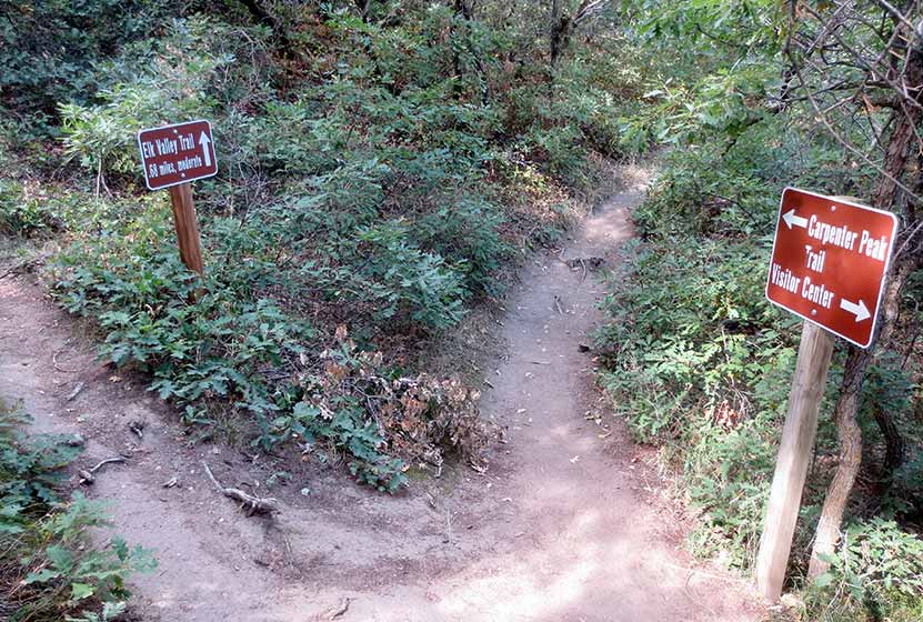
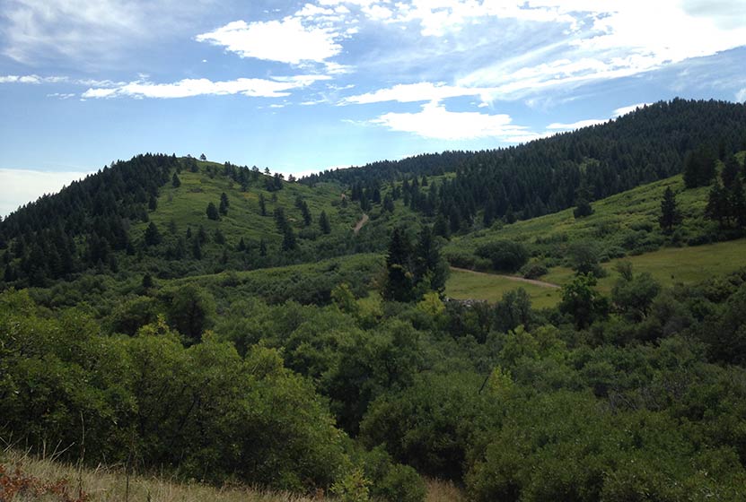
At 1.7 mile into the hike, the trail comes to a Y intersection (pictured below). The trail up the Carpenter Peak takes hikers to the right. The route to Elk Meadows and the Douglas Country Trails beyond it, lead off to the left.
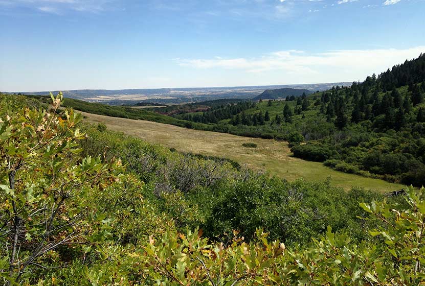
The trail climbs through the forest then opens back to the oaks thickets where, in Autumn you’ll hear the continual crunch of of acorns underfoot. Elk Valley comes into view before the trail comes to its end. Another bench sits in the shade of a pine tree and overlooks Elk Valley below. This is a quieter and less visited pat of Roxborough State Park and an ideal spot for viewing wildlife–especially in the early morning or at dusk.
Though the official Elk Valley hike ends at 2.4 miles in, the trail terminates at a junction with a set of Douglas County Trails and USFS trails. These can be used to create two different loop hike options.
Loop Hike Option #1: At the intersection, a 1.75 mile USFS Powerline Trail leads to the right, working its way North where it comes to a junction with the Carpenter Peak Trail. Here hikers can take a right, and hike approximately 1/2 mile to the summit of Carpenter Peak. From the summit, return to the visitor center by following the Carpenter Peak trail back down into the valley floor. This makes for a 7.7 mile strenuous loop hike.
Loop Hike Option #2: At the intersection, a 1.28 stretch of Douglas County Trail leads off to the left. The trail works its way East over a small peak (pictured below), then descends to a junction with the Sharptail and Swallowtail trails. The route back into Roxborough State Park requires taking a left onto a dirt road, Iron Bark Drive. This .88 mile segment (pictured on the trail map) leads northwest back into the heart of the park. Back in the park, hikers can rejoin the trails that lead back to the visitor center. This demanding loop hike totals approximately 5.3 miles.
Tips & Resources for Hiking to Elk Valley in Roxborough
- Packing List: Always pack the 10 Essentials. Download our Hiking Guide to get list and dayhiking packing checklist.
- Dealing with Poison Ivy: You don’t have to come into direct contact with poison ivy to get it. Often, it transfers from your clothing to your skin. So be sure to wash your clothing when you get home, if you think you have brushed up against it during your hike in Roxborough.
- Hiking in Winter: If you plan to hike Elk Valley in the winter, it is advised that you have traction devices like YakTrax because much of the trail will be in shadow, and ice will likely form on the trail.
- Trail Map for Roxborough State Park: Trail Map Link
- Colorado Road Conditions: Colorado Road Conditions
- After the Hike: Waterton Tavern in Roxborough
Weather
Map & Driving Directions
Click for Driving Directions


