The Crags Trail takes hikers up a 2-mile gradual hike to the the dramatic granite pinnacles on the shoulders of Pikes Peak to take in views of snowcapped peaks. A shaded creekside hike great for families and out-of-town guests, the Crags shows off summer wildflowers in mountain meadows. Explore the full Crags hike profile below for trail map, driving directions, and more tips and details to help you enjoy this adventure in the Pikes Peak region.
Trail Snapshot: The Crags near Colorado Springs
| Hike Distance | 4.5 miles Round Trip |
|---|---|
| Difficulty | Moderate |
| Duration | Approx 2 hours |
| Trail Type | Out and Back |
| Starting Elevation | 10,900′ |
| Elevation Gain | Approx +800′ |
| Seasons | Year Round/Snow in Winter |
| Dogs | Allowed On Leash |
| Hike Trail Map | Click for a Map of The Crags |
| Denver Drive Time | 2 hr |
| Driving Directions to The Crags Trailhead | Click for Google Map </a |
| Town Nearest Hike | Divide, Colorado |
| Beauty | Rock Formations, Views to Snowcapped Mountains, Vistas, Wildflowers, and Creek. |
| Activities | Hiking, trail running, snowshoeing, photography |
Parking & Trailhead Information for The Crags
From Denver, you can get to the Crags by driving a direct route via I25 and HWY 24 or you can take a more Scenic Route through the foothills on 67.
The Direct Route
Take interstate 25 south to Colorado Springs, exit at 141 onto US 24 West. You’ll drive for about 25 miles into the mountains and through the small town of Divide. Turn left/south onto Hwy 67. Signs should point the way to Mueller State park, which is also on this stretch of road. Just after the entrance to Mueller (on the left), the road you need for the Crags is on the left, CO RD 62. Taking a left onto 62, and drive for about 3 miles. The parking area for the Crags will be on the right side of the road and the trail will start on the left side of the road. Note that this last segment of road is improved dirt road, so the quality of the drive will depend on the current conditions, and may require 4WD in the Winter months.
The Scenic Route
From Denver, take Hwy 285 South toward Pine Junction. Take a left onto Pine Valley road. Here your journey becomes scenic and the roads curvy. Pay close attention while driving and be prepared for the drive to take longer than the 2 hours and 15 minutes posted by mapping software. You’ll have some beautiful segments in here, especially the drive along the South Platte River. Cell service is spotty out here, so I always recommend having on hand the Colorado Gazetteer Map printed by DeLorme. The Road changes names to Deckers Road when it passes through the Buffalo Creek area. Eventually, it Deckers road will weave its way down into Deckers. There is a small restaurant here where we’ve stopped for ice cream. In Deckers, you’ll continue straight (south) on 67, passing through Westcreek, until it ends at a stoplight in Woodland Park. Go right at the light, West on 24, until you come again to Hwy 67 just outside of Divide. Then follow the directions above on 67 to the Crags Trailhead.
The Hike: The Crags
This is my favorite hike in the Pikes Peak Region because it’s relatively easy, shows off a variety of landscapes, and has incredible views at the top. The trail starts off at the end of the Crags Campground loop and follows the drainage of Fourmile creek. Early on, hikers will come to a fork in the trail. The left-side branch is a more demanding hike, gaining elevation more quickly and has less shade. This trail profile will follow the right-branch, which is more gradual and offers more shade than the left branch. The left branch and right branch can be connected via a scramble at the top to form a loop trail. If taking this route, be aware of the conditions (snow and ice accumulate October through June). Scrambling is fun, but it’s also easy to find yourself in a difficult and dangerous circumstance.
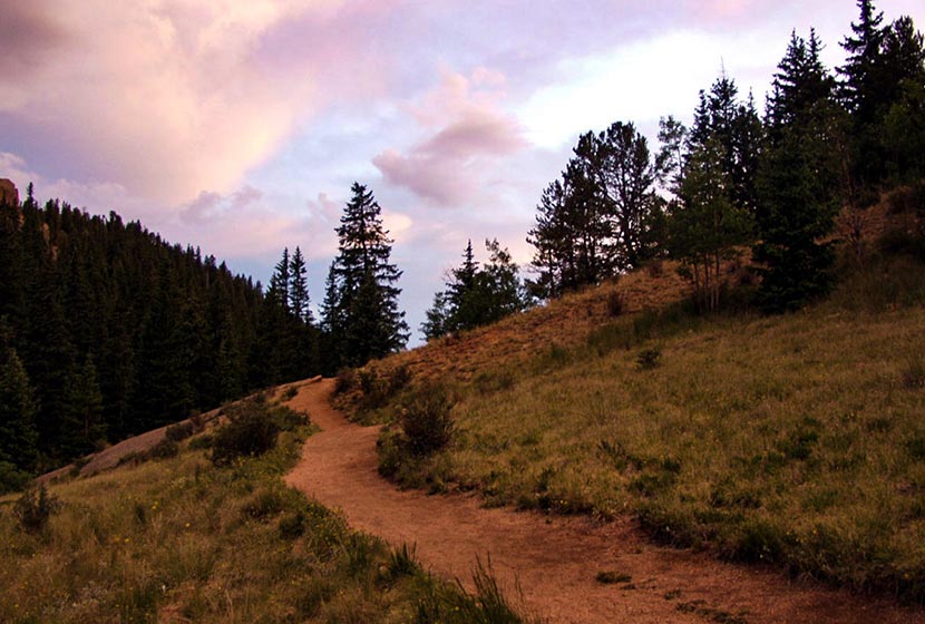
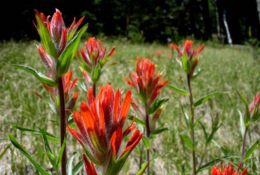
Taking the right branch, the trail will follow alongside Fourmile creek through evergreens and aspens until it opens out into a broad valley surrounded by orange and pink granite cliffs. Wildflowers, like the Indian Paintbrush, bloom in these meadows during the summer months. An interesting fact about Indian Paintbrush: the “flowers” are actually its leaves and there are oranges, reds, and even yellow types of this plant in Colorado.
In the valley, the trail will come to another fork. The main route goes straight up a gradual ascent to the crags and the right-branch is more steep, leading to another vista point. Continuing on the main route, the trail makes its way up gentle slopes, the grassy terrain giving way to cubic granite rock.
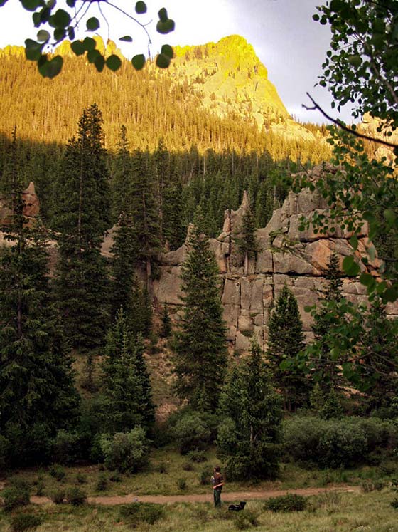
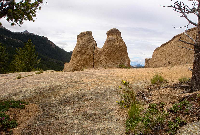
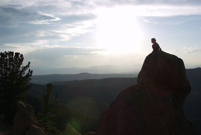
The pink and orange granite pinnacles come into view and the ground eventually opens up to a broad area where hikers gain views of the Sangre De Cristo Mountains in the south, of Pikes Peak, and Mueller State Park. This hike is great for families, but do keep a close eye on children as the rock gives way to steep segments of cliffs at the edges.
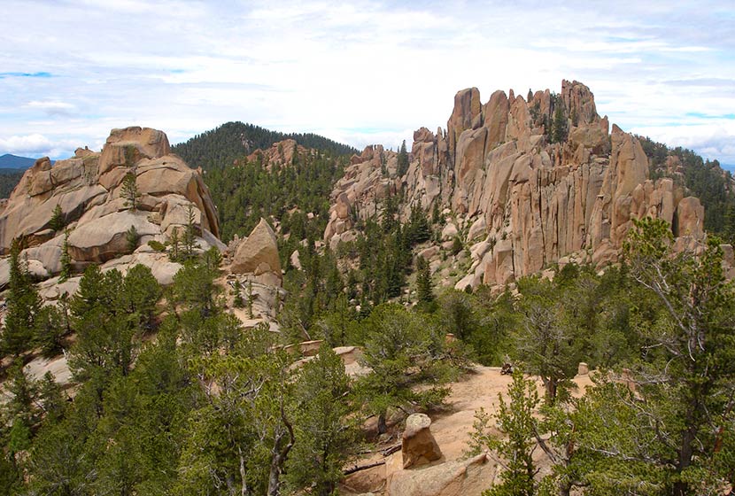
I’m not sure what the locals have named this formation pictured below, but I think of it as the Twin Bears, because it looks like a couple bears sitting on their haunches taking in the views.
I considered grading this an easy hike because the trail is so gradual, the total elevation gain is under 1000 feet. However, those who are hiking with kids or out-of-town guests, should consider it more moderate because it’s almost 5 miles total and does gain 800 feet. It makes for a perfect picnic hike with friends.
If hiking in the later hours of the day, it’s important to know that because most of the hike is in the folds of the mountain, it gets dark quickly. I always pack my headlamp, but it’s especially relevant if you are hiking during these hours.


Tips & Resources for Hiking The Crags
- Dogs: While a dog friendly hike, the granite rock up top is jagged and can impact your dogs padded feet.
- Options: See the different trail options above to take in different unique views of the surrounding landscapes.
- Trail Map: The Crags Trail Map
- Packing List: Always pack the 10 Essentials. Download our Hiking Guide to get the list and dayhiking packing checklist.
- Colorado Road Conditions: Colorado Road Conditions
- After the Hike: Swirl Wine Bar in Manitou Springs
Weather
Map & Driving Directions
Click for Driving Directions


