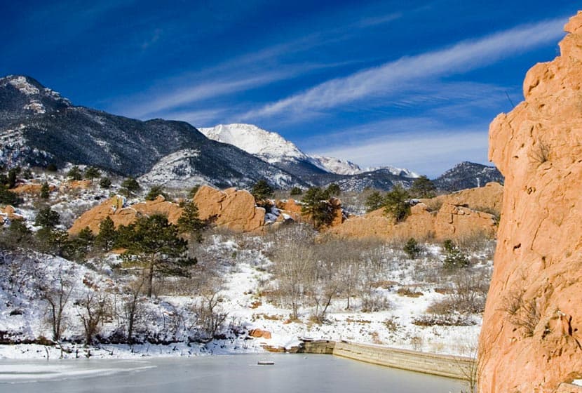
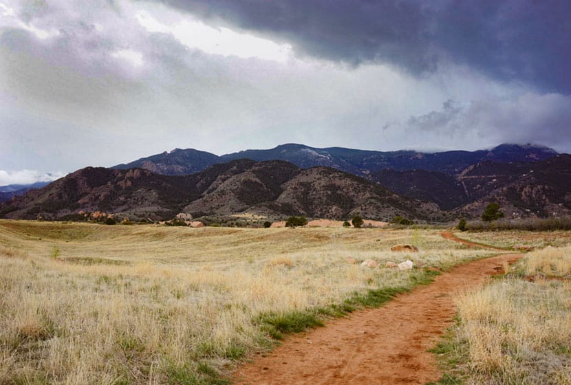
Red Rock Canyon Open Space features miles of easy hiking trails just a few miles west of Colorado Springs with views of Pikes Peak to the West and Garden of the Gods to the North. The park has two off-leash dog trails and most other trails are accessible to and shared by hikers, trail runners, and mountain bikers. Check out the full Red Rock Canyon Open Space hike profile below for trail map, driving directions, and more five different hike options to explore at this park near Colorado Springs.
Trail Snapshot: Red Rock Canyon Open Space
| Hike Distance | 1 to 3.3 miles Round Trip |
|---|---|
| Difficulty | Easy |
| Duration | Approx 1-2 hours |
| Trail Type | Loops and Out and Back Options |
| Starting Elevation | 6100′ |
| Elevation Gain | Approx +100′to +900′ |
| Seasons | Year Round |
| Dogs | Allowed On Leash, Off Leash in Designated Areas |
| Hike Trail Map | Click for a Map of Red Rock Canyon Open Space |
| Denver Drive Time | 1hr 15min |
| Driving Directions to Red Rock Canyon Open Space | Click for Google Map |
| Town Nearest Hike | Colorado Springs, Colorado |
| Beauty | Red rock formations, migratory birds, ruins of red rock quarry, pond area, and deer. |
| Activities | hiking, mountain biking, trail running, snowshoeing, photography |
Parking & Trailhead Information for Red Rock Canyon Open Space
From Denver, take Interstate 25 south to Colorado Springs, taking the Cimarron St/24 West. Proceed about 3 miles West on Cimarron/24 and take a left onto Ridge Road. At the roundabout, take a left (by going around 3/4 of the roundabout). The parking lot and trailhead for Red Rock Canyon will be on your right.
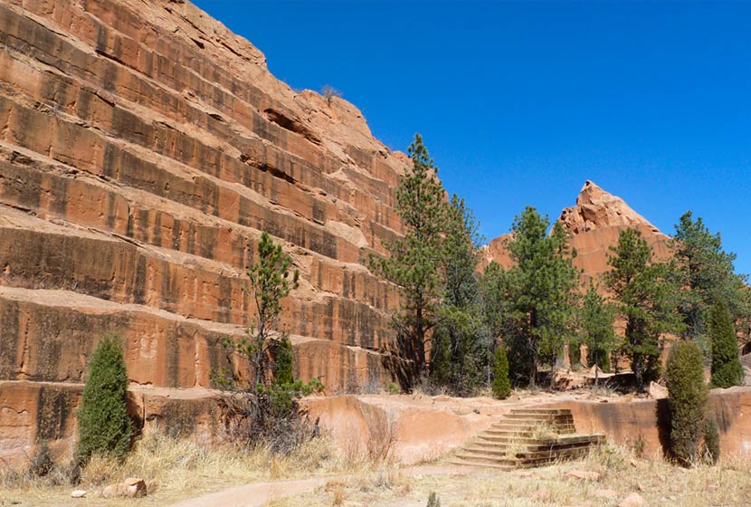
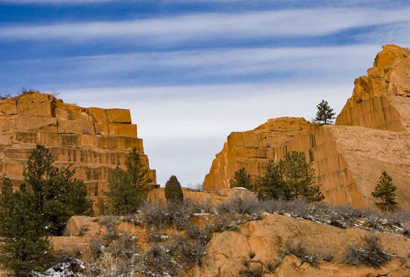
From the trailhead hikers can pick up two of the main trail arteries, the Mesa Trail that works its way through the middle of the park, and the Red Rock Canyon Trail, which runs along the east side. Both lead toward the most popular destination, the quarry.
5 Hike Options in Red Rock Canyon Open Space
-
-
The Dog Loops: 1/2 and 1 mile
-
The upper dog loop is an approximately one-mile curcuit, while the lower is about 1/2mile. Both are great options for a quick walk with the dog after work in a space set aside for off-leash exercise and play. You’ll find these two off-leash dog trails immediately South of the parking lot.
-
-
Contemplative-Sand Canyon Loop: 1.75 miles
-
This short loop hike offers more peace and quite because it’s tucked away along some of the red rock formations, and the Contemplative Trail segment is designated a hiker-only trail. Pick up the Contemplative trail by starting at the Sand Canyon Trail (West end of the parking lot). This will lead to the Contemplative Trail. You can hike the Contemplative Trail out-and-back, but hikers also have a loop option by joining back up with the Sand Canyon Trail and taking it back to the parking lot.
-
-
The Quarry Loop: 2 Miles
-
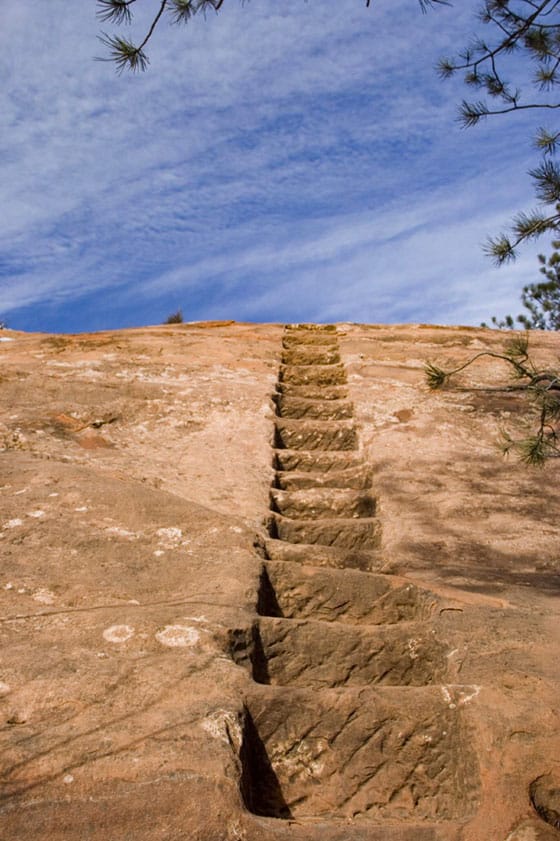
The most interesting destination in Red Rock Canyon is the old Quarry. If you’ve been in downtown Denver or Colorado Springs, you’ve probably seen old houses and buildings built with Red Rock cut from quarries like this one. One 2-mile loop option starts by taking the Red Rock Canyon trail to the east side of the Quarry (pick this trail up from the East end of the parking lot). This will run along to the back side of the quarry where you can take the old miner’s steps up the side of the red rock. Once up and over, take the Quarry Pass Trail to the Mesa Trail, and hike the Mesa Trail North back to the parking area.
-
-
Hogback Valley-Lion Loop: 3.3 Miles
-
Starting at the east parking lot, pick up the Lower Hogback Tail. The trail will lead up to the Red Rock Rim Trail, then the Hogback Valley Trail taking you into a mesa of meadows with views into Colorado Springs and of Pikes Peak. Take a trail map with you as several trails will tie in together. Connect with the Lion Trail (the upper Codell Trail is more demanding, so be aware of this if choosing that option). Taking the Lion Trail North (right), it will lead back towards the parking area.
-
-
Mesa-Greenlee Loop: 3 Miles
-
This is probably the best hike in the park because it takes hikers through the heart of Red Rock Canyon along the gentle ridge of mesa where you can take in expansive views up to Pikes Peak and out to Garden of the Gods. Start at the Mesa Trail, taking it to the Southern end of the park where it connects with the Greenlee Trail. Return North via the Greenlee Trail to make this a 3 mile loop hike.

Tips & Resources for Hiking Red Rock Canyon Open Space
- TIP: The Southern end trails at Red Rock Canyon connect up with the following area trails: Intemann Trail, and Palmer Red Rock Trail, and others that lead south into Bear Creek Park.
- Nearby Hikes: The Crags Hike, Garden of the Gods Trails, and Helen Hunt Falls.
- Trail Map: Red Rock Canyon Open Space
- Packing List: Always pack the 10 Essentials. Download our Hiking Guide to get the list and dayhiking packing checklist.
- Colorado Road Conditions: Colorado Road Conditions
- Photo: We would like to express our gratitude to Brian Schultze, Sfgamchick, and Cody Wellons for sharing such an amazing photographs of this hike in Colorado Springs.
- After the Hike: Bristol Brewing Company
Weather
Map & Driving Directions
Click for Driving Directions


