The Eagles View Loop hike in Reynolds Park is a 4-mile, moderate, loop trail to a scenic outlook. The trail ascends through meadows and ponderosa pine forest to views of Pikes Peak and the sawtooth spires and peaks of the Rampart Range. Explore the full Reynolds Park Eagle View Loop hike profile below for trail map, driving directions, and more tips and details to help you enjoy this adventure near Conifer, Colorado.
Trail Snapshot: Reynolds Park Eagle View Loop
| Hike Distance | 4 or 4.4 miles Round Trip |
|---|---|
| Difficulty | Moderate |
| Duration | Approx. 2 hours |
| Trail Type | Loop |
| Starting Elevation | 7,250’′ |
| Elevation Gain | Approx +900′ |
| Seasons | Year Round |
| Dogs | Allowed On Leash |
| Hike Trail Map | Click for a Map of Eagles View Loop at Reynolds Park |
| Denver Drive Time | Approx. 50 min |
| Driving Directions to Reynolds Park | Click for Google Map |
| Town Nearest Hike | Conifer, Colorado |
| Beauty | Scenic Overlook, Aspen woodlands, Views of Pikes Peak and Cathedral Spires |
| Activities | Hiking, Trail Running, Equestrian Trails, Photography |
Parking & Trailhead Information for Reynolds Park
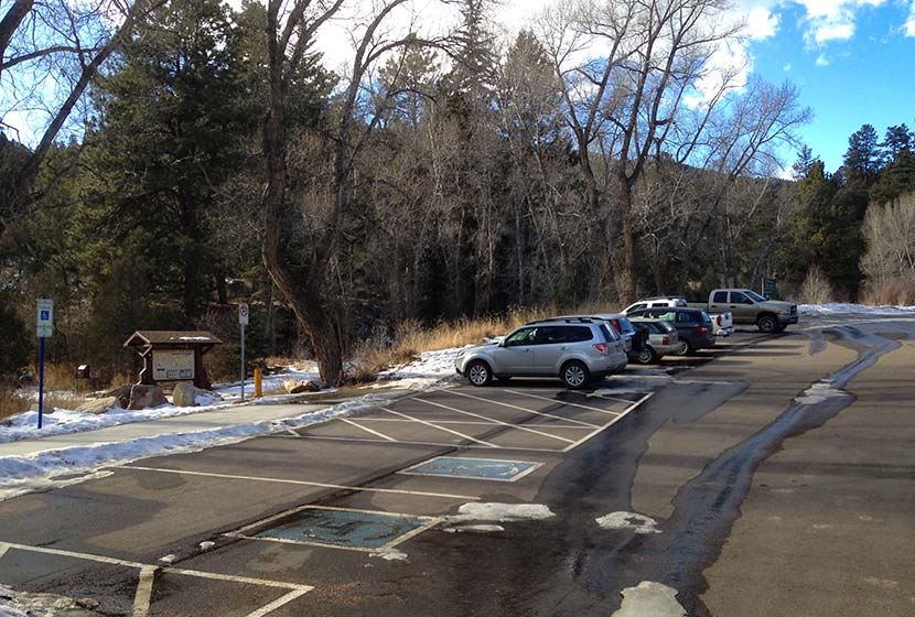
I really enjoy the drive into Reynolds Park, particularly for the last stretch descending to the trailhead. The trailhead is about 50 minutes from downtown Denver. From Denver, take 285 South to Conifer, Colorado taking the Kennedy Gulch exit. At the exit, you’ll take a left onto Kennedy Gulch Road, which will go under the 285 overpass. At the next stop sign, you’ll see a red barn in front of you and an entrance to 285 on your right. Here, you’ll take a left onto Foxton Road. This is where that beautiful stretch of road begins. Drive for about 5 miles and the Reynolds Park parking area will be on your right. The parking area can hold about 45 vehicles. There are restrooms, picnic tables, and grills at the trailhead.
The Hike: Eagles View Loop at Reynolds Park
This loop hike gives hikers the most extensive exploration of the larger West side of Reynolds park. Begin by taking the main trail found on the south end of the parking lot (near the restrooms). It’s wider than the other trails. At the first junction, take a right onto the Elkhorn Trail. This will lead through a mix of wooded areas and meadow.
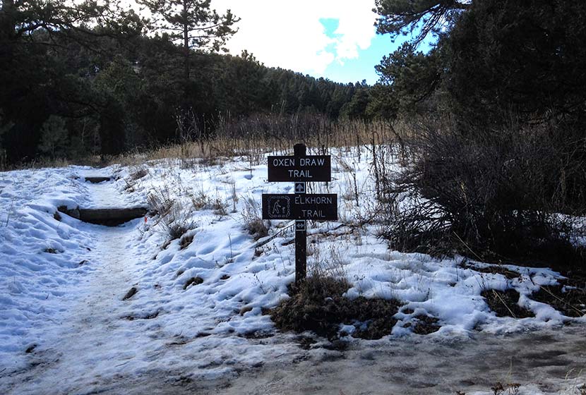
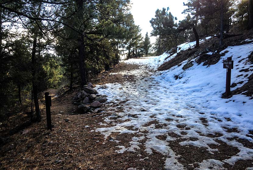
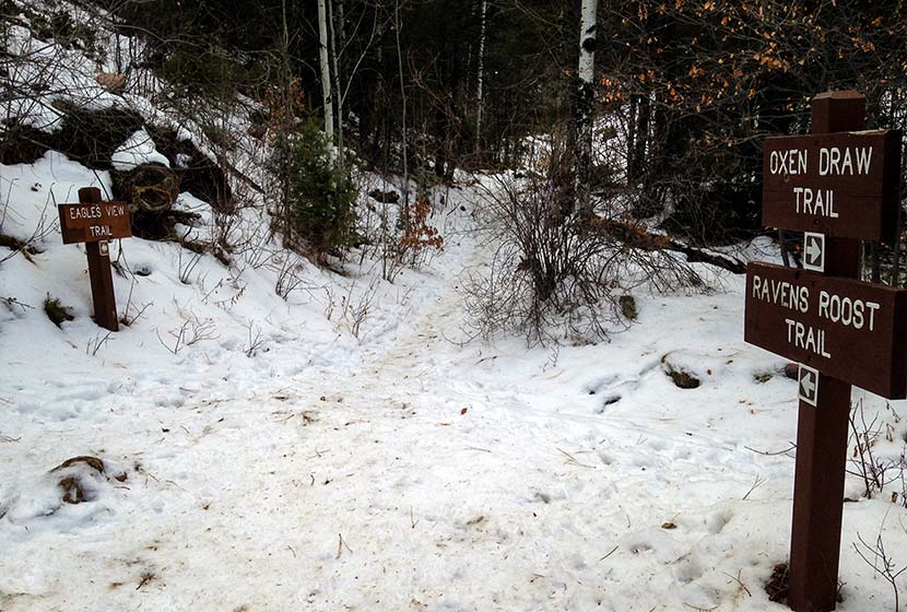
Hikers will travel about 0.3 mile on this segment of the Elkhorn Trail until it intersects with the Ravens Roost Trail. Here, take the Ravens Roost trail which is more steep, ascending for 0.6 of a mile up to the next junction with the Eagles View Trail. Both the Ravens Roost and Eagles View trails are Hiker and Equestrian Only (no bikes, but dogs are allowed). You’ll travel through stands of ponderosa pine. Look for Clarks Nutcracker and Stellar Jays as you hike. At the junction, the Eagles View Trail will bear to the right (pictured below).
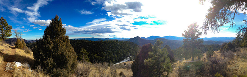
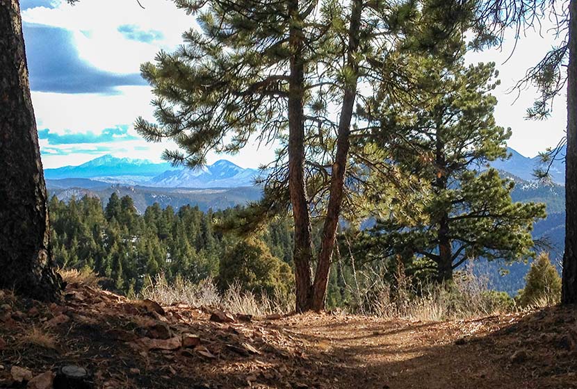
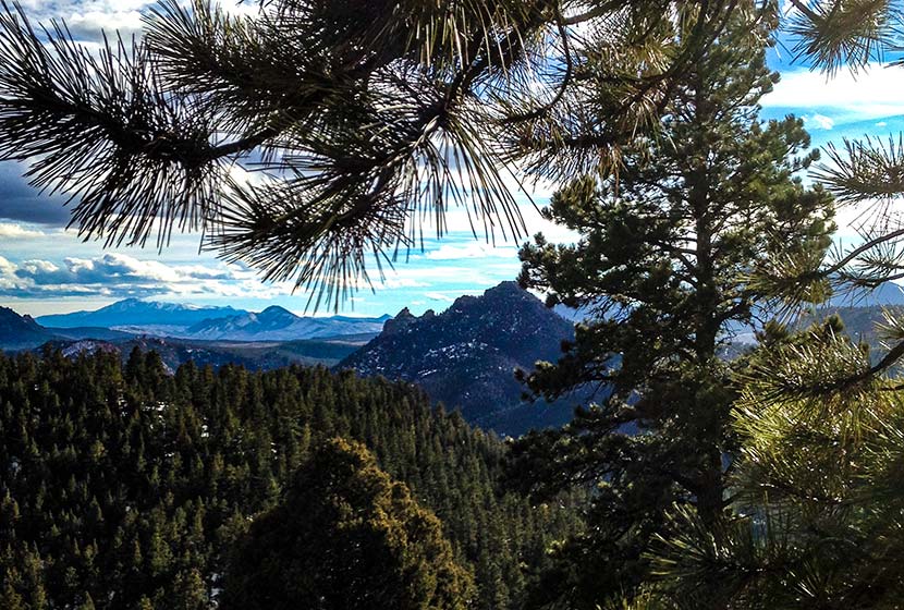
The trail will eventually open up to panoramic views, with the Eagles View scenic viewpoint being the best.
At the viewpoint, there are expansive views of the Rampart Range, and pikes Peak to the South. The Rampart Range is a low mountain range that stretches from south of Denver to Colorado Springs. The range is characterized by scraggy granite peaks jutting out of green forested foothills. At sunrise the granite rock formations light up orange and pink, and look like a series of castles or the rampart wall of a giant ancient fortress. My favorite view of the Rampart Range is from the Devils Head trail and from the Fire Lookout Tower up on Devils Head. It’s the tallest peak in the range with an elevation of 9632 feet.
From the scenic point at Eagles View, the trail begins to descend and wind its way north. Pause on this segment to take in the views into the valley below and out to the distant plains in the East.
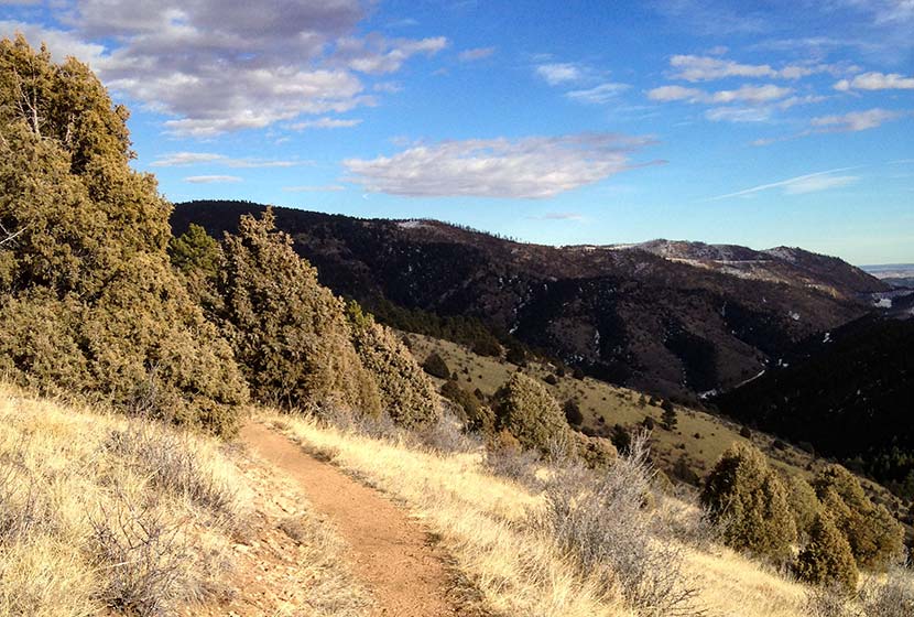
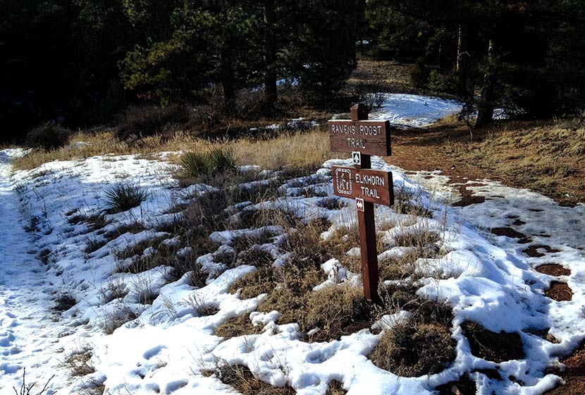
Eventually, the trail will come to another juncture with the Ravens Roost (south segment) and the Oxen Draw Trail. Both are options back to the Trailhead. Taking the Ravens Roost trail makes for a longer 4.4 miles total. Taking the Oxen Draw trail will make your total trip around 4 miles.
When I hikes this in the Winter, the Oxen Draw Trail got quite icy from a recent thaw and freeze. I’m assuming this is pretty normal for this shaded area of the park during the cold months. I wish I had brought my traction devices because the trail had some steep and sketchy, ice-coated segments. I had my trekking poles, and they helped, but it was difficult to navigate.
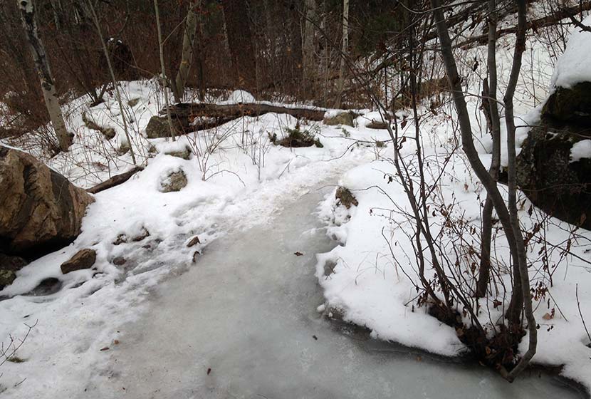
You may notice that I’ve marked this as a dog-friendly hike. Most of the year that’s true, but these icy segments of the Oxen Draw Trail in the Winter may not be the best for your best friend. Overall, though this hike has proven to be one of the lesser traveled trails near Denver–especially on a weekday. Be sure to watch the video below to get a feel for the hike.

Tips & Resources for Hiking at Reynolds Park in Jefferson County
- Trekking Poles and Traction: If you are hiking in the Winter or Spring, the this trail (as you can see from the photos above) can get icy and muddy. Trekking Poles and Traction Devices are recommended for these seasons. I’m a huge fan of trekking poles because they take so much impact off the knees when hiking and backpacking, and they allow us to navigate more demanding terrain. Check out Trekking Pole options at REI.
- Camping: There are 5 tent camping areas on the East end of Reynolds Park that require only a short hike in and make for a good way to introduce your kids or family to a weekend camping trip without having to travel far from Denver. You can reserve a campsite at the Idylease Campground at the Jefferson County Parks Reservations Page. The campground is just a 1/2 mile hike in and has restrooms–but no drinking water–available at the site.
- Trail Map: Reynolds Park in Jefferson County Park Map
- Packing List: Always pack the 10 Essentials. Download our Hiking Guide to get the list and dayhiking packing checklist.
- Colorado Road Conditions: Colorado Road Conditions
- After the Hike: Scooters Smokehouse BBQ
Weather
Map & Driving Directions to Reynolds Park
Click for Driving Directions


