Hikes in Colorado Springs will take you to some stunning waterfalls and through the red rocks of Garden of the Gods with the snow-capped backdrop of Pikes Peak filling against a blue sky. Because Colorado Springs is situated right at the base of the foothills, there are many trailheads right within the city limits. You can be out of the car and on the trail in a matter of just a few minutes. If you live in the Denver area, Colorado Springs is located just 1 hour south of the city center.

Blodgett Peak Hike Near Colorado Springs
Blodgett Peak requires a challenging 3.2 mile ascent through the passage of rocky canyon to the summit where hikers gain panoramic views of Pikes Peak, Rampart Reservoir, and the United States Air Force Academy. Located on the northwestern edge of Colorado Springs, Blodgett Peak is a local favorite for those looking for demanding workout or just to enjoy the 360 ...
Catamount Falls Hike Near Colorado Springs
The hike to Catamount Falls is a moderate 2.8-mile loop hike about 25 minutes outside of Colorado Springs. This waterfall hike takes hikers to three different waterfalls and over two different creeks that spill down from the heights of Pikes Peak. It makes for a great weekend adventure, coupled with a great opportunity for brunch at the Pantry in Green ...
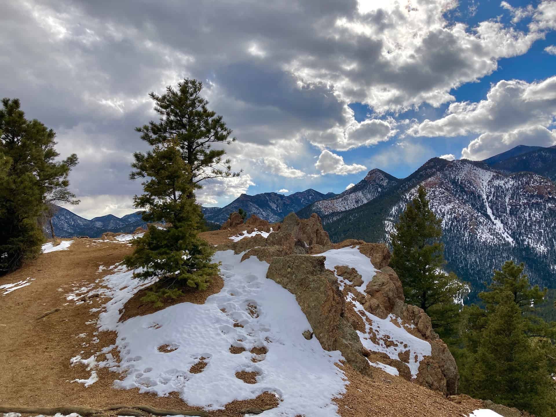
Crags Hike Near Colorado Springs
The Crags Trail takes hikers up a 2-mile gradual hike to the the dramatic granite pinnacles on the shoulders of Pikes Peak to take in views of snowcapped peaks. A shaded creekside hike great for families and out-of-town guests, the Crags shows off summer wildflowers in mountain meadows. Explore the full Crags hike profile below for trail map, driving directions, ...
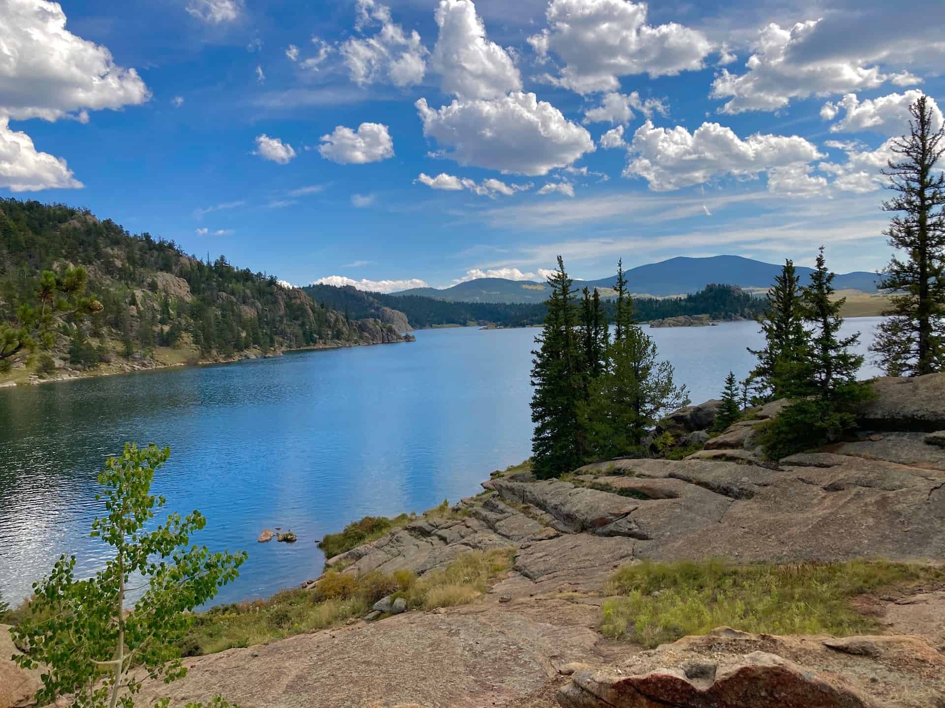
Eleven Mile State Park Interpretive Trail
Eleven Mile State Park feels like the proverbial "hidden in plain sight" gem. Situated off the commonly traveled Highway 24 between Colorado Springs and Buena Vista, this loop hike blesses visitors with uncommon beauty. Trekking around the 3.5+ mile trail serves up a superb buffet of Colorado's classic outdoors: aspen and evergreen forests, meadows, rocky crags, vistas of mountain ranges, ...
Fallen Timbers Loop Hike at Fox Run Park
The Fallen Timbers Loop is an easy, 2-mile hike near Colorado Springs with great views of Pikes Peak. It makes for a great family hike because of the shade of the ponderosa pines and the nearby playground at this hike in Fox Run Regional Park. Explore the full hike profile for trail map, driving directions, and tips. Trail Snapshot: Fallen ...
Garden of the Gods Ultimate Hiking Guide
Garden of the Gods is argueabley the best place to hike in Colorado Springs. Designated a National Natural Landmark, the park is known for its towering red sandstone formations and panoramic views of Pikes Peak. Hiking, Horseback riding, mountain biking, birding, and climbing are among the activities that can be enjoyed here. This guide to the Garden of the Gods ...
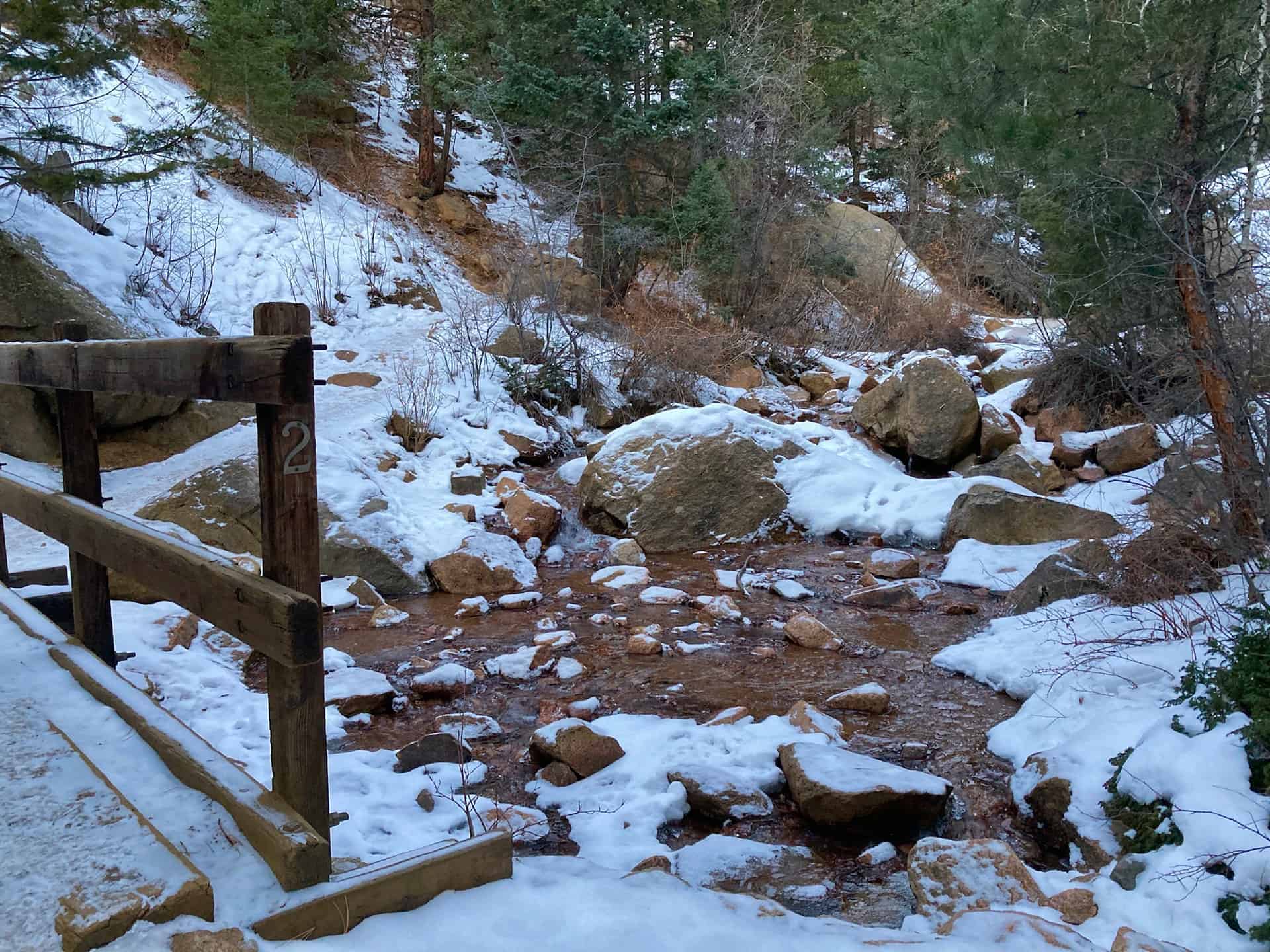
Helen Hunt Falls in Colorado Springs
Helen Hunt Falls in Colorado Springs is a 35 foot waterfall requiring only a short walk from the parking area. For a longer and more demanding hike, visitors can take the 4 mile Columbine Trail from the bottom of Cheyenne Canyon to Helen Hunt Falls. This strenuous option affords and experience of the rich ecosystem of this canyon at the ...
Horsethief Falls Hike Near Colorado Springs
Horsethief Falls is a small slab waterfall located 45 minutes from Colorado Springs on the West side of Pikes Peak. The Horsetheif Falls trail requires a 1.4-mile easy hike (one-way) to the falls. This hike, along with nearby Pancake Rocks make for great fall hiking and a scenic falls drive to see the golden aspens of the Colorado Front Range ...
Manitou Lake Hike Near Colorado Springs
Manitou Lake near Colorado Springs offers a pleasant and easy loop trail around its shores with views of Pikes Peak. It's also a great spot fishing and paddling on the 5-acres of water. There are nearby camping options detailed below. Explore the full Manitou Lake hike profile below for trail map, driving directions, campground info and more. Trail Snapshot: Manitou ...
Mt. Buckhorn hike near Colorado Springs
The Mt. Buckhorn Hike, taking the shape of what hikers often call a "lollipop loop," forms the bridge between the Section 16 hike and the Seven Bridges & Kineo Mountain hike. As with those hikes, the surprising aspect is its immediacy -- within minutes of turning off the highway the trailhead appears. And if parking has filled, other options await ...
Mt. Cutler Hike in Colorado Springs
Mt. Cutler in Colorado Springs is an easy, 1-mile hike to the summit of a foothill peak that overlooks Seven Falls, the canyon system of Cheyenne Canyon, and offers panoramic views that make this hike a great option for visiting friends and family. Because it's just 2 miles out-and-back with less than 500 feet of elevation gain, this hike offers ...
Paint Mines Hike Near Colorado Springs
The Paint Mines trail takes hikers on an easy 3.7 mile loop through a badlands landscape of rainbow sandstone and hoodoo rock formations about 90 minutes south of Denver and 45 minutes east of Colorado Springs. Explore the full Paint Mines hike profile below for trail map, driving directions, and more tips and details to help you enjoy this adventure ...
Petrified Forest Hike at Florissant Fossil Beds
The Petrified Forest trail is an easy 1.5 mile loop hike just a 50 minute drive from Colorado Springs. This hike at the Florissant Fossil Beds National Monument takes you past the fossilized stumps of ancient sequoia trees, over rolling mountain meadows with views of snowcapped peaks, and is a great way to learn about the geology of Colorado while ...
Rainbow Falls Hike in Colorado Springs
The hike to Rainbow Falls is a short easy walk to the waterfall and a historic bridge. The waterfalls is located in Manitou Springs, just west Colorado Springs. The waterfall and bridge had been neglected for decades, but the area is now being restored by local government and local citizens. Explore the full Rainbow Falls hike profile below for trail ...
Red Rock Canyon Hikes
Red Rock Canyon Open Space features miles of easy hiking trails just a few miles west of Colorado Springs with views of Pikes Peak to the West and Garden of the Gods to the North. The park has two off-leash dog trails and most other trails are accessible to and shared by hikers, trail runners, and mountain bikers. Check out ...
Santa Fe Regional Trail in Palmer Lake
The Santa Fe Regional Trail begins in Palmer Lake, Colorado, about 1 hour South of Denver. It's an easy trail with 17 miles from Palmer Lake to Colorado Springs along the old path of the Santa Fe Railroad. Explore the full Santa Fe Regional Trail hike profile below for trail map, driving directions, and more tips and details to help ...
Section 16 Hike near Manitou Springs
Nestled between Manitou Springs on the west and Colorado Springs on the east, the Manitou Section 16 Open Space overlaps with the Red Rock Canyon Open Space to the north, just off Highway 24. Both of these systems connect to two other regional parks, creating a massive complex of trails that delights hikers of all ages and abilities. This route ...
Seven Bridges to Kineo Mountain Loop
Immensely popular in the summer, the Seven Bridges trail beckons hikers up and across North Cheyenne Creek multiple times, meandering by and over tumbling creek waterfalls. The route described below launches from the Seven Bridges trail out onto a loop around Kineo Mountain, reaching a connection point with the Mt. Buckhorn hike. These two loops, along with the Section 16 ...
Seven Falls Hike in Colorado Springs
The hike to Seven Falls in Colorado Springs follows a paved canyon trail 0.8 mile to this famous tiered 181-foot waterfall. After severe damage by the floods in 2013, the Broadmoor Resort purchased the property and has made significant improvements, including trail and site repairs, as well as creating an on-site restaurant. As in the past, there is an access ...
Tarryall Falls Near Jefferson, Colorado
The Tarryall Falls Trail is a short, 1/4 -mile hike across a small canyon to a waterfall that pours into Tarryall Creek. The slopes of snow-capped peaks along Boreas pass make for a majestic backdrop against the contrasting sage grasslands of surrounding South Park.Tarryall Falls draws its waters from the Tarryall Reservoir, a popular camping and fishing destination here in ...
Ute Valley Park Loop in Colorado Springs
Ute Valley Park offers an easy 3-mile loop hike in the heart of northern Colorado Springs with views to snow-capped Pikes Peak. The trails make for a quick break from the city to trail run or walk the dog. Get the trail details, map, and driving directions in our full trail profile. Trail Snapshot: Ute Valley Park Hike Distance 2.5 ...
Thanks goes out to sctkirk for the beautiful image of Garden of the Gods.