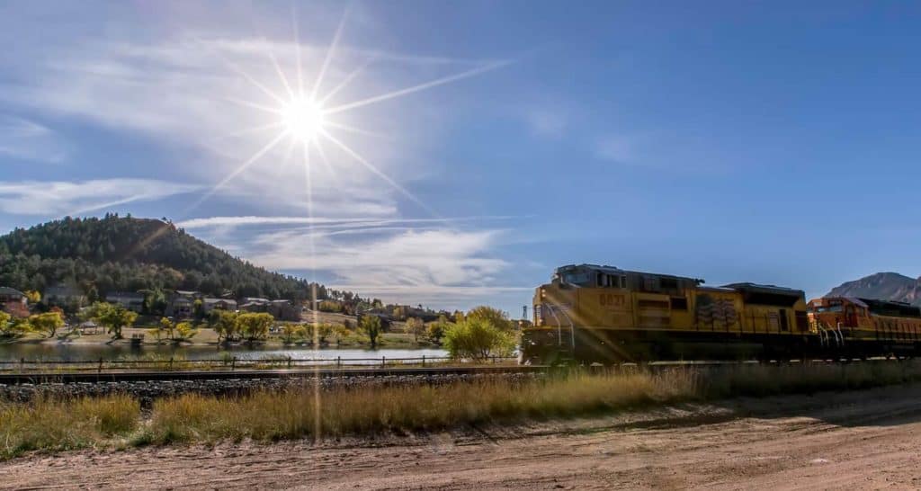
The Santa Fe Regional Trail begins in Palmer Lake, Colorado, about 1 hour South of Denver. It’s an easy trail with 17 miles from Palmer Lake to Colorado Springs along the old path of the Santa Fe Railroad. Explore the full Santa Fe Regional Trail hike profile below for trail map, driving directions, and more tips and details to help you enjoy this hike or bike adventure near Colorado Springs.
Trail Snapshot: Santa Fe Regional Trail
| Hike Distance | 1 to 17 miles one-way |
|---|---|
| Difficulty | Easy |
| Duration | Approx 1 hour+ |
| Trail Type | Out-and Back |
| Starting Elevation | 7200′ |
| Elevation Gain | Approx -900′ from Palmer Lake to Edmondson Trailhead |
| Seasons | Year Round |
| Dogs | Allowed On Leash |
| Hike Trail Map | Click for Trail Map of Santa Fe Regional Trail |
| Denver Drive Time | 1 hr |
| Driving Directions to Santa Fe Regional Trail Trailhead | Click for Google Map |
| Town Nearest Hike | Palmer Lake, Colorado and Colorado Springs |
| Beauty | Air Force Academy, Views of Pikes Peak |
| Activities | Hiking, Cycling, Trail Running |
Parking & Trailhead Information: Santa Fe Regional Trail
From Denver, take Interstate 25 south through Castle Rock and Larkspur, exiting onto County Line Road/Palmer Divide Road at exit 163, taking a right onto County Line Road. Stay on County Line Road for about 2.5 miles. Just before crossing the railroad tracks, the entrance to Palmer Lake Regional Recreation Area will be on your left. You’ll see a sign and the first parking area. Drive past this parking lot to the larger lot. Here, at this south lot, you’ll find restrooms, a playground, and the trailhead for the Santa Fe Regional Trail.
The Hike: Santa Fe Regional Trail
The Santa Fe Regional Trail begins in Palmer Lake and runs South for 17 miles where it merges with the Pikes Peak Greenway Trail. Because the trail follows the railroad grade of an abandoned railroad line, its relatively level, descending about 900 feet on its 17 mile course into Colorado Springs. This makes for a nice family bike ride, especially if you take two cars and drop a shuttle car off at the Edmondson Trailhead on the northern end of Colorado Springs. Here’s a map link of both trailheads , and a link to the Edmondson Trailhead with driving directions from Denver.
North Trail Segment
In Palmer Lake, you have North and South hiking options. You can go North via the Santa Fe to Greenland Trail Link to pick up the Greenland Trail which winds through the wild green meadows and towering buttes south of Larkspur. That stretch from Palmer Lake to the Greenland Open Space Trailhead is 5.4 miles.
South Trail Segment
The South Trail segment of the Santa Fe Regional Trail runs through Palmer Lake and the town of Monument. Just south of Baptist Road the trail enters the Air Force Academy and runs parallel for a while with interstate 25. Then the trail makes a hard bend to the west, taking hikers and bikers away from the noise of the roads and winding
through into the draw of Monument Creek. It then bends its way behind (West of) the Air Force Academy airfield. This segment gives visitors a unique view of the Academy seen by few people. The trail then exits the Academy and enters the City of Colorado Springs. Just south of the Edmondson Trailhead, the Santa Fe Regional Trail merges onto the Pikes Peak Greenway.

Tips & Resources for Hiking Santa Fe Regional Trail
- TIP: Bike helmets are required on the Air Force Academy segment of the Santa Fe Regional Trail
- TIP: Be sure to pack the sunscreen because there is no shade on the trail.
- Trail Map: Santa Fe Regional Trail
- Packing List: Always pack the 10 Essentials. Download our Hiking Guide to get the list and dayhiking packing checklist.
- Colorado Road Conditions: Colorado Road Conditions
- Photo: We would like to express our gratitude to Christopher Rosenberger for sharing such an amazing photographs of this hike to in Palmer Lake.
- After the Hike: Rock House Ice Cream in Palmer Lake


