The Fallen Timbers Loop is an easy, 2-mile hike near Colorado Springs with great views of Pikes Peak. It makes for a great family hike because of the shade of the ponderosa pines and the nearby playground at this hike in Fox Run Regional Park. Explore the full hike profile for trail map, driving directions, and tips.
Trail Snapshot: Fallen Timbers Loop Hike
| Hike Distance | 2 Miles |
|---|---|
| Difficulty | Easy |
| Duration | Approx 1 hour |
| Trail Type | Loop |
| Starting Elevation | 7300′ |
| Elevation Gain | Approx +200′ |
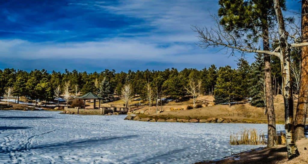
| Seasons | Year Round |
| Dogs | Allowed On Leash |
| Hike Trail Map | Click for a Map of Fallen Timbers Loop at Fox Run Regional Park |
| Denver Drive Time | 1 hr 15 min |
| Driving Directions to Fox Run Regional park | Click for Google Map |
| Town Nearest Hike | Monument, Colorado |
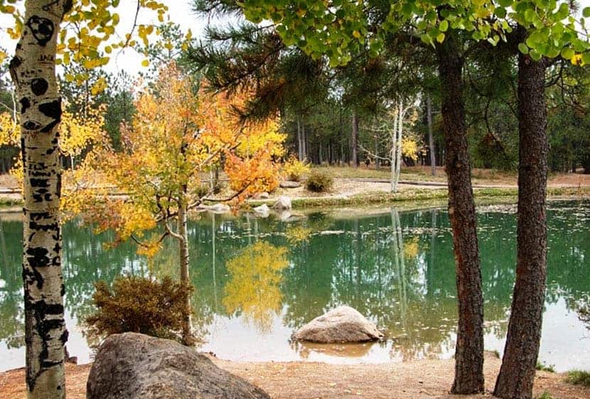
| Beauty | Ponderosa pine forest, ponds, and views of Pikes Peak. |
| Activities: | Hiking and mountain biking trails, Dog Park, Playground with climbing rock, gazebo. |
Parking & Trailhead Information for Fallen Timbers Loop at Fox Run
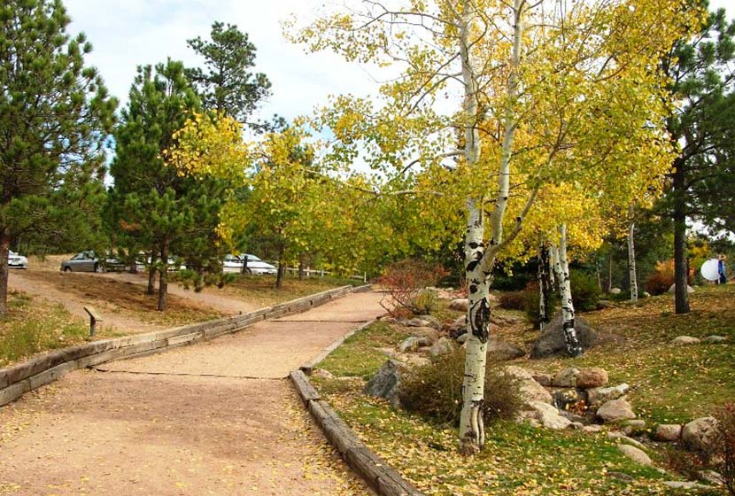
From Denver, take interstate 25 South and take exit 158 onto Baptist Road (left). Drive East for 2.3 miles and turn right onto Tari Drive. Proceed for about 300 feet, then take a left onto Becky Drive. Go about 1/2 mile and turn left onto Stella Drive. Drive about another 1/2 mile and the entrance to Fox Run park will be on your left. Drive around the loop to the parking area by the pond. This trailhead parking area has a restroom just to the southwest of the parking lot.
The Hike: Fallen Timbers Loop
The trail for the Fallen Timbers loop hike begins on the northeast end of the parking lot. When facing the pond, this will be the wide trail behind you, across the drive, and to the left. This little connector trail will soon come to a junction with the loop trail. I recommend hiking this counter-clockwise, so take a right onto the Fallen Timbers trail to begin the loop.
The trail works its way through the dappled shade of ponderosa pines and bends to the right (east). You’ll encounter a couple trail junctions. At the junctions, stay on the Fallen Timbers trail (bearing right). Just shy of 1 mile into the trail, you’ll arrive at the Roller Coaster Road parking area for Fox Run. The trail will continue north past this trailhead. However, there is a restsroom here at the trailhead that is open April through October.
The trail continues north, crossing a footbridge, then begins to bend West (left). Orange blaze markers should mark out the trail.
Along this entire trail, you’ll find interpretive signs explaining the impact of the pine beetle and tree bores on the ecosystems of Colorado, and about the local fauna in this area north of Colorado Springs. This makes for a great discussions with the kids about the environment and the impact that even small creatures and lightning can have on forests.
The trail bends South, opening up to great views of Pikes Peak. You’ll pass a small trail junction that leads right (west) out to the road. Continue past this and eventually you’ll come to a decision to either go left (east) finish this 2-mile loop or bear right and extend your hike to make it a longer 2.5 to 3 mile hike. Consult the Fox Run Trail Map, and follow the wester and southern trails of your choice. However, this profile will follow the rest of the 2-mile loop.
Going right will lead into a central parking area. The trail goes east, cutting through the middle of this circle road and then splits. At the split, take a right to begin the approx. 1/4 mile segment back to the parking area and trailhead.
Tips & Resources for Hiking the Fallen Timbers Loop
- A Great Wedding Spot: I’ve attended two weddings at Fox Run. It’s a beautiful and inexpensive option to host a wedding at the Wedding Gazebo. The gazebo can be reserved through the El Paso County reservation site.
- Taking Photos: The best time to get a photo of Pikes Peak will be in the early morning hours as the sun is rising over the plains. Photographers can capture some dramatic shots of the mountain as its skirts will still be in darkness and the peak bathed in soft light.
- Easy but Elevation: This is an easy hike, but if you are traveling to Colorado Springs from lower elevations, the 7300′ starting elevation at Fox Run park may make this trail a challenge. if that’s the case, take your time and oxygenate by drinking plenty of water.
- Trail Map: Trail Map for Fox Run Park
- Packing List: Always pack the 10 Essentials. Download our Hiking Guide to get the list and dayhiking packing checklist.
- Colorado Road Conditions: Colorado Road Conditions
- Photo: We would like to express our gratitude to Dave Jacquin , Mariana Wagner , and Nate Zoch for sharing such an amazing photographs of this hike to at Ute Valley Park.
- After the Hike: Serranos Coffee in Monument
Weather
Map & Driving Directions
Click for Driving Directions


