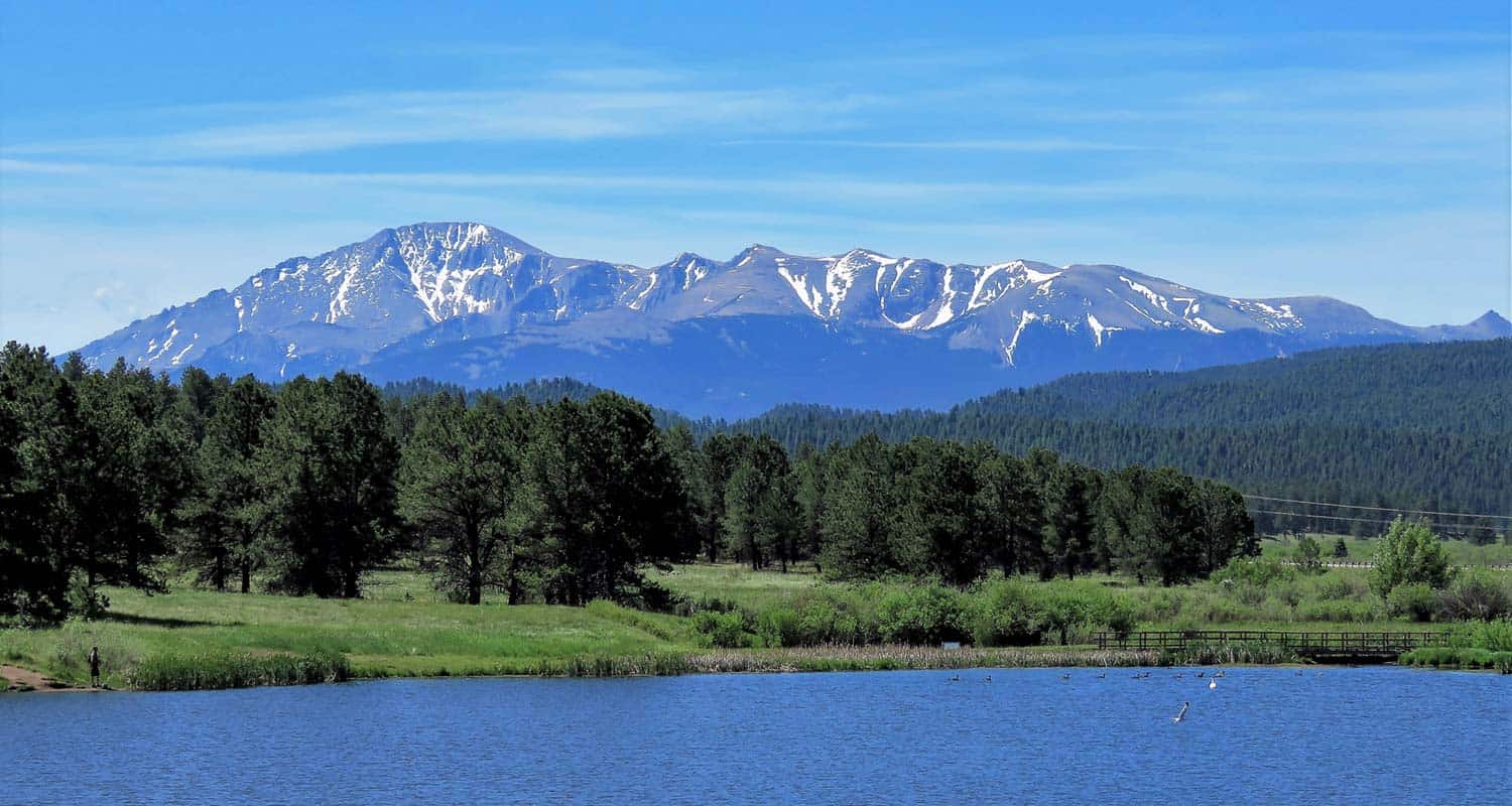
Manitou Lake near Colorado Springs offers a pleasant and easy loop trail around its shores with views of Pikes Peak. It’s also a great spot fishing and paddling on the 5-acres of water. There are nearby camping options detailed below. Explore the full Manitou Lake hike profile below for trail map, driving directions, campground info and more.
Trail Snapshot: Manitou Lake Loop Hike
| Hike Distance | Approx. 1 mile Round Trip |
|---|---|
| Difficulty | Easy |
| Duration | approx. 1 hour |
| Trail Type | Loop |
| Starting Elevation | 7,700′ |
| Elevation Gain | Nominal |
| Seasons | Year Round |
| Dogs | Allowed On Leash; Not allowed in Water |
| Hike Trail Map | Click for Trail Map of Manitou Lake Loop Hike Map |
| Denver Drive Time | 1hr 45min |
| Driving Directions to Manitou Lake | Click for Google Map |
| Town Nearest Hike | Woodland Park, Colorado |
| Beauty | Views of Pikes Peak, |
| Activities | Hiking, Paddleboarding, Canoeing and Kayaking, 2 nearby campgrounds, birdwatching, and fishing. Swimming is prohibited. |
| Fee | $7 day use fee per vehicle |
Parking & Trailhead Information for Manitou Lake
Interstate Route
From Denver, take Interstate 25 South to Colorado Springs. Exit onto 24 West and drive US Highway 24 about 18 to Woodland Park. In Woodland Park, take HWY 67 North for about 7.5 miles. Manitou Lake will be on the east side of the highway.
Scenic Route
The scenic route and interstate route take about the same amount of time, but there will likely be less traffic on this trip. There are a lot of curves though, so be prepared for that aspect of the drive. From Denver, take 285 South toward Pine Junction. Take a left onto Pine Valley Road, which curves around through some beautiful Front Range landscapes, goes through Pine and just outside of Buffalo Creek the road changes names to Deckers Road. Follow Deckers road until it terminates at US 67 in Deckers. In Deckers, take US 67 South (right) for 15.7 miles. Manitou Lake will will be on the lefthand (east) side of the road.
Trailhead and Facilities
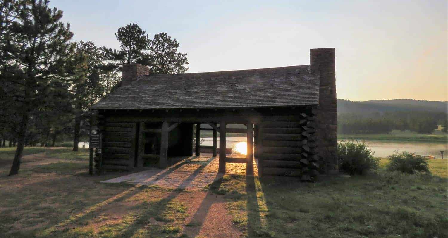
Manitou Lake is heavily used in the Summer months and weekends and has limited parking. There are two vault toilet, one across from the pavillion and one adjacent to the parking loop area. The pavillion can be reserved for a fee from Recreation.gov site. It’s important to note when reserving that each vehicle is still required to pay the day use access fee. There are several access trails that run from the parking area to the main trail that circles the lake.
The Hike: Manitou Lake
Beginning at the access trail near the pavillion, head toward the lake to pick up the main trail near a small dock. Head north (left) hiking along the western shore of the lake. You’ll pass another small fishing dock, then come to a trail intersection. Go right, crossing the small footbridge spanning Trout Creek, the small creek that feeds the reservoir.
Continue following the trail along the northern edge of Manitou Lake as it eventually bends toward the south. Here, you’ll be able to take in the best views of Pikes Peak. This is why we recommend hiking the loop clockwise instead of counter clockwise. Stop to take in Summer wildflowers that grow in the meadows surrounding the lake.
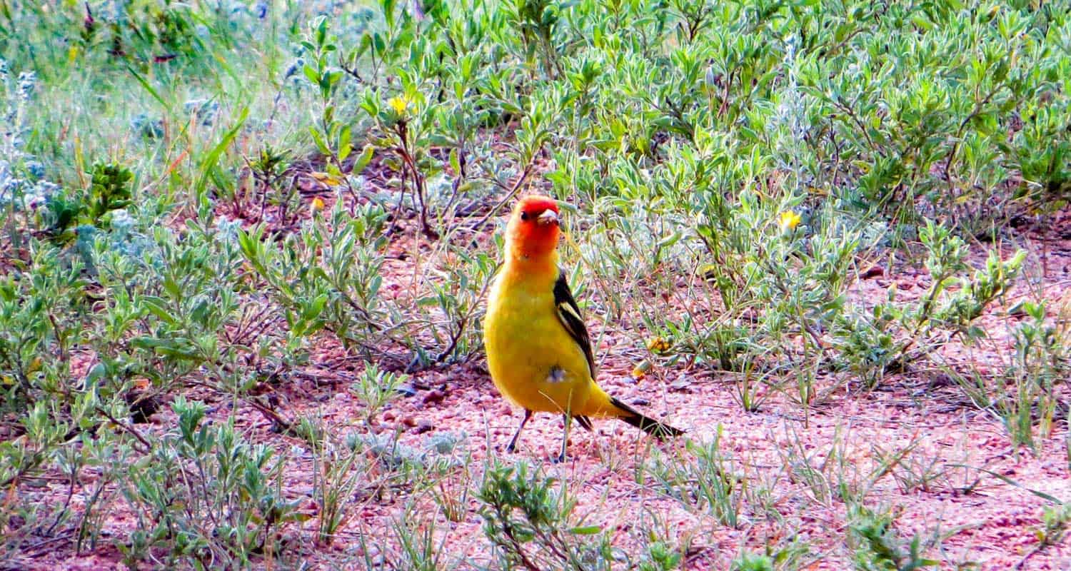
The trail will then enter and exit a small stand of ponderosa pines. Then the trail bends to the west and crosses a marshland. Be alert for herons and other wildlife in this wetland segment of the trail. The dirt path becomes a boardwalk on this final segment of the trail.
Longer Hike Options
There are ways to extend your hike and explore other areas around Manitou Lake. The first is a trail segment north of the lake, near the bridge that leads along Trout Creek. This is an undeveloped social trail created by fisherman, so it’s a non-destination trail and has a lot of small spurs to access the creek. The second trail leads South to the Colorado Campground site. The third is the 4.2 mile segment of bike trail that runs alongside highway 67 connecting the campgrounds and Manitou Lake.
Camping Near Manitou Lake
There are several campgrounds along highway 67 near Manitou Lake to serve the Pikes Peak Region. Here’s a list from the southern end to the north with links to their reservation pages. All of these campsites are close to Woodland Park andn great places to basecamp for exploring the surrounding Colorado Springs area. All have toilets and water.
- South Meadows Campground: Open June through Oct. 27 (see page for updated dates), access to bike path and forest roads. Shaded by ponderosa pines. About 60 total campsites.Reserve South Meadows camping sites online at recreation.gov
- Pike Community Campground: Open each year May 22 through Sept. 8 (see page for updated dates), a single group site that can accomodate up to 100 people. Closed in 2020 due to COVID-19 restrictions. Reserve South Meadows camping sites online at recreation.gov
- Colorado Campground: Open June through Sept. 7 (see page for updated dates). Both single family and double-family campsites. About 80 campsites. Access to Manitou Lake, shaded by ponderosa pines. Reserve South Meadows camping sites online at recreation.gov
- Painted Rocks Campground: Open June through Sept. 7 (see page for updated dates). About 18 campsites. Named for nearby sandstone rock formations. Reserve South Meadows camping sites online at recreation.gov
Tips & Resources for Hiking Manitou Lake
- Fishing: The Department of Wildlife stocks Manitou lake with Rainbow and Cutbow Trout. The beaver ponds above lake along Trout Creek are also good spots to fish.
- Dogs at Manitou Lake: Manitou Lake is a great spot to take your dog for a walk. Because it is a reservoir, dogs must be kept out of the water and leashed at all times.
- Trail Map: Manitou Lake
- Packing List: Always pack the 10 Essentials. Download our Hiking Guide to get the list and dayhiking packing checklist.
- Colorado Road Conditions: Colorado Road Conditions
- Photo: We would like to express our gratitude to Patricia Henschen for sharing such an amazing photograph of this hike at Manitou Lake near Colorado Springs.
- After the Hike: The Donut Mill. The Donut Mill serves epic donuts. That’s not an overstatement. The donuts are gigantic and dream-inducing (perhaps from the sugar coma). They cost more than most donut places, but if you are a donut lover, this place is not to be missed. Their biscuits and gravey also are a worth noting.
Weather
Map & Driving Directions
Click for Driving Directions


