The Chautauqua Trail is an easy 3.6 mile loop hike along Boulder’s Flatirons. The trails pass several historical sites: a quarry, cabin, shelter, and ski area as it weaves through the meadows and ponderosa forest of Chautauqua Park. About 40 minutes from Denver, the Chautauqua Loop hike makes for a great hike for visitors who are looking for stunning landscapes without the long drive or elevation gain.
Trail Snapshot: Chautauqua Loop Hike
| Hike Distance | 3.6 Miles |
|---|---|
| Difficulty | Easy |
| Duration | 2 hrs |
| Trail Type | Loop |
| Elevation Gain | Approx +700′ |
| Seasons | All Year |
| Dogs | Allowed on Leash |
| Hike Trail Map | Click for a Trail Map for the Chautauqua Loop |
| Denver Drive Time | 40 min |
| Directions | Click for Google Map |
| Town Nearest Hike | Boulder, Colorado |
| Beauty | Rock formations, ranger cottage, raptors, quarry site, Roosa Cabin, Bluebell Shelter |
| Activities | Hiking, Picnics, Wildlife |
Parking & Trailhead Information for the Chautauqua Loop
The trailhead for Chautauqua Park is located downtown in the City of Boulder. The park’s 58 parking spaces fill quickly, so plan to arrive early. Alternatively, when the lot is full, hikers can park along Baseline Road and side streets, just be sure to respect the neighbors by parking at least 5 feet from driveways. There are bike racks at the trailhead, so you can bike in from other lots in town, or take the Park-to-Park Shuttle that operates on the weekends and on holidays from the Saturday around Memorial Day to Labor Day Weekend. Here’s a map of the free parking lots and shuttle stop locations.
Get a map, fill up your water bottle, and get trail advice from locals at the Ranger Cottage, which is located at the trailhead. See the Ranger Cottage site for current hours and closure information.
The Hike: Chautauqua Loop
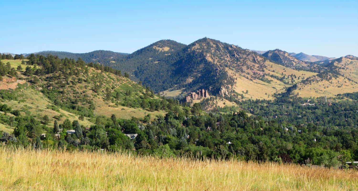
Beginning at the Ranger Cottage, head south on the Bluebell Road Trail. This first segment leads up a gentle slope to its intersection with the Mesa trail. The Mesa trail takes us into our first lollipop loop and to Woods Quarry. After about 0.2 of a mile, you’ll come to another trail intersection. Heading right, takes you on a counter-clockwise loop and up to Woods Quarry. The quarry was used in the early years of Boulder for building homes and sidewalks out of its iconic red and orange sandstone.
After the quarry, the trail will bend north and return to the Mesa Trail. At the intersection, notice an old stone structures, the Roosa Cabin.
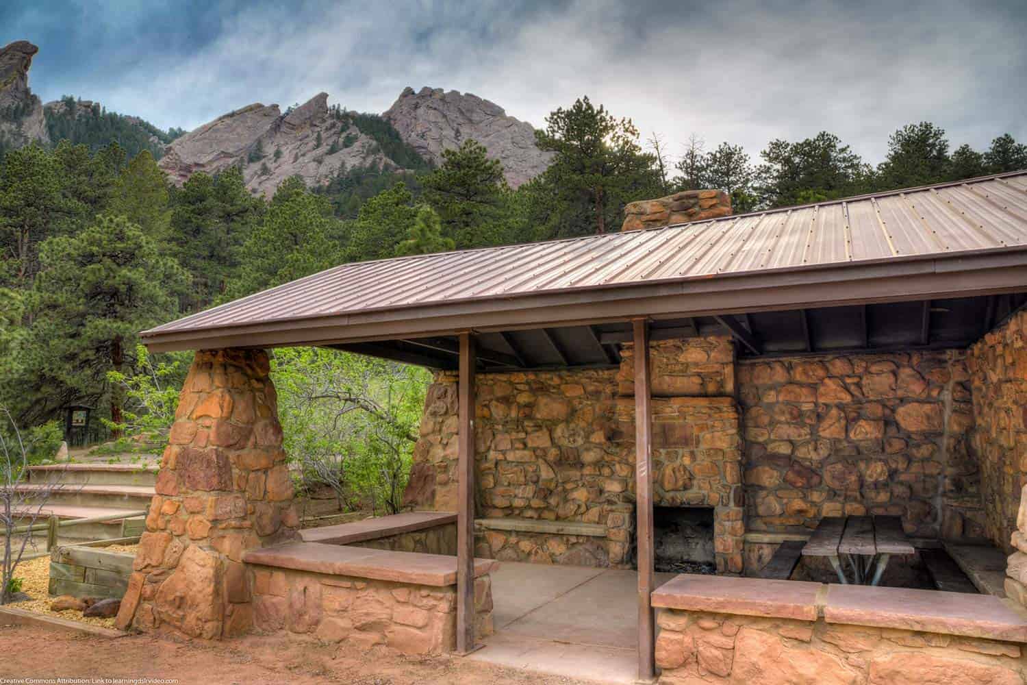
Continue north on the Mesa Trail back up to the Bluebell Road Trail. Go west (left) onto Bluebell Road. Soon you’ll encounter another stone structure, the Bluebell Shelter (pictured below). Built in the early 1900’s and preserved in the 1930’s by the CCC, the historic shelter has become a Chautauqua landmark, undergoing some more recent restoration. This is a great place to have a picnic, and can be reserved for special events.
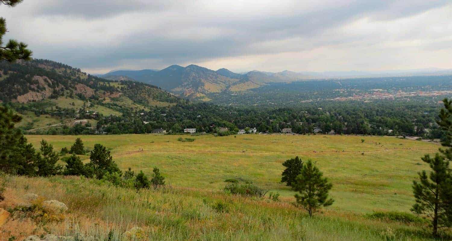
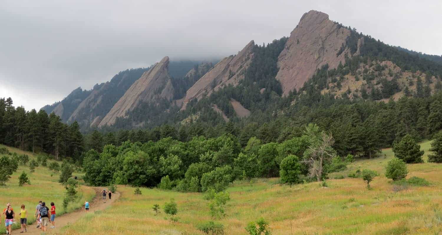
Now we begin heading into the northern and larger loop of this hike. The Bluebell Road Trail becomes the Bluebell-Baird trail and weaves its way north along the base of the Flatirons. If you are interested in hiking the Flatirons, explor our trail profile for the First and Second Flatirons Hike. You’ll enter tall stands of Ponderosa pines with views out to the meadows of the northern meadows.
Notice the interpretive signs along the full hike and stop to read the history of the old ski jump that was in operation post WW2 into the early 1960’s. Pass by the Ski Jump Trail and continue northwest until you come to the Gregory Canyon Trailhead. Gregory Canyon is also a beautiful hike (see our Gregory Canyon trail profile for details). Take a right (heading east) onto the Baseline Trail. This will take you past the old ski jump and the site of a CCC camp that operated here during the years of the Great Depression.
The Baseline trail will lead back to the trailhead to complete this 3.6 mile hike.
Tips & Resources for Hiking the Chautauqua Loop
- Bring Snacks and Water: It probably goes without saying, but be sure to bring food and water to refill your tank. This hike demands it.
- Bring Your Camera: This area along the Flatirions is picturesque, especially in the early morning light.
- Keep and Eye on the Weather: Talking to one of the rangers, he shared that storms can come up quickly along the Flatirons, which will catch hikers unawares. The Flatirons area is like a lot of other mountain hikes, storms typically roll in during the early afternoon.
- Trail Map for Chautauqua Loop: Trail Map Link
- Colorado Road Conditions: Colorado Road Conditions
- Photo: We would like to express our gratitude to Dave Dugdale for sharing his photograph of the Bluebell Shelter.
- After the Hike: Ozo Coffee in Boulder, Colorado

Weather
Map & Driving Directions
Click for Driving Directions


