Grizzly Peak is a challenging 5-mile hike from Loveland Pass that ends with a scramble to its craggy 13,427′ summit with breathtaking views of the Loveland Pass area, local ski resorts, and 14ers Grays and Torreys Peaks. About one hour from Denver, Grizzly and it’s sister peak, Sniktau are two of the most accessible 13er peak hikes near Denver.
Trail Snapshot: Grizzly Peak
| Hike Distance | 5 miles Round Trip |
|---|---|
| Difficulty | Difficult |
| Duration | Approx 3-4 Hours |
| Trail Type | Out-and-Back |
| Starting Elevation | 11,990′ |
| Elevation Gain | Approx +1635′ |
| Seasons | Year Round |
| Dogs | Allowed On Leash |
| Hike Trail Map | Click for Trail Map of Grizzly Peak Hike Map |
| Denver Drive Time | 1 hour |
| Driving Directions to Loveland Pass Trailhead for Grizzly Peak | Click for Google Map |
| Town Nearest Hike | Dillon, Colorado |
| Beauty | Views of the Rocky Mountains and Loveland Pass area, Views of local ski areas, Summit, Alpine tundra |
| Activities | Hiking |
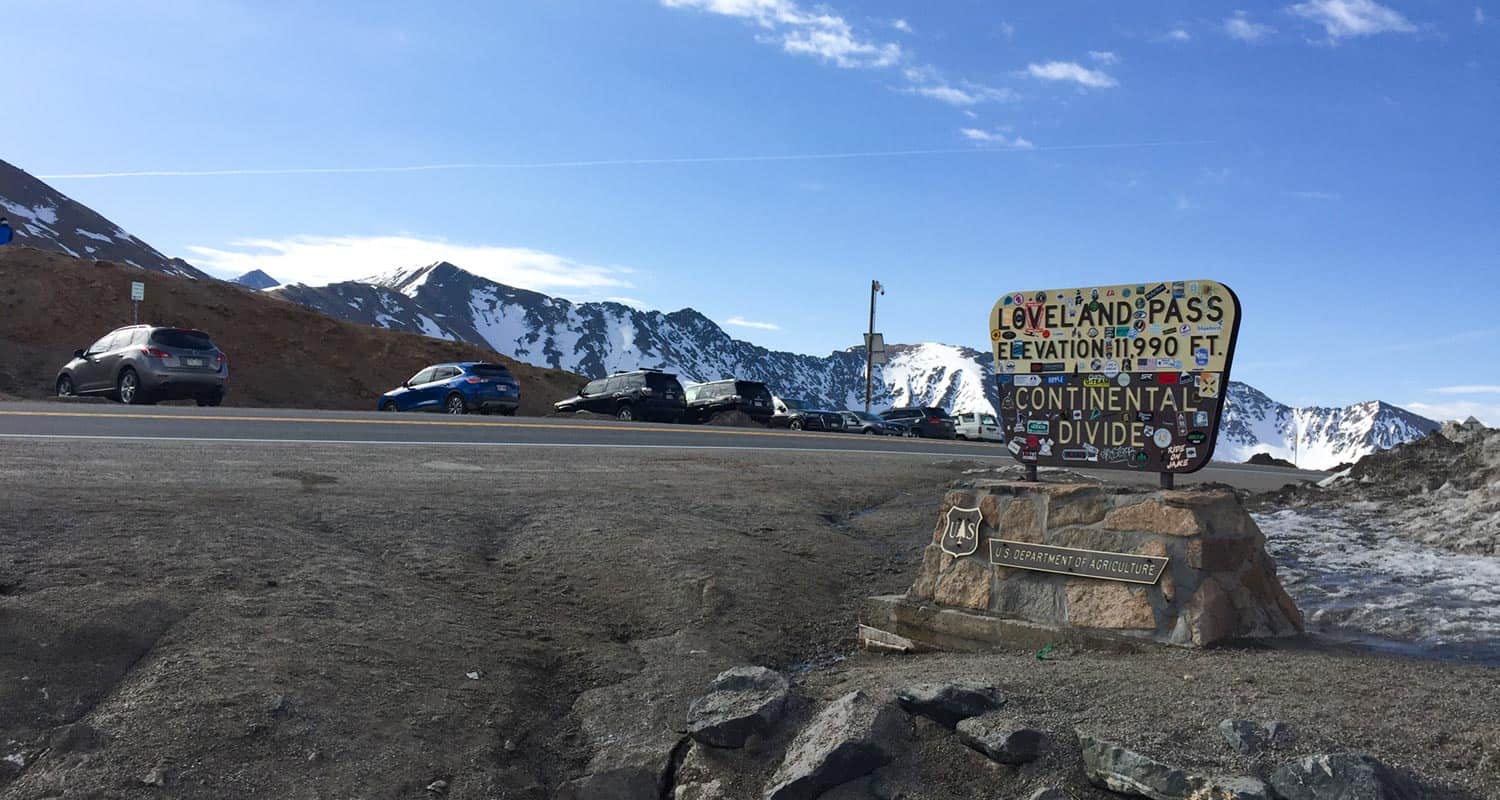
Parking & Trailhead Information for Grizzly Peak
The trailhead at Loveland Pass for Grizzly Peak and Mt. Sniktau has capacity for about 25 vehicles with additional roadside parking on the opposite side of the road. Because of this, the lot fills fast. So, plan to arrive early and carpool when hiking with friends. Do be aware of vehicles coming over the pass when crossing. They can come at high speeds and visiblity is limited. There are no restrooms or other facilities at the trailhead.
The Hike: Grizzly Peak
The hike begins by climbing a short set of rock steps up to the trail. After a few hundred yards of gentle grade, the trail becomes more steep as it follows a ridgeline across the high country tundra. It’s important to note that this ecosystem is fragile, so going off trail and indavertantly stepping on plants and flowers can do permanent damage or require these unique flora years to recover. Additionally, because this trail is so accessible from Denver, off-trail hiking compounds, creating areas where eroded washouts and other trail damage. So, stay the trail as you take in the incredible views on the way up to the first small “summit.” This first segment from the trailhead to the trail split is about 0.8 mile.
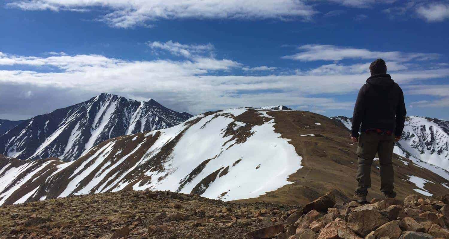
The photo above is from this first “plateau” where past hikers have built some windbreaks. Here the trail splits and the right side leads to Grizzly Mountain. The left trail leads up to Mt. Sniktau, a less demanding hike that is about 1 mile shorter in total route and requires no scrambling to reach the peak. The hiker in the photo above is looking out to the Grizzly Peak trail and Grizzly Peak. The trail is discernable in the photo and follows the top of the ridgeline. The map below traces the trail but do not rely on this to be GPS exact.
From the trail split, the next segment dips down then levels out onto a broad stretch of tundra, then climbs again to another point at about 1.5 miles into the hike. From here, hikers can trace the ridgeline that leads up to Grizzly. Hiking this in mid-May, a long snow cornice was visible along the eastern side of the ridge (in photo below). Cornices like this are visible at a distance, but are hard to see when hiking near them. They pose a real avalanche danger, too. So, be sure to stay to the west side while hiking along the ridge. The trail should avoid these cornices, however, when snowcovered, it can be easy to lose the trail.
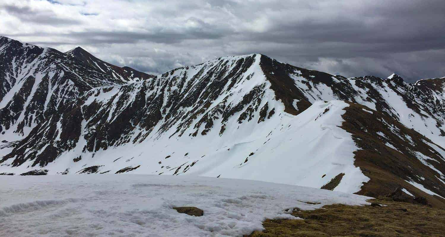
As pictured in the above photo, the trail descends about 150′ then climbes again to another peak-shaped rise along the ridge. After descending once more, the trail becomes steep and the tundra gives way to rock, making its way through a series of switchbacks and a scramble to Grizzly’s 13,427′ summit. At the summit, take in views of the Gore Range to the northwest and Grays and Torreys peaks looming right in front of Grizzly to the southeast. These are farther away than they appear and the ridgeline between Grizzly and Torreys is not the recommended route. Return to the trailhead via the route hiked to Grizzly Peak.
Tips & Resources for Hiking Grizzly Peak
- Be Weather Aware: Grizzly Peak trail accumulates cornices on its eastern edges which means avalanche danger and the danger of falling through the cornice if walking upon it’s surface. Though most years, most of the trail is discernable in Winter months, heavy snows can change the landscape and cover the trail without warning. Thunderstorms can appear quickly, so climb early before the early afternoon thunderstorms roll in during the Summer months.
- Mt. Sniktau: If you are considering including Mt. Sniktau to your itinerary, this will add about 2.4 miles to your hike, making for an approximately 7.5 mile and 4-6 hour adventure.
- Trail Map: Grizzly Peak
- Packing List: Always pack the 10 Essentials. Download our Hiking Guide to get the list and dayhiking packing checklist.
- Colorado Road Conditions: Colorado Road Conditions
- After the Hike: http://www.thepourhousecoffee.com/
Weather
Map & Driving Directions
Click for Driving Directions