Eleven Mile State Park feels like the proverbial “hidden in plain sight” gem. Situated off the commonly traveled Highway 24 between Colorado Springs and Buena Vista, this loop hike blesses visitors with uncommon beauty. Trekking around the 3.5+ mile trail serves up a superb buffet of Colorado’s classic outdoors: aspen and evergreen forests, meadows, rocky crags, vistas of mountain ranges, and a shoreline. Rarely do trails achieve a true “all-year” rating, but this loop qualifies. This hike near Denver could function as an along-the-way pit stop or a destination in itself, perfect for a swift pace or a lingering stroll with the family. Explore the full Eleven Mile State Park hike profile below for trail map, driving directions, and more tips and details to help you enjoy this treasure outside Lake George, CO.
Trail Snapshot: Eleven Mile State Park Loop
| Hike Distance | 3.5-5.5 miles Round Trip |
|---|---|
| Difficulty | Easy |
| Duration | Approx 2-3hr |
| Trail Type | Loop |
| Starting Elevation | 8575′ |
| Elevation Gain | Approx +225′ |
| Seasons | All Year |
| Dogs | Allowed On Leash |
| Hike Trail Map | Click for Trail Map of Eleven Mile State Park Loops |
| Denver Drive Time | 2hrs 15min |
| Driving Directions to Eleven Mile State Park | Click for Google Map |
| Town Nearest Hike | Lake George, Colorado |
| Beauty | Aspen Forest, Lake, Wetlands, Meadow, Crags |
| Activities | Hiking, Photography, Biking, Snowshoeing, Paddle Boarding, Kayaking |
| Fee | Entrance Fee or State Parks Pass Required |
Parking & Trailhead Information for Eleven Mile State Park
Cruising south out of Denver on I-25, take Exit 141 for Highway 24 West. Just barely outside of Lake George, turn left onto County Road 90 and go four miles — here the pavement will curve left onto County Road 92. After about 5.5 miles on CR-92, look for the Coyote Ridge sign indicating a left-hand turn. Follow this road for 1/2-mile to the parking lot. (Alternately, following Highway 285 South out of Denver, pick up CR-9 South at Fairplay to Highway 24 East at Harstel. On Highway 24, just beyond the gorgeous Wilkerson Pass, look for CR-90 on the right. This is a graded gravel road that will intersect with CR-92, as described above.)
The Hike: Eleven Mile State Park Loops
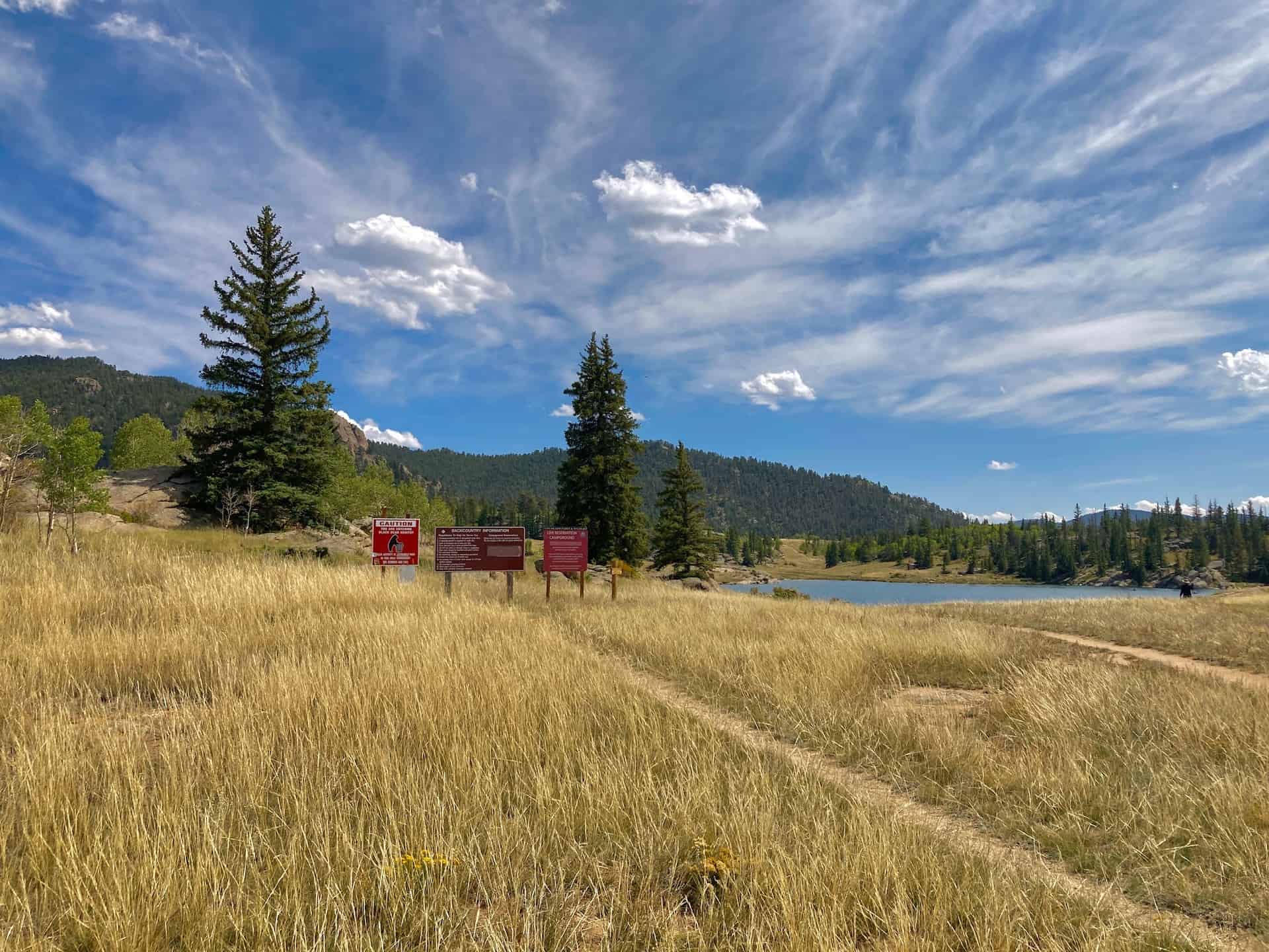
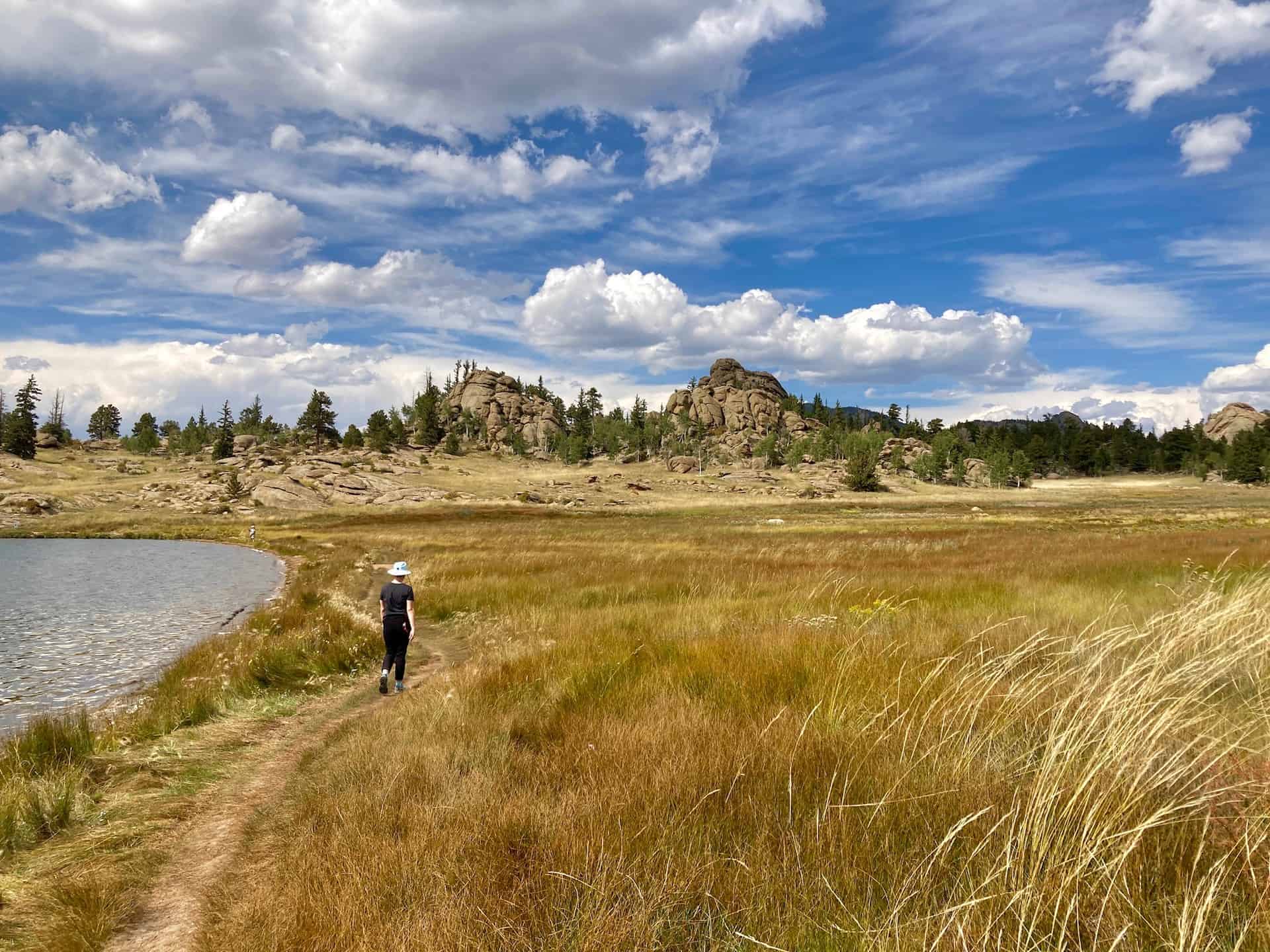
One of the many reasons to plan a trip here is the Coyote Ridge Interpretive Trail, one of four loops. At less than 1.5 miles in length, it offers a family a fun exploratory and engaging getaway. The recommended route takes advantage of the best of each smaller, individual loop (Ponderosa, Aspen, Midland, Black Bear). Going clockwise from the parking lot brings hikers through crags, meadows, forests, ridges, and the spectacular shoreline. Spring brings flowers, summer the bluebird skies; in autumn it bursts with golden aspens, winter the arresting contrast of snow and rock, evergreen and ice.
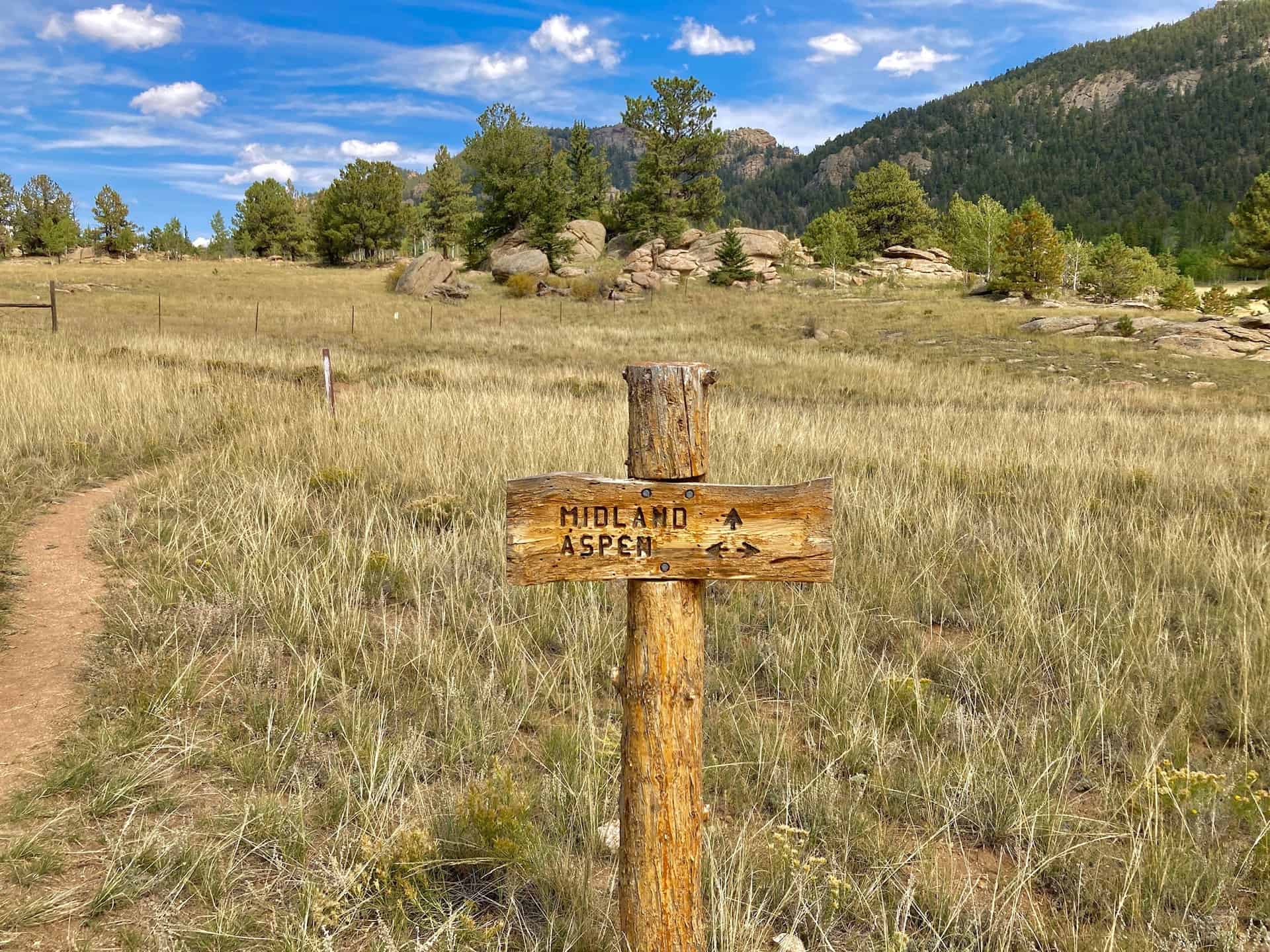
Joining up with the trail on the north side of the parking lot, the route heads up and onto slickrock terraces dotted with pines. Even this early in the hike views break open into the meadow and onto the water. After 1/3-mile, a right-hand turn at the juncture leads the Ponderosa Trail past a small stand of trees, then quickly encounters another juncture, this one with the Aspen Trail. The route continues on for another 1/3-mile to the next juncture, where the trail turns right, joining the longer Midland Trail.
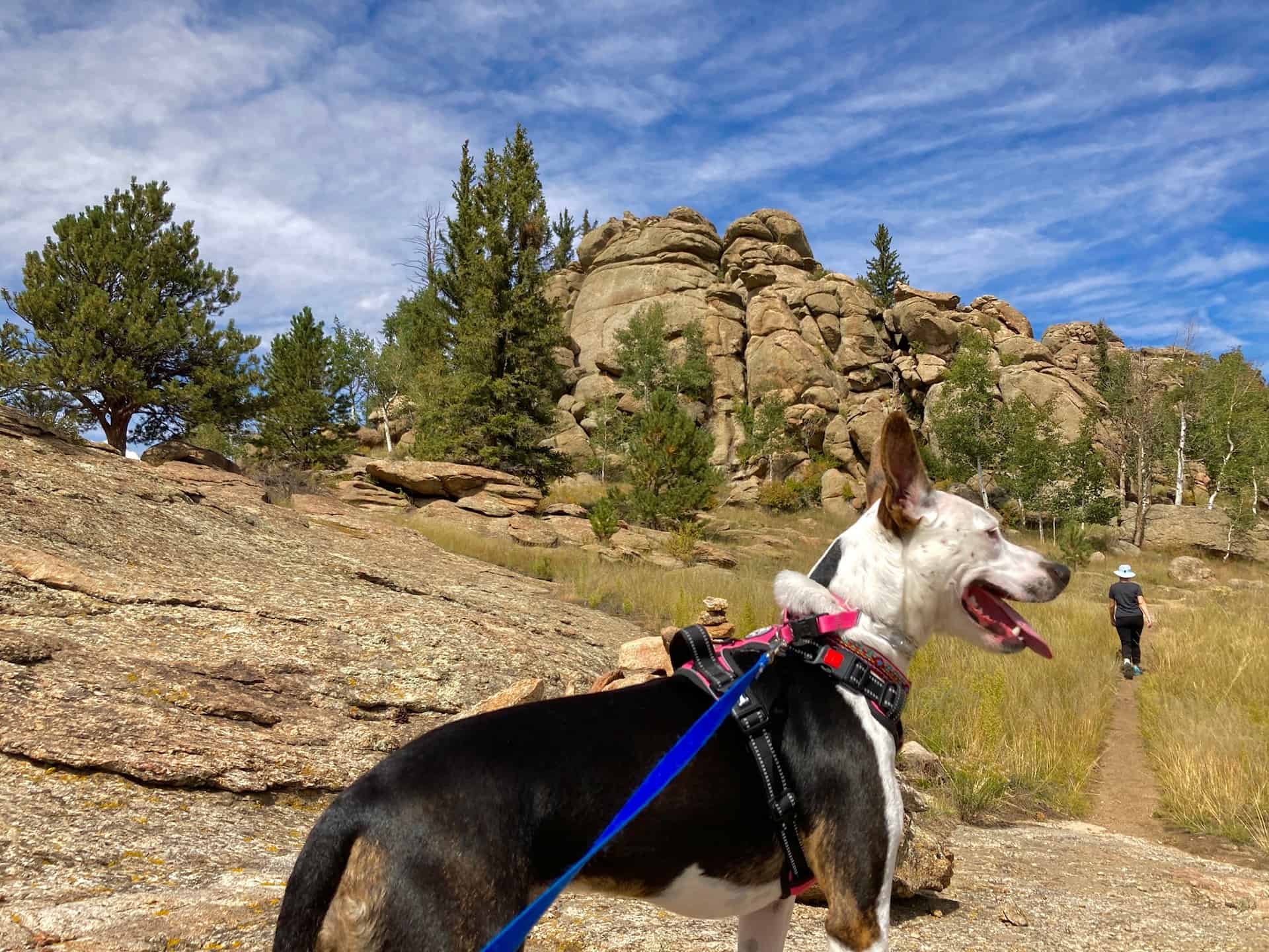
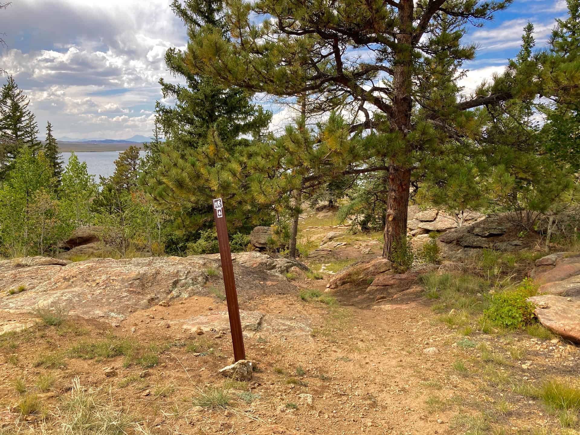
Crossing a faded service road and passing by an old cattle corral, the route slowly rolls into the wetland meadow before rising gently to enter an evergreen and aspen forest. Throughout the forest, vistas of distant mountain ranges punctuate the trail to the hiker’s right. At approximately the two mile mark, the trail crosses the service road again and begins descending toward the shoreline. Within 1/3-mile a lookout point trail branches off to the left (south) where those with time and a desire to soak in the sun can rest overlooking the water. (Note: the lookout trail is a mere 1/10-mile one-way.) Turning back northwest, the trail arrives at the Black Bear Trail options. Here, pay attention to signs with the “hiker” symbol for guidance on the route’s flow. Consider also using this interactive trail map (Eleven Mile State Park Loops) for more precision than the state park PDF map.
If at any point the Black Bear Trail loops feel complex, realize that they simply give hikers a choice to either scamper along the shore or journey inland. Both pass through a handful of tempting camp sites…plan far ahead to secure a spot! Once back on the main Midland Trail around the three mile mark, the route hugs the shore while looking back over the wetland meadow to the east. A well-timed hike can catch the sunrise or sunset with broad, open views for either. Reaching the north edge of the shore signals that barely 1/10-mile remains before reaching the parking lot.
Tips & Resources for Hiking Eleven Mile State Park
- TIP: Other than a small general store, supplies are limited. Be sure you have plenty of water and food with you.
- TIP: Familiarize yourself with the various trail junctions that intersect in this area. Wooden signs mark the junctures, but from time to time the weather (or wildlife!) can disrupt the signage.
- Trail Map: Eleven Mile State Park Loops
- Packing List: Always pack the 10 Essentials. Download our Hiking Guide to get the list and dayhiking packing checklist.
- Colorado Road Conditions: Colorado Road Conditions
- After the Hike: Regardless if this happens as an along-the-way pit stop or a destination, take heed: there’s not much around for food! Depending on the day, consider Honey Badger’s Mountain Grill (note carefully their open/closed hours), or simply plan to pick up something in Woodland Park, CO. And remember, the remote location is a good thing!
Weather
Map & Driving Directions
Click for Driving Directions


