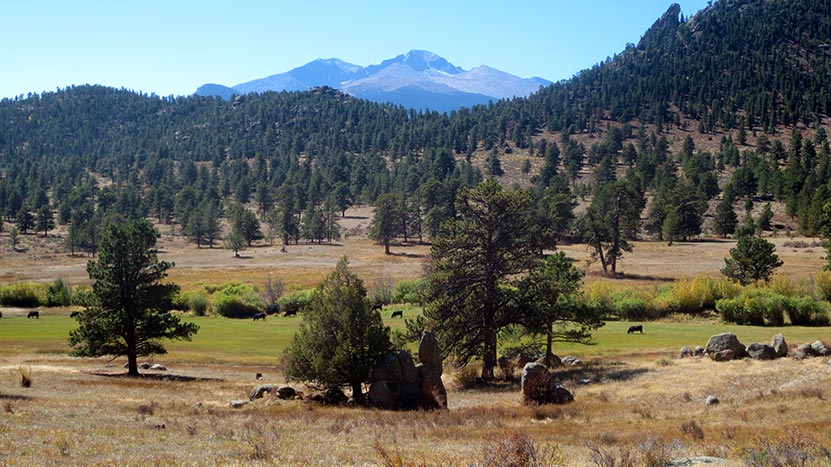
MacGregor Falls has become one of my favorite hidden waterfall hikes in Rocky Mountain National Park. The Black Canyon Trail meanders through old ranch land meadows, along the captivating Lumpy Ridge rock formations, and offers views of Longs Peak to the southwest. The falls are 3.1 miles (one way) from the Lumpy Ridge Trailhead. It’s a lesser-known hike with a quaint notation “falls” on the National Geographic RMNP Map. Explore the full MacGregor Falls hike profile below for trail map, driving directions, and more tips and details to help you enjoy this adventure in Rocky Mountain National Park.
Note: Rocky Mountain National Park now requires timed entry permits from May 27th through October 10th. See the RMNP permits page for more information.
Trail Snapshot: MacGregor Falls in Rocky Mountain National Park
- Hike Distance: 6.2 miles Round Trip
- Difficulty: Moderate
- Duration: Approx 3-4 hr Round Trip
- Trail Type: Out and Back
- Starting Elevation: 7870′
- Elevation Gain: Approx. +460′
- Seasons: Spring through Fall, Winter Snowshoeing
- Dogs: Dogs Prohibited in RMNP
- Hike Trail Map: National Geographic Trails Illustrated Map
- Denver Drive Time: 1 hr 30 min
- Driving Directions to Lumpy Ridge Trailhead: Click for Google Map
- Town Nearest Hike: Estes Park, Colorado
- Beauty: Waterfall, aspen, ponderosa pine, mountain views, wildlife: Abert’s squirrel, elk, deer, moose, bear; wildflowers.
- Activities: Picnicking, hiking trails, snowshoeing, horseback riding, backcountry camping (with a permit), photography
- Fee: Park Pass Required
Parking & Trailhead Information for MacGregor Falls
The Lumpy Ridge Trailhead (also known as the Twin Owls Trailhead) is located north of Estes Park. It’s just a short drive out of Estes Park on MacGregor Avenue, which turns into Devils Gulch Road. This road meets Lumpy Ridge Road, which leads to the trailhead and parking area around 0.3 miles from the intersection.
The Hike: MacGregor Falls Trail in RMNP
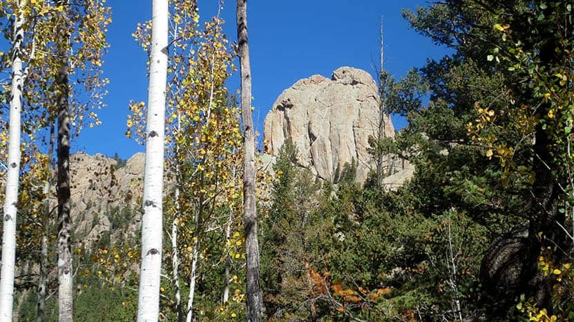
From the Twin Owls/Lumpy Ridge Trailhead, the hike begins by heading west on the main trail that runs parallel with the Lumpy Ridge. This segment of trail passes through the expansive meadows of MacGregor Ranch which is situated at the base of Lumpy Ridge. Lumpy Ridge is a world-renown rock climbing area; you’ll likely be able to spot climbers along the grey granite faces of the cliffs as you hike. And yes, you’ll be hiking with the cows through this segment of the hike.
At about 0.6 mile into the trail, hikers will encounter the first trail junction. The way to MacGregor Falls is to the left toward “The Pear.”
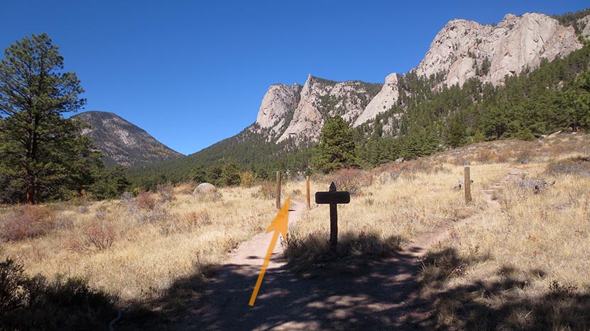
At the second major trail junction, the climbing routes trail leads up to the right. The correct way to MacGregor falls is to continue straight on the main trail (see photo below).
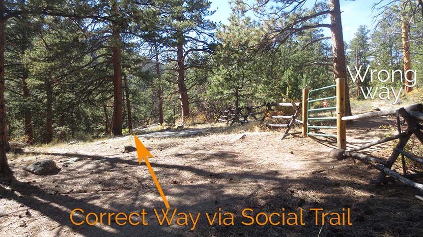
The trail will transition from meadows into stands of Ponderosa pine. Eventually the trail will arrive at a green gate (see photo below). This area is not very well marked and part of what makes this a lesser known hike. I accidentally continued on the main trail through the green gate and had to backtrack down to the creek. The correct route is to take a connector/social trail that leads along the fence line to a dirt road.
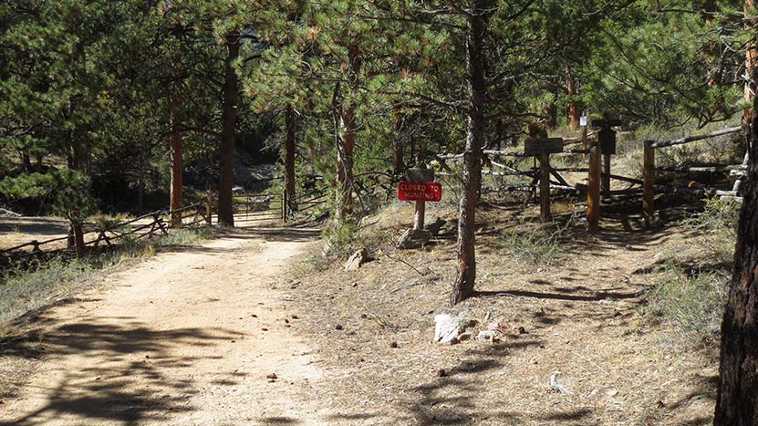
At the dirt road, the way to MacGregor falls is to the right (West) and follows close beside Black Canyon Creek. Note that the signage here could be knocked over. You’ll notice in the photo that the sign post is leaning against a tree. It is also important to be more aware of the terrain in this final segment of the hike as flooding in recent years has carved away the creek sides and portions of the trail. It’s conceivable that the dirt sides of the creek could collapse if hiking in a highly eroded areas.
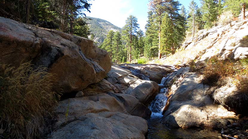
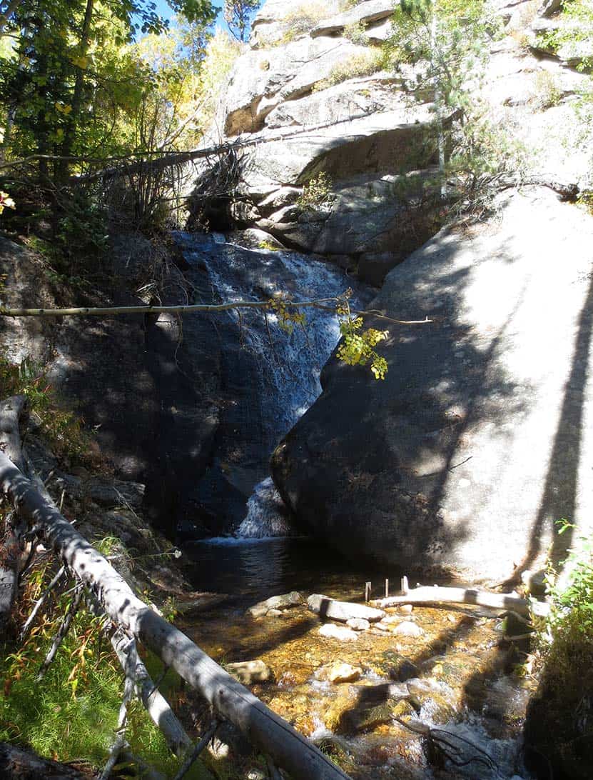
Black Canyon Creek is beautiful. When the water level is low or moderate, you can trace cascades that have been sculpted through the granite. I found these features as enjoyable to explore as the waterfall itself.
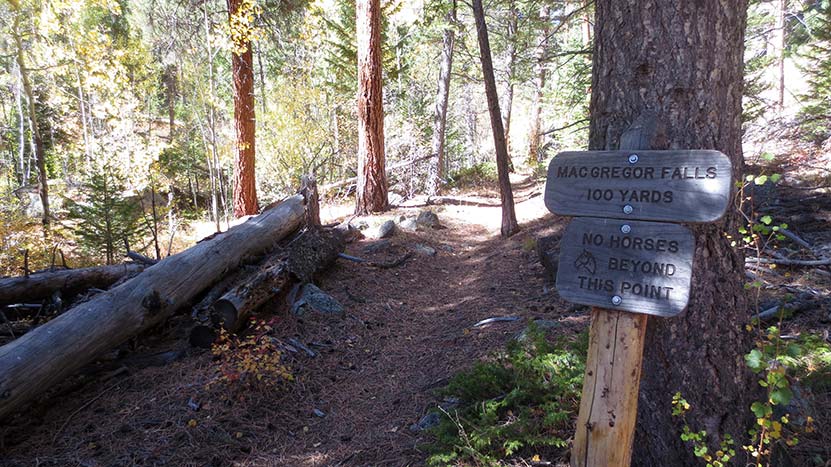
The trail enters a more narrow area full of aspen trees, almost a tunnel of green, and eventually arrives at the waterfall. There is a small cascade just before MacGregor falls that could easily be mistaken for the waterfall. The true waterfall is just a few yards further up the trail. MacGregor falls is a unique slab waterfall that is funneled down at an angle, then crashes into a granite wall, sending the water into a second cascade. Be careful walking around in this area as there are ruins of an old water project with sharp pieces of old metal protruding up out of the creek.
The best views of MacGregor falls are from the opposite side of the creek. However, exercise caution in this area because it is steep and the terrain can be even more unpredictable when snow is still on the ground.

Tips & Resources for Hiking to MacGregor Falls in RMNP
- TIP: Bring lots of water and high-energy food.
- A Better View: To view the waterfalls more favorably, the creek would be crossed only if conditions permit it.
- Trail Map: Rocky Mountain National Park has a map to MacGregor Falls on page 21 of this PDF
- Packing List: Always pack the 10 Essentials. Download our Hiking Guide to get list and dayhiking packing checklist.
- Colorado Road Conditions: Colorado Road Conditions
- After the Hike: Notchtop Bakery & Cafe
Weather
Map & Driving Directions
Click for Driving Directions


