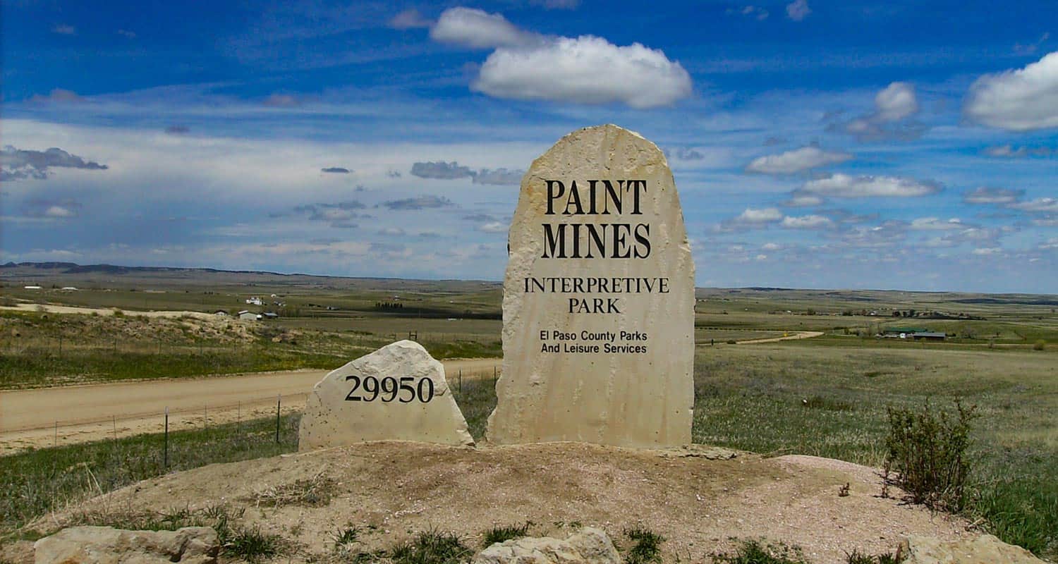
The Paint Mines trail takes hikers on an easy 3.7 mile loop through a badlands landscape of rainbow sandstone and hoodoo rock formations about 90 minutes south of Denver and 45 minutes east of Colorado Springs. Explore the full Paint Mines hike profile below for trail map, driving directions, and more tips and details to help you enjoy this adventure in the plains of Colorado.
Trail Snapshot: Paint Mines Loop
| Hike Distance | 3.7 miles Round Trip |
|---|---|
| Difficulty | Easy |
| Duration | Approx 2 Hours |
| Trail Type | Loop |
| Starting Elevation | 6600′ |
| Elevation Gain | Approx +200′ |
| Seasons | Year Round |
| Dogs | Dogs are prohibited at the Paint Mines |
| Hike Trail Map | Click for Trail Map of the Calhan Paint Mines |
| Denver Drive Time | 1hr 40min |
| Driving Directions to Paint Mines Interpretive Park | Click for Google Map |
| Town Nearest Hike | Calhan, Colorado |
| Beauty | Rock Formations, Views of Pikes Peak, native Buffalo Grass, Lark Bunting, pronghorn antelope, and horned lizards. |
| Activities | Hiking (bikes are prohibited), Picnic Tables, Interpretive Displays |
Driving Directions to the Paint Mines
From Denver, take interstate 25 south toward Colorado Springs. Exiting at exit 163, take a left (east) onto South County Line/Palmer Divide Road, traveling for about 5 miles before then taking a right onto CO-83. Travel for about 4 miles, then turn left onto Hodgen Road.Travel for 10.3 miles on Hodgen Road, then take a right onto Eastonville Road. Going for about 2 miles, turn left onto Murphy Road (a lot of turns on this drive). Go 5 miles on Murphy Road, then take a right onto Peyton Hwy. Travel for about 1 mile, then just before you get into the small town of Peyton, take a left to stay onto Peyton Hwy. This segment is just about 0.2 of a mile before you turn left onto Highway 24 which will take you into the town of Calhan. Driving through town and take a right onto Yoder St./North Calhan Hwy (south). Just past the El Paso County Raceway, take a left onto Paint Mine Road. After 1.4 mile on Paint Mine Road, the trailhead and parking area will be on your left.
Parking & Trailhead Information for the Paint Mines
The parking area for the Paint Mines has spaces for about 40 vehicles. Though the park is hidden away in the plains of Colorado, it’s a well-known park and the lot can fill up on weekends. There is a toilet facility at the trailhead parking area. No water, so bring water with you.
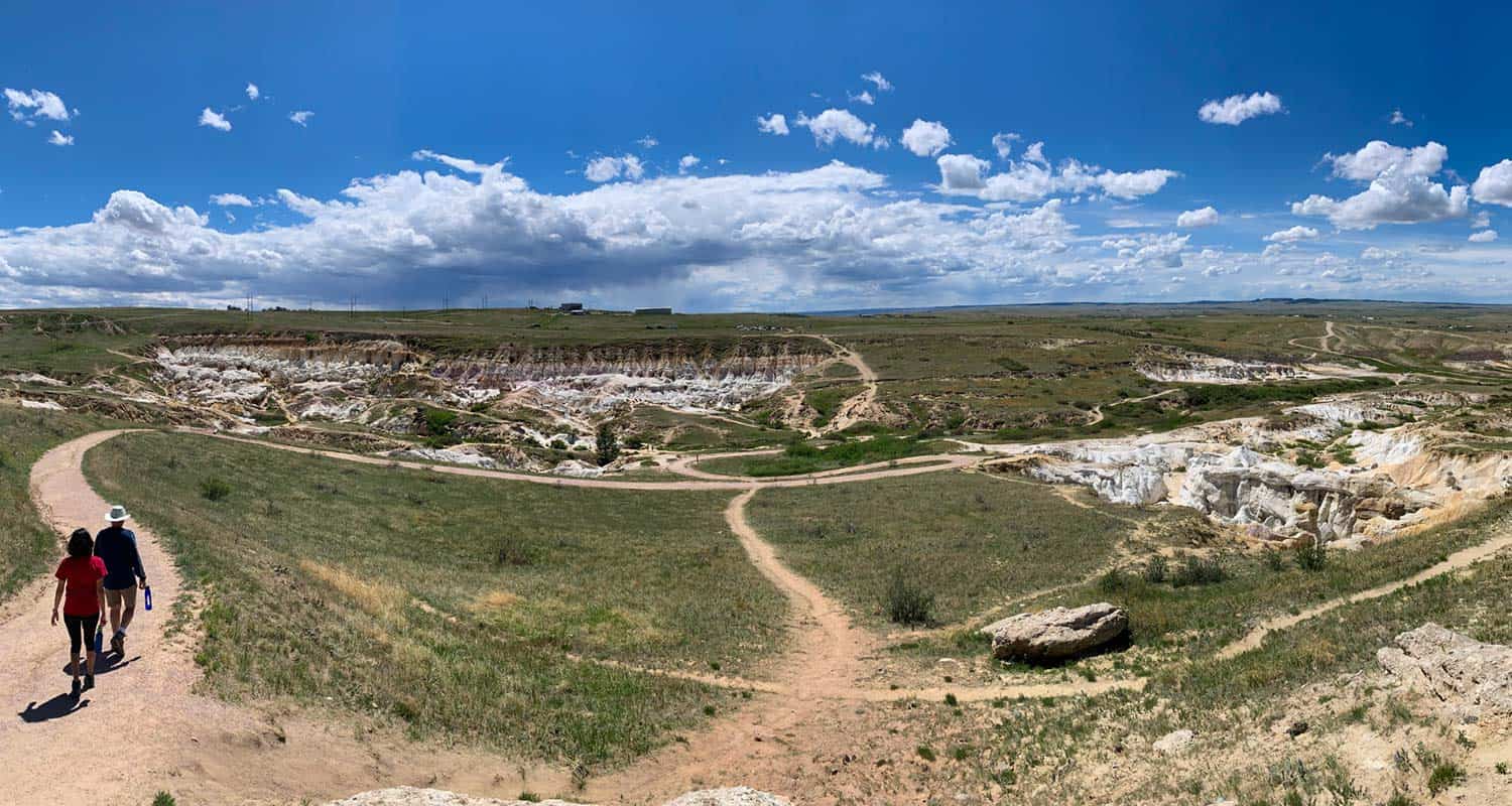
The Hike: Paint Mines Loop
We recommend hiking this trail clockwise. There is a northern and southern trailhead (and a West overlook lot), and the route described here begins at the larger, northern trailhead (described above). The trail begins near the restroom on the southeast side of the parking area and travels northeast into a grasslands lanscape. The path bends to the right, narrows, and heads south through a white sandsone wash that descends into a gully turning as it makes its way down to the first trail interesection with the broad, double-track Green Trail.
Taking a left (southeast) onto the Green Trail, it will climb to a bench, giving you a great vantage point overlooking the plains and badlands of the Paint Mines. The trail makes its way north. At the northern apex of the trail, you’ll encounter another interpretive sign marking the site of an old brick quarry.
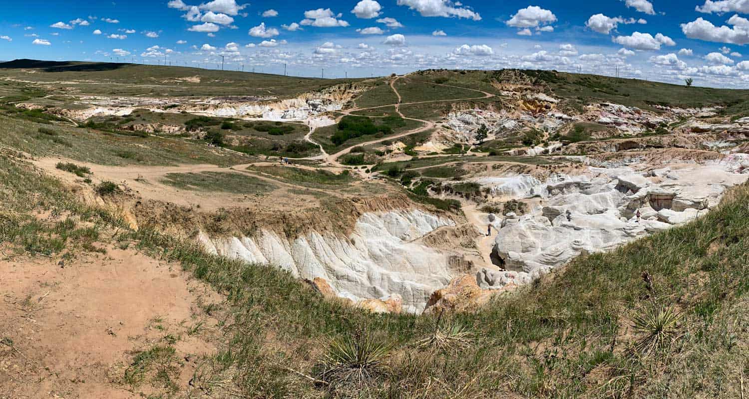
The route now takes you South past the East Overlook with views out to Pikes Peak, and then to another interpretive area with signs detailing the local geology. At about 2.5 miles on this route, hikers reach another trail intersection. Go right (west) to continue on the loop. This segment is where things get interesting.
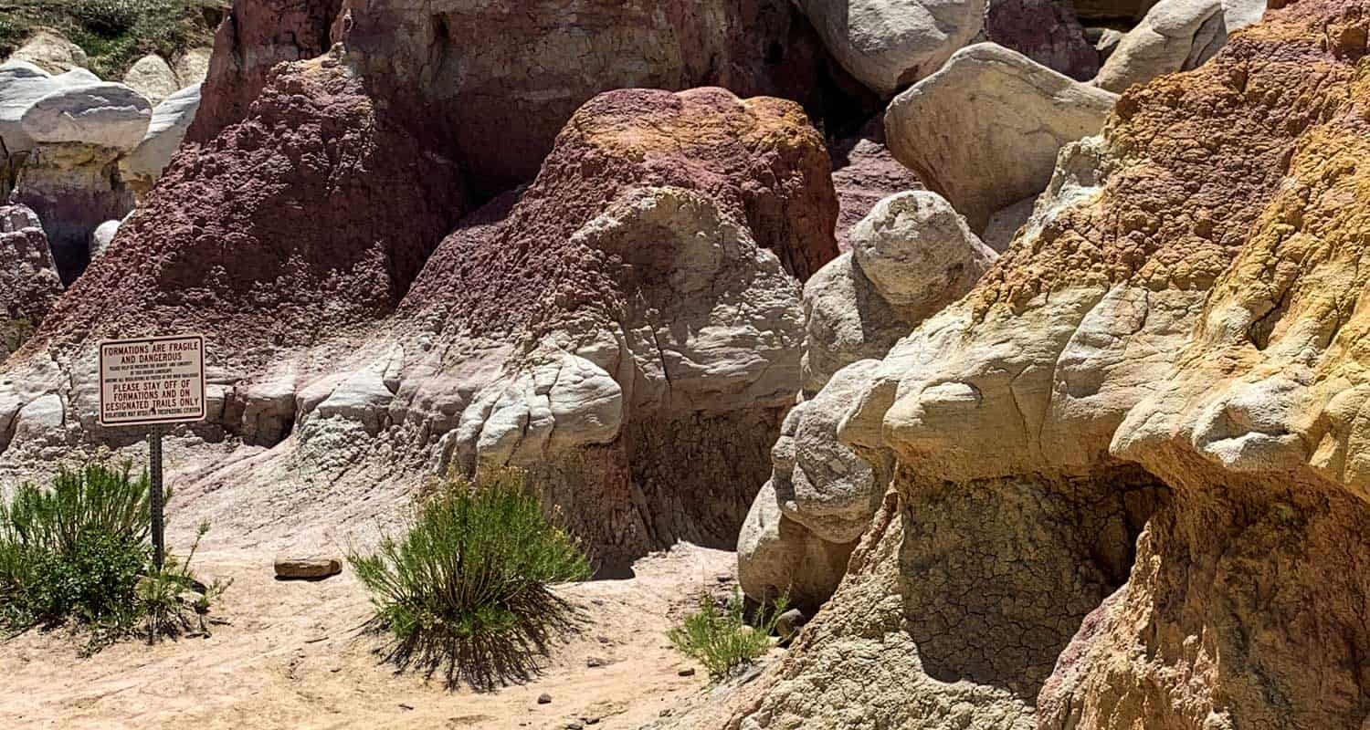
This next part of th trail takes you down right into the heart of the Paint Mines. After abou 0.6 miles, at the next trail junction, a spur trail goes to the left into the floor of the Paint Mines adding about 0.4 mile to the hike. Here is where you’ll want to spend some time and snap some photos. Though the rock formations call out, be sure to stay the trail to protect this wild and fragile area and for your own safety.
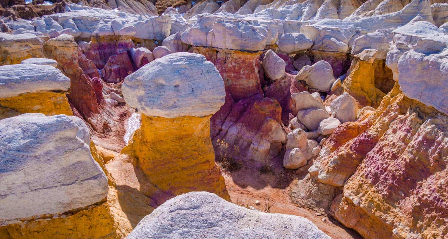
The Paint Mines were given their name because Native Americans used the crushed and colored sandstone to make paint and mined the soils to craft ceramic potter. Later, settlers mined the same area to make bricks. The swathes of color are made up of iron compounds that oxidize when the rock is exposed to air. Gypsum and quartize bring the white colors and sparkles to the rock. It’s all clay, dense sandstone color, and the erosion from many years of water of wind has carved out some spectacular hoodoos (those columns of weird looking rock that stand out) and gullies that look like something from the surface of Mars.
To finish the hike, leave the gully floor and head North until the trail once again comes to the 4-way trail junction. Take a left and ascend about a half mile back to the trailhead.
Tips & Resources for Hiking The Calhan Paint Mines
- Fragile: The rock formations are made up a a brittle form of sandstone that easily chips and can be damaged even by the rubber soles of our shoes. Take care not to walk on the edges and near drop offs as the rock can give way. Do your part to care for the area by staying the trail.
- Photography: One of the best spots for taking photos of the paint mines is at the bench about 1.2 miles into the hike.
- Trail Map: Paint Mines
- Packing List: Always pack the 10 Essentials. Download our Hiking Guide to get the list and dayhiking packing checklist.
- Colorado Road Conditions: Colorado Road Conditions
- Photo: We would like to express our gratitude to Torrence Jackson for sharing such amazing photos with us of his family’s hike at the Paint Mines. Along with Ryan Fonkert, Bryce Bradford, and Jay Gannet
- After the Hike: The Pikes Peak Brewing Company is situated in Monument, Colorado and a great spot to visit for a a drink and flatbread pizza.
Weather
Map & Driving Directions
Click for Driving Directions


This is the most comprehensive guide to the Paint Mines I’ve found, and the only one with a map. Thank you!