The Square Top Lakes Trail, one of several cresting Guanella Pass above Georgetown, CO, gives hikers a chance to behold sweeping valley vistas and the imposing profile of Mount Bierstadt. Simply driving to the trailhead along Guanella Pass can soothe a weary soul and take its breathe away at the same time! Once on the trail, the expansive pass greets hikers young and old of all skill levels.
Explore the full Square Top Lakes Hike profile below for trail map, driving directions, and more tips and details to help you enjoy this adventure on Guanella Pass near Denver.
Trail Snapshot: Square Top Lakes Trail
| Hike Distance | 4.5 miles Round Trip |
|---|---|
| Difficulty | Easy to Moderate |
| Duration | Approx 2-3hr |
| Trail Type | Out-and-Back |
| Starting Elevation | 11,600′ |
| Elevation Gain | Approx +700′ |
| Seasons | Summer |
| Dogs | Allowed On Leash |
| Hike Trail Map | Click for Trail Map of Square Top Lakes Hike |
| Denver Drive Time | 1.5 hours |
| Driving Directions to Square Top Lakes | Click for Google Map |
| Town Nearest Hike | Georgetown, Colorado |
| Beauty | Wildflowers, 14er, Lakes, Valleys, Guanella Pass, Aspens |
| Activities | Hiking, Fishing |
Parking & Trailhead Information for Square Top Lakes Hike
From Denver, heading west on I-70, exit 228 for Georgetown, CO. Going left under the bridge, Georgetown’s Visitor’s Center appears immediately on the right. This is an excellent place to rest before or after a hike. Going straight through the traffic circle and turning right onto Rose Street, Guanella Pass begins at the end of the street, curving up and up! Square Top Lakes Trail, easily accessed directly from the pass in the summer (when the pass opens) means that crowds often swell on weekends. Parking is free, but can present a challenge by mid-morning, especially near the Mount Bierstadt trailhead. The Square Top Lakes parking sits on the west side of the pass. Restrooms are available at the trailhead at the far end of the parking lot.
The Hike: Square Top Lakes Trail
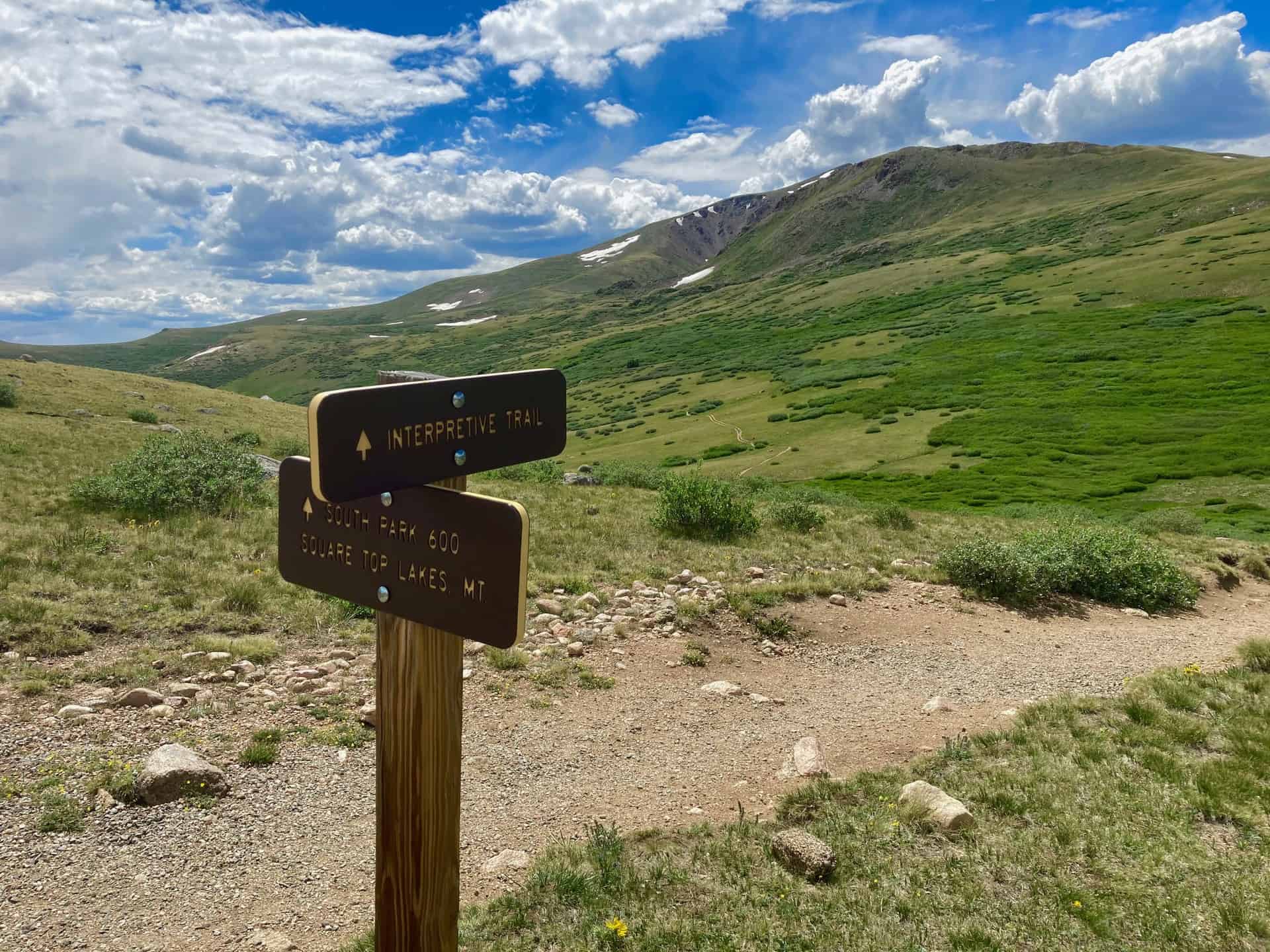
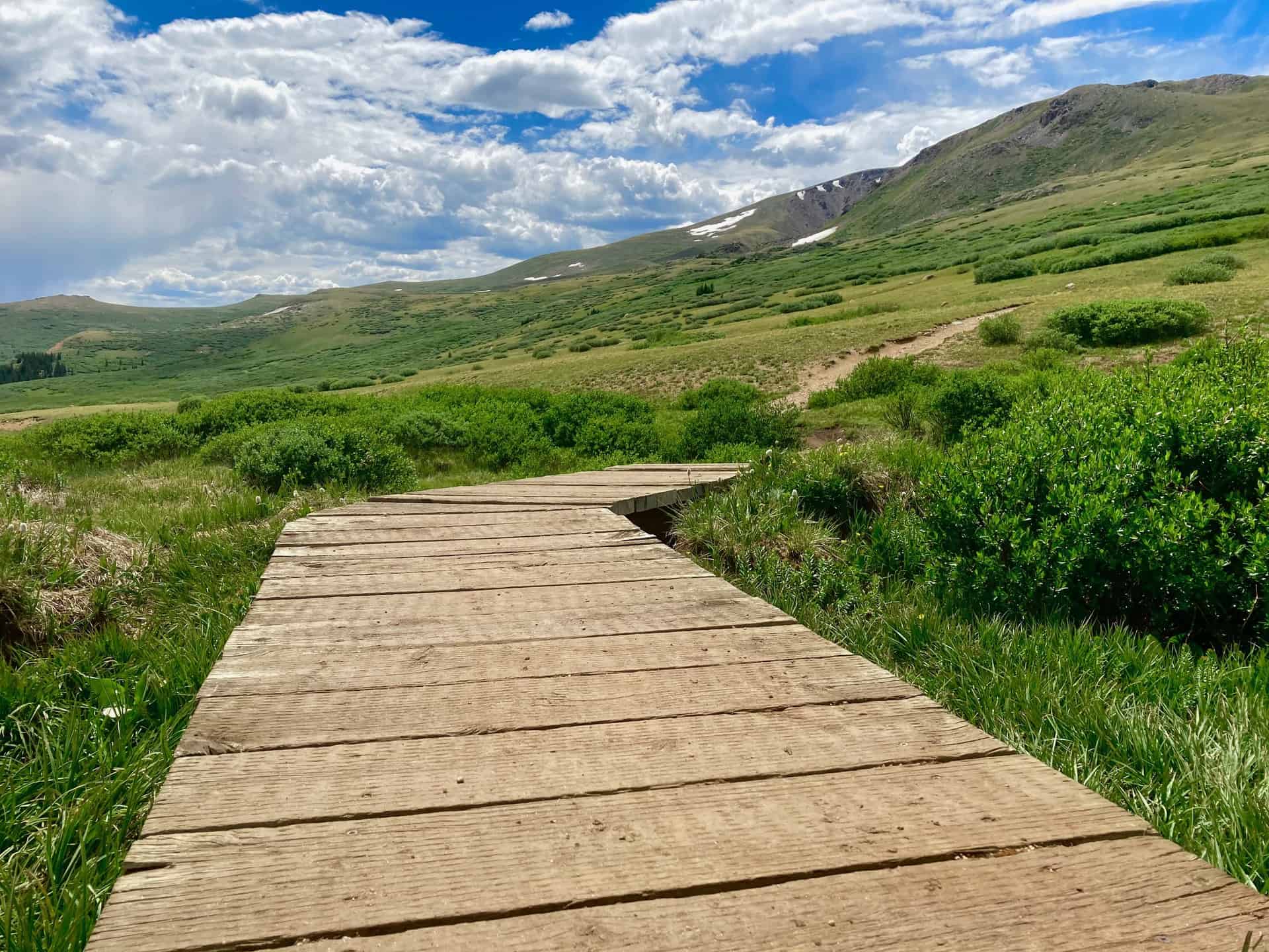
Beginning near the restrooms, the trail immediately jaunts left to reach a junction between the Interpretive Trial and the hiking trail. Turning right and heading down the steps into the valley, hikers encounter the signature Guanella Pass landscape…willows and mud. Thankfully, several years ago, boardwalks were installed to assist in traversing the low-lying areas. While more willows await hikers ahead on the Square Top Lakes trail, a clear pathway enables simple navigation. Still, some may prefer long pants to protect legs from scrapes.
Soon after, as the trail commences a steady ascent, the sloping ridge provides a view onto Duck Lake to the south. It disappears as quickly as it appears. At approximately 1.5 miles the trail rises over a small ridge. The wind often flows from the valley up through this small dip, and weather can change quickly atop the pass in general, so wise hikers keep an eye on the sky. Barely 1/4-mile later the trail meets, but skirts to the left of, the lower lake. A few paces beyond the lower lake the trail intersects with South Park Trail 600.
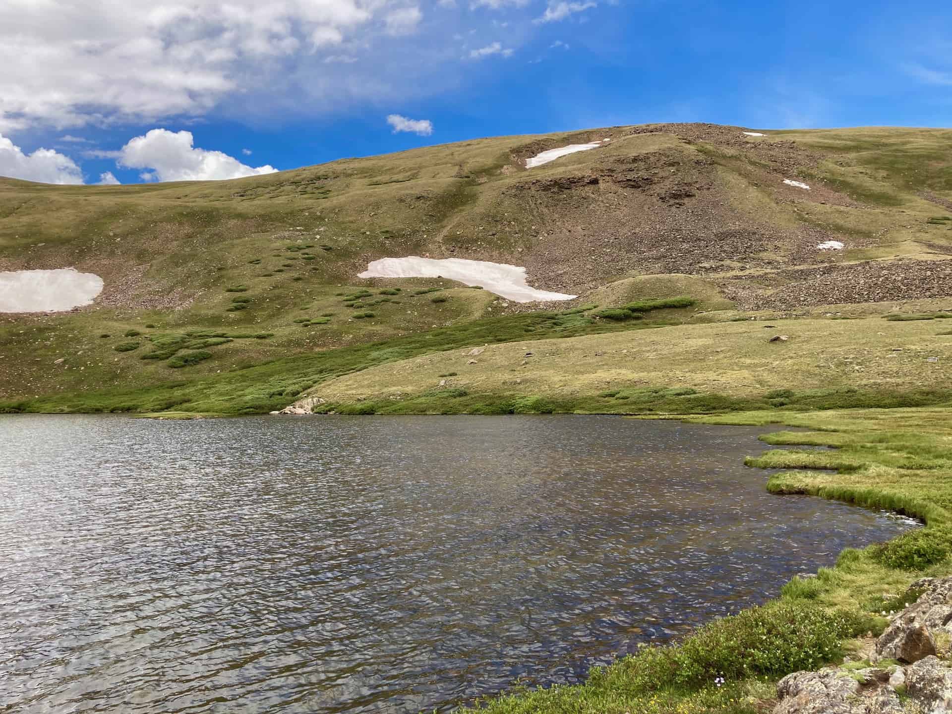
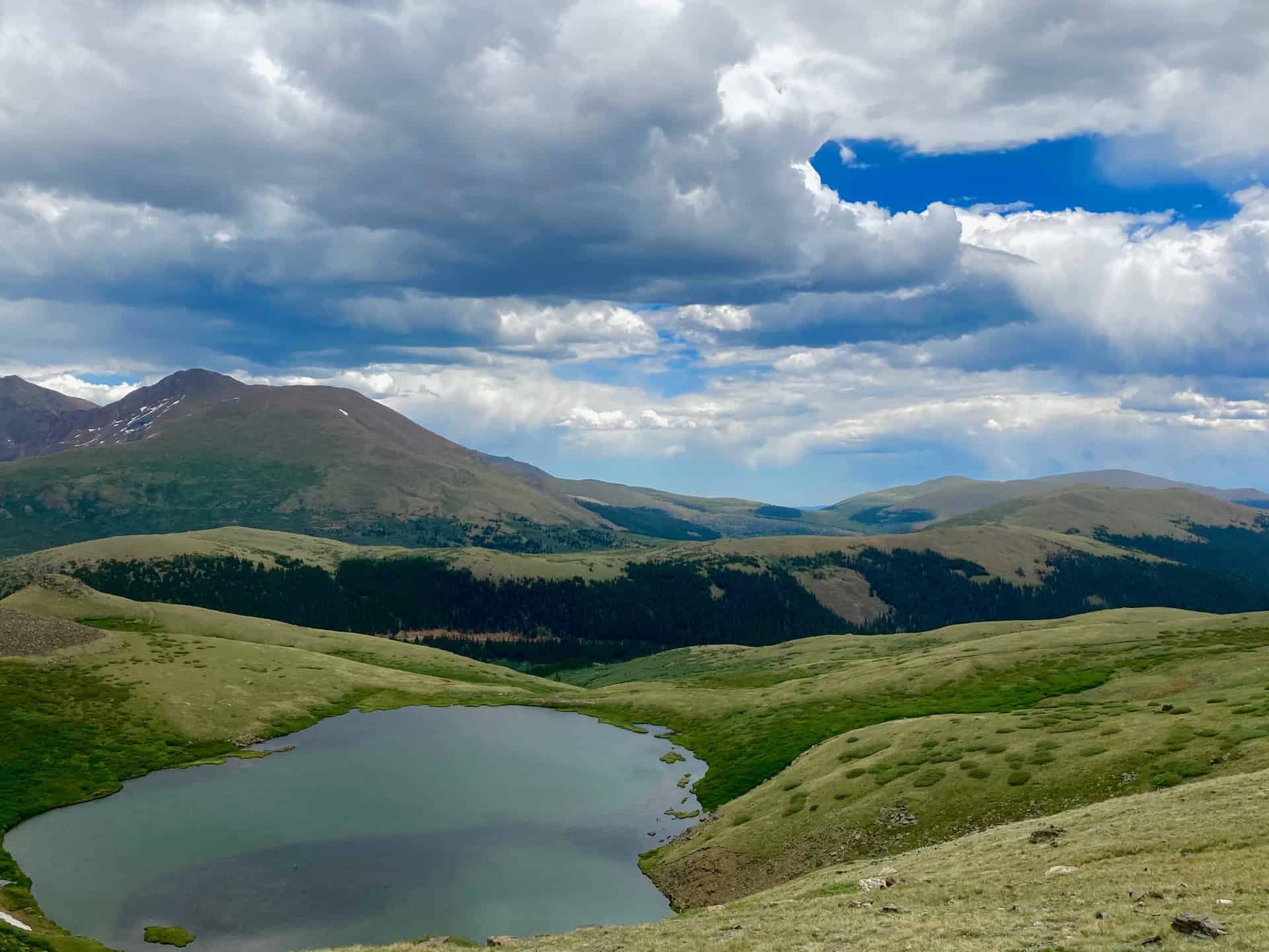
Staying right, the trail presents presents the upper Square Top Lake via a half-mile ascent. Informal trails spread out around the lake. The eastern ridge of the lake puts hikers on seemingly eye-level with Mount Bierstadt, a local favorite 14er. The return hike simply reverses the route, following the trail back down and out of the valley.
Tips & Resources for Hiking Square Top Lakes Trail
- TIP: The Square Top Lakes Trail completely lacks shade. Consider hiking early to mid-morning. If hiking later in the day, pay attention to the weather forecast–it changes quickly on Guanella Pass.
- Trail Map: Square Top Lakes Hike
- Packing List: Always pack the 10 Essentials. Download our Hiking Guide to get the list and dayhiking packing checklist.
- Colorado Road Conditions: Colorado Road Conditions
- After the Hike: While time may require a direct return trip to Denver, if time permits, many enjoy continuing on over Guanella Pass, following it down to Grant, CO. Turning left onto Highway 285 toward Denver, a late breakfast or early lunch awaits hungry hikers at The Shaggy Sheep. Further up the road, looking to the left, a 55-ft tall statue of Jesus watches over the historic town of Santa Maria, CO.
Weather
Map & Driving Directions
Click for Driving Directions


