Immensely popular in the summer, the Seven Bridges trail beckons hikers up and across North Cheyenne Creek multiple times, meandering by and over tumbling creek waterfalls. The route described below launches from the Seven Bridges trail out onto a loop around Kineo Mountain, reaching a connection point with the Mt. Buckhorn hike. These two loops, along with the Section 16 hike, create opportunity for a longer figure-8 adventure, or even a double-helix hike for those wanting an all-day excursion.
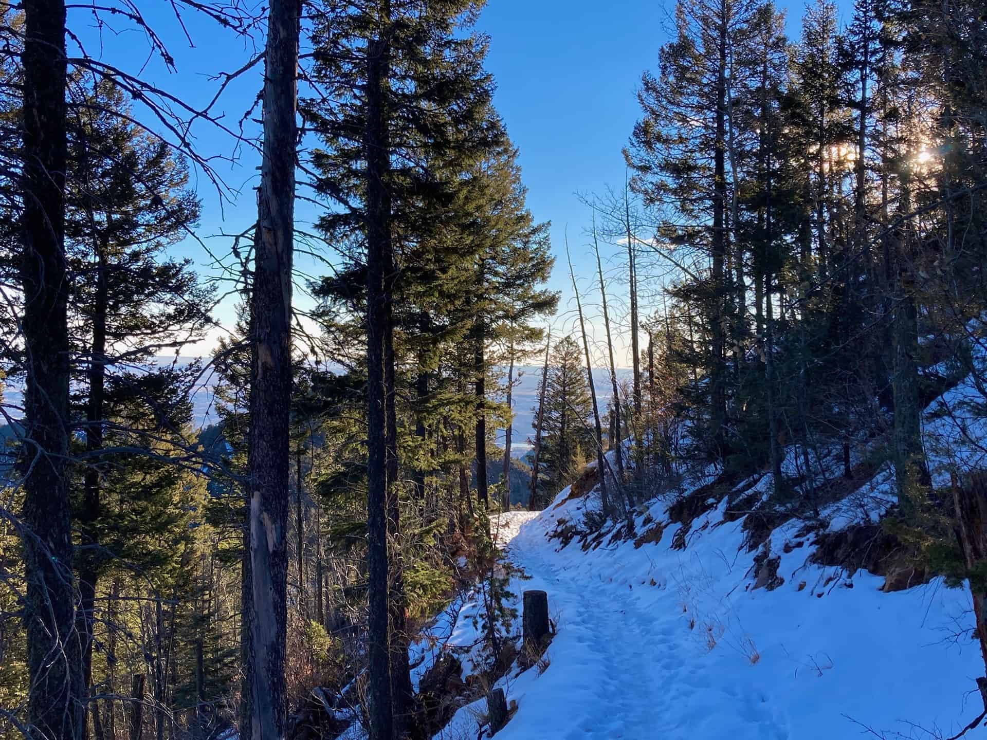
Due to its easily accessible trailhead, crowds are common — those wanting a simpler, quieter experience aim for an early morning start or a winter hike. Depending on recent weather in winter months, traction may be required, but the frozen waterfalls, snow-laden evergreens, and shimmering valley views make it worth it. Explore the full Seven Bridges to Kineo Mountain Hike profile below for trail map, driving directions, and more tips and details to help you enjoy this year-round adventure just south of Denver.
Trail Snapshot: Seven Bridges to Kineo Mountain Loop
| Hike Distance | 7.5 miles Round Trip |
|---|---|
| Difficulty | Moderate to Difficult |
| Duration | Approx 4hr |
| Trail Type | Loop |
| Starting Elevation | 7,500′ |
| Elevation Gain | Approx +1,600′ |
| Seasons | Year Round |
| Dogs | Allowed On Leash |
| Hike Trail Map | Click for Trail Map of the Seven Bridges to Kineo Mountain Hike |
| Denver Drive Time | 90 minutes |
| Driving Directions to Seven Bridges Trailhead | Click for Google Map |
| Town Nearest Hike | Manitou Springs and Colorado Springs, Colorado |
| Beauty | waterfalls, backcountry valleys, views of Colorado Springs |
| Activities | Hiking, Biking, Snowshoeing |
Parking & Trailhead Information for Seven Bridges Trail
From Denver, cruising south on I-25, take exit 140 for Tejon Street. After turning right onto Tejon, curve slightly right through the traffic circle to jump onto Cheyenne Blvd. In 2.5 miles, stay right and begin the ascent up North Cheyenne Canyon Road. About 3 miles up the road a large dirt parking lot sits at the junction of Cheyenne Canyon Road, Gold Camp Road, and High Drive (gated). (Note: just prior to reaching this junction, daytime sightseers can stop at Helen Hunt Falls.) The Seven Bridges parking lot fills fast and sometimes attracts unscrupulous thieves, so we recommend going early and placing valuables securely out of sight.
The Hike: Seven Bridges to Kineo Mountain Loop
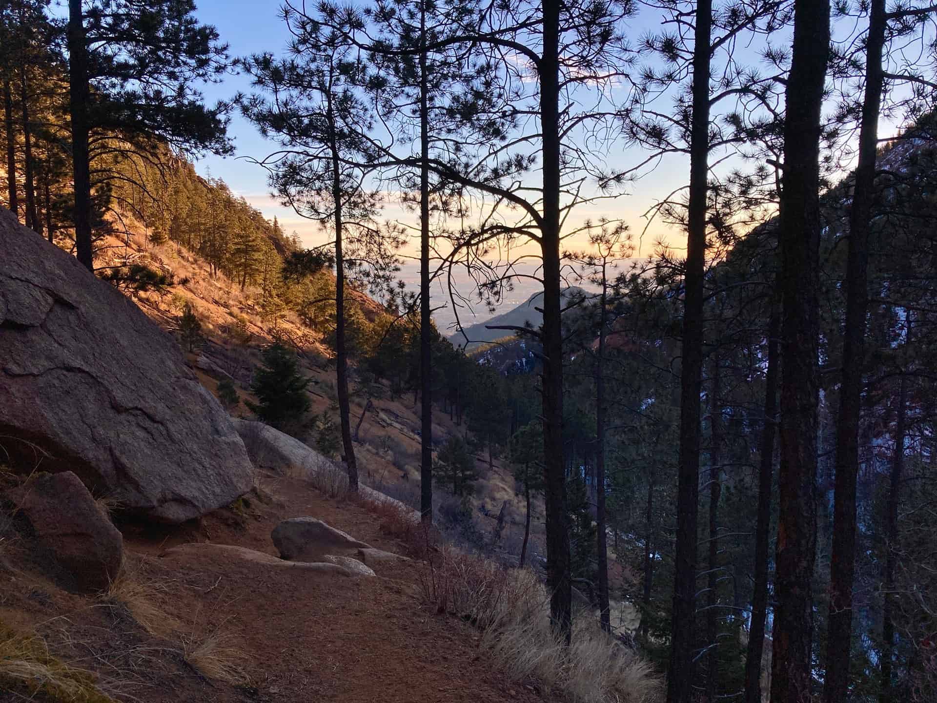
The trail commences at the far end of the parking lot, beyond a stout gate, heading up the decommissioned section of Gold Camp Road. At about 3/4-mile, the road crosses North Cheyenne Creek and immediately after, on the left, appears the Seven Bridges Trail (#662) junction.
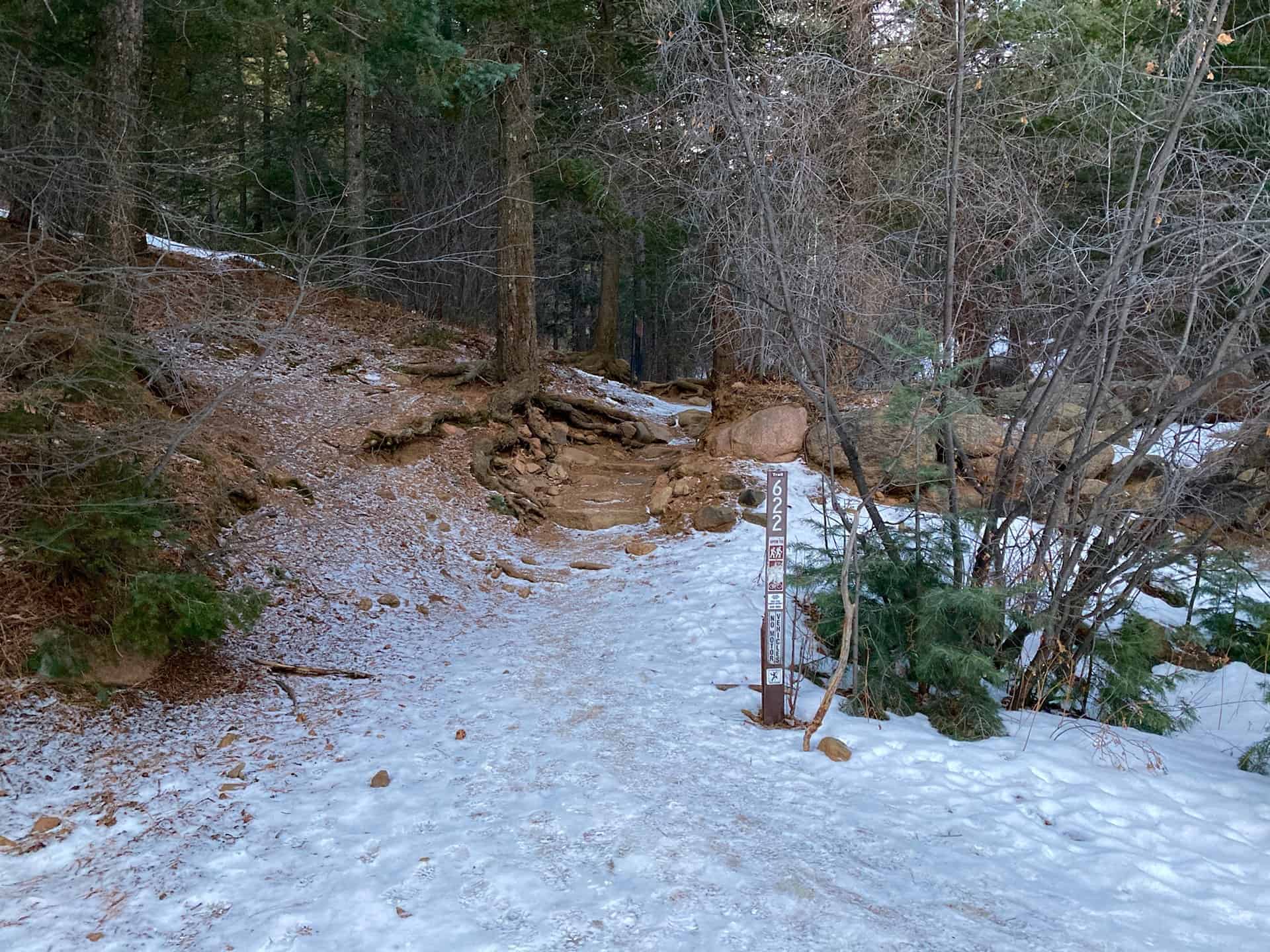
Over the next 1/4-mile, Trail 662 follows the creek, crossing it seven times. This short stint offers nearly endless opportunities to stop, listen, marvel and wonder. After Bridge #7, the trail steepens considerably as it stretches toward its junction with the overlapping Jones Park (#701) / Kineo Mountain / Captain Jack’s (#667) trails. Just under 1.5 miles ahead, a bypass trail curves off to the right, marked by bright fuchsia blazes. Taking this bypass reduces the total hike lengthy by approximately 3/4-mile. If staying straight to reach the multi-trail junction, continue for another 1/4-mile along the creek and then turn sharply right onto Trail 701/667. The route levels and lingers along the backcountry ridge through evergreen and aspens, providing respite from the steady ascent.
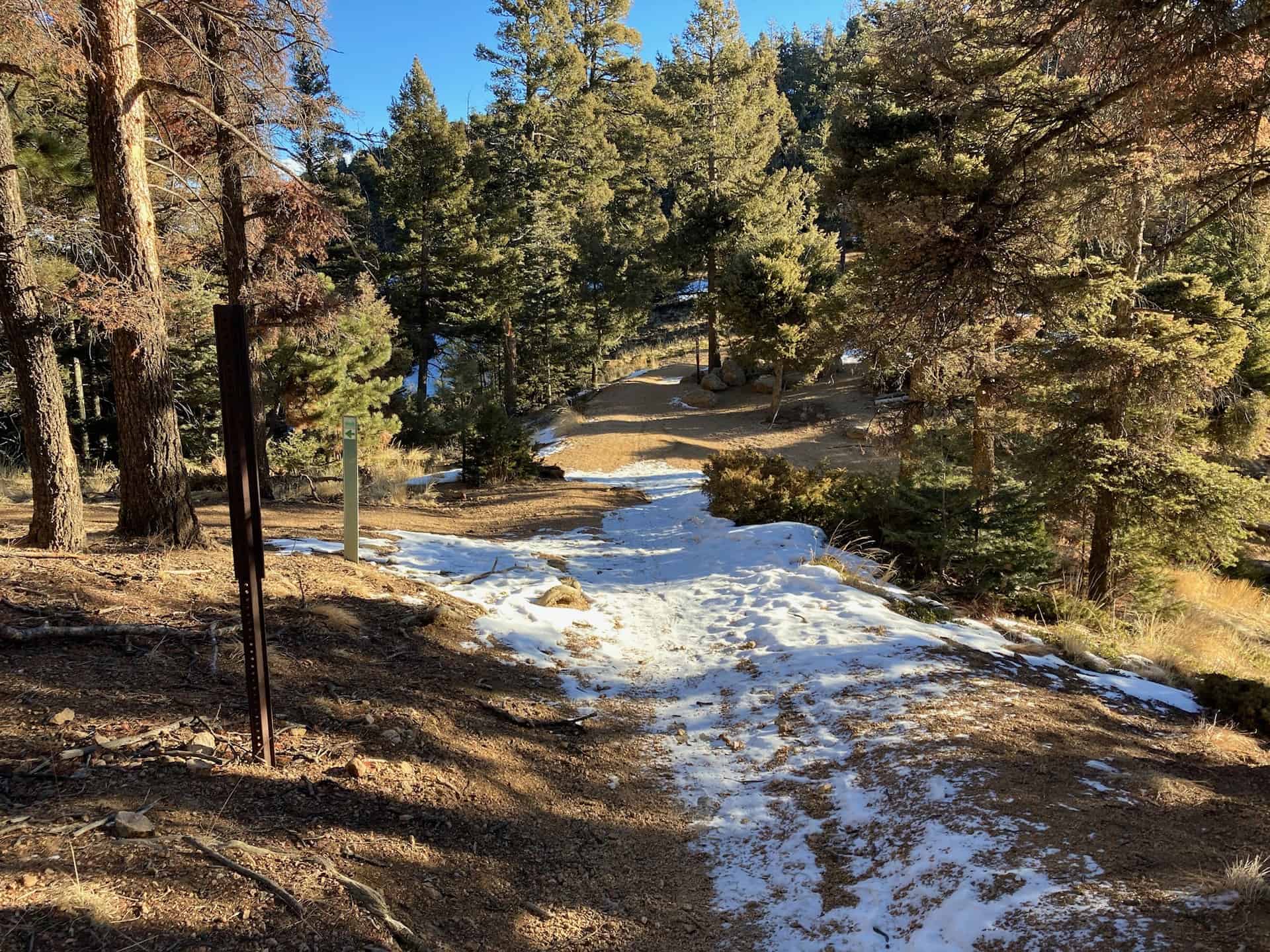
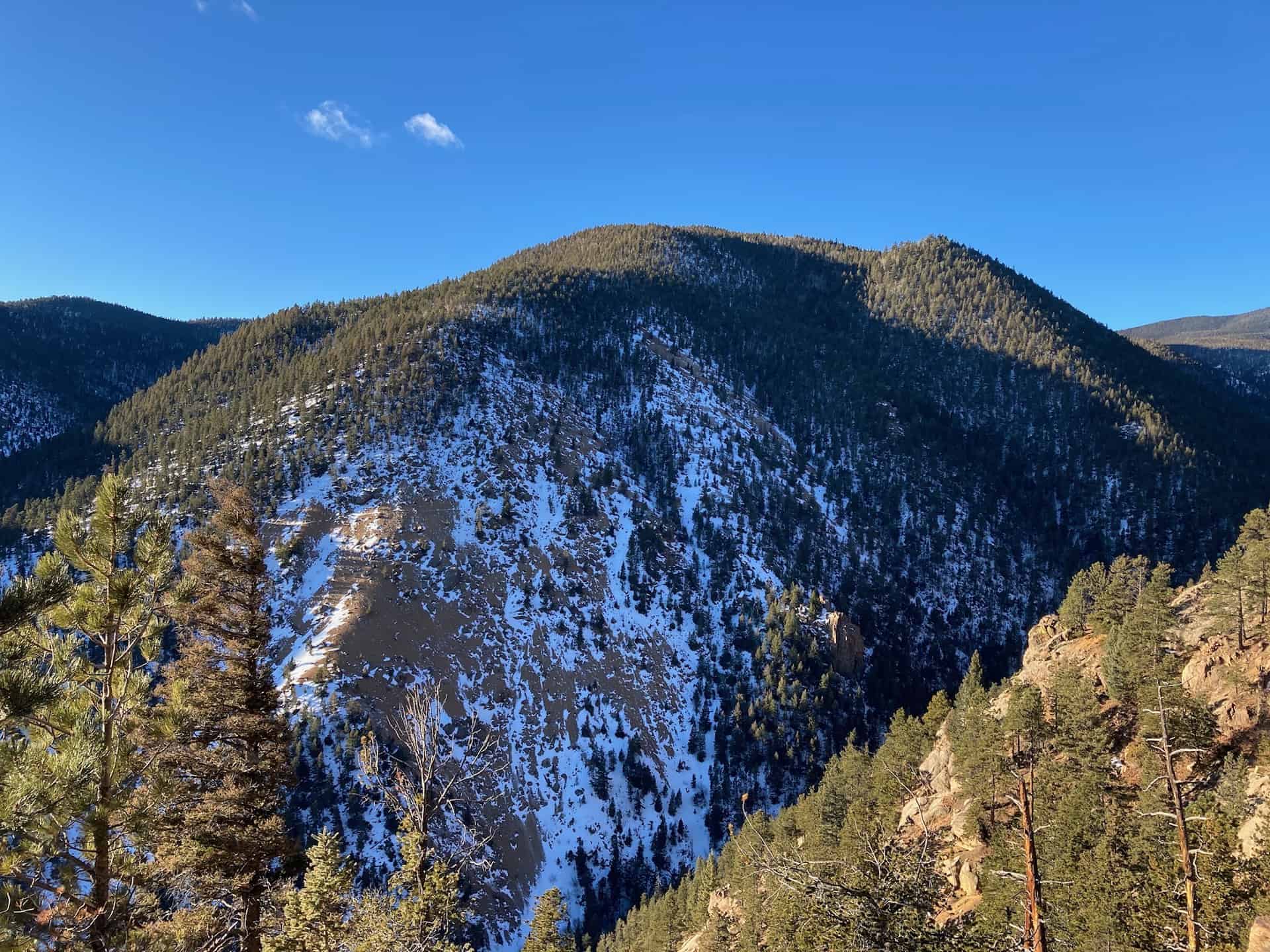
Now the joyful task is simply plodding along a valley ridge for about 2.5 miles, up to the connection with the Mt. Buckhorn hike trail. The route weaves in and out of trees, punctuating the hike with vistas of the trail hiked 2.5 miles ago, etched into the opposite valley wall.
After the junction with Bear Creek Trail (#666), the Kineo Mountain loop continues by swinging back right, down the slope onto Trail 776 (Buckhorn Trail). Following this for about 1 mile, another bypass greets hikers on the left, permitting them to quickly regain Gold Camp Road and stroll back to the parking lot.
Tips & Resources for Hiking the Seven Bridges to Kineo Mountain Loop
- TIP: Parking fills fast, but an early start helps noticeably. Once back to the vehicle after the hike, a drive down Gold Camp Road cruises through chiseled tunnels and by more trailheads, used by hikers and bikers alike. Please note: this stretch of road is maintained but not paved and has several narrow turns. Do not drive this return route unless accustomed to mountain driving.
- Trail Map: Seven Bridges to Kineo Mountain Hike
- Packing List: Always pack the 10 Essentials. Download our Hiking Guide to get the list and dayhiking packing checklist. Additionally, take some time to review our 10 Winter Hiking Tips.
- Colorado Road Conditions: Colorado Road Conditions
- After the Hike: A local favorite, Wild Goose Meeting House (or their counterpart, Good Neighbors Meeting House), captures the essence of downtown COS. Grab a craft coffee and chef-level dish, or later in the day, a local beer on tap. For unique local fare, consider Edelweiss, a Old World treat.
Weather
Map & Driving Directions
Click for Driving Directions


