The Mt. Buckhorn Hike, taking the shape of what hikers often call a “lollipop loop,” forms the bridge between the Section 16 hike and the Seven Bridges & Kineo Mountain hike.
As with those hikes, the surprising aspect is its immediacy — within minutes of turning off the highway the trailhead appears. And if parking has filled, other options await in the vicinity. Explore the full Mt. Buckhorn Hike profile below for trail map, driving directions, and more tips and details to help you enjoy this year-round adventure just south of Denver.
Trail Snapshot: Mt. Buckhorn Lollipop Loop
| Hike Distance | 6.25 miles Round Trip |
|---|---|
| Difficulty | Moderate to Difficult |
| Duration | Approx 3-4hr |
| Trail Type | Loop |
| Starting Elevation | 6,600′ |
| Elevation Gain | Approx +1,600′ |
| Seasons | Year Round |
| Dogs | Allowed On Leash |
| Hike Trail Map | Click for Trail Map of the Mt. Buckhorn Hike |
| Denver Drive Time | 1.25 hours |
| Driving Directions to Mt. Buckhorn Trailhead | Click for Google Map |
| Town Nearest Hike | Manitou Springs and Colorado Springs, Colorado |
| Beauty | backcountry valleys, views of Colorado Springs |
| Activities | Hiking, Biking, Snowshoeing |
Parking & Trailhead Information for Section 16 Trail
From Denver, cruising south on I-25, take exit 141 for Highway 24 West. After approximately 1.5 miles, turn left (south) onto 21st Street, and then shortly thereafter, right (west) onto Lower Gold Camp Road. Turning left at the 4-way stop (junction with Bear Creek Road), the Bear Creek Canyon pullout parking trailhead appears on the left just prior to the 3-way junction with a bend of Gold Camp Road. This parking lot offers head-in spots and fills fast; other pullout parking lots dot the road before and after this one.
The Hike: Mt. Buckhorn Lollipop Loop Hike
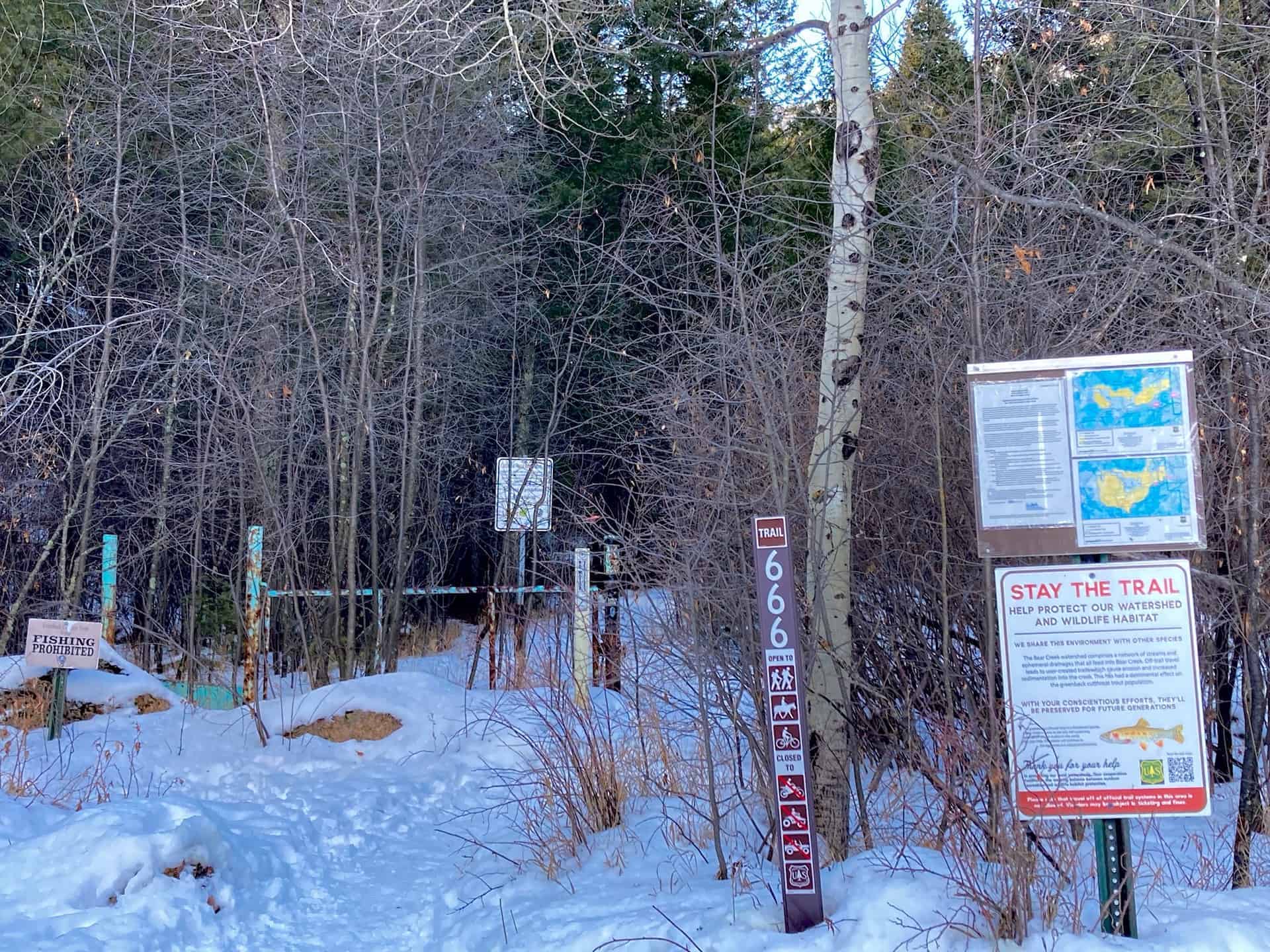
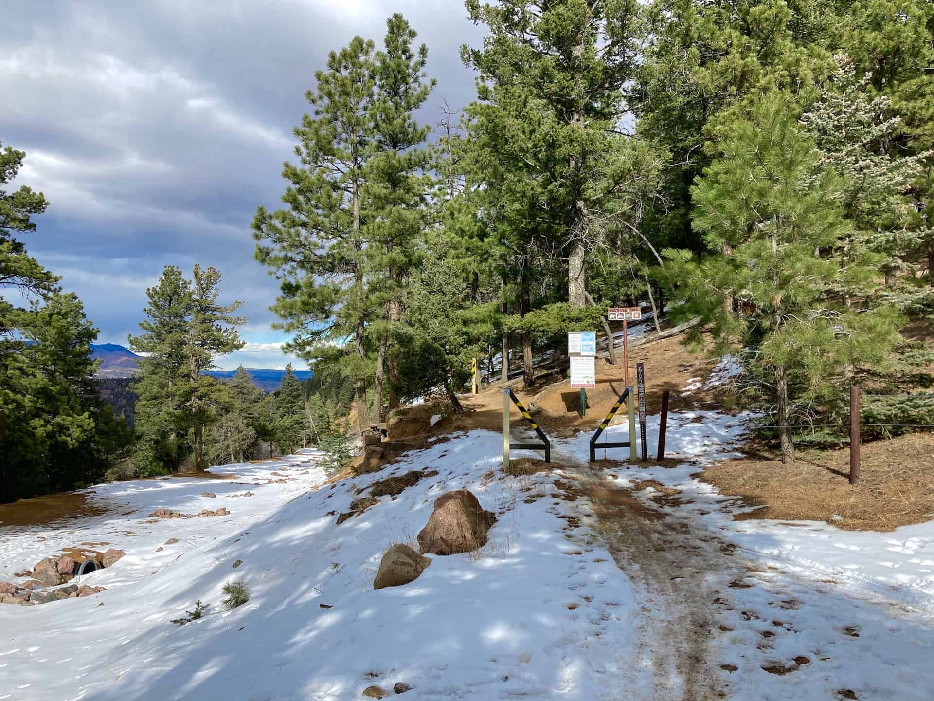
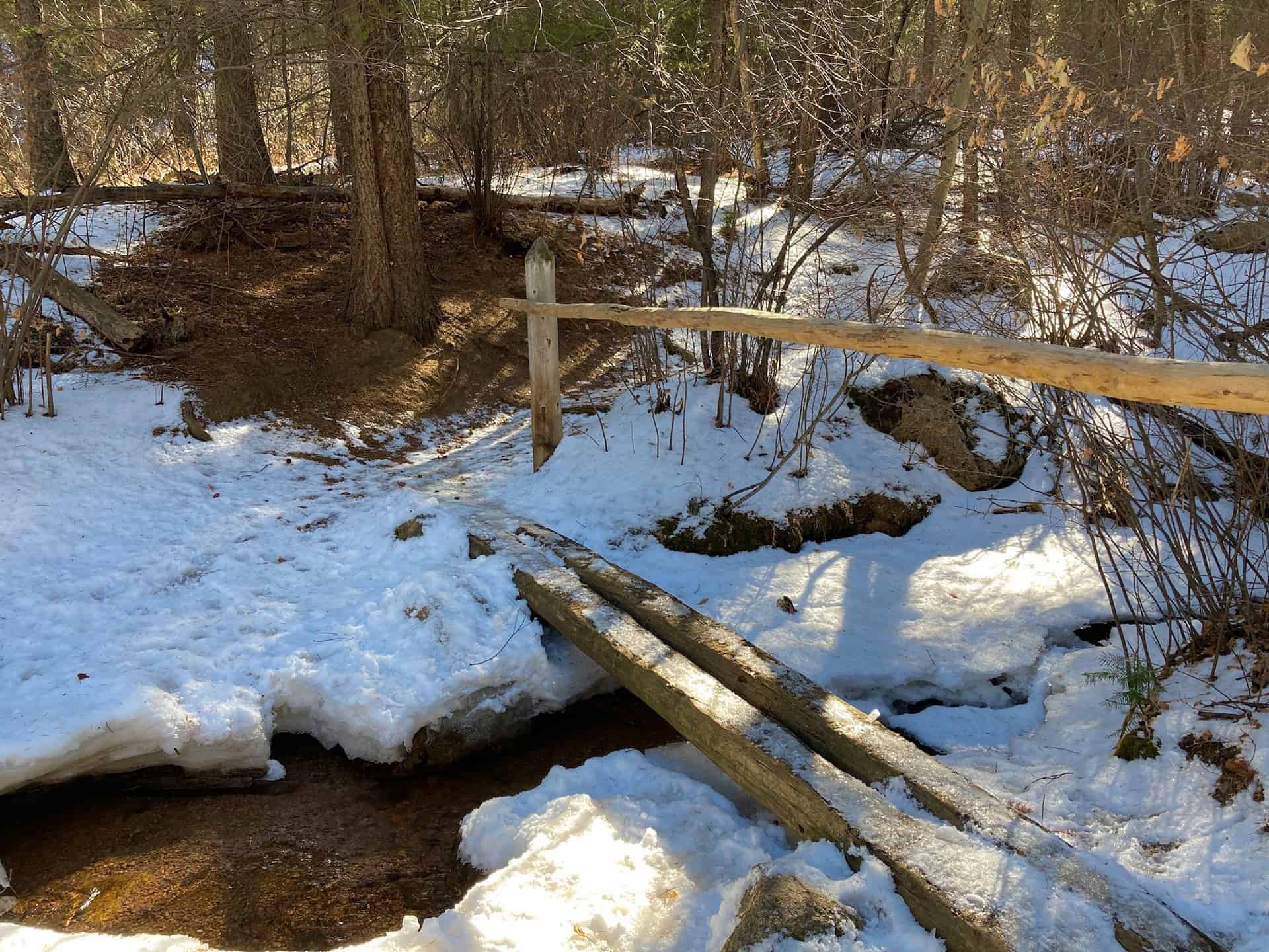
Leaving the parking lot, continuing toward the junction with Gold Camp Road, the route joins High Drive. High Drive meanders up into the backcountry past split-rail fences, over rock bridges, and through wide slot canyons. At approximately the 1-mile mark, less than 1/4-mile past the Section 16 Hike trail junction, the junction for the ominously named Trail 666 branches off to the right.
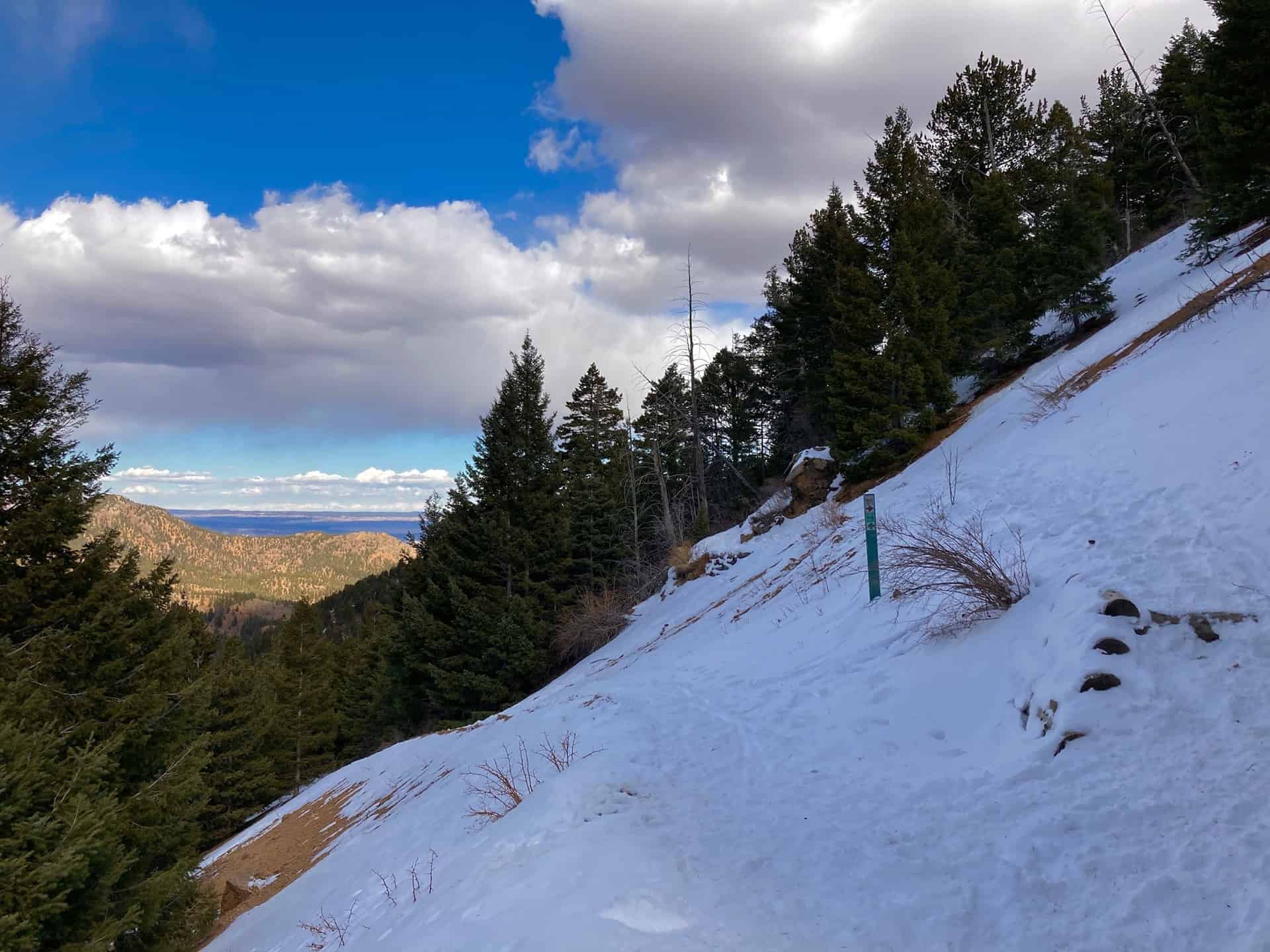
Over the next 1.5 miles, Trail 666 traces the valley wall, gracing hikers with unobstructed views of the basin below, crags on the opposite valley wall, and view of Colorado Springs in the rearview mirror. After ascending nearly 1,000ft, the route meets the junction with Trail 776. Taking a sharp left, Trail 776 tugs toward a 180-degree turn up the valley slope.
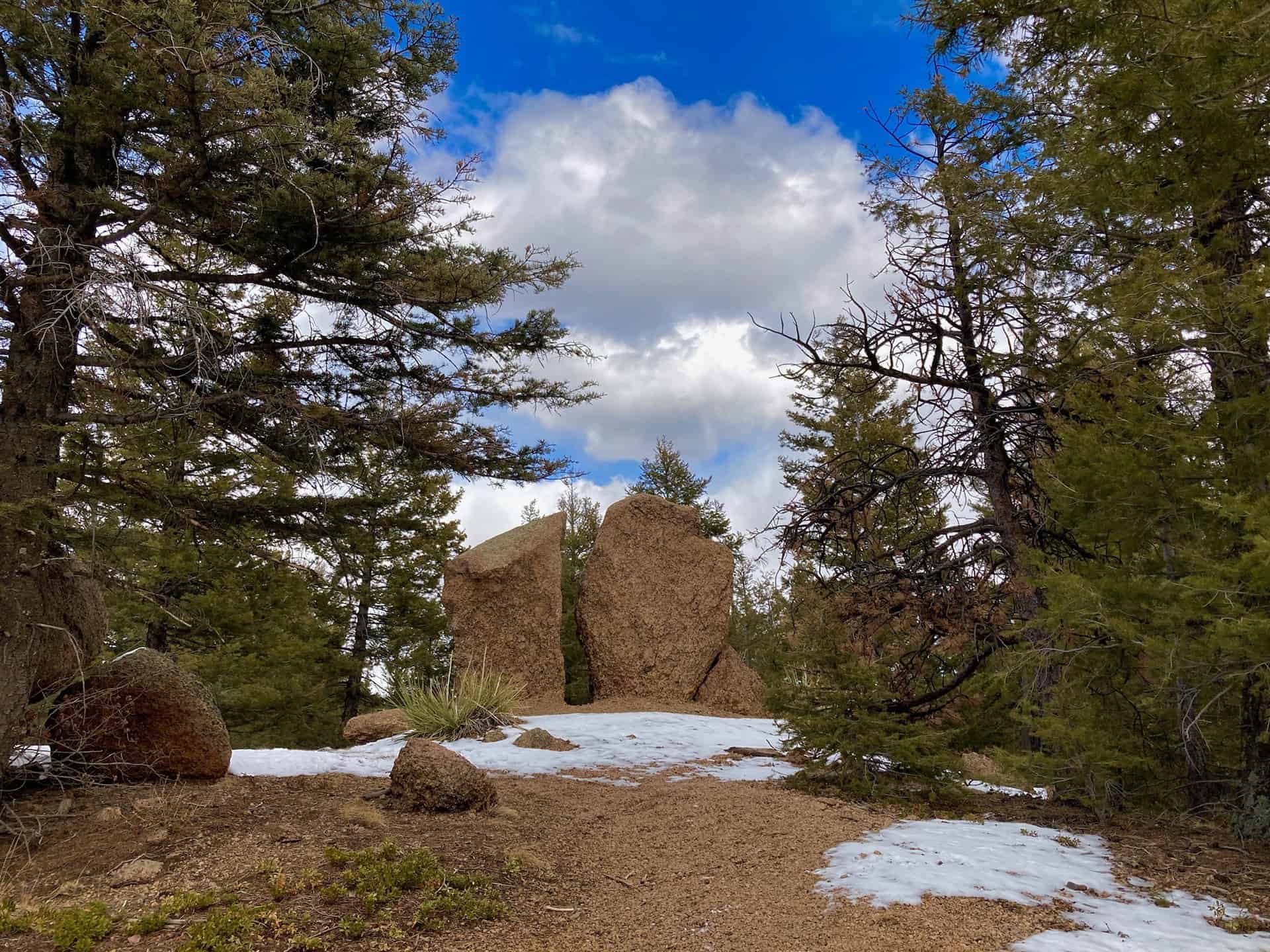
Now as the trail levels, more vistas break open to hikers’ delight. Approximately 1/2-mile up the trail, another key junction helps guide the backcountry adventurer. Trail 776 (aka Buckhorn Trail) crosses paths with Trail 667 (Upper Captain Jack’s Trail). Here one finds the connecting point to the Seven Bridges & Kineo Mountain hike. Staying slightly left by joining Trail 667, the route moves further into the backcountry and a stunning new valley. At the end of the elevation shelf, approximately 1/3-mile ahead, those with energy and gumption can trek to the top of Mt. Buckhorn. This adds about 1/2-mile total to the hike.
Continuing along Trail 667, the route begins its steady descent to meet up again with High Drive, but at a different juncture. At High Drive, a broad open space with signage and fencing, the lollipop loop turns left down the wide High Drive road and rolls 1.5-miles back to where Trail 666 first appeared. (Note carefully that Trail 667 (Captain Jack’s) crosses over High Drive and resumes climbing up the facing ridge. Taking the trail, instead of High Drive, will pull hikers far into the backcountry and away from the originating parking pullout.)
The last part of the Mt. Buckhorn lollipop loop hike simply follows High Drive all the way. Generally staying straight, with a couple hard curves along the way, the trail flows back down and out approximately 2.5 miles to the parking pullout.
Tips & Resources for Hiking Mt. Buckhorn near Colorado Springs
- TIP: Parking fills fast, but an early start helps noticeably.
- Trail Map: Mt. Buckhorn Hike
- Packing List: Always pack the 10 Essentials. Download our Hiking Guide to get the list and dayhiking packing checklist. Additionally, take some time to review our 10 Winter Hiking Tips.
- Colorado Road Conditions: Colorado Road Conditions
- After the Hike: A local favorite, Wild Goose Meeting House (or their counterpart, Good Neighbors Meeting House), captures the essence of downtown COS. Grab a craft coffee and chef-level dish, or later in the day, a local beer on tap. For a quick grab-n-go, consider Wimberger’s Old World Bakery and Delicatessen, on the way out from the trailhead.
Weather
Map & Driving Directions
Click for Driving Directions


