
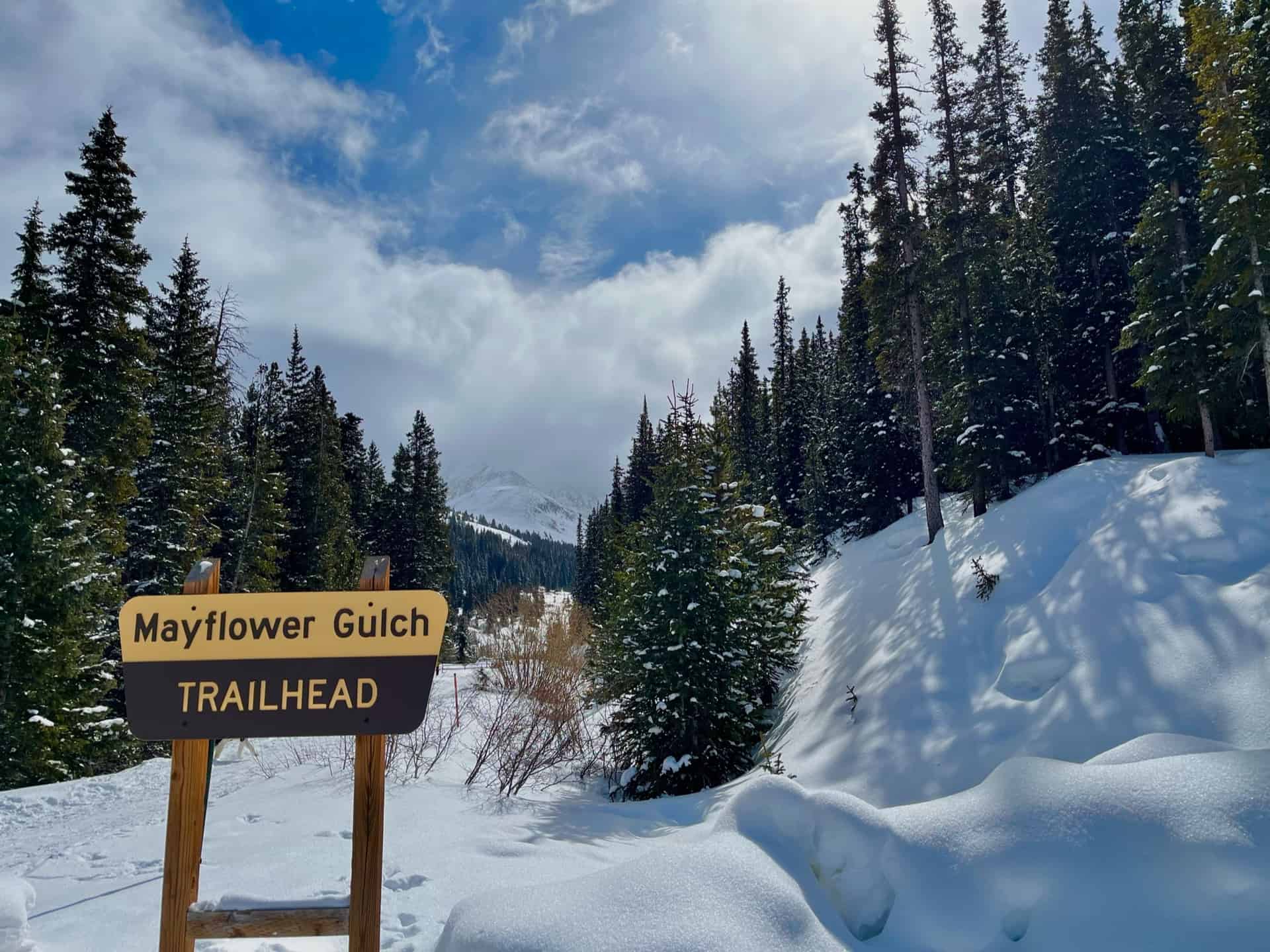
Mayflower Gulch Trail near Copper Mountain
Easy parking. Gentle elevation. Three miles round trip. And a ghost town? The Mayflower Gulch Trail gives you all this and a shockingly gorgeous basin to behold. On top of all this, the hike works well for families, especially if there exists any curiosity about the old west. The spacious gulch invites visitors to wander around and discover the fringes...a running stream, abandoned mines, and ridge line views. Caution: DO NOT inspect abandoned mines or even walk too closely; enjoy them from a distance! They can have unstable internal structures and entrances.
Explore the full Mayflower Gulch Hike profile below for trail map, driving directions, and more tips and details to help you enjoy this old west adventure near Denver.
Trail Snapshot: Mayflower Gulch Trail
| Hike Distance | 3 miles Round Trip (longer if exploring) |
|---|---|
| Difficulty | Easy to Moderate |
| Duration | Approx 2-3hr |
| Trail Type | Out-and-Back |
| Starting Elevation | 11,000′ |
| Elevation Gain | Approx +600′ |
| Seasons | All Seasons |
| Dogs | Allowed On Leash |
| Hike Trail Map | Click for Trail Map of Mayflower Gulch Hike |
| Denver Drive Time | 1.5 hours |
| Driving Directions to Mayflower Gulch | Click for Google Map |
| Town Nearest Hike | Copper Mountain, Colorado |
| Beauty | Valley basin, 13ers, Ghost Town |
| Activities | Hiking, Snowshoeing, Cross-country skiing |
Parking & Trailhead Information for Mayflower Gulch
From Denver, heading west on I-70, exit 195 for Copper Mountain. The road curves to the left, heading south into the resort area. Only six miles later along Highway 91, the free parking appears on the left (east), immediately after a short bridge over Mayflower Creek.
The Hike: Mayflower Gulch Trail
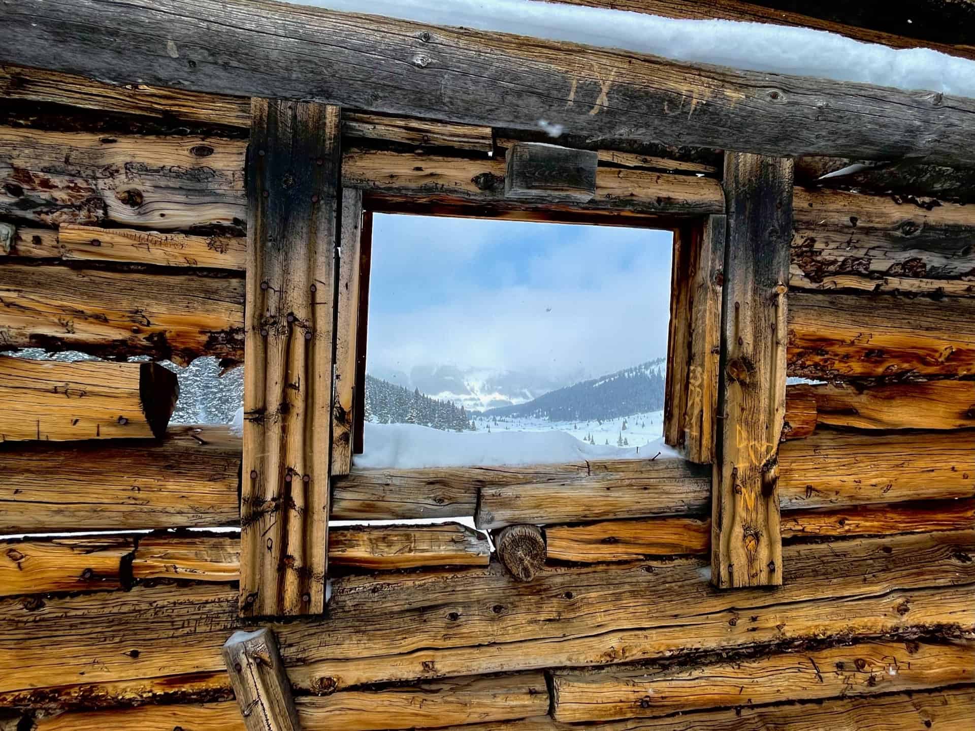
From the trailhead marker, the trail proceeds straight for approximately 1.5 miles. It's that simple! Meandering through pines, bordering the actual Mayflower Creek, hikers can devote almost all of their attention toward experiencing the trail and its surroundings. A mining remnant about 1/2-way up foreshadows the ghost town and abandoned mines in the peak-ringed basin. 4x4 vehicles are permitted along this route during the summer, so keep an ear open. Immediately before the valley floor, a gate and small parking lot indicate the destination reached.
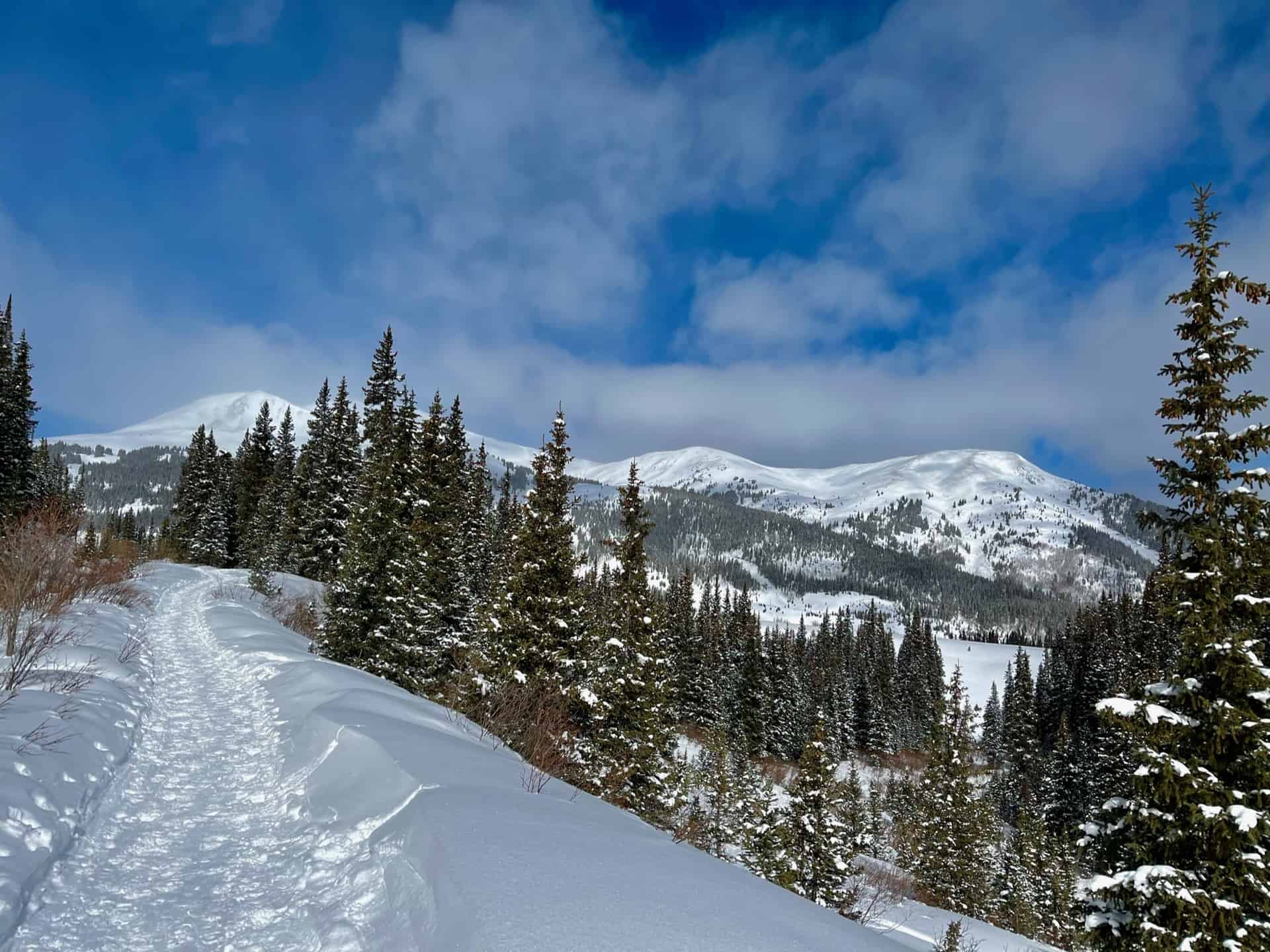
Some advanced hikers double-back and gain the ridge to the north. (Note: do not attempt without GPS, a reliable map, and alerting others to the plan.) This leads up to Atlantic Peak, a 13er sitting between two others -- Pacific Peak to the north and Fletcher Mountain to the south. Both Atlantic Peak and Fletcher Mountain tower over the gulch, so whether one views them from above or below, they greet visitors with majesty. After strolling the valley floor and taking in the gorgeous views, the return hike simply reverses the route, following the trail back down and out of the valley.
Tips & Resources for Hiking Mayflower Gulch
- TIP: Due to the ease of access, parking can fill fast, even in the winter. Also in the winter or early spring, "ski traffic" along I-70 can be unusually heavy on weekends during the morning and evenings. Therefore, this makes an excellent mid-week rest day to take a break from the slopes!
- Trail Map: Mayflower Gulch Trail
- Packing List: Always pack the 10 Essentials. Download our Hiking Guide to get the list and dayhiking packing checklist. Additionally, take some time to review our 10 Winter Hiking Tips.
- Colorado Road Conditions: Colorado Road Conditions
- After the Hike: Summer or winter, grab a slice at Mamma's Italiano! If there were a rebel's daughter who camped in the ghost town up in the gulch, she'd likely eat here and blend in with the menagerie of visitors.
Weather
Map & Driving Directions
Click for Driving Directions

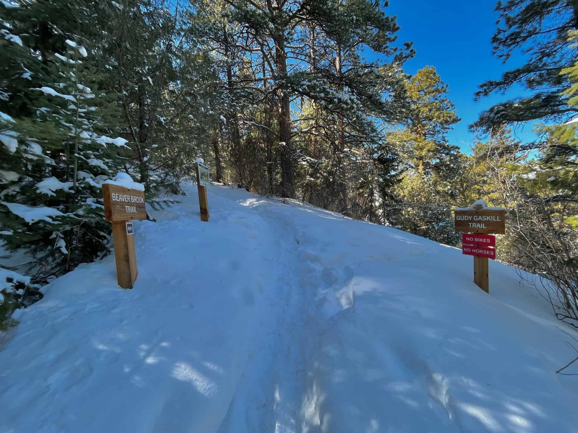
Beaver Brook Trail at Windy Saddle Park
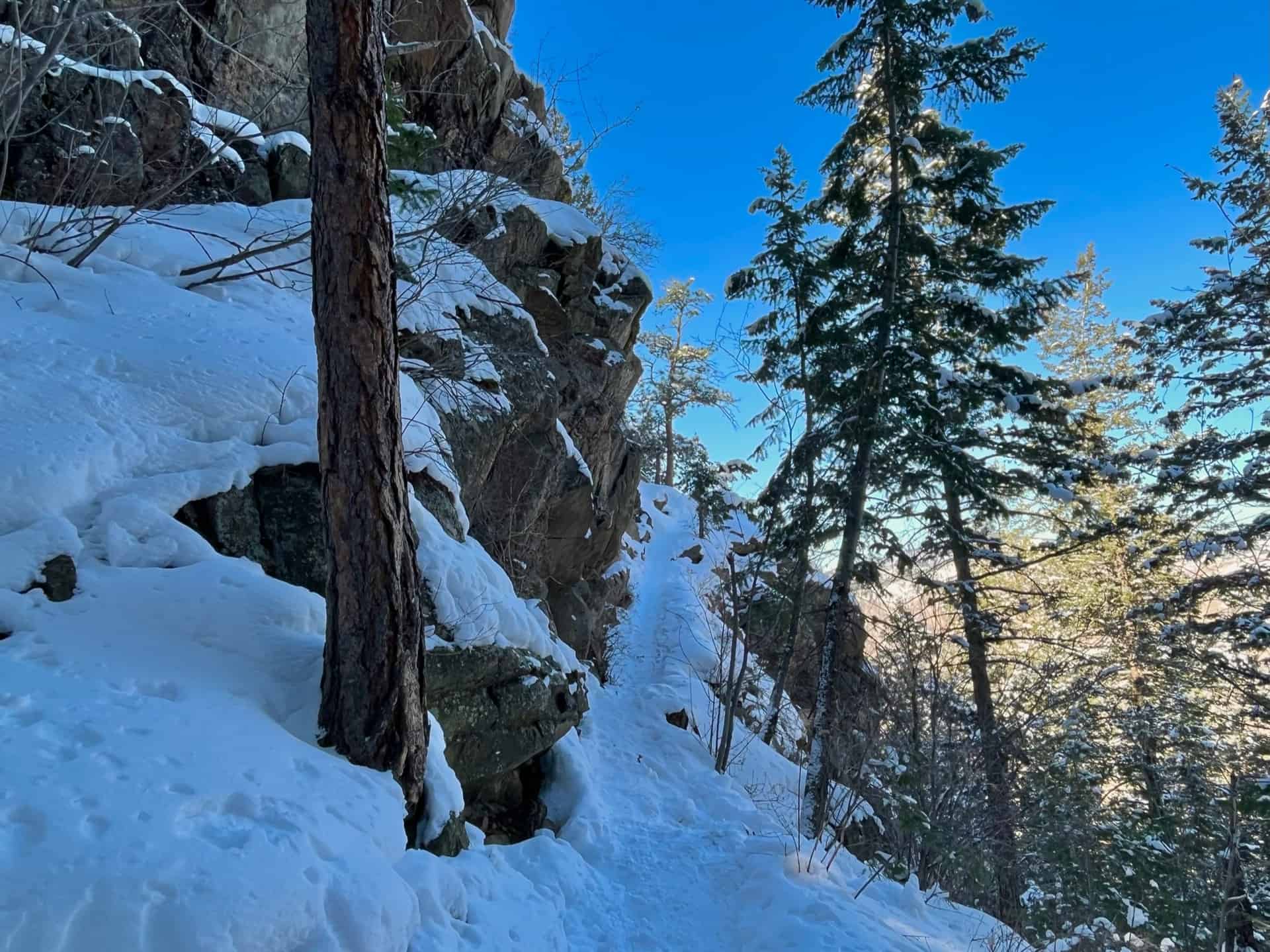
One aspect that commends the Beaver Brook Trail hike to all ranges of ability and interest is its ease of editing. Need a short stroll to clear the mind? Take a stretch to the first vista and turn around. Ready to engage in a healthy, keep-your-wits challenge? Press ahead to the highest point on the trail, which this post describes. The undulating elevation, and the carousel of pine-lined trail, rock ledges, and bursts of expansive valley views entreat hikers to take one more step. (For an exceptionally demanding trek, start with Chimney Gulch Hike).
Another advantage may surprise many...the entire length of the formal Beaver Brook Trail remains "HIKE ONLY." Hikers can stroll without any worry of bikers or skiers. Situated just below the local landmark, Lookout Mountain, the Beaver Brook Trail begins at a split in the Lookout Mountain Trail. Explore the full Beaver Brook hike profile below for trail map, driving directions, and more tips and details to help you enjoy this adventure in Windy Saddle Park near Denver.
Trail Snapshot: Beaver Brook Trail at Windy Saddle Park
| Hike Distance | 11 miles Round Trip (modifiable) |
|---|---|
| Difficulty | Moderate to Difficult |
| Duration | Approx 3+ hrs |
| Trail Type | Out and Back |
| Seasons | All Season |
| Dogs | Allowed On Leash |
| Hike Trail Map | Click for a Map of Windy Saddle Trailhead, or use this 3D Topographical Map to view the entire length of the trail. |
| Denver Drive Time | 35 min |
| Driving Directions to Windy Saddle Trailhead | Click for Google Map |
| Town Nearest Hike | Golden, Colorado |
| Beauty | Rocky Mountain vista at top, views of Golden & Denver |
| Activities | Hiking, trail running |
The Hike: Beaver Brook Trail
Note: The Beaver Brook Trail continues for almost another 3.5 miles to the official Beaver Brook Trailhead, at Genesee Park, off the Chief Hosa exit on I-70 (Exit 253). Hikes may also start from this location and go toward Windy Saddle. Along the way, multiple side trails, all well-marked, invite further adventure.
Easily accessible from Denver - on average, just a 35 minute drive - this trail empowers the hiker to adjust the length and demands based on the day. Nearly every 1/2-mile the route wraps around a valley wall, giving way to inspiring views of the Rockies. From time to time, Highway 6 (between Golden and Idaho Springs) pops up. The elevation hovers between 6800ft and 7200ft almost the full length; the exception comes at the end, when this route pushes up to 7400ft, then scales to 7750ft to reach the payoff perch.
Tips & Resources for Hiking the Beaver Brook Trail
- TIP: JeffCo designated the entirety of Beaver Brook Trail as "HIKE ONLY." However, dogs are permitted on-leash. Unlike Chimney Gulch, the Beaver Brook trail offers a quiet, semi-solitary hike.
- TIP: The parking lot is small. Many times, people come and just take in the views and then leave after 15-20min, but some park to hike and keep their spot all day. Consider coming early, or late, and seasonally the trail will be less crowded in winter.
- Trail Map: Beaver Brook Trail Hike
- Packing List: Always pack the 10 Essentials. Download our Hiking Guide to get the list and dayhiking packing checklist. Additionally, take some time to review our 10 Winter Hiking Tips.
- Colorado Road Conditions: Colorado Road Conditions
- After the Hike: Keep the adventure alive! Visit the The Buffalo Bill Museum and Grave.
Weather
Map & Driving Directions for Windy Saddle Trailhead
Click for Driving Directions
Eleven Mile State Park Interpretive Trail
Eleven Mile State Park feels like the proverbial "hidden in plain sight" gem. Situated off the commonly traveled Highway 24 between Colorado Springs and Buena Vista, this loop hike blesses visitors with uncommon beauty. Trekking around the 3.5+ mile trail serves up a superb buffet of Colorado's classic outdoors: aspen and evergreen forests, meadows, rocky crags, vistas of mountain ranges, and a shoreline. Rarely do trails achieve a true "all-year" rating, but this loop qualifies. This hike near Denver could function as an along-the-way pit stop or a destination in itself, perfect for a swift pace or a lingering stroll with the family. Explore the full Eleven Mile State Park hike profile below for trail map, driving directions, and more tips and details to help you enjoy this treasure outside Lake George, CO.
Trail Snapshot: Eleven Mile State Park Loop
| Hike Distance | 3.5-5.5 miles Round Trip |
|---|---|
| Difficulty | Easy |
| Duration | Approx 2-3hr |
| Trail Type | Loop |
| Starting Elevation | 8575′ |
| Elevation Gain | Approx +225′ |
| Seasons | All Year |
| Dogs | Allowed On Leash |
| Hike Trail Map | Click for Trail Map of Eleven Mile State Park Loops |
| Denver Drive Time | 2hrs 15min |
| Driving Directions to Eleven Mile State Park | Click for Google Map |
| Town Nearest Hike | Lake George, Colorado |
| Beauty | Aspen Forest, Lake, Wetlands, Meadow, Crags |
| Activities | Hiking, Photography, Biking, Snowshoeing, Paddle Boarding, Kayaking |
| Fee | Entrance Fee or State Parks Pass Required |
Parking & Trailhead Information for Eleven Mile State Park
Cruising south out of Denver on I-25, take Exit 141 for Highway 24 West. Just barely outside of Lake George, turn left onto County Road 90 and go four miles -- here the pavement will curve left onto County Road 92. After about 5.5 miles on CR-92, look for the Coyote Ridge sign indicating a left-hand turn. Follow this road for 1/2-mile to the parking lot. (Alternately, following Highway 285 South out of Denver, pick up CR-9 South at Fairplay to Highway 24 East at Harstel. On Highway 24, just beyond the gorgeous Wilkerson Pass, look for CR-90 on the right. This is a graded gravel road that will intersect with CR-92, as described above.)
The Hike: Eleven Mile State Park Loops
One of the many reasons to plan a trip here is the Coyote Ridge Interpretive Trail, one of four loops. At less than 1.5 miles in length, it offers a family a fun exploratory and engaging getaway. The recommended route takes advantage of the best of each smaller, individual loop (Ponderosa, Aspen, Midland, Black Bear). Going clockwise from the parking lot brings hikers through crags, meadows, forests, ridges, and the spectacular shoreline. Spring brings flowers, summer the bluebird skies; in autumn it bursts with golden aspens, winter the arresting contrast of snow and rock, evergreen and ice.
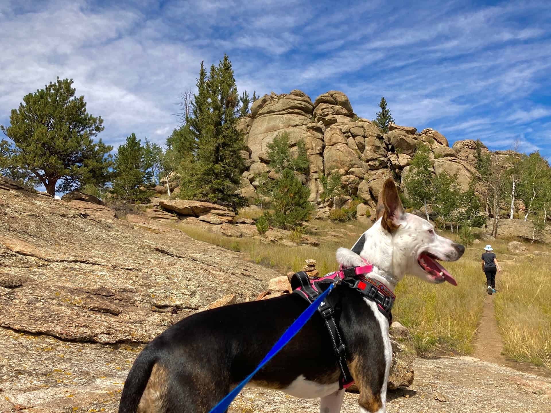
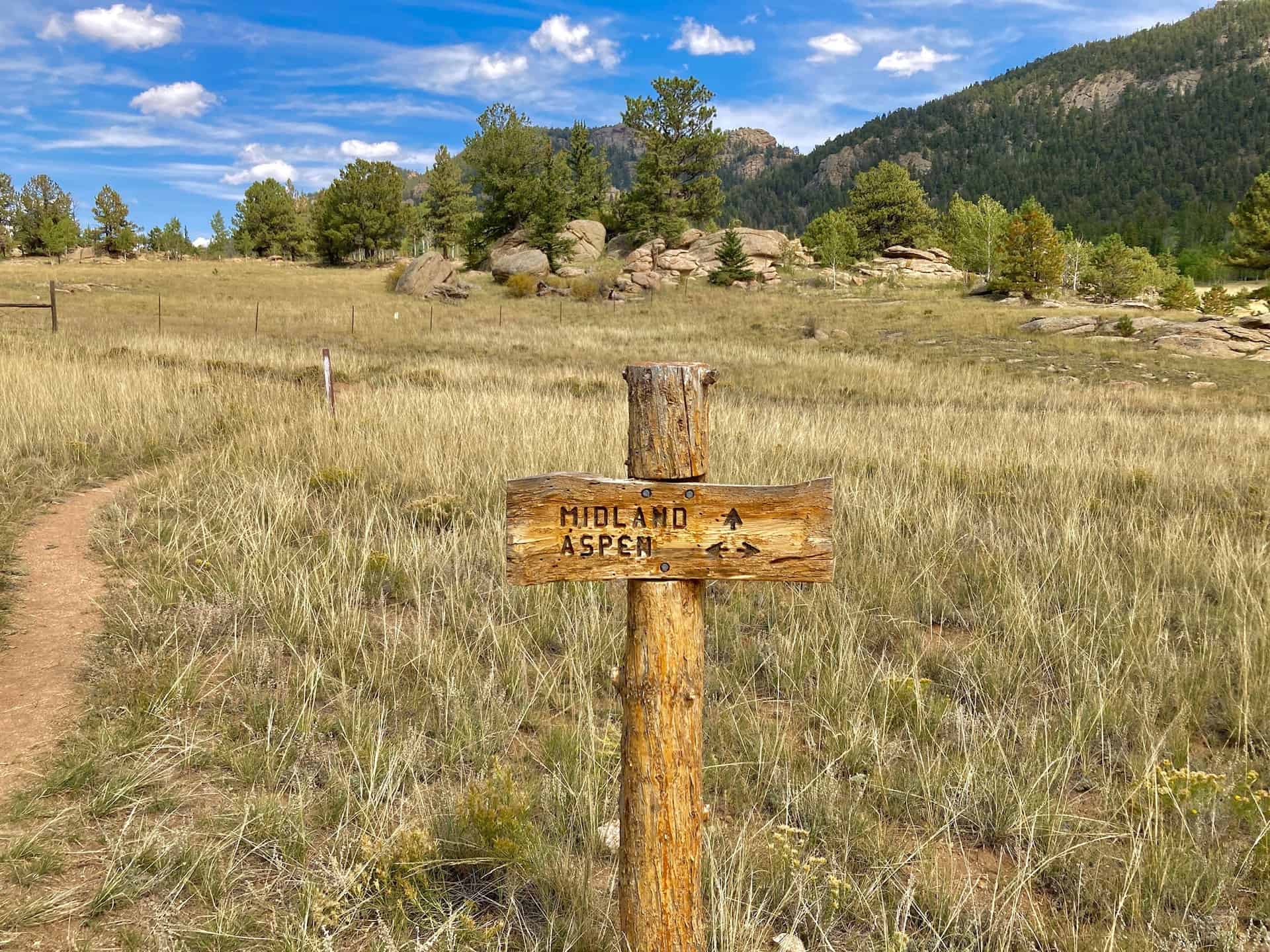
Joining up with the trail on the north side of the parking lot, the route heads up and onto slickrock terraces dotted with pines. Even this early in the hike views break open into the meadow and onto the water. After 1/3-mile, a right-hand turn at the juncture leads the Ponderosa Trail past a small stand of trees, then quickly encounters another juncture, this one with the Aspen Trail. The route continues on for another 1/3-mile to the next juncture, where the trail turns right, joining the longer Midland Trail.
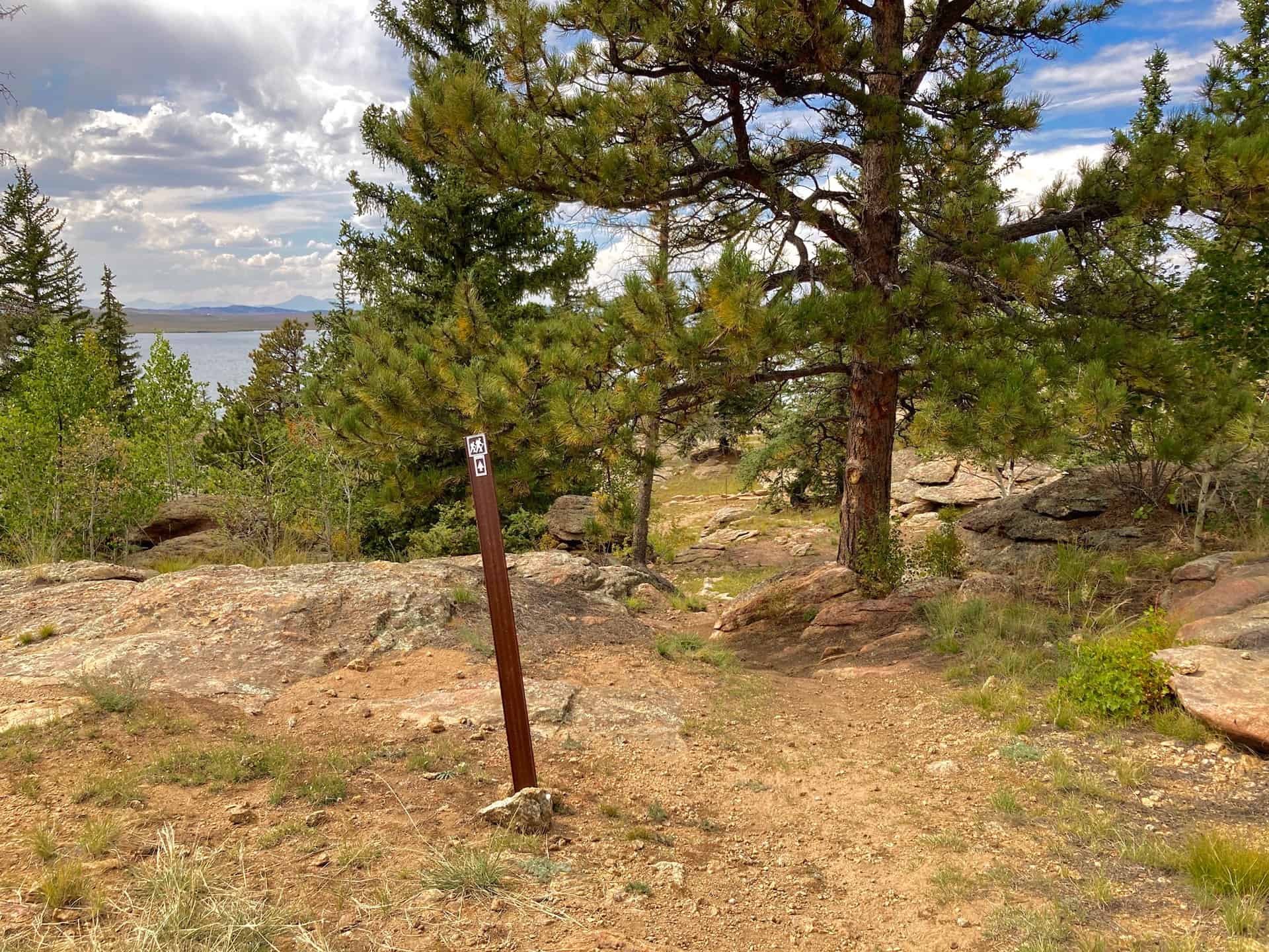
Crossing a faded service road and passing by an old cattle corral, the route slowly rolls into the wetland meadow before rising gently to enter an evergreen and aspen forest. Throughout the forest, vistas of distant mountain ranges punctuate the trail to the hiker's right. At approximately the two mile mark, the trail crosses the service road again and begins descending toward the shoreline. Within 1/3-mile a lookout point trail branches off to the left (south) where those with time and a desire to soak in the sun can rest overlooking the water. (Note: the lookout trail is a mere 1/10-mile one-way.) Turning back northwest, the trail arrives at the Black Bear Trail options. Here, pay attention to signs with the "hiker" symbol for guidance on the route's flow. Consider also using this interactive trail map (Eleven Mile State Park Loops) for more precision than the state park PDF map.
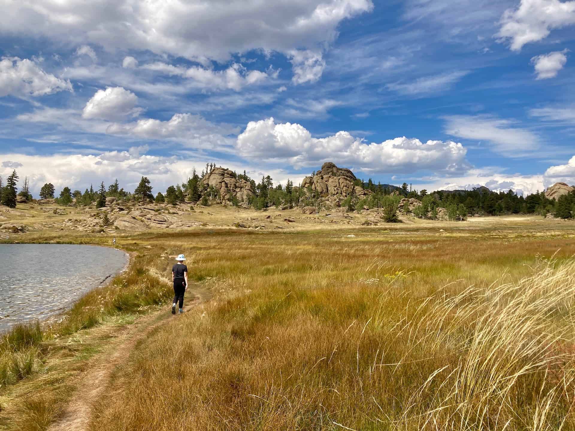
If at any point the Black Bear Trail loops feel complex, realize that they simply give hikers a choice to either scamper along the shore or journey inland. Both pass through a handful of tempting camp sites...plan far ahead to secure a spot! Once back on the main Midland Trail around the three mile mark, the route hugs the shore while looking back over the wetland meadow to the east. A well-timed hike can catch the sunrise or sunset with broad, open views for either. Reaching the north edge of the shore signals that barely 1/10-mile remains before reaching the parking lot.
Tips & Resources for Hiking Eleven Mile State Park
- TIP: Other than a small general store, supplies are limited. Be sure you have plenty of water and food with you.
- TIP: Familiarize yourself with the various trail junctions that intersect in this area. Wooden signs mark the junctures, but from time to time the weather (or wildlife!) can disrupt the signage.
- Trail Map: Eleven Mile State Park Loops
- Packing List: Always pack the 10 Essentials. Download our Hiking Guide to get the list and dayhiking packing checklist.
- Colorado Road Conditions: Colorado Road Conditions
- After the Hike: Regardless if this happens as an along-the-way pit stop or a destination, take heed: there's not much around for food! Depending on the day, consider Honey Badger's Mountain Grill (note carefully their open/closed hours), or simply plan to pick up something in Woodland Park, CO. And remember, the remote location is a good thing!
Weather
Map & Driving Directions
Click for Driving Directions
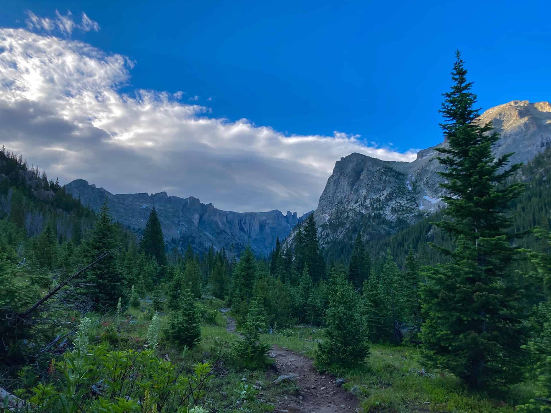
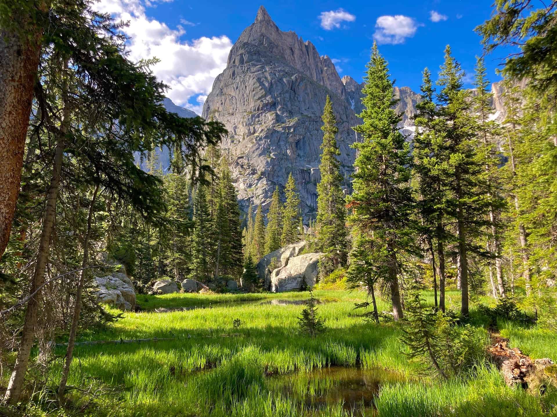
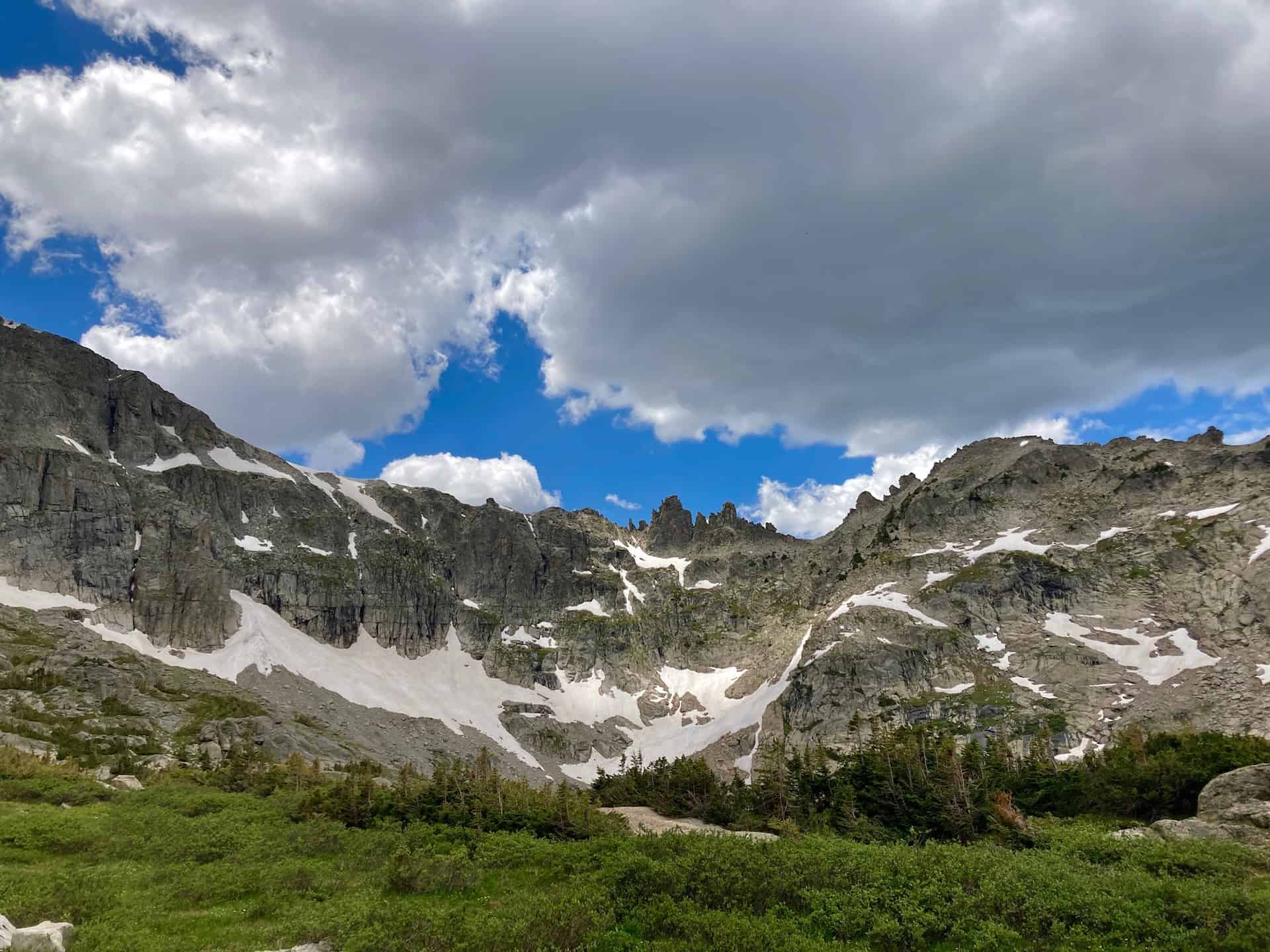
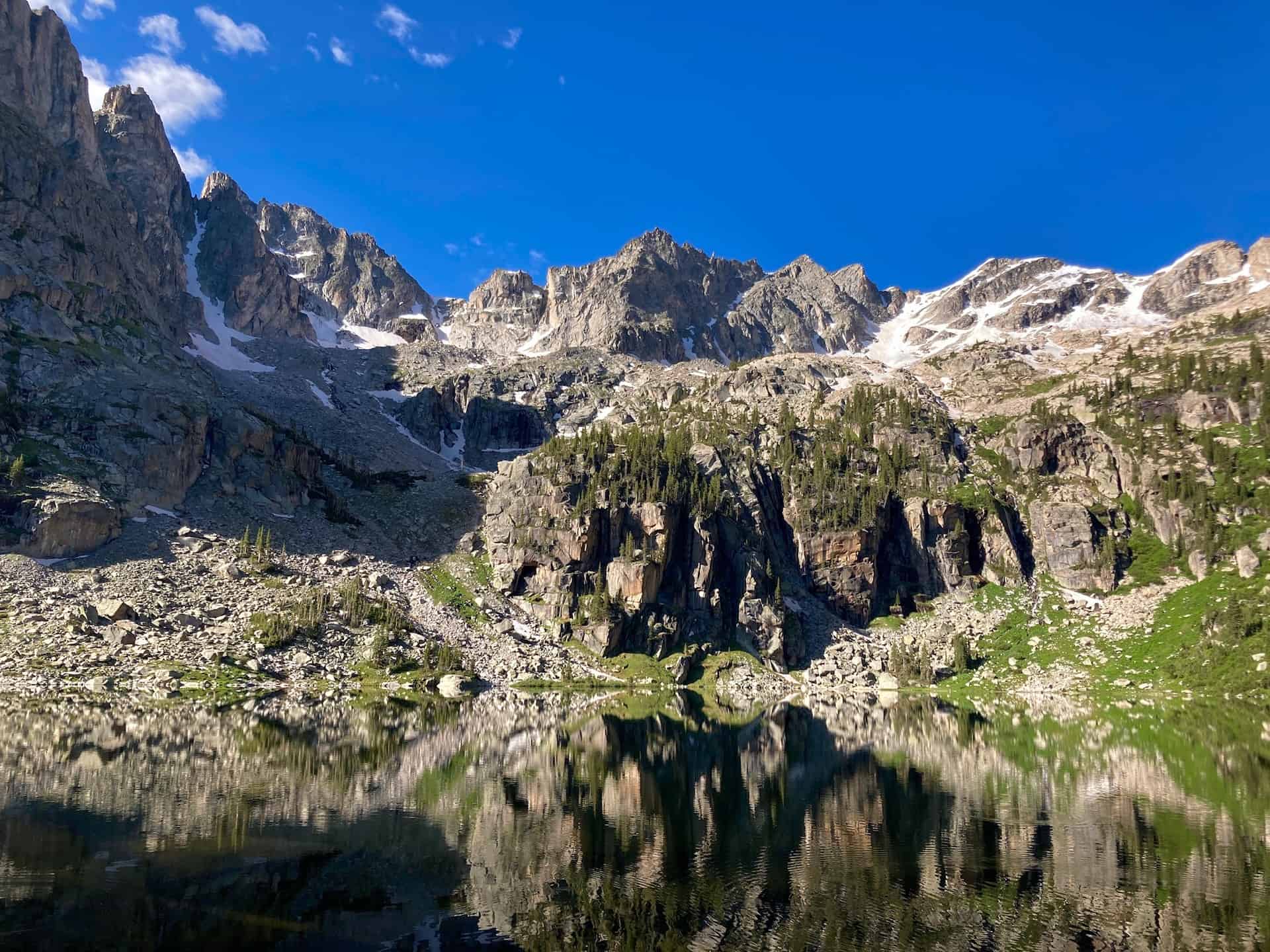
Crater Lake Hike in the Indian Peaks Wilderness
California may boast Yosemite, but Colorado offers the Indian Peaks Wilderness valley. And within this wilderness, one happens upon an arresting sight -- Mirror Lake and Crater Lake, dutifully monitored by the impressive Lone Eagle Peak. Long considered an iconic range, the Indian Peaks give hikers an endless stream of prime photography, wildflowers, and "Look at that!" moments. From the trailhead to Mirror Lake hikers encounter a half-dozen waterfalls, any one of which would capture all-star status on another trail!
Explore the full Crater Lake Hike profile below for trail map, driving directions, and more tips and details to help you enjoy this bucket list hike just west of Denver.
Trail Snapshot: Crater Lake via Mirror Lake
| Hike Distance | 15 miles Round Trip |
|---|---|
| Difficulty | Difficult |
| Duration | Approx 7-8hrs |
| Trail Type | Out and Back |
| Starting Elevation | 8,400′ |
| Elevation Gain | Approx +2,500′ |
| Seasons | Year Round |
| Dogs | Allowed On Leash |
| Crater Lake Hike Map | Click for Trail Map of Crater Lake Hike |
| Denver Drive Time | 2.5 hours |
| Driving Directions to Monarch Lake Trailhead | Click for Google Map |
| Town Nearest Hike | Granby and Grand Lake, Colorado |
| Beauty | Indian Peaks Wilderness, wildflowers, waterfalls, lakes |
| Activities | Hiking, Snowshoeing, Camping | Fee | Entrance Fee or National Parks Pass Required |
Parking & Trailhead Information for Crater Lake Hike
From Denver, head west on I-70 to exit 232 for Highway 40W. Climb up the gorgeous Berthoud Pass and through Winter Park on to Granby, CO. Barely out of Granby, look for Highway 34 off to the right, heading northeast. Follow this for five miles to Route 6; turn right onto Route 6. If you do not have an annual National Park pass ("America the Beautiful" pass), a self-pay station sits off to the left as you enter. The U.S. Forest Service does regularly check for passes or purchased day-use permits. To reach the Monarch Lake Trailhead, continue on Route 6 for another nine miles. With campers, hikers, and sightseers, the lot fills quickly.
The Hike: Crater Lake Hike in the Indian Peaks Wilderness
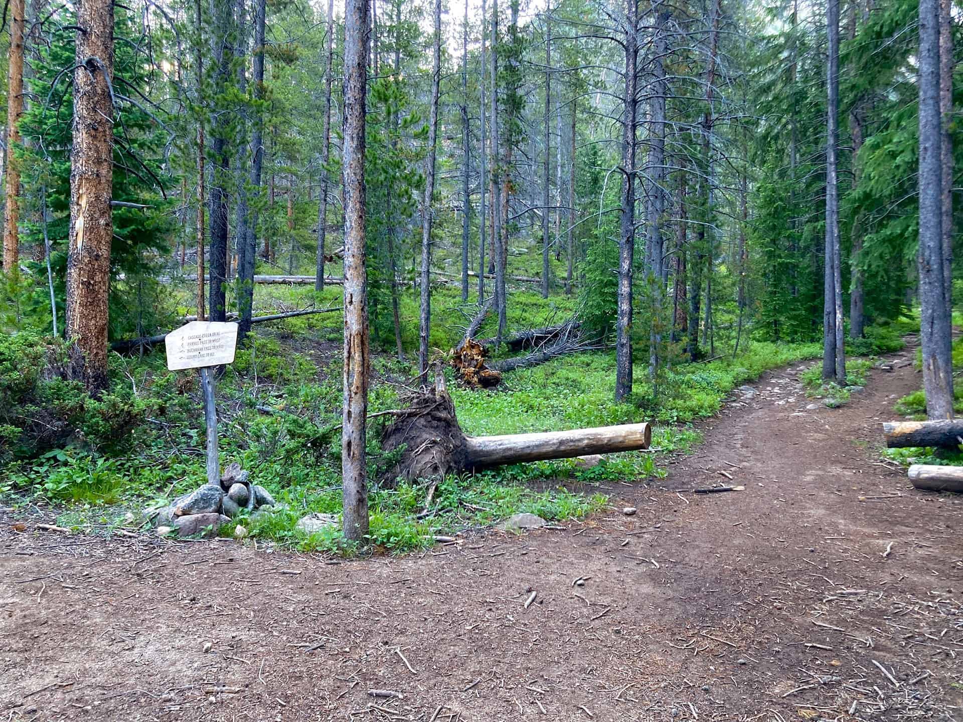
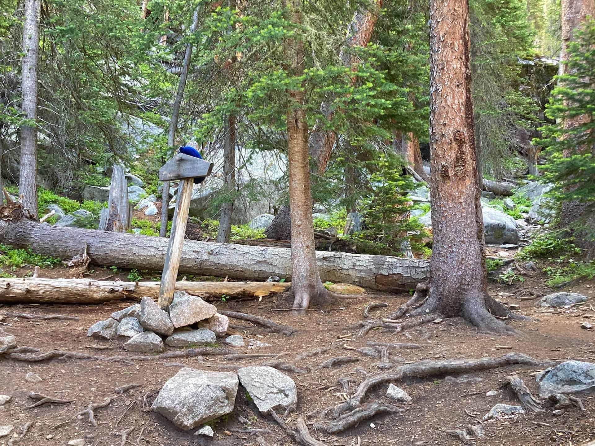
Beginning from the eastern edge of the Monarch Lake Trailhead parking area, the trail commences immediately after metal gate leading to the lake. At the lake, a three-panel sign orients visitors to the recreation area. Staying left, hugging the northern rim of the lake, the trail proceeds along the shore with views into the valley soon to be explored. At 1.5 miles, a juncture peels off to the right to circumnavigate the lake; this trail stays left and begins a moderate climb up through Hell Canyon, along Buchannan Creek. While the name feels foreboding, the trek is quite pleasant as it ascends through a forest with periodic windows down onto the rushing creek. The first key junction appears at 3.5 miles, where the trail stays straight, remaining on the Cascade Creek Trail:
The trail continues gently through the forest, and the waterfalls start punctuating the creek's flow. Time and again, hikers will have reason to stop, listen, and marvel at water crashing down from 10-50ft or more above. Many of the falls tempt travelers to walk up close...be VERY attentive. The falls show no mercy if you take a dip!
Over the next three to 3.5 miles the trail gains approximately 1,200, but the scenery so powerfully captures one's sense of awe that the ascent passes unnoticed. Wildflowers, valley floors etched with streams, creek crossings on logs, peaks and crags and more waterfalls...the sights never stop. The only thing stopping hikers is another key junction, this time for the turnoff (to the right) for Crater Lake Trail:
Staying right and feeling another ascent, push on for 1 mile toward Mirror Lake:
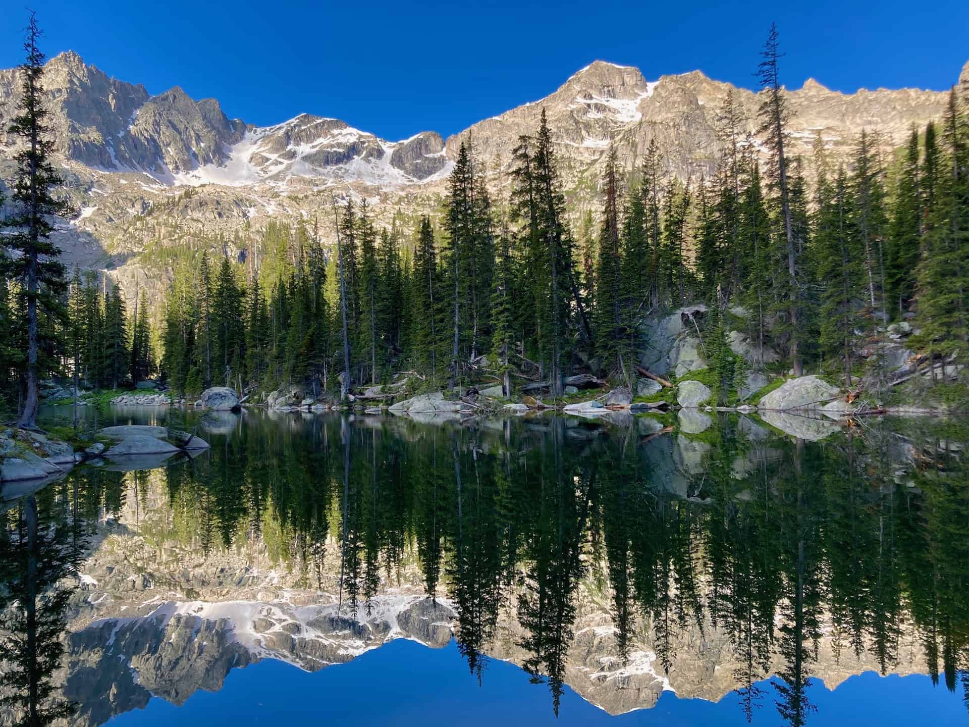
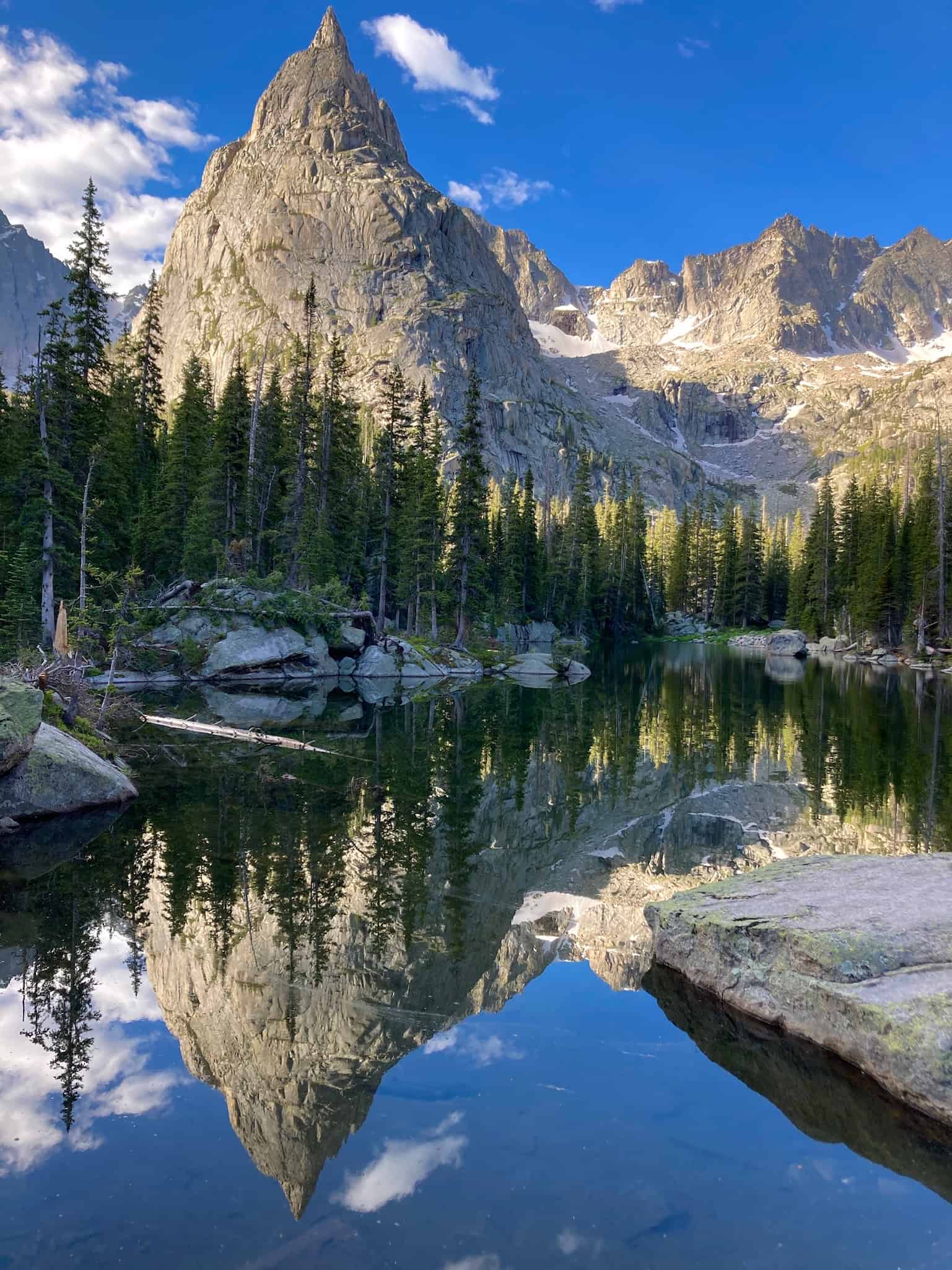
Barely 1/4-mile beyond this, take in the majestic setting of Crater Lake:
By far the hardest part of the hike now hits -- the decision to return to the trailhead! Given the effort required to reach Crater Lake, hikers often linger and grab a snack from their pack. Wise and attentive backcountry explorers will take note of the time, assuring themselves of sufficient daylight for a safe return hike. Weather can shift quickly in the wilderness, and rushing back over 7-8 miles increases risk of injury. Plan ahead. However, all cautions in hand, with diligent prep work, the Crater Lake Hike via Mirror Lake stands among the best of all wilderness hikes in Colorado.
Tips & Resources for Hiking to Crater Lake in the Indian Peaks Wilderness
- TIP: The adventurous soul may consider cresting Pawnee Pass for views down onto Brainard Lake Recreation Area, one of the most popular summer destinations. Brainard contains the beloved Long, Mitchell, Blue, and Isabelle Lakes. Wise hikers may have to choose between Crater Lake OR Pawnee Pass, as doing both in the same day is extremely strenuous.
- Trail Map: Crater Lake Hike
- Packing List: Always pack the 10 Essentials. Download our Hiking Guide to get the list and dayhiking packing checklist. Additionally, take some time to review our 10 Winter Hiking Tips.
- Colorado Road Conditions: Colorado Road Conditions
- After the Hike: Scoot up to Grand Lake (10 miles north on Highway 34) or drop down into Winter Park (27 miles back toward Denver). Grand Lake has a delightful downtown boardwalk and borders Rocky Mountain National Park. If time permits, a drive up and over Trail Ridge Road puts one in touch with national history and world-class views.
Weather
Map & Driving Directions
Click for Driving Directions
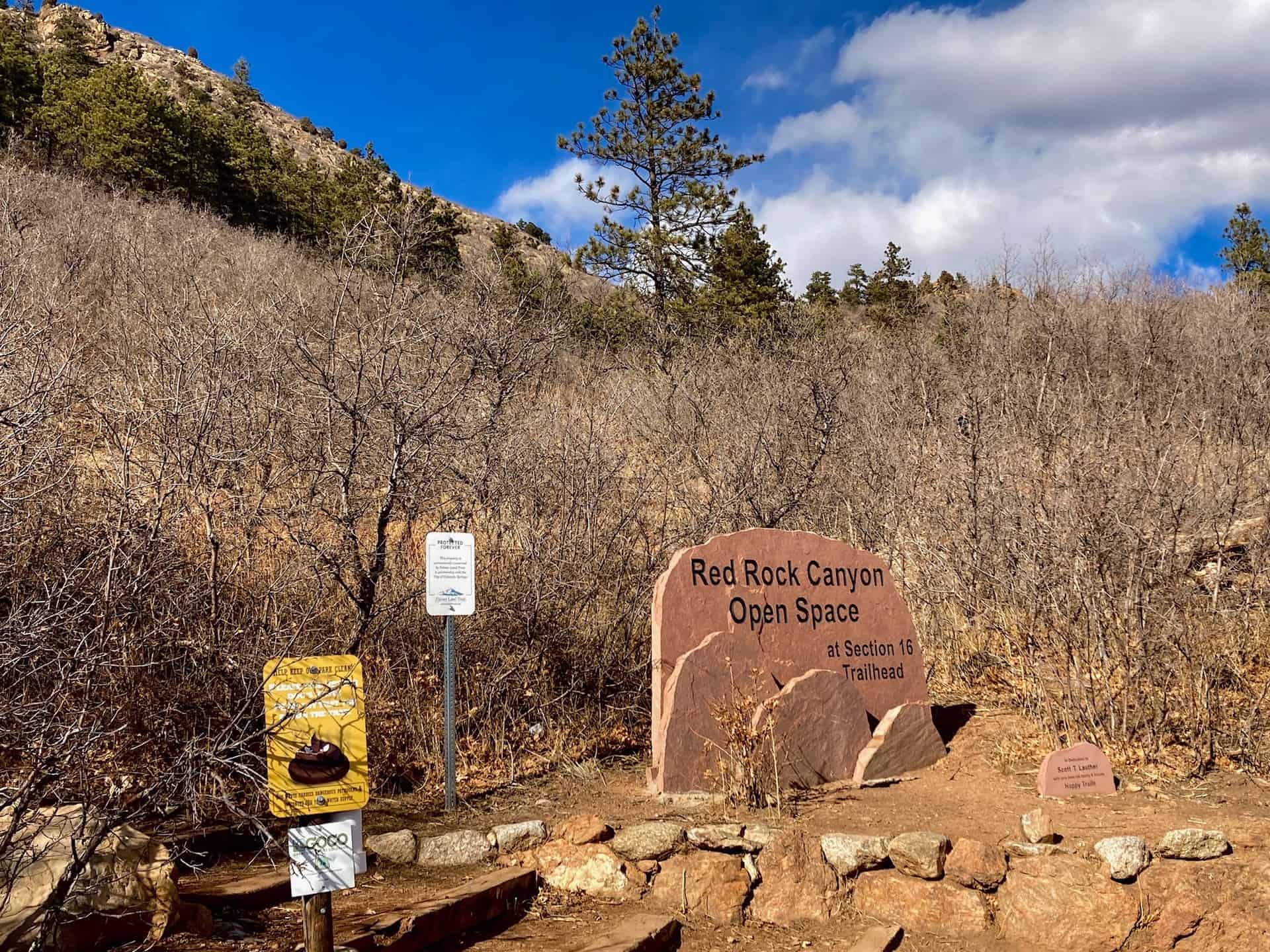
Section 16 Hike near Manitou Springs
Nestled between Manitou Springs on the west and Colorado Springs on the east, the Manitou Section 16 Open Space overlaps with the Red Rock Canyon Open Space to the north, just off Highway 24. Both of these systems connect to two other regional parks, creating a massive complex of trails that delights hikers of all ages and abilities. This route follows three trails through two territories for one heckuva hike! For the eager, this route can be augmented with the Mt. Buckhorn hike, and even the Seven Bridges & Kineo Mountain hike for the all-day trekker.
The surprising aspect of this Section 16 hike is its immediacy -- within minutes of turning off the highway the trailhead appears. Within minutes of leaving the trailhead the cityscape disappears. Even better, this hike delights hikers in all seasons: the new growth of spring, the full blossom of summer, the changing colors of fall, and the magically reflective light of winter's snow. Explore the full Section 16 Hike profile below for trail map, driving directions, and more tips and details to help you enjoy this year-round adventure just south of Denver.
Trail Snapshot: Section 16 Trail
| Hike Distance | 5.5-6.25 miles Round Trip |
|---|---|
| Difficulty | Moderate |
| Duration | Approx 3-4hr |
| Trail Type | Loop |
| Starting Elevation | 6,600′ |
| Elevation Gain | Approx +1,300′ |
| Seasons | Year Round |
| Dogs | Allowed On Leash |
| Hike Trail Map | Click for Trail Map of Section 16 Hike |
| Denver Drive Time | 1.25 hours |
| Driving Directions to Section 16 Trailhead (Section 16) | Click for Google Map |
| Town Nearest Hike | Manitou Springs and Colorado Springs, Colorado |
| Beauty | Pike's Peak, views of Colorado Springs |
| Activities | Hiking, Biking, Snowshoeing |
Parking & Trailhead Information for Section 16 Trail
From Denver, cruising south on I-25, take exit 141 for Highway 24 West. After approximately 1.5 miles, turn left (south) onto 21st Street, and then shortly thereafter, right (west) onto Lower Gold Camp Road. Staying straight through the 4-way stop (junction with Bear Creek Road), the Palmer Red Rock (Section 16 Open Space) trailhead is just under one mile up on the right. This parking lot offers about a dozen head-in spots and fills fast; another pullout parking lot is available up the road on the left.
The Hike: Section 16 Trail in Red Rock Canyon Open Space
While many hikers jump straight into the trek by ascending the stairs at the trailhead, taking a counter-clockwise tack, the following notes describe a clockwise path. This direction provides a spectacular viewing angle on Pike's Peak, and positions hikers for a fun descent through the trees at the end.
Leaving the parking lot, continuing up Gold Camp Road (which actually heads southwest), the route joins High Drive after 1/4-mile just as the road turns sharply left. High Drive meanders up into the backcountry past split-rail fences, over rock bridges, and through wide slot canyons. At approximately the 1-mile mark, the junction for the Section 16 Trail branches off to the right.
Now on Section 16 trail officially, the trail weaves in and out of forest, gently ascending toward a top elevation of nearly 7,900ft. At this point, around the 3.5 miles, watch for a connector trail shooting off to the left. For the curious, a short jaunt out and back affords sweeping views of peaks around Manitou Springs, as well as Garden of the Gods outside Colorado Springs.
Staying right and beginning a descent, the Section 16 Trail continues another 3/4-mile to an excellent excursion on an unmarked overlook trail. The tributary is heavily trafficked and easy to identify: it runs straight out from the main trail just prior to a moderate lefthand descent deep into the forest and rounds of switchbacks. The overlook ridge out-and-back adds approximately 3/4-mile to the overall milage of this loop. Once at the ridge edge, the sprawling plains of Colorado Springs spread out like a carpet from the forest's edge. Turning back toward the main trail, hikers gaze on Pike's Peak, perched between two converging foothill peaks.
The last part of the Section 16 Hike loop presents hikers with multiple connector trails. Generally staying straight, the trail flows back down and out of the valley approximately 2.25 miles to the parking lot.
Tips & Resources for Hiking Section 16 in the Red Rock Canyon Open Space
- TIP: The two connecting open space trail systems remain popular all year long. Parking fills fast, but an early start helps noticeably. Also, consider carrying a complete map that displays the many connector trails, such as this Red Rock Canyon Open Space Trail Map.
- Trail Map: Section 16 Hike
- Packing List: Always pack the 10 Essentials. Download our Hiking Guide to get the list and dayhiking packing checklist. Additionally, take some time to review our 10 Winter Hiking Tips.
- Colorado Road Conditions: Colorado Road Conditions
- After the Hike: A local favorite, Wild Goose Meeting House (or their counterpart, Good Neighbors Meeting House), captures the essence of downtown COS. Grab a craft coffee and chef-level dish, or later in the day, a local beer on tap. For a quick grab-n-go, consider Wimberger's Old World Bakery and Delicatessen, on the way out from the trailhead.
Weather
Map & Driving Directions
Click for Driving Directions
Indian Creek Loop Hike
The Indian Creek Trail is tucked away outside of Sedalia, CO, just under an hour's drive from Denver, you find a trailhead leading to a vast internal system of trails that links up to the Colorado Trail, Roxborough State Park, and Nelson Ranch Open Space. The number of configurations you can devise awaits your creativity...and endurance! The Indian Creek Campground opens the door to trails meandering up and through the Pike National Forest with frequent vistas out into the valleys west and north. Explore the full Indian Creek Loop hike profile below for trail map, driving directions, and more tips and details to help you enjoy this adventure in the San Isabel National Forest.
Trail Snapshot: INDIAN CREEK LOOP
| Hike Distance | 7.5 miles Round Trip |
|---|---|
| Difficulty | Moderate |
| Duration | Approx 3-4hr |
| Trail Type | Loop |
| Starting Elevation | 7300′ |
| Elevation Gain | Approx +1300′ |
| Seasons | All Year |
| Dogs | Allowed On Leash |
| Hike Trail Map | Click for Trail Map of Indian Creek Loop |
| Denver Drive Time | 55 min |
| Driving Directions to Indian Creek Loop | Click for Google Map |
| Town Nearest Hike | Sedalia, Colorado |
| Beauty | Pine Forest, Streams, Colorado Trail |
| Activities | Hiking, Photography, Wildflowers |
| Fee | Entrance Fee or State Parks Pass Required for Roxborough State Park segment |
Parking & Trailhead Information for Indian Creek
The easiest waypoint for GPS is the Indian Creek Campground, which sits just west of the Rampart Range Riding Area on Highway 67. Once you pass the Rampart Range entrance the road curves and winds down a hill; at the bottom the parking lot appears off to the right with a lone bathroom. Park here; do not go up the road to the actual campground. The trailhead begins about 15 paces beyond the bathroom, up the hill. Look for the sign for Trail #800.
The Hike: Indian Creek Loop
The trail begins winding through aspen, oak, and evergreen. You'll immediately notice the clean, earthy air rising up from the forest floor. The initial stretch of the trail provides ample shade, and at approximately 0.5 mile, the trail opens up to its first vista. As the trail turns sharply right, the unofficial trail bends left up a small hill to a clearing with views down into the valley and a massive lean-to teepee tree.
Continuing up, soon another vista opens up off to the left with sight line down the valley and onto the next ridge line, and then at approximately 1.5 mile the trail reaches a junction with the fire road (FR) and Ringtail Trail. (If you follow Ringtail toward Thomas Hill, the trails opens up to th north. On a clear day you can see the skyscrapers of downtown Denver!) Staying straight to continue on the FR, the trail descends to approximately 2.3 mile to reach the next trail junction. Here you have options: take a sharp left to join Steven's Gulch Trail (the present track), veer right toward Roxborough State Park, or stay straight for a longer loop that will wrap back around to the present track. As the trail descends to the left, it reveals a snug little meadow swimming in prairie grasses--perfect playground for the deer often passing through.
Now, the hike becomes pure descent to approximately 4.25 mile and the junction with the Colorado Trail. (This is where the longer loop mentioned above rejoins the present track.) You know you're close when you spy an old broken down cabin nestled along the shore of the stream. Here, the loop route goes left onto the Colorado Trail.
All along the descent and this return ascent, thick foliage, flowers, ferns, and the occasional patch or puddle of mud keep you company. It's fascinating terrain that also hosts horse riders from time to time, so watch your step! At 5.0 mile the Colorado Trail continues straight but an alternate Indian Creek Trail pulls sharply right. Staying straight on the Colorado Trail the trail begins another descent.
While this loop hike follows a stream almost all the way, you get the pleasure of a stream crossing at approximately 6.25 mile when it meets up with Bear Creek. From here the trail bends its way up and out of the shallow canyon, past the equestrian stables and campground, and back to the parking lot.
Tips & Resources for Hiking Indian Creek Loop
- TIP: Wildlife is active in this area. Be sure to let someone know your hiking itinerary, or take a hiking partner with you.
- TIP: Familiarize yourself with the various trail junctions that intersect in this area. You can trek to Roxborough, connect to the Colorado Trail, or end up in an open space...on accident if you're not aware! Also, keep an eye on the weather as it can change suddenly along the Front Range.
- Trail Map: Indian Creek Loop
- Packing List: Always pack the 10 Essentials. Download our Hiking Guide to get the list and dayhiking packing checklist.
- Colorado Road Conditions: Colorado Road Conditions
- After the Hike: If you need breakfast, hit up the local fave, O'Brien's Cafe, or catch a pizza-pie at PieZano's
Weather
Map & Driving Directions
Click for Driving Directions
Manitou Lake Hike Near Colorado Springs
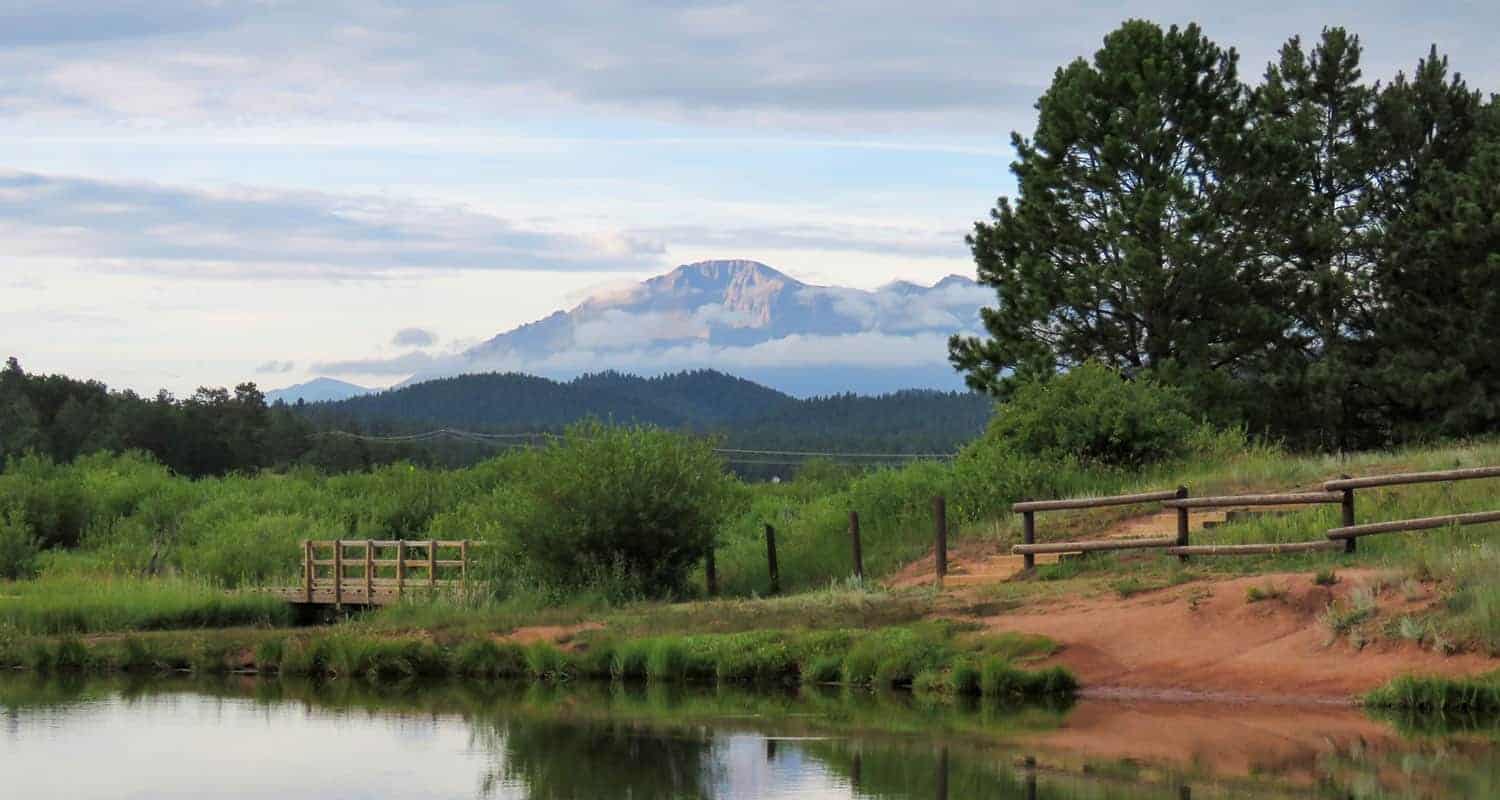
Manitou Lake near Colorado Springs offers a pleasant and easy loop trail around its shores with views of Pikes Peak. It's also a great spot fishing and paddling on the 5-acres of water. There are nearby camping options detailed below. Explore the full Manitou Lake hike profile below for trail map, driving directions, campground info and more.
Trail Snapshot: Manitou Lake Loop Hike
| Hike Distance | Approx. 1 mile Round Trip |
|---|---|
| Difficulty | Easy |
| Duration | approx. 1 hour |
| Trail Type | Loop |
| Starting Elevation | 7,700′ |
| Elevation Gain | Nominal |
| Seasons | Year Round |
| Dogs | Allowed On Leash; Not allowed in Water |
| Hike Trail Map | Click for Trail Map of Manitou Lake Loop Hike Map |
| Denver Drive Time | 1hr 45min |
| Driving Directions to Manitou Lake | Click for Google Map |
| Town Nearest Hike | Woodland Park, Colorado |
| Beauty | Views of Pikes Peak, |
| Activities | Hiking, Paddleboarding, Canoeing and Kayaking, 2 nearby campgrounds, birdwatching, and fishing. Swimming is prohibited. |
| Fee | $7 day use fee per vehicle |
Parking & Trailhead Information for Manitou Lake
Interstate Route
From Denver, take Interstate 25 South to Colorado Springs. Exit onto 24 West and drive US Highway 24 about 18 to Woodland Park. In Woodland Park, take HWY 67 North for about 7.5 miles. Manitou Lake will be on the east side of the highway.
Scenic Route
The scenic route and interstate route take about the same amount of time, but there will likely be less traffic on this trip. There are a lot of curves though, so be prepared for that aspect of the drive. From Denver, take 285 South toward Pine Junction. Take a left onto Pine Valley Road, which curves around through some beautiful Front Range landscapes, goes through Pine and just outside of Buffalo Creek the road changes names to Deckers Road. Follow Deckers road until it terminates at US 67 in Deckers. In Deckers, take US 67 South (right) for 15.7 miles. Manitou Lake will will be on the lefthand (east) side of the road.
Trailhead and Facilities
Manitou Lake is heavily used in the Summer months and weekends and has limited parking. There are two vault toilet, one across from the pavillion and one adjacent to the parking loop area. The pavillion can be reserved for a fee from Recreation.gov site. It's important to note when reserving that each vehicle is still required to pay the day use access fee. There are several access trails that run from the parking area to the main trail that circles the lake.
The Hike: Manitou Lake
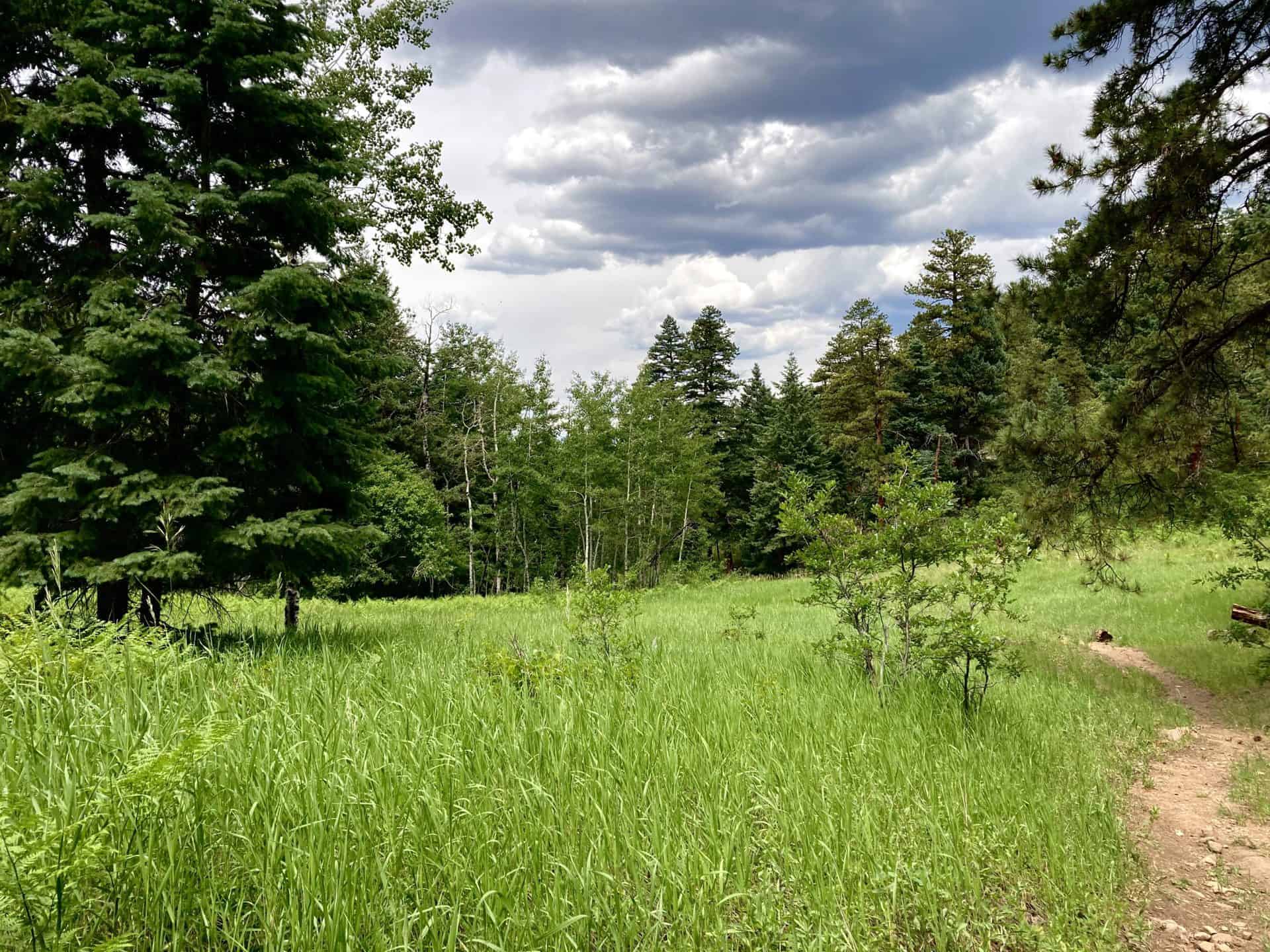
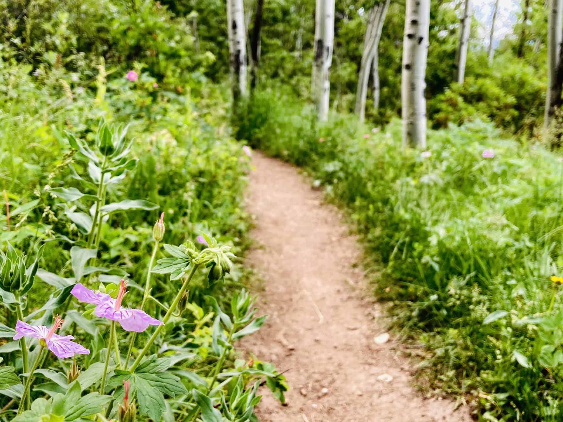
Beginning at the access trail near the pavillion, head toward the lake to pick up the main trail near a small dock. Head north (left) hiking along the western shore of the lake. You'll pass another small fishing dock, then come to a trail intersection. Go right, crossing the small footbridge spanning Trout Creek, the small creek that feeds the reservoir.
Continue following the trail along the northern edge of Manitou Lake as it eventually bends toward the south. Here, you'll be able to take in the best views of Pikes Peak. This is why we recommend hiking the loop clockwise instead of counter clockwise. Stop to take in Summer wildflowers that grow in the meadows surrounding the lake.
The trail will then enter and exit a small stand of ponderosa pines. Then the trail bends to the west and crosses a marshland. Be alert for herons and other wildlife in this wetland segment of the trail. The dirt path becomes a boardwalk on this final segment of the trail.
Longer Hike Options
There are ways to extend your hike and explore other areas around Manitou Lake. The first is a trail segment north of the lake, near the bridge that leads along Trout Creek. This is an undeveloped social trail created by fisherman, so it's a non-destination trail and has a lot of small spurs to access the creek. The second trail leads South to the Colorado Campground site. The third is the 4.2 mile segment of bike trail that runs alongside highway 67 connecting the campgrounds and Manitou Lake.
Camping Near Manitou Lake
There are several campgrounds along highway 67 near Manitou Lake to serve the Pikes Peak Region. Here's a list from the southern end to the north with links to their reservation pages. All of these campsites are close to Woodland Park andn great places to basecamp for exploring the surrounding Colorado Springs area. All have toilets and water.
- South Meadows Campground: Open June through Oct. 27 (see page for updated dates), access to bike path and forest roads. Shaded by ponderosa pines. About 60 total campsites.Reserve South Meadows camping sites online at recreation.gov
- Pike Community Campground: Open each year May 22 through Sept. 8 (see page for updated dates), a single group site that can accomodate up to 100 people. Closed in 2020 due to COVID-19 restrictions. Reserve South Meadows camping sites online at recreation.gov
- Colorado Campground: Open June through Sept. 7 (see page for updated dates). Both single family and double-family campsites. About 80 campsites. Access to Manitou Lake, shaded by ponderosa pines. Reserve South Meadows camping sites online at recreation.gov
- Painted Rocks Campground: Open June through Sept. 7 (see page for updated dates). About 18 campsites. Named for nearby sandstone rock formations. Reserve South Meadows camping sites online at recreation.gov
Tips & Resources for Hiking Manitou Lake
- Fishing: The Department of Wildlife stocks Manitou lake with Rainbow and Cutbow Trout. The beaver ponds above lake along Trout Creek are also good spots to fish.
- Dogs at Manitou Lake: Manitou Lake is a great spot to take your dog for a walk. Because it is a reservoir, dogs must be kept out of the water and leashed at all times.
- Trail Map: Manitou Lake
- Packing List: Always pack the 10 Essentials. Download our Hiking Guide to get the list and dayhiking packing checklist.
- Colorado Road Conditions: Colorado Road Conditions
- Photo: We would like to express our gratitude to Patricia Henschen for sharing such an amazing photograph of this hike at Manitou Lake near Colorado Springs.
- After the Hike: The Donut Mill. The Donut Mill serves epic donuts. That's not an overstatement. The donuts are gigantic and dream-inducing (perhaps from the sugar coma). They cost more than most donut places, but if you are a donut lover, this place is not to be missed. Their biscuits and gravey also are a worth noting.
Weather
Map & Driving Directions
Click for Driving Directions
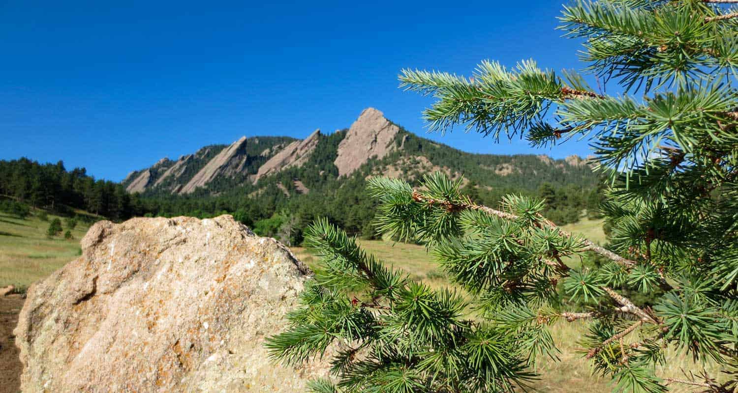
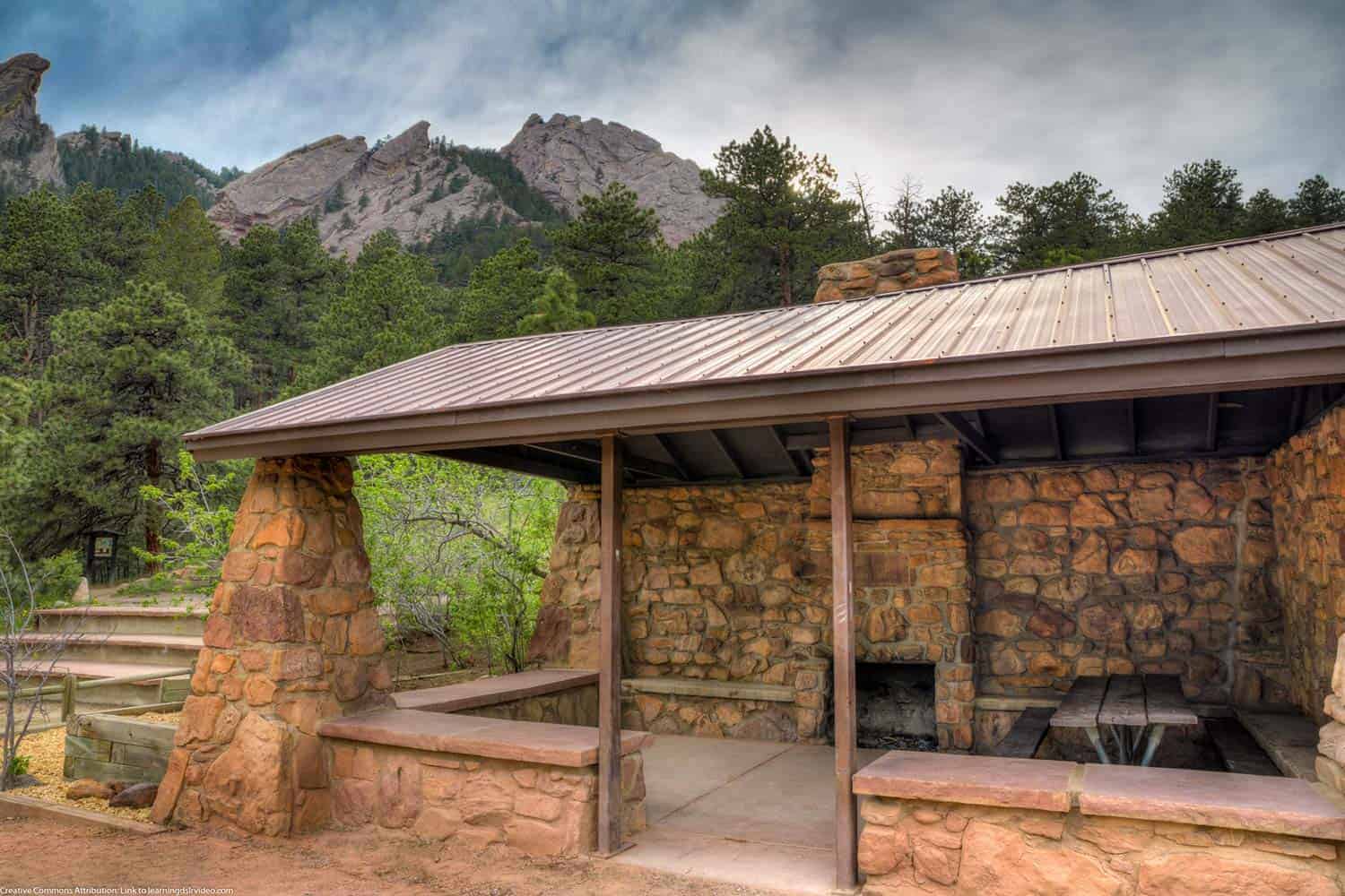
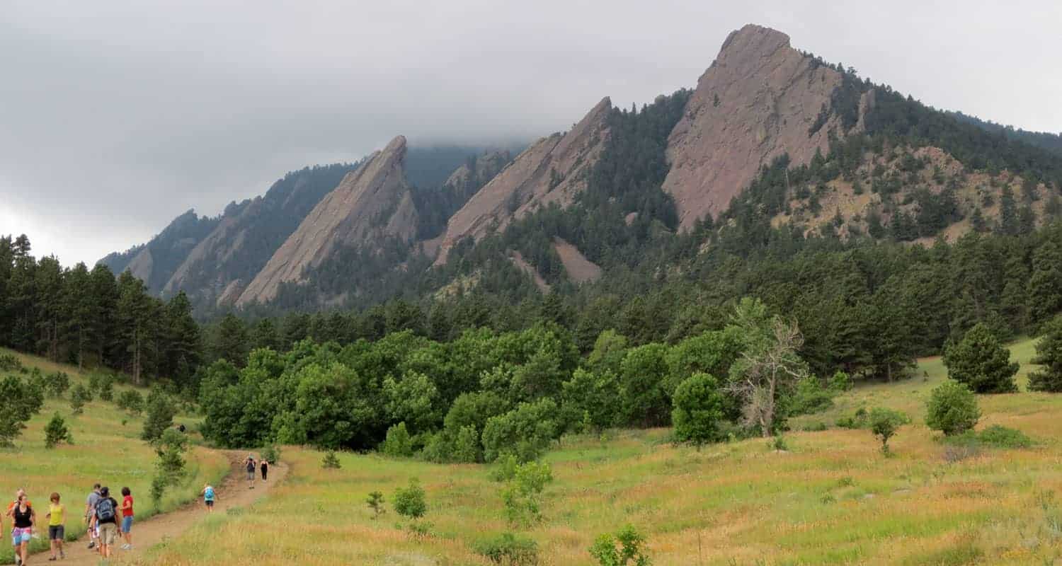
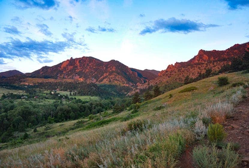
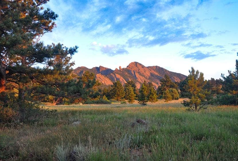
Chautauqua Loop Trail in Boulder
The Chautauqua Trail is an easy 3.6 mile loop hike along Boulder's Flatirons. The trails pass several historical sites: a quarry, cabin, shelter, and ski area as it weaves through the meadows and ponderosa forest of Chautauqua Park. About 40 minutes from Denver, the Chautauqua Loop hike makes for a great hike for visitors who are looking for stunning landscapes without the long drive or elevation gain.
Trail Snapshot: Chautauqua Loop Hike
| Hike Distance | 3.6 Miles |
|---|---|
| Difficulty | Easy |
| Duration | 2 hrs |
| Trail Type | Loop |
| Elevation Gain | Approx +700′ |
| Seasons | All Year |
| Dogs | Allowed on Leash |
| Hike Trail Map | Click for a Trail Map for the Chautauqua Loop |
| Denver Drive Time | 40 min |
| Directions | Click for Google Map |
| Town Nearest Hike | Boulder, Colorado |
| Beauty | Rock formations, ranger cottage, raptors, quarry site, Roosa Cabin, Bluebell Shelter |
| Activities | Hiking, Picnics, Wildlife |
Parking & Trailhead Information for the Chautauqua Loop
The trailhead for Chautauqua Park is located downtown in the City of Boulder. The park's 58 parking spaces fill quickly, so plan to arrive early. Alternatively, when the lot is full, hikers can park along Baseline Road and side streets, just be sure to respect the neighbors by parking at least 5 feet from driveways. There are bike racks at the trailhead, so you can bike in from other lots in town, or take the Park-to-Park Shuttle that operates on the weekends and on holidays from the Saturday around Memorial Day to Labor Day Weekend. Here's a map of the free parking lots and shuttle stop locations.
Get a map, fill up your water bottle, and get trail advice from locals at the Ranger Cottage, which is located at the trailhead. See the Ranger Cottage site for current hours and closure information.
The Hike: Chautauqua Loop
Beginning at the Ranger Cottage, head south on the Bluebell Road Trail. This first segment leads up a gentle slope to its intersection with the Mesa trail. The Mesa trail takes us into our first lollipop loop and to Woods Quarry. After about 0.2 of a mile, you'll come to another trail intersection. Heading right, takes you on a counter-clockwise loop and up to Woods Quarry. The quarry was used in the early years of Boulder for building homes and sidewalks out of its iconic red and orange sandstone.
After the quarry, the trail will bend north and return to the Mesa Trail. At the intersection, notice an old stone structures, the Roosa Cabin.
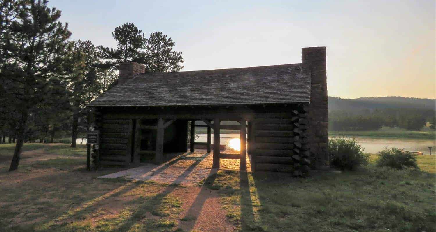
Continue north on the Mesa Trail back up to the Bluebell Road Trail. Go west (left) onto Bluebell Road. Soon you'll encounter another stone structure, the Bluebell Shelter (pictured below). Built in the early 1900's and preserved in the 1930's by the CCC, the historic shelter has become a Chautauqua landmark, undergoing some more recent restoration. This is a great place to have a picnic, and can be reserved for special events.
Now we begin heading into the northern and larger loop of this hike. The Bluebell Road Trail becomes the Bluebell-Baird trail and weaves its way north along the base of the Flatirons. If you are interested in hiking the Flatirons, explor our trail profile for the First and Second Flatirons Hike. You'll enter tall stands of Ponderosa pines with views out to the meadows of the northern meadows.
Notice the interpretive signs along the full hike and stop to read the history of the old ski jump that was in operation post WW2 into the early 1960's. Pass by the Ski Jump Trail and continue northwest until you come to the Gregory Canyon Trailhead. Gregory Canyon is also a beautiful hike (see our Gregory Canyon trail profile for details). Take a right (heading east) onto the Baseline Trail. This will take you past the old ski jump and the site of a CCC camp that operated here during the years of the Great Depression.
The Baseline trail will lead back to the trailhead to complete this 3.6 mile hike.
Tips & Resources for Hiking the Chautauqua Loop
- Bring Snacks and Water: It probably goes without saying, but be sure to bring food and water to refill your tank. This hike demands it.
- Bring Your Camera: This area along the Flatirions is picturesque, especially in the early morning light.
- Keep and Eye on the Weather: Talking to one of the rangers, he shared that storms can come up quickly along the Flatirons, which will catch hikers unawares. The Flatirons area is like a lot of other mountain hikes, storms typically roll in during the early afternoon.
- Trail Map for Chautauqua Loop: Trail Map Link
- Colorado Road Conditions: Colorado Road Conditions
- Photo: We would like to express our gratitude to Dave Dugdale for sharing his photograph of the Bluebell Shelter.
- After the Hike: Ozo Coffee in Boulder, Colorado

Weather
Map & Driving Directions
Click for Driving Directions

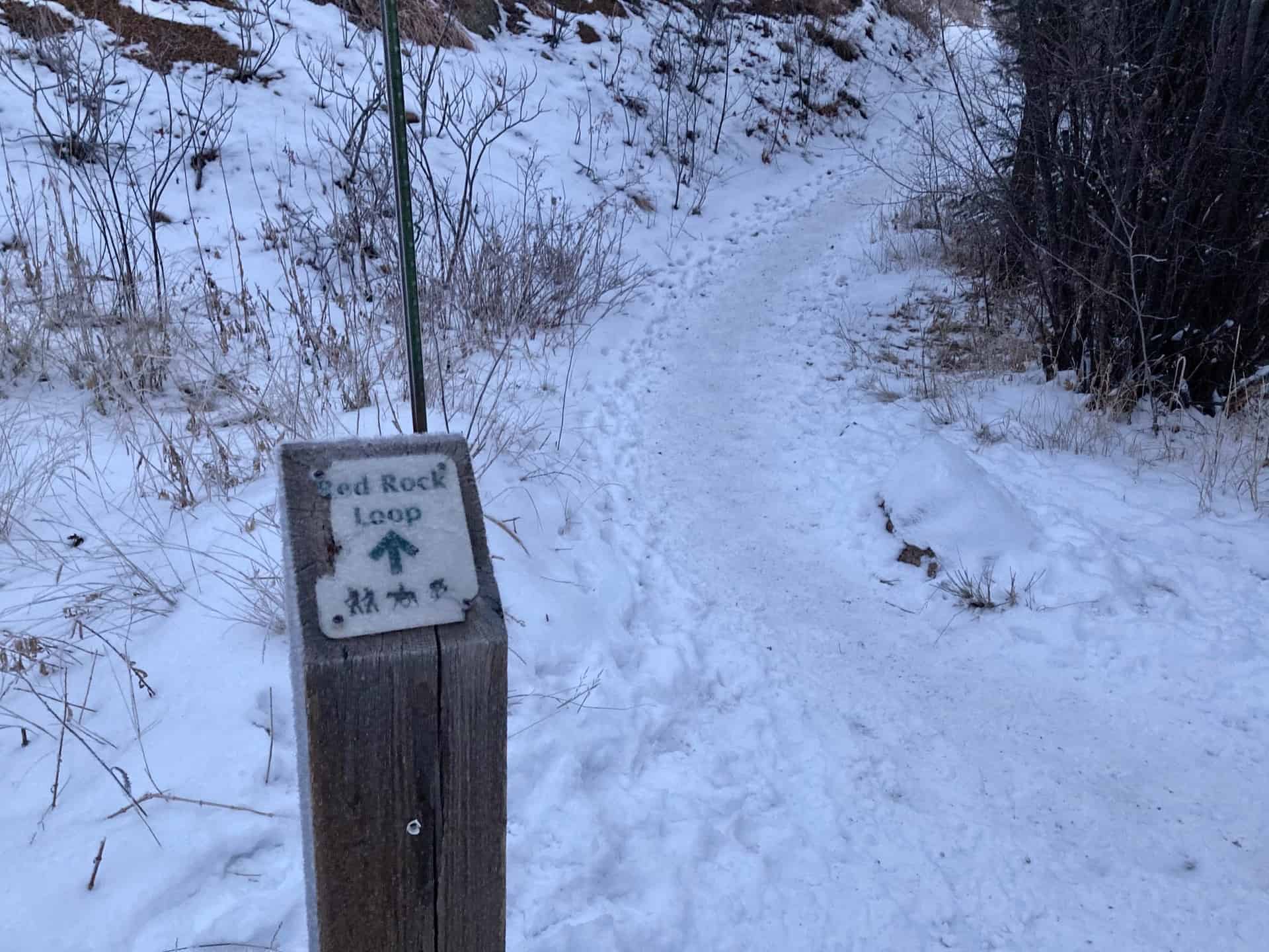
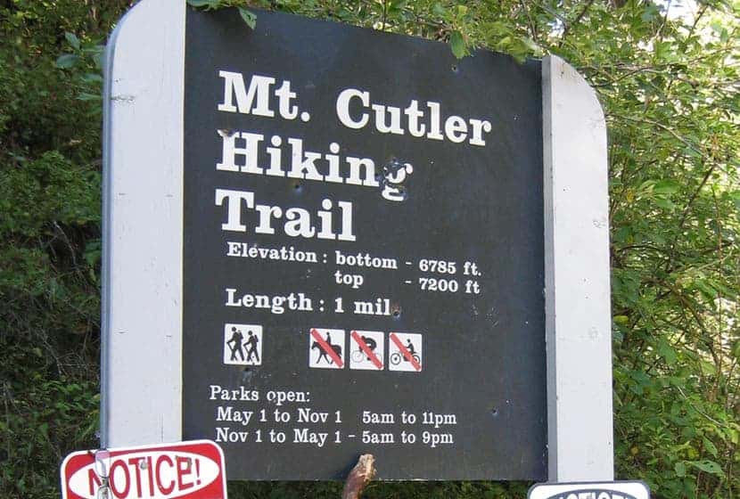
Mt. Cutler Hike in Colorado Springs
Mt. Cutler in Colorado Springs is an easy, 1-mile hike to the summit of a foothill peak that overlooks Seven Falls, the canyon system of Cheyenne Canyon, and offers panoramic views that make this hike a great option for visiting friends and family. Because it's just 2 miles out-and-back with less than 500 feet of elevation gain, this hike offers a lot of reward with less effort. Explore the full Mt. Cutler hike profile below for trail map, driving directions, and more tips and details to help you enjoy this adventure in Colorado Springs.
Trail Snapshot: Mt. Culter
| Hike Distance | 2 miles Round Trip |
|---|---|
| Difficulty | Easy |
| Duration | Approx 1 to 2 Hours |
| Trail Type | Out-and-Back |
| Starting Elevation | 6785′ |
| Elevation Gain | Approx +415′ |
| Seasons | Year Round |
| Dogs | Allowed On Leash |
| Hike Trail Map | Click for Trail Map of Mt. Culter in Cheyenne Canyon |
| Denver Drive Time | 1hr 30min |
| Driving Directions to Mt. Cutler Trailhead | Click for Google Map |
| Town Nearest Hike | Colorado Springs, Colorado |
| Beauty | Peak-Top Views, View down into Seven Falls, Rock Formations |
| Activities | Hiking |
Parking & Trailhead Information for Mt. Cutler
From Denver, take Interstate 25 South to Colorado Springs. Exit onto Tejon St. via Exit 140 then take a right onto S. Tejon St. Stay in the right hand lane so that you can turn right onto Cheyenne Boulevard. Follow Cheyenne Blvd. for about 2.5 miles. Here road will fork as it enters Cheyenne Canyon. Take the road to the right that leads into North Cheyenne Canyon. Proceed for about 1.5 miles until you see the Mt. Culter Trailhead roadside parking area on your left. There are no ameneties at the trailhead. The lot will fill fast on the weekends. If it is full, there are other hike options in North Cheyenne Canyon if you continue up the road to Helen Hunt Falls and to the Seven Bridges Hike that also offers a view of a small waterfall, Undine Falls.
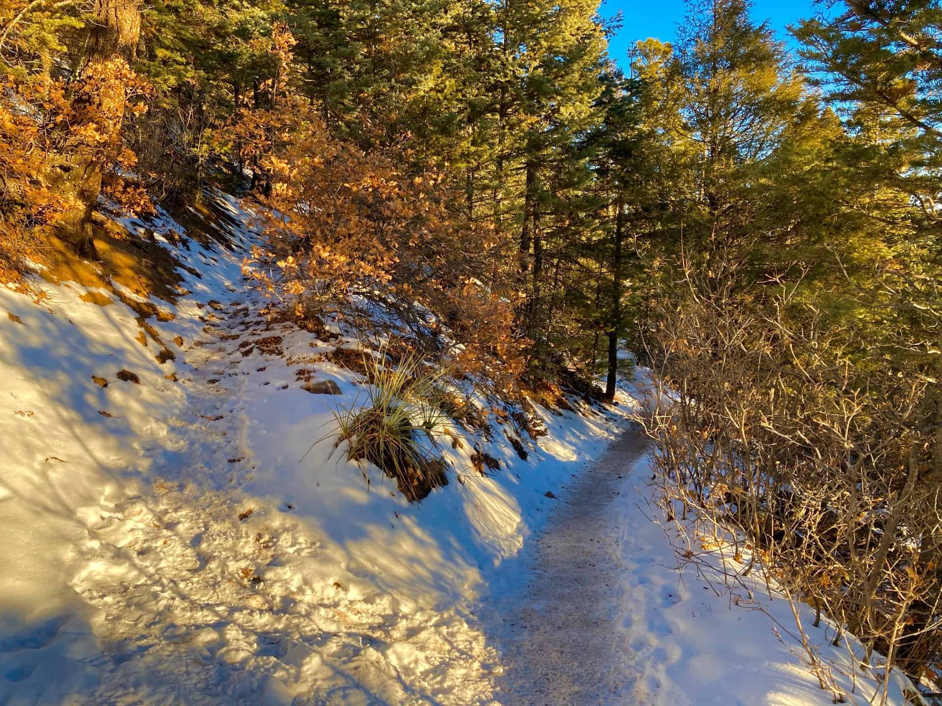
The Hike: Mount Cutler in Cheyenne Canyon
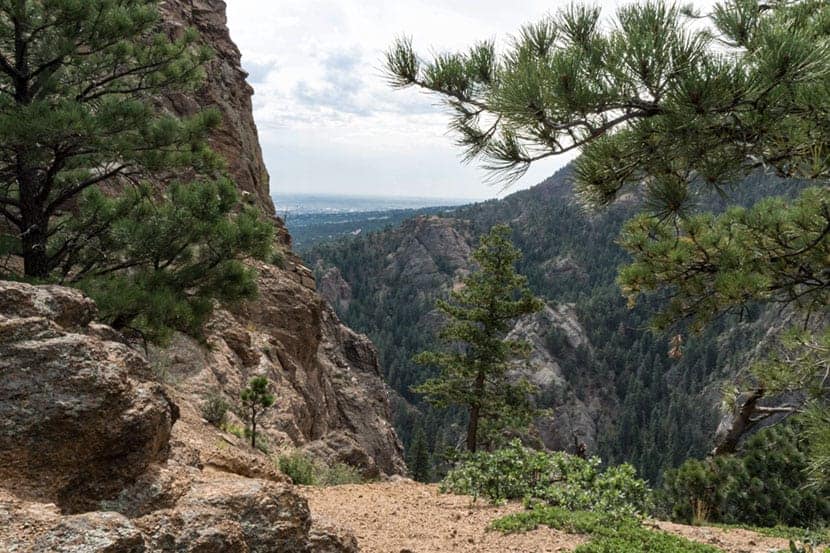
The Mt. Culter trail begins at the blue trailhead sign as a broad path ascends on a gentle grade under the shade of pine trees. The trail passes through some deadfall, evenutally opening out to a more level area where red rock formations have been pushed up into what might otherwise be a dull landscape. Like the Royal Arch in the Flatirons and the formations in Red Rocks Canyon in Colorado Springs, these orange and red granite fins are part of a formation that begins 14,000 feet under the surface and runs almost the entire length of Coloroado.
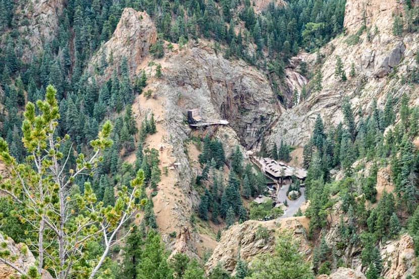
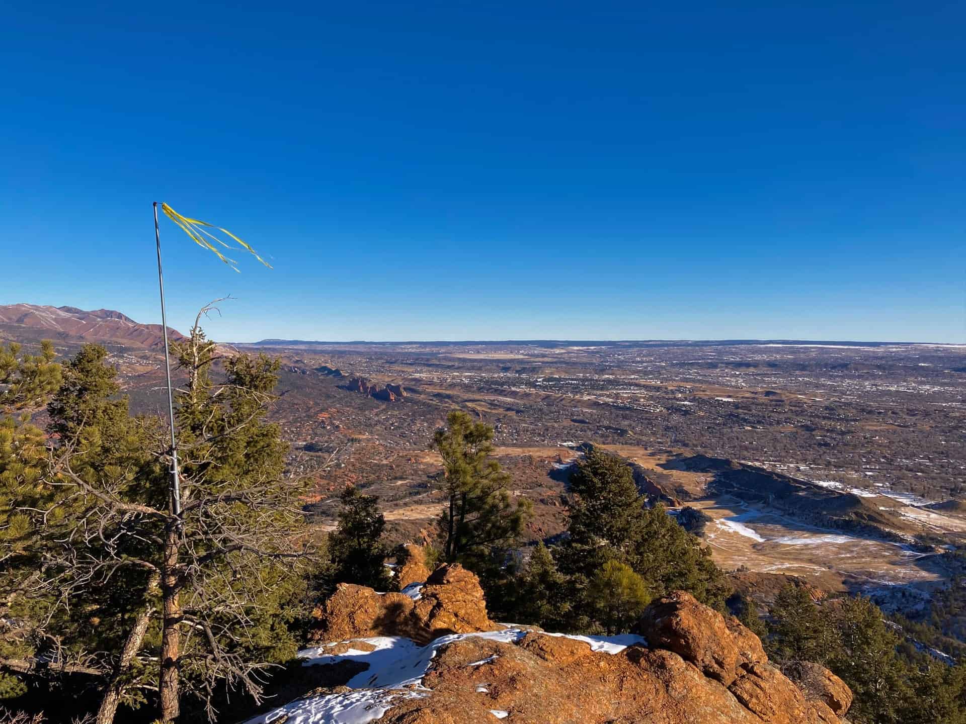
At approximately 0.8 mile, the views open up to the south, where you can look down into Seven Falls. In the Spring and after a good rain, the distant waterfall is quite stunning. To get a close up tour of the falls, you'll need to make a reservation. See our full trail profile on Seven Falls for more details.
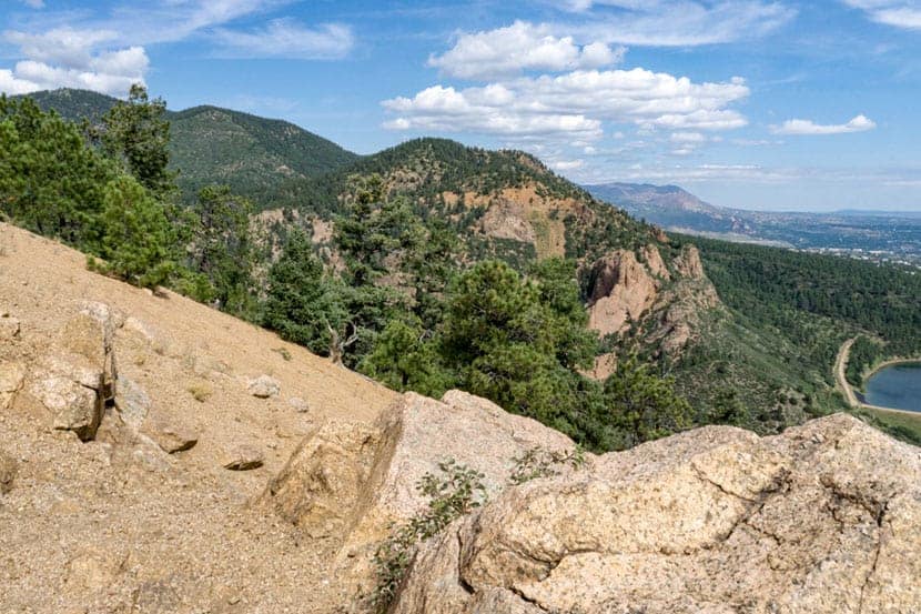
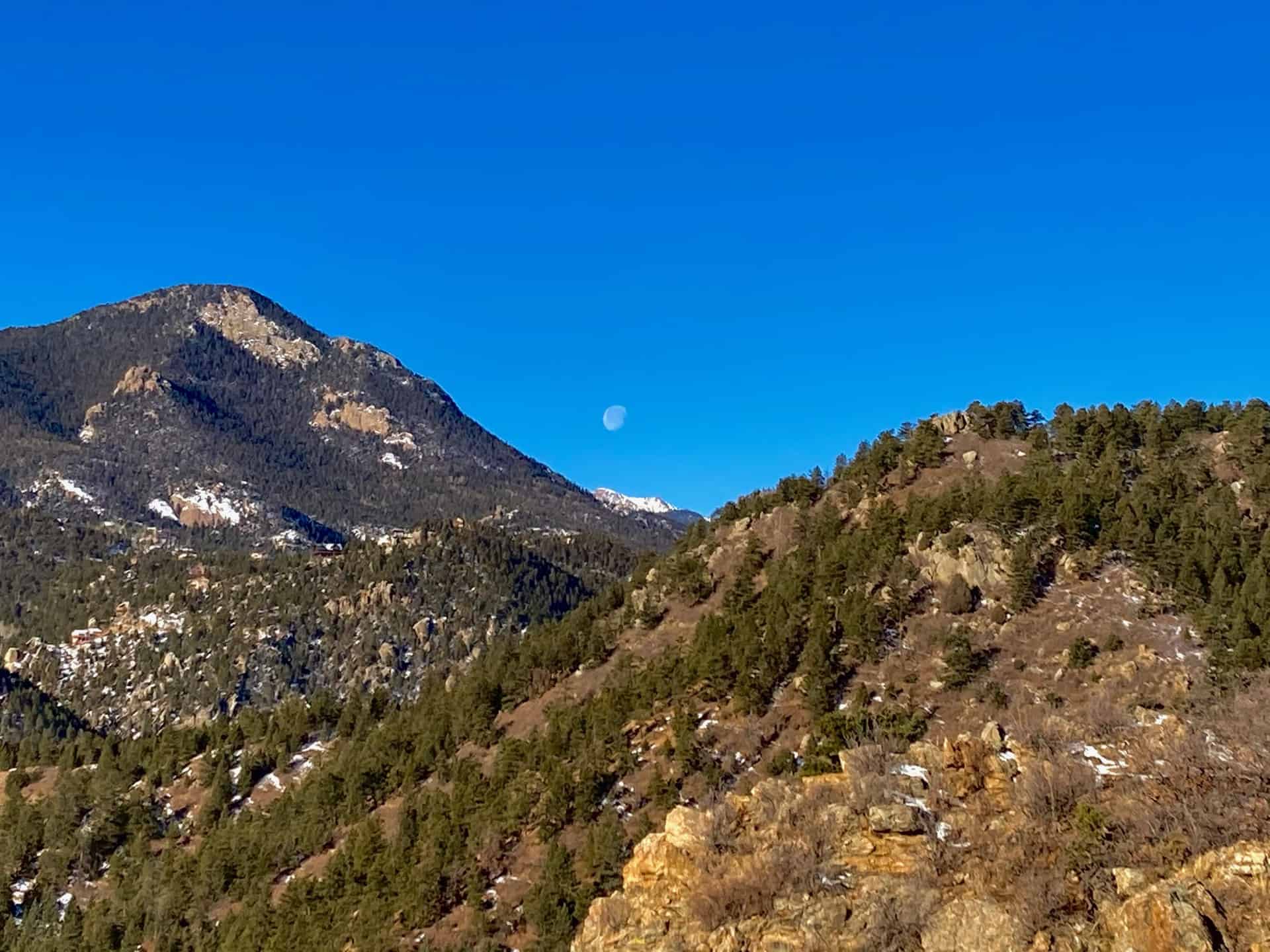
The last segment of the hike to the summit of Mt. Cutler offers great views to the south and the north. At the Summit of Mt. Cutler, look to the North to take in the foothills and views down into the canyon, and to the Southeast you'll gain views out to the great plains of Colorado. Return via the same trail you hiked to the summit.

Tips & Resources for Hiking Mt. Cutler
- Visit the Starsmore Visitor Center: On your way in or out of the trailhead, stop by the Starsmore Visitor Center to pick up a trail map and view the exhibits.
- TIP: Wear boots or a tennis shoe that has a good sticky tread as there is a lot of loose gravel on this trail up Mt. Cutler
- Trail Map: Cheyenne Canyon and Mt. Cutler Trial Map
- Packing List: Always pack the 10 Essentials. Download our Hiking Guide to get the list and dayhiking packing checklist.
- Colorado Road Conditions: Colorado Road Conditions
- Photo: We would like to express our gratitude to Fritz MB and Phillip Stewartfor sharing such an amazing photographs of Mt. Cutler.
- After the Hike: Bristol Brewing Company
Weather
Map & Driving Directions
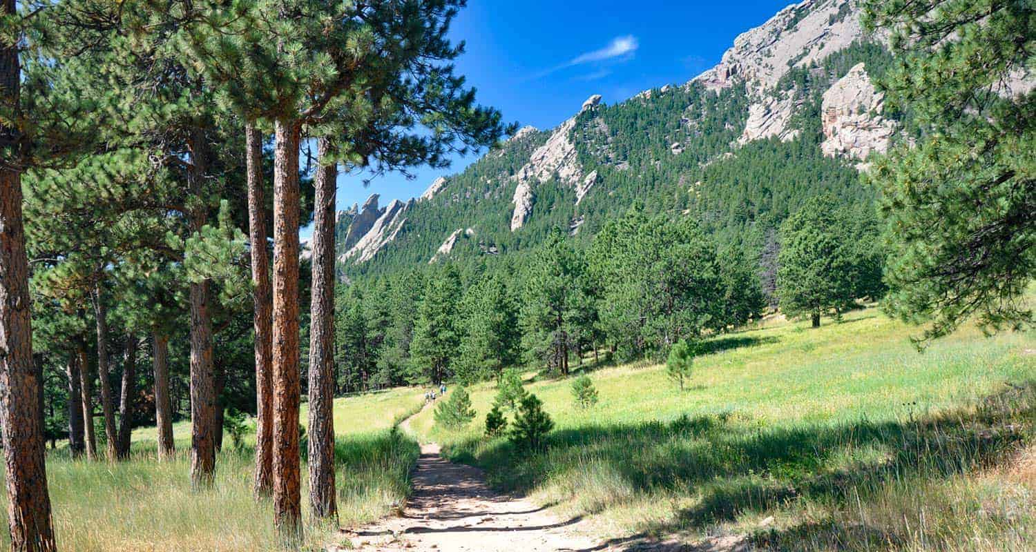
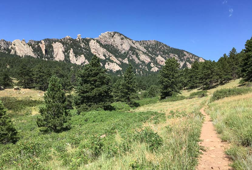
Mesa Trail to Bear Canyon Creek
The Mesa Trail south of Boulder, Colorado, rambles across wild open country at the base of the iconic Flatirons. Hike a 4.1 mile loop or an 8.4 mile out-and-back option through pine woods, verdant creek draws, and flowering meadows. Explore the full Mesa Trail profile for this southern segment of one of our favorite dog-friendly hikes near Denver.
Trail Snapshot: Mesa Trail South
| Hike Distance | 8.4 miles Round Trip |
|---|---|
| Difficulty | Easy to Moderate |
| Duration | Approx 4 hours |
| Trail Type | Out-And-Back |
| Starting Elevation | 5650′ |
| Elevation Gain | Approx +900′ |
| Seasons | Year Round |
| For Closure Updates: | Boulder Open Space Closures |
| Dogs | Allowed On Leash |
| Hike Trail Map | Click for Trail Map of the Mesa Trail near Boulder |
| Denver Drive Time | 45 min |
| Driving Directions to South Mesa Trailhead | Click for Google Map |
| Town Nearest Hike | Boulder, Colorado |
| Beauty | Wildflowers, Sunrise, Meadows, Rock Formations, Wildlife: Deer, Bear, Birding. |
| Activities | Hiking, Trail Running, Photography |
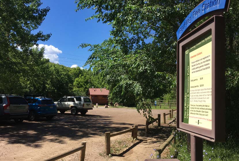
Parking & Trailhead Information for the South Mesa Trailhead
Access to South Mesa is from the South Mesa Trailhead off of Eldorado Springs Drive just South of Boulder. From Denver, drive North on interstate 25 to 36 toward Boulder. Take the McCaslin Blvd exit and then go south/west onto McCaslin. At the intersection of McCaslin and Marshall, take a right onto Marshall Road. Marshall will intersect with Eldorado Springs Drive. Here, take a left onto Eldorado Springs Drive. About two miles down the road, you’ll find the South Mesa Trailhead on your right. The South Mesa Trailhead is a part of the Boulder County Open Space and requires a daily parking fee, or an annual pass. I went online and bought an annual parking pass through the Open Space website. This gives you access to all the southern fee parking areas as well as the parking areas on Flagstaff Mountain. There are restrooms at the trailhead.
Alternatively, you can park at NCAR and hike south to the South Mesa Trailhead. If you want to hike this one-way without a return, you can park a car at NCAR or the South Mesa Trailhead. The National Center for Atmospheric Research (NCAR) Trailhead is located about 40 minutes North of Denver. From Denver, follow U.S. Route 36 to Boulder. Take the exit for Table Mesa Drive and follow it west. It will wind through a neighborhood to the end as it winds through the neighborhood and past Bear Creek Elementary School. The road will turn into the Drive for NCAR which winds up and around to a large parking area at the lab.
Waypoints and Hike Options for the South Mesa Hike
- South Mesa Trailhead to NCAR Trailhead 4.7 Miles - One-Way
- South Mesa Trailhead to Bear Canyon Creek and Back - 8.4 Miles
- South Mesa to Bluestem Loop 4.1 Miles - One-Way
- South Mesa to Chautauqua Park 6.75 Miles - One-Way
The Hike: Mesa Trail to Bear Canyon Creek
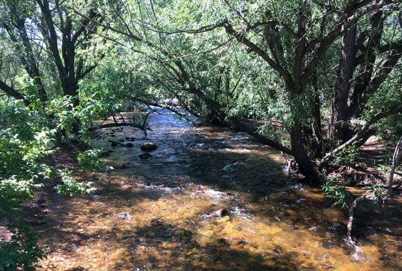
From the South Mesa Trailhead just East of Eldorado Springs, this hike begins along the banks of Boulder Creek (pictured above). Cross the bridge and pause to take in the willow trees bending over the creek and creating a tunnel of green above the silver waters. You'll cross another footbridge and emerge onto a broad trail. Soon, you'll come to the first trail junction with the Towhee and Homestead Trails. The Towhee cuts off a bit of distance and will take you back to the Mesa Trail, or just keep following the signs for the Mesa Trail as it wraps around to the west. Either way, the trails will both merge back onto the main Mesa Trail.
The Homestead trail heads west to Shadow Canyon and takes hikers up toward South Boulder and Bear Peaks. Both are more challenging hikes and provide incredible views out to the plains and west to snowcapped peaks.
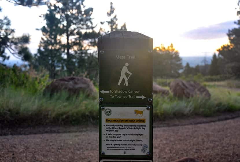
This area of the South Mesa has a lot of side trails and options, so the most important thing to keep in mind is that the Mesa Trail, over its course runs north/south all the way up to Chautauqua Park.
Before you hike, be sure to review the map to get a feel for the area. The trails weave round, so it's easy to just meander around and take in the meadows and surrounding peaks. The trails are all well-marked, so when in doubt, just look for signs indicating the Mesa Trail and continue hiking north (with the foothills on your left). There are a lot of options for shorter hikes, but we will detail the journey up the Bear Creek Canyon and back.
Early on, you'll gain a great view down into the entrance to Eldorado Canyon. The morning light brings out the pink granite of this range of sharp and angular foothill rock.
The Mesa trail then heads west and up along a gentle slope, then bends north to run parallel with the eastern flanks of the Flatiron range. Along the foothills to the left, you'll see Devils Thumb and the summit of Bear Peak.
As the Mesa Trail continues north, open sky gives way to the shade and scents of ponderosa pine trees then opens back to meadows again. In the Spring, wildflowers push up through the meadow grasses and unique fuana thrives in the unique zone where the foothills of the Front range meet the meadows. It feels humind in verdant creeks draws and dry when you emerge back onto the open Mesa.
If you would like to shorten your hike and make this into a loop hike, at around mile 2, you can take the Bluestem Trail back toward the trailhead. Otherwise, continue north on the Mesa Trail.
This is one of our favorite dog-friendly hikes near Boulder, and it's quite popular with dog owners on the weekends. In fact, just south of the intersection with the Bluestem, just shy of mile 2, there is a spring you'll find a small spring. It's a great place for your pup to get a drink to refuel for the rest of the hike. These trails also allow you to hike with your dog off-leash, if you've taken the Voice and Sight class and have a current Voice and Sight tag issued by Boulder county. You can get more info on this at the Boulder County Open Space site.
The trail will go up and down through several draws, then eventually cross Bear Creek. Here you are about a mile from the NCAR parking lot. If you've parked a car at NCAR, you can then shuttle back for your other vehicle, making this a 4.7 mile hike.
Bear Creek is the turn around point for this trail profile, making it an 8.4 mile out-and-back journey. However, if you want to add a cave to your adventure, continue north, then west for about 1.2 miles following the signs to Mallory Cave. If you have your dog with you, I would not recommend this extra jaunt as the terrain is rocky and steep.

Return south on the Mesa Trail and take the Bluestem Trail to cut off a bit of extra hiking.
Tips & Resources for Hiking the Mesa Trail
- Sunscreen: We added this hike to our list of hikes with shade, but there are still open segments, so sunscreen is still needed.
- Go on a Weekday: The South Mesa Trail system is busy on the weekends. So, if you are looking for some solitude, try a weekday
- Trail Map: South Mesa Trail System Map
- Packing List: Always pack the 10 Essentials. Download our Hiking Guide to get the list and dayhiking packing checklist.
- Colorado Road Conditions: Colorado Road Conditions
- After the Hike Cafe: Walnut Cafe in Boulder
- After the Hike Brewery: Sanitas Brewing Company
Weather
Map & Driving Directions
Click for Driving Directions