
10 Best Hikes in Rocky Mountain National Park
If it's your first time visiting Rocky Mountain National Park and you're wanting to make the most of your visit, then this set of hikes is a great place to start. I've spent over six full months hiking the hundreds of miles of trails in RMNP, and we drive up with visiting family and friends to show them around. However, before we get into the hikes, here are a few scenarios on how you might want to spend your day.
NOTE: Rocky Mountain National Park requires that you have timed-entry permits Late-May through Late-October. More information at the RMNP Timed-Entry Permit Page.
Hiking Scenarios for Rocky Mountain National Park
Scenario #1: You have a full day and young kids.
Think of your day in two parts. Part 1 is hiking and Part 2 is the scenic drive up Trail Ridge Road (if it's open) to the Alpine Visitor Center. Hike first, early in the day, before the storms roll in during the afternoon. Some great family hikes are: Horseshoe Falls, Sprague Lake, the short hike around Bear Lake, and Alberta Falls, or Emerald Lake. Between driving, parking, and hiking, you'll likely have time for just one of these before your drive up Trail Ridge Road.
Scenario #2: You have a full day and no kids with you
You've got some options. Option A is to do one of the longer hikes in this post: Sky Pond, Timberline Falls, Ouzel Falls, or Fern Lake.
Scenario #3: You only have a few hours.
This one is the toughest scenarios because there are so many great places to see, and many of them require a drive. If you only have a few hours, I'd recommend the short hike around Sprague Lake, and if you have a bit more time, to drive up to Bear Lake. Bear Lake will give you an up-close feel of the mountains, and Sprague Lake will provide you with a larger-than-life panorama of the continental divide.
Top 10 Hikes at Rocky Mountain National Park
I've organized these from easiest to most demanding (which are also the longest).
-
Sprage Lake Loop Hike
-
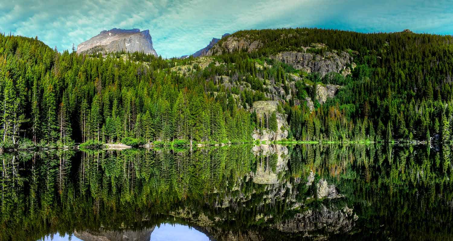
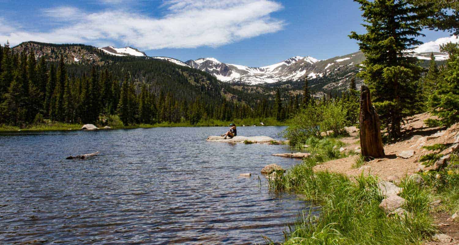
Bear Lake
-
Horseshoe Falls
-
Alberta Falls
-
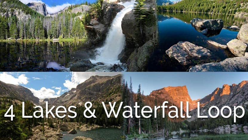
Four Lakes and Waterfall Loop
-
Fern Falls
-
Fern Lake
-
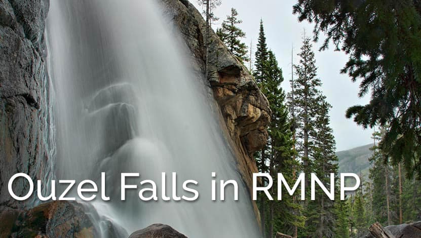
Ouzel Falls
-
Timberline Falls
-
Sky Pond
Distance: 0.5 Mile | Difficulty: Easy
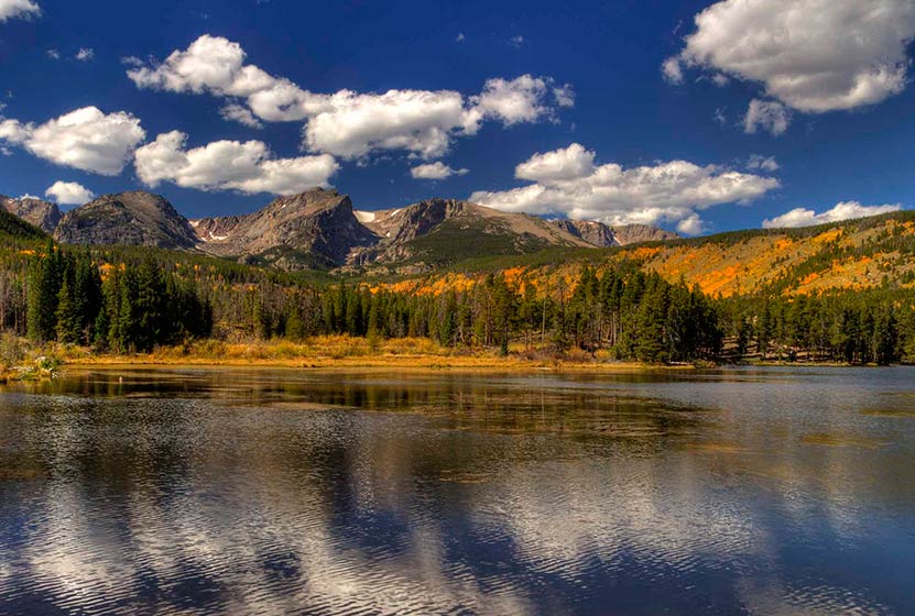
If you don't have a lot of time and are lookign for an easy introduction to Rocky Mountain National Park, Sprague Lake is the place to start. On the way, be sure to stop and look for elk in Moraine Park. This small lake was actually built by an early settler of the area, Albert Sprague, who built a resort along its waters. This is a great place to bring a picnic lunch or watch the sun set over the Rockies.
![]()
Distance: 0.6 Miles | Difficulty: Easy | Elevation Gain: Nominal
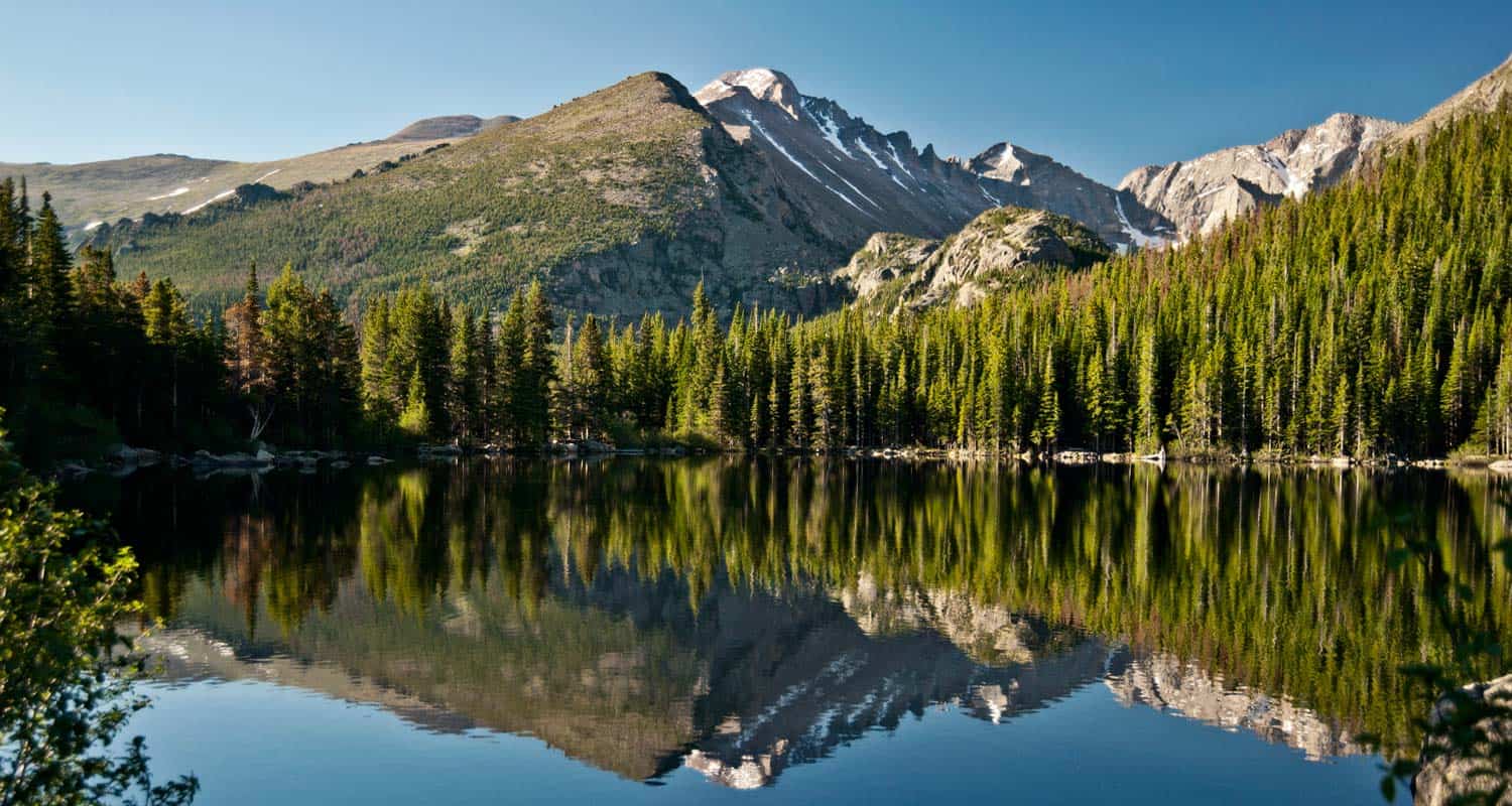
Think of Bear Lake as the epicenter of Rocky Mountain National Park. From the Bear Lake Trailhead, you can venture to destinations inside Glacier Gorge, Andrews Creek, or even up to the top of Hallett Peak. Though the parking lot is huge, it fills quickly, and you may need to take the shuttle from down in Glacier Basin. The hike at Bear Lake is an easy half-mile around the lake. If you've traveled all this way, I'd recommend checking out Alberta Falls and the hike to Emerald Lake.
![]()
Distance: 0.4 Miles | Difficulty: Easy | Elevation Gain: Nominal
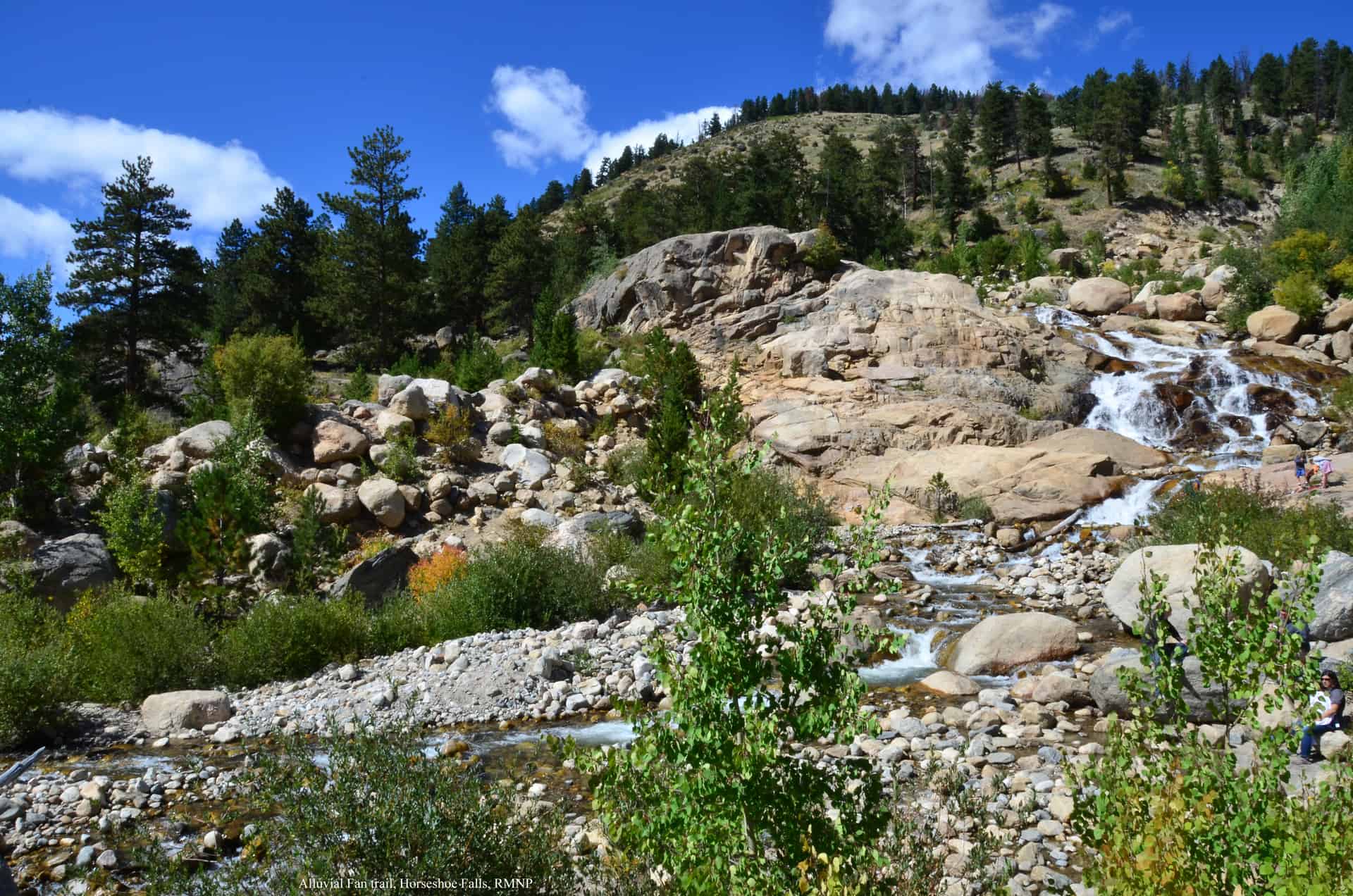
Horseshoe Falls is a beautiful and easily accessed off Old Fall River Road. When our kids were younger, they loved this hike because you can scramble along small boulders and explore the many courses of the waterfall. Do be careful though as rocks can shift, and the granite can be sharp. If you're up for a longer adventure, you can drive up Old Fall River Road (when it's open) and take Trail Ridge Road back down.
![]()
Distance: 1.6 Miles | Difficulty: Easy | Elevation Gain: 200'
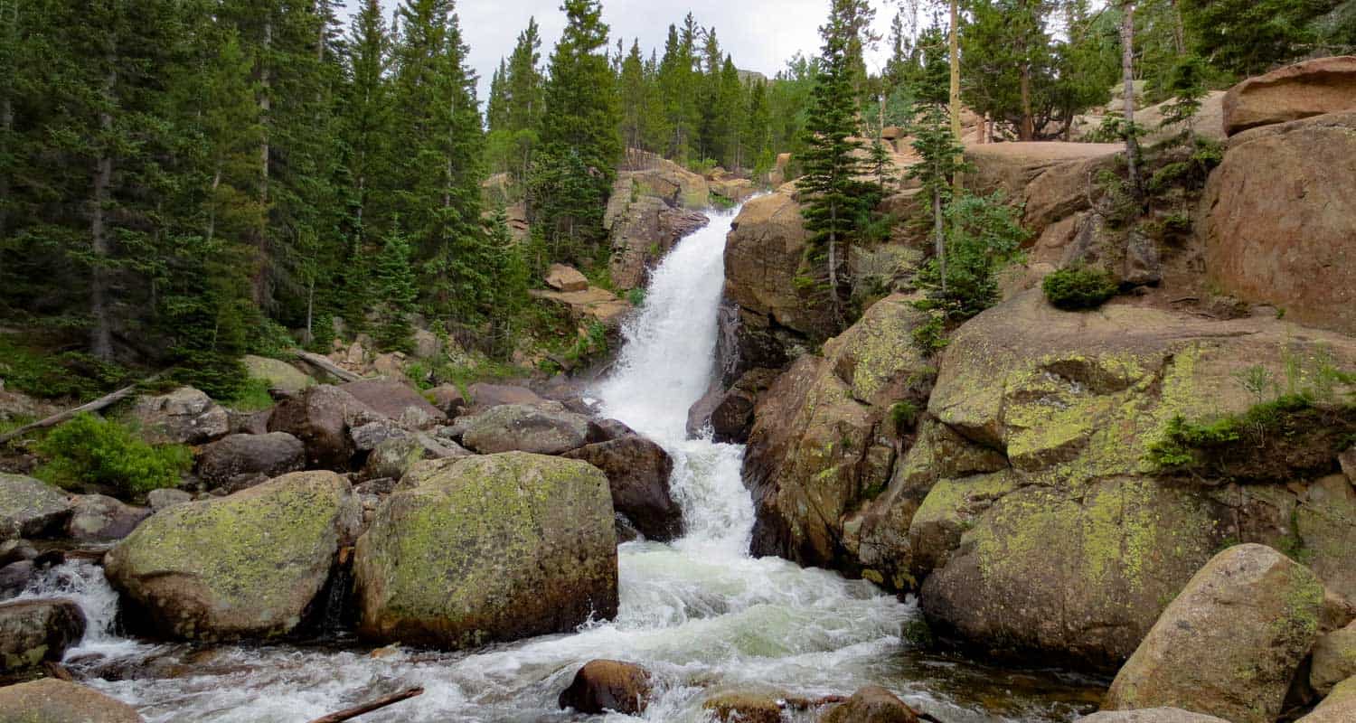
Glacier Creek plummets thirty feet to creat the impressive spray of Alberta Falls. The falls are known for their impressive flow, especially during the spring and early summer months when the snowmelt increases the water volume. The hike up to Albrta Falls is short and easy, making it perhaps the busiest trail in the entire park. However, we recently hiked it in the late afternoon and were the only people on the trail for most of our hike.
![]()
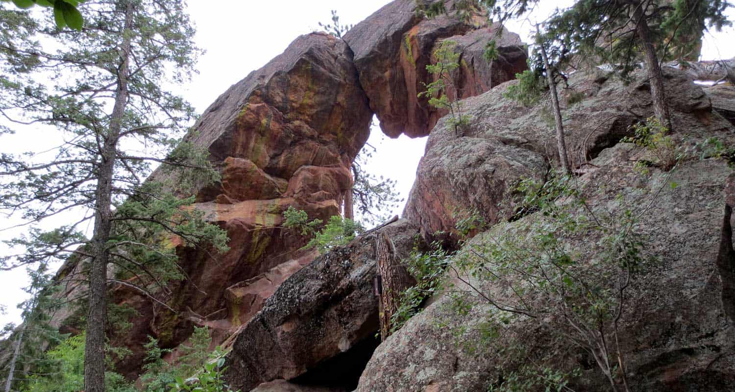
Distance: 6.4 Miles | Difficulty: Moderate | Elevation Gain: 800'
This is one of my favorite hikes to take friends on in RMNP. You'll travel past Alberta Falls on your way up to Lake Haiyaha. I love lake Haiyaha because it's right up against the mountainside, had really cool big granite boulders, and a beautiful old pine tree along its shore. After that, you'll hike to Dream Lake. From there, you'll hike to Dream Lake and Nymph Lake, with the option of adding an out-and-back segment to Emerald Lake to your adventure. From Nymph Lake, take the trail back to Bear Lake.
![]()
Distance: 5.4 to 8 Miles | Difficulty: Moderate | Elevation Gain: 650'
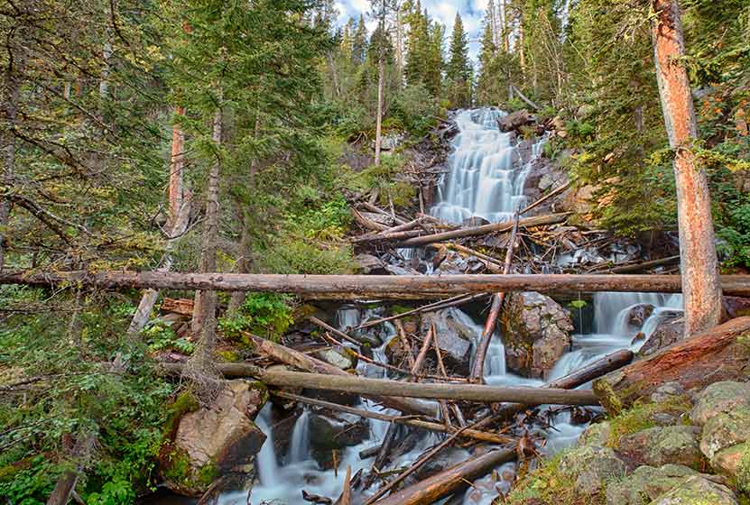
The hikes up to Fern Falls and Fern Lake begin at the Fern Lake Trailhead. It's a small trailhead with limited parking, so go early, or plan to add 0.8 (one-way) to your hike from the shuttle stop. I love Fern Falls because it crashes through the forest over granite boulders and deadfall. It's loud and picturesque. Along the way you'll pass through Arch Rocks, pass by The Pool, and hear the rushing waters of the Big Thompson River as it courses its way out of the high country.
![]()
Distance: 7.8 to 9.4 Miles | Difficulty: Moderate | Elevation Gain: 1400'
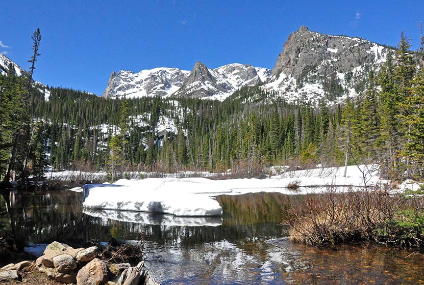
Fern Lake is a beautiful alpine lake, and worth taking this more demanding hike. Be aware that there can be snow covering the upper reaches of the trail into early Summer. The fishing at the lake is great, and the lake is a perfect place to hike to for an afternoon picnic. If you start early, you can add Odessa Lake to your trip.
![]()
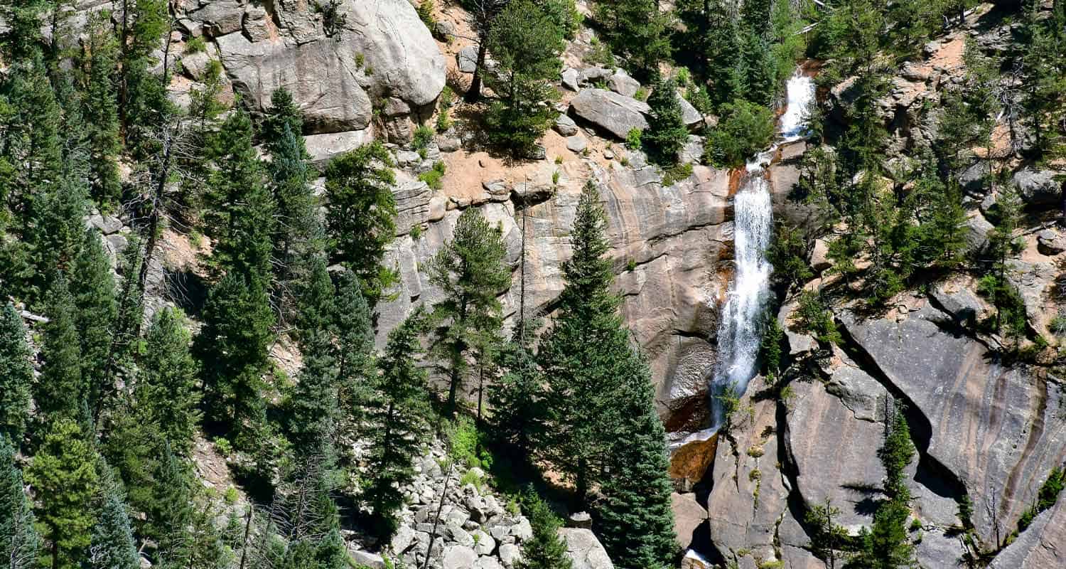
Distance: 5.4 Miles | Difficulty: Moderate | Elevation Gain: 1000'

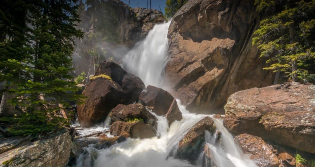
The hike up to Ouzel will take you into the Wild Basin area of Rocky Mountain National Park and past two other smaller but beautiful waterfalls. Less than a half-mile into your hike you'll pass Copeland Falls, and at approximately one mile into the trail, you'll see Calypso Cascades. The trail climbs, becoming more demanding and providing some great views into the Wild Basin. A bridge crosses Ouzel Creek and offers the first breathtaking views of the falls. It might be my favorite waterfall in the park because of how it shoots off the cliff above.
![]()
Distance: 8 Miles | Difficulty: Difficult | Elevation Gain: 1500'
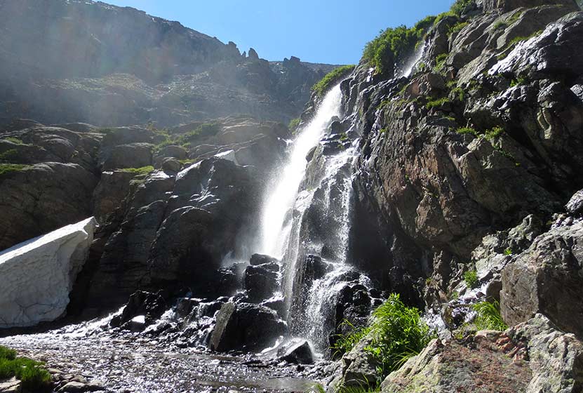
If you're looking for a challenging hike in Rocky Mountain National Park that offers a ton of scenery, the hike up to Timberline Falls is perfect. You'll venture into Loch Vale and experience the vaulting grey-granite spires of the surrounding mountains. During snowmelt, the waterfall covers a long ridge as well has has a central spout that leaps from the cliffside. If you've hiked this far, think about pushing further to Sky Pond.
![]()
Distance: 9+ Miles | Difficulty: Difficult | Elevation Gain: 1650'
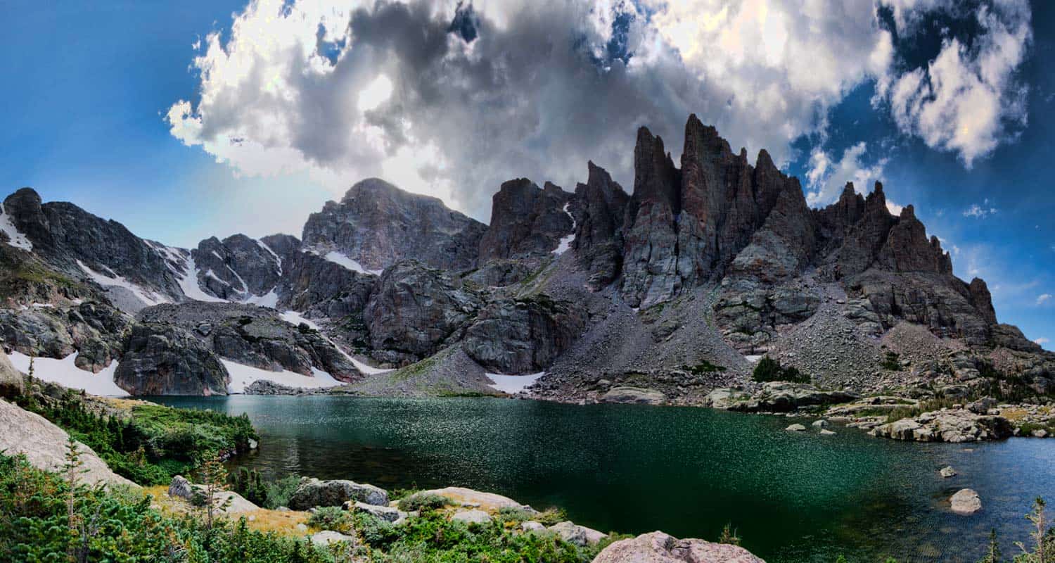
There are so many sights to take in on the way to Sky Pond, you should plan to take your time and plan on it taking your entire day. The peaks surrounding Sky Pond look like jagged sharks teeth, and the wildflowers on it's western flanks are resplendant in the mid-summer. Along the way, you'll pass Alberta Falls, The Loch, Timberline Falls, and Lake of Glass.
![]()
10 Best Hikes Near Boulder Colorado
Where are the best hiking trails close to Boulder? We've been hiking in and around Boulder, Colorado for years, profiling over 30 different trails. So, we decided to share here our favorite hikes near Boulder. These ten hikes will give you a variety of landscapes and experiences. You'll find dog friendly hikes, hikes to summits, and waterfalls. And we'll update it when a new hike strikes our fancy and pushes one of the others off the list. Explore this page for an overview. But there is more, as each hike has a detailed page with trail maps, driving directions, and photos.
-
First and Second Flatirons Hike
-
Bear Peak Summit Hike
-
Eldorado Canyon State Park Trails
-
Boulder Falls
-
Mesa Trail: South Segment Hike
-
Green Mountain Summit Hike
-
Mt. Sanitas Hike
-
Royal Arch Hike in Chautauqua Park
-
Lost Lake Hike in Indian Peaks Wilderness
-
South Boulder Peak Summit Hike
Distance: 2.6 Miles
Difficulty: Moderate
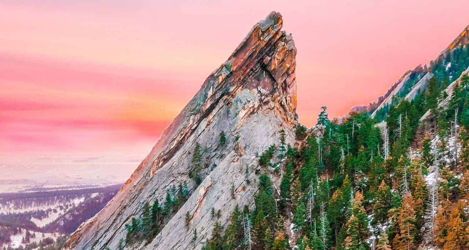
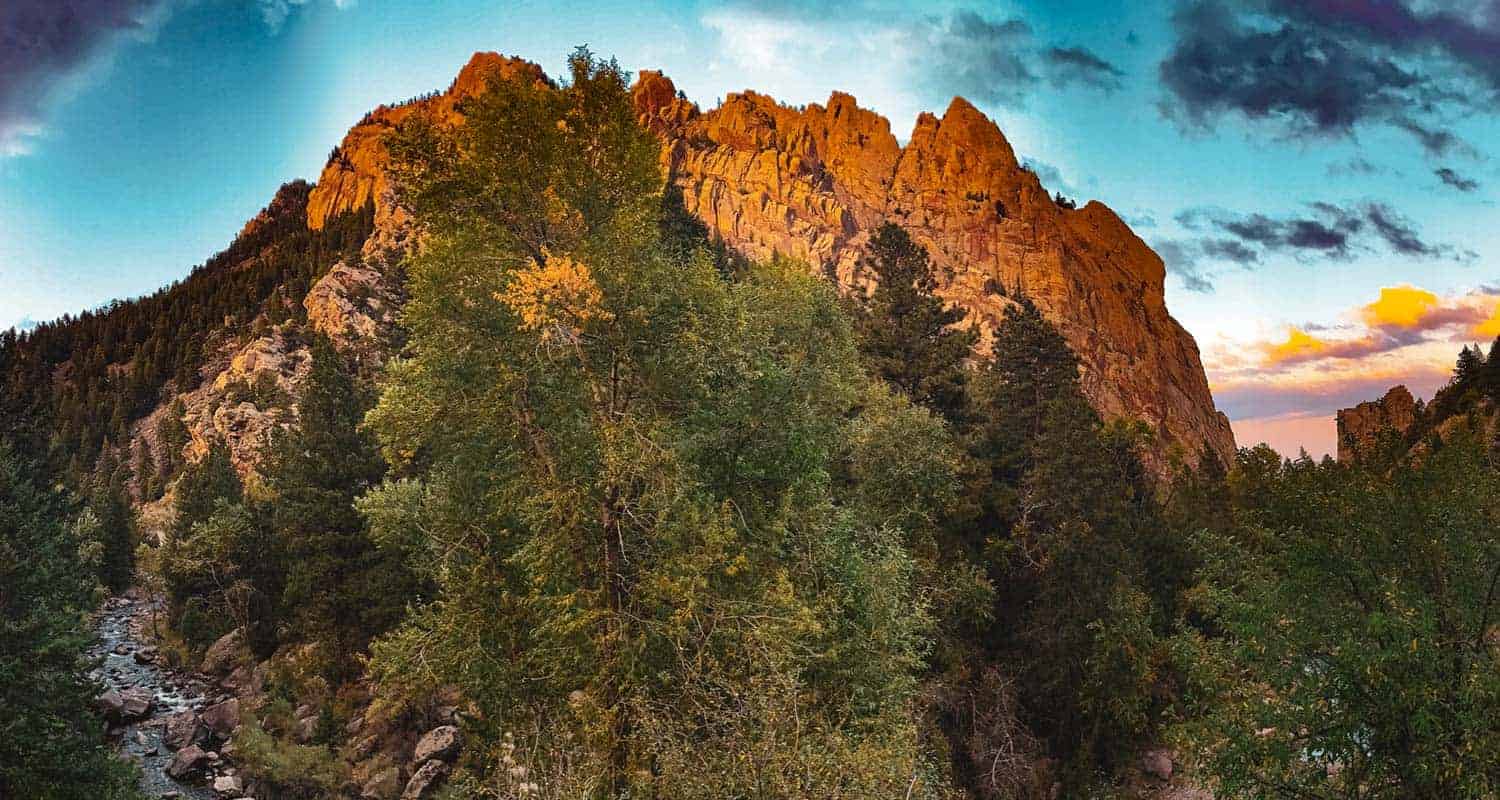
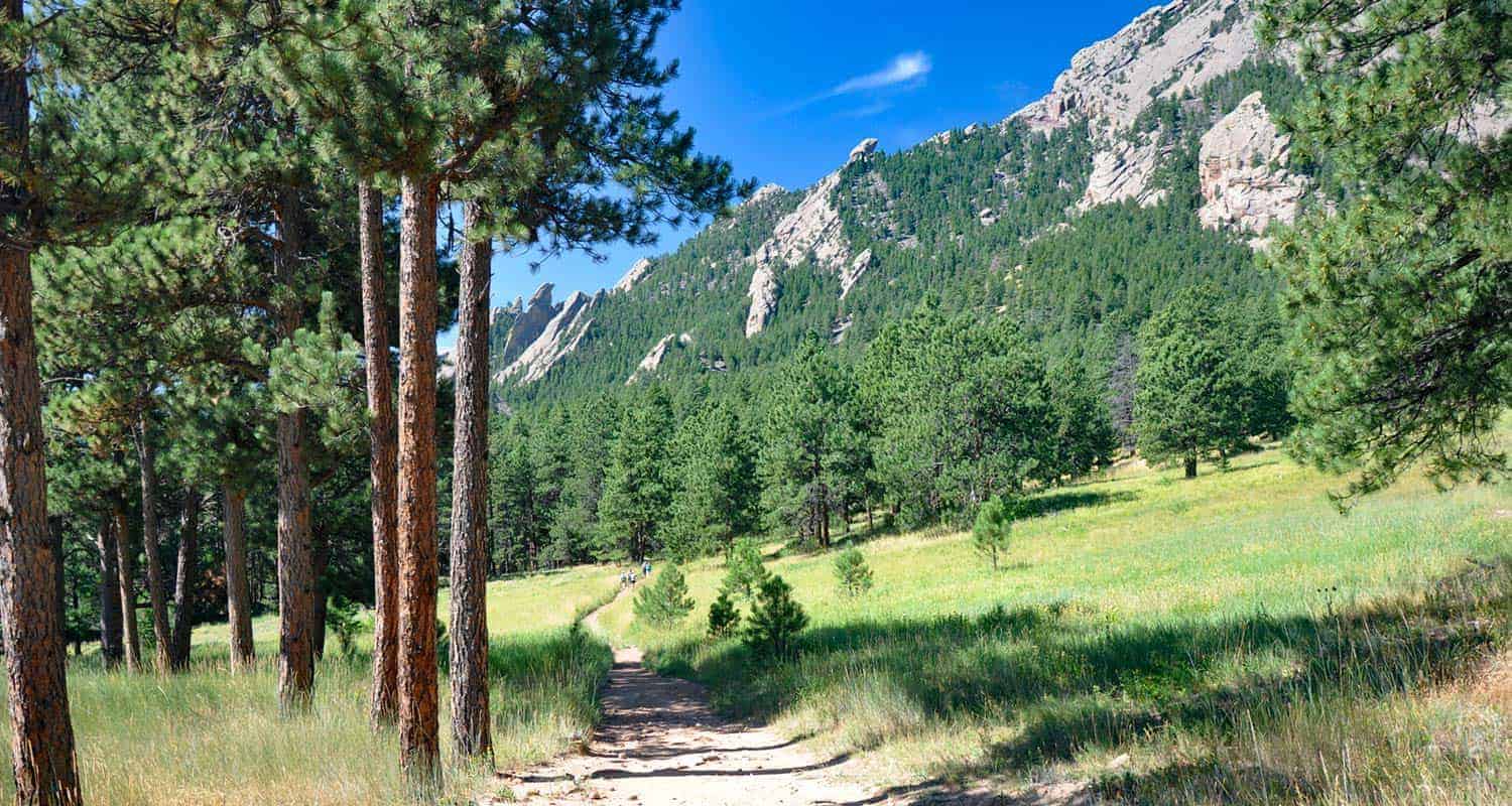
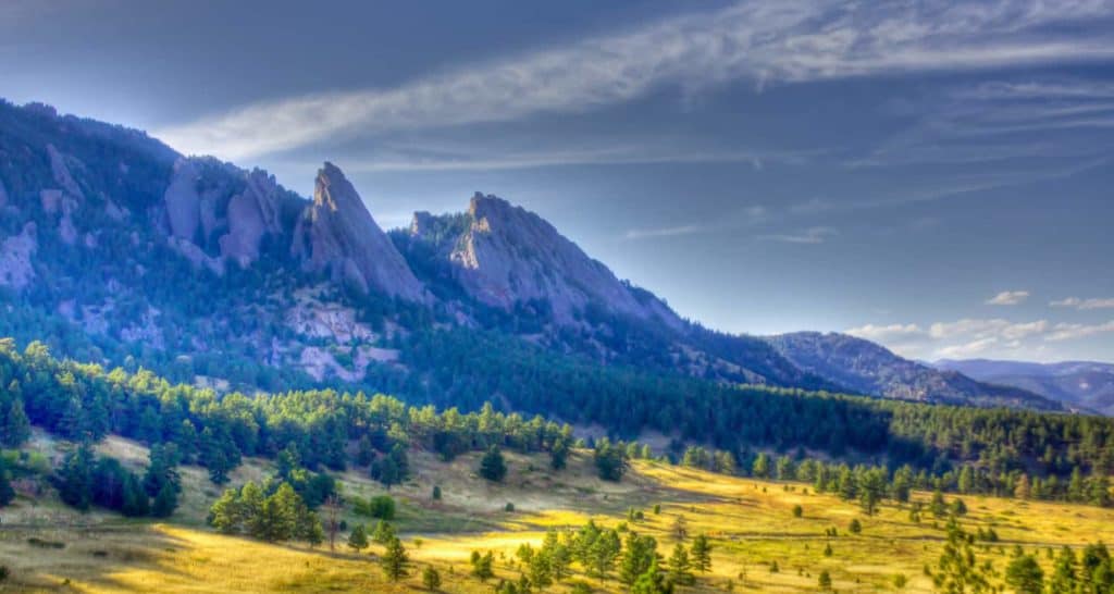
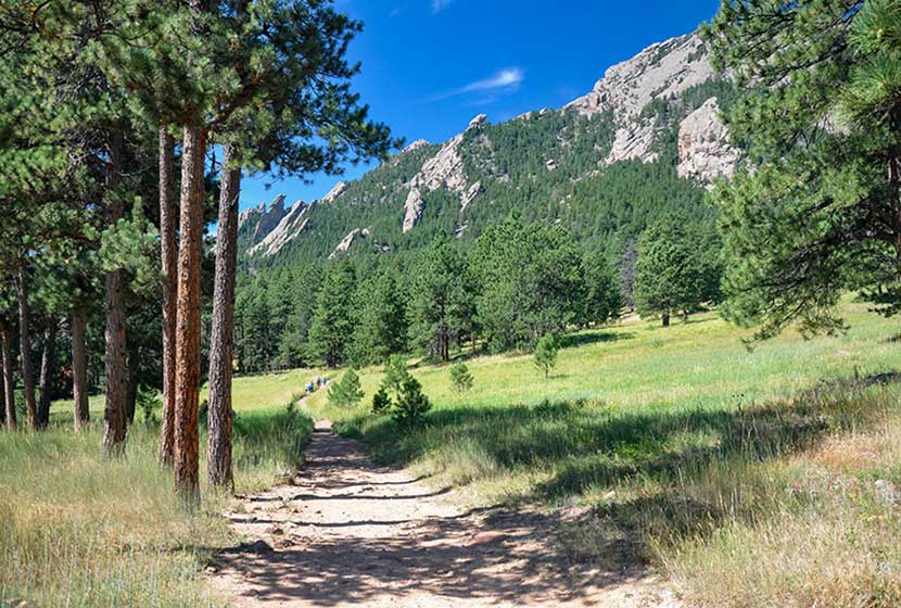
Let's start with my favorite and probably the most classic hike in Boulder, the trail that leads between the 1st and 2nd Flatiorns in Chatauqua Park. The trail takes you across the open meadows of the park, then ascends up the long ridge of the Second Flatiron before passing through the gateway between the two stunning rock spires. The trail curves around to the back side of the First Flatiron where you can scramble up to a natural alcove and take in views of the snowcapped Rocky Mountains in the west. The photo at the top of this page with the pink sky is of the 2nd Flatiron. Explore our full trail profile for trail map, driving directions and more photos of the hike.
![]()
Distance: 7.4 Miles Round Trip or 8.4 Mile Loop
Difficulty: Difficult
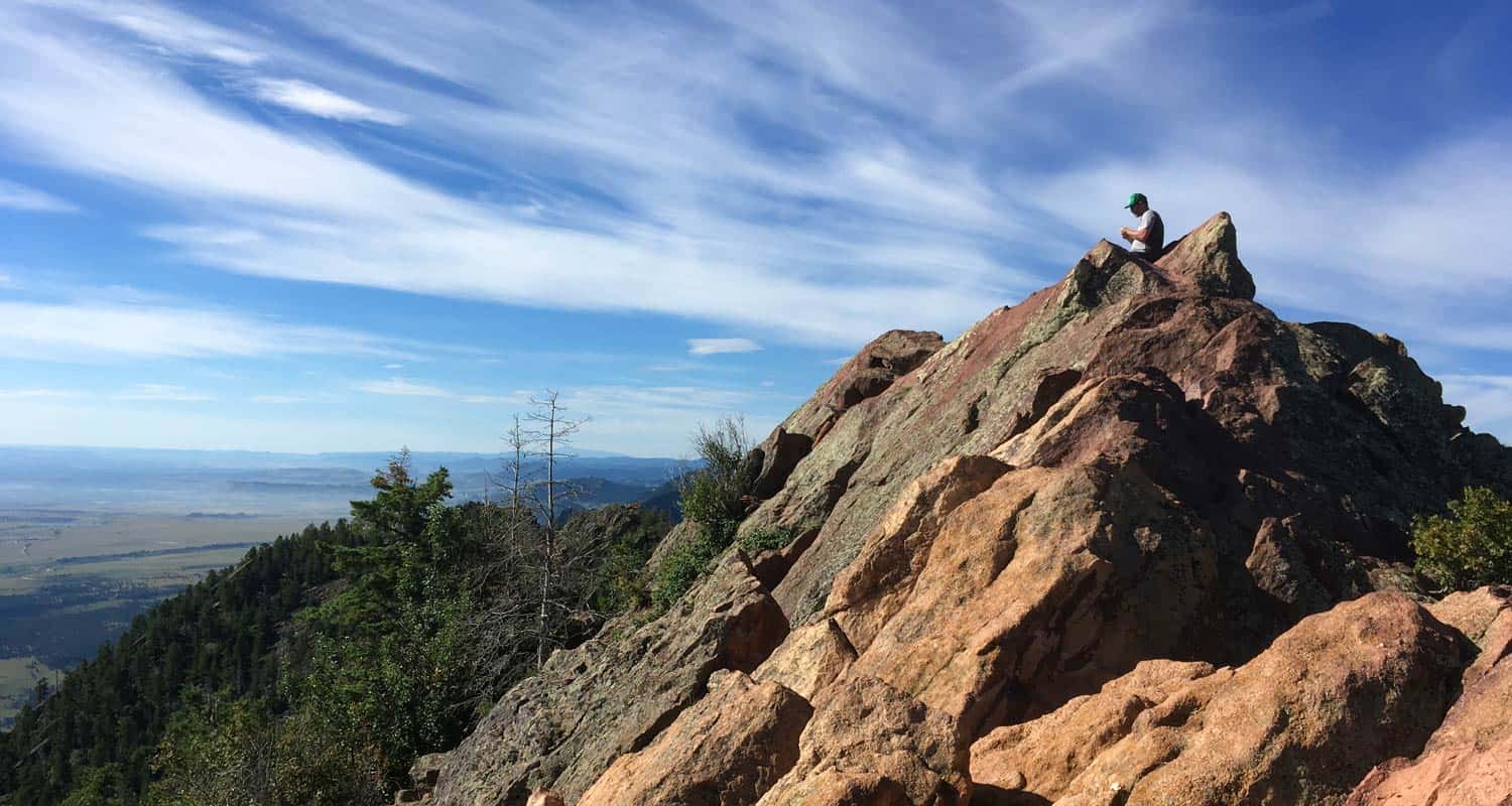
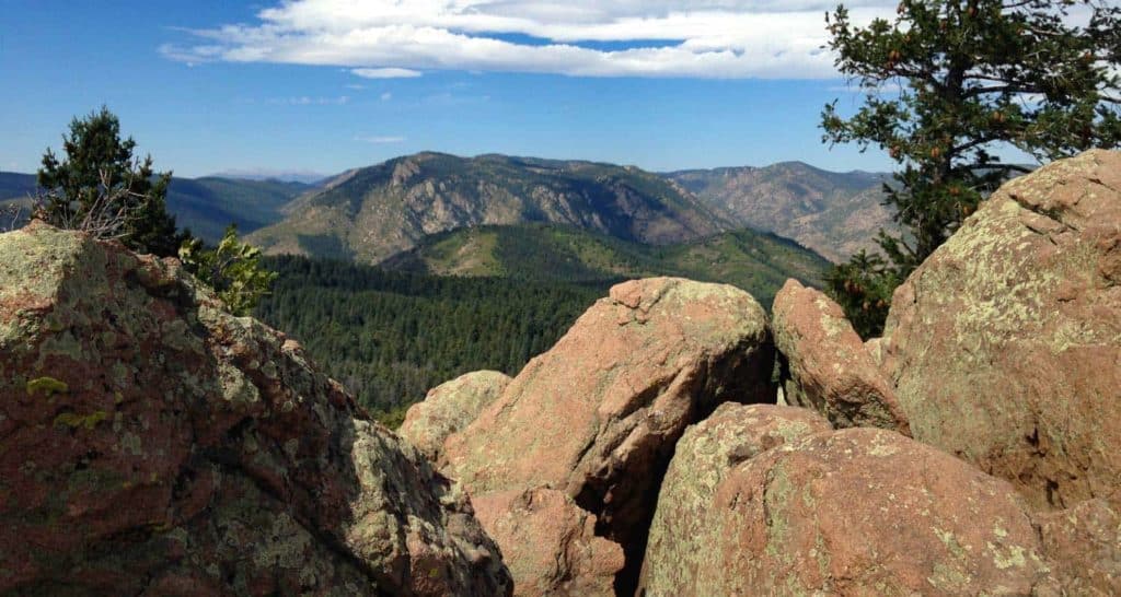
Bear Peak is located along the Flatirons range just south of Boulder, Colorado. The South Mesa Trailhead is one of our favorites because of the number and variety of hikes that start here. The hike up to Bear Peak starts out on a gradual ascent up the mesa, then follows the route of Fern Canyon until it breaks out into an open saddle between South Boulder and Bear Peaks. The last bit to the summit is a scramble along a real knife edge to its pointed peak.
![]()
Distance: 0.5 to 7 Miles
Difficulty: Easy to Moderate
Eldorado Canyon is like entering another world. The high and narrow canyon walls shut out the distant sounds of the city and South Boulder Creek tumbles over cascades through the middle of the park. It's a rock climbing mecca and quite popular, so you'll need to go early and either pay the daypass fee or have a Colorado State Parks Pass to enter. Hikes in Eldorado Canyon State Park range from easy short jaunts along the creek or more demanding hikes up to the top.
![]()

Distance: 100 Yards
Difficulty: Easy
Just a short drive out of Boulder, you'll find one of the best waterfalls along the Front Range of Colorado. Boulder Falls requires a walk, not a hike, to take in its 70 foot plunge over a cliff face in Boulder Creek Canyon. Parking is roadside on a curving road, so be alert along the road. Climbing is prohibited inthe area around Boulder falls, so stay the trail and take in the beauty of this waterfall.
![]()
Distance: 8.4
Difficulty: Easy to Moderate
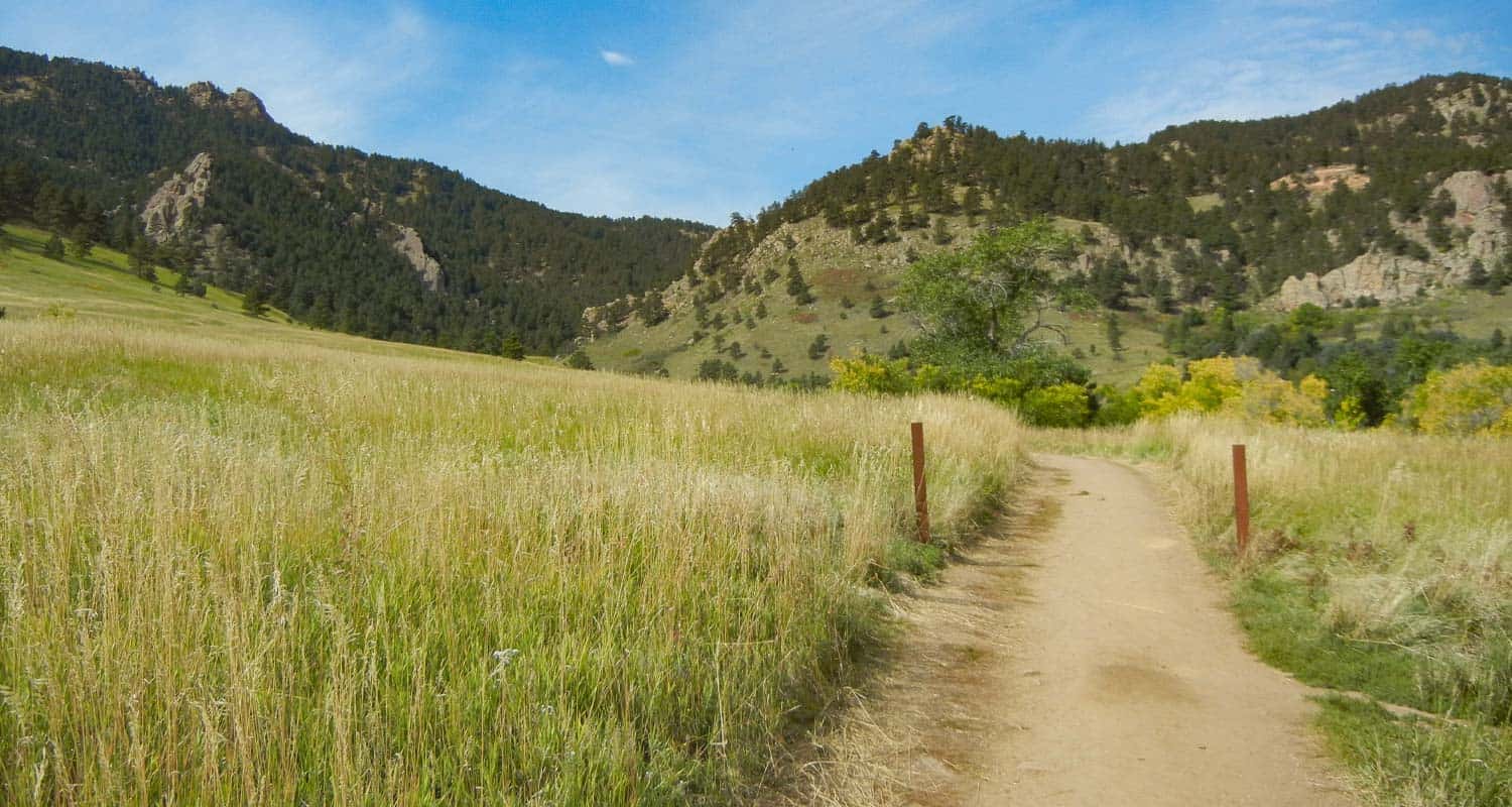
The southern segment of the Mesa Trail is my favorite easy hike near Boulder. The trail starts by crossing South Boulder creek then making its way through meadow grasses onto the expansive mesa, giving you views of the entire Flatirons and down into Eldorado Canyon. The ecosystem here where the foothills meet the prairie is unique, and you'll take this in as the land makes a gentle roller-coaster, dipping into canyon draws and back into wooded areas of ponderosa pine.
![]()
Distance: 5.5
Difficulty: Difficult
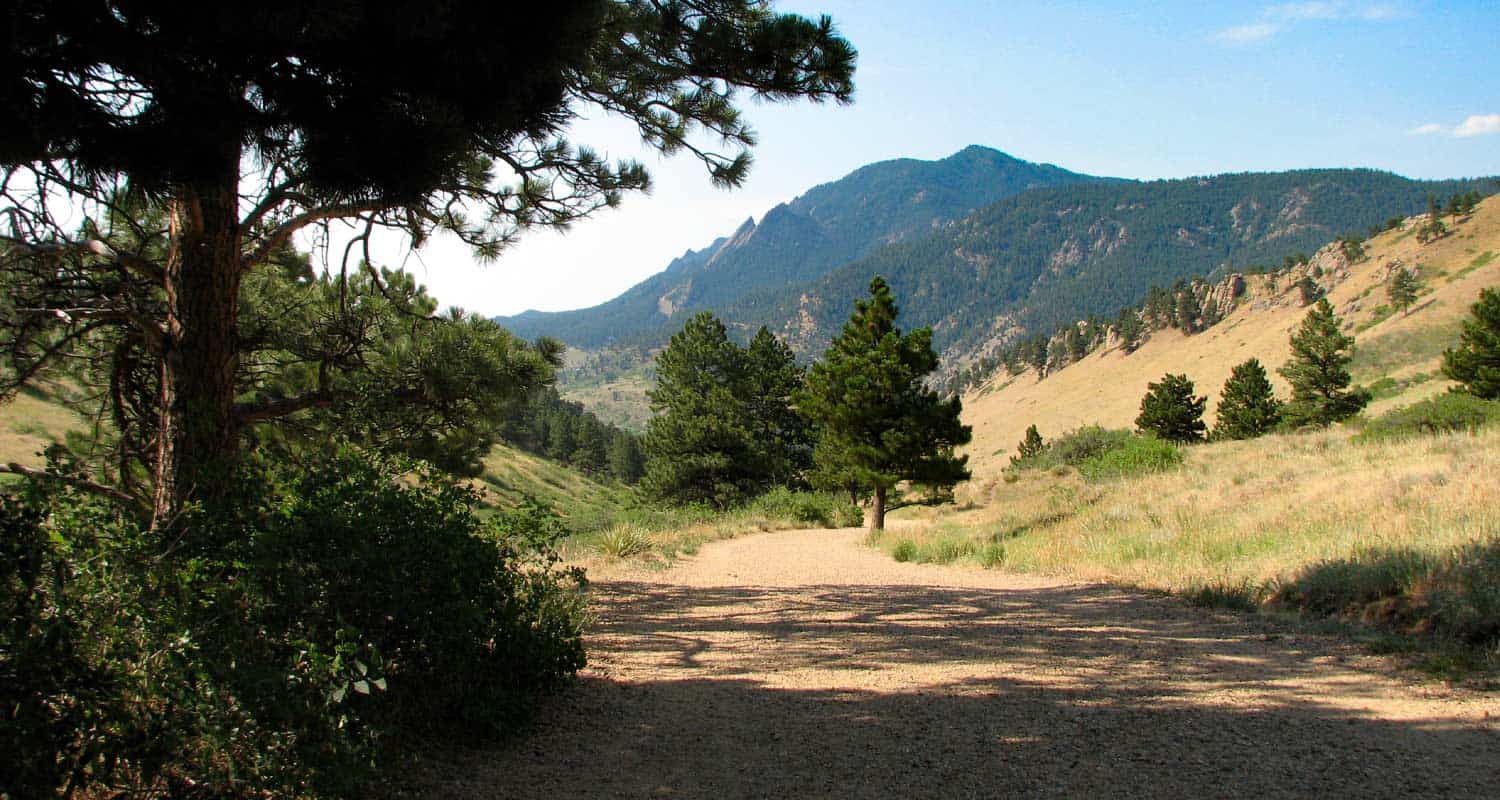
Like the 1st and 2nd Flatirons, Green Mountain is situated on the north end of Chautauqua Park, right in the heart of Boulder. If you are looking for a challenging hike that takes you to a summit with 360 degree views, then Green Mountain is a great workout to great panoramas.
![]()
Distance: 2 and 3.1 Mile Loop Options
Difficulty: Easy to Moderate
Liesurely. That's the word that comes to mind when I think about hiking Mt. Sanitas. Well, that's true of the trail near the bottom of the mountain. The climb up is more challenging. Situated right in the heart of Boulder, the trails at the base of Mt. Sanitas may be the best place to walk your dog in town because of the broad trails, great views, and places for your pup to get a sip of water. Take the broad ridge trail up to the summit if you want to shift into workout mode and take in views of the city.
![]()
Distance: 3.5 Mile
Difficulty: Moderate
The Royal Arch is a pink granite formation tucked back into the heart of the Flatirons range. This 3.5 mile, out-and-back hike. The hike climbs over 1000 feet in a short distance, as the trail makes its way up through narrow Bluebell canyon. Because of the many steps and because it's a popular hike, we recommend not hiking to Royal Arch with your pup. But because of the uphill and many steps, this adventure makes for a great leg workout.
![]()
Distance: 4 Mile
Difficulty: Moderate
Indian Peaks is so breathtaking, that we had to include at least one hike on the list from the closest wilderness area to Boulder. The Lost Lake hike is a moderate, out-and-back trek from the Hessie Trailhead, located about 45 minutes west of Boulder. Because the trailhead has limited parking and is a popular hiking and backpacking starting point, there is a shuttle that runs during the Summer months that you can pick up in the mountain town of Nederland. We love this hike because it gets you back in the heart of the mountains and offers landscapes similar to those in Rocky Mountain National Park. Check out the full trail profile for more details on the hike and the seasonal shuttle service.
![]()
Distance: 7.4 Mile Out-and-Back or 8.7 Mile Loop Hikes
Difficulty: Difficult
We'll finish up this list of best hikes near Boulder with a classic, South Boulder Peak. Like the Bear Peak an Mesa Trail hikes, the 3.7 mile ascent up to the summit begins at the South Mesa Trailhead (see trail profile for parking fee details). Enjoy late-summer raspberries along the trail, and take in 360 degree views of the surrounding Colorado countryside.
![]()
Dayhikes Near Denver has been serving the outdoor community of the Colorado Front Range since 2010. In 2020, we have launched a line of apparel designed by Colorado-based artists featuring Colorado peaks and landscapes. Check out our store for new designs and to wear clothing that shows off your love for our beautiful state.
November Hikes
Where are the best places to hike near Denver in November?
November hiking on the Front Range of Colorado can be cold and snowy or 70 degrees and sunny. It can feel like the continuation of Fall or the depths of winter. And so much depend on where you want to hike. Travel an hour West into the mountains, and it's like you've been transported into a different country--because you have. So, you can see the answer to "Where do I hike this weekend?" in November depends a lot on location and the weather forecast.
Because of this, I think in terms of hike purpose: A) Just Enjoying the Outdoors or B) Adventure. If your goal is to hike alongside a friend and enjoy the beauty of Colorado, or get the dog out for a long walk, then you're probably staying within about 45 minutes of Denver. If you're looking for some adventure, you're driving further and stepping into a whole different and sometimes higher risk landscape. In the rest of this post, I'll recommend a series of trails in both categories.
Just Enjoying the Outdoors
In November, there are three go-to places I'd recommend hiking that are closer in to the Denver metro area and have a lot of options.
-
Hikes in Staunton State Park:
-
Hikes in Chautauqua Park in Boulder:
-
St. Mary's Glacier Trail:
-
Just South of Boulder:
Less than an hour from Denver, this newest of our State Parks has miles upon miles of sunny trails. If you want sun and a great hike with your dog, Staunton is a great go-to. The Staunton Ranch Trail runs right through the middle of the park through ponderosa pines and with great views of Staunton Rocks to the North. Our kids loved hiking the loop hike to Davis Ponds. And for those of you looking for a longer more demanding hike, check out our hike profile for Elk Falls overlook. A CO State Parks pass is required. See the hike profiles above for details.
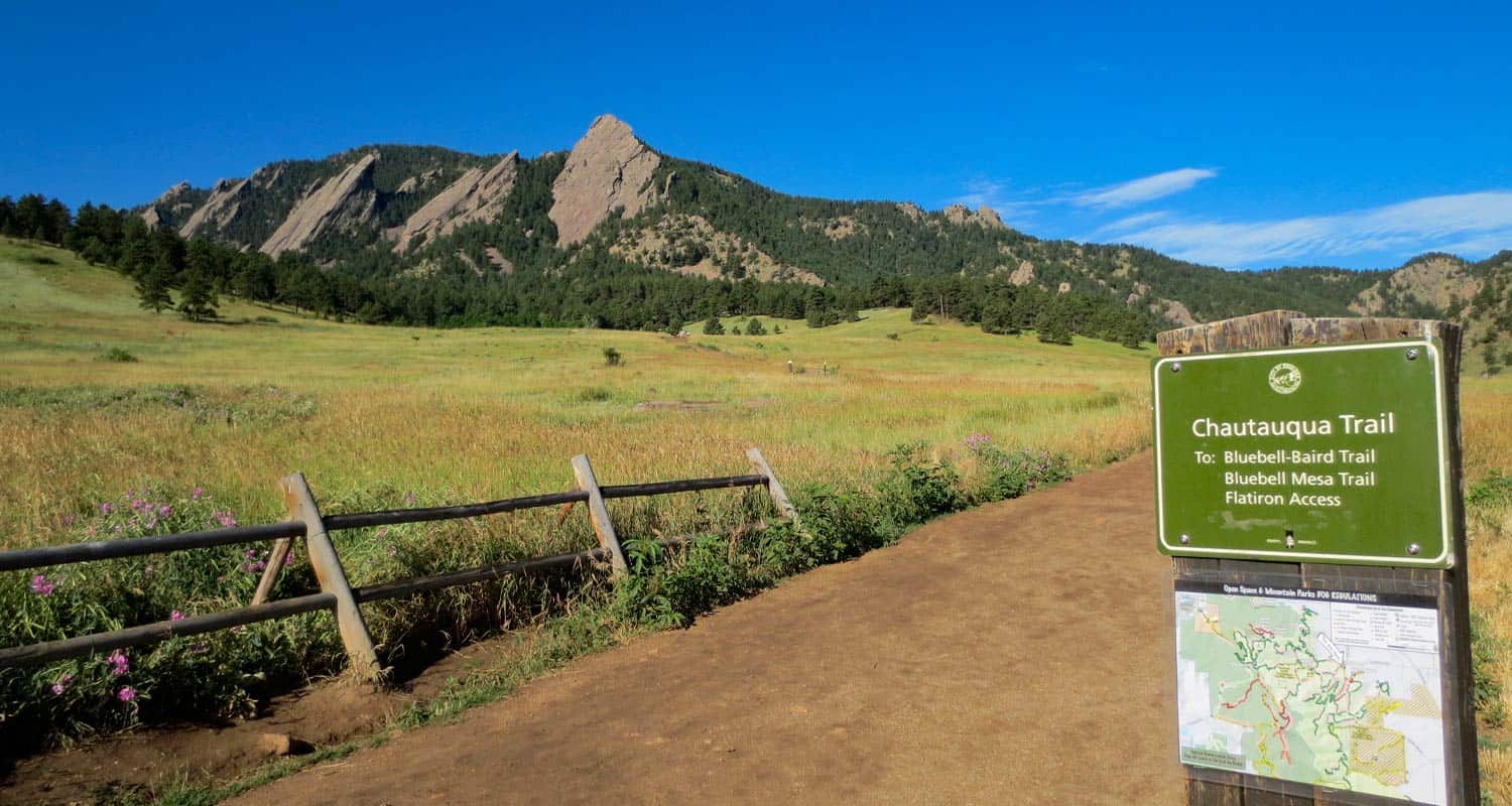
Flatirons at the entrance of Chautauqua Park in Boulder, Colorado
I love hiking Chautauqua Park because it's right down in the city of Boulder and the park provides access to all kinds of hiking options. Like Staunton, dogs are allowed in most areas of the park. You can grab good coffee or lunch after an early morning hike, or enjoy a sunset at places like Realization Point. My favorite is the hike up to the alcove behind the First and Second Flatiron. The trail to Royal Arch is a local favorite. If you are looking for something less demanding, consider Shanahan Ridge or the Enchanted Mesa Loop. There are a labyrinth of trails, so you can always just grab a map and explore. Remember, the sun goes down early and fast behind the mountains, so plan out your return. When hiking during these winter months, I always pack the 10 Essentials, my down coat, and have my headlamp in the top of my pack. Sign up for our Trail Dispatch email and get a download of our recommended packing list, trail meals ideas, and more hike recommendations.
St. Mary's Glacier is a favorite destination year round. The photo at the top of this post is of St. Mary's Lake and you can see the glacier, complete with ski trail marks, on the glacier just above the lake. It's just a 1.7 mile round-trip hike, but don't let the short distance deceive you. You're back in the high country of Colorado and weather conditions can change super fast. So, be prepared. Get to the trailhead early on the weekends, and by early, I mean before 7AM, and have cash for the parking fee. See our St. Mary's Glacier trail profile for more details.
Along the Mesa Trail South of Boulder, Colorado
I love the Marshal Mesa area on the South end of the Flatirons. The Marshall Mesa trail runs along the base of the flatirons below Bear Peak and offers some beautiful scenery without the demand of steep grades. The parking area is along the same road that leads into Eldorado Canyon, which is another wonderful place to visit this time of year. The trails in the Canyon because of the topography are going to have snow and mud patches, so bring your trekking poles or pack some traction devices for your backpack. See our Eldorado Canyon hikes page for several trails to explore.
The Walker Ranch Loop, or just the top end of it at Eldorado Falls, is a great option for hiking with the dog and friends. The loop is longer and more demanding, but a wonderful way to spend the day with a companion just talking and taking in the beauty of Colorado. North from the Marshall Mesa Traihead along 93 is the Flatirons Vista Trailhead. We have profiled a 1.9-mile and 3.3 mile set of loop hikes that give you the grand views of the Flatirons on these broad rolling meadows of this area North of Denver.
A CO State Parks pass is required for Eldorado Canyon and there are access fees at the Marshall Mesa and Flatirons Vista Trailheads. See the hike profiles above for details.
More Adventurous Hikes
If you are looking for a more demanding workout and possibly some peak-top views or destination hikes, then here are a few trails I'd recommend for this time of year. Before taking off into the woods though, be sure to review our 10 Winter Hiking tips. Safety and smarts are always important--they are critical during these Winter months however because of the cold and the unpredictable weather.
View from the peak of Carpenter Peak
-
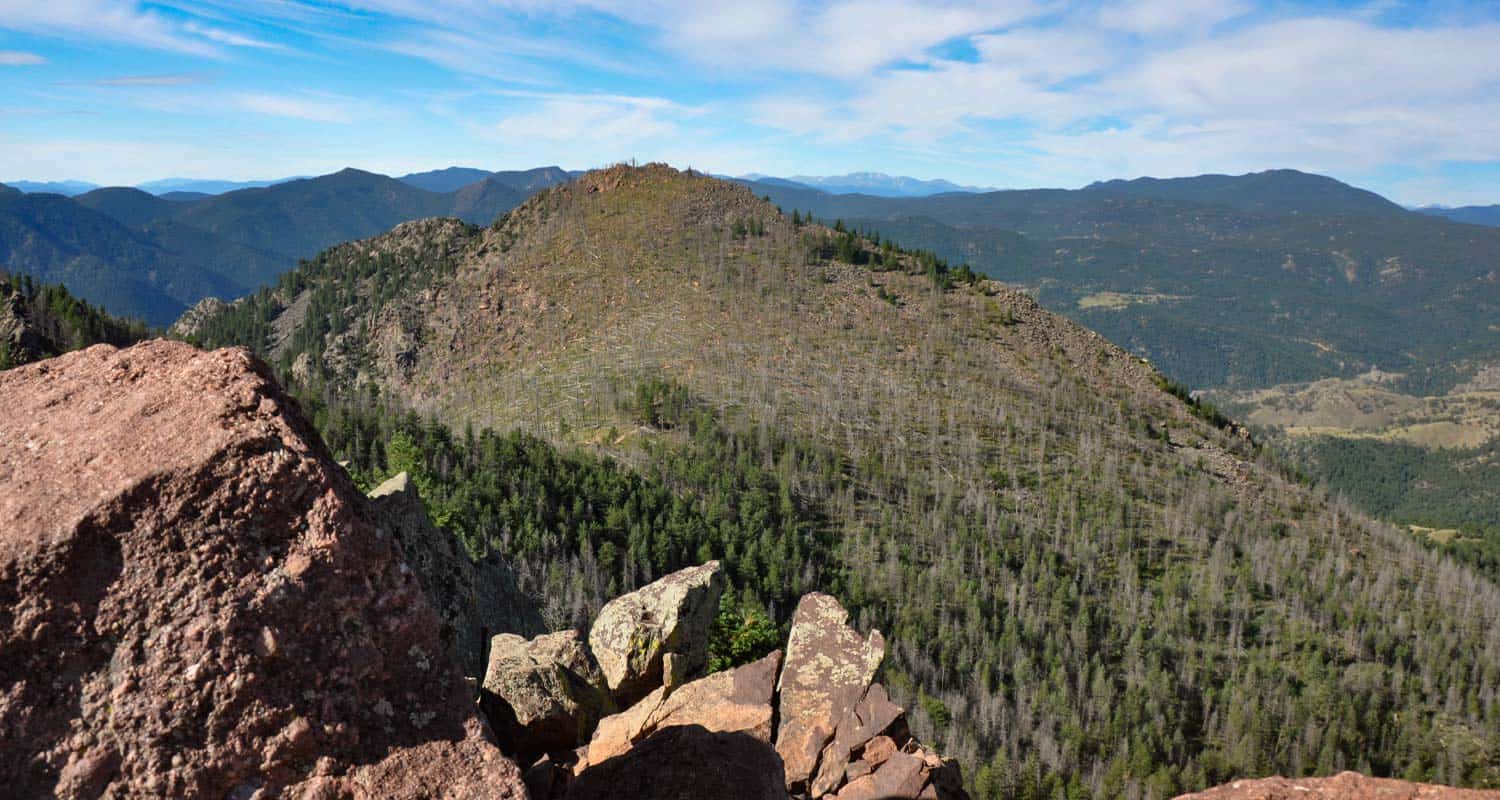
Carpenter Peak in Roxborough State Park:
This is a great 6.2 mile, out-and-back trail South of Littleton, Colorado. I like this trail because you get views to the West of the Front Range, and you get to look down on the beauty of Roxborough State Park and it's gigantic fins of red rock. The only drawback is that dogs are not allowed in the park.
-
Windy Peak in Golden Gate Canyon State Park:
-
South Boulder and Bear Peaks:
-
Rocky Mountain National Park:
You can bring your dog on this one. The hike up to Windy Peak is a 6.4 mile loop hike to views out to the snow-capped peaks in the West. There are lot of other hike options in Golden Gate Canyon State Park, so check out our trails page for the park for more ideas.

Hiker at the top of Bear Peak
These two hikes are more demanding and can be made into a 9-mile loop hike where you bag both peaks on the same hike. Bear Peak has a little knife edge that requires a few moments of hand-over-hand, and the summit of South Boulder Peak requires a bit of scrambling, but most of the hike is moderate. Bring plenty of water as you'll need it.
Ouzel Falls in the Wild Basin of RMNP
This shoulder season can be a perfect time to visit RMNP because the crowds have subsided. Be ready for muddy trails and snow, but on those sunny warm weekends, the Wild Basin and Bear Lake areas will be quiet escapes from the city. I'd recommend giving the RMNP ranger offices a call to get a feel for the weather or checking out the RMNP Trail Conditions page Traction devices and trekking poles will make your hike in these winter conditions way more enjoyable. I'd recommend checking Calypso Cascades and Ouzel Falls in the Wild Basin area. The trailhead changes in winter months for the Wild Basin, so be sure to add the additional mileage to your hike because you'll be starting from the Winter Trailhead. In the Bear Lake and Moraine Park area, I'd recommend Fern Falls, an easier hike to Alberta Falls or Emerald Lake, and the more demanding hike up to The Loch.
Waterfall Hikes in November
The best time of year to explore the waterfalls near Denver is during the early Summer months of May, June, and July. However, the waterfalls wills surge over sheets of ice during those warm days following a good snow. It's going to be pretty hit or miss, but if you are looking for a waterfall hike near Denver during these early winter months, I'd recommend a few.
-
Boulder Falls:
-
Elk Falls:
-
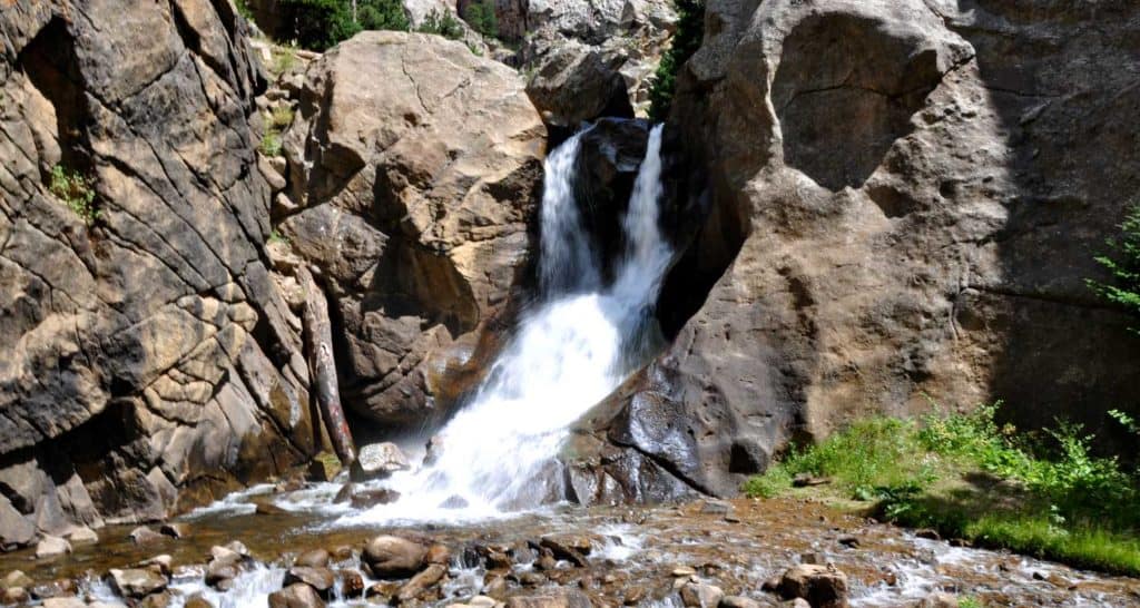
Alberta Falls:
Right off of the road, so really no hike at all. This is a great year-round waterfall just 50 minutes North of Denver. Pictured above.
A longer hike in Staunton State Park to the tallest waterfall near Denver.
A short 1.6 mile hike from Bear lake in Rocky Mountain National Park.

7 Hikes Near Denver for Your Fourth of July Weekend
7 Hikes Near Denver for Your Fourth of July Weekend
Are you looking forward to hike this Fourth of July Weekend? Getting up into the mountains near Denver is a great way to cool off during the Fourth of July weekend. Colorado's wildflowers are in their glory and the mountain streams are still gushing with melt-water alongside the trails. But you probably don't want to break the bank paying for fuel; and if you are like us, you've got some events to attend close to home. So, we've come up with 7 great hikes that are close to Denver, and hopefully (we can't make promises) won't be too crowed on the holiday weekend. Be sure to download our Free Hiking Guide to help you prepare and pack smart for your dayhikes.
- Ample Parking: The 4th of July Weekend means some of the highest traffic on the trails in Colorado. School is out, and it's the height of vacation season. So, while I'd rather direct you first to some wonderful features like waterfalls and peak-top views, getting a parking space is probably priority number one this weekend.
- Enjoyable with Friends & Family: On holiday weekends we are often out hiking with friends and family. I tried to put together a set of hikes that are not too difficult and open up spaces for conversation as we all hike along the trail together.
- Close to Denver: This set of hikes are all within 90 minutes of Denver, Colorado--and most are within 60 minutes of downtown. If you want to explore hikes that are further from town, check out our Hikes Worth the Drive page.
-
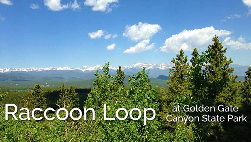
Raccoon Loop Hike in Golden Gate Canyon State Park
-
Eldorado Falls Hike at Walker Ranch
-
Clear Creek Trail in Downtown Golden
-
Ouzel Falls Hike in Rocky Mountain National Park
-
Four Lakes and Waterfall Loop Hike in Rocky Mountain National Park
-
Trading Post Trail at Red Rocks Park
-
Elk Range Trail at Centennial Cone Park
Distance: 2.5-mile Loop
Drive Time from Denver: 1 Hour
Difficulty: Easy
The Raccoon Loop in Golden Gate Canyon State Park is a new family favorite. It features lots of shade, and easy to moderate trail difficulty, and incredible mountain views of the Indians Peaks. Parking at Panorama Point is limited, but this hike can also be started from the Reverend's Ridge Campground parking area, which offers a lot more parking (though this weekend will be pretty busy up there). As with all these hikes, go early to avoid the heat of midday and find a good place to park. If you are looking for more loop hikes near Denver, check out our our page with a few other nearby loops.
![]()
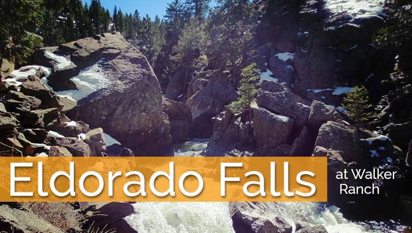
Distance: 2.5 miles Round Trip
Drive Time from Denver: 1 Hour
Difficulty: Moderate
Eldorado Falls is a small cascade waterfall found along a stretch of the larger Walker Ranch Loop. It's a 2.5 mile round-trip hike from the nearest parking area, but the Walker Ranch loop can be accessed from several other trailheads. We are including it in this post because this trailhead sees less traffic, and there are other trailhead options down the road. Do be courteous to the folks who live in this residential area by not parking along the narrow dirt road. They would great appreciate it. After 8am, the drive over the Flatirons necessary to get to this trailhead will likely have some congestion because Flagstaff road has so many hikers crossing it and folks driving slow to take in the sites. You can check the google map/driving directions on our full trail profile to see traffic and drive times. For a full list of Waterfall hikes, you can explore our many pages of Waterfall Hikes Near Denver page.
![]()
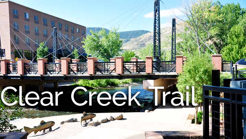
Distance: 1.8 miles Round Trip
Drive Time from Denver: 30 Minutes
Difficulty: Easy
The Clear Creek trail in Golden offers a great opportunity for families with strollers and groups to hike alongside one another. There are little "beach" areas where kids can play in the shallow water, and watch the tubers and kayakers going by. With water levels high and currents swift this time of year, be cautious around the water's edge. At the time of this writing (7/2016) the City of Golden has certain restrictions posted for tubers because of the high water levels. See our Clear Creek hike profile page for full details, including directions to several parking areas. It's not your classic backcountry hike, but it's a great weekend adventure. For more hikes near Golden, Colorado, check out our Hikes Near Golden page.
![]()
Distance: 5.4 miles Round Trip
Drive Time from Denver: 1 Hour 30 Minutes
Difficulty: Moderate
Though Ouzel Falls is only 40-feet high, it may be one of the most beautiful in Rocky Mountain National. On this 5.4 mile round-trip hike, hikers will take in several waterfalls as they hike along the course of North St. Vrain Creek. We are including a couple trails, Ouzel Falls and the next hike, which are located in Rocky Mountain National Park in this set just because they are so gorgeous this time of year. But, these are probably not good options if you arrive after 7:30 AM. From May through mid-August, we recommend always getting there early. Buy a park pass online before you go. For our full set of over 50 hikes in Rocky Mountain National Park, explore our Rocky Mountain National Park Trails pages.
![]()
Distance: 6.4-mile Loop
Drive Time from Denver: 2 Hours
Difficulty: Moderate
This second hike in Rocky Mountain National takes hikers along some well-traveled trails on a 6.4 mile loop to visit four sub-alpine lakes and Alberta Falls. For more hike options in RMNP, be sure to check out our Waterfall Hikes in Rocky Mountain National Park and Lake Hikes in Rocky Mountain National Park pages.
![]()
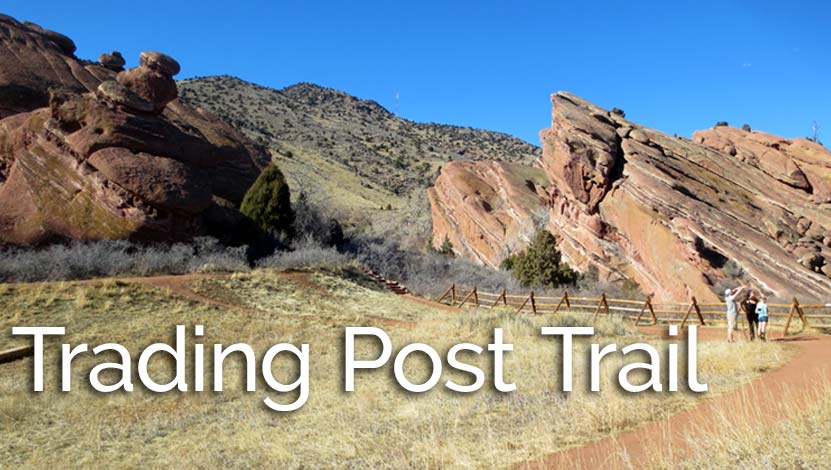
Distance: 1.4-mile Loop
Drive Time from Denver: 30 Minutes
Difficulty: Easy
I recommend the Trading Post Trail at Red Rocks more than any other hike in the Denver Area. I have three reasons: The hike is beautiful, it's short, and it's super close to Denver. There is more than just the trail to explore. Be sure to take in the amphitheater and the cave just north of the amphitheater. You'll find the cave info on another trail profile for the Red Rocks Trail below. This is a great hike for families with kids and the perfect hike for family who are visiting for the holiday weekend. There are a lot of hikes near Denver featuring red rock formations--more than you might guess--so, check out our Hikes with Red Rock Formations page for a selection of several more trail options.
![]()
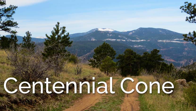
Distance: 6.6 miles Round Trip
Drive Time from Denver: 40 Minutes
Difficulty: Easy
A sunrise or sunset hike up at Centennial Cone may be your best shot at some solitude. Rolling green mountainsides, herds of elk and deer, and views to the distant mountains all are great reasons to make the 45 minute drive to this Jefferson County Park. If you are looking for more hikes with Mountain Range views near Denver, explore our Mountain Range View Hikes page.
![]()
Map of 7 Fourth of July Weekend Hikes Near Denver
Elk Falls - New Waterfall Near Denver
Elk Falls in Colorado's new Staunton State Park opened to the public in 2013. This highest waterfall near Denver had been unknown to most, and inaccessible, except to a few. Now it's an adventure waiting for able hikers! If you are a fan of waterfall hikes and you live near Denver, you'll know that it's kind of slim pickings; most of the best waterfalls in Colorado require driving beyond the Front Range, or into Rocky Mountain National Park. Elk Falls, is just 50 minutes from Denver! The 3700 acre Staunton State Park offers incredible hiking, rock climbing, and beautiful rock formations - all making for some great Colorado day hikes. Explore the full Elk Falls hike profile below for trail map, driving directions, and many of the details you need to enjoy this adventure in Staunton State Park.
Trail Snapshot: Elk Falls Overlook Hike at Staunton State Park
| Hike Distance | 10.8 miles Round Trip |
|---|---|
| Difficulty | Moderate to Difficult |
| Duration | Approx 4-6 hr |
| Trail Type | Out and Back |
| Starting Elevation | 8200′ |
| Elevation Gain | +900′ |
| Seasons | All Year |
| Dogs | Allowed On Leash |
| Hike Trail Map | Click for a Map of Staunton State Park |
| Denver Drive Time | 45 min |
| Driving Directions to Staunton State Park | Click for Google Map |
| Town Nearest Hike | Conifer, Colorado |
| Beauty | Waterfall, Rock Formations, Meadows, Pine Forest, Ponds, Hummingbirds, and Deer |
| Activities | Hiking, Photography, Mountain Biking (on many trails) |
| Fee | Entrance Fee or State Parks Pass Required |
Parking & Trailhead Information for Elk Falls in Staunton State Park
The parking and trailhead area are immediately noticeable after the park entrance. On weekends, things can really back up at the entrance due to the number of visitors and those who need to purchase a parks pass. If you don't have your yearly parks pass, you can pick one up at a local Kings Soopers grocery store at the customer service area. Because your hike will begin with the Staunton Ranch Trail, the main artery of Staunton State Park, just look for the main trail which heads to the center of the park. If you've parked at the lower parking area, you'll have two Trailheads before you, the Staunton Ranch and the Mason Creek trailheads. Be sure to choose the Staunton Ranch Trail. The Elk Falls overlook can be reached by starting on the Mason Creek Trail, but its a significantly longer and more difficult 17 mile loop hike. Maps are available at the entrance and highly recommended for this hike.
The Hike: Elk Falls in Staunton State Park
The Staunton Ranch Trail leads hikers into the heart of Staunton State Park, through stands of ponderosa pine and past the Staunton Rocks climbing area. After 3.3 miles, the trail ends at a trail intersection with three new trails. The most direct route to the Elk Falls overlook is to choose the Bugling Elk trail which follows a small creek for 1.1 miles until it arrives at Elk Falls Pond, a good place to stop and Fish.
At Elk Falls Pond, a third trail, the Lion's Back Trail, leads another 1 mile up to the Elk Falls Overlook. Atop a highpoint, hikers will gain great views down to where Elk Falls drops from the cliff face into a beautiful mult-tiered waterfall. Out and Back, its a total of 10.8 miles.
Colorado State Parks is working on an Elk Falls Trail project that will eventually open access to the base of Elk Falls. This is projected to be completed and opened to the public in the Fall of 2016.
If you'd like to add a more challenging return segment to your hike and see new areas of the park, hikers can pick up the Marmot Passage trail until it meets with the hiker-only Scout Line trail, which eventually leads back to the main Staunton Ranch trail. This return route will add additional mileage, difficulty, and time to the hike back. Consult the trail map and topo lines to get a feel for the demanding nature of this option.
Tips & Resources for Hiking To Elk Falls Overlook:
- TIP: Getting into the park can be slow at times, so be prepared to wait at the entrance on busy weekends.
- Trekking Poles & Traction Devices are Recommended in Spring and Winter: During this time of year, there can be patches and even longer segments of snow and ice on the trail. Because of this, we recommend Trekking Poles and/or Traction Devices for this trail.
- Trail Map for Staunton State Park: Trail Map Link
- Packing List: Always pack the 10 Essentials. Download our Hiking Guide to get list and dayhiking packing checklist.
- Colorado Road Conditions: Colorado Road Conditions
- After the Hike: Crow Hill Cafe in Bailey
- We would like to express our gratitude to Bill Chopp for sharing such an amazing photograph of Elk Falls.
Weather
Map & Driving Directions
Click for Driving Directions

Looking for more waterfalls near Denver? Explore our more than 50 Colorado Waterfall Hikes, our favorite Waterfall Hikes in Rocky Mountain National Park, or 7 Waterfalls within One Hour of Denver.
4 Great Stroller Hikes Near Denver
Our children are not big enough to hike long distances yet. So, we usually we put the kiddos in child carrier backpacks. When we can though, we try to break out the Bob Stroller and hit a local trail. Here are 4 trails close to Denver that work great with a stroller.
Criteria for these Denver Area Stroller Hikes
- Crushed Gravel or Paved Trail
- Great Views or Natural Features
- Accessibility
Click on the Maroon Links to get directions, trail maps, and hiking profiles.
#1 The Bluffs Loop South of Denver
 This 2.7 mile loop trail is one of our favorites, and probably is the hike we do the most. The Bluffs provide panoramic views of Colorado's Front Rang and of downtown Denver. We try to go around 7pm when the sun is setting. You're likely to see deer and meadowlarks along the trail. Right now, we just hike it, but other will use this as a challenging run with the stroller.
#2 Bear Creek Trail at Lair O' The Bear Park

This 1.7 mile stretch of the Bear Creek Trail is accessed at Lair O' the Bear park. We've observed from our O'Fallon Park Hike that the trail stretches further west.We doubt that all 6.3 miles are stroller accessible, but there is definitely more to explore. The trail follows bear creek and goes in and out of the trees, so you get a bit of shade. Be alert for mountain bikes as it's one of the more popular mountain biking trails near Denver.
#3 Fountain Trail at Roxborough State Park
 This trail is not paved but all 2.7 miles are considered handicap accessible, so it makes for a great hike with your stroller. Of the four hikes, this is the most beautiful. It's also great for birdwatching as well as giving the kids a chance to see deer, as they are used to the human traffic in the park.
#4 Clear Creek Trail in Golden
 We'll admit that this last one isn't that much of a "real hike." But it makes for a great lazy weekend morning. The trail runs along Clear Creek and there is always something to entertain: swallows playing under the bridge, kayakers and water rescue training, and the summer farmers market. We love to take a picnic, and throw a blanket down in Parfet Park or grab coffee at the Windy Saddle Cafe which has a great little play room for the kids.
Disclaimer: These hikes are for strollers that are designed for jogging and trails. The Clear Creek trail is paved and would be great for almost any stroller.
3 Easy Winter Hikes
It's hard to just get out of the house on a Saturday morning. Add a bit of cold weather, scraping the frost off the car, getting the family bundled up, and it's just that much harder to get out and enjoy nature. So, I've looked over a few of our favorite local trails and decided on three Denver hikes that are really easy to get to and have a lot of "bang for the buck."
Criteria for these Denver Winter Hikes:
- Accessible in the Winter
- Mostly Level Trails
- High on the Beauty & Wildlife Scale
Three Easy Winter Hikes
#1 - South Valley Park Trails
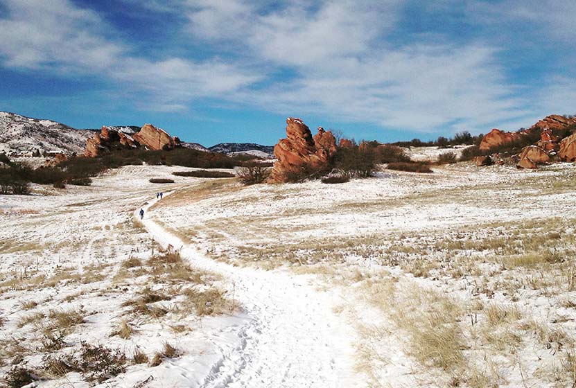
Red Rock, Deer, and beautiful meadows are the draw here. This hike is on the south-west side of Denver in Littleton, Colorado, and very accessible from 470. When there is good snowfall, it would be perfect for snowshoeing and cross-country skiing. This Denver trail has been one of our favorite sunset hikes because of the way the setting sun lights up the red rock. Click Here for the Full Trail Profile.
#2 - Lakes Loop Trail at Rocky Mountain Arsenal
It might sound kind of strange to say, "We're headed over to the arsenal for a hike", but the Rocky Mountain Arsenal has been turned into what has been called an "island of habitat" in the middle of the city. There are lakes, Bison, waterfowl, deer, burrowing owls, all just about 7 miles east of the center of Denver. The Rocky Mountain Arsenal features several hikes, and we profile a beautiful one at the trail page for the Lakes Loop Hike. Finally, be sure to check their seasonal hours at their website.
#3 - Roxborough State Park Hikes
When you enter Roxborough State Park, it is a bit like entering a different world. There is a real sense of being down and inside of it because the towering red rock creates such a unique space. This is one of the best winter hikes near Denver because you are often shielded from the wind, and the trails of the valley floor are fairly level. If there has been a lot of snow, we would suggest you call the park office to be sure that the road is clear. We have a couple trail profiles in the links below, but the park offers several other options as well.
If you have any hikes that you would add to the list of Best Easy Hikes Near Denver, then post a comment. If we haven't profiled them yet, we will.
Happy Colorado Hiking!
Photo Credits: Thanks goes out to Adam Meek and the US Fish and Wildlife service for photos in this post.