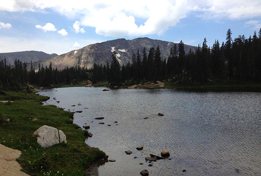
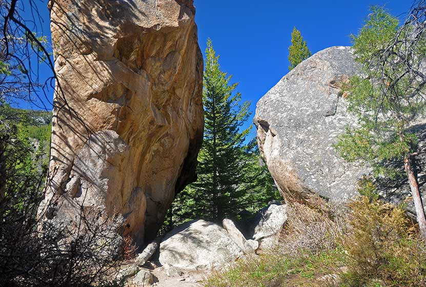
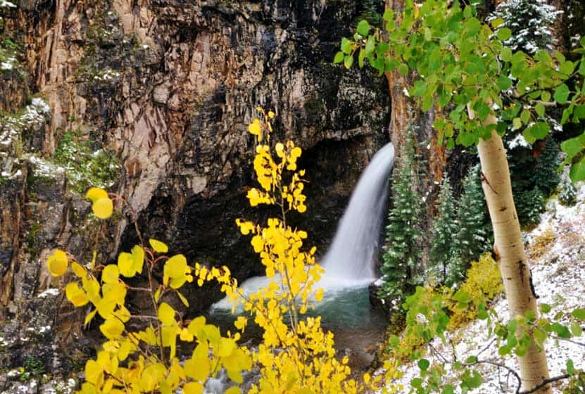
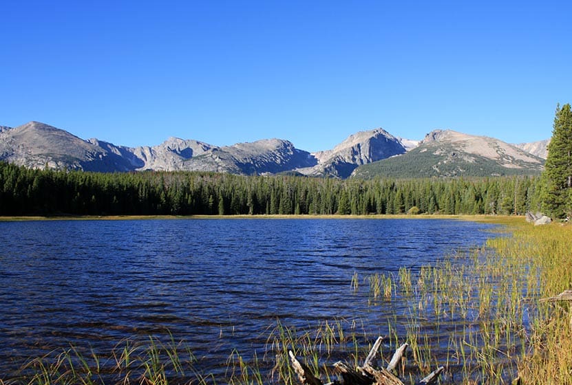
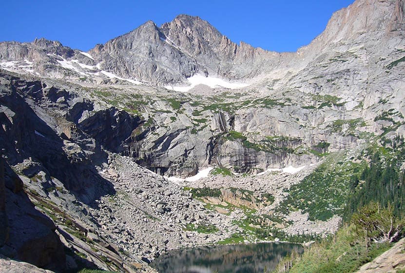
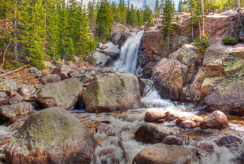
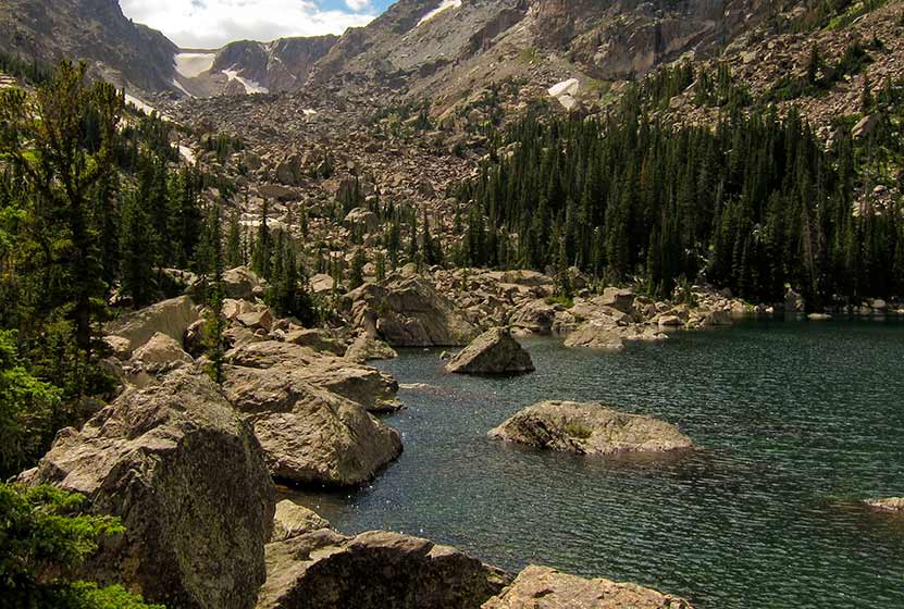
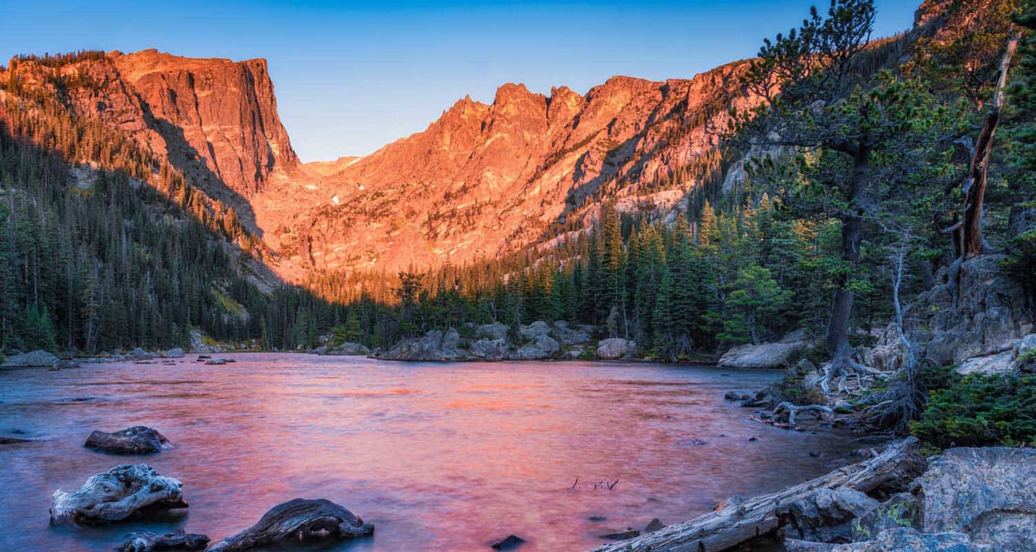
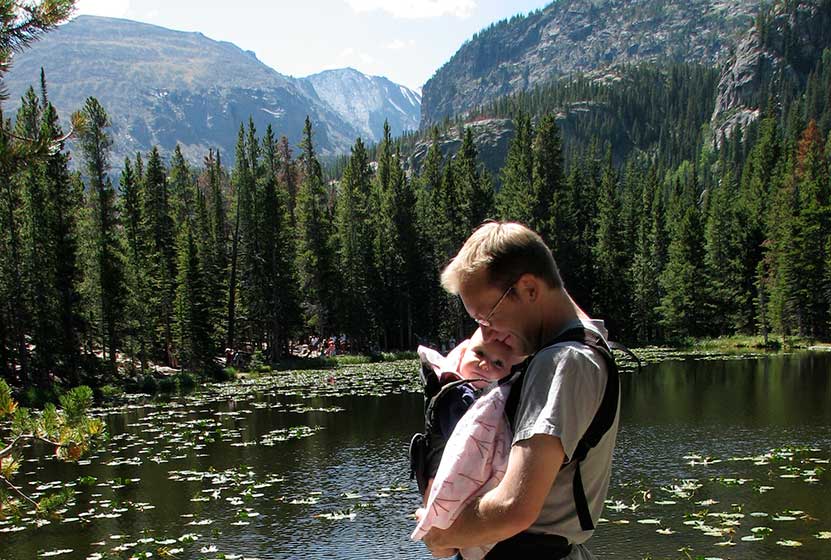
Lion Lake in Rocky Mountain National Park
The Lion Lake #1 in Rocky Mountain National Park boasts a dramatic alpine landscape hidden away in the northwestern corner of the Wild Basin. The trail to this high-mountain lake passes several waterfalls and offers access to other lakes and surrounding peaks. Because the Lions lake is more remote, a trip to it may require an overnight stay at one of RMNP's backcountry camping sites. Explore the full Lion Lake #1 hike profile below for trail map, driving directions, and more tips and details to help you enjoy this adventure in Rocky Mountain National Park.
Note: Rocky Mountain National Park now requires timed entry permits from May 27th through October 10th. See the RMNP permits page for more information.
Trail Snapshot: Lion Lake #1 in Rocky Mountain National Park
| Hike Distance | 14 miles Round Trip |
|---|---|
| Difficulty | Difficult |
| Duration | 7-10 hr Round Trip |
| Trail Type | Out and Back |
| Starting Elevation | 8566' |
| Elevation Gain | Approx. +2565' |
| Seasons | Spring through Fall |
| Dogs | Prohibited in RMNP |
| Hike Trail Map | Click for a Map of Lion Lakes RMNP |
| Recommended Trail Map | National Geographic Trails Illustrated Map |
| Denver Drive Time | 1 hr 30 min |
| Driving Directions to Wild Basin Trailhead | Click for Google Map |
| Driving Directions to Winter Recreation Parking for Wild Basin Hikes | Click for Google Map |
| Town Nearest Hike | Allenspark, Colorado |
| Beauty | Lake, waterfall, mountain views, meadows, river, wildlife: Abert's squirrel, elk, deer, moose, bear; wildflowers |
| Activities | Picnicking, hiking trails, snowshoeing, horseback riding, backcountry camping (with a permit), photography |
| Fee | Park Pass Required |
Parking & Trailhead Information for Lion Lake
The southeast corner of Rocky Mountain National Park boasts one of the loveliest portions in the park known as the Wild Basin. The Wild Basin Trailhead is located just 15 minutes outside of Allenspark, Colorado along Highway 115. There is a ranger station at at the Wild Basin Trailhead with toilets and drinking water available.
In the winter (October-May), Hwy 115 may not be plowed to the trailhead, and hikers will need to park their vehicles at a winter parking lot for Wild Basin hikes. Be aware that hikes from the winter parking lot add on another 3 miles of hiking (one-way). There are other small parking areas, like the Finch Lake Trailhead, that may be accessible and allow hikers to park closer to the Wild Basin Trailhead. It's important to know that Hwy 115, though titled a "highway", is a maintained dirt road, which means that it can be used by 2WD vehicles. However, after heavy rains and other severe weather, its quality may degrade until it is repaired. 4WD may be needed when snow is on the ground.
The Hike: Lion Lake #1 Trail in RMNP
It's seven miles one-way to Lion Lake #1, which requires that hikers get a very early start, or build this hike into a multi-day camping trip in Rocky Mountain National Park. If you are considering camping, there are several reservable backcountry camping spots in the Wild Basin area, and camping permits can be obtained through the RMNP Wilderness offices.
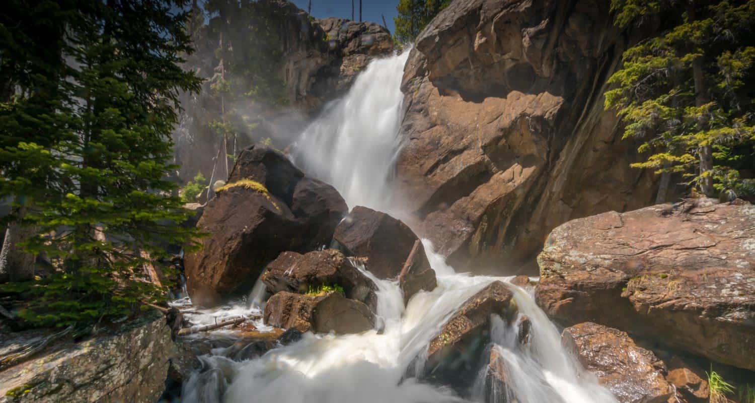
The trail begins at the Wild Basin Trailhead, and takes hikers through the central area of the Wild Basin, past three sets of cascade waterfalls, then up into the highest reaches of this lesser visited section of the National Park.
The first waterfall, Copeland Falls, is just 0.4 mile into the hike. For details on accessing both the lower and upper leaps of Copeland Falls, be sure to explore our full trail profile for Copeland Falls.
The trail then traces the path of North Saint Vrain Creek, until it encounters a junction. The trail to the right leads past a series of backcountry campsites mentioned above, and is a slightly more direct route to Lion Lake #1. However, the left-hand trail is not much longer and leads to two more waterfalls, Calypso Cascades and Ouzel Falls. The rest of this trail profile will explain this route.
Having taken the left-hand trail, you'll cross a large log bridge spanning North St. Vrain Creek. Pause when you hear the sounds of an unnamed cascade that can be viewed from the bridge area. Soon after the bridge, the trail will meet with a second trail junction at Calypso Cascades. Taking the right-hand trail, hikers will soon encounter the sight and spray of the cascades. Then trail will cross over another bridge at 1.8 miles, then things begin to get more challenging, as the trail weaves through a set of switchbacks to Ouzel Falls at 2.7 miles. Ouzel Falls, while not large when compared to Alberta or Fern Falls, may be one of the most stunning waterfalls in Rocky Mountain National Park.
After Ouzel Falls, the trail comes to a junction with the Bluebird Lake trail at 3.1 miles. However, the way to the Lion Lake passes by this junction and keeps going straight/northwest.
In approximately 1.5 mile from the Bluebird Trail junction, the trail makes a final split. The trail to the left leads up to Thunder Lake and Fan Falls. The right leads up to the Lion Lakes and is a hiker-only trail (no horses or pack animals beyond this point). Now you're entering the very heart of Rocky Mountain National Park.
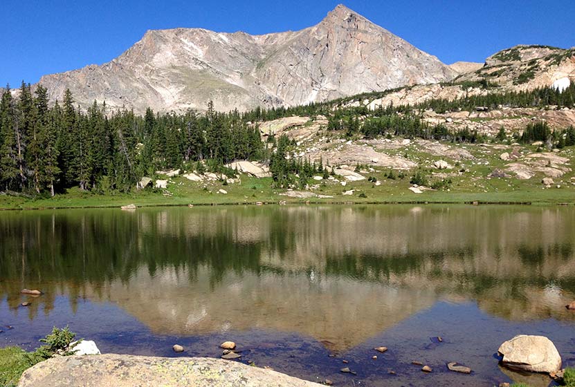
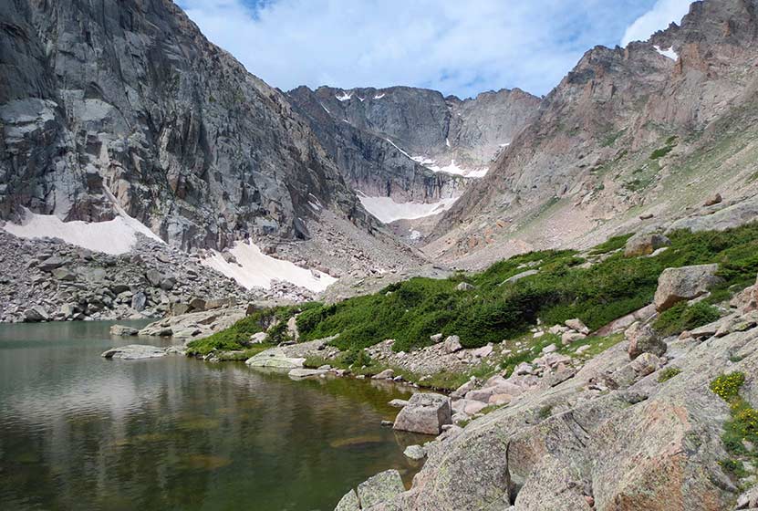
The trail now becomes undulating, with spots of level ground, meadows, boulders, and marsh. It's the kind of diversity that characterizes the beautiful high-country of Colorado. On the approach to Lion Lake #1, Mt. Alice comes into view with it's sheer rock wall and pyramid peak. Moving into the Lion Lakes area, beautiful meadows and marsh hold the delight of wildflowers, and the nuisance of mosquitos.
Following a social trail from the shores of Lion Lake #1, hikers can push on to the Trio Falls and Lion Lake #2. Because this next segment is on unmaintained trails in a remote section of the park, hikers should possess both land navigation skills, map, and equipment.

Tips & Resources for Hiking to Lion Lake #1 in RMNP
- TIP: There are food storage lockers available at the Wild Basin, Finch Lake, and Sandbeach Lake Trailheads. These are required for visitors staying overnight. Make sure there is nothing that smells good to bears left in your car (that includes air fresheners).
- Get there early: Parking may be somewhat limited as with many hikes in RMNP area and can get full even early in the morning.
- Camping: The Thunder Lake campsite and others along this route can be reserved through the Rocky Mountain National Park Wilderness Offices. Because this is an extensive hike in rugged country, it may be wise to make this expedition a part of a multi-day trip.
- You're in Bear Country: Black Bears live in the Wild Basin area and are active on the months of April through November. Be aware, and dispose of your food responsibly.
- Recommended Trail Map for Lion Lake Hike: National Geographic Trails Illustrated Map
- Packing List: Always pack the 10 Essentials. Download our Hiking Guide to get list and dayhiking packing checklist.
- Colorado Road Conditions: Colorado Road Conditions
- Photo: We would like to express our gratitude to Shea Oliver for sharing such amazing photographs of this hike to Lion Lake in RMNP.
- After the Hike: Rock Creek Tavern & Pizzeria
Weather
Map & Driving Directions
Click for Driving Directions

Fern Lake in Rocky Mountain National Park
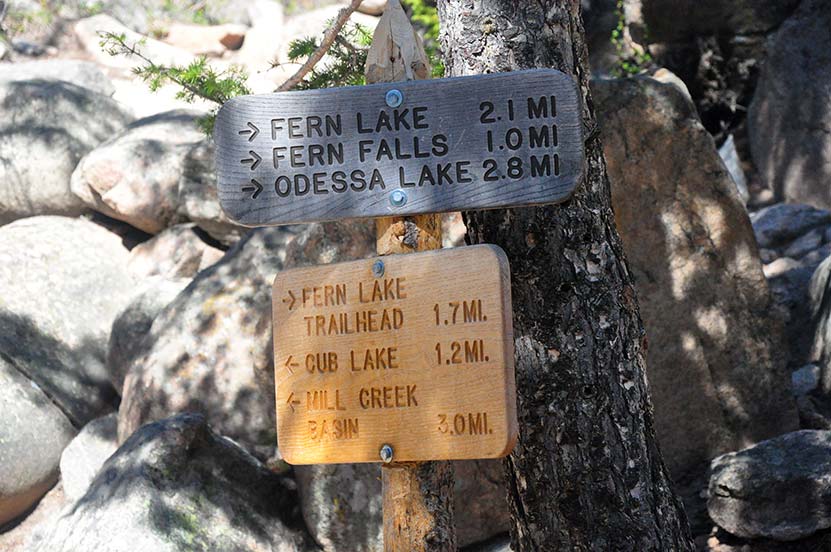
A hike up to Fern Lake begins at the Fern Lake Trailhead on the east side of Rocky Mountain National Park. Along the Fern Lake Trail, hikers pass through Arch Rocks, over a bridge at The Pool, and by three cascade waterfalls. Near the, you'll gain spectacular views of The Gable, Knobtop Mountain, Notchtop Mountain, and Little Matterhorn from its northern shore. Explore the full Fern Lake hike profile below for trail map, driving directions, and more of the details and tips you need to enjoy this adventure in Rocky Mountain National Park.
Note: Rocky Mountain National Park now requires timed entry permits from May 27th through October 10th. See the RMNP permits page for more information.
Trail Snapshot: Fern Lake in Rocky Mountain National Park
| Hike Distance | 7.8 miles Round Trip (from Fern Lake TH) |
|---|---|
| Difficulty | Moderate |
| Duration | Approx 4 to 5 hr Round Trip |
| Trail Type | Out and Back |
| Starting Elevation | 8155' |
| Elevation Gain | Approx. +1375' |
| Seasons | Spring through Fall |
| Dogs | Prohibited in RMNP |
| Hike Trail Map | Click for a Map of Fern Lake RMNP |
| Denver Drive Time | 1 hr 40 min |
| Driving Directions to Fern Lake Trailhead | Click for Google Map |
| Driving Directions to Fern Lake Bus Stop Parking | Click for Google Map |
| Driving Directions to Park & Ride Trailhead | Click for Google Map |
| Town Nearest Hike | Estes Park, Colorado |
| Beauty | Sub-alpine lakes, mountain views, river, wildflowers, aspen trees, ponderosa pine, waterfalls, wildlife: Abert's squirrel, elk, deer, moose, duck, bear |
| Activities | Picnicking, hiking trails, snowshoeing, fishing |
| Fee | Park Pass Required |
Parking & Trailhead Information for Fern Lake in RMNP
Parking is more limited in this area of Rocky Mountain National Park, and you'll likely have to park at the Park & Ride then take the shuttle to the Fern Lake Trailhead. You'll find driving directions above to The Fern Lake Trailhead (closest to this hike), the Fern Lake Bus Stop Parking area (very limited parking), and for the Park & Ride lot. See the RMNP Shuttle page for dates and times of service. Avoid parking along the road as this damages the roadside, and vehicles will be ticketed. If you park or are dropped off at the Fern Lake Bus Station, the hike from the station to the trailhead will add and additional .8 mile, one-way, to your hike.
The Hike: Fern Lake in RMNP
The hike up to the lake is a moderate one. The only demanding aspect is the round-trip distance of 7.8 miles. In the late-Spring and early-Summer, snow may still be on the ground, adding some difficulty to navigating the trail. However, most of the summer months, this is a pleasant hike with a significant amount of shade. The first trailside sight is a cascade tucked away in a gulch above the tail, Windy Gulch Cascades, which can be seen to the North (right) about 1/2 mile in.
The trail continues, following the Big Thompson River. At 1.5 Miles in, the trail weaves through several house-size boulders at Arch Rocks (pictured below).
Just a bit further at 1.7 miles in, a bridge crosses the Big Thompson River near the spot of its confluence with both Spruce and Fern Creeks. This area is know as The Pool. After crossing the bridge at The Pool, there is a trail junction. The trail up to the lake splits off to the right.
Just about 1/10th of a mile past The Pool, an unnamed set of cascades can be heard and seen to the right of the trail (pictured below).
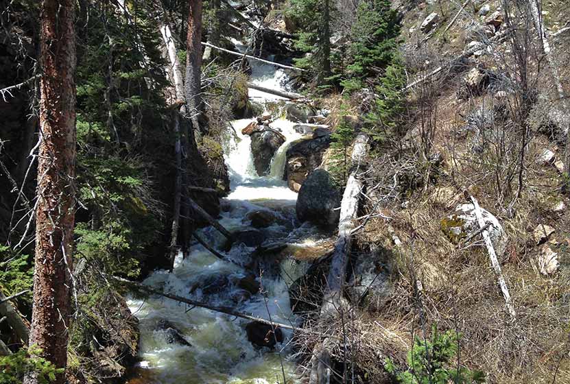
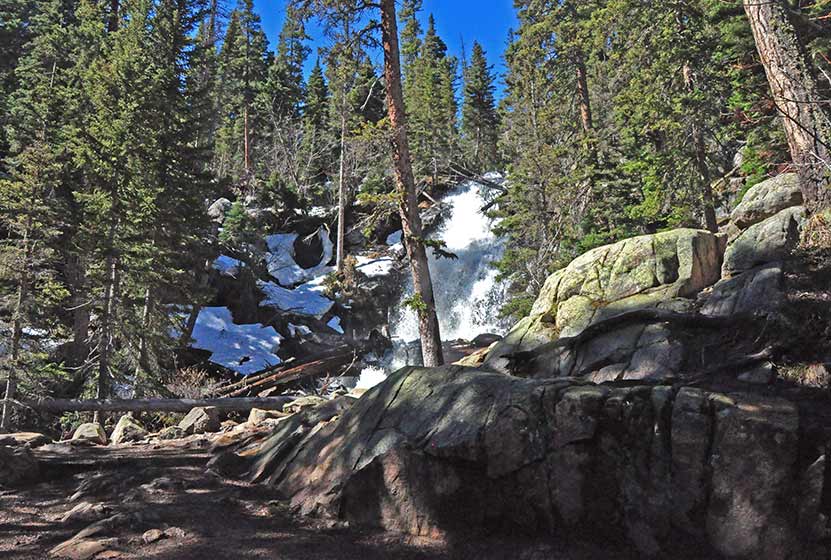
The next mile of trail continues up a set of switchbacks that make a steady climb through the forest to Fern Falls (pictured below).
After Fern Falls, there is just 1.1 mile left to the Lake. This is the segment that may still be packed with snow. At the Lake, hikers will find a panorama of sights. From here, a social trail can be traced down to Marguerite Falls, a small set of hidden cascades along Fern Creek and just below the Lake.
Fern Lake can be a jumping off point for several other destinations:
- Spruce Lake - .9 mile from Fern Lake (one-way)
- Odessa Lake - .7 mile from Fern Lake (one-way)
- Lake Helene - 1.8 mile from Fern Lake (one-way)
Tips & Resources for Hiking to Fern Lake in Rocky Mountain National Park
- TIP: It is advisable to arrive early as parking is limited. One may opt to ride a shuttle that drops you off at the trailhead.
- Trekking Poles & Traction Devices are Recommended in Spring and Winter: During this time of year, there can be patches and even longer segments of snow and ice on the trail. Because of this, we recommend Trekking Poles and/or Traction Devices for this trail.
- Bring Snack or Picnic Lunch: You'll need fuel for this hike. There are a lot of great spots along the shores of the Lake to sit down and enjoy a picnic lunch.
- Trail Map for Bear Lake Corridor: Trail Map Link
- Packing List: Always pack the 10 Essentials. Download our Hiking Guide to get list and dayhiking packing checklist.
- Colorado Road Conditions: Colorado Road Conditions
- After the Hike: Baba's Burgers & Gyros
Weather
Map & Driving Directions
Click for Driving Directions
Whitmore Falls Near Lake City Colorado
Whitmore Falls is a lesser-known waterfall deep in the mountains of Colorado. But, it is just a 1/10th of a mile hike from the pull-off along Engineer Pass Road. It's a great destination hike for those vacationing in the Lake City area and are looking to combine a scenic drive with a short waterfall hike. Explore the full Whitmore Falls hike profile below for a trail map, driving directions, and all the details you need to enjoy this adventure near Lake City, Colorado.
Trail Snapshot: Whitmore Falls Near Lake City, Colorado
| Hike Distance | 0.2 mile Round Trip |
|---|---|
| Difficulty | Easy |
| Duration | Approx 15 min Round Trip |
| Trail Type | Out and Back |
| Starting Elevation | 9970′ |
| Elevation Gain | Approx -50′ |
| Seasons | May-September |
| Dogs | Allowed On Leash |
| Hike Trail Map | Click for a Map of Whitmore Falls |
| Denver Drive Time | 6 hr |
| Driving Directions to Whitmore Falls, Colorado | Click for Google Map |
| Town Nearest Hike | Lake City, Colorado |
| Beauty | Scenic Drive, Waterfall, Historic Capitol City Landmark |
| Activities | Short hike, Scenic Drive |
Directions, Parking, & Trailhead Information
Whitmore Falls is off the beaten path, located about 1hr west of Lake City, Colorado along the Alpine Loop Scenic Byway. From Lake City, take 1st Street northwest, then a left onto the Alpine Loop Scenic Byway/20/Engineer Pass Road. This dirt road which follows Henson Creek is closed December through May. It may be closed or difficult to navigate depending on weather and how recently its been graded. Typically, it is navigable for 2WD passenger cars up to Whitmore Falls, but SUVs will fare best on this stretch of road.
Beyond Whitmore Falls, the road requires higher clearance vehicles more suitable to the difficult terrain, and drivers who possess off-road driving experience. See the Colorado BLM site for more information on the Loop. Whitmore Falls is located approximately 11 miles West of Lake City, and about 2 miles after passing the Capitol City Landmark, a set of restored historic buildings. Take your time, the drive and the scenery is half the adventure.
The parking area for Whitmore Falls is a small pulloff on the right/west side of the road. The falls trail should be marked with a sign on the opposite side of the pulloff. Because of the limited cell service in this part of Colorado, we advise that drivers not rely on phone-based map services that require a cellular connection. Take care in crossing the road to the other side where you can make your way down to the waterfall.
The Hike to Whitmore Falls

Tips & Resources for Hiking to Whitmore Falls
The drive to Whitmore Falls is more harrowing than the hike. It's just a short 1/10th of a mile from the roadside down to the falls. However, it is steep and the terrain is mostly gravel, much of it talus and loose scree. So, take care making your way down to the falls. Trekking poles will be a great aid in making it down the switchback trail to the overlook and to the falls. The trail can be located near the Whitmore Falls BLM sign.
Whitmore Falls is a plunge waterfall that launches over 40' from the rock cliffs surrounding Henson Creek. Depending on the flows of Henson Creek, the base of the waterfall provides close access for viewing the falls.
- TIP: Bring trekking poles to assist the short hike down the steep, gravel path.
- Take Your Time: Pack a picnic lunch, and enjoy the scenic drive. Hikers can stop and explore the Capitol City historic site before or after their visit to Whitmore Falls.
- Packing List: Always pack the 10 Essentials. Download our Hiking Guide to get list and dayhiking packing checklist.
- Colorado Road Conditions: Colorado Road Conditions
- Photo: We would like to express our gratitude to Dan Parker for sharing such an amazing photograph of this hike.
- After the Hike: Lake City Cafe
Weather
Map & Driving Directions
Click for Driving Directions See More Detailed Driving Directions Above
Monarch Lake Loop Hike
The Monarch Lake Loop is a perfect family hike that leads 4 miles through shaded forest, across creeks, and along the shore of the lake. It's one of the more diverse, but easy, hikes in the area. Monarch Lake is a popular destination for canoeing, kayaking, and access to the Indian Peaks Wilderness area. Explore the full Monarch Lake Loop hike profile below for trail map, driving directions, and many of the details you need to enjoy this adventure in Grand County, Colorado.
Trail Snapshot: Monarch Lake Loop, Colorado
| Hike Distance | 4 miles |
|---|---|
| Difficulty | Easy |
| Duration | Approx 2-3hr |
| Trail Type | Loop |
| Starting Elevation | 8400′ |
| Elevation Gain | Approx +300′ |
| Seasons | All Year, Road open from June 16 to Nov. 14 |
| Dogs | Allowed On Leash |
| Hike Trail Map | Click for a Map of Monarch Lake Loop |
| Denver Drive Time | 2 hr 50 min |
| Driving Directions to Monarch Lake, CO | Click for Google Map |
| Town Nearest Hike | Granby, Colorado |
| Beauty | Lake, shaded forest, wetlands, wildlife: moose, elk, deer, fox, waterfowl |
| Activities | Hiking, canoeing, horseback riding, photography, fishing |
| Fee Required | ANRA Day Use Fee |
Parking & Trailhead Information for Monarch Lake, Colorado
Following the driving directions in the above trail snapshot for Monarch Lake, the road will end at the Monarch Lake Trailhead. Here, you'll find parking spaces for about 40 vehicles. The parking area fills fast and cars and trucks often line both sides of the road to the trailhead. An Arapahoe National Recreation Area day use pass is required and can be purchased at the kiosk at the Arapahoe Bay Pay Station. This pay station is located shortly after you turn onto County Hwy 6 and before crossing over the dam. While Monarch lake is open in the winter, and Hwy 6 is plowed, the approximately 1 mile final segment of road that leads into the trailhead is closed from Nov. 15 to June 15. Because of this, hikers will have to park and snowshoe, cross-country ski, or hike in to the trailhead.
The Hike: Monarch Lake, CO
From the trailhead, a shaded tunnel of trees leads down a short gravel path to the Wilderness Information Cabin. Here you can pick up trail maps and information about hikes up into the Indian Peaks Wilderness area. The trail description here is of hiking the Monarch Lake Loop in a clockwise fashion. Begin on the Cascade Creek trail #N1. This will follow the shoreline of the lake and soon enter the forested area along the Northern end of the lake. After approximately 1 mile, the landscape changes and enters a wetland marsh. Keep your eyes peeled for moose and other wildlife here.
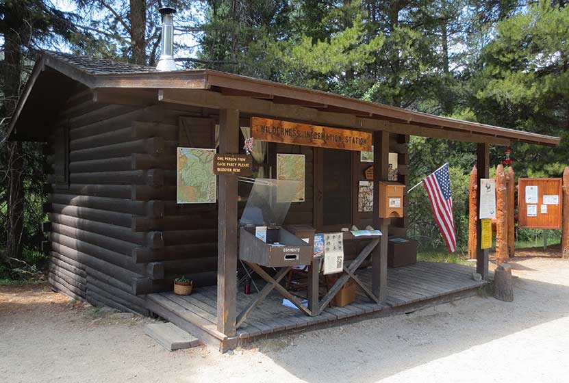
Wilderness Info Cabin at Monarch Lake
After 1.5 miles on the Cascade Creek Trail, the loop will be continued by taking a right onto the Arapaho Pass Spur Trail. This will head south, crossing Buchanan Creek, then Arapaho Creek. Here, after .8 mile, the spur trail ends and the Arapaho Pass trail begins. This last segment on the Arapaho Pass trail #N6 is 1.7 miles long.
Because of the pine beetle kill, there are many dead trees throughout the Monarch Lake Loop hike. Be alert for falling trees, especially when gusts of wind blow through. Hikers may also encounter deadfall across the trail. Be careful going under any fallen trees as they are often unstable and may only be supported by a few small, dead branches.
The hike continues on the south shore of the lake, passing an old, rusty steam engine. These "steam donkeys" were used to pull logs down out of the mountains back in the logging camps of the 1800's. After the steam engine, the trail will cross two more creeks, and finally make its way across the dam at the northwestern end of the Lake.
Because this hike is so perfect as a family outing, or for visiting family and friends, we recommend the following day trip:
1) Leave early (take breakfast with you) and arrive at the trailhead at or before 8AM (better chance of seeing wildlife and better parking)
2) Hike Monarch Lake
3) Drive over Trail Ridge Road (fee required--but worth every penny)
4) Eat a late Lunch in Estes Park (so bring snacks)
5) Head back home or drive in to Moraine Park in Rocky Mountain National Park.
Tips & Resources for Hiking the Monarch Lake Loop
- Fishing: Monarch Lake is a popular fishing spot for trout. Colorado State fishing regulations apply.
- Falling Trees: Because of the amount of dead trees in this area, hikers should be on alert for falling trees.
- Trail Map for Monarch Lake Area: Trail Map Link
- Packing List: Always pack the 10 Essentials. Download our Hiking Guide to get list and dayhiking packing checklist.
- Colorado Road Conditions: Colorado Road Conditions
- After the Hike: Mavericks Grill in Granby, CO
Weather
Map & Driving Directions
Click for Driving Directions

Bierstadt Lake in Rocky Mountain National Park
Bierstadt Lake is a short destination hike in Rocky Mountain National Park to a sub-alpine lake with great panoramic views. At Bierstadt Lake, the trail forms a 1 mile loop along its shores, making it a perfect leisurely hike with friends. Bierstadt lake can be accessed from several different trailheads with differing terrain and demand. Explore the full Bierstadt Lake hike profile below for trail map, driving directions, and more of the details you need to enjoy this adventure in Rocky Mountain National Park.
Note: Rocky Mountain National Park now requires timed entry permits from May 27th through October 10th. See the RMNP permits page for more information.
Trail Snapshot: Bierstadt Lake in Rocky Mountain National Park
| Hike Distance | 3.2 to 4.8 miles Round Trip (depending on trailhead and adding loop) |
|---|---|
| Difficulty | Easy to Moderate |
| Duration | Approx 2 hrs Round Trip |
| Trail Type | Out and Back or Lollipop Loop |
| Starting Elevation | 8850′ |
| Elevation Gain | +566' from Bierstadt TH, +255' from Bear Lake TH |
| Seasons | Spring through Fall, Winter Snowshoeing |
| Dogs | Dogs Prohibited in RMNP |
| Hike Trail Map | Click for a Trail Map |
| Denver Drive Time | 2 hr |
| Driving Directions to Bierstadt Lake Trailhead | Click for Google Map |
| Driving Directions to the Bear Lake Trailhead | Click for Google Map |
| Driving Directions to Park & Ride Trailhead | Click for Google Map |
| Town Nearest Hike | Estes Park, Colorado |
| Beauty | Sub-alpine lakes, mountain views, wildlife: Abert's squirrel, elk, deer, waterfowl, moose; aspen trees |
| Activities | Picnicking, Hiking Trails, Snowshoeing |
| Fee | Park Pass Required |
Parking & Trailhead Information for Bierstadt Lake Trail
Bierstadt Lake can be accessed from several trailheads in Rocky Mountain National Park. Driving directions to all of these trailheads are available in the Bierstadt Lake trail snapshot above. Review the options below to find the best fit for your hiking plans.
From the Bierstadt Trailhead: Limited parking and the most difficult route because of the elevation gain traversing Bierstadt Moraine. This route is 1.4 miles to the lake with +566' elevation gain.
From Bear Lake Trailhead: Recommended for those looking for a less demanding hike to Bierstadt Lake. This way is 1.6 miles to the lake with about +255' elevation gain.
From the Park & Ride lot in RMNP: There is a trail on the northwestern edge of the parking lot that leads directly to Bierstadt Lake. It is approximately 1.5 miles from the parking lot to Bierstadt Lake and a less demanding route than hiking from the Bierstadt Trailhead.
The Hike: Bierstadt Lake Trail in RMNP
The hike to Bierstadt Lake will be different depending on your starting point. I've hiked the trail starting at the Bierstadt Trailhead. It's demanding. The Bierstadt Moraine will require a lot from your quads. So, if you take this route, be sure to bring some trekking poles.
The route from Bear Lake can be accessed by hiking the paved path from the trailhead to Bear Lake, then taking the first right-hand trail, which is the one that leads to Flattop Mountain. You may be thinking, "Flattop is in the west, and Bierstadt Lake is in the east." You're right, and the trail will soon (after approx. 1/2 mile) split. At this first junction, the right-hand path will take you Northeast into the Mill Creek Basin area.
Down in Mill Creek Basin, a spur trail, to the right, will lead to Bierstadt Lake. If you want to make your hike a bit longer, you can pass this spur trail, and hike further through the basin for about another 1/2 mile until you encounter a 2nd spur trail that leads (to the right/east) over to Lake Bierstadt.
Hikers can pick a spot to rest and enjoy the sites of the lake, or they can continue around the 1 mile loop trail that encircles it. The best views are from the east side, and are worth the extra distance to take in some incredible views of the Rocky Mountains.
Tips & Resources for Hiking to Bierstadt Lake in RMNP
- Trekking Poles: For most hikes in RMNP, especially if you are traveling on unmaintained trails, we recommend using Trekking Poles. They take a lot of weight off the knees and help in navigating uneven terrain.
- TIP: The Bierstadt Lake trailhead has limited parking. You can opt to park at Bear Lake, or the Park & Ride trailhead instead.
- Fishing: Bierstadt Lake is not on the list of fishable lakes in RMNP.
- Trail Map for Bear Lake Corridor Trails: Trail Map Link
- Packing List: Always pack the 10 Essentials. Download our Hiking Guide to get list and dayhiking packing checklist.
- Colorado Road Conditions: Colorado Road Conditions
- Photo: We would like to express our gratitude to Chris for sharing such an amazing photograph of this hike to Bierstadt Lake in RMNP.
- After the Hike: Baba's Burgers & Gyros
Weather
Map & Driving Directions
Click for Driving Directions
Solitude Lake Hike in Rocky Mountain National Park
Solitude Lake is an alpine lake situated in the heart of Rocky Mountain National Park. Solitude is aptly named, as it is hidden from the main trail system, situated high above Glacier Gorge in the shadow of Thatchtop and Arrowhead Peak. Because the hike to Solitude and its twin sister, Shelf Lake, require travel on unmaintained trails, it is best suited for more experienced hikers who are familiar with Rocky Mountain National Park and who are have honed their land navigation skills. Full details can be found in the trail profile for Shelf Lake. Explore the full Solitude Lake hike profile below for trail map, driving directions, and all the tips and resources for this hike in Rocky Mountain National Park.
Note: Rocky Mountain National Park now requires timed entry permits from May 27th through October 10th. See the RMNP permits page for more information.
Trail Snapshot: Solitude Lake in Rocky Mountain National Park
| Hike Distance | 9 miles Round Trip |
|---|---|
| Difficulty | Difficult |
| Duration | Approx 5-7 hrs Round Trip |
| Trail Type | Out and Back |
| Starting Elevation at Glacier Gorge Trailhead | 9240′ |
| Elevation Gain | Approx +2400′ |
| Seasons | Mid-Summer-September |
| Dogs | Prohibited in RMNP |
| Hike Trail Map | National Geographic Trails Illustrated Map |
| Denver Drive Time | 2 hr |
| Driving Directions to Glacier Gorge Trailhead | Click for Google Map |
| Town Nearest Hike | Estes Park, Colorado |
| Beauty | Waterfalls, wildlife: elk, deer, marmots; meadows, lakes, streams, wildflowers |
| Activities | Hiking, photography, fishing |
| Fee | Park Pass Required |
Solitude Lake is located about a quarter mile beyond Shelf Lake. Between the Shelf and Solitude are an unusual set of cascades, Shelf Lake Falls. Above the falls, you'll find a beautiful array of alpine wildflowers and breathtaking views of Longs Peak, Keyboard of the Winds, and the broad valley of Glacier Gorge. The hike up to Solitude take hikers past Alberta Falls, Mills Lake, and Shelf Creek Falls.
A final reminder: This hike is not on maintained trails, is a long hike, and demanding. Hikers should be familiar with RMNP and developed the skills needed for backcountry travel. A more detailed trail profile for locating the trail and a brief description of its course and hazards are can be found on the Shelf Lake hike profile page. If you are looking for a demanding hike on maintained trails in Rocky Mountain National Park, we would recommend exploring trail profiles for Sky Pond and Black Lake.
Tips & Resources for Hiking to Solitude Lake in Rocky Mountain National Park
- Recommended Map for Rocky Mountain National Park: The trail maps provided by Rocky Mountain National Park are usually sufficient. However, if you plan to hike RMNP often, we recommend purchasing a National Geographic Trails Illustrated Map.
- Packing List: Always pack the 10 Essentials. Download our Hiking Guide to get list and dayhiking packing checklist.
- Colorado Road Conditions: Colorado Road Conditions
- After the Hike: Inkwell & Brew Coffee
Weather
Map & Driving Directions
Click for Driving Directions
Sprague Lake Loop Hike in Rocky Mountain National Park
At Sprague Lake you'll find an easy loop hike with some stunning views of the mountains that make Rocky Mountain National Park famous. It's a perfect hike in RMNP for young families because the trail is short and has no real elevation gain. With diverse wildlife and a beautiful, peaceful lake, this is one of those spots you should not miss in RMNP. Explore the full Sprague Lake hiking profile below for trail map, driving directions, and all the details you need to enjoy this Colorado adventure in Rocky Mountain National Park.
Trail Snapshot: Sprague Lake Loop in Rocky Mountain National Park
| Hike Distance | 1/2 mile |
|---|---|
| Difficulty | Easy |
| Duration | Approx 30 min |
| Trail Type | Loop |
| Starting Elevation | 8690' at Trailhead |
| Elevation Gain | Approx +20′ |
| Seasons | Spring through Fall, Winter Snowshoeing |
| Dogs | Prohibited in RMNP |
| Hike Trail Map | Click for a Map of Sprague Lake RMNP |
| Denver Drive Time | 2 hr |
| Driving Directions to Sprague Lake Trailhead | Click for Google Map |
| Town Nearest Hike | Estes Park, Colorado |
| Beauty | Sub-alpine lake, mountain views, wildlife: Abert's squirrel, elk, bear, beavers, waterfowl, moose, ducks, Canadian geese |
| Activities | Picnicking, hiking trails, snowshoeing |
| Conditions at Bear Lake Trailhead | Click Here |
| Fee | Park Pass Required |
Sprague Lake Loop Hike
Sprague Lake is a 13-acre lake named after Abner Sprague, an early resident of the Estes Park area who ran a game lodge on the this property which is now part of Rocky Mountain National Park. To access the 1/2 mile loop hike around Sprague Lake, cross the bridge near the parking area. Be sure to pause at the bridge to look for trout. We've spotted an enormous brown trout motoring in these waters near the bridge. It's a regular spawning area in the autumn, so this little segment of water can become quite crowded with fish.
After the bridge, the trail can be hiked to either the left or the right around the perimeter of Sprague Lake. Keep your eyes peeled for Beaver and Moose, both residents of the area. You will be more likely to spot wildlife in the early morning hours.
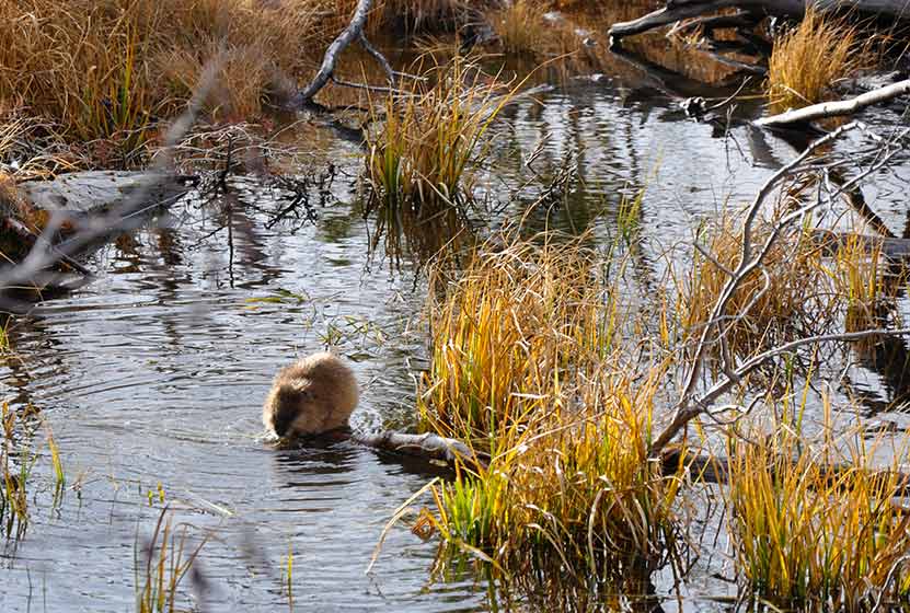
A Beaver at Sprague Lake RMNP
In the early spring, the trail will likely still be under snow. However, this is such a popular area that it should be easy to spot the trail left by others. As you make your way to the northeastern rim of Sprague Lake, you'll gain views of the continental divide, including Hallett Peak. This is a perfect spot to set up your camera for an iconic photo of RMNP.
In the Fall, this is one of the better spots in Rocky Mountain National Park to view the aspen trees changing on the distant mountains.
Tips & Resources for Hiking to Sprague Lake :
- TIP: Hiking shoes are recommended if you hike during early spring or late winter as you might need to pass through snow on the trail.
- TIP: If you get out early on a spring morning, you might be lucky enough to spot a moose or more.
- Rocky Mountain National Park Trail Conditions: Click for RMNP Trail Conditions
- Trail Map for Bear Lake Corridor: Trail Map Link
- Colorado Road Conditions: Colorado Road Conditions
- After the Hike: Poppy's Pizza
- Photo: We would like to express our gratitude to Tim Stacks for sharing such a beautiful photograph of this hike at Sprague Lake.
Weather
Map & Driving Directions
Click for Driving Directions
Black Lake Falls in Rocky Mountain National Park
Black Lake Falls cascades down the towering granite cliffs above Black Lake in Rocky Mountain National Park. This trail through Glacier Gorge takes hikers past multiple sub-alpine lakes and several waterfalls. It's a demanding, 10 mile, round-trip hike with significant elevation gain in the heart of RMNP.
Note: Rocky Mountain National Park now requires timed entry permits from May 27th through October 10th. See the RMNP permits page for more information.
Trail Snapshot: Black Lake Falls in Rocky Mountain National Park
| Hike Distance | 10 mile Round Trip |
|---|---|
| Difficulty | Difficult |
| Duration | Approx 6 hrs Round Trip |
| Trail Type | Out and Back |
| Starting Elevation | 9240' at Trailhead |
| Elevation Gain | +1430′ |
| Seasons | May-September |
| Dogs | Prohibited in RMNP |
| Hike Trail Map | Click for a Trail Map |
| Denver Drive Time | 2 hr |
| Driving Directions to Glacier Gorge Trailhead | Click for Google Map |
| Town Nearest Hike | Estes Park, Colorado |
| Beauty | Waterfalls, wildlife: elk, deer, marmots; meadows, lakes, streams, wildflowers, aspen trees |
| Activities | Hiking, photography, fishing |
| Fee | Park Pass Required |
Black Lake Falls is located on the cliffside above the western edges of Black Lake and is best viewed from the boulder strewn shores of Black Lake. In the photo above, you'll be able to distinguish the stream of the falls cascading over grey granite cliffs. For a detailed description of this journey to Black Lake Falls, explore our full trail profile on Black Lake. Below you'll find a list of some of the other destinations in the Glacier Gorge trail system.
List and Links of Destinations From Glacier Gorge Trailhead to Black Lake
1. Glacier Gorge Trailhead
2. Alberta Falls - @ .8 mile
3. Mills Lake - @ 2.8 miles
4. Jewel Lake - @ 3.2 miles
5. Ribbon Falls - @ 4.8 miles
6. Black Lake - @ 5 miles
Tips & Resources for Hiking Black Lake Falls in Glacier Gorge RMNP :
- Start Early: The hike to Black Lake and Black Lake Falls is challenging and hikers will want to begin early to avoid being in this exposed area when afternoon thunderstorms often tear through the area in Summer.
- Trekking Poles in Spring and Winter: Because the trail is high in the mountains, the snow and ice can hang around into late Spring and even early Summer, then pick up again in the Fall. Because of this, we recommend Trekking Poles and/or Traction Devices for this trail when the trail conditions are such.
- Parking: If the parking lot is full at Glacier Gorge Trailhead, there is a shuttle available to take you to the trailhead, or you can park at the Bear Lake Trailhead.
- Rocky Mountain National Park Trail Conditions: Click for RMNP Trail Conditions
- Trail Map for Bear Lake Corridor Trails: Trail Map Link
- Rain Gear Recommended: On every occasion I've been into Glacier Gorge, it's been gorgeous weather--and it rained. So, bring Rain gear. In the summer months, thunderstorms can form quickly in this area, especially in the afternoon--just another reason to begin your hike early.
- Packing List: Always pack the 10 Essentials. Download our Hiking Guide to get list and dayhiking packing checklist.
- Colorado Road Conditions: Colorado Road Conditions
- After the Hike: Inkwell Brew Coffee
- Photo: We would like to express our gratitude to Martin Braveboer for sharing such an amazing photograph of Black Lake and Black Lake Falls.
Weather
Map & Driving Directions
Click for Driving Directions
Four Lakes and Waterfall Loop in Rocky Mountain National Park
This loop hike in Rocky Mountain National Park takes you to four beautiful, subalpine lakes and Alberta Falls, one of the parks most visited and photographed waterfalls. It's a moderate, 6.4 mile hike that will give you a great taste for the breathtaking scenery found in this treasure of our National Parks system. Explore the full hiking trail profile below for trail map, driving directions, and all the details you need to enjoy this adventure in Rocky Mountain National Park.
Note: Rocky Mountain National Park now requires timed entry permits from May 27th through October 10th. See the RMNP permits page for more information.
Trail Snapshot: Alberta Falls + Lake Haiyaha Loop in Rocky Mountain National Park
| Hike Distance | 6.4 miles |
|---|---|
| Difficulty | Moderate |
| Duration | Approx 3-4 hr |
| Trail Type | Loop |
| Starting Elevation | 9475' at Trailhead |
| Elevation Gain | Approx. +800' |
| Seasons | Spring through Fall, Winter Snowshoeing (demanding) |
| Dogs | Prohibited in RMNP |
| Hike Trail Map | Click for a Trail Map |
| Denver Drive Time | 2 hr |
| Driving Directions to Bear Lake Trailhead | Click for Google Map |
| Town Nearest Hike | Estes Park, Colorado |
| Beauty | Sub-alpine lakes, mountain views, wildlife: Abert's squirrel, elk, bear |
| Activities | Picnicking, hiking trails, snowshoeing, photography |
| Conditions at Bear Lake Trailhead | Click Here |
| Fee | Park Pass Required |
Parking & Trailhead Information for Alberta Falls - Lake Haiyaha Loop
This loop hike begins at the Bear Lake Trailhead (driving directions). In the event that parking lot at Bear Lake is full, you'll then need to park at the Park & Ride near the Bierstadt Trailhead and take the bus into the trailhead. This service runs 7am to 7PM and more information on the RMNP shuttle bus routes can be found at this link.
List and Waypoints on the Alberta Falls - Lake Haiyaha Loop Hike
As with any loop, this can be hiked clockwise or counter clockwise. We prefer hiking it clockwise with the following waypoints.
- Beginning at Bear Lake
- Alberta Falls - @ .8 miles
- Glacier Gorge Junction - @ 1.7 miles
- Loch Vale/Haiyaha Junction - @ 2.2 miles
- Lake Haiyaha - @ 4.3 miles
- Dream Lake - @ 5.4 miles
- Nymph Lake - @ 5.9 miles
- Back at Bear Lake - @ 6.4 miles
At less than one mile in, the first destination is Alberta Falls. For more information, visit our Alberta Falls Hike page.
After Alberta Falls, hikers will continue towards Glacier Gorge/Loch Vale until they encounter the first significant trail junction. The correct trail, the Glacier Gorge/Loch Vale trail, bears right and ascends for about another .5 mile to a second trail junction. At this second junction, you will have traveled about 2.2 miles. One trail leads up into Loch Vale and to such destinations as Timberline Falls. However, this loop hikes takes a different path, and hikers will want to follow the trail leading to Lake Haiyaha. The journey to Lake Haiyaha (pictured below) is 2.1 miles from this junction. You can explore a more detailed trail profile on Lake Haiyaha here.
When you near Haiyaha, a trail sign will point the way left, down a short spur to the lake. After visiting Lake Haiyaha, the spur trail will take you back down the to the main trail. The trail to Dream, Nymph, and Bear Lake goes to the left (north. The trail meanders for about 1 mile--mostly downhill--to the next trail junction (pictured below). On this segment hikers will gain views down into the valley that contains Nymph and Bear Lakes.
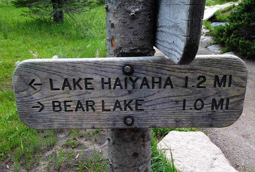
On the other side of the post pictured above, is a sign indicating that Dream lake is to the left (west), and only .1 mile away. Dream Lake won't disappoint (pictured below). See our full trail profile for Dream Lake.
After your trip to Dream Lake, double-back to head toward Nymph Lake by following signs to Bear Lake. In about .5 mile, hikers will arrive at their fourth destination, Nymph Lake. It's known for the pond lilies that bloom yellow in the summer months. You can explore more trail info on Nymph lake at here.
Finally, after almost six and a half miles of hiking, hikers will return to Bear lake and the Bear Lake Trailhead.
Tips & Resources for Hiking the Alberta Falls - Lake Haiyaha Loop, Colorado
- TIP: Trekking Poles in Spring and Winter Because the trail is often in shade, the snow and ice can remain into the early summer months. Because of this, we recommend Trekking Poles and/or Traction Devices for this trail.
- Trail Map for Bear Lake Corridor: Trail Map Link
- Colorado Road Conditions: Colorado Road Conditions
- After the Hike: Poppy's Pizza
- Photo: We would like to express our gratitude to several fantastic photographers whose work is featured in this post: Ben Grey, Bear Lake; Miguel Vieira, Lake Haiyaha, Marco Becarra, Dream Lake; Pete Sheffield, Nymph Lake; Bert Cash, Alberta Falls.
Weather
Map & Driving Directions
Click for Driving Directions
Lake Haiyaha Hike in Rocky Mountain National Park
Lake Haiyaha, in Rocky Mountain National Park, is tucked away in the recesses of a large valley, and its shoreline is surrounded by stacks of massive granite boulders. This relatively easy, 4.2 mile round-trip hike can be a quieter retreat on the busy east side of RMNP, especially if hikers arrive during the early morning hours. Explore the full Lake Haiyaha hike profile below for trail map, driving directions, and all the details you need to enjoy this adventure in Rocky Mountain National Park.
Note: Rocky Mountain National Park now requires timed entry permits from May 27th through October 10th. See the RMNP permits page for more information.
Trail Snapshot: Lake Haiyaha in Rocky Mountain National Park
| Hike Distance | 4.2 miles Round Trip |
|---|---|
| Difficulty | Moderate |
| Duration | Approx 2 to 3 hr Round Trip |
| Trail Type | Out and Back |
| Starting Elevation | 9475' at Trailhead |
| Elevation Gain | Approx. +745' |
| Seasons | Spring through Fall, Winter Snowshoeing |
| Dogs | Prohibited in RMNP |
| Hike Trail Map | Click for a Map of Lake Haiyaha RMNP |
| Denver Drive Time | 2 hr |
| Driving Directions to Bear Lake Trailhead | Click for Google Map |
| Town Nearest Hike | Estes Park, Colorado |
| Beauty | Sub-alpine lakes, mountain views, wildlife: Abert's squirrel, elk, bear |
| Activities | Picnicking, hiking trails, snowshoeing, photography |
| Conditions at Bear Lake Trailhead | Click Here |
| Fee | Park Pass Required |
Lake Haiyaha has become one of my new favorite destinations on the east side of Rocky Mountain National Park. Why, it's got character. The shoreline is more rugged, and the trees surrounding its waters look like ancient sentinels stationed to protect something secret hidden in its depths.
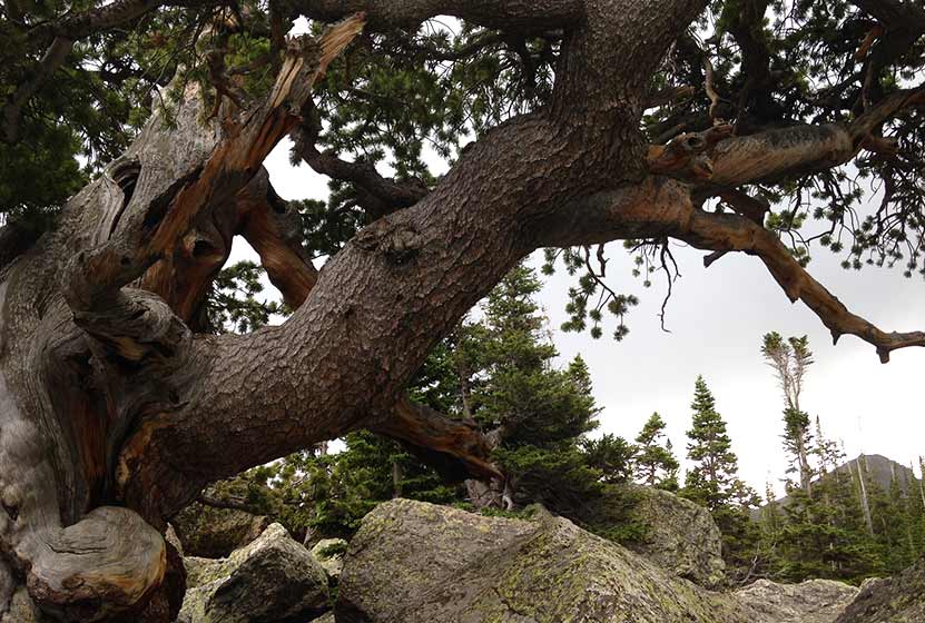
An Ancient Pine at the Boulder-Strewn Gateway to Lake Haiyaha
Parking & Trailhead Information for Lake Haiyaha, Colorado
The trail up to Lake Haiyaha begins at the Bear Lake Trailhead (driving directions). In the event the parking lot at Bear Lake is full, you'll then need to park at the Park & Ride near the Bierstadt Trailhead and take the bus into the trailhead. This service runs 7am to 7PM and more information on the RMNP shuttle bus routes can be found at this link. The trail to Lake Haiyaha is located on your way to Bear Lake, off to the left, just before reaching the shore viewing area of Bear Lake. It follows the same main trail that leads hikers up to both Nymph and Dream Lakes.
From the Bear Lake Trailhead, hikers will reach Nymph Lake at .5 mile in. After continuing on the trail for approximately another .5 mile, hikers will reach a trail split. Be sure to first hike the additional .1 mile (right-hand trail) up to Dream Lake first, then return to this trail split to take the trail leading another 1.2 mile to Lake Haiyaha. Dream Lake is aptly named and should not be missed. This adds just .2 mile to your total hike.
Here, the trail climbs, zig zagging with switch backs through spruce and fir forest. Out-of-state hikers, who are not acclimated to the altitude, may find this stretch both demanding and tiring. But pushing on to Haiyaha is worth it. Near the lake, the trail makes its way through a maze of boulders, which may require hikers to scramble over them to gain views of the lake. Be gentle with the ancient pines that surround the lake. These have been standing, some for centuries, and are exposed to a lot of human contact. On the way back down the trail, you'll encounter new views. Nymph and Bear Lakes can now be seen from above, giving you a birds eye view of your journey.
Tips & Resources for Hiking to Lake Haiyaha, Colorado
- Explore More: Make this a loop hike and see 4 lakes and one of the RMNP's best Waterfalls - Four Lakes and a Waterfall Loop
- Trail Map for Bear Lake Corridor: Trail Map Link
- Colorado Road Conditions: Colorado Road Conditions
- After the Hike: Poppy's Pizza
- Photo: We would like to express our gratitude to Miguel Vieira for sharing such an amazing photograph of this hike in Rocky Mountain National Park.
Weather
Map & Driving Directions
Click for Driving Directions