Kenosha Pass Hiking Trails
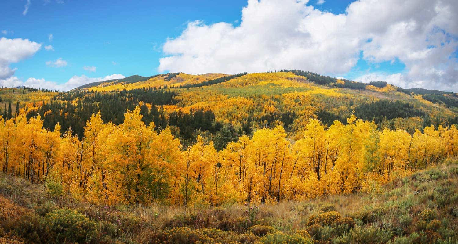
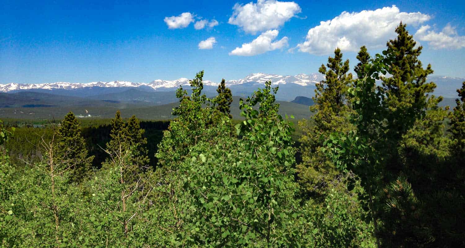
Kenosha Pass is probably the best place to view the changing aspens near Denver. It offers both an East and West trail option with gradual ascents to stunning views. Starting at 10,000' the initial elevation gain on the trails make for easy to moderately strenuous hikes, all depending on how far one decides to travel on these beautiful segments of the Colorado Trail. Vantage points can be accessed about 1/2 mile up both trails offering views down into the high country plains of South Park and out to the Rocky Mountains. Explore the full Kenosha Pass hike profile below for trail map, driving directions, and more tips and details to help you enjoy this Colorado hike.
Trail Snapshot: Kenosha Pass Colorado
| Hike Distance | <1 to 14.4 miles Round Trip |
|---|---|
| Difficulty | Easy to Moderate |
| Duration | Depends on Segment Hiked |
| Trail Type | Out and Back |
| Starting Elevation | 10,000′ |
| Elevation Gain | Approx +400' for shorter hikes |
| Seasons | Year Round |
| Dogs | Allowed On Leash |
| Hike Trail Map | Click for a Map of Kenosha Pass |
| Denver Drive Time | 1 hr 30 min |
| Driving Directions to Kenosha Pass East Parking Area | Click for Google Map |
| Town Nearest Hike | Grant, Colorado |
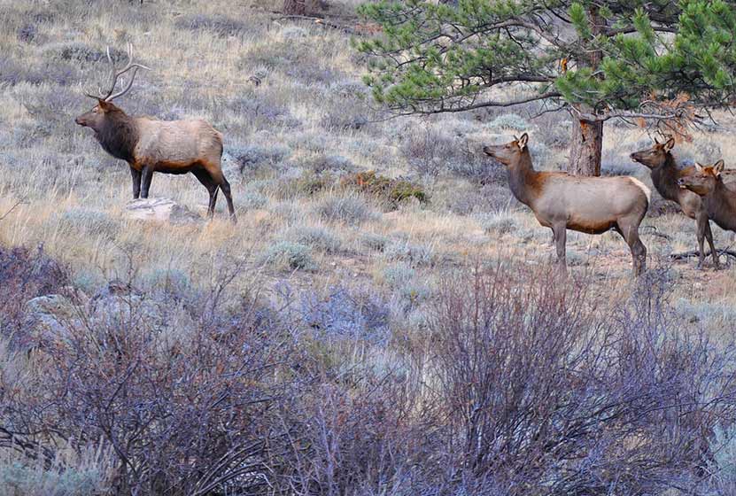
| Beauty | aspen groves, creek, wildflowers, mountain range views, views of South Park, wildlife: moose |
| Activities | Hiking, mountain biking, horseback riding, photography, snowshoeing, camping |
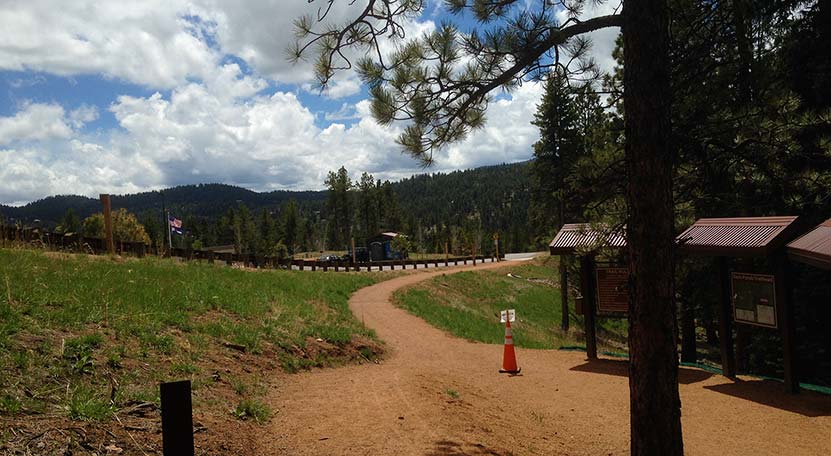
Parking & Trailhead Information for Kenosha Pass Hike
Kenosha Pass is located about 65 miles southwest of Denver along US 285. From Denver, take US 285 towards Bailey, Colorado. From Bailey, continue driving approximately 19 miles on 285 to the Kenosha Pass Trailhead. The trailhead parking area is located on both East (left when coming from Denver) and West (right side when coming from Denver) of 285. There is additional parking on the East side after crossing a cattle gate. Parking can get tight in the Autumn when the aspens are at their peak, so be considerate of others and the land as you park your vehicle. It's about a 90 minute drive from Denver. Restrooms can be found on both trailheads.
Hiking the Kenosha Pass Trail
Two Hiking Options and Where the Trails Begin
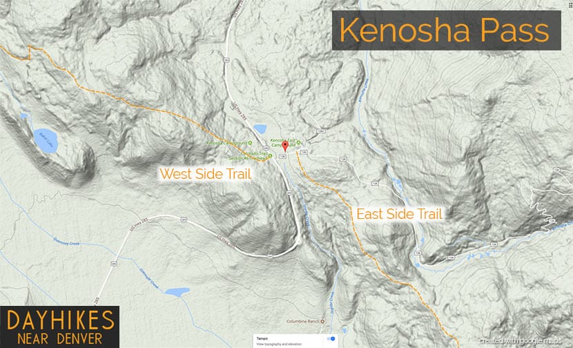
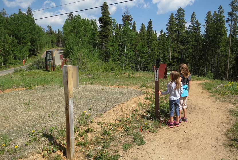
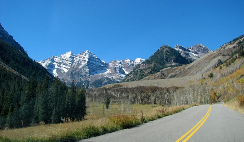
The hiking trails at Kenosha Pass easy to moderate in difficulty and can be done by hikers of all experience levels. At Kenosha Pass, the Colorado Trail, which goes from Denver to Durango, intersects with US Highway 285. This creates an East side trail option and an West side trail option. Both offer incredible views down into the South Park plains of Colorado and out to the often snow-capped peaks of the Mosquito Range.
Hiking the East Side of Kenosha Pass
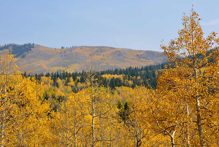
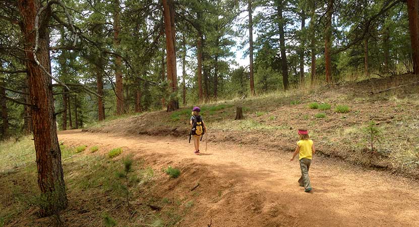
Hikers can pick up the Colorado Trail after crossing the cattle gate (if parked along 285) and hiking along the dirt road that leads to the restrooms that are near the 2nd parking area (after the cattle gate). The Trailhead is located just before the 2nd parking area, and will be located on the right (south). While most visitors park, take a jaunt into the aspens, snap a few photos and leave, the more stunning views await those who venture further south along the trail. The initial trail segment enters with a gradual ascent into the aspens, then at 1/2 a mile into the hike the woods opens up to incredible views into South Park.
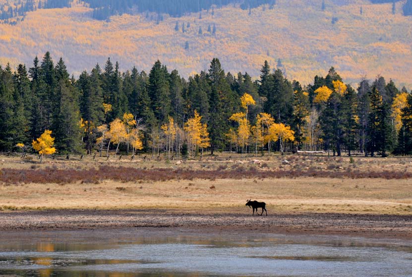
South Park is a high mountains plains area that stretches out mile-upon-mile to its western and norther mountain borders, the Collegiate Peaks and the Mosquito Range of the Rocky Mountains. The climb continues at a gradual pace and hikers will emerge to a second panorama at 1.5 miles. This is a great place to turn-around, making it into a 3 mile out-ant-back hike. Of course, hikers can continue on the trail all the way back into Denver, but that requires a multi-day backpacking trip. As always, keep eyes peeled for changing weather, and pack the 10 Essentials. If you are wondering what should be in your daypack, be sure to download our free Dayhike Hiking and Packing Guide. As for wildlife, moose are often spotted on this side along the lake near the trailhead.
Hiking the West Side of Kenosha Pass
The West Side Trail at Kenosha Pass can be picked up immediately on the West side of 285. The trail enters conifer and aspen forest, making a gentle climb toward the northwest until popping out of the trees to breathtaking views down into South Park and the Mosquito Range. After this viewpoint, the trail travels a short distance uphill, then makes its way down toward Guernsey Creek. The distance from the trailhead to Guernsey Creek is approximately 3 miles, making this a 6 mile out-and-back adventure. Because this is the Colorado Trail, it does continue west, offering multi-day backpacking options that lead all the way to Durango, Colorado.
Tips & Resources for Hiking the Kenosha Pass Trail
- TIP: Bring sunscreen for protection against the sun.
- TIP: One the east side of the highway, there is another parking lot with a lot of bathrooms.
- Trail Map: Map for Trailhead Locations
- Trails Illustrated Kenosha Pass Map: Trails Illustrated Map Link
- Packing List: Always pack the 10 Essentials. Download our Hiking Guide to get the list and dayhiking packing checklist.
- Colorado Road Conditions: Colorado Road Conditions
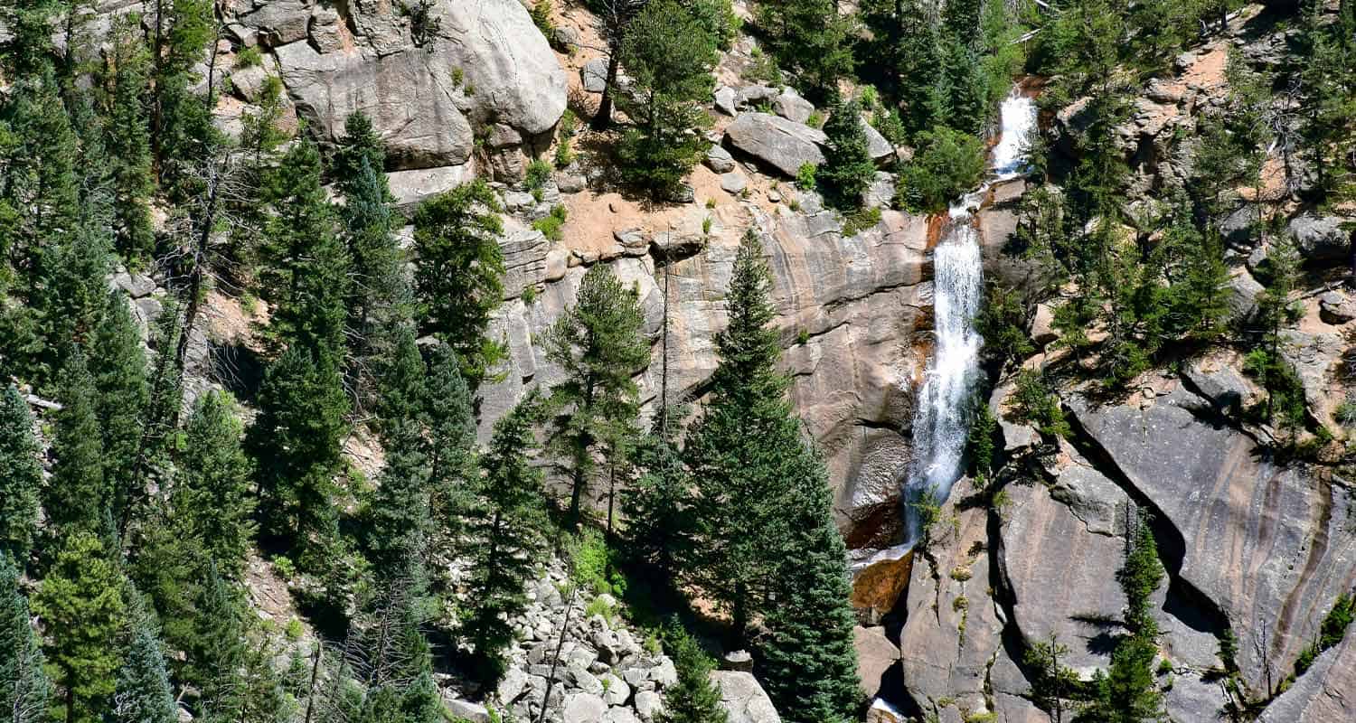
- Photo: We would like to express our gratitude to Ed Ogle for sharing such an amazing photograph of this hike on Kenosha Pass.
- After the Hike: The Shaggy Sheep
Weather
Map & Driving Directions to Kenosha Pass
Click for Driving Directions

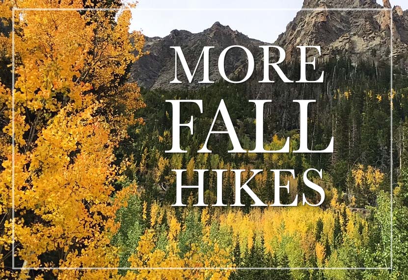
Top 10 Fall Hikes Near Denver with Aspens
Enjoy the Fall Colors of Colorado with these Trails near Denver with Changing Aspens
Where can you find hikes near Denver to view the changing aspens and fall colors? We've looked through all our hiking profiles to identify trails near Denver that are decorated with glowing aspens in the Fall. Some of these Autumn Colorado hikes have spectacular drives to the trailhead. Because some of the hikes closer to Denver are just so-so (it takes driving further into the mountains to get the best views of the Aspens), I'll identify some of the best hikes to see the Fall colors near Denver here. Be sure to download our Free Hiking Guide to help you prepare and pack smart for your dayhikes near Denver.
When do Aspens Change in Colorado? Hiking at the Right Time.
September is the best time of the year to see the changing aspens in Colorado, particularly during the 3rd and 4th weeks when they hit their peak splendor of golds, oranges, reds. Aspens change color in response to the changing temperatures in the Rocky Mountains, so it can vary a bit year-to-year and in different regions of the state. A good rule of thumb is to plan your hikes and drives to take in Fall colors during mid-September through mid-October. Near Denver, the temperatures tend to be warmer, so aspens will change later along the Front Range and earlier up in the mountains.
Top Fall Hikes Near Denver: Our Favorite Hikes
-
Sprague Lake Loop in Rocky Mountain National Park
-
Devil's Head Firetower Hike
-
Elk Falls Overlook at Staunton State Park
-
Raccoon Loop at Golden Gate Canyon
-
Mt. Bierstadt Hike on Guanella Pass
-
Kenosha Pass Hike: Resplendent with Aspens
-
Butler Gulch Hike Near Berthoud Falls
-
Ouzel Falls in Rocky Mountain National Park
-
Diamond Lake Hike
-
Herman Gulch Hike Near Idaho Springs
Distance: 1/2-Mile Round Trip
Difficulty: Easy
Drive Time from Denver: 2 Hours
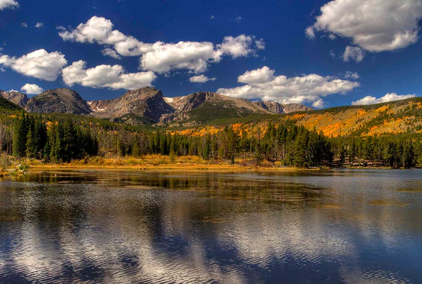
Let's start with an easy hike in Rocky Mountain National Park. The Sprague Lake loop offers an 1/2 mile loop hike with 360 degree breathtaking views of the changing aspens mirrored in face of the water and leaden grey peaks in the distance. It's a two-hour drive from Denver, and requires a park pass, but it's worth it. Parking is limited at the lake, but a shuttle runs to the trailhead. See our full trail profile for all the details.
![]()
Distance: 2.8 Miles Round Trip
Difficulty: Moderate
Drive Time from Denver: 1 Hour 15 Minutes
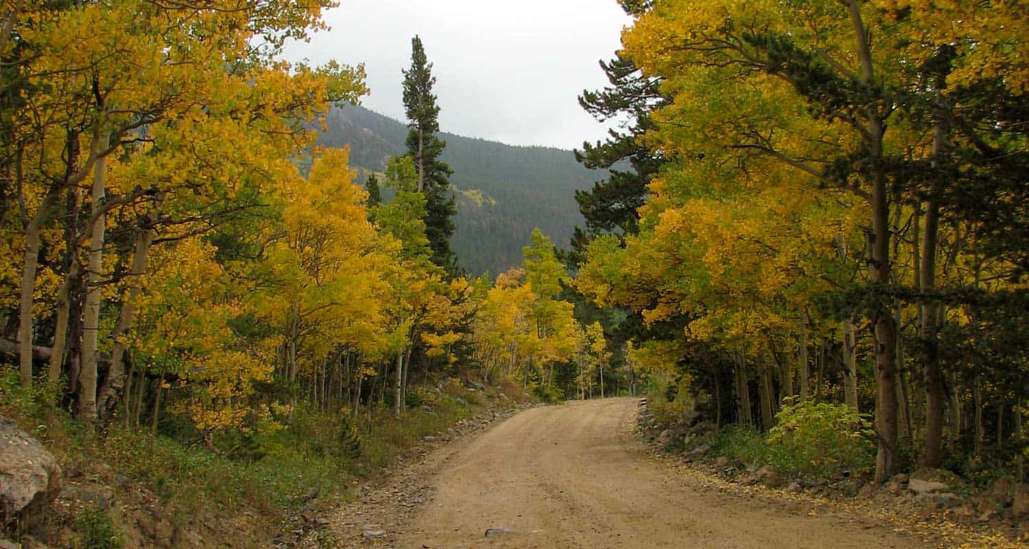
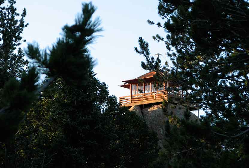
Here's why you need to do this hike in the fall season: 1) The drive there will take you up Rampart Range road which should be gilded with changing Aspens, 2) When you get to the top of Devil's Head, you'll gain 360 degree views that will let you drink in the colors from for miles and miles. I love to make this hike in the early morning as the sun is rising and lighting up the spires along the spine of the Rampart Range.
![]()
Distance: 11 Miles Round Trip
Difficulty: Moderate to Difficult
Drive Time from Denver: 45 Minutes
This may be the most challenging hike in this list of fall hiking trails. Elk Falls was hidden for years on private land and recently opened to the public at Staunton State Park. This entire area near both Guanella Pass and Hoosier pass is amazing in the fall. After the hike, there are options to drive further out 285 to Hoosier Pass or to take the seasonal road up Guanella pass. The great thing about Stuanton State Park is that you have other options, too: shorter easy strolls with aspen meadows and towering pines, and more moderate hikes through the heart of the park. Scan the rock cliffs and mountainsides to see if you can get a glimpse of the occasional aspen tree turning red.
![]()
Distance: 2.5 Miles Round Trip
Difficulty: Easy
Drive Time from Denver: 1 Hour
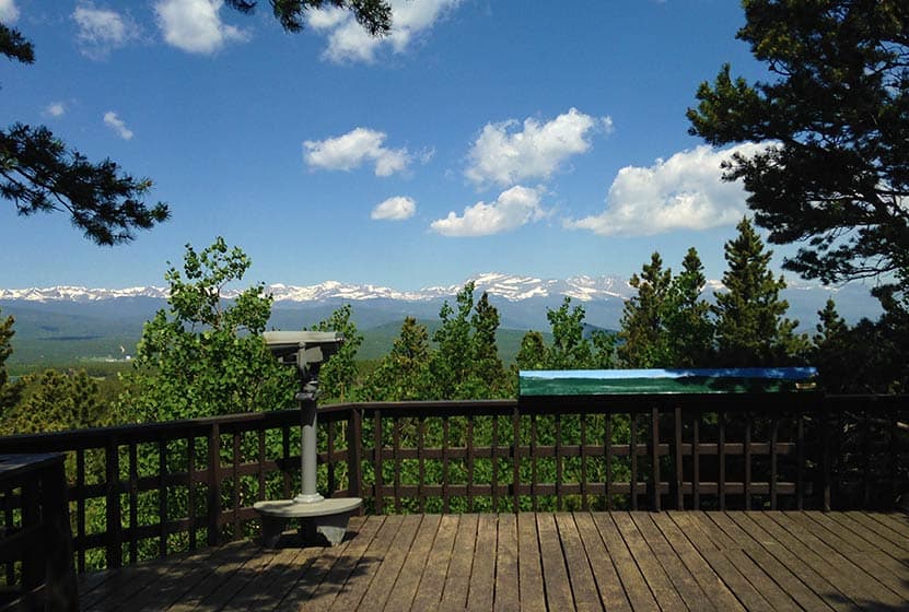
Our family loves this 2.5 mile hike in Golden Gate Canyon State Park. There are panoramic views of the Front Range all lit up with gold and green at the Panorama Point viewing area. It's not like Kenosha Pass (see below), but it's still beautiful and closer to Denver. The Raccoon Loop hike weaves through meadows of changing aspens, past seasonal creeks, and through pine forest. The drive from Golden to the park takes you along a really curvy road, so take your time and be aware for cyclists.
![]()
Distance: 1 to 7 Miles Round Trip
Difficulty: Easy to Difficult
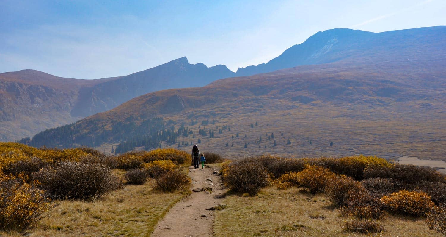
Drive Time from Denver: 90 Minutes
This drive to Guanaella Pass and hike are both breathtaking when the aspens are turning in the fall. We suggest starting on the north end (I-70 end) and to make your way south over Guanella pass. You can stop here and hike a length of the Mt. Beirstadt Trail, taking a short stroll in the high country, or making the more adventurous hike to the summit of Mt. Bierstadt (be sure to prepare for this as you would any summit trip to a fourteener--it's not a walk in the park). Continuing over Guanella pass, hikers can drive further to Kenosha Pass, which may be the most best place to view the changing aspens near Denver. When Guanella Pass road intersects with 285, a right turn (west) leads to Kenosha Pass. See below for more hike details on Kenosha Pass.
![]()
Distance: A Short Stroll, or a 6 mile to 8.2 Mile Options
Difficulty: Easy to Moderate
Drive Time from Denver: 1 Hour 30 Minute
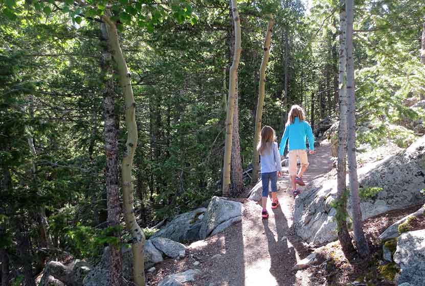
Kenosha Pass may be the best place to soak in the miles upon miles and mountains behind mountains of golden aspens in the Fall. The trail that runs on both sides of 285 is easy to moderate, and because it is part of the Colorado Trail system, it seems to go on forever. Most families hike in a short distance, but we recommend pushing further beyond the congested trail segments to higher points where you'll break out to views of South Park below and the Ten Mile Range of the Rocky Mountains.
![]()
Distance: Up to 5 Miles Round Trip
Difficulty: Moderate
Drive Time from Denver: 1 Hour
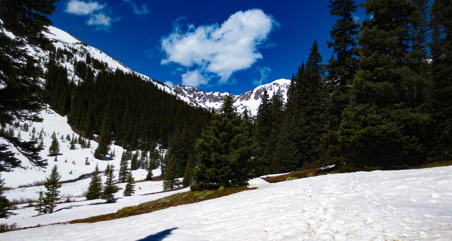
The Butler Gulch Trail near Jones Pass is a "get into the mountains" hike. About an hour from Denver and you're completely surrounded by mountains. The trail gains altitude fast and the ridgeline offers incredible views for miles of Colorado's fall colors. Hike a bit further to gain a higher ridge marking the continental divide for a 360 degree panorama of gilded high-country. The parking area is just past the Henderson Mine and will be busy this time of year, so be sure to arrive early to get a parking space at the trailhead.
![]()
Distance: 5.4 Miles Round Trip
Difficulty: Moderate
Drive Time from Denver: 1 Hour 30 Minutes
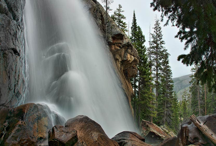
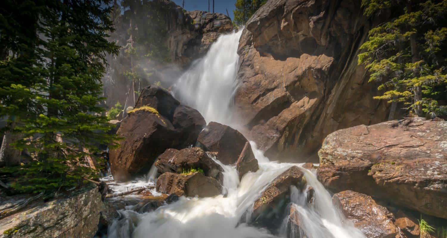
Aspens + Mountain Streams + Cascades + a Waterfall = A great Fall Colorado experience. Before reaching this 40-foot falls, this fall hike traces the course of a number of creeks and takes hikers past three other cascade waterfalls. Ouzel Falls is probably one of the most beautiful waterfalls in Rocky Mountain National Park, an arched stream of water spilling from the cliffside. Explore the full trail profile for parking details, trail map info, and tips for this hike in the Wild Basin of Rocky Mountain National Park.
![]()

Looking for more waterfalls near Denver? Explore our more than 50 Colorado Waterfall Hikes, our favorite Waterfall Hikes in Rocky Mountain National Park, or 7 Waterfalls within One Hour of Denver.
Distance: 5 Miles Round Trip
Difficulty: Moderate
Drive Time from Denver: 1 Hour 30 Minutes
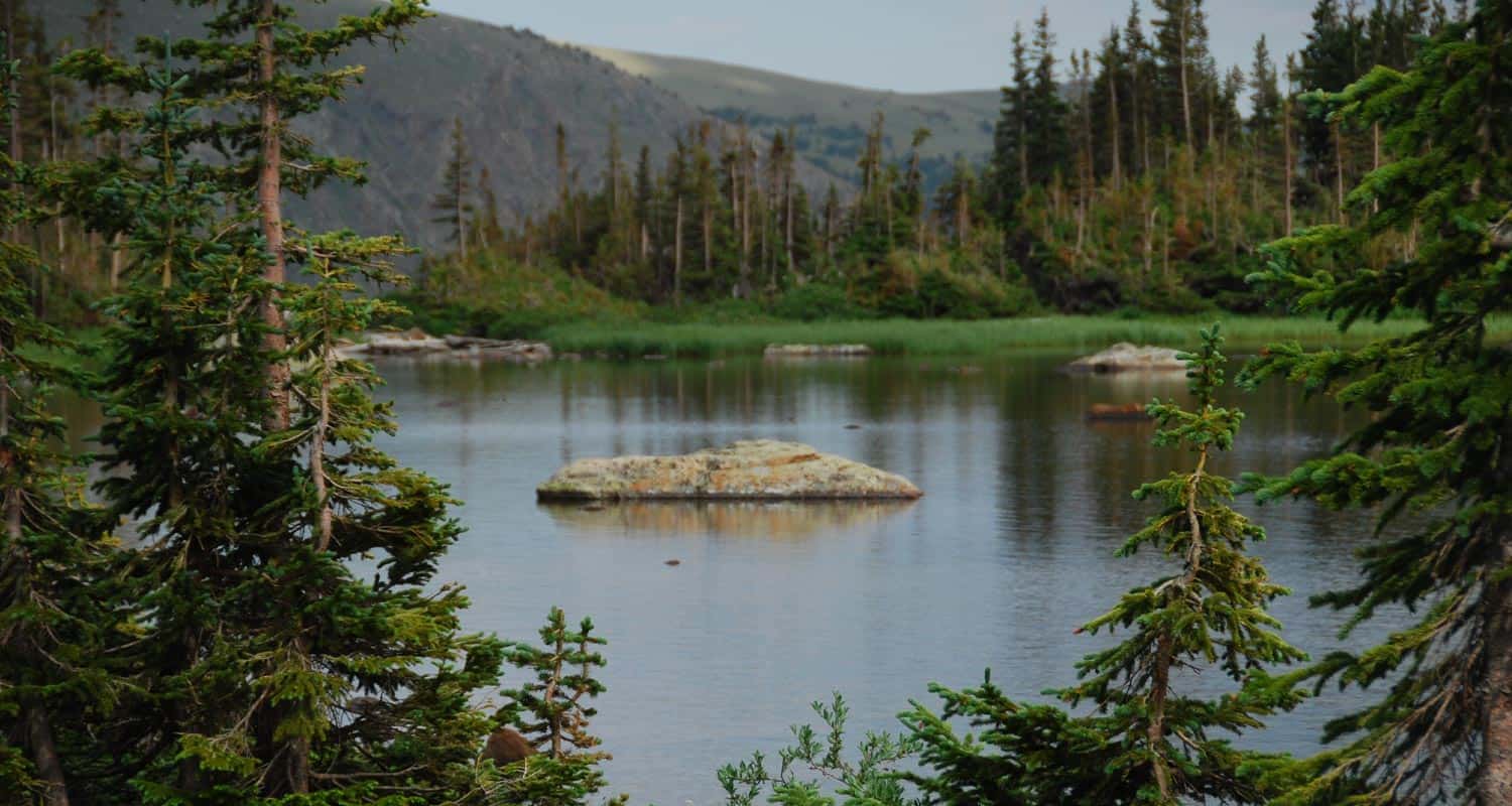
This hike in Indian Peaks Wilderness leads to a high mountain lake surrounded by multiple peaks. In the Summer, this area is adorned with wildflowers that give way to the splendor of gold and red aspens in the Fall. Hikers pass a waterfall and an old mine site on the way to Diamond Lake. The 4th of July Trailhead fills up very early, so we recommend arriving before 7AM on the weekends in the Fall.
![]()
Distance: 5 Miles Round Trip
Difficulty: Moderate
Drive Time from Denver: 1 Hour
Herman Gulch Hike near Silver Plume is a more demanding hike that leads into the heart of the Front Range. The canyon has spectacular views of Clear Creek, mountain peaks and the Loveland ski area. The trail leads back to a high-mountain lake underneath Pettingell Peak. Aside from being a wonderful fall hike, this is another great place for snowshoeing and skiing activities during winter.
![]()
Raccoon Loop Hike in Golden Gate Canyon State Park
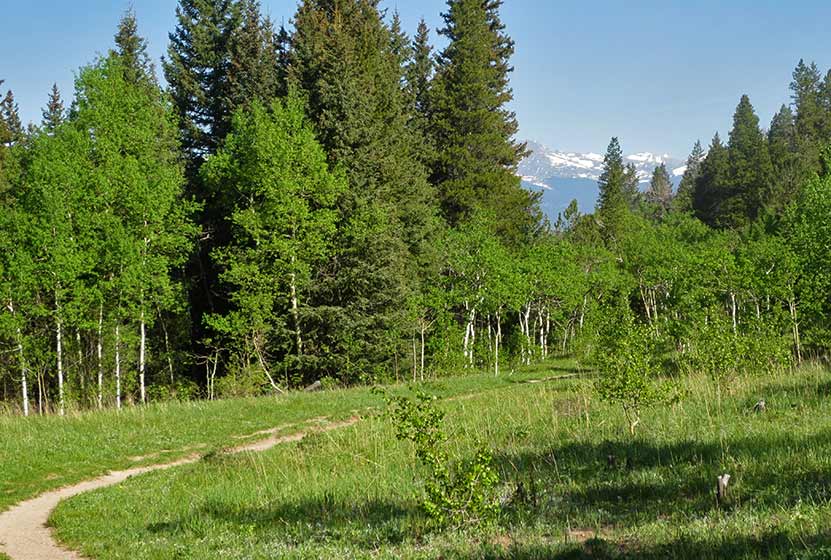
Our kids loved this 2.5 mile loop hike in Golden Gate Canyon State Park. The trail sports lots of shade, panoramic views of snowcapped peaks, wildflowers, and trickling brooks. Be sure to see the details below regarding an annual raptor closure that detours one segment of this hike. Explore the full Raccoon Loop Hike profile for trail map, driving directions, and many of the details you need to enjoy this adventure in Golden Gate Canyon State Park.
Trail Snapshot: Raccoon Trail Loop at Golden Gate Canyon
| Hike Distance | 2.5 miles |
|---|---|
| Difficulty | Easy |
| Duration | Approx 1.5 hr |
| Trail Type | Loop |
| Starting Elevation | 9120′ |
| Elevation Gain | Approx +500′ |
| Seasons | Year Round |
| Dogs | Allowed On 6' Leash |
| Hike Trail Map | Click for a Map of Golden Gate Canyon State Park |
| Denver Drive Time | 1 hr |
| Driving Directions to Panorama Point Trailhead | Click for Google Map |
| Driving Directions to Reverends Ridge Campground Trailhead | Click for Google Map |
| Town Nearest Hike | Golden, Colorado |
| Beauty | Mountain range views of snowcapped peaks, wildflowers, aspens |
| Activities | Hiking, mountain biking, photography, snowshoeing in winter |
| Fee | Colorado State Parks Pass Required |
Parking & Trailhead Information for the Raccoon Loop Hike
You can begin your hike at either the Panorama Point Trailhead or at the Reverend Ridge Campground Trailhead. Our family hiked this from the Panorama Point Trailhead. Though parking is limited, there is additional parking located directly across the street in a dirt lot. Reverend Ridge Trailhead, while a larger parking area, can fill up fast because it is located at the campground. Either one, however, is a good option. Driving directions for both trailheads are located in the trail snapshot above.
The Hike: The Raccoon Loop Hike in Golden Gate Canyon
We hiked the Raccoon Loop counter-clockwise from the Panorama Point Trailhead and found it to be easy to moderate in difficulty. Our kids (at the time of this post) are 5 and 8. Both were wearing tennis shoes and did well on the trail. There was a steep segment with loose rock, where our youngest needed me to hold her hand as she navigated here way down the trail.
The trail begins with incredible views of the snowcapped Indian Peaks stretched out against the western sky. Soon, views of Thorodin Mountain and Starr peak dominate the landscape as the trail winds to the east and crosses a seasonal brook. Raccoon Trail then gently drops into aspen groves and green meadows full of wildflowers.
Entering a more mature stand of aspens, the trail begins a more steep descent. This is where hikers will want to watch their footing on the loose rock and gravel surface of the trail. After this short descent, the trail crosses another brook over a small footbridge, then begins to climb a bit further west before turning sharply to the south.
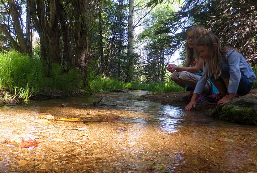
Shortly after the brook is where we encountered the closure of approximately 0.5 mile of the Raccoon trail. These closures are announced on the front page of the Golden Gate Canyon State Park website, and we knew about it before making our trip.
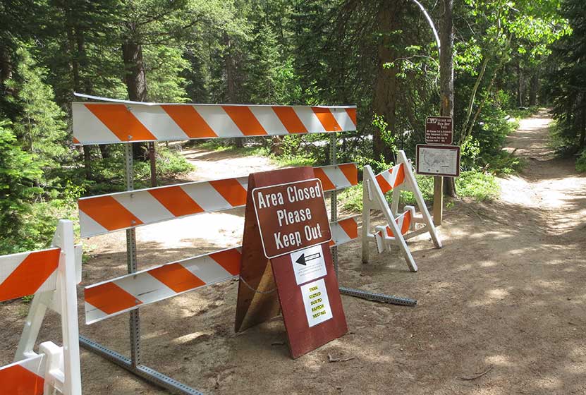
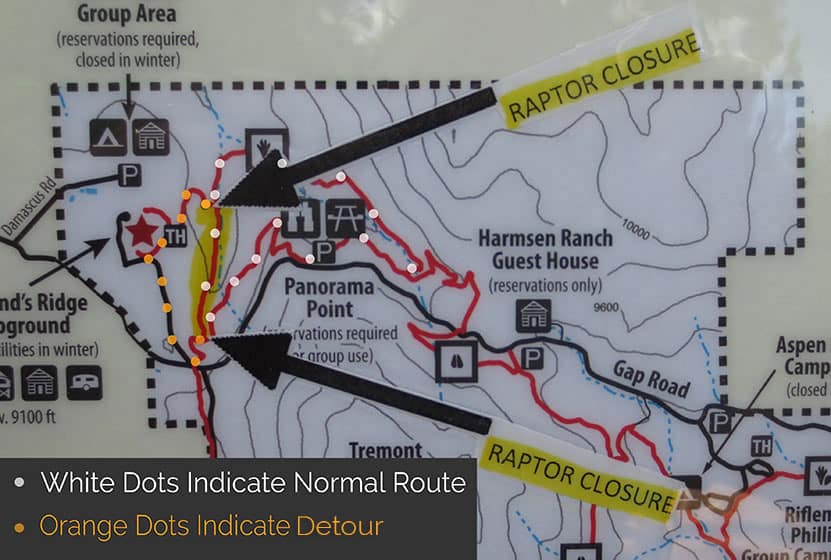
This rerouted us up to the Reverend Ridge Campground, then required that we hike down State Park Road for about 0.5 mile until we were able to pick up the Raccoon Trail again. Because the detour wasn't clearly marked, we've provided an image of the normal route vs. the detour route we took below.
It probably goes without saying, but do exercise caution when walking the road, and assume that cars will not see you. There are several sharp turns/switchbacks. We were able to pick up the trail down where the road comes to a stop sign, then hike back to Panorama Point. The detour adds approximately 1 mile to the original hike, making this into a 3.5 mile loop hike.
This last section had some elevation gain, but still was moderate in difficulty. This is a great hike for visiting friends and family, but those who have not acclimatized to the altitude, or who are not in the best shape, may find this last part challenging. There is a bench strategically placed on the ascent, and rocks where you can rest your legs.
At Panorama Point, hikers will find a large deck and viewing area. It's one of the best accessible views you'll get of the Front Range near Denver.

Tips & Resources for Hiking the Raccoon Loop Hike
- Be Aware of Closures: The Raccoon Loop has seasonal closures when raptors are nesting. However, it's just one segment of the trail that is closed, and a (not-so-well-marked) detour is available.
- Look out for Mtn Bikers: We always find mountain bikers to be considerate on the trails near Denver. There is an established etiquette and they will call their pass. Still, it's good to know that this trail is popular with both mountain bikers and hikers, so keep your eyes and ears peeled and give them plenty of room to pass.
- Trail Map for Golden Gate Canyon State Park: Trail Map Link
- Packing List: Always pack the 10 Essentials. Download our Hiking Guide to get the list and dayhiking packing checklist.
- Colorado Road Conditions: Colorado Road Conditions
- After the Hike: Windy Saddle Cafe in Golden, Colorado
Weather
Map & Driving Directions
Click for Driving Directions to Panorama Point Trailhead
Ouzel Falls in Rocky Mountain National Park
Ouzel Falls spills over a cliffside and enormous boulders, making it arguably one of the most beautiful waterfalls in Rocky Mountain National Park. Before reaching this 40-foot falls, the trail traces the course of several creeks and leads hikers past three other cascade waterfalls. Explore the full Ouzel Falls hike profile below for trail map, driving directions, and more tips and details to help you enjoy this adventure in the Wild Basin of Rocky Mountain National Park.
Note: Rocky Mountain National Park now requires timed entry permits from May 27th through October 10th. See the RMNP permits page for more information.
Trail Snapshot: Ouzel Falls in Rocky Mountain National Park
| Hike Distance | 5.4 miles Round Trip |
|---|---|
| Difficulty | Moderate |
| Duration | 3 - 4 hr Round Trip |
| Trail Type | Out and Back |
| Starting Elevation | 8566' |
| Elevation Gain | Approx +950' |
| Seasons | Spring through Fall, Winter Snowshoeing |
| Dogs | Prohibited in RMNP |
| Hike Trail Map | Click for a Map of Ouzel Falls RMNP |
| Denver Drive Time | 1 hr 30 min |
| Driving Directions to Wild Basin Trailhead | Click for Google Map |
| Driving Directions to Winter Recreation Parking for Wild Basin Hikes | Click for Google Map |
| Town Nearest Hike | Allenspark, Colorado |
| Beauty | Waterfall, mountain views, meadows, river, wildlife: Abert's squirrel, elk, deer, moose, bear; wildflowers |
| Activities | Picnicking, hiking trails, snowshoeing, horseback riding, backcountry camping (with a permit), photography |
| Fee | Park Pass Required |
Parking & Trailhead Information for Ouzel Falls
The southeast corner of Rocky Mountain National Park boasts one of the loveliest portions in the park known as the Wild Basin. The Wild Basin Trailhead is located just 15 minutes outside of Allenspark, Colorado along Highway 115. There is a ranger station at at the Wild Basin Trailhead with toilets and drinking water available.
In the winter (October-May), Hwy 115 may not be plowed to the trailhead, and hikers will need to park their vehicles at a winter parking lot for Wild Basin hikes. Be aware that hikes from the winter parking lot add on another 3 miles of hiking (one-way). There are other small parking areas, like the Finch Lake Trailhead, that may be accessible and allow hikers to park closer to the Wild Basin Trailhead. It's important to know that Hwy 115, though titled a "highway", is a maintained dirt road, which means that it can be used by 2WD vehicles. However, after heavy rains and other severe weather, its quality may degrade until it is repaired. 4WD may be needed when snow is on the ground.
The Hike: Ouzel Falls Trail in RMNP
This 2.7 mile hike (one-way) begins at the Wild Basin Trailhead and passes three other cascade waterfalls before arriving at the Ouzel Falls. Copeland Falls are found just 0.4 miles into the hike. For details on locating both the lower and upper cascades, explore our full trail profile on Copeland Falls. After Copeland Falls, the trail continues following alongside North Saint Vrain Creek for about 1 mile to where it splits. The right-hand trail leads south to a log bridge crossing the creek. Near the bridge, hikers can take in the sights and sounds of another small cascade.
The trail continues south to Calypso Cascades, the third and final cascade waterfall before reaching Ouzel Falls. Here the trail splits again. The left-hand/east trail leads aback towards the Finch Lake trail and the Allenspark Trailhead. The right-hand/west trail leads towards Ouzel Falls and the Bluebird Lake Trail. Here, the trail crosses a set of two bridges, then climbs uphill through a set of switchbacks. The mountains to the north now come into view, both Mt. Meeker, Pagoda, and Longs Peak. This segment of trail between Calypso Cascades and Ouzel Falls is approximately 1 mile.
A second set of switchbacks brings hikers within earshot of the falls, and they will come into view at the bridge that crosses over Ouzel Creek. However, the best views of the falls can be gained via a social trail that is located before the bridge on the left side of the creek. This unmaintained trail leads to an area above the falls with incredible views of alpine meadows and craggy peaks. As with any social trails, please use the most worn paths and hike on durable surfaces. Be aware that the rock can become slick in this area and hikers should exercise caution when navigating above the falls.
Ouzel Falls is named after the Ouzel or Water-Dipper, the only songbird that lives a mostly aquatic life. Ouzels weave globe-shaped nests near waterfalls, lakes, and streams. They dive--even walk--underwater to catch insects and larvae.
Hikers can return the 2.7 miles back they way they came to Ouzel Falls, or can hike further to destinations such as Ouzel Lake (an additional 2.2 miles, one-way).
Ouzel Falls on a Wet Spring Day - Courtesy of Chris Heald
Tips & Resources for Hiking to Ouzel Falls in RMNP
- Get there early: Parking may be somewhat limited as with many hikes in RMNP. Parking at the trailhead can fill up, even in the early morning.
- You're in Bear Country: Black Bears live in the Wild Basin area and are active on the months of April through November. Be aware, and dispose of your food responsibly. Be sure that no food or strong scented items are left in your car.
- TIP: There are food storage lockers available at the Wild Basin, Finch Lake, and Sandbeach Lake Trailheads. These are required for visitors staying overnight.
- Trail Map for Wild Basin Area: Trail Map Link
- Packing List: Always pack the 10 Essentials. Download our Hiking Guide to get list and dayhiking packing checklist.
- Colorado Road Conditions: Colorado Road Conditions
- Photo: We would like to express our gratitude to Steven Bratman for sharing such an amazing photograph of this hike to Ouzel Falls in RMNP.
- After the Hike: Meadow Mountain Cafe
Weather
Map & Driving Directions
Click for Driving Directions

Moraine Park Loop Hike in Rocky Mountain National Park
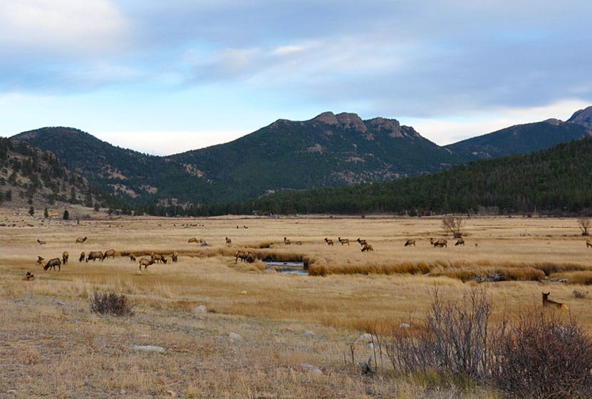
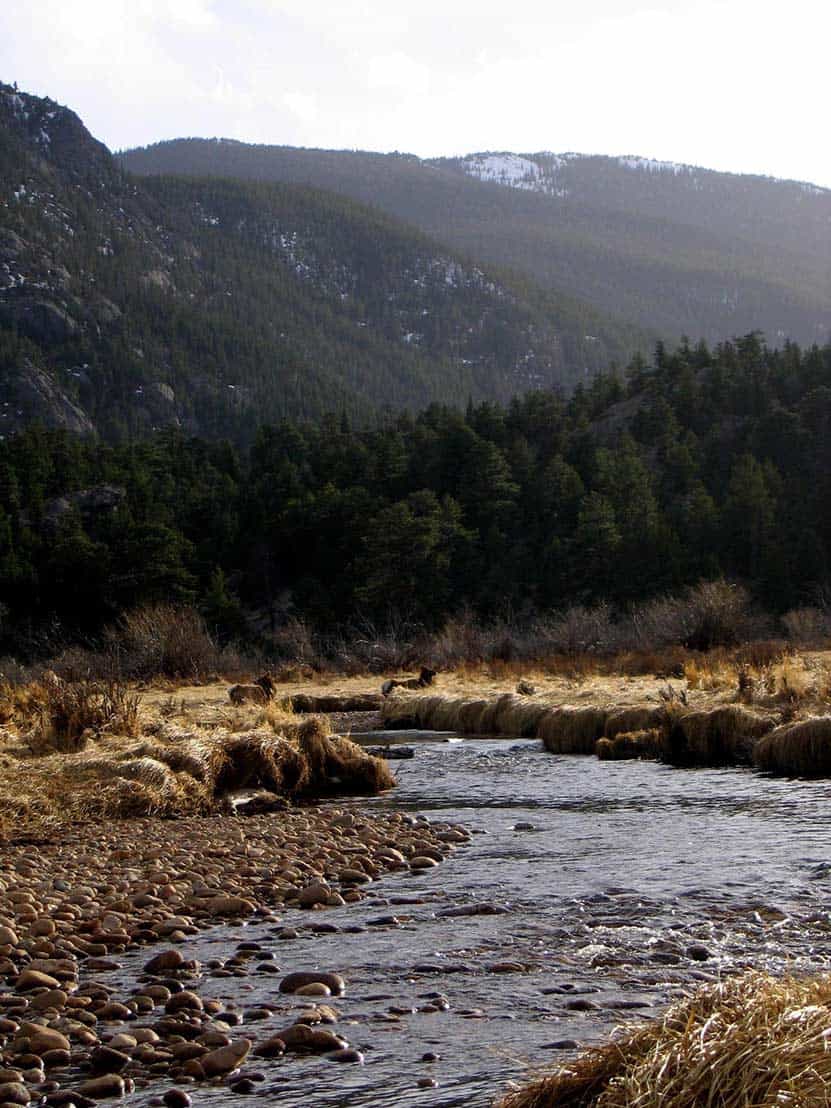
The Moraine Park Loop encircles the golden meadows of Moraine Park in Rocky Mountain National Park. The morning mists rising from the Big Thompson River, and herds of grazing elk make for an enchanted landscape. In the evening, the setting sun brings shadows and light play to the valley floor. All of this is against the backdrop of the distant snowcapped peaks of the Rocky Mountains. Explore the full Moraine Park Loop hike profile below for trail map, driving directions, and all the details you need to enjoy this adventure in Rocky Mountain National Park.
Note: Rocky Mountain National Park now requires timed entry permits from May 27th through October 10th. See the RMNP permits page for more information.
Trail Snapshot: Moraine Park Loop in Rocky Mountain National Park
| Hike Distance | 5.5 miles |
|---|---|
| Difficulty | Easy |
| Duration | Approx 3 hrs |
| Trail Type | Loop |
| Starting Elevation | 8128' |
| Elevation Gain | Approx +90' |
| Seasons | Spring through Fall, Winter Snowshoeing |
| Dogs | Prohibited in RMNP |
| Hike Trail Map | Click for a Map of Moraine Park Loop RMNP |
| Denver Drive Time | 1 hr 30 min |
| Driving Directions to Moraine Park Discovery Center | Click for Google Map |
| Town Nearest Hike | Estes Park, Colorado |
| Beauty | Mountain views, meadows, river, wildlife: Abert's squirrel, elk, deer, moose, duck, bear, mountain goat; wildflower |
| Activities | Picnicking, hiking trails, snowshoeing, horseback riding, backcountry camping (with a permit) |
| Fee | Park Pass Required |
Waypoints Along the Moraine Park Loop
A. 0.0 miles : Moraine Park Discovery Center
B. 0.6 miles : Moraine Park Trailhead
C. 0.8 miles : Trail through the Lateral Moraine Trail
D. 1.7 miles : Lateral Moraine Trail and Moraine Service Road intersection
E. 2.1 miles : Head west through the Lateral Moraine Trail
F. 2.9 miles : Lateral Moraine Trail - Cub Lake intersection
G. 3.4 miles : Cub Lake Trailhead
H. 4.1 miles : Continue east through Fern Lake Road
I. 4.5 miles : To Moraine Park Road
J. 5.3 miles : Back at Moraine Park Discovery Center
Parking & Trailhead Information for Moraine Park Loop
The Moraine Park Loop can be accessed from several different small parking areas such as the Cub Lake Trailhead and the Fern Lake Bus Stop, but the largest parking lot in the area is found at the Moraine Park Discovery Center. It's a great place to learn about the history and habitat of the area before or after your hike. Those staying at the Moraine Park Campground in RMNP can access this loop of trails by walking down the campground road, or via some short connector trails that come off the south end of the campground. Please only use well-worn trails, and don't cut across the fields from the campground, as this causes a lot of disruption and damage to the landscape.

The Hike: Moraine Park Loop Trail in RMNP
This 5.3 mile loop begins at the Moraine Park Discovery Center and follows a clockwise route around the outer rim of Moraine Park. Though this valley is the centerpiece of Rocky Mountain National Park, drawing thousands every year to watch the bull elk bugle and battle over rights to their harem of cows, the loop hike is not very well marked. However, much of this loop hike is an oft-used route for horseback rides guided by the local YMCA camp. Segments of this loop run along the dirt and asphalt roads at the rim of the meadows. Because of this, it's recommended to 1) Be very aware of cars. While the speed limit is low, drivers are often distracted by the views and wildlife, and 2) Look for paths in the meadow alongside the road. These will be safer routes than walking the roads. 3) When walking along the roads, please walk against traffic and walk in single file along the roads.
The hike begins at a high point, looking down upon the Park from the discovery center, and the trail can be picked up just to the east of Bear Lake road. By zooming in on the google map provided above, hikers should be able to discern a trail that runs roughly alongside the road. This is the safest option. The next segment, the South Moraine Trail, can be picked up by crossing Bear Lake Road and heading west on South Moraine Road.
The South Moraine Trail travels across the foot of the moraine for which this area is named. A moraine is a deposit left by either the side or foot of a glacier (imagine the piles of dirt left by an excavator as it cuts a path through the earth). This segment of the loop is a favorite for its views and partial shade.
After approximately 2 miles on the South Lateral Moraine Trail, hikers will encounter a junction with the Cub Lake Trail. To continue on the Moraine Park Loop, the correct direction is right/north on the Cub Lake Trail. After crossing the Big Thompson River, the stream that snakes its way through the meadows, the trail will come out at the Cub Lake Trailhead. Here, the loop continues right/east along Fern Lake road. Again, it's best to travel on any well-worn paths alongside the road when possible.
Fern Lake Road will terminate at Moraine Park Road. Here, the loop continues right/east back to the Moraine Park Discovery Center. An alternative route that avoids walking along Moraine Park Road is to cut through the Park on an established trail back down to the southeast corner of Moraine Park. Here, hikers can cross Bear Lake Road and take the same trail they used at the beginning and return to the Moraine Park Discovery Center.
Tips & Resources for Hiking to Moraine Park Loop in Rocky Mountain National Park
- Arrive Early for Parking: It is advisable to arrive early to avoid entry lines and to find suitable parking.
- Wildlife: Keep your distance from the Elk. While they are very used to humans, cows may be protecting calves, and bull elk can be aggressive during certain seasons. It's always best to view wildlife at a distance in our National Parks.
- The Fences: You'll notice fences along the route, and some gates you may pass through. These have been established because of the very high populations of elk in the park, which has in turn had a negative impact on the vegetation. These are here to help reestablish overbrowsed habitat.
- Trail Map for Bear Lake Corridor: Trail Map Link
- Packing List: Always pack the 10 Essentials. Download our Hiking Guide to get list and dayhiking packing checklist.
- Colorado Road Conditions: Colorado Road Conditions
- After the Hike: Mountain Home Café
Weather
Map & Driving Directions
Click for Driving Directions

Sprague Lake Loop Hike in Rocky Mountain National Park
At Sprague Lake you'll find an easy loop hike with some stunning views of the mountains that make Rocky Mountain National Park famous. It's a perfect hike in RMNP for young families because the trail is short and has no real elevation gain. With diverse wildlife and a beautiful, peaceful lake, this is one of those spots you should not miss in RMNP. Explore the full Sprague Lake hiking profile below for trail map, driving directions, and all the details you need to enjoy this Colorado adventure in Rocky Mountain National Park.
Trail Snapshot: Sprague Lake Loop in Rocky Mountain National Park
| Hike Distance | 1/2 mile |
|---|---|
| Difficulty | Easy |
| Duration | Approx 30 min |
| Trail Type | Loop |
| Starting Elevation | 8690' at Trailhead |
| Elevation Gain | Approx +20′ |
| Seasons | Spring through Fall, Winter Snowshoeing |
| Dogs | Prohibited in RMNP |
| Hike Trail Map | Click for a Map of Sprague Lake RMNP |
| Denver Drive Time | 2 hr |
| Driving Directions to Sprague Lake Trailhead | Click for Google Map |
| Town Nearest Hike | Estes Park, Colorado |
| Beauty | Sub-alpine lake, mountain views, wildlife: Abert's squirrel, elk, bear, beavers, waterfowl, moose, ducks, Canadian geese |
| Activities | Picnicking, hiking trails, snowshoeing |
| Conditions at Bear Lake Trailhead | Click Here |
| Fee | Park Pass Required |
Sprague Lake Loop Hike
Sprague Lake is a 13-acre lake named after Abner Sprague, an early resident of the Estes Park area who ran a game lodge on the this property which is now part of Rocky Mountain National Park. To access the 1/2 mile loop hike around Sprague Lake, cross the bridge near the parking area. Be sure to pause at the bridge to look for trout. We've spotted an enormous brown trout motoring in these waters near the bridge. It's a regular spawning area in the autumn, so this little segment of water can become quite crowded with fish.
After the bridge, the trail can be hiked to either the left or the right around the perimeter of Sprague Lake. Keep your eyes peeled for Beaver and Moose, both residents of the area. You will be more likely to spot wildlife in the early morning hours.
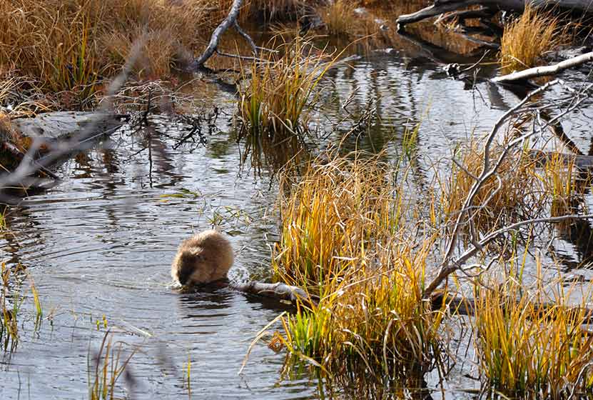
A Beaver at Sprague Lake RMNP
In the early spring, the trail will likely still be under snow. However, this is such a popular area that it should be easy to spot the trail left by others. As you make your way to the northeastern rim of Sprague Lake, you'll gain views of the continental divide, including Hallett Peak. This is a perfect spot to set up your camera for an iconic photo of RMNP.
In the Fall, this is one of the better spots in Rocky Mountain National Park to view the aspen trees changing on the distant mountains.
Tips & Resources for Hiking to Sprague Lake :
- TIP: Hiking shoes are recommended if you hike during early spring or late winter as you might need to pass through snow on the trail.
- TIP: If you get out early on a spring morning, you might be lucky enough to spot a moose or more.
- Rocky Mountain National Park Trail Conditions: Click for RMNP Trail Conditions
- Trail Map for Bear Lake Corridor: Trail Map Link
- Colorado Road Conditions: Colorado Road Conditions
- After the Hike: Poppy's Pizza
- Photo: We would like to express our gratitude to Tim Stacks for sharing such a beautiful photograph of this hike at Sprague Lake.
Weather
Map & Driving Directions
Click for Driving Directions
Eldorado Cascades at Walker Ranch
Eldorado Cascades is tucked back in Walker Ranch near Boulder, Colorado. It's an easy to moderate 1.25 mile hike from the Ethel Harrold Trailhead down to where South Boulder Creek winds through the park and crashes over the boulders blocking its path. Explore the full trail profile below for all the details: tips, trail map, and driving directions to the trailhead.
Trail Snapshot: Eldorado Cascades at Walker Ranch
| Hike Distance | 2.5 mile Round Trip |
|---|---|
| Difficulty | Moderate |
| Duration | Approx 1.5 hr Round Trip |
| Trail Type | Out and Back |
| Starting Elevation | 7000′ |
| Elevation Gain | Approx -500' to Cascades, +500 back to Trailhead |
| Seasons | Spring through Fall |
| Dogs | Allowed On Leash |
| Hike Trail Map | Click for a Map of Walker Ranch |
| Denver Drive Time | 1 hr |
| Driving Directions to Walker Ranch Ethel Harrold Trailhead | Click for Google Map |
| Town Nearest Hike | Boulder, Colorado |
| Beauty | Boulder Creek, Cascades, Wildlife: Birds, Elk |
| Activities | Hiking, picnic facilities, mountain biking, horseback riding |
Eldorado Cascades can be reached from several different trailheads that tie into the Walker Ranch Loop system. However, the shortest and probably easiest access is by starting at the Ethel Harrold Trailhead. See the directions driving directions links on this page, and be sure to make note of your last couples turns because cell phone services are spotty.
The drive up to the trailhead on Flagstaff Road is a beautiful one, but do be aware of the many hikers, climbers, and cyclists along the road. After Flagstaff road, the two roads that lead to the trailhead, Pika, then Bison, are improved dirt roads. These were recently graded when we visited (early April) and were fine to drive. However, 4-wheel drive is probably necessary during the winter months or after early Spring rains or snowfall. The trailhead parking area has a pit toilet and information board. If you are interested in birdwatching, you'll find a Birds of Walker Ranch Chechlist at the board.
The Hike to Eldorado Cascades
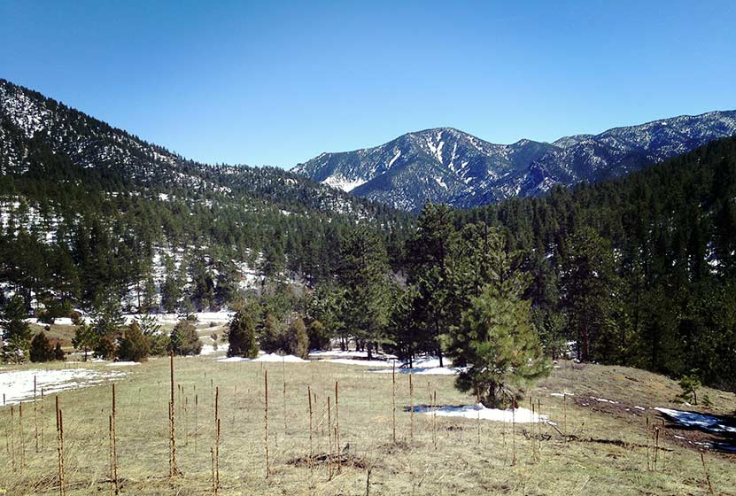
The hike begins with expansive views of Walker Ranch and out towards Eldorado Canyon State Park (pictured above). The air was full of the scent of juniper trees, and we found abundant Elk sign in the meadows near the trailhead. The trail winds down to a intermittent stream that was gushing with the early Spring snowmelt. A bridge buried in snow leads across the creek, then the trail skirts the hillside for most of the hike, gradually working its way down to a junction with the Walker Ranch Loop Trail. At the junction, the trail to Boulder Creek and Eldorado Cascades is to the right and takes hikers further downhill to a bridge that crosses South Boulder Creek.
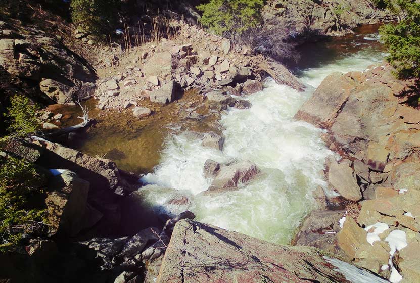
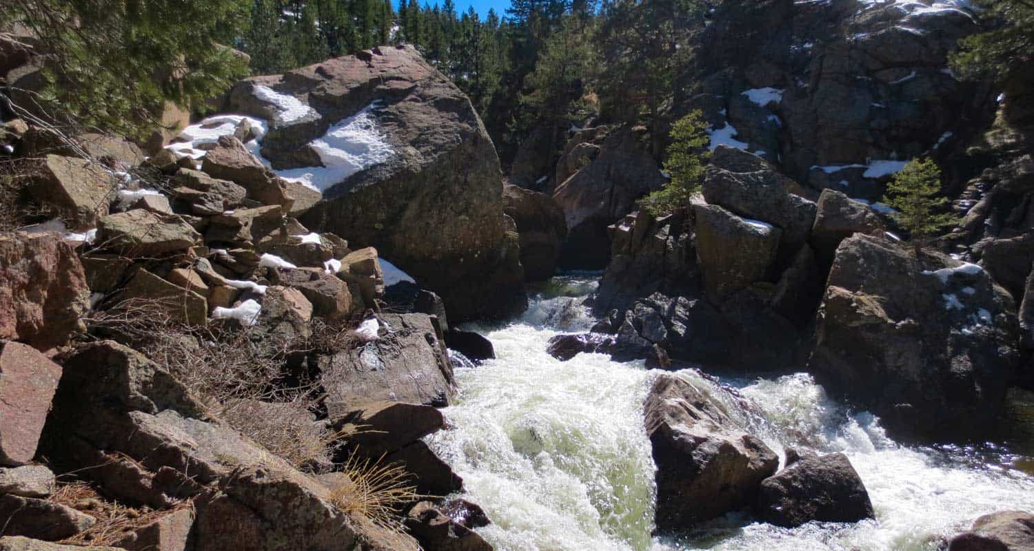
The sound of water is almost always within earshot, and the chirps of a variety of birds fill the air. Shortly before the bridge, hikers may notice a "To Eldorado Canyon" sign and trail on the left side of the Walker Ranch Trail. This leads to Eldorado Canyon State Park, about 3.5 miles away, but does not lead to the cascades. The cascades can be found almost immediately after crossing the bridge that spans South Boulder Creek. Here the trail becomes a series of uneven rock stairs that lead to the top of the cascades (pictured above is view from the top).
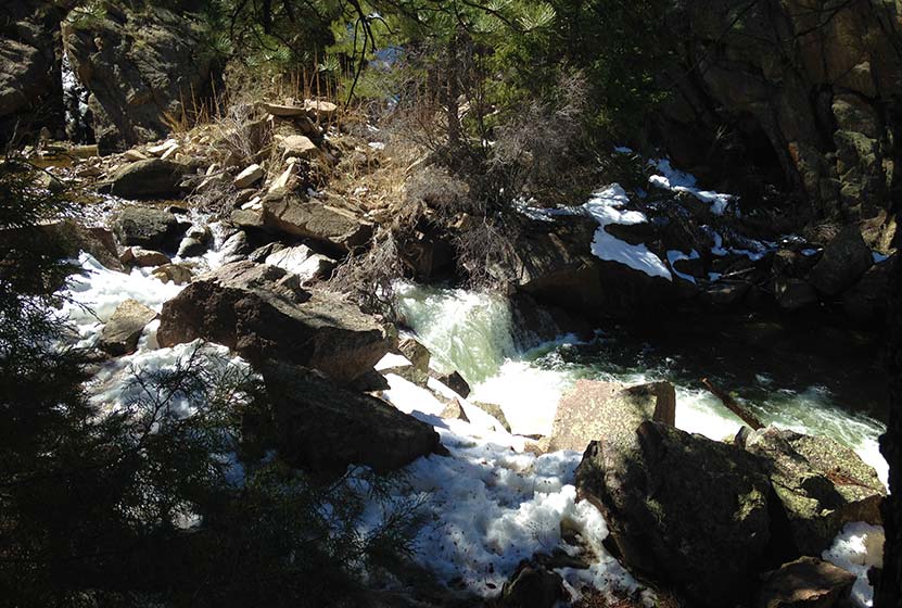
"Eldorado Falls" seems to be a local and unofficial name given to this set of cascades. The trail map simply marks them as "falls." On the back side of the cascades, South Boulder Creek seems to disappear under massive boulders that block its path. Here the water slips under the rock then shoots out on the other side in a series of small cascades. The water pools, then pours over another lower cascades (pictured above) before returning to calmer waters.
The hike back is mostly uphill, but it's only about a +500' of elevation gain. The park is open in the winter; however, the trail from the Ethel Harrold trailhead down to the Walker Ranch Loop might become difficult to discern after a blanket of snow. So, the ideal times are Spring through Fall.
Tips & Resources for Hiking to Eldorado Cascades
- Come Prepared in Spring and Winter: Because the trail is mostly in shade of ponderosa pines, the snow and ice can settle in during both winter and spring. Therefore, we recommend Trekking Poles and/or Traction Devices for this trail (I wish I had brought mine).
- Exercise Caution Around the cascades: The area around Eldorado Cascades is rocky and uneven. The cascades are also difficult to photograph because of how it's tucked back into the canyon. For this reason, exercise caution along the slippery rock and near the waters of South Boulder Creek.
- Trail Map for Walker Ranch: Trail Map Link
- Packing List: Always pack the 10 Essentials. Download our Hiking Guide to get list and dayhiking packing checklist.
- Colorado Road Conditions: Colorado Road Conditions
- After the Hike: Ozo Coffee in Boulder
Weather
Map & Driving Directions
Click for Driving Directions
Looking for waterfalls near Denver? Explore our more than 50 Colorado Waterfall Hikes, our favorite Waterfall Hikes in Rocky Mountain National Park, or 7 Waterfalls within One Hour of Denver.
Hiking Davis Ponds Hike at Staunton State Park
The Davis Ponds loop is a short and easy hike, perfect for young families. Davis Ponds is a great place to take your kids fishing near Denver. Explore the full trail profile below for all the details: hiking trails, trail map, and detailed directions to the trailhead.
Staunton State Park is one of Colorado's newest gems and located just 45 minutes from downtown Denver. It's a great park for outdoor activities, including hiking, mountain biking, and rock climbing. Staunton has some longer and more demanding trails, but this hike, the Davis Ponds Loop Trail, is a lighter option with some beautiful views to the mountains and the prominent Lions Head outcropping.
Trail Snapshot: Davis Ponds Loop at Staunton State Park
| Hike Distance | 2.15 Miles |
|---|---|
| Difficulty | Easy |
| Duration | Approx 1 hr |
| Trail Type | Loop |
| Starting Elevation | 8200′ |
| Elevation Gain | +80′ |
| Seasons | All Year |
| Dogs | Allowed On Leash |
| Hike Trail Map | Click for a Trail Map |
| Denver Drive Time | 45 min |
| Driving Directions to Staunton State Park | Click for Google Map |
| Town Nearest Hike | Conifer, Colorado |
| Beauty | Meadows, Pine Forest, Ponds, Hummingbirds, and Deer |
| Activities | Hiking, Fishing |
| Fee | Entrance Fee or State Parks Pass Required |
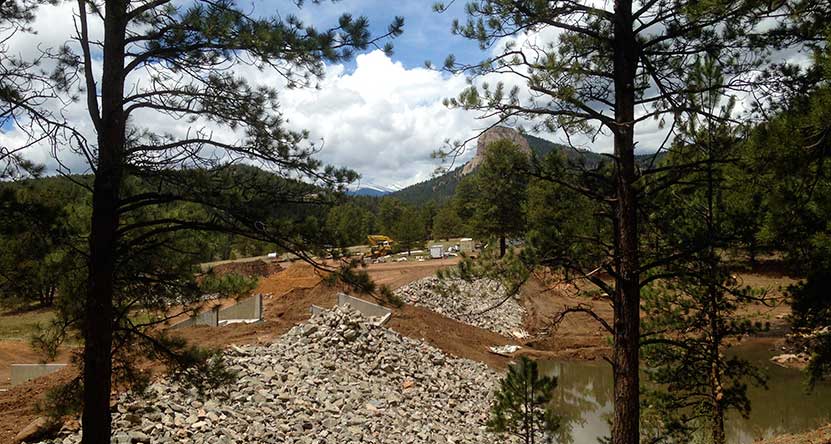
The trail begins just to the north of the initial parking lot (pictured above). We hiked the trail clockwise, taking the trail to the left, but it can be hiked in either direction. The Davis Ponds trail is hiker-only, so you will not encounter any mountain bike or horse traffic, making this perfect for young kids. There is scattered shade as the trail winds in and out of meadows and pine forest. Deer make their way grazing near the trail and hummingbirds buzz by, finding nectar in the wildflowers growing out of the rocky soil.
Before the ponds, there is a cut-through trail that can be used to shorten the hike by approximately 1/2 mile, but it's worth going all the way to Davis Ponds and to gain views to the west. The Davis Ponds were under construction and improvements while we were there, but they have now been finished and stocked with rainbow and cutthroat trout. If you are looking for a weekend destination near Denver to fish with your children, this may be one of the best.
On the way back, the trail will merge again with the cut-through trail. The trail back to the trailhead bears left and slightly uphill.
Tips & Resources for Hiking the Davis Ponds Loop :
- TIP: Getting into the park can be slow at times, so be prepared to wait at the entrance on busy weekends.
- Wildlife: You'll find that deer are out grazing in the early morning and closer to twilight.
- Winter: During the Winter, park hours are 8am - 7pm.
- Trail Map for Staunton State Park: Trail Map Link
- Packing List: Always pack the 10 Essentials. Download our Hiking Guide to get list and dayhiking packing checklist.
- Colorado Road Conditions: Colorado Road Conditions
- After the Hike: Crow Hill Cafe in Bailey
Weather
Map & Driving Directions
Click for Driving Directions
Ultimate Guide to Maroon Bells in Colorado
The Maroon Bells offer several hikes and some of the most beautiful scenery in Colorado. It's a Rocky Mountain landscape painted with cascades, lakes, golden aspens, and all against the backdrop of the peaks of the Maroon Bells. This guide to the Maroon Bells features 5 different hiking trail options, spanning from easy hikes to moderately demanding. Because traffic in this area has skyrocketed in recent years, a fee is required to access whether you are driving in or taking the shuttle.
We've attempted to create the definitive guide to hiking from the Maroon Bells Trailhead. In this guide, you'll find: Driving directions to Maroon Bells, Trail Maps, Important Shuttle Bus information, Photography tips, Camping information for the Maroon Bells area, and Tips & Resources for planning your Colorado Vacation. This guide to Maroon Bells is extensive, so we have created a table of contents to help you navigate. Have fun exploring!
Maroon Bells Hiking Guide Contents
1. Trail Snapshot
2. Driving Directions: Parking, Fees, and Permits
3. Parking & Trailhead
4. Hiking the Trail
5. Maroon Lake Trail
6. The Scenic Loop Trail
7. Maroon Creek Trail
8. The Crater Lake Trail
9. The Willow Lake Trail
10. Photography
11. Hiking with Kids
12. For Out-of-State Hikers
13. Things to Do Nearby
14. History and Geology
15. Protect Maroon Bells
Maroon Bells Hike Snapshot
Hike DistanceFive Trails: 1 to 13 miles Round Trip - Depending on TrailDifficultyEasy to ModerateDurationDepends on Hike (see trails below)Trail TypeBoth Loop and Out-and-Back HikesStarting Elevation9500′Elevation GainNominal up to +3030'SeasonsMid-May to Mid-November (weather dependent)DogsAllowed On 6' leash - but Prohibited on the Scenic Loop TrailHike Trail MapClick for a Map of Maroon Bells Area HikesDenver Drive Time4 hoursDirections Click for Driving Directions to Maroon Bells Town Nearest HikeAspen, ColoradoBeautyIconic Mountain Views, Lakes, Meadows, Tundra, Fall Aspens, Moose, Beaver, and ElkActivitiesHiking, Backpacking, CampingFeeAccess Fee of $10 per vehicle or individual shuttle bus fee
Driving Directions to Maroon Bells: Parking, Fees, and Permits
Because the Maroon Bells trailhead is one of the heaviest used recreation areas in the state of Colorado, there are some driving and access restrictions during the busy summer months. That's why it's important to carefully read these details before you plan your trip.
The Basics
- The Maroon Bells Trailhead is seasonal, and closed from about mid-November though mid-May. Because snow is unpredictable, the exact dates may change. Check the AspenChamber.org page for the most up-to-date and accurate information.
- Parking is very limited at the Trailhead and requires both a permit/reservation and fee. Read all the details at the AspenChamber.org Maroon Bells Reservations page.
- During the busy season, you have to arrive and park at the trailhead by 8AM or After 5PM.
- Most visitors will need to take the shuttle in during the day. Tickets are available online at the RFTA website https://www.rfta.com/routes/maroon-bells/
- Be prepared to shell out some cash for the trip. Parking in Aspen is both limited and expensive. Parking + shuttle costs can really add up for a group. The least expensive way to visit, is to book a parking permit for the trailhead (often many weeks ahead of time) at https://aspenchamber.org/plan-trip/trip-highlights/maroon-bells/reservations
- Plan, Plan, Plan: There are still a ton of places in Colorado where you can jump in the car, drive to a trailhead, and hike. Maroon Bells is not one of them. So, take your time, make your reservations, and plan out your trip.
Driving Directions
There are three different sets of driving directions that you may find helpful.
- Driving Directions to the Maroon Bells Trailhead
- Driving Directions to the Maroon Bells Shuttle Bus service at Aspen Highlands
- Driving Directions to the Rubey Park in Aspen for the free shuttle to Aspen Highlands where you can catch the Shuttle
Access Tips for Maroon Bells in the Summer
- If the Aspen Highlands lot is full--which is often the case--, you can take the free Castle/Maroon bus from Rubey Park in Aspen to Aspen Highlands, where can pick up the Maroon Bells shuttle (link and map for directions to Rubey Park).
- It's also important to note that if your plans are to backpack and camp in the Maroon-Snowmass Wilderness, you will not be given a parking exception, but will need to take the bus in from the Aspen Highlands lot during the 8am-5pm timeframe.
- Another option is to cycle the 8 miles, one-way from Aspen Highlands up to the Maroon-Snowmass trailhead. There is no fee for cyclists, only vehicles. However, it's important to remember that the road is still very busy, even during the 8am-5pm hours when the driving restrictions apply. As with hiking the area, plan to bring proper gear for the frequent afternoon thunderstorms--yet another reason to go early.
- Driving Out: It's important to note that if you drive in to the trailhead, you may drive out at any time.
Access Tips for Maroon Bells During the Rest of the Year
- In Late-Spring: From when Maroon Creek road opens, which is historically mid-May, and until mid-June--when the shuttle bus service starts--you are allowed to drive the road from 8am-5pm. Of course, permits are still required.
- In Late-Fall: There is a small window, during the last week of October, when you can drive Maroon Creek road to the trailhead any day and any time of the week. Again, the access fee applies. See details at https://aspenchamber.org/plan-trip/trip-highlights/maroon-bells/reservations
- Maroon Bells During the Winter Months: Winter comes in early at this elevation and it holds on well through April. Maroon Creek road is closed during the winter months, beginning in mid-November. Until the road reopens around mid-May of each year, the trailhead is only accessible by hiking in, cross-country skis, or via snowmobile tours. Snowmobile tours can be booked through T-Lazy-7 Ranch. From the gate, the hike/ski in is about 6 miles one-way, and from Aspen Highlands, it's about 8 miles one-way.
Parking and Facilities at the Maroon Bells Trailhead
The Maroon Bells Trailhead--officially titled the Maroon-Snowmass Trailhead--has limited parking and no facilities, except for restrooms. There is plenty of space to lock up your bike on the provided bike racks. There are 35 parking spaces designated for backpackers who are overnighting in the wilderness and you may park for up to 5 consecutive nights in those designated spots. These fill up during the busy season, so be sure to have the shuttle as your plan-b. If you get to Aspen Highlands after the last bus, then you will need to have a plan-c: take a taxi (expensive) in or ask a friend to drive you into the trailhead. Overnight backpackers are not allowed to park in the day-use area. Again, get all the details and permits at https://aspenchamber.org/plan-trip/trip-highlights/maroon-bells/reservations
Guide for Hiking at Maroon Bells
Trail Option #1 - The Maroon Lake Trail at Maroon Bells
- Distance: Less than One Mile
- Difficulty: Easy
- Trail Type: Out & Back
- Elevation Gain: Nominal
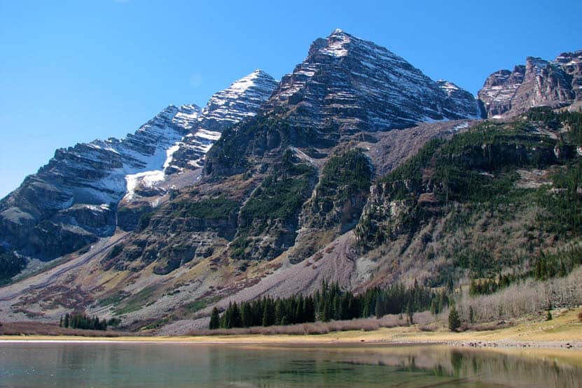
The Maroon Lake Trail heads out from the trailhead to the northeast side of Maroon Lake (elevation 9580’) where hikers can take in iconic views of the peaks of the Maroon Bells reflected in its mirrored waters. Fishing is allowed at Maroon Lake, but a Colorado fishing license is required. Be sure to follow limits and regulations. Bring a picnic lunch and soak in the scenery, which includes aspen groves, Maroon Creek, and surrounding meadows. Do be mindful to stay to the trail as the high amount of foot traffic has a profound impact on the environment. For tips on taking a great photo of the Maroon Bells, check out the Photography at Maroon Bells section below.
Trail Option #2 - The Scenic Loop Trail at Maroon Bells
- Distance: 3 Miles
- Difficulty: Easy
- Trail Type: Lollipop Loop
- Elevation Gain: Approx. +120'
- Dogs are prohibited because of Moose inhabiting this area.
The Scenic Loop Trail is probably the most popular trail at Maroon Bells, and for good reason: the views are incredible, the loop takes you along the cascades of Maroon creek for much of the hike, and wildflowers spring up at your feet along the trail. A lollipop loop is a hike that begins with a straightaway (part of the out & back hike above), which takes you to a loop on the end. The Scenic Trail Loop begins at a footbridge on the far/west end of the lake. A way up the trail, hikers will notice another footbridge on the right. This can be taken to shorten the trip by crossing the creek then turning right to head back to Maroon Lake and the trailhead. However, the loop trail actually goes further and past some exceptionally beautiful cascades before turning back toward Maroon lake.
Trail Option #3 - The Maroon Creek Trail
- Distance: 2.5 or 3.5 Miles - One-Way
- Difficulty: Easy
- Trail Type: One-Way
- Elevation Gain: -870'
- Maroon Creek Lake Trail Map: Map Link
If you are looking for a less crowded option, the Maroon Creek Trail may be the best choice. The Maroon Creek Trail winds downhill alongside Maroon Creek for 3.5 miles. Being near water, the chances of seeing wildlife are pretty good. Maroon Creek Trail begins at Maroon Lake and the trail can be picked up by hiking across the footbridge, turning left, then following the trail down into the valley (away from the Maroon Bells). The trail offers two options.
#1 - 2.5 Mile Hike:
Hikers will encounter and cross a bridge at about 2.5 miles into their hike. At this point, a trail off to the left can be taken across the meadow and up to the road where they can catch the bus back to Aspen Highlands or back to the trailhead. Of course, be mindful of the traffic.
#1 - 3.5 Mile Hike:
The second option is to continue on the trail, cross another bridge, then to stay left onto the East Maroon Trail. This will wind downhill a bit further to another area where you can catch the bus along Maroon Creek Road. As you hike, don't forget to stop occasionally to take in the views behind you of the Maroon Bells.
Trail Option #4 - The Crater Lake Trail at Maroon Bells
- Distance: 3.6 Miles Round Trip
- Difficulty: Moderate
- Trail Type: Out & Back
- Elevation Gain: +500'
- Crater Lake Trail Map: Map Link
The Maroon/Snowmass trail (right of lake) will lead hikers through a meadow and to a forest service bulletin board at the far end of the lake. From this point the correct trail is the West Maroon/Crater Lake trail which leads up through meadows, aspens forests, and scree fields. The trail can be extremely rock, so be sure that you have excellent footwear. The trail will split at about 1.7 miles where the correct trail to follow is the West Maroon/Crater Lake Trail. At this point, Crater Lake is not far away. The trail will eventually dip down into a beautiful basin that holds Crater lake and incredible views of the Maroon Bells. Crater Lake is not stocked or fishable as it is a dead lake. It is also an area that has been negatively impacted by heavy use and poor camping practices. Because of this, camping is now prohibited and great care should be exercised to keep human and canine impact to a minimum.
Trail Option #5 - The Willow Lake Trail at Maroon Bells
- Distance: approx. 13 Miles Round Trip
- Difficulty: Difficult
- Trail Type: Out & Back
- Elevation Gain: +3020' to Willow Pass
- Willow Lake Trail Map: Map Link
The Willow Lake trail is demanding and may require an overnight. The trail begins at Maroon Lake and follows the same trails that lead to Crater Lake. At the Crater Lake bulletin board, the trail forks to right and makes its way up through Minnehaha gulch, through alpine meadows and eventually to a trail sign for Maroon-Snowmass/Willow Lake Junction. Here the trail goes to right. Switchbacks lead to top of Willow Pass. After making it over Willow Pass, Willow Lake is a more gradual 1.5 miles further down the trail. This hike is difficult, steep, and more exposed to the regular thunderstorms that form in the afternoons. Camping is prohibited in the meadow near Buckskin Pass, and camping is discouraged at Willow lake. The best option is to camp in the established sites in Minnehaha Gulch.
Get our Dayhikes Near Denver Hiking Guide. It includes our favorite hikes near Denver, packing lists, hiking food and snack ideas, and tips for hiking the Front Range of Colorado.
Photography: How to Get Great Photos of the Maroon Bells
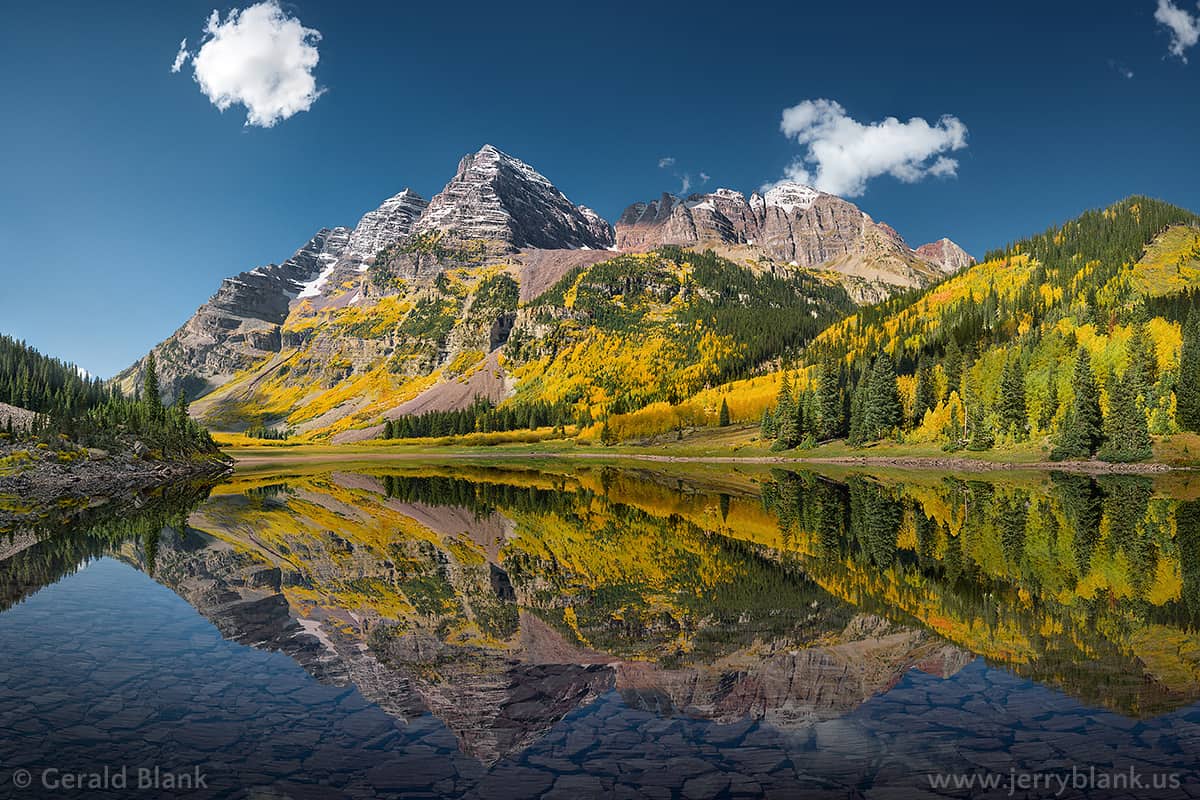
We would like to thank photographer Jerry Blank for the stunning photo of the Maroon Bells at the top of this post. We asked him for a few photography tips and he emphasized the importance of arriving early in order to 1) get a parking spot, and 2) to get a shot of the water before the wind kicks up ripples on the early morning mirror surface of the lakes. More of his photos can be viewed and prints can be ordered from his galleries at this link.
- Fall is the Best Time for Photos: The changing aspens peak in their golden hues during the latter half of September. However, this is just a rule of thumb because much depends on the changing temperature, so it varies from year to year.
- Sunrise Shots are Primo: We all have our best side, and the Maroon Bells' best side faces east. This means that the morning sunrise provides the best opportunity for photos.
- What Time Should I Get There? Earlier than you think. The shoreline of Maroon Lake fills up fast with tripods, so you'll want to get there well before sunrise.
- Dress for the Occasion: Wear your down coat and bring a thermos of hot coffee. The morning breeze and cold temps will conspire to make the wait for sunrise a cold one.
Hiking with Kids at Maroon Bells
- Hydrate: We hike a lot with our kids and it's easy for them to get dehydrated, especially in the dry climate and at high altitude in Colorado. Bring water bottles full of water for everyone.
- Pack Snacks or Bring a Lunch: The drive back to Maroon Bells takes you pretty far out of town and you'll want to stay a while. Bring snacks or a picnic lunch to refuel while you are exploring.
- Choose a Hike with Options: If your children are younger then you may want to begin with the Maroon Lake Trail. If you are still feeling adventurous after that, you could add on all or part of the Scenic Loop. Be aware of Moose and keep your distance from them.
Visiting Maroon Bells From Out-of-State
- Download our Hiking Guide for a list of hiking tips, 10 essentials that everyone should pack for their dayhike, and recommended hiking snacks.
- Take it Easy: Hiking at altitude (almost 2 miles above sea level at the Maroon Bells trailhead) can be really demanding. Choose a trail that matches your physical shape and be prepared to go at a slower pace.
- Don't Drink from Streams or Lakes: There is a misconception that drinking from a mountain stream or lake is the purest water in the world--it's not! Mountain streams and lakes are watering holes for wildlife, especially rodents that carry parasites like giardia and other waterborne infectious diseases that can completely ruin your vacation. All water from these areas should be properly filtered and/or purified.
Camping Near Maroon Bells
There are three established USFS camping areas along Maroon Creek Road on your way in to the Maroon Bells Trailhead. These three are some of the more popular campsites in the state during the summer and fall, so you will want to reserve them well ahead of time. You'll find profiles for the three camping areas below. Reservations can be made at all three campgrounds by calling 1-877-444-6777 or by reserving online at www.recreation.gov
Crater Lake Campground has been closed because of bear activity in the past, so be sure to check to see if it is currently open. However, there are about 20 USFS campgrounds in the White River National Forest area near Aspen. The USFS has a handy camping brochure that can be downloaded at this link.
Silver Bar Campsite
- Driving Directions to Silver Bar Campground: Click for Directions
- Four primitive walk-in campsites only
- Elevation: 8500'
- Drinkable water and toilets, as well as picnic tables and fire-grates are available.
- Five-day camping limit with 2pm checkout.
- Eight-person, two car limit per campsite.
- Pets allowed but must be leashed at all times.
- Reservable Dates: 5/26 - 9/13
- Fees: Camping Fee + Vehicle Fee
Silver Bell Campsite
- Driving Directions to Silver Bell Campground: Click for Directions
- Fourteen campsites
- Elevation: 8350'
- Drinkable water and toilets, as well as picnic tables and firegrates are available.
- Five-day camping limit with 2pm checkout
- Eight-person, two-car limit per campsite.
- Pets allowed but must be leashed at all times
- 30' RV limit
- Reservable Dates: 5/26 - 9/13
- Fees: Camping Fee + Vehicle Fee
Silver Queen Campsite
- Driving Directions to Silver Queen Campground: Click for Directions
- Six campsites
- Elevation: 9100'
- Drinkable water and toilets, as well as picnic tables and firegrates are available.
- Five-day camping limit with 2pm checkout
- Eight-person, two-car limit per campsite.
- Pets allowed but must be leashed at all times
- 30' RV limit
- Reservable Dates: 5/26 - 9/13
- Fees: Camping Fee + Vehicle Fee
Backcountry Camping in the Maroon Bells/Snowmass Wilderness
- Camping is allowed within the Maroon Bells/Snowmass Wilderness area. Be sure to follow all the Wilderness Use Regulations and Practice Leave No Trace principles.
- Camping at the designated spots at Crater Lake is currently allowed, but has been closed in 2014-2015 because of increased bear activity in the area, which is due to poor camping practices. The USFS will close the area again if bear activity becomes problematic.
- Bear canisters are required
- Self-registration required at the trailhead
- Pets allowed but must be on a 6' leash at all times in the wilderness.
Things to Do Near Maroon Bells
- White Water Rafting with Aspen Whitewater Rafting
- Guided Climbing, Hiking, and Mountaineering Trips with Aspen Alpine Guides
- Winter Snowmobile Access to Maroon Bells with T-Lazy-7 Snowmobile Tours
History and Geology of Colorado’s Maroon Bells
The brick red color of the Maroon Bells is created by the oxidation of iron in the ancient sedimentary rock that makes up the mountains. They were formed when ancient granite mountains eroded, then were thrust toward the sky in a later mountain building event. Glaciers then cut valleys and cirque lakes, like Maroon Lake and Crater Lake. The Maroon Bells are considered Colorado Fourteeners with North Maroon at 14,014' and the summit of South Maroon Peak at 14,156'. They are called "the bells" because the shape of the mountains resemble church bells. The surrounding Maroon Bells-Snowmass Wilderness area was one of the first US Wilderness areas established in 1964. The ruins of mine riddle the landscape from the silver mining activity of the late 1800's.
The sedimentary siltstone that makes up the Maroon Bells and nearby mountains, like Pyramid Peak, makes them very dangerous to climb. It's described by climbers as "rotten" rock and very unstable. In fact, in 1965 there were five different climbing accidents on the Maroon Bells, taking the lives of eight climbers. This gave the Maroon Bells the new monicker, the "Deadly Bells". There are yearly accidents and usually deaths on the Bells. Because of this, we recommend that those contemplating an ascent of the Maroon Bells should contact a professional guiding service.
How You Can Protect the Maroon Bells Area
- Camp in Designated Spots: Camping has been prohibited at many of the high-mountain lakes in the Maroon Bells-Snowmass area in order to protect these overused and highly impacted environs. The USFS has inventoried over 700 campsites, that have impacted the equivalent of 35 football fields of land. So, be sure to use established camping areas in both the wilderness and along Maroon Creek road.
- Keep Out of the Water: People and Dogs can greatly disturb fragile ecosystems in streams and lakes because of detergents and oils on our clothing and skin. The water sources around Maroon Bells are at a much higher risk because of the sheer volume of hiker and backpacker traffic.
- Keep Dogs on a 6' Leash: I have regularly hiked with my dog for years, and have often let her off the leash. But in the last few years, I've become much more aware that man's best friend has a significant impact on the wildlife that make our wilderness areas their home. Even in areas that don't require leashes, I now leash our dog. As much as you would love for your dog to run free, it's important to remember that both we and our dogs are guests in this place and we want to leave the least amount of impact possible. Of course, this is a 6' leash required area. The Ranger District is now giving special attention to unleashed dogs and writing tickets.
- Pack Out All Trash: It should probably go without saying, but be sure to pack out your trash, including both human and dog waste. In 2015 alone, forest rangers packed out over 500 pounds of trash left by visitors to the Maroon Bells-Snowmass area.
Weather
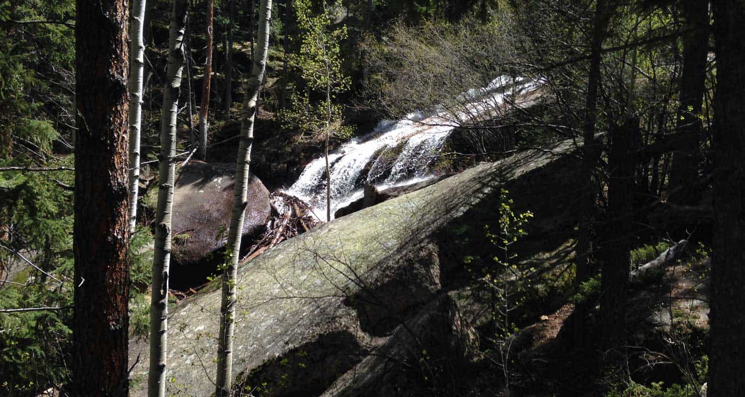
Buffalo Creek Falls at Wellington Lake
This waterfall isn't even on the map, and it's become my favorite waterfall hike near Denver. In fact, this is the only post that I'm tempted to keep to myself, because not only is there great hiking, but Wellington Lake may be the best camping spot within 90 minutes of Denver.
There is a hitch though: it's a privately held recreation area and requires a day-use fee of $14 per adult (age 13+) and a fee of $6 fee per child. Fees have gone up so, (depending on the size of your party) it probably makes more sense to pay the camping fee, stay for at least one night, and make the waterfall hike a part of your adventure. Explore the full trail profile below for this beautiful waterfall hike near Denver.
Trail Snapshot: Buffalo Creek Falls at Wellington Lake
| Hike Distance | 0.5 mile RT |
|---|---|
| Difficulty | Easy |
| Duration | approx. 30 minutes |
| Trail Type | Out and Back |
| Elevation Gain | Approx. +500' |
| Seasons | Year Round |
| Dogs | Allowed On Leash |
| Hike Trail Map | Click for a Map of Buffalo Creek Falls |
| Denver Drive Time | 1 hr 45 min |
| Directions | Click for Google Map |
| Town Nearest Hike | Bailey, Colorado |
| Beauty | Waterfall, Lake, Castle Mountain, Osprey, Waterfowl |
| Activities | Hiking, camping, boating (non-motorized), fishing |
| Fee | 14$ per adult, 6$ per child ages 6-12. See Castle Mountain Rec site for up-to-date fees |
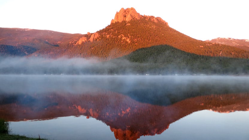
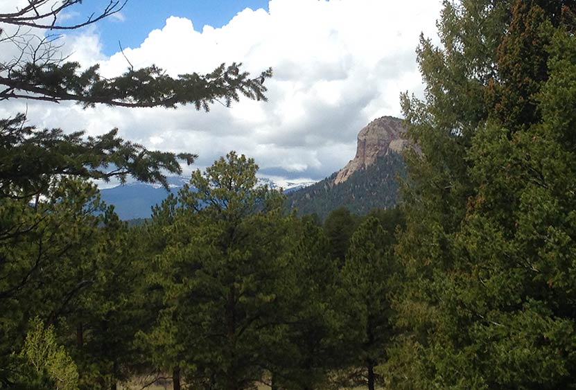
You'll find Buffalo Creek Falls at the backside of Lake Wellington and just under the shadow of The Castle, a granite mountain that rises off the lake and is named--you guessed it--because it looks like a fortress. Read on to get a detailed set of driving directions, a description of Buffalo Creek Falls, places to explore beyond the falls, and some details on camping at Wellington Lake.
Driving Directions to the Trailhead:
You'll drive 285 to Bailey, then hang a left onto 68/Wellington Lake Road. 68 is a dirt road and relatively smooth. Still, rain can change things in an instant, so we advise being alert for potholes and washboard. When you arrive at the lake, pull up to the office building, and pay your day-use fee. We have been incredibly impressed by the folks who work here, they are hospitable and kind. If you decide to camp, this is where you pay your campsite fees and get firewood. Put the day-use tag in your car where it's visible, then take the road around the lake. Be aware of kids running and playing because the road runs right through the campground. The Google maps provided in this post only go about halfway around the lake. You'll want to continue further, all the way to the scout camp, and that's where you'll find the large dirt parking area and the trailhead.
The Hike to Buffalo Creek Falls
My friend Matt and I took our two 4 1/2-year-old daughters with us on this hike and they did great. Look for the trailhead that begins just to the left of the Scout Camp sign. It's been raining almost every day this year (2015) so there was a lot of mud and puddles at the start. This gives way to a trail that climbs about 400 yards or less up to the base of the falls.
Here, at the bottom of the waterfall, the creek spills itself into a fan of cascades. Look for the trail that runs to your right and goes to a falls overlook bridge. The trail and steps are in need of some repair, but it's a short jaunt to the top. The waterfall is really unique. It's a shelf waterfall, but the water, over time, has scalloped out the rock to create ripples. So, when the water is really flowing, such as in early Summer or after a good rain, the waterfall creates a spray of waves. It's not enormous or breathtaking, but it's got a really unusual character about it. Watch the video to see what I'm trying to describe with words that an image can better tell. In my opinion, it's much better than Maxwell Falls, which is probably the most popular waterfall hiking destination near Denver.
But the waterfall isn't even the best part. The creek above the falls is nothing but cascade after cascade. I scrambled around and explored about 100 yards further up South Buffalo Creek and found some shallow caves and hidden spots with pools and miniatures falls. I'm looking forward to going back to hike the creek as far as I can manage, possibly all the way to the ridgeline. I should make a few of recommendations at this point: 1) hike on durable areas to prevent erosion, 2) it's an easy place to slip and twist an ankle, so wear good shoes or boots and be mindful, and 3) pick up any trash you see and pack it out with you.
Finally, it's important to note that this waterfall will likely be a trickle by midsummer. The best time to go will we mid-May through July 1. However, it should also be a great midsummer after a good rain.
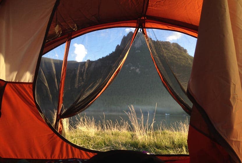
Camping at Wellington Lake
There are 75 camping sites at Wellington Lake, including group sites, and many of them right on the shore. You can camp with everything from tents to larger RVs, though it depends on the site you pick. To make sure you will have enough room at a particular site, be sure to give Castle Mountain Rec a call at 303.838.5496 before you book online. We love this place because we can paddleboard, fish, the kids catch minnows and crawdads, and there more hikes beyond the waterfall hike. We even watched an osprey dive into the water and snag a fish from the lake. There are restrooms, water sources, but no showers and no cell service (but that's why you're camping).
Tips & Resources for Hiking Buffalo Creek Falls:
- You've Got to Camp Here: You can book your campsite online at the Castle Mountain Recreation Reservation Page. This place packs out in the Summer, so make your reservations early. There are also First Come, First Served sites.
- Dogs: If you bring your dog on this hike, be sure to keep them on a leash. If they get out on the rock, it's slick, and they can tumble into the cascades. We heard a story of a dog getting swept away down the falls. Of course, the same thing can be said for children. Well, you don't need them on a leash, but keep a close eye on them around the steep and slick terrain around the waterfall.
- Trail Map for Buffalo Creek Falls Trailhead: Trail Map Link
- Colorado Road Conditions: Colorado Road Conditions
- After the Hike: Crow Hill Cafe, Bailey, Colorado
Weather
Map & Driving Directions
Click for Driving Directions