Meyers Homestead Hike in Walker Ranch
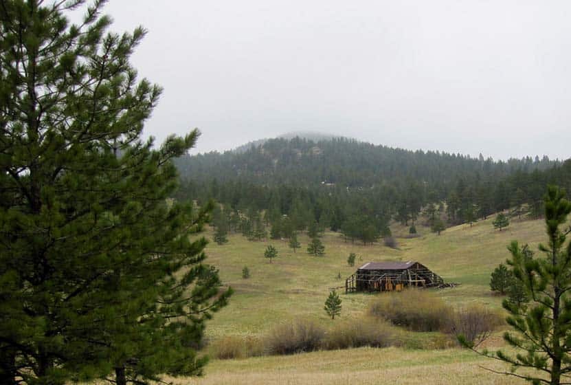
The Meyers Homestead Hike located in Walker Ranch is an almost perfect family hike near Boulder, Colorado. This 5.2-mile out-and-back hike travels through Meyers Gulch, past the remnants of a historic homestead, to an overlook offering panoramic views of Boulder Canyon and the snowcapped mountains of Indian Peaks. It's a wide trail through meadows, stands of aspen, and punctuated by ponderosa pine and wildflowers. Explore the full Meyers Homestead hike profile below for trail map, driving directions, and more tips and details to help you enjoy this trail near Boulder.
Trail Snapshot: Meyer Homestead Hike Near Boulder
| Hike Distance | 5.2 miles Round Trip |
|---|---|
| Difficulty | Easy to Moderate |
| Duration | Approx 3 hrs |
| Trail Type | Out and Back |
| Starting Elevation | 7500′ |
| Elevation Gain | Approx +750′ |
| Seasons | Year Round |
| Dogs | Allowed On Leash |
| Hike Trail Map | Click for a Map of Meyers Homestead Trail in Walker Ranch |
| Denver Drive Time | 1 hr |
| Driving Directions to Meyer Homestead Trailhead | Click for Google Map |
| Town Nearest Hike | Boulder, Colorado |
| Beauty | Meadows, historic homestead, wildflowers, peak views, aspen, ponderosa |
| Activities | Hiking, Walker Ranch homestead tours, horseback riding, mountain biking (double-track most sections), trail running, snowshoeing, photography |
Parking & Trailhead Information for Meyers Homestead Trail
The drive to Meyers Homestead Trailhead starts on the Baseline Road in Boulder. Traveling West past Chautauqua Park, the road will turn into Flagstaff Road at the base of Flagstaff Mountain and begin a windy and steep ascent. The overall trip on Flagstaff Road to the trailhead is about 6.2 miles. The Myers Homestead Trailhead is located on the right (West) side of the road. Restrooms, picnic area, and interpretive signs are available at the trailhead.
The Hike: Meyers Homestead Trail
The hike starts from the Meyers Homestead Trailhead by taking the trail on the right marked with a sign that reads "Meyers Homestead Trail - 2.6 Miles One-Way." The initial trail segment descends into a broad meadow. Around just 1/4 mile into the trail, you'll spot the remnants of a sawmill, part of the original Meyer Homestead. There is a spur trail that leads to a mill. Once past the sawmill, the trail begins a very gradual ascent and follows a small seasonal creek into the Meyer Gulch.
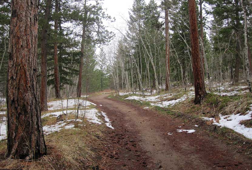
Starting at around 1/2 mile in, the trail will begin to weave in and out of groves of aspens and ponderosa pine, providing intermittent shade on a hot summer day. The trail will eventually open to another large meadow before entering the final, wooded and steeper 1/2 mile. This segment of switchbacks leads to a small unnamed peak with a bench and overlook. Here, you can take in views of Sugarloaf Mountain, Indian Peaks, Longs Peak, and Boulder Canyon.
A great related hike is the Eldorado Falls hike that is also part of the Walker Ranch Trail system.

Tips & Resources for Hiking the Meyers Homestead Trail
- TIP: Pause to read thee interpretative signs along the trail to indicate places that have historical and ecological significance.
- Trail Map for Meyers Homestead Trail: Trail Map for Meyers Homestead Trail
- Packing List: Always pack the 10 Essentials. Download our Hiking Guide to get the list and dayhiking packing checklist.
- Colorado Road Conditions: Colorado Road Conditions
- Photo: We would like to express our gratitude to Ian W. Stearns for sharing such amazing photographs of this hike to Meyers Homestead.
- After the Hike: The Parkway Cafe
Weather
Map & Driving Directions
Click for Driving Directions

Hall Ranch Hike Near Lyons, Colorado
Hall Ranch, just outside of Lyons Colorado, is a hiking, mountain biking, trail running destination that features red sandstone buttes, vast green meadows, and panoramic views of white snowcapped meadows. Tucked into the foothills near the St. Vrain River, the trails at Hall Ranch are a great escape from life in the city. Explore the full Hall Ranch hike profile below for trail map, driving directions, and more tips and details to help you enjoy this adventure in the Boulder County.
Trail Snapshot: Hall Ranch Hike Near Lyons
| Hike Distance | 2 to 9.2 miles Round Trip |
|---|---|
| Difficulty | Easy to Moderate |
| Duration | Approx 5.5 hrs for Loop Hike |
| Trail Type | Out and Back and Loop |
| Starting Elevation | 5500′ |
| Elevation Gain | Approx Total +2479' on Loop |
| Seasons | Year Round |
| Dogs | Dogs are Prohibited in Hall Ranch |
| Hike Trail Map | Click for a Map of Hall Ranch Hiking Trails |
| Denver Drive Time | 1 Hour |
| Driving Directions to Hall Ranch Trailhead | Click for Google Map |
| Town Nearest Hike | Lyons, Colorado |
| Beauty | wildflowers, vistas, grasslands, buttes, pine trees, wildlife |
| Activities | Hiking, photography, picnic tables, mountain biking, trail running |
Directions & Trailhead Information for Hall Ranch Hike
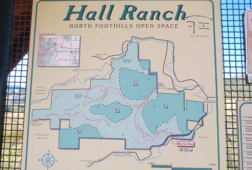
Hall Ranch is situated west of Lyons, Colorado about 16 miles north of Boulder. It's easy to access via the CO 7. There are two trailheads for Hall Ranch. The primary Hall Ranch Trailhead is located off Saint Vrain Drive/CO 7 West, about a mile outside of Lyons. The parking area is located on the North side of the road. This is the best access for most of the hikes and has both restrooms as well as a picnic shelter that can accommodate up to 24 people. The second smaller trailhead is the Antelope Trailhead, located at the end of Antelope Drive just northwest of Lyons. This second trailhead provides access to the Antelope trail, a connector trail described below.
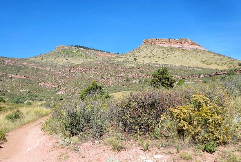
Sandstone Buttes at Hall Ranch
The Hikes: Hall Ranch Hike
There are several options for trails at Hall Ranch:
-
Nighthawk/Bitterbrush Loop - 9.2 Miles RT - +2480' - Moderat
-
Nelson Loop Trail - 2.2 Mile Loop - +299' - Moderate
-
Nighthawk Trail at Hall Ranch - 9 Miles RT - +1282' - Moderate/h3>
-
Bitterbrush Trail - 7.4 RT - +898' - Moderate
-
Antelope Trail - 1 Mile Trail Connector +458' - Moderate
-
Button Rock Trail - 2 Mile Trail Connector +220' - Easy
Probably the most popular is the Nighthawk Trail/Bitterbrush Loop. The loop starts at the west side of the main trailhead and sports a variety of landscapes: expansive meadows, tall buttes, pinion pines, and 180-degree views at its higher elevations. Starting at the main trail, hikers will soon come to an intersection with the Nighthawk trail and Bitterbrush. For this trail profile, we'll take a clockwise approach, following the Nighthawk trail westward. The Nighthawk trail makes a steady climb to where it tops out at approximately 7700' where it offers great views out to Longs Peak and a panorama of Rocky Mountain National Park. Here, hikers will notice an intersection with the Button Rock trail. This 2-mile out-and-back trail is not part of the loop. Staying on the Nighthawk Trail, it will meet up with the Nelson Loop Trail. Hikers can choose to go right or left, both trail segments will link up with the Bitterbrush after approximately 1 mile. Now about 5.5 miles into the hike, hikers will follow the Bitterbrush Trail as it descends for 3.7 miles back down to the main trailhead.
The Nelson Loop can only be accessed by first hiking either the Nighthawk or the Bitterbrush to where they connect up with the Nelson Loop. If you would like to do a lollipop loop hike, we recommend taking the Bitterbrush up to the Nelson Loop, hiking the loop, then returning via the Bitterbrush. This makes for a 9.6-mile hike. The Nelson Loop features the remnants of the old Nelson Homestead just off of the southern segment of the loop.
The Nighthawk trail can also be hiked as a 9-mile out-and-back trail. However, we recommend the full loop above because it's almost the same total distance and offers a greater variety of landscape. The Nighthawk Trail is hiker-only, so it makes for a great option if you prefer to avoid horse and mountain bike traffic. This trail is our favorite, offering vast meadows of green in the Spring and early Summer with views out to Mt Meeker and other snowcapped peaks.
The Bitterbrush Trail is a moderate 3.7 trail that begins at the main trailhead or that can be accessed midway by way of the Antelope Trailhead. Out-and-back, it makes for a 7.4-mile trip.
From the Antelope Trailhead, the 1-mile Antelope Trail takes you west to meet up with the Bitterbrush Trail. Gaining approximately 500' in a mile, it can make for a great 2-mile out-and-back trail run and provides some unique views not available on the longer trails.
The Button Rock Trail leads down to the Sleepy Lion Trail at Button Rock Preserve where hikers can pick up a whole series of trails around Ralph Price Reservoir.
Tips & Resources for Hiking Hall Ranch Hike Near Boulder
- Stay the Trail: Follow the designated trails. Keep off the old dirt roads.
- Dogs Prohibited: No pets are allowed at Hall Ranch in order to protect wildlife habitat.
- Trail Map: Hall Ranch Trail Map
- Packing List: Always pack the 10 Essentials. Download our Hiking Guide to get the list and dayhiking packing checklist.
- Colorado Road Conditions: Colorado Road Conditions
- After the Hike: The Stone Cup
Weather
Map & Driving Directions
Click for Driving Directions

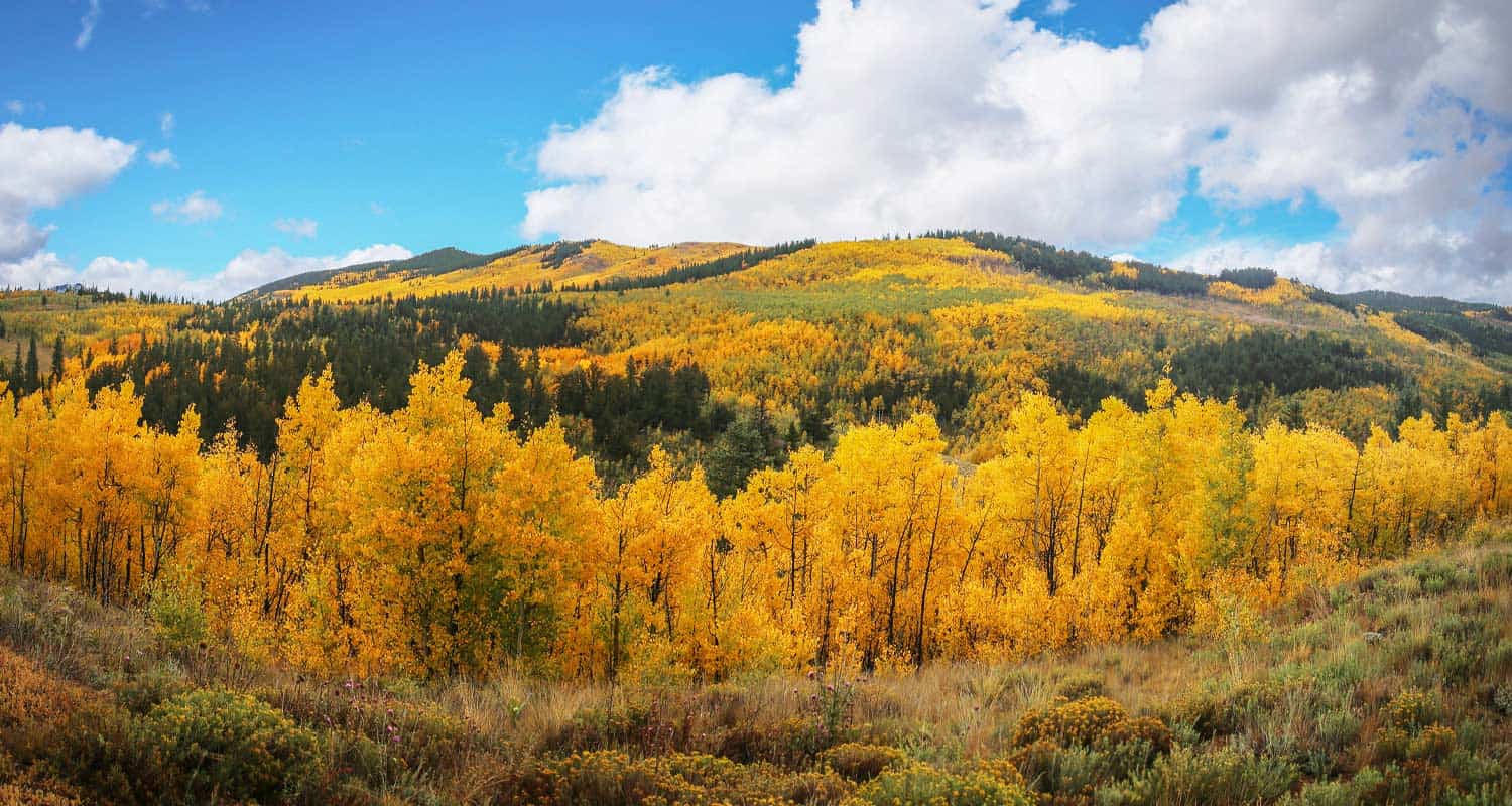
Kenosha Pass Hiking Trails
Kenosha Pass is probably the best place to view the changing aspens near Denver. It offers both an East and West trail option with gradual ascents to stunning views. Starting at 10,000' the initial elevation gain on the trails make for easy to moderately strenuous hikes, all depending on how far one decides to travel on these beautiful segments of the Colorado Trail. Vantage points can be accessed about 1/2 mile up both trails offering views down into the high country plains of South Park and out to the Rocky Mountains. Explore the full Kenosha Pass hike profile below for trail map, driving directions, and more tips and details to help you enjoy this Colorado hike.
Trail Snapshot: Kenosha Pass Colorado
| Hike Distance | <1 to 14.4 miles Round Trip |
|---|---|
| Difficulty | Easy to Moderate |
| Duration | Depends on Segment Hiked |
| Trail Type | Out and Back |
| Starting Elevation | 10,000′ |
| Elevation Gain | Approx +400' for shorter hikes |
| Seasons | Year Round |
| Dogs | Allowed On Leash |
| Hike Trail Map | Click for a Map of Kenosha Pass |
| Denver Drive Time | 1 hr 30 min |
| Driving Directions to Kenosha Pass East Parking Area | Click for Google Map |
| Town Nearest Hike | Grant, Colorado |
| Beauty | aspen groves, creek, wildflowers, mountain range views, views of South Park, wildlife: moose |
| Activities | Hiking, mountain biking, horseback riding, photography, snowshoeing, camping |
Parking & Trailhead Information for Kenosha Pass Hike
Kenosha Pass is located about 65 miles southwest of Denver along US 285. From Denver, take US 285 towards Bailey, Colorado. From Bailey, continue driving approximately 19 miles on 285 to the Kenosha Pass Trailhead. The trailhead parking area is located on both East (left when coming from Denver) and West (right side when coming from Denver) of 285. There is additional parking on the East side after crossing a cattle gate. Parking can get tight in the Autumn when the aspens are at their peak, so be considerate of others and the land as you park your vehicle. It's about a 90 minute drive from Denver. Restrooms can be found on both trailheads.
Hiking the Kenosha Pass Trail
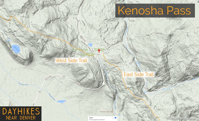
Two Hiking Options and Where the Trails Begin
The hiking trails at Kenosha Pass easy to moderate in difficulty and can be done by hikers of all experience levels. At Kenosha Pass, the Colorado Trail, which goes from Denver to Durango, intersects with US Highway 285. This creates an East side trail option and an West side trail option. Both offer incredible views down into the South Park plains of Colorado and out to the often snow-capped peaks of the Mosquito Range.
Hiking the East Side of Kenosha Pass
Hikers can pick up the Colorado Trail after crossing the cattle gate (if parked along 285) and hiking along the dirt road that leads to the restrooms that are near the 2nd parking area (after the cattle gate). The Trailhead is located just before the 2nd parking area, and will be located on the right (south). While most visitors park, take a jaunt into the aspens, snap a few photos and leave, the more stunning views await those who venture further south along the trail. The initial trail segment enters with a gradual ascent into the aspens, then at 1/2 a mile into the hike the woods opens up to incredible views into South Park.
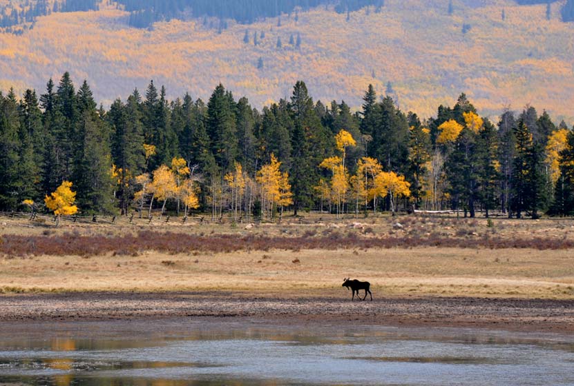
South Park is a high mountains plains area that stretches out mile-upon-mile to its western and norther mountain borders, the Collegiate Peaks and the Mosquito Range of the Rocky Mountains. The climb continues at a gradual pace and hikers will emerge to a second panorama at 1.5 miles. This is a great place to turn-around, making it into a 3 mile out-ant-back hike. Of course, hikers can continue on the trail all the way back into Denver, but that requires a multi-day backpacking trip. As always, keep eyes peeled for changing weather, and pack the 10 Essentials. If you are wondering what should be in your daypack, be sure to download our free Dayhike Hiking and Packing Guide. As for wildlife, moose are often spotted on this side along the lake near the trailhead.
Hiking the West Side of Kenosha Pass
The West Side Trail at Kenosha Pass can be picked up immediately on the West side of 285. The trail enters conifer and aspen forest, making a gentle climb toward the northwest until popping out of the trees to breathtaking views down into South Park and the Mosquito Range. After this viewpoint, the trail travels a short distance uphill, then makes its way down toward Guernsey Creek. The distance from the trailhead to Guernsey Creek is approximately 3 miles, making this a 6 mile out-and-back adventure. Because this is the Colorado Trail, it does continue west, offering multi-day backpacking options that lead all the way to Durango, Colorado.
Tips & Resources for Hiking the Kenosha Pass Trail
- TIP: Bring sunscreen for protection against the sun.
- TIP: One the east side of the highway, there is another parking lot with a lot of bathrooms.
- Trail Map: Map for Trailhead Locations
- Trails Illustrated Kenosha Pass Map: Trails Illustrated Map Link
- Packing List: Always pack the 10 Essentials. Download our Hiking Guide to get the list and dayhiking packing checklist.
- Colorado Road Conditions: Colorado Road Conditions
- Photo: We would like to express our gratitude to Ed Ogle for sharing such an amazing photograph of this hike on Kenosha Pass.
- After the Hike: The Shaggy Sheep
Weather
Map & Driving Directions to Kenosha Pass
Click for Driving Directions
Elk Valley Trail in Roxborough State Park
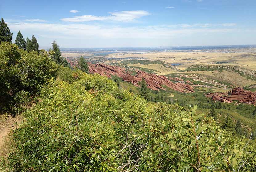
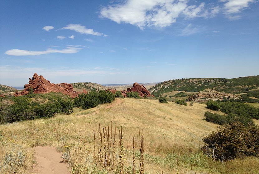
The Elk Valley Trail in Roxborough State Park climbs to a lesser visited valley in the park. Incredible views of the red rock formations of Roxborough make this a great moderate hike near Denver. The hike to Elk Valley is a 4.8 mile out-and-back journey, but can be turned into one of two more strenuous loop hikes. Explore all the details below for trail map, driving directions, trailhead info, and photos of this hike near Littleton, Colorado.
Trail Snapshot: Elk Valley Trail at Roxborough State Park
| Hike Distance | 4.8 Mile with options |
|---|---|
| Difficulty | Moderate |
| Duration | 2-3hrs |
| Trail Type | Out-and-Back with Loop Options |
| Starting Elevation | 6200′ |
| Elevation Gain | +640′ |
| Seasons | Year Round |
| Dogs | Prohibited in the Park |
| Hike Trail Map | Click for a Trail Map |
| Denver Drive Time | 45 min |
| Driving Directions to Roxborough State Park | Click for Google Map |
| Town Nearest Hike | Littleton, Colorado |
| Beauty | Red rock formations, meadows, wildlife: mule deer, eagles, foxes, birds |
| Activities | Hiking, birdwatching, Visitors’ Center |
| Fee | Entrance Fee or State Parks Pass Required |
Roxborough State Park Parking Trailhead Information
Roxborough State Park is located south of Littleton, Colorado, at the base of the foothills near Pike National Forest. The last two miles of access road into Roxborough State Park are a maintained dirt road. This segment of road can get washboarded and can be tough on the car. Undulating green hills can be seen to the east where deer and antelope graze. Roxborough can fill up during the busy weekend hours. If that's the case, you can wait in line at the gatehouse until vehicles and a ranger gives you the signal to drive in. My guess is that the peak times are around 10AM-2PM. If the line looks long, you can always turn around and head over to Waterton Canyon or to South Valley Park--both are great options.
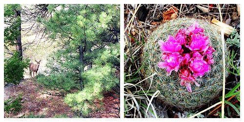
The 2.4 mile, one-way hike up to Elk Valley in Roxborough State Park begins at the main connector trail that runs south from the visitor center. Pictured above, this nearly 1/2 mile connector takes hikers through a passageway created by the scrub oak trees overarching the trail. The undergrowth in this segment of the hike contains a lot of poison ivy. While the poison ivy is off to the side of the trail, it's still easy to brush up against. So, be aware as you make your way through this part of your hike. Also, keep alert for the many birds that make this thicket their home, especially the Western Tanagers that visit in the Spring.
The trail emerges from the shade of the scrub oak into a meadow framed by red rock and yellow cliff bands. A lone cottonwood with a bench stands in the open field of tall grass. One of the great things about Roxborough State Park is the strategic placement of benches, many of them offering shade and wonderful views into the park. At the meadow, the trail will pass through a junction with the South Rim trail and cross a dirt service road. At this point, the trail becomes more demanding, working up a series of switchbacks that lead in and out of the forested sides of the foothills.
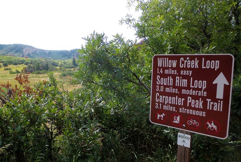
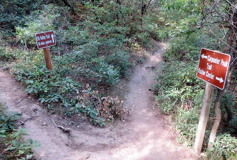
At 1.7 mile into the hike, the trail comes to a Y intersection (pictured below). The trail up the Carpenter Peak takes hikers to the right. The route to Elk Meadows and the Douglas Country Trails beyond it, lead off to the left.
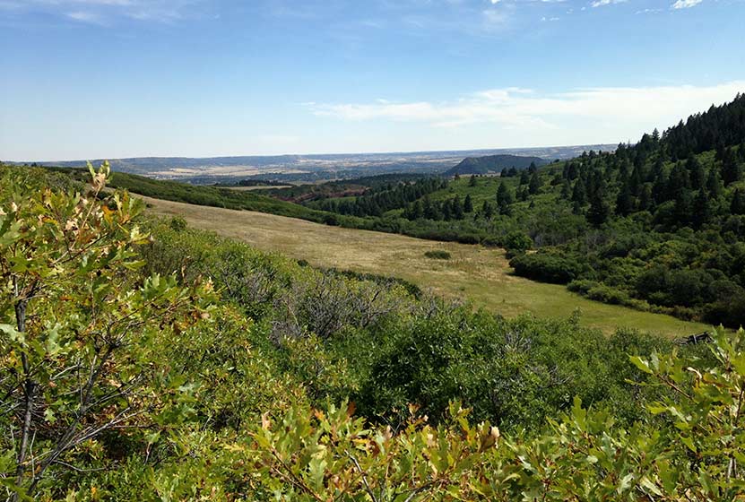
The trail climbs through the forest then opens back to the oaks thickets where, in Autumn you'll hear the continual crunch of of acorns underfoot. Elk Valley comes into view before the trail comes to its end. Another bench sits in the shade of a pine tree and overlooks Elk Valley below. This is a quieter and less visited pat of Roxborough State Park and an ideal spot for viewing wildlife--especially in the early morning or at dusk.
Though the official Elk Valley hike ends at 2.4 miles in, the trail terminates at a junction with a set of Douglas County Trails and USFS trails. These can be used to create two different loop hike options.
Loop Hike Option #1: At the intersection, a 1.75 mile USFS Powerline Trail leads to the right, working its way North where it comes to a junction with the Carpenter Peak Trail. Here hikers can take a right, and hike approximately 1/2 mile to the summit of Carpenter Peak. From the summit, return to the visitor center by following the Carpenter Peak trail back down into the valley floor. This makes for a 7.7 mile strenuous loop hike.
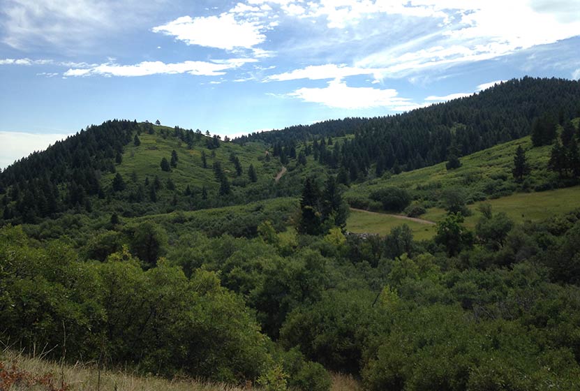
Loop Hike Option #2: At the intersection, a 1.28 stretch of Douglas County Trail leads off to the left. The trail works its way East over a small peak (pictured below), then descends to a junction with the Sharptail and Swallowtail trails. The route back into Roxborough State Park requires taking a left onto a dirt road, Iron Bark Drive. This .88 mile segment (pictured on the trail map) leads northwest back into the heart of the park. Back in the park, hikers can rejoin the trails that lead back to the visitor center. This demanding loop hike totals approximately 5.3 miles.
Tips & Resources for Hiking to Elk Valley in Roxborough
- Packing List: Always pack the 10 Essentials. Download our Hiking Guide to get list and dayhiking packing checklist.
- Dealing with Poison Ivy: You don't have to come into direct contact with poison ivy to get it. Often, it transfers from your clothing to your skin. So be sure to wash your clothing when you get home, if you think you have brushed up against it during your hike in Roxborough.
- Hiking in Winter: If you plan to hike Elk Valley in the winter, it is advised that you have traction devices like YakTrax because much of the trail will be in shadow, and ice will likely form on the trail.
- Trail Map for Roxborough State Park: Trail Map Link
- Colorado Road Conditions: Colorado Road Conditions
- After the Hike: Waterton Tavern in Roxborough
Weather
Map & Driving Directions
Click for Driving Directions

Granite Falls in Rocky Mountain National Park
Granite Falls takes a 5.1 mile journey from the Green Mountain Trailhead in Rocky Mountain National Park. At Granite Falls, the waters of Tonahutu Creek drop fifty feet through a course of smooth granite slabs. The hike offers a diverse landscape: from tranquil forests, to expansive meadows, and verdant creeksides--all alive with wildflowers and wildlife. Explore the full Granite Falls hike profile below for trail map, driving directions, and more tips and details to help you enjoy this adventure in Rocky Mountain National Park.
Note: Rocky Mountain National Park now requires timed entry permits from May 27th through October 10th. See the RMNP permits page for more information.
Trail Snapshot: Granite Falls Hike in Rocky Mountain National Park
| Hike Distance | 10.2 miles Round Trip |
|---|---|
| Difficulty | Moderate |
| Duration | Approx 5 to 7 hr Round Trip |
| Trail Type | Out and Back |
| Starting Elevation | 8800' |
| Elevation Gain | Approx. +940' |
| Seasons | Spring through Fall |
| Dogs | Prohibited in RMNP |
| Hike Trail Map | Click for a Map of Granite Falls RMNP |
| Denver Drive Time | 2 hr |
| Driving Directions to Green Mountain Trailhead | Click for Google Map |
| Town Nearest Hike | Grand Lake, Colorado |
| Beauty | Waterfall, pine, aspen, mountain views, wildlife: Abert’s squirrel, elk, deer, moose, bear; wildflowers |
| Activities | Picnicking, hiking trails, snowshoeing, horseback riding, backcountry camping (with a permit), photography |
| Fee | Park Pass Required |
Parking & Trailhead Information for Granite Falls
The Green Mountain Trailhead is located on the western side area of Rocky Mountain National Park, north of Grand Lake, Colorado, along Trail Ridge Road. From the Kawuneeche Visitor Center in Grand Lake, drive 3 miles north on Trail Ridge Road. The Green Mountain Trailhead will be on the right/east side of the road, and has a capacity for around 25 vehicles.
The Hike: Granite Falls Trail in RMNP
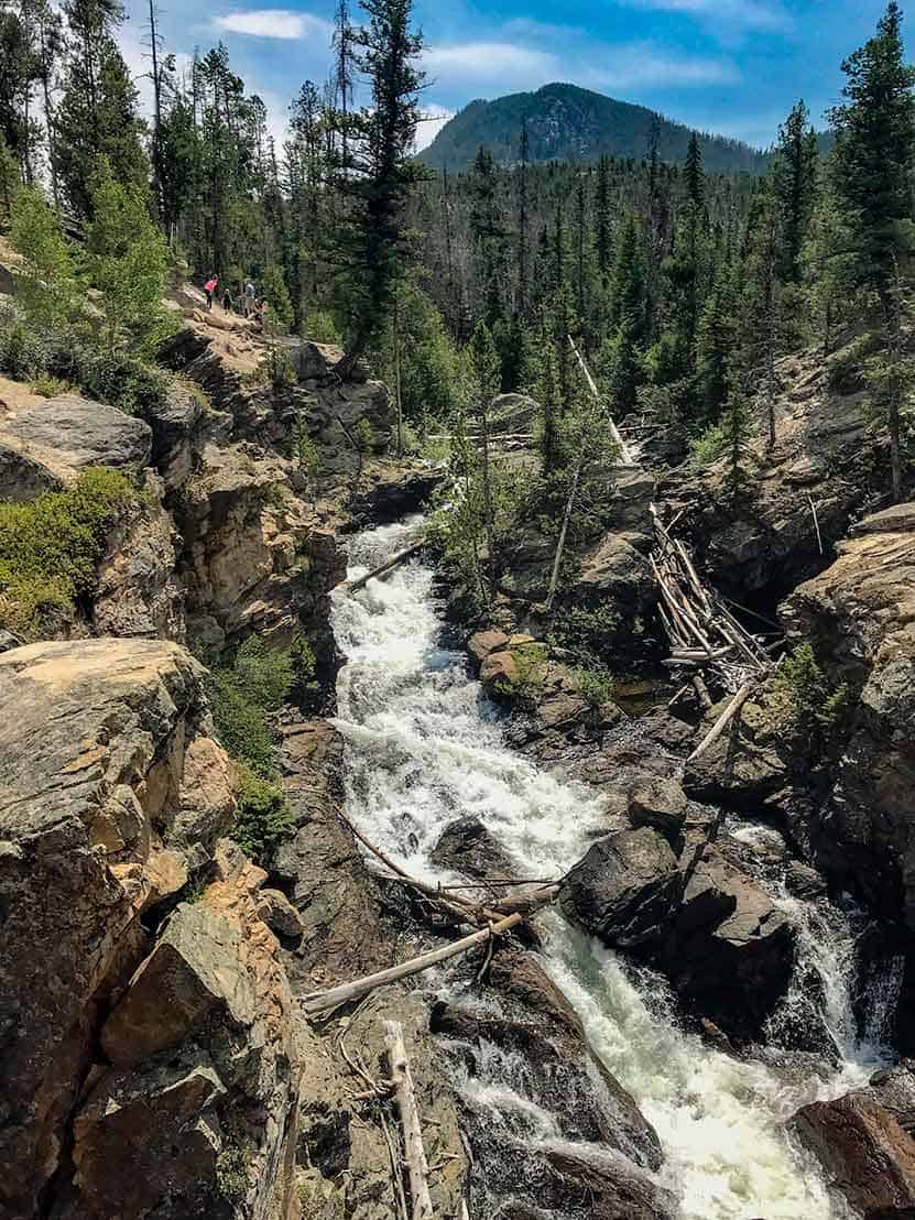
The hike begins at the Green Mountain Trailhead and follows the Green Mountain Trail for 1.9 miles to Big Meadows, and encounters the first trail junction. The way to Granite Falls is to take the left-hand trail for 0.7 mile that skirts the western border of Big Meadows. There is a group campsite in Big Meadows that offers some of the most spectacular views of the night sky. Moose and elk frequent this area and brook trout can be found in nearby Tonahutu Creek.
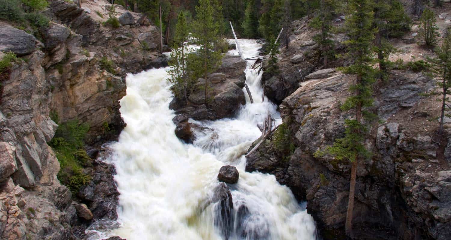
At 2.6 miles, the trail meets a second trail junction. The way to Granite Falls is to go right/east on the Tonahutu trail towards Flattop Mountain. Because their is only a 1000' elevation gain over the course of the 5.1 miles to Granite Falls, the trail only has a mild and undulating slope. After crossing two creeks, a small sign will point the way down a spur trail that leads to Granite Falls. The waterfall is a series of slide cascades flowing over broad granite slabs into a pool of swirling waters. The hike back follows the same route, making this a 10.2 mile out-and-back hike.

Tips & Resources for Hiking to Granite Falls in RMNP
- Prepare: Bring lots of water and high-energy food for this longer 10.2 mile hike.
- Trail Map for Kawuneeche Valley: Trail Map Link
- Packing List: Always pack the 10 Essentials. Download our Hiking Guide to get list and dayhiking packing checklist.
- Colorado Road Conditions: Colorado Road Conditions
- Photo: We would like to express our gratitude to Will Currier for sharing such an amazing photograph of this hike to Granite Falls in RMNP.
- After the Hike: Fat Cat Cafe It may be the best breakfast in Colorado!
Weather
Map & Driving Directions
Click for Driving Directions

Moraine Park Loop Hike in Rocky Mountain National Park
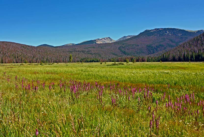
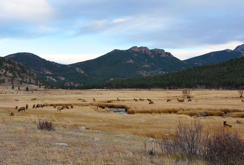
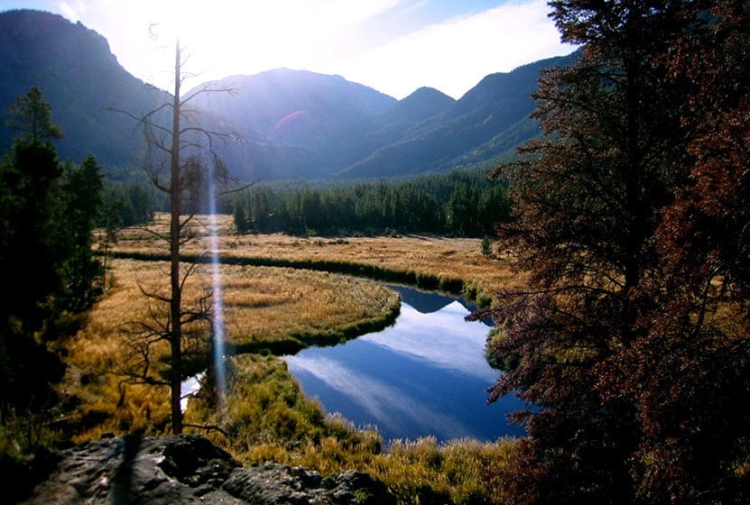
The Moraine Park Loop encircles the golden meadows of Moraine Park in Rocky Mountain National Park. The morning mists rising from the Big Thompson River, and herds of grazing elk make for an enchanted landscape. In the evening, the setting sun brings shadows and light play to the valley floor. All of this is against the backdrop of the distant snowcapped peaks of the Rocky Mountains. Explore the full Moraine Park Loop hike profile below for trail map, driving directions, and all the details you need to enjoy this adventure in Rocky Mountain National Park.
Note: Rocky Mountain National Park now requires timed entry permits from May 27th through October 10th. See the RMNP permits page for more information.
Trail Snapshot: Moraine Park Loop in Rocky Mountain National Park
| Hike Distance | 5.5 miles |
|---|---|
| Difficulty | Easy |
| Duration | Approx 3 hrs |
| Trail Type | Loop |
| Starting Elevation | 8128' |
| Elevation Gain | Approx +90' |
| Seasons | Spring through Fall, Winter Snowshoeing |
| Dogs | Prohibited in RMNP |
| Hike Trail Map | Click for a Map of Moraine Park Loop RMNP |
| Denver Drive Time | 1 hr 30 min |
| Driving Directions to Moraine Park Discovery Center | Click for Google Map |
| Town Nearest Hike | Estes Park, Colorado |
| Beauty | Mountain views, meadows, river, wildlife: Abert's squirrel, elk, deer, moose, duck, bear, mountain goat; wildflower |
| Activities | Picnicking, hiking trails, snowshoeing, horseback riding, backcountry camping (with a permit) |
| Fee | Park Pass Required |
Waypoints Along the Moraine Park Loop
A. 0.0 miles : Moraine Park Discovery Center
B. 0.6 miles : Moraine Park Trailhead
C. 0.8 miles : Trail through the Lateral Moraine Trail
D. 1.7 miles : Lateral Moraine Trail and Moraine Service Road intersection
E. 2.1 miles : Head west through the Lateral Moraine Trail
F. 2.9 miles : Lateral Moraine Trail - Cub Lake intersection
G. 3.4 miles : Cub Lake Trailhead
H. 4.1 miles : Continue east through Fern Lake Road
I. 4.5 miles : To Moraine Park Road
J. 5.3 miles : Back at Moraine Park Discovery Center
Parking & Trailhead Information for Moraine Park Loop
The Moraine Park Loop can be accessed from several different small parking areas such as the Cub Lake Trailhead and the Fern Lake Bus Stop, but the largest parking lot in the area is found at the Moraine Park Discovery Center. It's a great place to learn about the history and habitat of the area before or after your hike. Those staying at the Moraine Park Campground in RMNP can access this loop of trails by walking down the campground road, or via some short connector trails that come off the south end of the campground. Please only use well-worn trails, and don't cut across the fields from the campground, as this causes a lot of disruption and damage to the landscape.
The Hike: Moraine Park Loop Trail in RMNP
This 5.3 mile loop begins at the Moraine Park Discovery Center and follows a clockwise route around the outer rim of Moraine Park. Though this valley is the centerpiece of Rocky Mountain National Park, drawing thousands every year to watch the bull elk bugle and battle over rights to their harem of cows, the loop hike is not very well marked. However, much of this loop hike is an oft-used route for horseback rides guided by the local YMCA camp. Segments of this loop run along the dirt and asphalt roads at the rim of the meadows. Because of this, it's recommended to 1) Be very aware of cars. While the speed limit is low, drivers are often distracted by the views and wildlife, and 2) Look for paths in the meadow alongside the road. These will be safer routes than walking the roads. 3) When walking along the roads, please walk against traffic and walk in single file along the roads.
The hike begins at a high point, looking down upon the Park from the discovery center, and the trail can be picked up just to the east of Bear Lake road. By zooming in on the google map provided above, hikers should be able to discern a trail that runs roughly alongside the road. This is the safest option. The next segment, the South Moraine Trail, can be picked up by crossing Bear Lake Road and heading west on South Moraine Road.
The South Moraine Trail travels across the foot of the moraine for which this area is named. A moraine is a deposit left by either the side or foot of a glacier (imagine the piles of dirt left by an excavator as it cuts a path through the earth). This segment of the loop is a favorite for its views and partial shade.
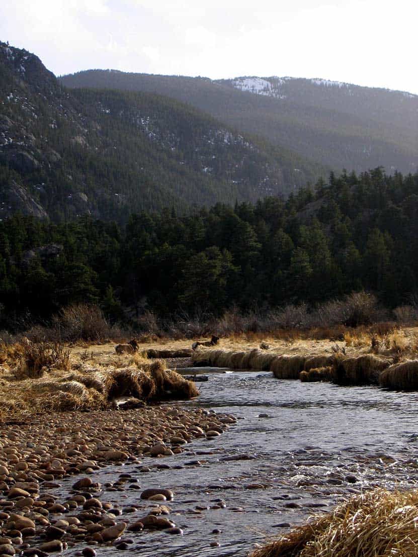
After approximately 2 miles on the South Lateral Moraine Trail, hikers will encounter a junction with the Cub Lake Trail. To continue on the Moraine Park Loop, the correct direction is right/north on the Cub Lake Trail. After crossing the Big Thompson River, the stream that snakes its way through the meadows, the trail will come out at the Cub Lake Trailhead. Here, the loop continues right/east along Fern Lake road. Again, it's best to travel on any well-worn paths alongside the road when possible.
Fern Lake Road will terminate at Moraine Park Road. Here, the loop continues right/east back to the Moraine Park Discovery Center. An alternative route that avoids walking along Moraine Park Road is to cut through the Park on an established trail back down to the southeast corner of Moraine Park. Here, hikers can cross Bear Lake Road and take the same trail they used at the beginning and return to the Moraine Park Discovery Center.
Tips & Resources for Hiking to Moraine Park Loop in Rocky Mountain National Park
- Arrive Early for Parking: It is advisable to arrive early to avoid entry lines and to find suitable parking.
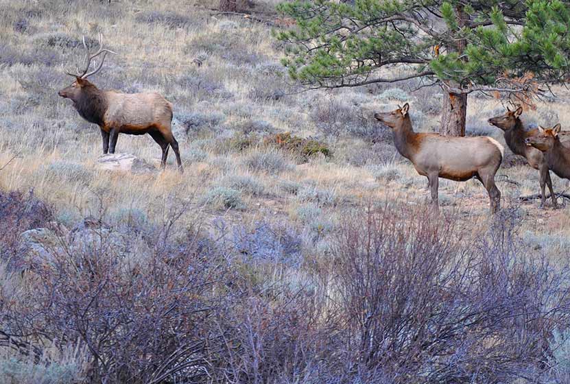
- Wildlife: Keep your distance from the Elk. While they are very used to humans, cows may be protecting calves, and bull elk can be aggressive during certain seasons. It's always best to view wildlife at a distance in our National Parks.
- The Fences: You'll notice fences along the route, and some gates you may pass through. These have been established because of the very high populations of elk in the park, which has in turn had a negative impact on the vegetation. These are here to help reestablish overbrowsed habitat.
- Trail Map for Bear Lake Corridor: Trail Map Link
- Packing List: Always pack the 10 Essentials. Download our Hiking Guide to get list and dayhiking packing checklist.
- Colorado Road Conditions: Colorado Road Conditions
- After the Hike: Mountain Home Café
Weather
Map & Driving Directions
Click for Driving Directions
Adams Falls in Rocky Mountain National Park
Adams Falls is a short .6-mile round-trip hike near Grand Lake, Colorado. The waterfall borders Rocky Mountain National Park and its trail begins at the same trailhead for the East Inlet Trail. Explore the full Adams Falls hike profile below for trail map, driving directions, and all the details you need for this short waterfall Hike in Rocky Mountain National Park.
Note: Rocky Mountain National Park now requires timed entry permits from May 27th through October 10th. See the RMNP permits page for more information.
Trail Snapshot: Adams Falls in Rocky Mountain National Park
| Hike Distance | 0.6 mile Round Trip |
|---|---|
| Difficulty | Easy |
| Duration | Approx 30 min Round Trip |
| Trail Type | Out and Back |
| Starting Elevation | 8400' |
| Elevation Gain | +79' |
| Seasons | May-September |
| Dogs | Prohibited in Rocky Mountain National Park |
| Hike Trail Map | Click for a Trail Map |
| Denver Drive Time | 2 hr 15 min |
| Driving Directions to Adams Falls, Colorado | Click for Google Map |
| Town Nearest Hike | Grand Lake, Colorado |
| Beauty | Waterfall, East Inlet Creek |
| Activities | Hiking, picnicking, photography |
Adams Falls is named after Jay E. Adams, an early settler of Grand Lake, Colorado. This hike is on the quieter western side of Rocky Mountain National Park. However, it's still a popular trail, so expect to encounter a lot of hikers. Go on a weekday or early morning for the experience of quiet and solitude. After hiking the .3 mile segment of trail, you'll arrive at Adams Falls. There is an observation area that grants the best and safest views of the falls.
The hike to Adams Falls is perfect for families with young children who may not be able to hike as far. As with all streams and waterfalls, have children exercise caution and stay away from the streambank. Rocks are slippery and the hydraulic force of the creek can be incredibly powerful. About 1/4 mile beyond Adams Falls, there are spectacular views of the East Meadows, making the short distance a worth addition to this easy waterfall hike.
Tips & Resources for Hiking to Adams Falls, Grand Lake, CO
- Wear Good Footwear: The trail has a lot of rocks and roots, so be sure to have shoes or boots that can handle slick surfaces.
- Explore More: Hike about a quarter mile past the falls to where the meadows open up and East Inlet creek meanders through the tall grass. It's an amazing sight.
- Trail Map for Rocky Mountain National Park: Trail Map
- Packing List: Always pack the 10 Essentials. Download our Hiking Guide to get list and dayhiking packing checklist.
- Colorado Road Conditions: Colorado Road Conditions
- After the Hike: The Hub Coffee
- Photo: We would like to express our gratitude to Kimon Berlin for sharing such an amazing photograph of this hike.
Weather
Map & Driving Directions
Click for Driving Directions

Black Lake in Rocky Mountain National Park
Black Lake is among the most spectacular lakes in Rocky Mountain National Park. The journey to Black Lake is a strenuous, 10 mile, round-trip hike with significant elevation gain--but both the destination of Black Lake and the several waterfalls along the way make it more than worth the effort. Explore the full Black Lake hiking trail profile for trail map, driving directions, and all the details you need to enjoy this adventure in Rocky Mountain National Park
Note: Rocky Mountain National Park now requires timed entry permits from May 27th through October 10th. See the RMNP permits page for more information.
Trail Snapshot: Black Lake Falls in Rocky Mountain National Park
| Hike Distance | 10 mile Round Trip |
|---|---|
| Difficulty | Difficult |
| Duration | Approx 6 hrs Round Trip |
| Trail Type | Out and Back |
| Starting Elevation | 9240' at Trailhead |
| Elevation Gain | +1430′ |
| Seasons | May-September |
| Dogs | Prohibited in RMNP |
| Hike Trail Map | Click for a Trail Map |
| Denver Drive Time | 2 hr |
| Driving Directions to Glacier Gorge Trailhead | Click for Google Map |
| Town Nearest Hike | Estes Park, Colorado |
| Beauty | Waterfalls, wildlife: elk, deer, marmots; meadows, lakes, streams, wildflowers, aspen trees |
| Activities | Hiking, photography, fishing |
| Fee | Park Pass Required |
Parking & Trailhead Information for Black Lake RMNP, Colorado
The trail to Black Lake begins at either the Glacier Gorge Trailhead (see driving directions above), or at the Bear Lake Trailhead (driving directions). Because the Glacier Gorge Trailhead has more limited parking, you may need to drive further up to Bear Lake. There you'll find a short connector trail that will put you on the path to the Glacier Gorge Trail system. In the event that parking at Bear Lake is full, you'll then need to park at the Park & Ride near the Bierstadt Trailhead and take the bus into the trailhead. This service runs 7am to 7PM and more information on the RMNP shuttle bus routes can be found at this link.
The Hike to Black Lake RMNP
Hiking to Black Lake takes you into the Glacier Gorge Trail system with many wonderful destinations including Mills Lake, Jewel Lake, and Ribbon Falls. Be sure to review the different waypoints and destinations below so that you don't miss any of the sites. The first destination--and one you can't miss because it's right along the trail--is at .8 miles, Alberta Falls. After the waterfall, the trail ascends toward an eventual trail junction. The way to Black Lake is to follow the Glacier Gorge/Loch Vale trail that bears right. This trail climbs steadily for about another half mile until arriving at a second major trail junction with three options. The left-hand trail leads into Glacier Gorge and eventually to Mills Lake.
List and Links of Destinations From Glacier Gorge Trailhead to Black Lake
1. Glacier Gorge Trailhead
2. Alberta Falls - @ .8 mile
3. Mills Lake - @ 2.8 miles
4. Jewel Lake - @ 3.2 miles
5. Ribbon Falls - @ 4.8 miles
6. Black Lake - @ 5 miles
At Mills Lake, the trail follows its eastern shore for about 1/2 a mile until arriving at Jewel Lake, a much smaller body of water surrounded by lush green marshes. The next segment of the trail is my favorite, a challenging stretch of approximately 2 miles that leads hikers across bogs, and through verdant forest where the snow hangs on well into the summer months. In fact, this stretch may prove very difficult in the spring and early weeks of June depending on that year's weather. The trail continues to follow Glacier Creek up into the higher reaches of the park and ever closer to Keyboard of the Winds, the jagged rock formation ever present against the eastern sky.
Keyboard of the Winds is named for the sounds that flow from it's sharp edges as high winds whistle and roar across its peaks. Be sure to stop and listen for the music. It can be a mesmerizing experience.
If snow is still on the ground, then the last bit of the trail may require some basic route finding. The established trail skirts the left/east side of Black Lake, but can at times be hard to find. Stay close to the creek and you should be okay. Soon, hikers will encounter Ribbon Falls, a beautiful slide waterfall. Black Lake is just .2 mile further up the trail. This final segment is steep and requires negotiating some rocks and boulders before coming over the rise to gain breathtaking views of Black Lake.
Tips & Resources for Hiking Black Lake in Glacier Gorge RMNP :
- Start Early: The hike to Black Lake is challenging and hikers will want to begin early to avoid being in this exposed area when afternoon thunderstorms often tear through the area in Summer.
- Trekking Poles in Spring and Winter: Because the trail is high in the mountains, the snow and ice can hang around into late Spring and even early Summer, then pick up again in the Fall. Because of this, we recommend Trekking Poles and/or Traction Devices for this trail when the trail conditions are such.
- Parking: If the parking lot is full at Glacier Gorge Trailhead, there is a shuttle available to take you to the trailhead, or you can park at the Bear Lake Trailhead.
- Rocky Mountain National Park Trail Conditions: Click for RMNP Trail Conditions
- Trail Map for Bear Lake Corridor Trails: Trail Map Link
- Rain Gear Recommended: On every occasion I've been into Glacier Gorge, it's been gorgeous weather--and it rained. So, bring Rain gear. In the summer months, thunderstorms can form quickly in this area, especially in the afternoon--just another reason to begin your hike early.
- Packing List: Always pack the 10 Essentials. Download our Hiking Guide to get list and dayhiking packing checklist.
- Colorado Road Conditions: Colorado Road Conditions
- After the Hike: Inkwell Brew Coffee
- Photo: We would like to express our gratitude to Erik Page for sharing such an amazing photograph of this hike.
Weather
Map & Driving Directions
Click for Driving Directions
Hiking Davis Ponds Hike at Staunton State Park
The Davis Ponds loop is a short and easy hike, perfect for young families. Davis Ponds is a great place to take your kids fishing near Denver. Explore the full trail profile below for all the details: hiking trails, trail map, and detailed directions to the trailhead.
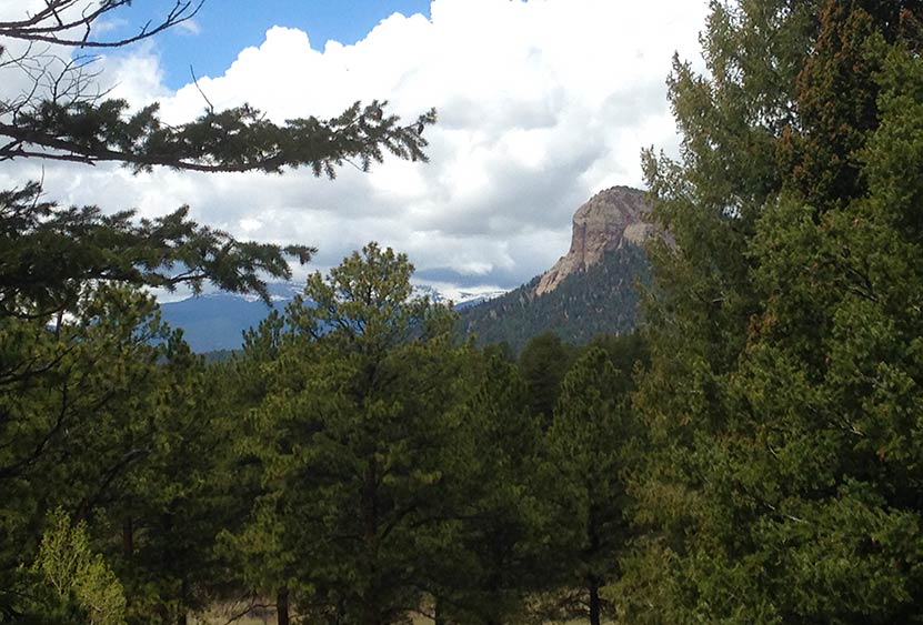
Staunton State Park is one of Colorado's newest gems and located just 45 minutes from downtown Denver. It's a great park for outdoor activities, including hiking, mountain biking, and rock climbing. Staunton has some longer and more demanding trails, but this hike, the Davis Ponds Loop Trail, is a lighter option with some beautiful views to the mountains and the prominent Lions Head outcropping.
Trail Snapshot: Davis Ponds Loop at Staunton State Park
| Hike Distance | 2.15 Miles |
|---|---|
| Difficulty | Easy |
| Duration | Approx 1 hr |
| Trail Type | Loop |
| Starting Elevation | 8200′ |
| Elevation Gain | +80′ |
| Seasons | All Year |
| Dogs | Allowed On Leash |
| Hike Trail Map | Click for a Trail Map |
| Denver Drive Time | 45 min |
| Driving Directions to Staunton State Park | Click for Google Map |
| Town Nearest Hike | Conifer, Colorado |
| Beauty | Meadows, Pine Forest, Ponds, Hummingbirds, and Deer |
| Activities | Hiking, Fishing |
| Fee | Entrance Fee or State Parks Pass Required |
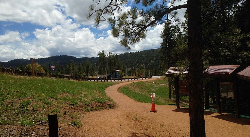
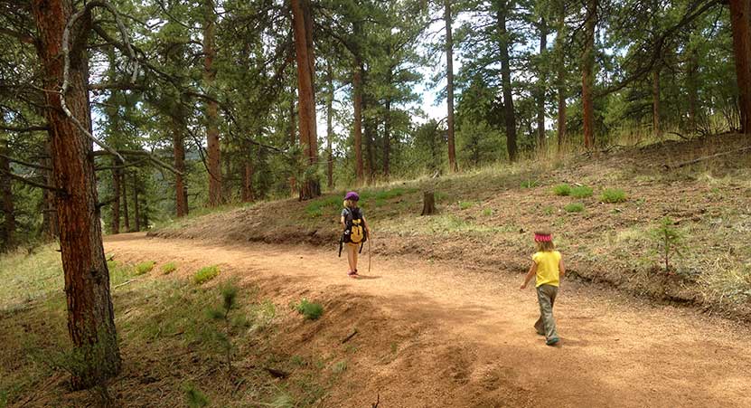
The trail begins just to the north of the initial parking lot (pictured above). We hiked the trail clockwise, taking the trail to the left, but it can be hiked in either direction. The Davis Ponds trail is hiker-only, so you will not encounter any mountain bike or horse traffic, making this perfect for young kids. There is scattered shade as the trail winds in and out of meadows and pine forest. Deer make their way grazing near the trail and hummingbirds buzz by, finding nectar in the wildflowers growing out of the rocky soil.
Before the ponds, there is a cut-through trail that can be used to shorten the hike by approximately 1/2 mile, but it's worth going all the way to Davis Ponds and to gain views to the west. The Davis Ponds were under construction and improvements while we were there, but they have now been finished and stocked with rainbow and cutthroat trout. If you are looking for a weekend destination near Denver to fish with your children, this may be one of the best.
On the way back, the trail will merge again with the cut-through trail. The trail back to the trailhead bears left and slightly uphill.
Tips & Resources for Hiking the Davis Ponds Loop :
- TIP: Getting into the park can be slow at times, so be prepared to wait at the entrance on busy weekends.
- Wildlife: You'll find that deer are out grazing in the early morning and closer to twilight.
- Winter: During the Winter, park hours are 8am - 7pm.
- Trail Map for Staunton State Park: Trail Map Link
- Packing List: Always pack the 10 Essentials. Download our Hiking Guide to get list and dayhiking packing checklist.
- Colorado Road Conditions: Colorado Road Conditions
- After the Hike: Crow Hill Cafe in Bailey
Weather
Map & Driving Directions
Click for Driving Directions
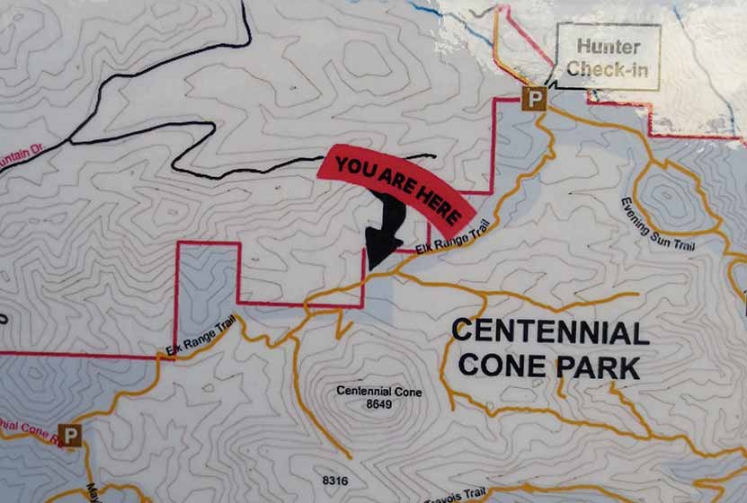
Elk Range Trail at Centennial Cone Park
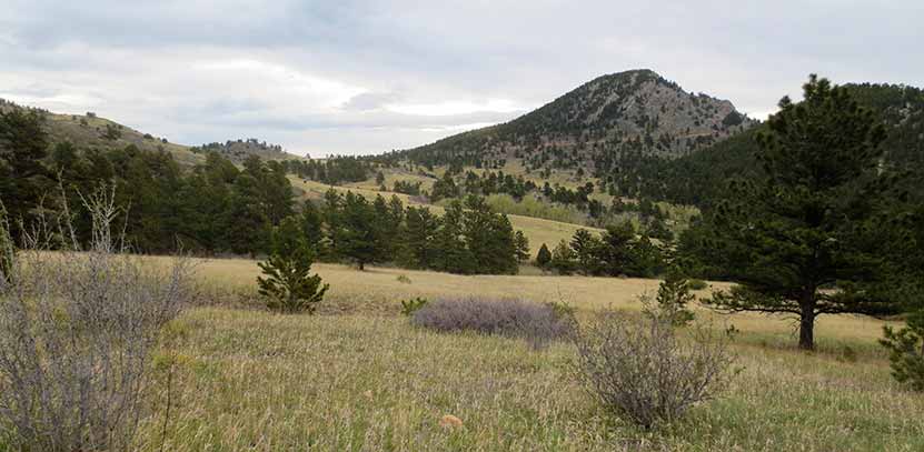
For those who are looking for a nice hike that incorporates the highland meadows of Colorado and views to snowcapped mountains, then the Elk Range Trail at Centennial Cone Park is the perfect hike. The Elk Range Trail can be hiked as an out-and-back 6.6 mile adventure, starting from one of two different trailheads. We saw a lot of wildlife and few people. Explore the full trail profile below for trail details, Centennial Cone park map, driving directions, and more.
Trail Snapshot: Elk Range Trail at Centennial Cone
| Hike Distance | 6.6 miles Round Trip |
|---|---|
| Difficulty | Easy to Moderate |
| Duration | Approx 2.5 hr |
| Trail Type | Out and Back |
| Elevation | +446'/-314' |
| Seasons | All Year (closes during hunting season) |
| Dogs | Allowed on Leash |
| Hike Trail Map | Click for a Map of Centennial Cone Park |
| Denver Drive Time | 42 min |
| Directions | Click for Google Map |
| Town Nearest Hike | Golden, Colorado |
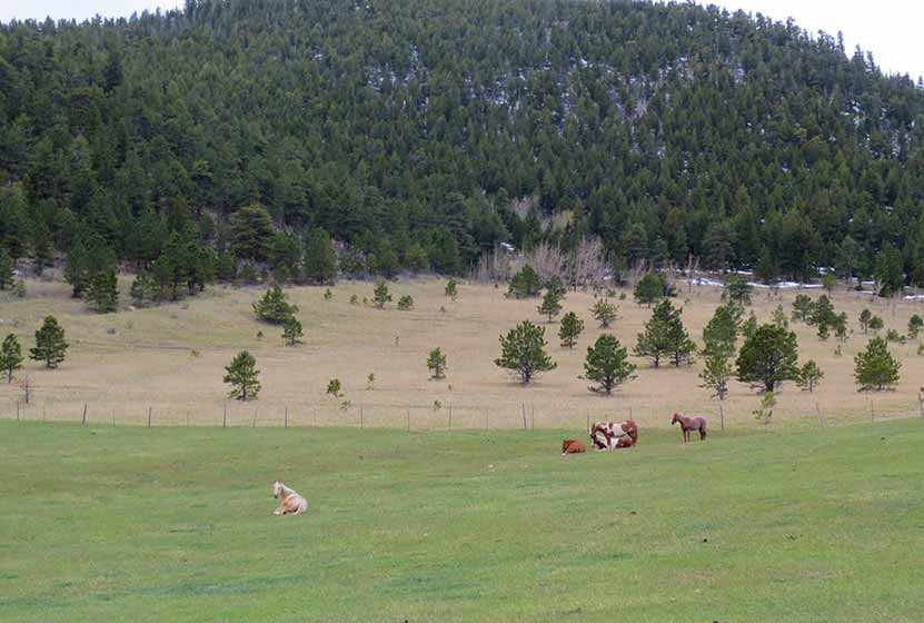
| Beauty | Upper foothills and the peaks of the Rockies beyond, high country meadows, grazing cattle and horses, elk and whitetail deer |
| Activities | Horseback riding, hiking, mountain biking and wildlife viewing |
| Video | Click For Video |
| Weekend Use | Odd days hiker-only, Even days bike-only |
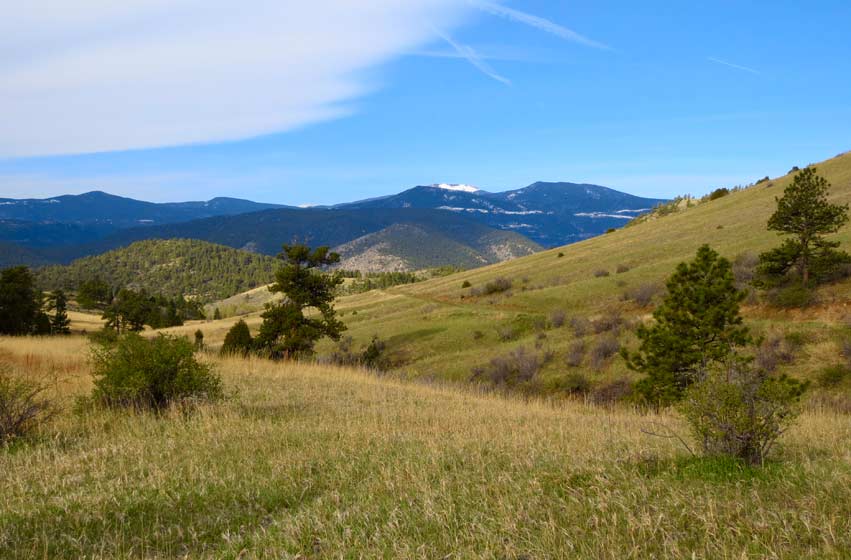
 Looking East towards Centennial Cone
Elk Range Trail at Centennial Cone Profile
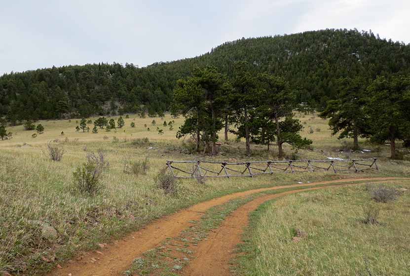
You have two trailhead options when taking the 6.6 mile Elk Range Trail.The driving directions link above are for the Centennial Cone Road trailhead. A North Centennial Cone Park Trailhead has equestrian trailer parking and can be located at this link. Our trail profile here describes the trail hiking from West to East.
From the Centennial Cone trailhead, you immediately find yourself surrounded by green open fields. At about half a mile in you'll encounter a fence with a gate. When you walk through the gate, you'll be on private property for a few hundred yards. Jefferson County parks has some sort of easement, so continue your hike but stay on the trail, until you get to the other gate. There are horses and cows that wander about the area without fences, so they may be on the trail when you arrive. Another reason to be sure that the gates close behind you.
Hiking along the Elk Range Trail, I couldn't help wondering, "Can you hike up to the top of Centennial Cone?" There is no trail on the map but there appears to be the vestiges of an old road or trail leading up the North end of Centennial Cone. Because I haven't hiked it yet, I can't recommend it, but the old trail can be found just before the trail enters private property. Where the trail bends just before the gate, you can follow a set of what look to be markers for an underground gas line. These lead up to the trail at the base of Centennial Cone. This is as far as I explored, and hope to get back to attempt a hike to the top of the cone.
It's important to know that on the weekends the trail alternates from hiker-only to biker-only. Here's how to keep track of it: Odd days are hiker only and even days are bikes only.The weekdays are open to both hikers and mountain bikers.The park is closed during certain days for hunting season. You can get the exact closure dates from the Centennial Cone page of Jefferson County's opens space site.
If you've started from the Centennial Cone Road trailhead and would like a pleasant and beautiful drive home, take Highway 6 through Clear Creek canyon, and into Golden.
Tips & Resources for Hiking the Elk Range Trail:
- Mud: The Elk Range Trail can be a bit muddy after a good rain. You'll want to bring appropriate gear if you're planning a hike after a storm for a good day or two, including sturdy shoes.
- Storms: The Elk Range Trail is at a high enough altitude that you'll want to keep an eye out for thunderstorms. There is very little cover on this trail, so check the weather report before heading out as well.
- After the Hike: Cafe13 in Golden
- Road Conditions: Colorado Road Conditions
- Trail Map for Centennial Cone Park: Trail Map Link
Weather
Map & Driving Directions
Click for Driving Directions