Granite Falls takes a 5.1 mile journey from the Green Mountain Trailhead in Rocky Mountain National Park. At Granite Falls, the waters of Tonahutu Creek drop fifty feet through a course of smooth granite slabs. The hike offers a diverse landscape: from tranquil forests, to expansive meadows, and verdant creeksides–all alive with wildflowers and wildlife. Explore the full Granite Falls hike profile below for trail map, driving directions, and more tips and details to help you enjoy this adventure in Rocky Mountain National Park.
Note: Rocky Mountain National Park now requires timed entry permits from May 27th through October 10th. See the RMNP permits page for more information.
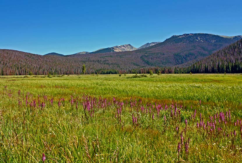
Trail Snapshot: Granite Falls Hike in Rocky Mountain National Park
| Hike Distance | 10.2 miles Round Trip |
|---|---|
| Difficulty | Moderate |
| Duration | Approx 5 to 7 hr Round Trip |
| Trail Type | Out and Back |
| Starting Elevation | 8800′ |
| Elevation Gain | Approx. +940′ |
| Seasons | Spring through Fall |
| Dogs | Prohibited in RMNP |
| Hike Trail Map | Click for a Map of Granite Falls RMNP |
| Denver Drive Time | 2 hr |
| Driving Directions to Green Mountain Trailhead | Click for Google Map |
| Town Nearest Hike | Grand Lake, Colorado |
| Beauty | Waterfall, pine, aspen, mountain views, wildlife: Abert’s squirrel, elk, deer, moose, bear; wildflowers |
| Activities | Picnicking, hiking trails, snowshoeing, horseback riding, backcountry camping (with a permit), photography |
| Fee | Park Pass Required |
Parking & Trailhead Information for Granite Falls
The Green Mountain Trailhead is located on the western side area of Rocky Mountain National Park, north of Grand Lake, Colorado, along Trail Ridge Road. From the Kawuneeche Visitor Center in Grand Lake, drive 3 miles north on Trail Ridge Road. The Green Mountain Trailhead will be on the right/east side of the road, and has a capacity for around 25 vehicles.
The Hike: Granite Falls Trail in RMNP
The hike begins at the Green Mountain Trailhead and follows the Green Mountain Trail for 1.9 miles to Big Meadows, and encounters the first trail junction. The way to Granite Falls is to take the left-hand trail for 0.7 mile that skirts the western border of Big Meadows. There is a group campsite in Big Meadows that offers some of the most spectacular views of the night sky. Moose and elk frequent this area and brook trout can be found in nearby Tonahutu Creek.
At 2.6 miles, the trail meets a second trail junction. The way to Granite Falls is to go right/east on the Tonahutu trail towards Flattop Mountain. Because their is only a 1000′ elevation gain over the course of the 5.1 miles to Granite Falls, the trail only has a mild and undulating slope. After crossing two creeks, a small sign will point the way down a spur trail that leads to Granite Falls. The waterfall is a series of slide cascades flowing over broad granite slabs into a pool of swirling waters. The hike back follows the same route, making this a 10.2 mile out-and-back hike.

Tips & Resources for Hiking to Granite Falls in RMNP
- Prepare: Bring lots of water and high-energy food for this longer 10.2 mile hike.
- Trail Map for Kawuneeche Valley: Trail Map Link
- Packing List: Always pack the 10 Essentials. Download our Hiking Guide to get list and dayhiking packing checklist.
- Colorado Road Conditions: Colorado Road Conditions
- Photo: We would like to express our gratitude to Will Currier for sharing such an amazing photograph of this hike to Granite Falls in RMNP.
- After the Hike: Fat Cat Cafe It may be the best breakfast in Colorado!
Weather
Map & Driving Directions
Click for Driving Directions


