Eldorado Cascades is tucked back in Walker Ranch near Boulder, Colorado. It’s an easy to moderate 1.25 mile hike from the Ethel Harrold Trailhead down to where South Boulder Creek winds through the park and crashes over the boulders blocking its path. Explore the full trail profile below for all the details: tips, trail map, and driving directions to the trailhead.
Trail Snapshot: Eldorado Cascades at Walker Ranch
| Hike Distance | 2.5 mile Round Trip |
|---|---|
| Difficulty | Moderate |
| Duration | Approx 1.5 hr Round Trip |
| Trail Type | Out and Back |
| Starting Elevation | 7000′ |
| Elevation Gain | Approx -500′ to Cascades, +500 back to Trailhead |
| Seasons | Spring through Fall |
| Dogs | Allowed On Leash |
| Hike Trail Map | Click for a Map of Walker Ranch |
| Denver Drive Time | 1 hr |
| Driving Directions to Walker Ranch Ethel Harrold Trailhead | Click for Google Map |
| Town Nearest Hike | Boulder, Colorado |
| Beauty | Boulder Creek, Cascades, Wildlife: Birds, Elk |
| Activities | Hiking, picnic facilities, mountain biking, horseback riding |
Eldorado Cascades can be reached from several different trailheads that tie into the Walker Ranch Loop system. However, the shortest and probably easiest access is by starting at the Ethel Harrold Trailhead. See the directions driving directions links on this page, and be sure to make note of your last couples turns because cell phone services are spotty.
The drive up to the trailhead on Flagstaff Road is a beautiful one, but do be aware of the many hikers, climbers, and cyclists along the road. After Flagstaff road, the two roads that lead to the trailhead, Pika, then Bison, are improved dirt roads. These were recently graded when we visited (early April) and were fine to drive. However, 4-wheel drive is probably necessary during the winter months or after early Spring rains or snowfall. The trailhead parking area has a pit toilet and information board. If you are interested in birdwatching, you’ll find a Birds of Walker Ranch Chechlist at the board.
The Hike to Eldorado Cascades
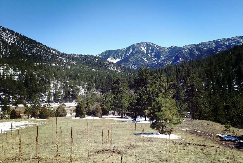
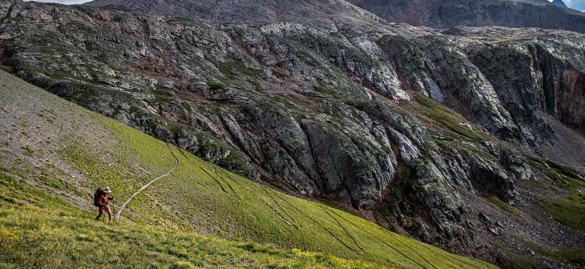
The hike begins with expansive views of Walker Ranch and out towards Eldorado Canyon State Park (pictured above). The air was full of the scent of juniper trees, and we found abundant Elk sign in the meadows near the trailhead. The trail winds down to a intermittent stream that was gushing with the early Spring snowmelt. A bridge buried in snow leads across the creek, then the trail skirts the hillside for most of the hike, gradually working its way down to a junction with the Walker Ranch Loop Trail. At the junction, the trail to Boulder Creek and Eldorado Cascades is to the right and takes hikers further downhill to a bridge that crosses South Boulder Creek.
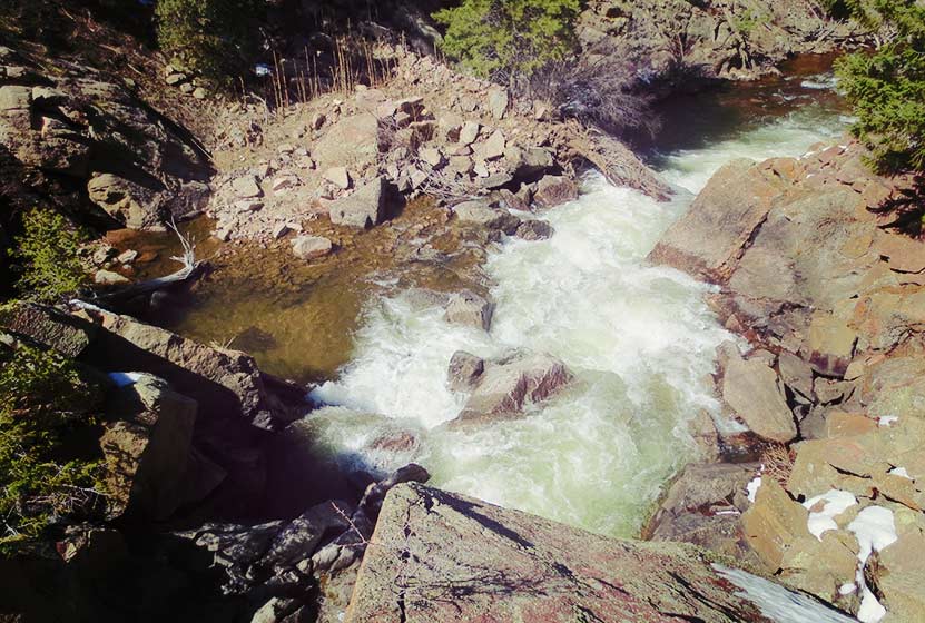
The sound of water is almost always within earshot, and the chirps of a variety of birds fill the air. Shortly before the bridge, hikers may notice a “To Eldorado Canyon” sign and trail on the left side of the Walker Ranch Trail. This leads to Eldorado Canyon State Park, about 3.5 miles away, but does not lead to the cascades. The cascades can be found almost immediately after crossing the bridge that spans South Boulder Creek. Here the trail becomes a series of uneven rock stairs that lead to the top of the cascades (pictured above is view from the top).
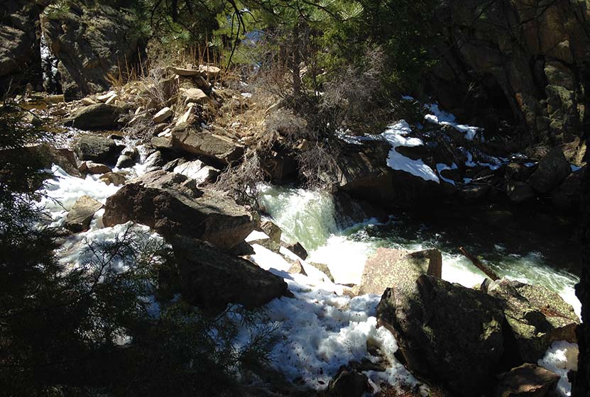
“Eldorado Falls” seems to be a local and unofficial name given to this set of cascades. The trail map simply marks them as “falls.” On the back side of the cascades, South Boulder Creek seems to disappear under massive boulders that block its path. Here the water slips under the rock then shoots out on the other side in a series of small cascades. The water pools, then pours over another lower cascades (pictured above) before returning to calmer waters.
The hike back is mostly uphill, but it’s only about a +500′ of elevation gain. The park is open in the winter; however, the trail from the Ethel Harrold trailhead down to the Walker Ranch Loop might become difficult to discern after a blanket of snow. So, the ideal times are Spring through Fall.

Tips & Resources for Hiking to Eldorado Cascades
- Come Prepared in Spring and Winter: Because the trail is mostly in shade of ponderosa pines, the snow and ice can settle in during both winter and spring. Therefore, we recommend Trekking Poles and/or Traction Devices for this trail (I wish I had brought mine).
- Exercise Caution Around the cascades: The area around Eldorado Cascades is rocky and uneven. The cascades are also difficult to photograph because of how it’s tucked back into the canyon. For this reason, exercise caution along the slippery rock and near the waters of South Boulder Creek.
- Trail Map for Walker Ranch: Trail Map Link
- Packing List: Always pack the 10 Essentials. Download our Hiking Guide to get list and dayhiking packing checklist.
- Colorado Road Conditions: Colorado Road Conditions
- After the Hike: Ozo Coffee in Boulder
Weather
Map & Driving Directions
Click for Driving Directions

Looking for waterfalls near Denver? Explore our more than 50 Colorado Waterfall Hikes, our favorite Waterfall Hikes in Rocky Mountain National Park, or 7 Waterfalls within One Hour of Denver.

It appears they’ve added a new section/route to this trail. Being my first time, I’m not an expert, but the hike is a good bit longer now. So expect about 4 miles round trip instead of 2.5. It does appear that the old trail/fine road is still accessible, but the signage will direct you to the new route.
Beautiful hike though and still family friendly.
This should probably be updated. The trail sign leads to the “loop”. We could not find a way to access the loop going left (clockwise) once we descended the first few hundred meters, so after an hour of hiking counterclockwise, we turned around to go home. We will however be attempting this again. There is a gate at the trail head for vehicles that was closed which must be the old trail described above and provides a straight shot to the falls. A look at Google Maps would have been incredibly helpful.
Updated trail map and info here: https://www.bouldercounty.org/open-space/parks-and-trails/walker-ranch/
The falls aren’t indicated on the trail map link above, but they are very near the fishing logo at the bottom, right near the trail to Eldorado Canon SP.
Please make sure to check the Walker Ranch webpage for complete information (link from boco.org/trails). There are no water falls, just a drop in the creek where the water “falls” a few feet. The Walker Ranch Loop is almost 8 miles of elevation gains and losses and we’ve had many people lost and out of their element looking for water falls.
Vivienne Jannatpour
Public Information & Engagement Manager
Boulder County Parks & Open Space
Be aware, the area is not the quiet personal hike described here. The trails are mostly crowded with people and mountain bikers. The “chirps of wild birds” described here are largely overridden by the noise of large groups of humans.
Parking is difficult to find unless you are very early due to limited space and large crowds that now flock to flagstaff mountain. Expect to add an extra 20 minutes or more to your drive time on weekends due to the nearly bumper to bomber traffic.