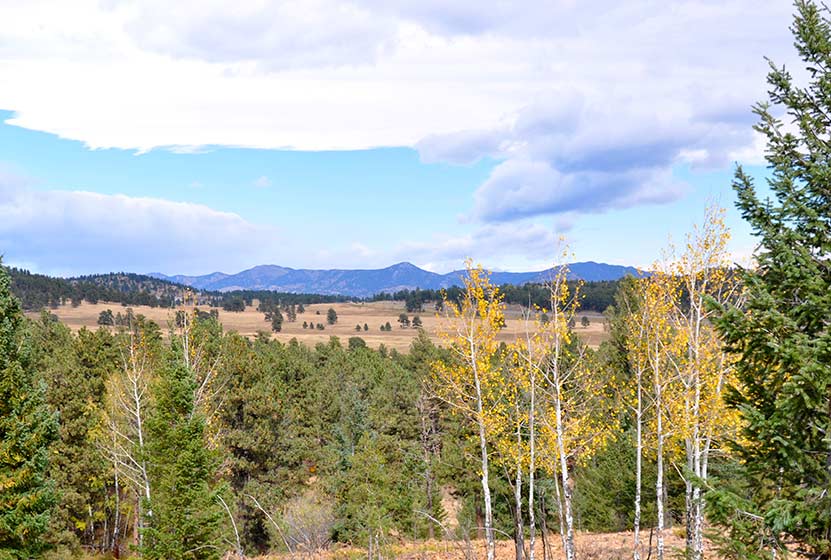
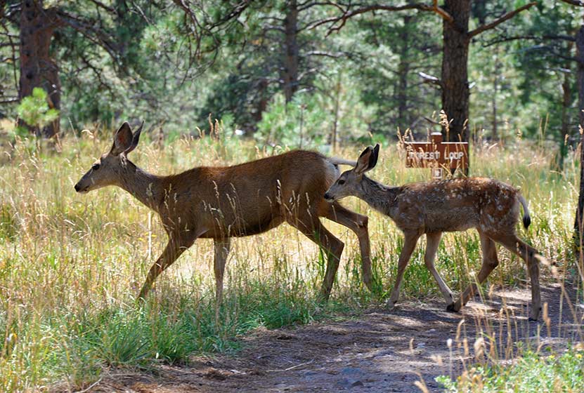
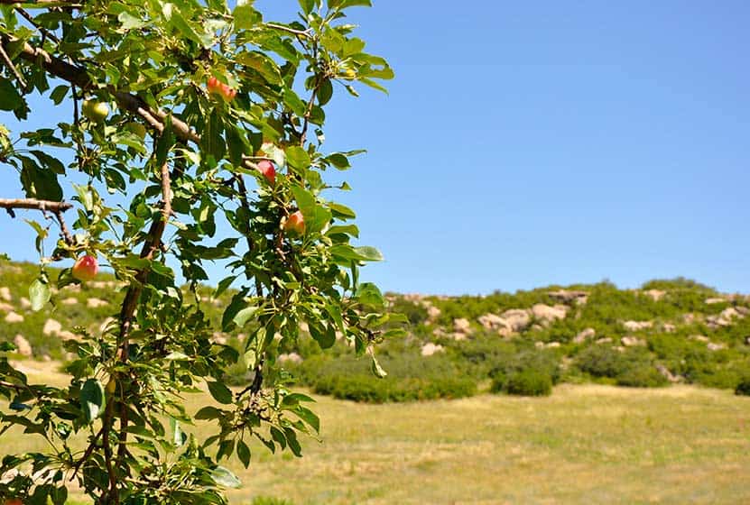
Meyer Ranch Open Space Hikes
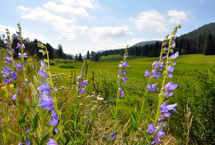
Meyer Ranch is just 30 minutes outside of Denver, Colorado and offers three different hiking trail options, ranging from 2.4 to 4.8 mile, easy to moderate hikes. Check out the three different hiking trail options for this hike near Conifer, Colorado.
| Hike Distance | 2.4 to 4.8 miles Round Trip |
|---|---|
| Difficulty | Easy to Moderate |
| Duration | Approx 1 hr to 2.5 hr Round Trip |
| Trail Type | Loops and Out & Back |
| Seasons | All Season |
| Dogs | Allowed On Leash |
| Hike Trail Map | Click for a Map of Meyer Ranch Open Space Hikes |
| Denver Drive Time | 30 min |
| Driving Directions to Meyer Ranch Open Space Hikes | Click for Google Map |
| Town Nearest Hike | Conifer, Colorado |
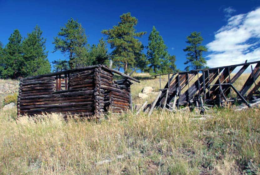
| Beauty | Meadows, overlooks, wildflowers, wildlife: deer & elk |
| Activities | Picnic area, hiking trails, mountain biking |
Meyer Ranch Open Space offers 3 great hiking options only 30 minutes from Denver. They range from easy to moderate in difficulty and 2.4 to 4.8 miles in length. Meyer Ranch has expansive meadows and patches of wildflowers, grazing deer & elk, and trails that take you to overlooks.
1. Lodgepole Loop: 2.4 miles - Easy - Take the Owl's Perch Trail South and continue straight (left) down the trail, at the next junction go right and continue on the Lodgepole loop for 1.2 miles until you arrive back at the Owl's Perch trail and take (left ) that back to the parking lot.
2. Sunny Aspen Trail Loop: 3 Miles - Moderate - Take the Owl's Perch Trail South and continue straight (left) down the trail, at the next junction go right and continue on the Lodgepole loop, go .6 miles and take a right onto the Sunny Aspen Trail, continue on the Sunny Aspen Trail for .8 miles until it joins again with the Lodgepole Loop (go right), follow this back to the Owl's Perch trail and back to the parking lot.
3. Old Ski Run Trail 4.8 Miles - Moderate - Take the Owl's Perch Trail South and continue straight (left) down the trail, at the next junction go left again for .2 mile until you find your next junction, go left onto the Sunny Aspen Trail taking that for .5 mile until you reach the junction with the Old Ski Run Trail. The Ski Run trail is an out & back trail with a loop at the end. The Ski Run section is 2 miles out and back (including loop). Return the way you came via the Sunny Aspen Trail.

Tips & Resources for Hiking Meyer Ranch Open Space Hikes :
- Picnic areas: There are picnic areas close to the trailhead as you go along Owl's Perch Trail.
- TIP: Initially you will hear noise from the road below. This will fade as you hike further into the park.
- Trail Map for Meyer Ranch Open Space: Trail Map Link
- Colorado Road Conditions: Colorado Road Conditions
- After the Hike: Aspen Perk Cafe
Weather
Map & Driving Directions
Click for Driving Directions
Elk Meadow Park - South Loop
Elk Meadow Park is a great place to hike with your family, if you have little ones, or if you just want to talk with a friend as you hike and take in great views of Colorado. It is important to know that the adjacent off-leash dog park has been closed. Get all the info you need to hike Elk Meadow Park in Evergreen by exploring the full trail profile below.
| Hike Distance | 2.6 miles |
|---|---|
| Difficulty | Easy |
| Duration | Approx 1.5 hr |
| Trail Type | Loop |
| Seasons | All |
| Dogs | Allowed On Leash |
| Hike Trail Map | Click for a Trail Map |
| Denver Drive Time | 35 min |
| Driving Directions to Elk Meadow Park - South Loop | Click for Google Map |
| Town Nearest Hike | Evergreen, Colorado |
| Beauty | Meadows, old barn, ponderosa pine, wildlife: elk, & Abert's squirrel |
| Activities | Hiking, dog park nearby |
Elk Meadow Park has just over 13 miles of hiking trails near Denver that wind through it's lower meadows, through ponderosa forest, and two more strenuous options that lead to the summit of Bergen Peak. This profiles a 2.6 mile loop that begins at the south parking area. To form the loop, combine the Meadow View Trail, Elk Ridge Trail, and the Sleepy "S" trail. Use the Elk Meadow Park map at this link. We chose this route because we have 2 children under 3 years old, and it was a good choice - just long enough, trails close to Denver, and lots of change of scenery during a short hike.
There had been an off-leash dog area just on the other side of the street from the south parking lot (not visible on this older google map, so you'll have to trust us that it's there). This was a great place to allow dogs to roam and play, but this has been closed due to excessive dog waste and damage to vegetation. Here is a link to the Jefferson County info page on the off-leash area. Dogs are required to be leashed in all other areas of the park.
Tips & Resources for Hiking Elk Meadow Park - South Loop :
- TIP: The Easy way. Take the loop clockwise for the easier route and counter-clockwise if you are looking for a more strenuous (but not much) hike.
- Parking: Park only in designated areas. There has been a lot of erosion damaged caused by visitors parking alongside the road. If parking is full, please find another park to visit.
- TIP: Enjoy some time in Evergreen. The town of Evergreen is a great place to retreat to during the summer. It's a few degrees cooler, Bear Creek runs through town, and you'll find some great places to eat.
- Trail Map for Elk Meadow Park: Trail Map Link
- Colorado Road Conditions: Colorado Road Conditions
- After the Hike: Beau Jo’s Pizza
Weather
Map & Driving Directions
Click for Driving Directions
Forgotten Valley Hike at Golden Gate State Park
Can you think of a more mysterious name for a hike? Colorado's Golden Gate State Park has many trails, and the Forgotten Valley is a great place to start discovering this gem that is tucked between Golden and Boulder, Colorado. Get all the details on hiking the Forgotten Valley by scrolling down to the hike snapshot and hiking tips below.
Trail Snapshot: Forgotten Valley Hike at Golden Gate State Park
| Hike Distance | 3 miles Round Trip |
|---|---|
| Difficulty | Moderate |
| Duration | Approx 2.5 hrs+ Round Trip |
| Trail Type | Out and Back |
| Seasons | Spring through Fall |
| Dogs | Allowed On Leash |
| Hike Trail Map | Click for a Map of Golden Gate State Park |
| Denver Drive Time | 55 min |
| Driving Directions to Forgotten Valley Hike at Golden Gate State Park | Click for Google Map |
| Town Nearest Hike | Golden, Colorado |
| Beauty | Pond, old homestead ruins, wildlife: mule deer, golden eagle, Abert's squirrel, Steller's jay |
| Activities | Hiking trails, fishing, backcountry camping, visitors center |
| Park Fee Required | Click For Info |
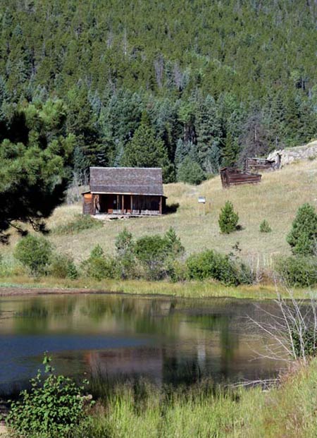
The Forgotten Valley in Golden Gate Canyon State Park is a step back in time.This day hike near Denver takes you 1.5 miles to an old homestead complete with front porch views of the small lake that sits in the bottom of the valley. From the Bridge Trailhead, take the Burro Trail for approximately 3/4 of a mile to where it intersects with the Mountain Lion Trail. Turn North (Left) on the Mountain Lion Trail, and follow that for about 3/4 of mile to Forgotten Valley and the Tallman Homestead. The pond in the valley is stocked by the division of wildlife. We want to thank Kenny Chaffin for his photo of the Tallman Homestead. You can view more of his Denver area photos here.
Tips & Resources for Hiking Forgotten Valley Hike at Golden Gate State Park :
- TIP: Pick up a Trail Map at the Golden Gate Canyon State Park Visitors Center.
- TIP: Parking at the Bridge Trailhead is very limited, so go early.
- TIP: There are some great options on this hike. Grab a Trails Illustrated Boulder/Golden Map and hike to the top of nearby Windy Peak or hike the entire Mountain Lion Trail Loop.
- Trail Map for Golden Gate Canyon State Park: Trail Map Link
- Colorado Road Conditions: Colorado Road Conditions
- After the Hike: Windy Saddle Cafe
Weather
Map & Driving Directions
Click for Driving Directions

Meadow & Forest Loop Trails at Lookout Mountain Nature Center
If you are looking for a family hike near Denver, this is a perfect trail, especially if you are getting started hiking with your kids in Colorado and want to guarantee a good experience. It's short, there's wildlife, and the Lookout Mountain Nature Center. Take a picnic lunch, just watch out for the squirrels; they'll run of with your dessert if you don't watch them closely. Explore the full Meadow & Forest Loop Trails hike profile below for trail map, driving directions, and more tips and details to help you enjoy this family adventure.
| Hike Distance | 0.6 & 0.8 Mile Loops |
|---|---|
| Difficulty | Easy |
| Duration | Approx 30 min |
| Trail Type | Loop |
| Seasons | Hours Vary |
| Dogs | Not Allowed |
| Hike Trail Map | Click for a Map of Meadow & Forest Loop Trails at Lookout Mountain Nature Center |
| Denver Drive Time | 30 min |
| Driving Directions to Lookout Mountain Nature Center | Click for Google Map |
| Town Nearest Hike | Golden, Colorado |
| Beauty | Front Range views, ponderosa pine, wildlife: Abert's squirrels, and deer |
| Activities | Hiking, nature center, picnic area, birdwatching |
Lookout Mountain Nature Center has 2 short loop hikes. If you have young children, this is a perfect trip. The trails at Lookout Mountain are short loops: 1- The Meadow Loop (.8 mile) & 2 - Forest Loop Trail (.6 mile). If you are looking for a longer hike, you can cross the street and take the Lookout Mountain Trail which connects to several other Jefferson County Parks and trails.
The nature center is a great place for your kids to learn about Colorado wildlife. The playroom has texture sames of bark, fur, animal tracks, and the biggest box of stuffed animal puppets you'll ever see. The last time we visited, our daughter didn't want to leave. Take a lunch and have a picnic under the towering Ponderosa Pines. We encountered 2 deer with their fawns along the Forest Loop trail. The immediate area around the nature center is handicap accessible.
Tips & Resources for Hiking Meadow & Forest Loop Trails at Lookout Mountain Nature Center
- TIP: If you take Lookout Mountain Road from Golden, it's a beautiful drive. However, on the weekends, this road has a ton of cycling traffic. So, plan for a slow drive.
- TIP: Visit the Boettcher Mansion next door
- Trail Map for Lookout Mountain Nature Center: Trail Map Link
- Packing List: Always pack the 10 Essentials. Download our Hiking Guide to get the list and dayhiking packing checklist.
- Colorado Road Conditions: Colorado Road Conditions
- After the Hike: Louis’ Cafe
Weather
Map & Driving Directions
Click for Driving Directions

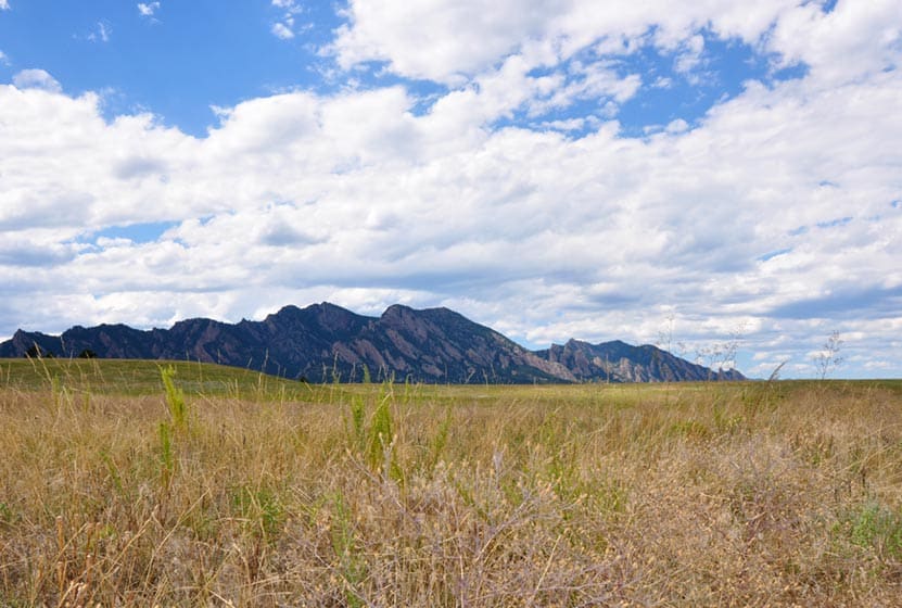
Flatirons Vista Loop Trail
If you are yearning for wide open spaces, the Flatirons Vista trail near Boulder, Colorado makes for a perfect hike. The trail has two loop options and links up to other hiking trails along the Flatirons. Explore the trail profile of this classic Colorado hike for a trail map and all the details like driving directions, trail difficulty rating, and distances.
Trail Snapshot: Flatirons Vista Loop Trail
| Hike Distance | 1.9 or 3.3 Miles |
|---|---|
| Difficulty | Easy to Moderate |
| Duration | 1 to 2.5 hrs |
| Trail Type | Loop |
| Seasons | All Season |
| Dogs | Allowed on Leash |
| Hike Trail Map | Click for a Trail Map |
| Denver Drive Time | 40 min |
| Directions | Click for Google Map |
| Town Nearest Hike | Boulder, Colorado |
| Beauty | Views of the Flatirons, Meadows, Ponderosa Pines, Wildlife: Bobcat, Bear, Mule Deer, Eagles (in winter), & coyote |
| Activities | Hiking Trails, Horseback Riding, Mountain Biking, Birdwatching, & Trail Running |
| Fee | $5 Parking fee or $25 Annual Pass |
You've got options. The Flatiron Vista Loop trail offers 2 loops. One is 3.3 miles and the other is just 1.9 miles. They will wind you through the ponderosa pines and meadows that skirt of the famous Flatirons just south of Boulder. It's an easy hike and a trail runner's dream. The Flatiron Vista Loops are a great destination for winter hikes as well. That's the time of year that you are likely to spot both Golden and Bald Eagles.
The Loops:
-
Longer Flatiron Vista Loop -3.3 miles:
Take the South Flatiron Vista trail (about .2 miles down the trailhead connector trail). After 2.4 miles, bear right onto the North Flatiron Vista Trail. Then, after 1 mile, take the connector trail you came in on back to the trailhead. (reverse this if you like).
-
Shorter Flatiron Vista Loop -1.9 miles:
Take the South Flatiron Vista trail (about .2 miles down the trailhead connector trail). After approx. 1 miles bear right onto Prairie Vista Trail. Continue about 1 mile, then take the connector trail you came in on back to the trailhead
Tips & Resources for Hiking at Flatirons Vista:
- No Shade: The trails at Flatirons Vista are very exposed. Bring a hat and use the sunscreen.
- Trail Map for Flatirons Vista Trail: Trail Map Link
- Colorado Road Conditions: Colorado Road Conditions
- After the Hike: Windy Saddle Cafe
Weather
Map & Driving Directions
Click for Driving Directions
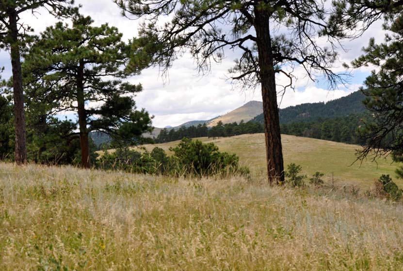
Canyon Loop Trail - Betasso Preserve, Boulder
This hike at Betasso Preserve near Boulder, Colorado makes for a perfect evening escape to watch the sunset over the town below. You'll cross through meadows dotted with wildflowers then under stands of Ponderosa pine that eventually open up to views to east. Explore the hiking trail profiles and map link below for details.
Trail Snapshot: Canyon Loop Trail at Betasso Preserve
| Hike Distance | 3.3 Miles |
|---|---|
| Difficulty | Moderate |
| Duration | Approx 1.5 hr |
| Trail Type | Loop |
| Seasons | All Season |
| Dogs | Allowed on Leash |
| Hike Trail Map | Click Here for a Trail Map |
| Denver Drive Time | 50 min |
| Directions | Click for Google Map |
| Town Nearest Hike | Boulder, Colorado |
| Beauty | Views of Boulder, Wildlife: Aberts Squirrel & Deer, Ponderosa Forest, Meadows |
| Activities | Picnic Area, Horseback Riding, Mountain Biking, Hiking Trails |
Tips & Resources for Hiking the Canyon Loop at Betasso Preserve :
- Easier Approach: Make your hike at Betasso Preserve a bit easier by starting from the East Trailhead
- Mountain Bikers: Each month the direction of travel required for Mountain Bikers is switched. Check the sign at the trailhead. Additionally, biking is not allowed on Wed. & Sat.
- Hikers: Check the sign at the trailhead as well and try to hike the opposite direction of the bike traffic.
- Trail Map for Betasso Preserve: Trail Map Link
- Colorado Road Conditions: Colorado Road Conditions
- After the Hike: Ozo Coffee in Boulder
Weather
Map & Driving Directions
Click for Driving Directions
Bluffs Loop Trail at Bluffs Regional Park
The Bluffs Regional Park features a 2.7 mile loop hike and 2 spurs that lead to panoramic overlooks. The Bluffs loop offers fantastic views of Denver and of the front range. We prefer hitting the trail as the sun is setting. As it gets dark, and the city lights begin to appear, warm winds sometimes will kick up along the Bluffs. Because it's so close to home, we have hiked the Bluffs more than any other trail near Denver. It's the best hike in Lone Tree, it's near Highlands Ranch, and can be made into either a great hike or trail run. We have often taken our jogging stroller, put the kids in, and hiked the loop. This makes for a great after-work workout.
Trail Snapshot: Bluffs Loop Trail at Bluffs Regional Park
| Hike Distance | 2.7 Miles+Spurs |
|---|---|
| Difficulty | Easy |
| Duration | Approx. 1 hr 45 min+ |
| Trail Type | Loop |
| Elevation Gain | Approx. +200' |
| Seasons | Summer & Fall |
| Dogs | Allowed On Leash |
| Hike Trail Map | Click for a Map of Bluffs Loop Trail at Bluffs Regional Park |
| Denver Drive Time | 30 min |
| Driving Directions to Bluffs Loop Trail at Bluffs Regional Park | Click for Google Map |
| Town Nearest Hike | Littleton, Colorado |
| Beauty | Grassland, Front Range views, bluff overlooks, wildlife: prairie dogs, rabbits, red fox |
| Activities | Picnic area, horseback riding, mountain biking, hiking trails |
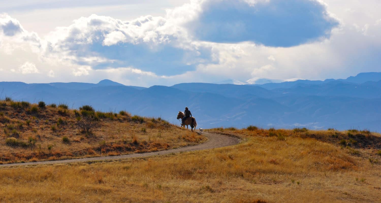
Because the Bluffs Regional Park is just a few minutes off of Interstate 25, it's a great place to meet friends who may be driving up from Castle Rock or Monument.
Be aware of horses on the trail and give them the right of way. There is a gentleman who likes to ride his horse in the late afternoon/early evening who can be quite reckless. We've seen him nearly collide with parties of hikers on two occasions. Just be aware of him.
2 Hike Options at the Bluffs Regional Park :
1. The Loop Hike: We prefer to hike the loop counter-clockwise (going right onto the trail from the trailhead) because the steepest part of the trail is downhill at the end. The trail does have a steady incline on the back side that can be challenge if you are pushing a stroller. This loop hike is 2.7 miles + spurs out to two overlooks.
2. Hike Directly to the Overlook: The most direct route to the Tepe Overlook at the Bluffs is by following the trail clockwise (to the left) from the trailhead for half a mile, then to follow the spur trail for .2 mile to the overlook. This makes for a 1.4 mile, out-and-back hike.
Tips & Resources for Hiking Bluffs Loop Trail at Bluffs Regional Park :
- TIP: The parking lot usually fills up on weekend mornings before 9-9:30AM.
- TIP: As there is no water available at the trailhead, you would want to bring some with you.
- Trail Map for Bluffs Loop Trail: Trail Map Link
- Colorado Road Conditions: Colorado Road Conditions
- After the Hike: DazBog Coffee
Weather
Map & Driving Directions
Click for Driving Directions
Glendale Farm Trail - Douglas County Open Space
Glendale Farm is a short hiking trail near Littleton, Colorado, that offers a seventeen-acre off-leash dog park. This makes for a great after-work trail run or a leisurely hike when the sun is setting over the mountains and the day is cooling down. Glendale Farm Open space is situated on a prairie plateau between Lone Tree and Castle Pines, Colorado. From the high point on the trail you'll gain views of Pikes Peak in the south, Devil's head in the west, and Rocky Mountain's Longs Peak in the North. It's just a 1.6 mile loop trail, so it makes for a great run or hike. There's not much shade on this trail, so bring sunscreen--or better yet, hit the trail as the sunsets.
Trail Snapshot: Glendale Farm Trail - Douglas County Open Space
| Hike Distance | 1.6 mile |
|---|---|
| Difficulty | Easy |
| Duration | Approx 45 min |
| Trail Type | Loop |
| Seasons | All Year |
| Dogs | Allowed On Leash |
| Hike Trail Map | Click for a Map of Glendale Farm Trail - Douglas County Open Space |
| Denver Drive Time | 35 min |
| Driving Directions to Glendale Farm Trail - Douglas County Open Space | Click for Google Map |
| Town Nearest Hike | Littleton, Colorado |
| Beauty | Grassland, Front Range views, Cherry Creek, wildlife: pronghorn antelope, rattlesnakes, prairie dogs, deer, rabbits, scrub jays, & spotted towhees |
| Activities | Picnic areas, horseback riding, mountain biking, adjacent dog park |
This is another one of those great hikes with your Dog near Denver. Leashes are required on the trail, but after doing the loop, you can let your dog loose in the adjacent 17 acre off-leash dog park. Greenland Open Space Trail has a similar off-leash dog park of 17 acres.
Tips & Resources for Hiking Glendale Farm Trail - Douglas County Open Space :
- An off-leash dog area: Located southwest of the main trailhead is a 17-acre parcel designated park that is fenced-in, and the only area where dogs are allowed off-leash.
- Watch your step: Prickly pear cacti grow along the trail and there are rattlesnakes present in the area.
- Trail Map for Glendale Farm Open Space: Trail Map Link
- Colorado Road Conditions: Colorado Road Conditions
- After the Hike: Crowfoot Valley Coffee
- Rules: For the most up-to-date rules and info in Douglas County dog parks, see this brochure.
Weather
Map & Driving Directions
Click for Driving Directions
Lakes Loop Trail at Rocky Mountain Arsenal
An arsenal turned into a Wildlife Refuge. What a great idea! The refuge boasts over 15,000 acres and over 300 species of wildlife. It also hosts three lakes and Denver lake hikes. The Lakes Loop Trail at the Rocky Mountain Arsenal Wildlife Refuge is a 1.7 mile loop that winds along the shores of two lakes in the park, Lake Mary and Lake Ladora. Explore the full trail profile for all the details: hiking trails, trail map, and detailed directions to the trailhead.
Trail Snapshot: Lakes Loop Trail at Rocky Mountain Arsenal
| Hike Distance | 1.8 mile Round Trip |
|---|---|
| Difficulty | Easy |
| Duration | Approx 1hr+ Round Trip |
| Trail Type | Loop |
| Seasons | All |
| Dogs | Prohibited in the Refuge |
| Hike Trail Map | Click for a Trail Map |
| Denver Drive Time | 30 min |
| Driving Directions to Lakes Loop Trail at Rocky Mountain Arsenal | Click for Google Map |
| Town Nearest Hike | Commerce City, Colorado |
| Beauty | Grassland, Front Range views, lakes wildlife: wild bison, deer, coyotes, bald eagles and burrowing owls |
| Activities | Hiking trails, wildlife viewing, seasonal fishing |
How to Hike the Loop: Check in and begin your hike at the visitors center. Follow the Lake Mary Trail along the northwest of the lake until it merges with the the Prairie Trail. Follow the Prairie Trail to the south until it merges with the Ladora Trail which will take you back to the visitors center and along the shore of Lake Ladora.
Tips & Resources for Hiking Lakes Loop Trail at Rocky Mountain Arsenal :
- TIP: Hiking and site seeing are open 7 days a week. However, the visitors center is closed on Mondays and Tuesdays, and pets are prohibited (makes sense - it's a wildlife refuge).
- TIP: Trolley Tours are available on the weekends. Check out this tours link or call 303/289-0250.
- Trail Map for Rocky Mountain Arsenal National Wildlife Refuge: Trail Map Link
- Colorado Road Conditions: Colorado Road Conditions
- After the Hike: Butcher Block Cafe
- Photo: We would like to express our gratitude to Ray Fetherman for sharing such a beautiful photograph of this hike.
Weather
Map & Driving Directions
Click for Driving Directions

Arthur's Rock Trail in Lory State Park
The Arthurs Rock trail in Lory State Park near Fort Collins, Colorado ends with a beautiful panoramic views. You'll pass through meadows, forest, then end your hike with a scramble to the top of Arthur's Rock. Dogs are allowed on a leash, just be sure to bring plenty of water as there are not many places to access drinking water.
| Hike Distance | 3.4 miles RT |
|---|---|
| Difficulty | Moderate |
| Duration | Approx 1 hr 15 min Round Trip |
| Trail Type | Out and Back |
| Starting Elevation | 5600′ |
| Elevation Gain | +1180′ |
| Seasons | Spring to Fall |
| Dogs | Allowed On Leash |
| Hike Trail Map | Click for a Map of Arthur’s Rock Trail in Lory State Park |
| Denver Drive Time | 1 hr 25 min |
| Driving Directions to Arthur’s Rock Trail in Lory State Park | Click for Google Map |
| Town Nearest Hike | Fort Collins, Colorado |
| Beauty | Views of Horsetooth Lake, views of the Front Range, forests, and meadows, wildlife: elk, bobcat, and many bird species |
| Activities | Hiker only trail, but park offers picnic areas, horseback riding, mountain biking, canoeing, & kayaking |
Arthur's Rock History
The place got its name from Arthur Howard who was the one who, along with his brother, Charlie, sold this piece of land. For more information on the history of Arthur's Rock and Lory State Park, visit this page.
Tips & Resources for Hiking Arthur’s Rock Trail in Lory State Park :
- TIP: There is a visitor's center near the Lory State Park entrance.
- TIP: At the summit of Arthur's Rock, there is a beautiful view of Horsetooth Reservoir and the Front Range available.
- Trail Map for Lory State Park: Trail Map Link
- Colorado Road Conditions: Colorado Road Conditions
- After the Hike: The Colorado Room
- Photo: We would like to express our gratitude to Luci Westphal for sharing a great photo of her hike to Arthur's Rock at Lory State Park. Check out her video from this hike.
Weather
Map & Driving Directions
Click for Driving Directions to Lory State Park