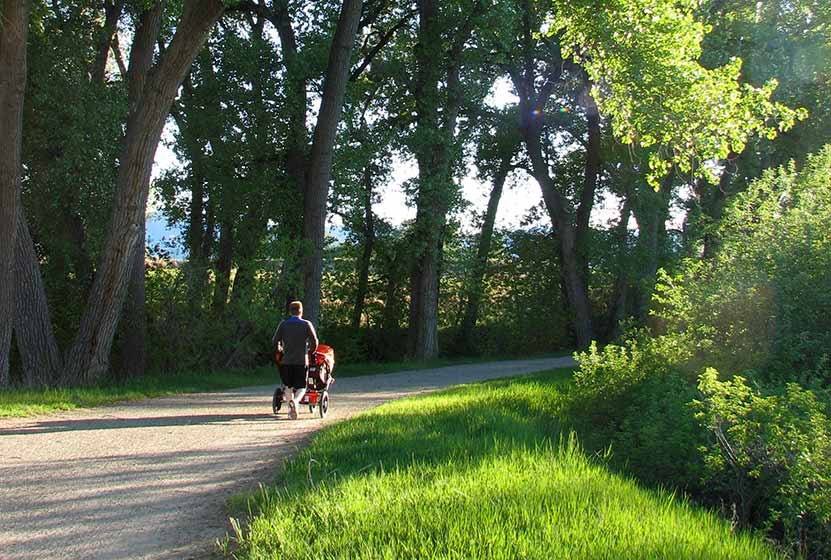
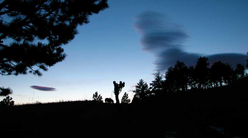
Meyer Ranch Open Space Hikes
Meyer Ranch is just 30 minutes outside of Denver, Colorado and offers three different hiking trail options, ranging from 2.4 to 4.8 mile, easy to moderate hikes. Check out the three different hiking trail options for this hike near Conifer, Colorado.
| Hike Distance | 2.4 to 4.8 miles Round Trip |
|---|---|
| Difficulty | Easy to Moderate |
| Duration | Approx 1 hr to 2.5 hr Round Trip |
| Trail Type | Loops and Out & Back |
| Seasons | All Season |
| Dogs | Allowed On Leash |
| Hike Trail Map | Click for a Map of Meyer Ranch Open Space Hikes |
| Denver Drive Time | 30 min |
| Driving Directions to Meyer Ranch Open Space Hikes | Click for Google Map |
| Town Nearest Hike | Conifer, Colorado |
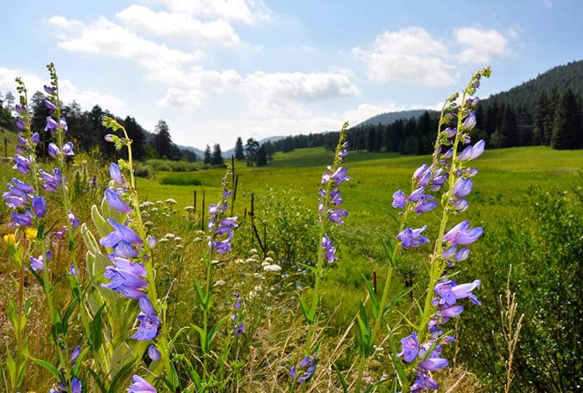
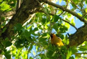
| Beauty | Meadows, overlooks, wildflowers, wildlife: deer & elk |
| Activities | Picnic area, hiking trails, mountain biking |
Meyer Ranch Open Space offers 3 great hiking options only 30 minutes from Denver. They range from easy to moderate in difficulty and 2.4 to 4.8 miles in length. Meyer Ranch has expansive meadows and patches of wildflowers, grazing deer & elk, and trails that take you to overlooks.
1. Lodgepole Loop: 2.4 miles - Easy - Take the Owl's Perch Trail South and continue straight (left) down the trail, at the next junction go right and continue on the Lodgepole loop for 1.2 miles until you arrive back at the Owl's Perch trail and take (left ) that back to the parking lot.
2. Sunny Aspen Trail Loop: 3 Miles - Moderate - Take the Owl's Perch Trail South and continue straight (left) down the trail, at the next junction go right and continue on the Lodgepole loop, go .6 miles and take a right onto the Sunny Aspen Trail, continue on the Sunny Aspen Trail for .8 miles until it joins again with the Lodgepole Loop (go right), follow this back to the Owl's Perch trail and back to the parking lot.
3. Old Ski Run Trail 4.8 Miles - Moderate - Take the Owl's Perch Trail South and continue straight (left) down the trail, at the next junction go left again for .2 mile until you find your next junction, go left onto the Sunny Aspen Trail taking that for .5 mile until you reach the junction with the Old Ski Run Trail. The Ski Run trail is an out & back trail with a loop at the end. The Ski Run section is 2 miles out and back (including loop). Return the way you came via the Sunny Aspen Trail.

Tips & Resources for Hiking Meyer Ranch Open Space Hikes :
- Picnic areas: There are picnic areas close to the trailhead as you go along Owl's Perch Trail.
- TIP: Initially you will hear noise from the road below. This will fade as you hike further into the park.
- Trail Map for Meyer Ranch Open Space: Trail Map Link
- Colorado Road Conditions: Colorado Road Conditions
- After the Hike: Aspen Perk Cafe
Weather
Map & Driving Directions
Click for Driving Directions
Mt. Evans Summit Hike
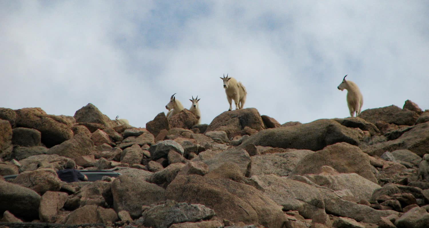
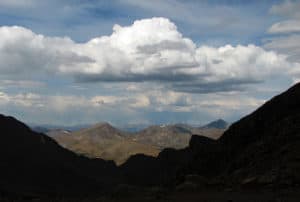
Mount Evans is one of Colorado's Front Range Fourteeners, and like Pikes Peak, Mt. Evans has a road that takes you to a trail just a few hundred feet shy of the summit where you are likely to see both Bighorn Sheep and Mountain Goats. The key to exploring Mount Evans is knowing the stops along the way. View our full trail profile for a suggested itinerary. Explore the full trail profile below for all the details: hiking trails, trail map, and detailed directions to the trailhead.
Trail Snapshot: Mt. Evans Summit Hike
| Hike Distance | 1/4 mile |
|---|---|
| Difficulty | Easy (but consider altitude) |
| Duration | Approx. 15-20 min |
| Trail Type | Out and Back |
| Seasons | Open early summer through Fall, Check Sites for Closure: #1 - #2 |
| Dogs | Allowed On Leash; Not Recommended bc will disturb wildlife |
| Hike Trail Map | Click for a Map of Mt. Evans Summit Hike |
| Denver Drive Time | 1 hr 40 min |
| Driving Directions to Mt. Evans Summit Hike | Click for Google Map |
| Town Nearest Hike | Idaho Springs, Colorado |
| Beauty | Lakes, mountain peak views, high country tundra, wildlife: mountain goats, bighorn sheep, marmots, & pika |
| Activities | Picnics, hiking, viewing wildlife |
| Fee Required | See Fee Schedule Link |
What it lacks in challenge Mt. Evans makes up in breathtaking panoramic views of the Rocky Mountains and opportunities to view wildlife up close. It isn't much of a hike, because you can summit this 14,265 foot peak in just a few minutes. Yet your trip to Mount Evans can include several stops at high mountains lakes, to view wildflowers, and to take in the expansive scenery (See our itinerary below). This is one of the best attractions near Denver for visiting friends and family, especially if you don't have the luxury or equipment to take them into the Colorado backcountry. The views are stunning and there is a good chance that you'll encounter wildlife that would usually require hours of hiking to see. Still, you are at fourteen thousand feet, so be aware of the effects of altitude, drink plenty of water, and keep an eye on the weather.
Here is our suggested Mt. Evans Adventure Itinerary
- Take The I-70 Route for a shorter Drive: Click for Directions
- Take the a bit more scenic route: Click for Directions
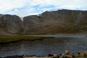
- First Stop, Echo Lake - We like to arrive here early in the morning when the water is like glass and before other visitors arrive. Check out our full profile on Echo Lake
- Second Stop, Mt. Goliath - After passing through the toll booth, you'll begin a drive up the winding Mt. Evans Highway. After a few miles you'll encounter a nature center Dos Chappell Nature Center at Mt. Goliath. Stop here for a short wildflower hike and to take in the views. Click for Google Map
- Third Stop, Summit Lake- Grey cliff bands drop to the base of Summit Lake. It's breathtaking. Keep your eyes out for Bighorn Sheep and Mountain Goats as well. Click Here for Google Map
- Finally, the Summit of Mt. Evans.
Tips & Resources for Hiking Mt. Evans Summit Hike :
- A Better Itinerary? Because weather comes in during the early afternoon, we suggest that you start early, make a short stop at Echo Lake, then drive straight to the summit. On your way down, stop at Summit lake, then make your last stop at the nature center at Mt. Goliath.
- Do consider altitude. We avoid bringing friends who are not in good health. Be sure to have your guests drink plenty of water, and make sure they have had a day or two to get used to the altitude in the mile-high city.
- The Weather link below is for Idaho Springs. Weather at the altitude of Echo Lake may be very different, and Weather at the summit will definitely be different. Check this National Weather Service Link for more accurate forecasts.
- Looking for a more challenging Hike? Try the Chicago Lakes Hike. The trail begins at the Echo Lake Parking Lot.
- Trail Map for Mount Evans Wilderness: Trail Map Link
- Colorado Road Conditions: Colorado Road Conditions
- After the Hike: Echo Lake Lodge
Weather
Map & Driving Directions for Mount Evans
Click for Driving Directions

High Line Canal Hike - County Line to Fly'n B Park
The High line Canal starts in the foothills and meanders over 60 miles through Denver, creating a treelined hiking and biking thoroughfare in the middle of the city. This stretch in Littleton, Colorado takes you past Fly'n B Park. Take the path south and you'll find yourself in Writer's Park. Scroll down for the trail snapshot, and for further details and tips for hiking this great segment of Denver's High Line Canal.
Trail Snapshot: High Line Canal Hike - County Line to Fly'n B Park
| Hike Distance | 3.7 miles Round Trip |
|---|---|
| Difficulty | Easy |
| Duration | Approx 2 hr Round Trip |
| Trail Type | Out and Back |
| Seasons | All Year |
| Dogs | Allowed On Leash |
| Hike Trail Map | Click for a Map of High Line Canal Hike - County Line to Fly'n B Park (see A6 to A2) |
| Denver Drive Time | 30 min |
| Driving Directions to High Line Canal Hike - County Line to Fly'n B Park | Click for Google Map |
| Town Nearest Hike | Littleton, Colorado |
| Beauty | Giant cottonwood trees, Highline Canal, wetlands, waterfowl, pond at the Fly'n B Park |
| Activities | Hiking, cycling, birdwatching, pond, picnic shelter |
Denver's Highline Canal was designed as an irrigation stream, but it has become a 66 mile long hiking and biking trail running through the heart of Denver. This particular hiking trail section is in the Littleton & Highlands Ranch area. There are two parking lots from which you can start the hike: the Countyline Road Trailhead, or the Fly'n B Park lot. Round Trip, this segment is about 4 miles. From the Countyline Trailhead, cross over the first footbridge and head South (left). You'll run into an intersection about 200 yards up. Take a right to continue following the Highline.
Water flows in the highland canal about 90 days a year. Because the canal only drops two feet per mile, the water, even when it is flowing fast, appears calm. This is part of what gives this trail such a pastoral feel, even though it is close to 470. Immense Cottonwood trees arch over the path, and all sorts of birds decorate the bushes and wetlands that have grown up wild along its edges.
The trail is great for a stroller hike and for wheelchairs. After about 2 miles of trail, you'll walk through a tunnel that goes under 470. You'll then emerge to find yourself at Fly'n B Park. It looks like it is an old ranch that has been converted into a great park near Highlands Ranch. It features a small pond with boat dock, and a fantastic shelter house. The pond looks like a perfect place to take kids fishing in Denver. We haven't tried it out yet, so we would love your feedback if you have. The Highlands Ranch Metro District Parks is currently (Spring 2014) renovating the home on the property. Outdoor restrooms and some parking is available. However, we recommend parking at the Countyline Road Trailhead for this hike.
Tips & Resources for Hiking High Line Canal Hike - County Line to Fly'n B Park :
- TIP: A detailed guide to of the Highline Canal Trail can be ordered from Denver Water.
- TIP: Take some snacks and extra water. The Highline continues well beyond this section and you're likely to want to explore more of it.
- TIP: From the Countyline Trailhead, you can also go North towards for views of McLellan Reservoir and the Front Range.
- Trail Map for High Line Canal Hike: Trail Map Link
- Colorado Road Conditions: Colorado Road Conditions
- After the Hike: Enchanted Grounds Coffee Shop
- Denver Water Highline Canal Site
Weather
Map & Driving Directions
Click for Driving Directions

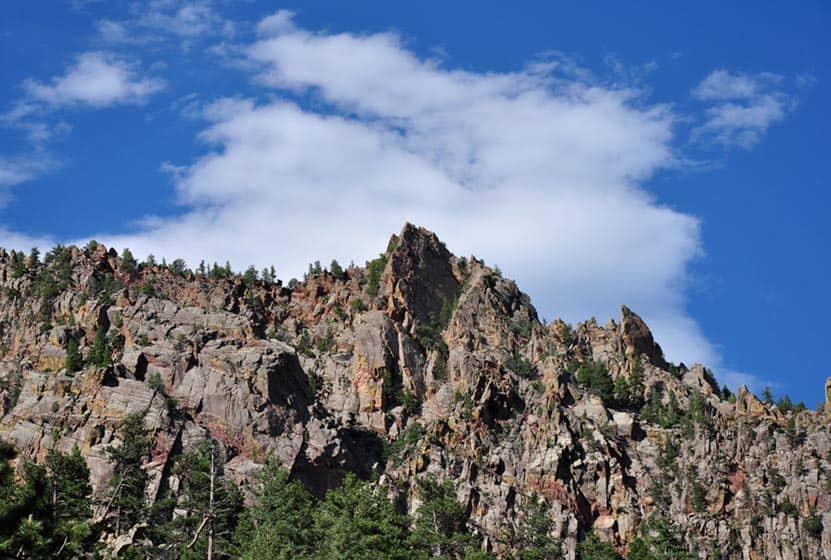
Mount Falcon - Castle & Tower Hike
A hike to castle ruins in Colorado? Yep. Throw in a lookout tower, a great view of Denver, of Red Rocks, and of the mountains, and you've got some of the highlights of the Mount Falcon Trail. The trailhead is nestled in a community in the foothills just about 40 minutes from Denver. Here we detail a 2.3-mile loop trail that hits all the destinations.
Trail Snapshot: Mount Falcon Castle & Tower Hike
| Hike Distance | Approx 2.3 miles |
|---|---|
| Difficulty | Easy |
| Duration | 1 hr 30 min+ |
| Trail Type | Loop |
| Seasons | All Year |
| Dogs | Allowed on Leash in Most Areas |
| Hike Trail Map | Click for a Trail Map |
| Denver Drive Time | 40 min |
| Directions | Click for Google Map |
| Town Nearest Hike | Morrison, Colorado |
| Beauty | Front Range views, Denver views, Fire Tower, ruins, & deer |
| Activities | Picnic area, horseback riding, mountain biking, hiking trails |
Mt. Falcon Loop Hike
Mount Falcon features several trails. By combining a few, you can create a 2.3-mile loop and take in several historic sites as well as breathtaking views of Denver, Red Rocks, and the Front Range. This makes it one of the best hikes close to Denver for visiting friends and family. Because it is an easy hike and has a relatively flat and wide trail, you can take the jogging stroller on this one, too. If you are looking for more great trails for your family, be sure to check out our Kid Friendly Trails Near Denver and our recommended Colorado Hikes for Visiting Friends and Family pages. If hiking with kids, be sure to access it via the West Trailhead as described in this post. Map apps and other sites may take you to the very demanding east trailhead, which is very exposed to the sun and has heavy mountain bike traffic.
The Loop Trail Sequence:Start at the parking lot off of Mt. Falcon Road, and when you come to a fork in the trail, take the Tower Trail to your right. Soon you'll pass the Eagle Eye Shelter which offers great views towards Mount Evans and the surrounding foothills. Stay on the Tower Trail until you get to the Fire Tower which commands a panoramic view of Denver, Red Rocks, and more of the Front Range of Colorado.
Then continue on the Tower Trail until it intersects with the Meadow Trail. Take the Meadow Trail North/Left for about .3 miles. It will end at the Castle Trail - take a left. The Castle Trail will lead you back to the parking lot, but don't head back until you stop at the ruins of the old Walker Home. The views from here are beautiful as well.
Tips & Resources for Hiking Mt. Falcon:
- TIP: Bring a Lunch and stop at the Eagle Eye Shelter for a Picnic
- TIP: Go early or late to catch some of the best sunsets along the Colorado's Front Range
- Trail Map for Mount Falcon Park: Trail Map Link
- Colorado Road Conditions: Colorado Road Conditions
Weather
Map & Driving Directions

Rattlesnake Gulch Trail at Eldorado State Park
The Rattlesnake Gulch trail takes you up the sides of Eldorado Canyon, one of Colorado's historic State Parks. This lollipop trail takes you past the ruins of the Crags Hotel, then on to gain views of the Continental Divide. Scroll down to look over the trail snapshot, then explore the trail details and tips below for this rewarding hike in Eldorado Canyon State Park.
Trail Snapshot: Rattlesnake Gulch Trail at Eldorado Canyon
| Hike Distance | Approx 2.5 to 4 miles |
|---|---|
| Difficulty | Moderate |
| Duration | 1.5-2.5 hrs |
| Trail Type | Lollipop w/Spur Option |
| Seasons | Spring, Summer, Fall |
| Dogs | Allowed on Leash |
| Hike Trail Map | Click for a Trail Map |
| Denver Drive Time | 45 min |
| Directions | Click for Google Map |
| Town Nearest Hike | Boulder, Colorado |
| Beauty | Canyon, waterfalls and cascades, cliff swallows, cliff-top views, geologic features |
| Activities | Picnic areas, horseback riding, mountain biking, rock climbing |
| Fee | Link to Fees Page |
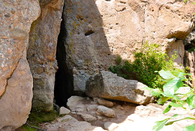
If your legs are ready to gain some quick elevation to some rewarding views, the Rattlesnake Gulch trail will give you just that. This trail starts at the west trailhead of the Fowler Trail about 1/2 a mile into Eldorado Canyon. The hike first takes you about 1.2 miles to the site of the Crags Hotel. The hotel was built in 1908 and visitors could reach it by taking an incline railroad and by an old wagon trail. In 1912, the hotel burnt to the ground, and just a few ruins remain. The parks department has put up interpretive signs to give you an idea of what the site was like in the early 1900's.
If you continue past the Crags Hotel site, you can add on an additional 1.4 miles by hiking the Rattlesnake Gulch Loop. A spur along the trail takes you to the Continental Divide overlook, where you can look out to the plains and towards a few peaks to the west. If you don't want to hike the entire loop, but you want to catch the view from the overlook, take the trail to the right after the hotel site and hike about 10 more minutes. See the map link above for the exact location of the spur that leads to the overlook.
The picture above is looking northeast towards the Cadillac Rock area. If you take a pair of binoculars, scan the formation for rock-climbers. Eldorado Canyon makes for some great Denver area hiking. It's one of those places with so many unique features, that you'll find yourself drawn back there time and time again.
Tips & Resources for Hiking the Rattlesnake Gulch Trail at Eldorado State Park:
- Exact Trail Length: Exact trail lengths are approximate until we can GPS this one. We've noticed discrepancies on maps and reports. So, be sure to add some buffer time on to this hike.
- Parking: Parking fills up fast at Eldorado Canyon. So, we suggest you go early in the day, or as the crowds are filtering out of the park in the late afternoon. As well, you'll find weekdays less crowed. Eldorado Canyon is open from sunrise to sunset year round.
- Directions: Use the driving directions on this page. They will lead you to the nearest parking area to the Rattlesnake Gulch Trailhead.
- Fee: There is an $8 parking fee per car or you can use your Colorado State Parks Annual Pass
- Trail Map for Eldorado Canyon State Park: Trail Map Link
- Colorado Road Conditions: Colorado Road Conditions
- After the Hike: Boxcar Coffee Roasters in Boulder
Weather
Map & Driving Directions
Click for Driving Directions

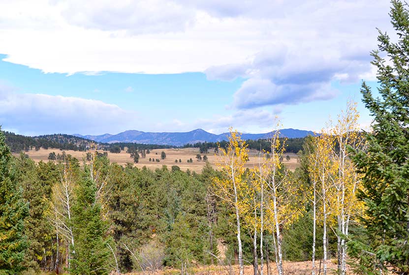
Elk Meadow Park - South Loop
Elk Meadow Park is a great place to hike with your family, if you have little ones, or if you just want to talk with a friend as you hike and take in great views of Colorado. It is important to know that the adjacent off-leash dog park has been closed. Get all the info you need to hike Elk Meadow Park in Evergreen by exploring the full trail profile below.
| Hike Distance | 2.6 miles |
|---|---|
| Difficulty | Easy |
| Duration | Approx 1.5 hr |
| Trail Type | Loop |
| Seasons | All |
| Dogs | Allowed On Leash |
| Hike Trail Map | Click for a Trail Map |
| Denver Drive Time | 35 min |
| Driving Directions to Elk Meadow Park - South Loop | Click for Google Map |
| Town Nearest Hike | Evergreen, Colorado |
| Beauty | Meadows, old barn, ponderosa pine, wildlife: elk, & Abert's squirrel |
| Activities | Hiking, dog park nearby |
Elk Meadow Park has just over 13 miles of hiking trails near Denver that wind through it's lower meadows, through ponderosa forest, and two more strenuous options that lead to the summit of Bergen Peak. This profiles a 2.6 mile loop that begins at the south parking area. To form the loop, combine the Meadow View Trail, Elk Ridge Trail, and the Sleepy "S" trail. Use the Elk Meadow Park map at this link. We chose this route because we have 2 children under 3 years old, and it was a good choice - just long enough, trails close to Denver, and lots of change of scenery during a short hike.
There had been an off-leash dog area just on the other side of the street from the south parking lot (not visible on this older google map, so you'll have to trust us that it's there). This was a great place to allow dogs to roam and play, but this has been closed due to excessive dog waste and damage to vegetation. Here is a link to the Jefferson County info page on the off-leash area. Dogs are required to be leashed in all other areas of the park.
Tips & Resources for Hiking Elk Meadow Park - South Loop :
- TIP: The Easy way. Take the loop clockwise for the easier route and counter-clockwise if you are looking for a more strenuous (but not much) hike.
- Parking: Park only in designated areas. There has been a lot of erosion damaged caused by visitors parking alongside the road. If parking is full, please find another park to visit.
- TIP: Enjoy some time in Evergreen. The town of Evergreen is a great place to retreat to during the summer. It's a few degrees cooler, Bear Creek runs through town, and you'll find some great places to eat.
- Trail Map for Elk Meadow Park: Trail Map Link
- Colorado Road Conditions: Colorado Road Conditions
- After the Hike: Beau Jo’s Pizza
Weather
Map & Driving Directions
Click for Driving Directions
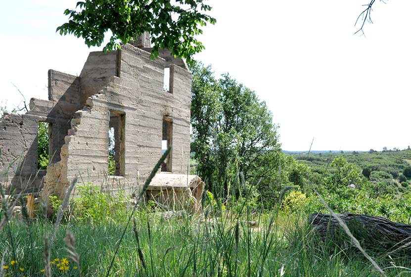
Homestead Trail at Castlewood Canyon
his trail is great place to begin if you plan to explore the west side of Castlewood Canyon. It's a short hike, but the Homestead Trail can be used to link up to other hiking trails in this Colorado State Park. Scroll down to get all the hiking info you need in the trail snapshot, trail options descriptions and tips.
Trail Snapshot: Homestead Trail at Castlewood Canyon
| Hike Distance | 2 or 4 mile options RT (see trail options below) |
|---|---|
| Difficulty | Easy to Moderate |
| Duration | Approx 30 min+ Round Trip |
| Trail Type | Out & Back and Loop Options |
| Seasons | All |
| Dogs | Allowed on Leash in Most Areas, But Not on the East Canyon Trail |
| Hike Trail Map | Click for a Map of Homestead Trail at Castlewood Canyon |
| Denver Drive Time | 45 min |
| Driving Directions to Homestead Trail at Castlewood Canyon | Click for Google Map |
| Town Nearest Hike | Castle Rock, Colorado |
| Beauty | Cherry Creek, waterfall, interesting geology, canyon views, ruins |
| Activities | Hiking, great picnic facilities, mountain biking, horseback riding |
| Fee Required | Visit Colorado State Parks Site |
The Homestead Trail in Castlewood Canyon is the first trail you will encounter as you enter the west side of the park. Park at the first lot and you'll immediately see the ruins of the old Lucas Homestead, an unusual concrete structure built in the late 1800's.
The trail is less than a mile round trip, but it links up with several other trails which form 2 loops. Download the Castlewood Canyon Brochure & Trail Map to get a better idea of how these two loops work.
4 Mile Loop: Hike the Rim Rock Trail for 2.14 miles to enjoy the east side of Cherry Creek. Eventually, you will meet with the Creek bottom trail. Take that North for 1.7 miles until you have returned to the Homestead Trail.
2 Mile Loop: When the Homestead Trail meets the Creek Bottom Trail, take the Creek Bottom Trail south for about .7 mile until it intersects with the Cherry Creek Trail. Take this North for 1 mile back to the Lucas Homestead.
Tips & Resources for Hiking Homestead Trail at Castlewood Canyon :
- Finding the Trailhead: The West Side entrance can be hard to find. Usually, Colorado state parks have brown signs indicating the park roads. The west side doesn't. But the name of the road you're looking for is "Castlewood Canyon" - easy to remember.
- TIP: Hikes in Castlewood Canyon can be quite exposed to the sun, so bring the sunscreen.
- TIP: Poison Ivy: We've been surprised how poison ivy flourishes in this park, often along the edge of the trail. Know how to identify it, so that you can avoid it. But don't let that deter you from the park. You just need to keep an eye out. See our post on how to identify and treat poison ivy.
- Trail Map for Castlewood Canyon State Park: Trail Map Link
- Additional Castlewood Canyon State Park Maps: Other Trails
- Colorado Road Conditions: Colorado Road Conditions
- After the Hike: Crowfoot Valley Coffee
Weather
Map & Driving Directions
Click for Driving Directions
Cave Trail at Castlewood Canyon
Colorado's Castlewood Canyon State Park has several caves hidden in the park, but this set has their own trail. It's a short trail, just a 1/8 mile one-way, but can be combined with other hiking trails--one that takes you to a waterfall--to create a real adventure. Check out the trail snapshot to get the map, driving directions to Castlewood Canyon, and tips for exploring the Cave Trail in Castlewood Canyon.
Trail Snapshot: Cave Trail at Castlewood Canyon
| Hike Distance | 0.14mi (.28mi RT) |
|---|---|
| Difficulty | Moderate due to terrain |
| Duration | Approx 30min Round Trip |
| Trail Type | Out and Back |
| Seasons | All |
| Dogs | Allowed on Cave Trail, But Not on the East Canyon Trail |
| Hike Trail Map | Click for a Map of Cave Trail at Castlewood Canyon |
| Denver Drive Time | 1 hr |
| Driving Directions to Cave Trail at Castlewood Canyon | Click for Google Map |
| Town Nearest Hike | Castle Rock, Colorado |
| Beauty | Cliffs, caves, mature ponderosa pines |
| Activities | Rock climbing, hiking, picnic areas, nearby waterfall |
| Fee Required | Visit Colorado State Parks Site |
Looking for caves close to Denver? They may not be extensive, but they are still fun to explore. There are actually two caves along the top of the trail. One is a kind of large crack in the rock that leads to a larger chamber. I wish I could describe it better, but my 2 1/2 year old, when I asked if she wanted to go inside, was concerned that the "bears might be awake." There are more caves hidden in Castlewood Canyon waiting to be found, but that is for another post.
Tips & Resources for Hiking Cave Trail at Castlewood Canyon :
- Finding the Trail: The cave trail can be accessed by hiking across the dirt road from the parking lot. The Google Map is very specific and should be helpful in finding the correct parking area.
- Add the Waterfall: The Waterfall Hike can be added to your trip. Midsummer raspberries can be found above the falls along the trail.
- Finding the Traihead: The West Side entrance can be difficult to find. Usually, Colorado State Parks have brown signs indicating the park roads. The west side doesn't. But the name of the road you're looking for is "Castlewood Canyon" - easy to remember.
- Short but Steep Hike: The hike is easy when you consider the distance, but we rated this one as difficult because the trail can be quite uneven and very steep. Watch your footing.
- Make it a Loop Hike: You can make an even larger loop out of the hike by exiting on either the north or south end of the Cliff Base or Climber's Trails, then crossing the road east to one of the parking areas. From there, take the West Side Spur or the Creek Bottom Trail back to your car. See the Castlewood Canyon Map below for details.
- TIP: Hikes in Castlewood Canyon can be quite exposed to the sun, so bring the sunscreen.
- TIP: Poison Ivy: We've been surprised how poison ivy flourishes in this park, often along the edge of the trail. Know how to identify it, so that you can avoid it. But don't let that deter you from the park. You just need to keep an eye out. See our post on how to identify and treat poison ivy.
- Trail Map for Castlewood Canyon: Trail Map Link
- Additional Maps: Castlewood Canyon State Park Trails
- Colorado Road Conditions: Colorado Road Conditions
- After the Hike: Crowfoot Valley Coffee
Weather
Map & Driving Directions
Click for Driving Directions
Evergreen Lake Trail
This Colorado hike (more of a stroll) is a perfect way to spend a Saturday morning. You can rent canoes and sailboats from the nature center and warming house. In the winter, the Evergreen Lake transforms into an ice skating wonderland. Explore this hike profile for all the details.
Trail Snapshot: Evergreen Lake Trail
| Hike Distance | 1.3 mile Round Trip |
|---|---|
| Difficulty | Easy |
| Duration | Approx 45 min Round Trip |
| Trail Type | Loop |
| Seasons | All |
| Dogs | Allowed On Leash |
| Hike Trail Map | Click for a Trail Map |
| Denver Drive Time | 40 min |
| Driving Directions to Evergreen Lake Trail | Click for Google Map |
| Town Nearest Hike | Evergreen, Colorado |
| Beauty | Lake, sunsets, wetlands, wildlife: elk & migratory birds |
| Activities | Picnic area, hiking trails, boating, fishing, ice skating |
| Handicap Accessible | Portions of this Trail are Handicap Accessible |
The Hike: Evergreen Lake Trail:
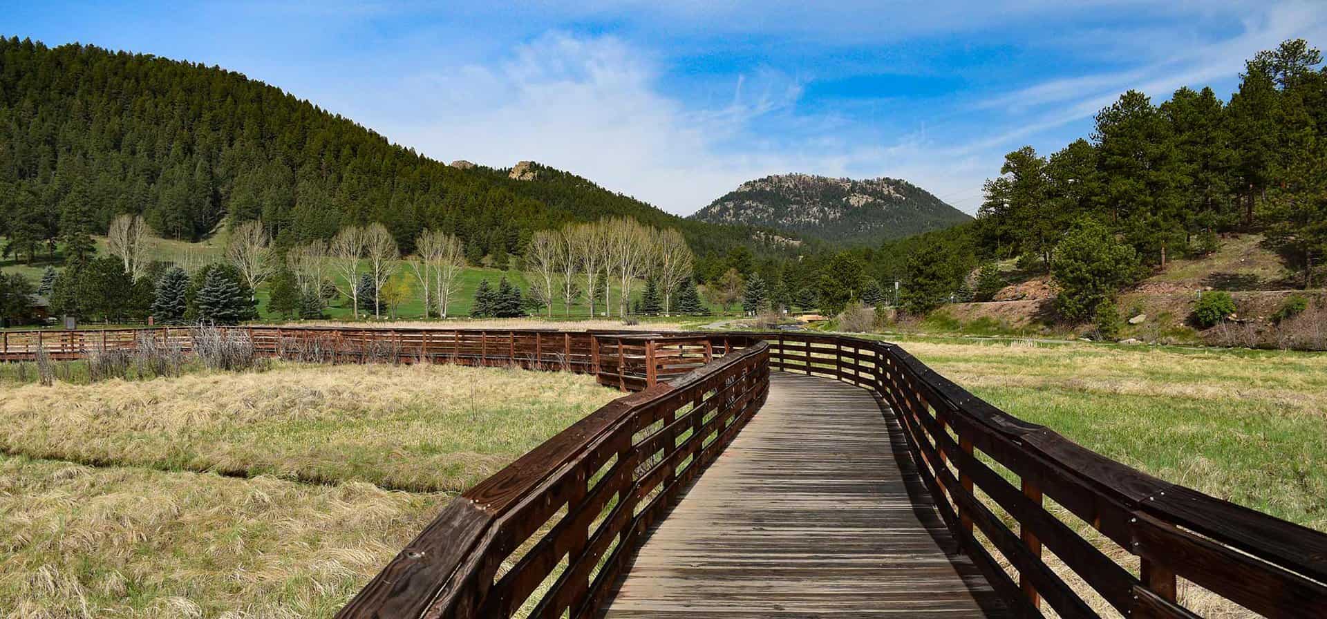
Evergreen Lake Trail is a 1.3 mile loop in the quaint mountain town of Evergreen, Colorado. If you have a young family like us, and are looking for an easy hike near Denver, this is a great choice.
From the Evergreen Lake house, the trail winds along a boardwalk, through a wetlands area, then towards town. If you are going this way (clockwise) around the lake, be sure to take the high path when you come to where the trail splits. The lower path is more of a fishing trail that soon becomes difficult to navigate. You can take the high path into town or over the dam and to the backside of the lake.
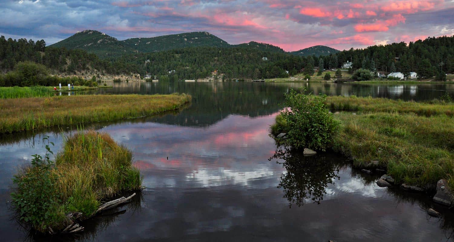
Along the back side of Evergreen Lake stands the old Warming House and Nature Center, operated by the Evergreen Audubon Society. Be sure to check their site for their seasonal hours. At the boathouse, the Evergreen Park & Recreation District operates boat rental and concessions. Their hours are seasonal as well. You can visit Evergreen Parks & Rec. boating page for rental info and hours. In the Winter, the lake transforms into an ice skating wonderland that rivals New York's Rockefeller Square. Skate rental and admission fees can be found on the Hockey and Skating page on the Evergreen Parks District Site.
Tips & Resources for Hiking Evergreen Lake Trail :
- TIP: Like we mentioned above, take the high path along the road when walking clockwise around the lake.
- TIP: Make it a day. There are several hikes near Evergreen to enjoy. As well, the lake is very accessible from town, so you can walk in, enjoy lunch or coffee, then hike back out.
- TIP: Listen for Elk in the Fall: On our most recent trip to Evergreen Lake, a bull elk was bugling. So, if you just don't have time to make it up to Estes Park, this is a great backup.
- Trail Map for Evergreen Lake Trail: Trail Map Link
- Colorado Road Conditions: Colorado Road Conditions
- After the Hike: Beau Jo’s Pizza
Weather
Map & Driving Directions
Click for Driving Directions
Chimney Gulch Trail at Windy Saddle Park
It's a demanding hike up Chimney Gulch near Golden, Colorado, but the views at the top are worth the workout. This hiking trail crosses streams as it zigzags up the side of local landmark, Lookout mountain. Explore the full Chimney Gulch hike profile below for trail map, driving directions, and more tips and details to help you enjoy this adventure in Windy Saddle Park.
Trail Snapshot: Chimney Gulch Trail at Windy Saddle Park
| Hike Distance | 5 miles Round Trip |
|---|---|
| Difficulty | Moderate to Difficult |
| Duration | Approx 2.5+ hrs |
| Trail Type | Out and Back |
| Seasons | All Season |
| Dogs | Allowed On Leash |
| Hike Trail Map | Click for a Map of Chimney Gulch Trail Map |
| Denver Drive Time | 25 min |
| Driving Directions to Chimney Gulch Trailhead | Click for Google Map |
| Town Nearest Hike | Golden, Colorado |
| Beauty | Rocky Mountain vista at top, views of Golden & Denver |
| Activities | Hiking, mountain biking, trail running |
The Hike: Chimney Gulch Trail
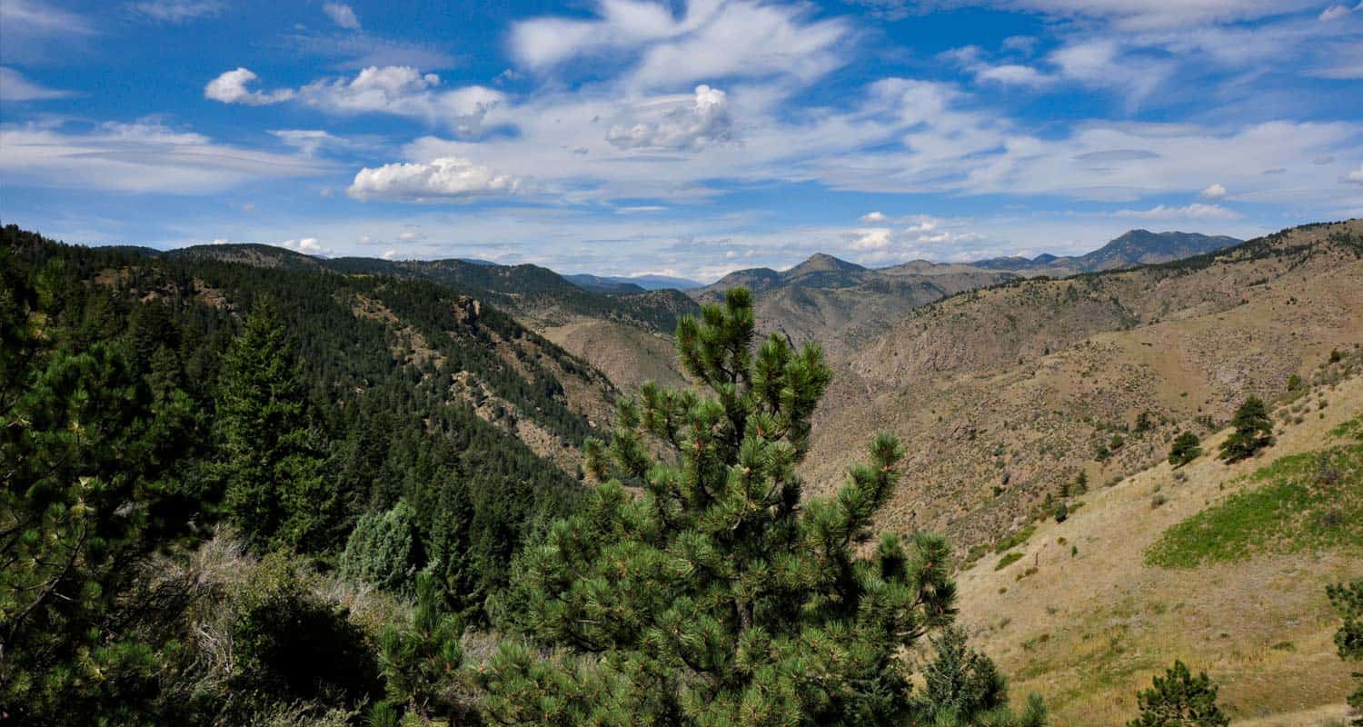
Steep - that's probably the best adjective for this hike. The trail is very accessible from Denver - on average, just a 25 minute drive. The trail begins at the base of Lookout Mountain in Golden and weaves it's way to the top, crossing the road twice, to a wonderful mountain vista. It's a perfect place, complete with benches, for viewing sunsets. However, a hike down in the twilight may be pretty difficult to negotiate. The Chimney Gulch Trail joins up with both the Beaver Brook Trail, and Lookout Mountain Trail. See the link to the trail map above for details.
Tips & Resources for Hiking the Chimney Gulch Trail
- TIP: Because the trail can be narrow and has a lot of mountain bike traffic, we suggest leaving the dog at home.
- TIP: If you want to start at the top, you can park at the Windy Saddle Trailhead along Lookout Mountain Road. Click for Google map and driving directions.
- Adjust Expectations: If you are hoping for a quiet, solitary hike, this is probably not the best choice. Because this trail is very accessible and challenging, there is a lot of hiking, running, and biking traffic.
- For a great detailed trail description: , check out Deb Stanley's Chimney Gulch Trail profile.
- Trail Map for Chimney Gulch Trail: Trail Map Link
- Packing List: Always pack the 10 Essentials. Download our Hiking Guide to get the list and dayhiking packing checklist.
- Colorado Road Conditions: Colorado Road Conditions
- After the Hike: Cafe 13
Weather
Map & Driving Directions for Chimney Gulch Trailhead
Click for Driving Directions