High mountains passes, like Guanella, Kenosha, and Loveland, all offer 14er-level views but often without the 14er-level effort…or crowds! The Mt. Flora hike (with option to Mt. Eva) provides this kind of experience. Explore the full Mt. Flora to Mt. Eva Hike profile below for trail map, driving directions, and more tips and details to help you enjoy this adventure above Berthoud Pass near Denver.
Trail Snapshot: Mt. Flora to Mt. Eva Trail
| Hike Distance | 6-10 miles Round Trip |
|---|---|
| Difficulty | Moderate to Difficult |
| Duration | Approx 3-6hr |
| Trail Type | Out-and-Back |
| Starting Elevation | 11,300′ |
| Elevation Gain | Approx 1,800′ to 2,800′ |
| Seasons | All Year |
| Dogs | Allowed On Leash |
| Hike Trail Map | Click for Trail Map of Mt. Flora and Mt. Eva Hikes |
| Denver Drive Time | 1 hour |
| Driving Directions to Berthoud Pass Trailhead | Click for Google Map |
| Town Nearest Hike | Idaho Springs and Georgetown, Colorado |
| Beauty | 360-degree vistas, Berthoud Pass, Valleys, Lakes |
| Activities | Hiking, Photography |
Parking & Trailhead Information for Mt. Flora and Mt. Eva Hikes
Berthoud Pass, barely an hour west of Denver, beckons hikers above 13,000ft to a crest of the Continental Divide trail. The trailhead serves as a fount for multiple hikes, with a common and simple trek up a forest road to the Colorado Mines Peak (just under 13,000ft). Other well-conditioned adventurers may opt to continue along Highway 40 another hour north, going just beyond Granby, to catch the Crater Lake Hike.
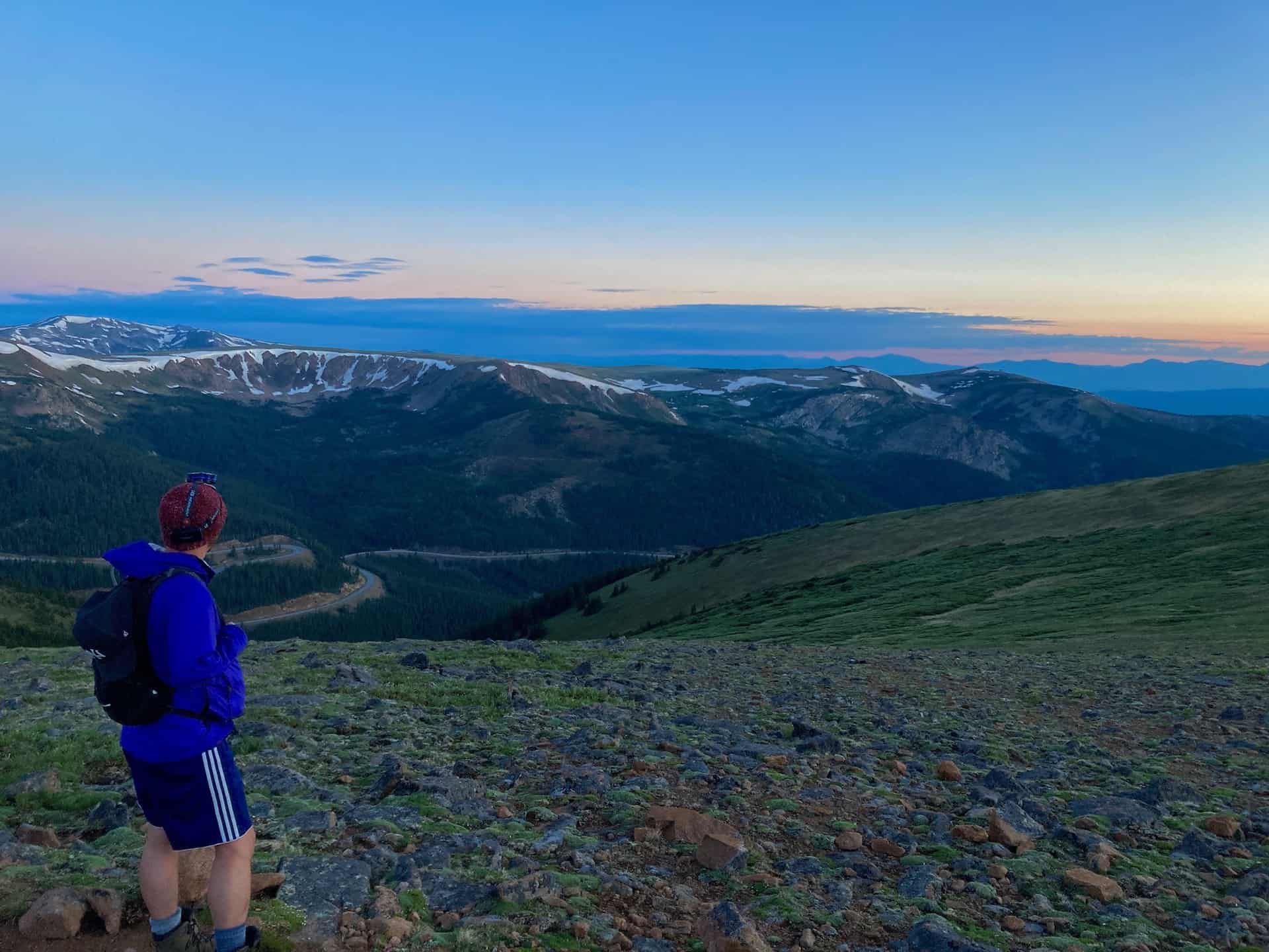
From Denver, heading west on I-70, take exit 232 for U.S. 40 toward Empire, CO. Staying straight to join Highway 40, continue for approximately 14 miles to the Berthoud Pass Parking lot, which sits on the right (east) side of the highway. Berthoud Pass requires navigating a half-dozen tight curves, so keep aware of the road while also appreciating the immense beauty around each of them! The parking lot provides ample parking for the official trailhead accessing the Mt. Flora hike.
The Hike: Mt. Flora and Mt. Eva Trail
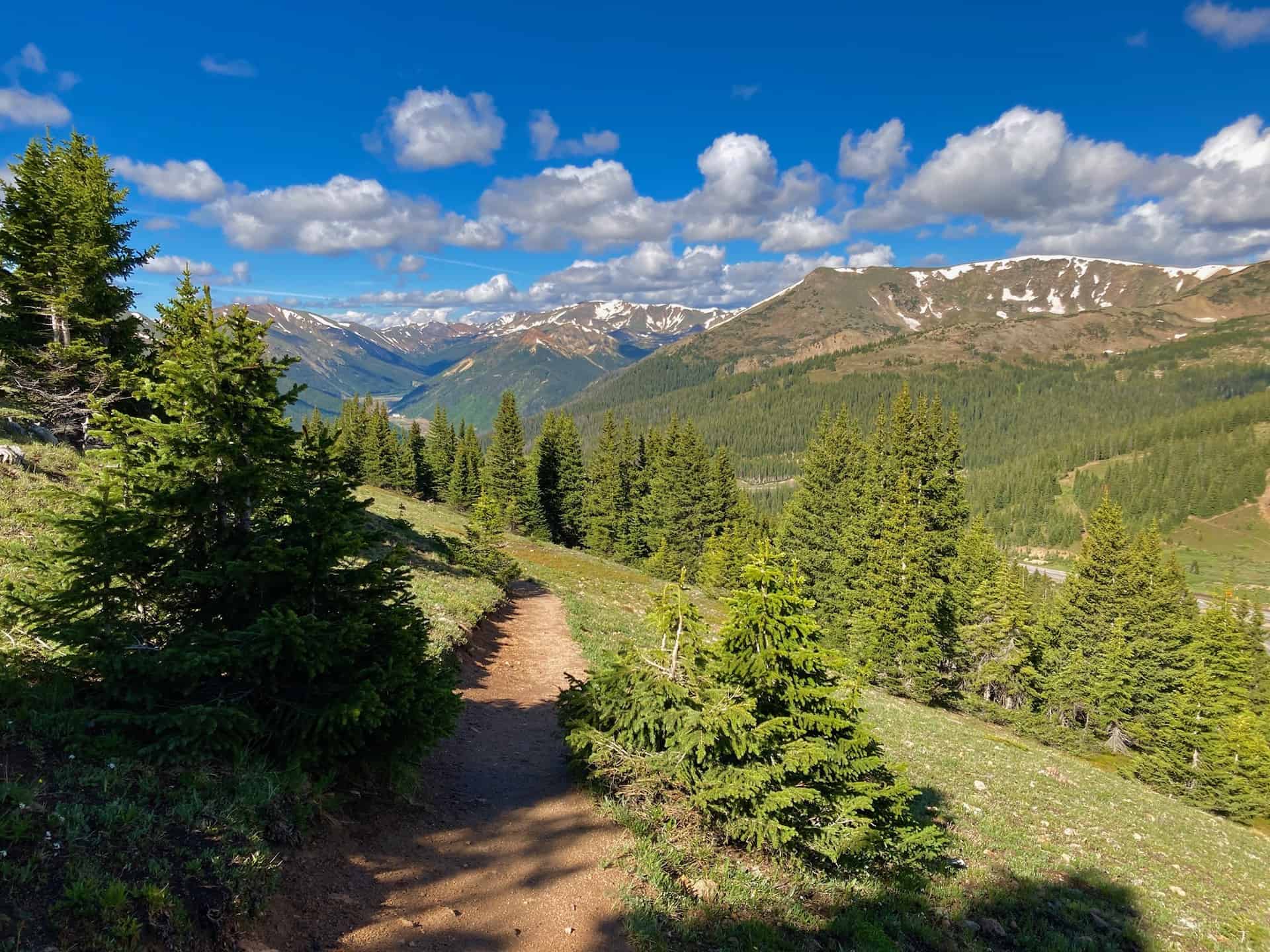
Beginning at the Berthoud Pass Parking Lot, the trail begins just beyond the gate to the forest road at the south end. The road is the trail for just over 3/4-mile, where a junction appears on the left at a sharp curve. Taking this foot-path for another 3/4-mile brings the trail to the ridge overlooking Blue Lake, and gazing back right (south), nearly eye-level with Colorado Mines Peak. Continuing along for approximately 1.5 miles, the trail tops the Mt. Flora peak, a small but broad mesa-like rock crop. From here, Ethel Lake and Mill Creek stand out below in the valley. The Continental Divide Trail veers to the right to descend to Breckenridge Peak.
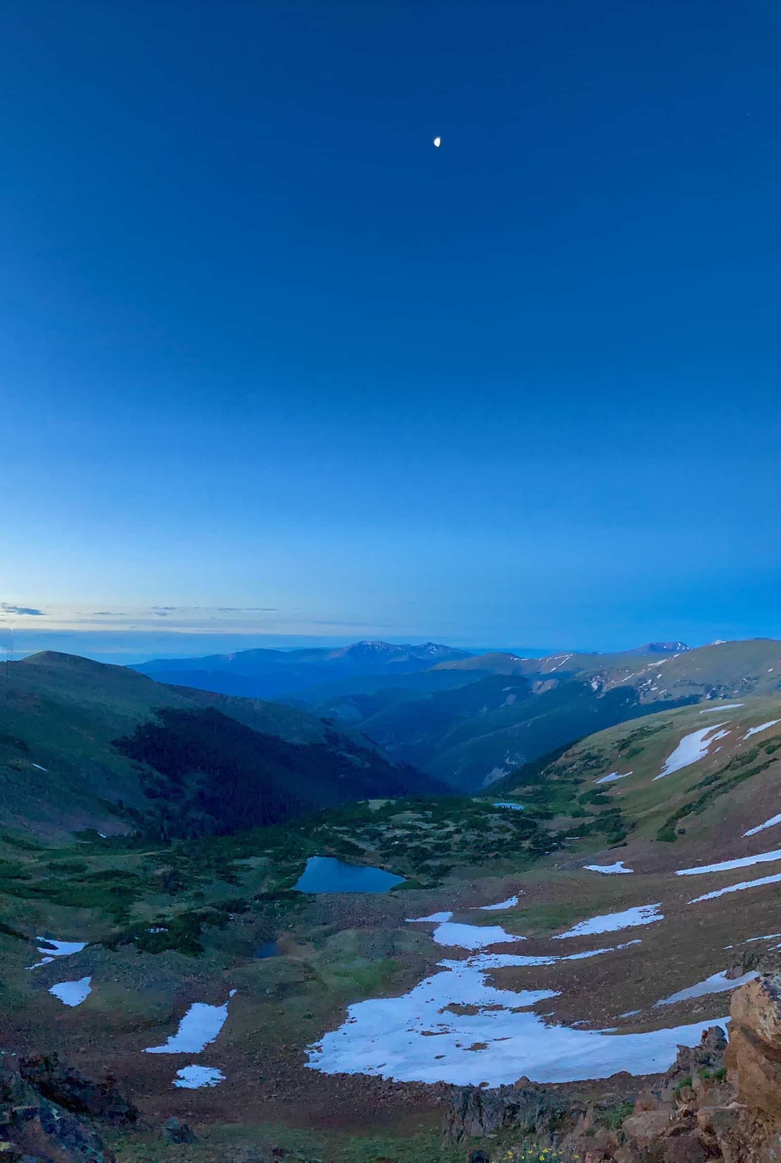
At this point, hikers have options. One may choose simply to return to the trailhead by reversing this route, completing six miles. The route under review here chooses to continue northeast — as if going straight and originally bypassing the Mt. Flora peak — and seek to capture the Mt. Eva peak, too. The next mile of the trail gradually unfolds by means of cairns (small piles of rocks stacked by previous hikers) and on- and off-again worn foot paths. It also descends over 600ft rapidly, then regains this in the next mile to reach the peak. However, the lung-busting elevation loss and gain comes with a stunning reward atop Mt. Eva…views of Slater Lake and three reservoirs, as well as Parry Peak and Mt. Bancroft to the north and northeast.
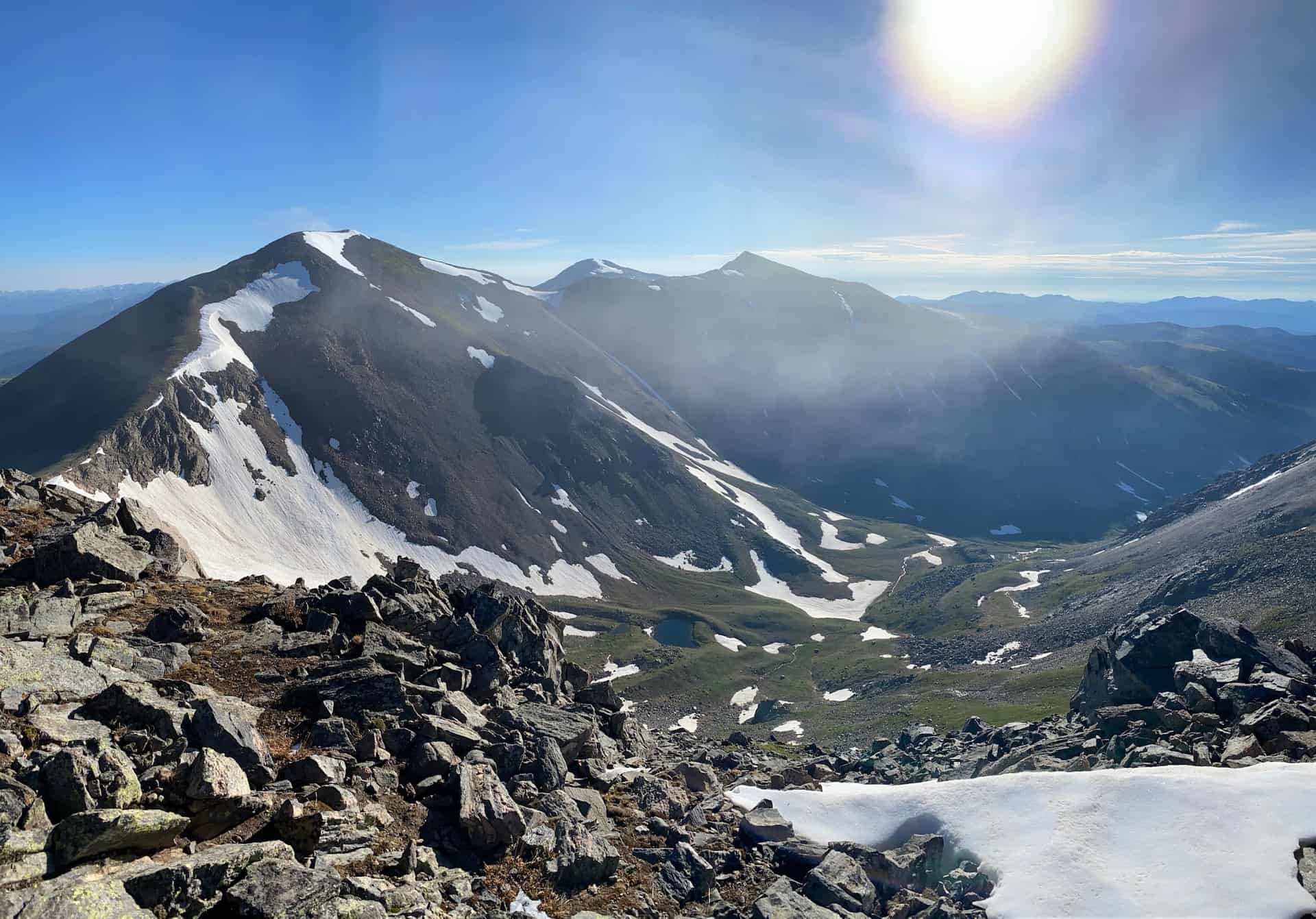
After soaking in the 360-degree vistas, including gazing down on Winter Park to the northwest, the return trail follows the route in reverse. As it descends, Berthoud Pass’ western slopes will change as the light changes, giving you an entirely new set of images for your mind or camera. Note: be careful as the trail re-enters the forest on its way back to the trailhead; a shortcut trail opens up high on the ridge. The route reviewed here follows the ascending route in reverse, with the exception of the last 1/10-mile, which has clear views of the parking lot and minimal trail hazards.
Tips & Resources for Hiking Mt. Flora and Mt. Eva above Berthoud Pass
- Trail Map: Mt. Flora to Mt. Eva Hike
- Packing List: Always pack the 10 Essentials. Download our Hiking Guide to get the list and dayhiking packing checklist.
- Colorado Road Conditions: Colorado Road Conditions
- After the Hike: Venture down into Winter Park, under 20min to the north of Berthoud Pass along Highway 40.
Weather
Map & Driving Directions
Click for Driving Directions


