“Where should I hike this Fall?” Friends text asking for Fall hike recommendations and coworkers stop me in the hallway to ask what trails are best for enjoying the colors of Colorado. During September and early October, we have a short window to see the golden yellows, bright oranges, and the fire reds of the changing aspens. In this post, I’m sharing my top Fall hike and scenic drive recommendations–the ones I share with my friends, family, and coworkers. Don’t Miss the Mountains!
-
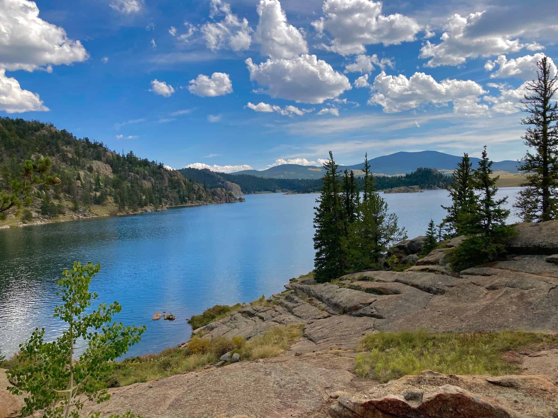
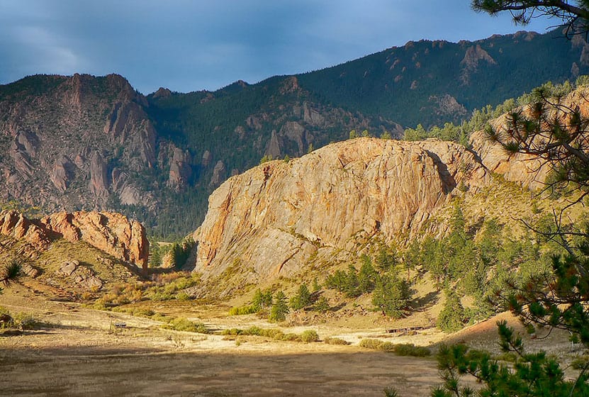
#1 Scenic Drive and Hike: Old Fall Creek Road
-
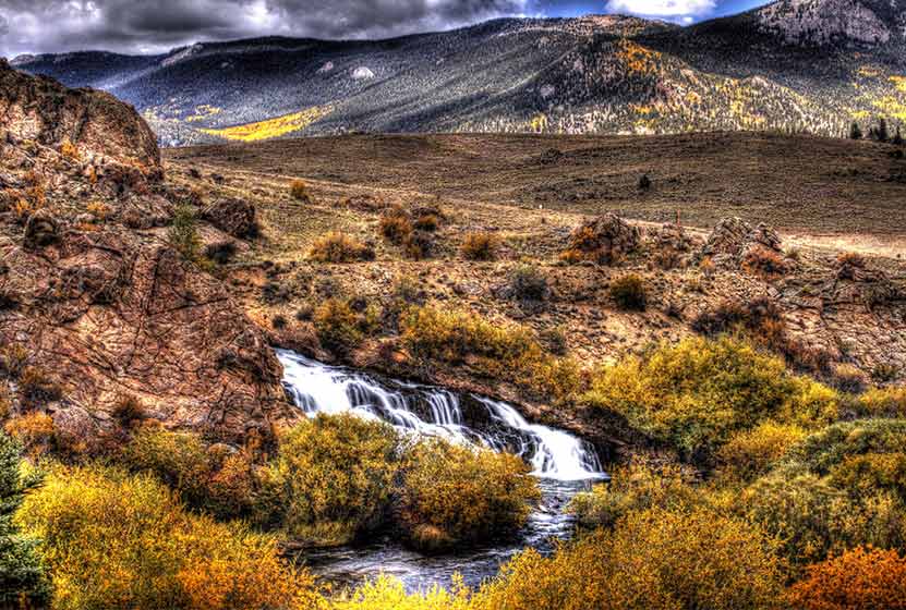
#2 Scenic Drive and Hike: Kenosha Pass and Highway 77
-
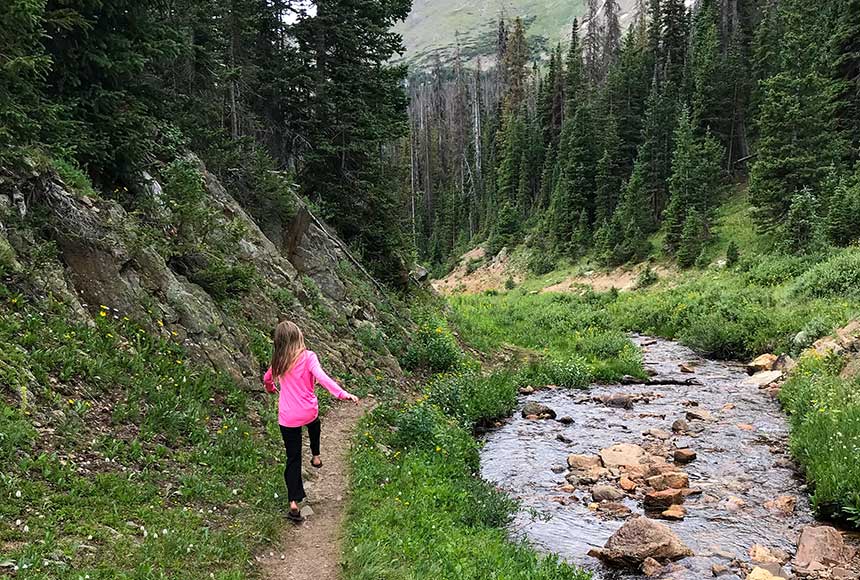
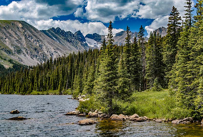
#3 Hike the Wild Basin in RMNP
-
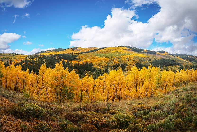
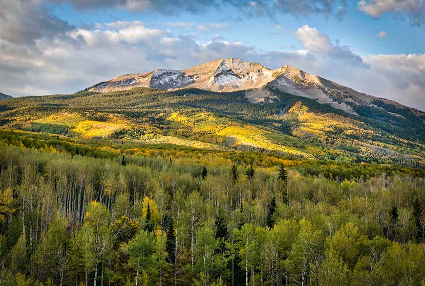
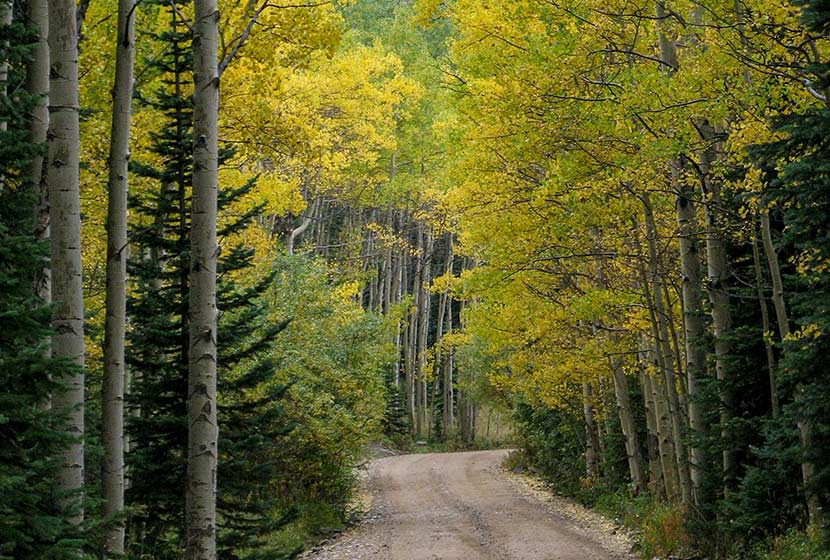
#4 Kebler Pass Scenic Drive and Camping Trip
-
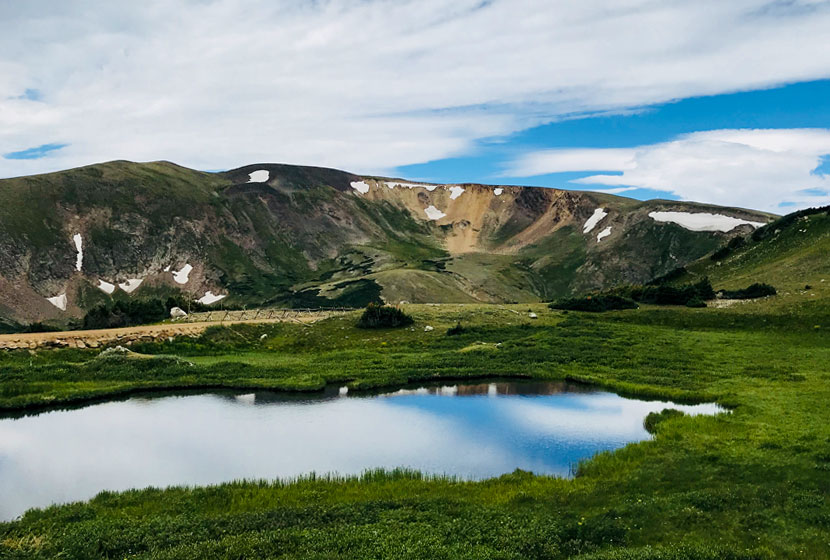
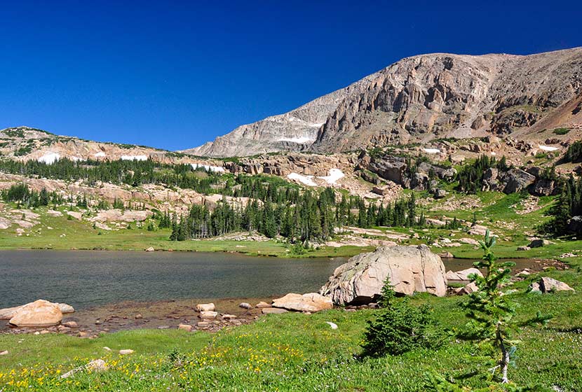
#5: Fall Hikes in Indian Peaks Wilderness
Fee: National Park Access Fee Required
Dogs: Dogs prohibited outside of your vehicle in these segments of RMNP
Miles of Driving: About 210 Miles or 5-6 hours in the Car
Access: Old Fall River Road is seasonal, so check for conditions and closures.
Last year, our family drove up one of the most scenic dirt roads in Colorado, Old Fall River Road in Rocky Mountain National Park. We stopped to visit two waterfalls, hiked through the wildflowers in an alpine meadow, saw moose and elk, then finished our day off with a great dinner on the other side of the Continental Divide.
The 9.5 mile dirt road is usually kept in good condition and was driveable with our low clearance, 2WD minivan. However, conditions can change quickly with weather, so be sure to check the RMNP road conditions page before setting off on your trip.
The trip starts at the Fall River Entrance on the Northeast side of Rocky Mountain National Park. There is an entrance fee, and each year we purchase the annual America the Beautiful pass, which gives you access to all the National Parks, Wildlife Refuges, and other BLM, National Forest, and Army Corp of Engineers sites. We visit RMNP several times each year, so it pays for itself after a few visits. If you have a 4th grader, your family can get a free annual pass through the Every Kid Outdoors program. You can purchase the pass online, or you can buy it at any of the entrance stations.
Our first stop was Horseshoe Falls, a beautiful set of cascades in the alluvial fan of the Roaring River. Next, we kept driving up Endovalley Road to the beginning of Old Fall River Road. Once on Old Fall River Road, you’ve committed to the drive because it’s a one-way, dirt road all the way to the top (about 10 miles). The Endovalley Picnic area is located just before Endovalley Road becomes Old Fall River Road and you’ll see signs pointing you to this shaded spot.
The next stop is Chasm Falls. Be mindful of others and park with care. It’s a beautiful waterfall–one of our favorites in the park because it is so accessible. Chasm Falls drops through a dark and narrow gorge in Fall River. You can get more details on its location from our trail profile of Chasm Falls. If you are interested in exploring the many waterfalls in RMNP, check out our Waterfall Hikes in RMNP page.
Higher up, you can park at the Chapin Creek Trailhead to hike in the high country. It’s a fragile tundra environment up here, so stay to the trail and do your part to care for this high traffic and easily damaged area. Parking is really limited. So, if you plan to hike here, be sure to start early so you can get a space. If you park roadside, be sure to use the pull-off areas. The trail here is high in elevation and very exposed, so be sure to keep an eye on the weather when hiking.
Towards the top, we found some trails along the south (left) side of the road leading to a beautiful creek, lined with wildflowers and surrounded by meadows where elk were grazing. Taking photos here was one of our favorite parts of the trip. Then, at the top, we stopped at the Alpine Visitor’s Center to use the restrooms and grab some coffee before our trip down. There is a cafe and gift shop.
From the top, you’ve got a couple choices: 1) Descend back into Estes Park on Trail Ridge Road, or 2) Travel down the West Side into Grand Lake. We chose to drive down to Grand Lake and stop at the Bowen-Baker Trailhead where we had a late picnic lunch on the banks of the Colorado River where we saw moose and elk in the meadows. Keep aware in this area as moose, though they are gigantic, can hide themselves well in the trees, and are very territorial–especially cows with their calves.
You can end your trip driving back to Denver via Highway 40 to interstate 70. We stopped and had pizza at Beaujo’s in Idaho Springs for Dinner. We also like stopping at The Peak in Winter Park, or grabbing a bite to eat (or great ice cream) in Grand Lake.
Map of Old Fall River Road to Grand Lake Scenic Loop
Hike Distance: Less than Mile to 14.4 Miles
Difficulty: Easy to Demanding
Miles of Driving: About 220 Miles or 4.5 hours in the Car
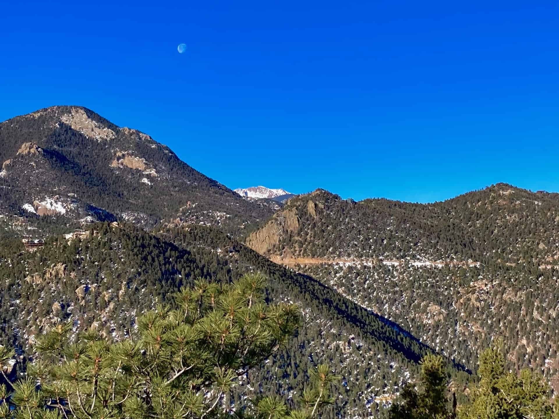
Kenosha Pass is arguably the most stunning fall landscape close to Denver. Check out our full trail profile page for Kenosha Pass. But with the population growth of the Front Range, and it being just 90 minutes from Denver, this place is getting a lot of traffic. Go on a weekday, or leave before 6am on the weekend to avoid traffic. Hiking etiquette becomes all that much more important when there are more people, so be sure to brush up on your trail courtesy before heading out. Expect a slow drive home if you are taking highway 85 back to Denver. However, I’d recommend taking a more leisurely way home and visit some other sites.
After hiking at Kenosha Pass, drive down into the South Park region to take in views of these stretch-to-forever countryside. In Jefferson, turn onto Highway 77. This highway is one of my favorite drives in all of Colorado (keep it a secret). Just about 30 minutes from Kenosha Pass, you’ll arrive at Tarryall Reservoir where you can park and take a short walk to a quaint waterfall, Tarryall Falls.
From Tarryall Reservoir, it’s another 30 minute drive on 77 south to Lake George, Colorado. Along the stretch of road you’ll see the China Wall (see photo below) and the mountains of Lost Creek Wilderness. If you got started early and want to hike in this area, start at the Twin Eagles Trailhead or Spruce Campground where you can begin hiking up into some beautiful stands of aspens along the boundary of Lost Creek. If you are hungry and looking for a place to stop, check out The Iron Tree Restaurant just outside Lake George.
From Lake George, it’s about a 1-hour drive back into Colorado Springs, or about a 2-hour drive back to Denver via 24 to interstate 25. If you want one more stop on this big loop drive, stop in at Garden of the God’s for a sunset stroll. See our Ultimate Guide to Hiking Garden of the Gods to plan on which of the six hiking trails you might decide to take.
Map of Kenosha Pass to Lake George Scenic Loop
Hike Distance: 5.4 to 14 miles
Difficulty: Easy to Moderate
Drive Time: About 90 minutes from Denver
Fee: National Park Access Fee Required
Dogs: Dogs prohibited in RMNP
Where is the Wild Basin? It’s a region of Rocky Mountain National Park, located South of Estes Park on the East side of the Continental Divide. And it’s gorgeous! A friend and I recently hiked in to one of the campsites, stayed the night, then hiked the entire next day. On the trip, I was in search of the trail to a massive, hidden waterfall. We got directions to the social trail from a local guide and an off-duty park ranger, but didn’t have time to hike it yet. I’ll send out a trail profile in one of our future Trail Dispatches (sign up here to get the email).
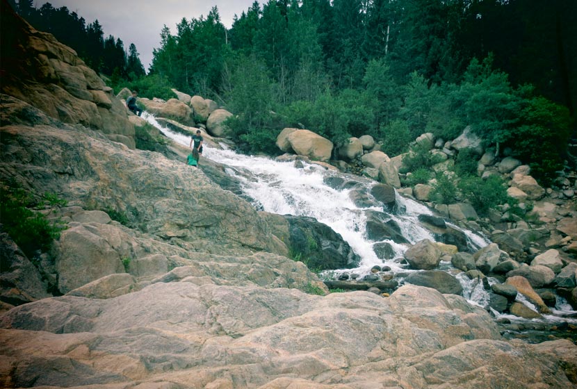
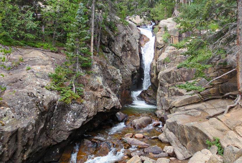
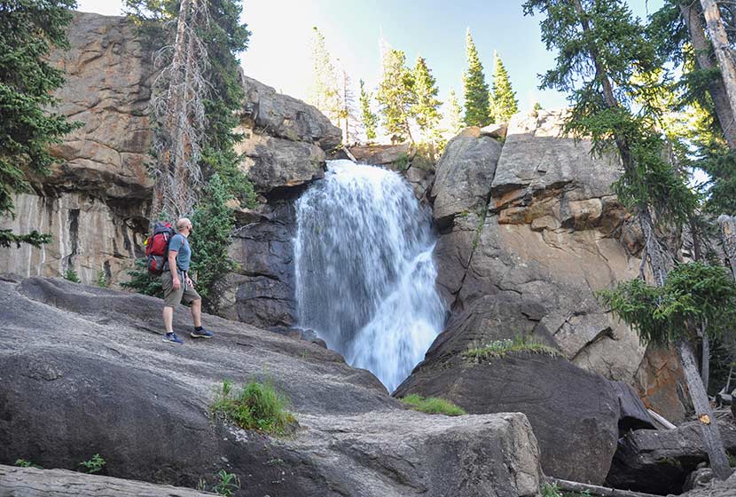
Like so many places near Denver, the Wild Basin trailhead can get busy; so, go early or on a weekday. And when I say “go early,” I mean, “leave before 6 AM.” I’d recommend two different options. The first is the shorter hike up to Ouzel Falls. It’s a 5.4-mile round trip hike, and you can make it into a loop hike by taking the campsite trail back. This also cuts off a bit of distance and time. The trail to Ouzel Falls takes you past upper and lower Copeland Falls, stunning Calypso Cascades, and the gushing spray of Ouzel Falls.
The other option is to hike a more demanding, 14-mile round trip trail up to Lion Lake. Your legs will feel like jelly on the way down, but it’s worth the sites. We opted to camp at St. Vrain campsite (any in that area will do) and to hike up to Lion Lake in the morning. Backcountry camping permits are required and can be acquired from the RMNP Backcountry Office (these must be picked up in person).
Just past Lion Lakes is an unusual waterfall, Trio Falls, spilling over the cubic face of granite outcropping. And higher up are two more alpine lakes worth visiting. Be sure to have a Trails Illustrated Rocky Mountain National Park map for these trips.
3-Day Camping Trip with Scenic Drive
Miles of Driving: About 470 Miles or 12 hours in the Car
This is one of our 2019 family fall adventures–and it’s a lot more ambitious than any of the above recommendations. I’ll be reporting back soon, so look for this description to be updated with better details. Here’s our plan for taking in the Fall colors of Colorado!
Day 1
The plan is to drive up Cottonwood Pass, a scenic highway outside of Buena Vista. It’s a seasonal road and usually closes sometime in October when the snow starts to pile up. There are about a dozen campsites along this approximately 50-mile stretch of road between Buena Vista and Altmont, Colorado. So, we plan to camp close to Altmont for our first night. Most all of the sites are first come, first served after mid-September.
Day 2
We’ll spend the day hiking around Crested Butte, take the scenic drive over Kebler Pass and camp somewhere outside of town or perhaps at Paonia State Park.
Day 3
I’m hoping we’ll still have some adventure left in us and can make an early morning drive to Aspen to the Maroon Bells trailhead. You can drive the road to the trailhead before 8am. There is a $10 access fee. From 8am-5pm, you have to take the shuttle. See our Ultimate Guide to Hiking the Maroon Bells for more details.
Here’s a map below of the proposed adventure.
Hike Distance: 1.5 to 13 miles
Difficulty: Easy to Difficult
Drive Time: About 90 minutes from Denver
If you are looking for some alpine scenery and a shorter scenic drive, the hikes coming out of the 4th of July, Hessie, and Brainard Lake Trailheads are top notch. You’ll have to leave super early to beat the crowds, but it’s worth it. The photo above is from the drive in on 4th of July Road during the early morning hours of September. Come prepared by packing the 10 essentials, and add to that a down coat because it gets cold the higher you hike and snow falls early at these reaches. A few hikes worth exploring are below.
Explore these 5 Trail Profiles in Indian Peaks
- Long Lake Loop Trail: An easy 1.5 mile loop hike with mountain and lake views. Accessed from the Brainard Lake Recreation area and entrance fee is required. Seasonal closures of trailhead.
- Lost Lake: A moderate hike of 4 miles round trip to a sub-alpine lake.
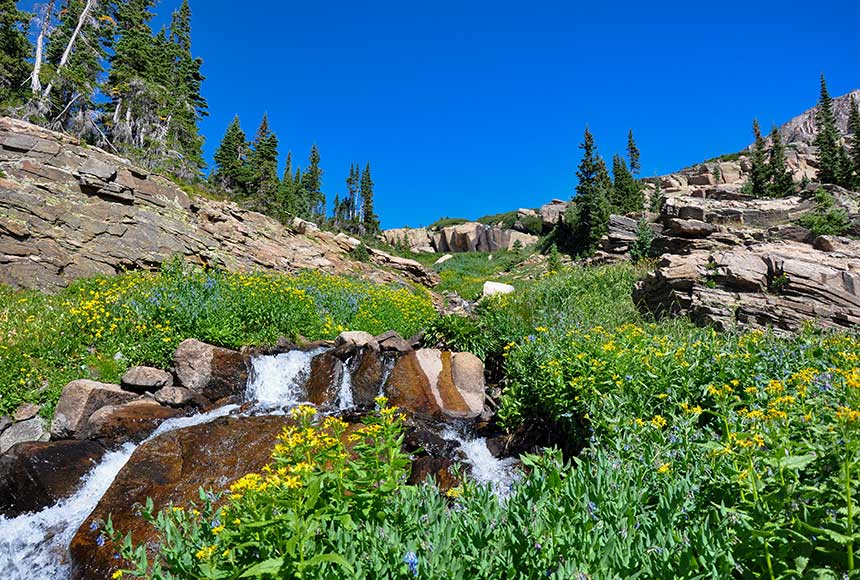
- Diamond Lake: 5.4 miles round trip, moderate, and passes a waterfall on the way.
- Jasper Lake: A demanding 11-mile round trip hike up to a stunning sub-alpine lake.
- Devils Thumb Lake: 13 miles round trip, demanding hike with approx. 2500′ of elevation gain with views of Devils Thumb lake and Devils Thumb