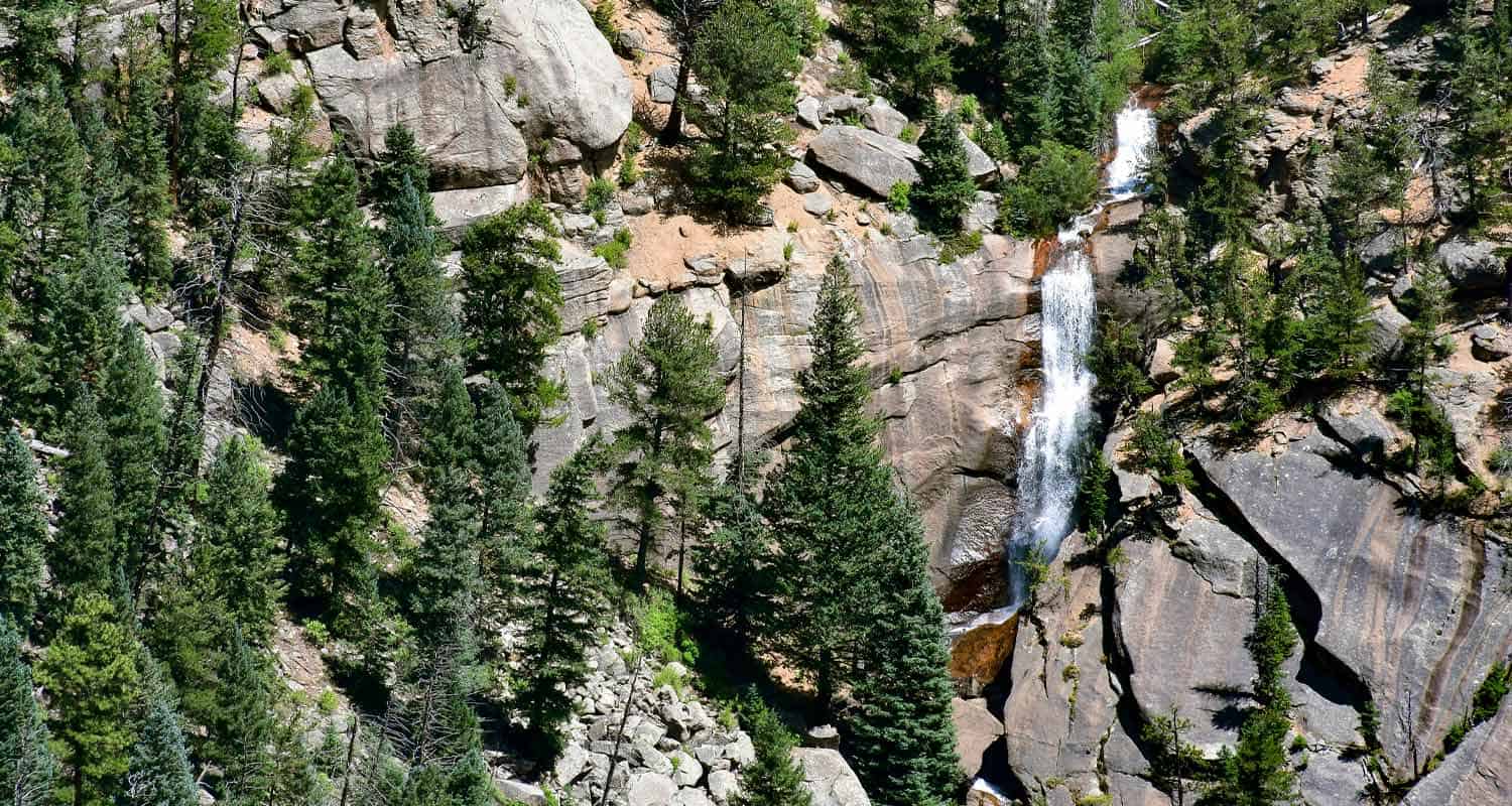
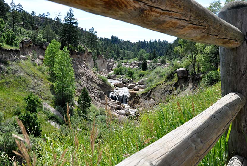
Elk Falls - New Waterfall Near Denver
Elk Falls in Colorado's new Staunton State Park opened to the public in 2013. This highest waterfall near Denver had been unknown to most, and inaccessible, except to a few. Now it's an adventure waiting for able hikers! If you are a fan of waterfall hikes and you live near Denver, you'll know that it's kind of slim pickings; most of the best waterfalls in Colorado require driving beyond the Front Range, or into Rocky Mountain National Park. Elk Falls, is just 50 minutes from Denver! The 3700 acre Staunton State Park offers incredible hiking, rock climbing, and beautiful rock formations - all making for some great Colorado day hikes. Explore the full Elk Falls hike profile below for trail map, driving directions, and many of the details you need to enjoy this adventure in Staunton State Park.
Trail Snapshot: Elk Falls Overlook Hike at Staunton State Park
| Hike Distance | 10.8 miles Round Trip |
|---|---|
| Difficulty | Moderate to Difficult |
| Duration | Approx 4-6 hr |
| Trail Type | Out and Back |
| Starting Elevation | 8200′ |
| Elevation Gain | +900′ |
| Seasons | All Year |
| Dogs | Allowed On Leash |
| Hike Trail Map | Click for a Map of Staunton State Park |
| Denver Drive Time | 45 min |
| Driving Directions to Staunton State Park | Click for Google Map |
| Town Nearest Hike | Conifer, Colorado |
| Beauty | Waterfall, Rock Formations, Meadows, Pine Forest, Ponds, Hummingbirds, and Deer |
| Activities | Hiking, Photography, Mountain Biking (on many trails) |
| Fee | Entrance Fee or State Parks Pass Required |
Parking & Trailhead Information for Elk Falls in Staunton State Park
The parking and trailhead area are immediately noticeable after the park entrance. On weekends, things can really back up at the entrance due to the number of visitors and those who need to purchase a parks pass. If you don't have your yearly parks pass, you can pick one up at a local Kings Soopers grocery store at the customer service area. Because your hike will begin with the Staunton Ranch Trail, the main artery of Staunton State Park, just look for the main trail which heads to the center of the park. If you've parked at the lower parking area, you'll have two Trailheads before you, the Staunton Ranch and the Mason Creek trailheads. Be sure to choose the Staunton Ranch Trail. The Elk Falls overlook can be reached by starting on the Mason Creek Trail, but its a significantly longer and more difficult 17 mile loop hike. Maps are available at the entrance and highly recommended for this hike.
The Hike: Elk Falls in Staunton State Park
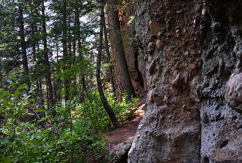
The Staunton Ranch Trail leads hikers into the heart of Staunton State Park, through stands of ponderosa pine and past the Staunton Rocks climbing area. After 3.3 miles, the trail ends at a trail intersection with three new trails. The most direct route to the Elk Falls overlook is to choose the Bugling Elk trail which follows a small creek for 1.1 miles until it arrives at Elk Falls Pond, a good place to stop and Fish.
At Elk Falls Pond, a third trail, the Lion's Back Trail, leads another 1 mile up to the Elk Falls Overlook. Atop a highpoint, hikers will gain great views down to where Elk Falls drops from the cliff face into a beautiful mult-tiered waterfall. Out and Back, its a total of 10.8 miles.
Colorado State Parks is working on an Elk Falls Trail project that will eventually open access to the base of Elk Falls. This is projected to be completed and opened to the public in the Fall of 2016.
If you'd like to add a more challenging return segment to your hike and see new areas of the park, hikers can pick up the Marmot Passage trail until it meets with the hiker-only Scout Line trail, which eventually leads back to the main Staunton Ranch trail. This return route will add additional mileage, difficulty, and time to the hike back. Consult the trail map and topo lines to get a feel for the demanding nature of this option.
Tips & Resources for Hiking To Elk Falls Overlook:
- TIP: Getting into the park can be slow at times, so be prepared to wait at the entrance on busy weekends.
- Trekking Poles & Traction Devices are Recommended in Spring and Winter: During this time of year, there can be patches and even longer segments of snow and ice on the trail. Because of this, we recommend Trekking Poles and/or Traction Devices for this trail.
- Trail Map for Staunton State Park: Trail Map Link
- Packing List: Always pack the 10 Essentials. Download our Hiking Guide to get list and dayhiking packing checklist.
- Colorado Road Conditions: Colorado Road Conditions
- After the Hike: Crow Hill Cafe in Bailey
- We would like to express our gratitude to Bill Chopp for sharing such an amazing photograph of Elk Falls.
Weather
Map & Driving Directions
Click for Driving Directions

Looking for more waterfalls near Denver? Explore our more than 50 Colorado Waterfall Hikes, our favorite Waterfall Hikes in Rocky Mountain National Park, or 7 Waterfalls within One Hour of Denver.
Rattlesnake Gulch Trail at Eldorado State Park
The Rattlesnake Gulch trail takes you up the sides of Eldorado Canyon, one of Colorado's historic State Parks. This lollipop trail takes you past the ruins of the Crags Hotel, then on to gain views of the Continental Divide. Scroll down to look over the trail snapshot, then explore the trail details and tips below for this rewarding hike in Eldorado Canyon State Park.
Trail Snapshot: Rattlesnake Gulch Trail at Eldorado Canyon
| Hike Distance | Approx 2.5 to 4 miles |
|---|---|
| Difficulty | Moderate |
| Duration | 1.5-2.5 hrs |
| Trail Type | Lollipop w/Spur Option |
| Seasons | Spring, Summer, Fall |
| Dogs | Allowed on Leash |
| Hike Trail Map | Click for a Trail Map |
| Denver Drive Time | 45 min |
| Directions | Click for Google Map |
| Town Nearest Hike | Boulder, Colorado |
| Beauty | Canyon, waterfalls and cascades, cliff swallows, cliff-top views, geologic features |
| Activities | Picnic areas, horseback riding, mountain biking, rock climbing |
| Fee | Link to Fees Page |
If your legs are ready to gain some quick elevation to some rewarding views, the Rattlesnake Gulch trail will give you just that. This trail starts at the west trailhead of the Fowler Trail about 1/2 a mile into Eldorado Canyon. The hike first takes you about 1.2 miles to the site of the Crags Hotel. The hotel was built in 1908 and visitors could reach it by taking an incline railroad and by an old wagon trail. In 1912, the hotel burnt to the ground, and just a few ruins remain. The parks department has put up interpretive signs to give you an idea of what the site was like in the early 1900's.
If you continue past the Crags Hotel site, you can add on an additional 1.4 miles by hiking the Rattlesnake Gulch Loop. A spur along the trail takes you to the Continental Divide overlook, where you can look out to the plains and towards a few peaks to the west. If you don't want to hike the entire loop, but you want to catch the view from the overlook, take the trail to the right after the hotel site and hike about 10 more minutes. See the map link above for the exact location of the spur that leads to the overlook.
The picture above is looking northeast towards the Cadillac Rock area. If you take a pair of binoculars, scan the formation for rock-climbers. Eldorado Canyon makes for some great Denver area hiking. It's one of those places with so many unique features, that you'll find yourself drawn back there time and time again.
Tips & Resources for Hiking the Rattlesnake Gulch Trail at Eldorado State Park:
- Exact Trail Length: Exact trail lengths are approximate until we can GPS this one. We've noticed discrepancies on maps and reports. So, be sure to add some buffer time on to this hike.
- Parking: Parking fills up fast at Eldorado Canyon. So, we suggest you go early in the day, or as the crowds are filtering out of the park in the late afternoon. As well, you'll find weekdays less crowed. Eldorado Canyon is open from sunrise to sunset year round.
- Directions: Use the driving directions on this page. They will lead you to the nearest parking area to the Rattlesnake Gulch Trailhead.
- Fee: There is an $8 parking fee per car or you can use your Colorado State Parks Annual Pass
- Trail Map for Eldorado Canyon State Park: Trail Map Link
- Colorado Road Conditions: Colorado Road Conditions
- After the Hike: Boxcar Coffee Roasters in Boulder
Weather
Map & Driving Directions
Click for Driving Directions

Homestead Trail at Castlewood Canyon
his trail is great place to begin if you plan to explore the west side of Castlewood Canyon. It's a short hike, but the Homestead Trail can be used to link up to other hiking trails in this Colorado State Park. Scroll down to get all the hiking info you need in the trail snapshot, trail options descriptions and tips.
Trail Snapshot: Homestead Trail at Castlewood Canyon
| Hike Distance | 2 or 4 mile options RT (see trail options below) |
|---|---|
| Difficulty | Easy to Moderate |
| Duration | Approx 30 min+ Round Trip |
| Trail Type | Out & Back and Loop Options |
| Seasons | All |
| Dogs | Allowed on Leash in Most Areas, But Not on the East Canyon Trail |
| Hike Trail Map | Click for a Map of Homestead Trail at Castlewood Canyon |
| Denver Drive Time | 45 min |
| Driving Directions to Homestead Trail at Castlewood Canyon | Click for Google Map |
| Town Nearest Hike | Castle Rock, Colorado |
| Beauty | Cherry Creek, waterfall, interesting geology, canyon views, ruins |
| Activities | Hiking, great picnic facilities, mountain biking, horseback riding |
| Fee Required | Visit Colorado State Parks Site |
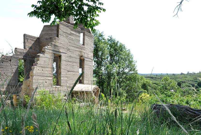
The Homestead Trail in Castlewood Canyon is the first trail you will encounter as you enter the west side of the park. Park at the first lot and you'll immediately see the ruins of the old Lucas Homestead, an unusual concrete structure built in the late 1800's.
The trail is less than a mile round trip, but it links up with several other trails which form 2 loops. Download the Castlewood Canyon Brochure & Trail Map to get a better idea of how these two loops work.
4 Mile Loop: Hike the Rim Rock Trail for 2.14 miles to enjoy the east side of Cherry Creek. Eventually, you will meet with the Creek bottom trail. Take that North for 1.7 miles until you have returned to the Homestead Trail.
2 Mile Loop: When the Homestead Trail meets the Creek Bottom Trail, take the Creek Bottom Trail south for about .7 mile until it intersects with the Cherry Creek Trail. Take this North for 1 mile back to the Lucas Homestead.
Tips & Resources for Hiking Homestead Trail at Castlewood Canyon :
- Finding the Trailhead: The West Side entrance can be hard to find. Usually, Colorado state parks have brown signs indicating the park roads. The west side doesn't. But the name of the road you're looking for is "Castlewood Canyon" - easy to remember.
- TIP: Hikes in Castlewood Canyon can be quite exposed to the sun, so bring the sunscreen.
- TIP: Poison Ivy: We've been surprised how poison ivy flourishes in this park, often along the edge of the trail. Know how to identify it, so that you can avoid it. But don't let that deter you from the park. You just need to keep an eye out. See our post on how to identify and treat poison ivy.
- Trail Map for Castlewood Canyon State Park: Trail Map Link
- Additional Castlewood Canyon State Park Maps: Other Trails
- Colorado Road Conditions: Colorado Road Conditions
- After the Hike: Crowfoot Valley Coffee
Weather
Map & Driving Directions
Click for Driving Directions

Cave Trail at Castlewood Canyon
Colorado's Castlewood Canyon State Park has several caves hidden in the park, but this set has their own trail. It's a short trail, just a 1/8 mile one-way, but can be combined with other hiking trails--one that takes you to a waterfall--to create a real adventure. Check out the trail snapshot to get the map, driving directions to Castlewood Canyon, and tips for exploring the Cave Trail in Castlewood Canyon.
Trail Snapshot: Cave Trail at Castlewood Canyon
| Hike Distance | 0.14mi (.28mi RT) |
|---|---|
| Difficulty | Moderate due to terrain |
| Duration | Approx 30min Round Trip |
| Trail Type | Out and Back |
| Seasons | All |
| Dogs | Allowed on Cave Trail, But Not on the East Canyon Trail |
| Hike Trail Map | Click for a Map of Cave Trail at Castlewood Canyon |
| Denver Drive Time | 1 hr |
| Driving Directions to Cave Trail at Castlewood Canyon | Click for Google Map |
| Town Nearest Hike | Castle Rock, Colorado |
| Beauty | Cliffs, caves, mature ponderosa pines |
| Activities | Rock climbing, hiking, picnic areas, nearby waterfall |
| Fee Required | Visit Colorado State Parks Site |
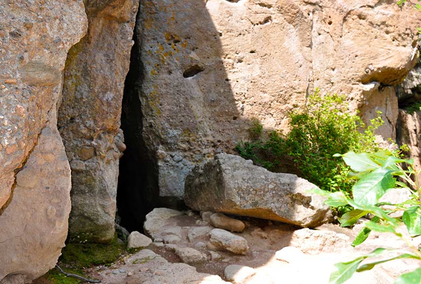
Looking for caves close to Denver? They may not be extensive, but they are still fun to explore. There are actually two caves along the top of the trail. One is a kind of large crack in the rock that leads to a larger chamber. I wish I could describe it better, but my 2 1/2 year old, when I asked if she wanted to go inside, was concerned that the "bears might be awake." There are more caves hidden in Castlewood Canyon waiting to be found, but that is for another post.
Tips & Resources for Hiking Cave Trail at Castlewood Canyon :
- Finding the Trail: The cave trail can be accessed by hiking across the dirt road from the parking lot. The Google Map is very specific and should be helpful in finding the correct parking area.
- Add the Waterfall: The Waterfall Hike can be added to your trip. Midsummer raspberries can be found above the falls along the trail.
- Finding the Traihead: The West Side entrance can be difficult to find. Usually, Colorado State Parks have brown signs indicating the park roads. The west side doesn't. But the name of the road you're looking for is "Castlewood Canyon" - easy to remember.
- Short but Steep Hike: The hike is easy when you consider the distance, but we rated this one as difficult because the trail can be quite uneven and very steep. Watch your footing.
- Make it a Loop Hike: You can make an even larger loop out of the hike by exiting on either the north or south end of the Cliff Base or Climber's Trails, then crossing the road east to one of the parking areas. From there, take the West Side Spur or the Creek Bottom Trail back to your car. See the Castlewood Canyon Map below for details.
- TIP: Hikes in Castlewood Canyon can be quite exposed to the sun, so bring the sunscreen.
- TIP: Poison Ivy: We've been surprised how poison ivy flourishes in this park, often along the edge of the trail. Know how to identify it, so that you can avoid it. But don't let that deter you from the park. You just need to keep an eye out. See our post on how to identify and treat poison ivy.
- Trail Map for Castlewood Canyon: Trail Map Link
- Additional Maps: Castlewood Canyon State Park Trails
- Colorado Road Conditions: Colorado Road Conditions
- After the Hike: Crowfoot Valley Coffee
Weather
Map & Driving Directions
Click for Driving Directions

Forgotten Valley Hike at Golden Gate State Park
Can you think of a more mysterious name for a hike? Colorado's Golden Gate State Park has many trails, and the Forgotten Valley is a great place to start discovering this gem that is tucked between Golden and Boulder, Colorado. Get all the details on hiking the Forgotten Valley by scrolling down to the hike snapshot and hiking tips below.
Trail Snapshot: Forgotten Valley Hike at Golden Gate State Park
| Hike Distance | 3 miles Round Trip |
|---|---|
| Difficulty | Moderate |
| Duration | Approx 2.5 hrs+ Round Trip |
| Trail Type | Out and Back |
| Seasons | Spring through Fall |
| Dogs | Allowed On Leash |
| Hike Trail Map | Click for a Map of Golden Gate State Park |
| Denver Drive Time | 55 min |
| Driving Directions to Forgotten Valley Hike at Golden Gate State Park | Click for Google Map |
| Town Nearest Hike | Golden, Colorado |
| Beauty | Pond, old homestead ruins, wildlife: mule deer, golden eagle, Abert's squirrel, Steller's jay |
| Activities | Hiking trails, fishing, backcountry camping, visitors center |
| Park Fee Required | Click For Info |
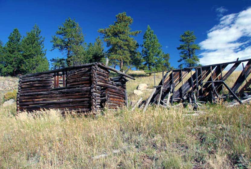
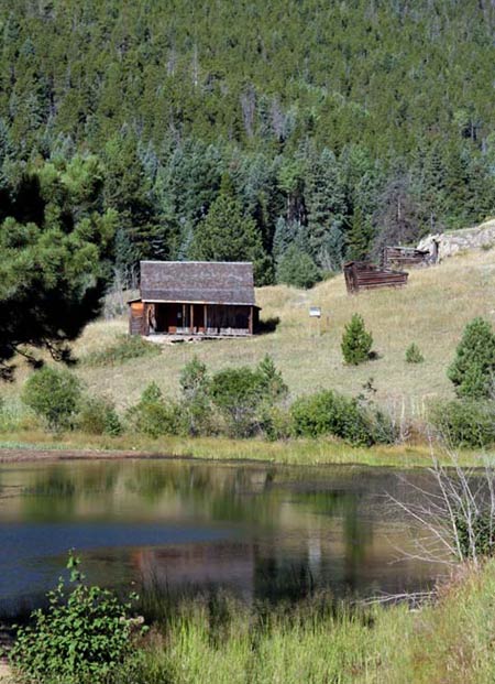
The Forgotten Valley in Golden Gate Canyon State Park is a step back in time.This day hike near Denver takes you 1.5 miles to an old homestead complete with front porch views of the small lake that sits in the bottom of the valley. From the Bridge Trailhead, take the Burro Trail for approximately 3/4 of a mile to where it intersects with the Mountain Lion Trail. Turn North (Left) on the Mountain Lion Trail, and follow that for about 3/4 of mile to Forgotten Valley and the Tallman Homestead. The pond in the valley is stocked by the division of wildlife. We want to thank Kenny Chaffin for his photo of the Tallman Homestead. You can view more of his Denver area photos here.
Tips & Resources for Hiking Forgotten Valley Hike at Golden Gate State Park :
- TIP: Pick up a Trail Map at the Golden Gate Canyon State Park Visitors Center.
- TIP: Parking at the Bridge Trailhead is very limited, so go early.
- TIP: There are some great options on this hike. Grab a Trails Illustrated Boulder/Golden Map and hike to the top of nearby Windy Peak or hike the entire Mountain Lion Trail Loop.
- Trail Map for Golden Gate Canyon State Park: Trail Map Link
- Colorado Road Conditions: Colorado Road Conditions
- After the Hike: Windy Saddle Cafe
Weather
Map & Driving Directions
Click for Driving Directions
Cliff & Climber's Trails at Castlewood Canyon
If you want to explore the crags and hidden pockets of Castlewood Canyon State Park, this combination of trails makes for a fun adventure in a part of Colorado that a lot of hikers miss. The park is nestled into the plains Southeast of Denver, and has a lot of hiking options. Check out the trail profile below to get driving directions, link to a map for the hike, tips, and all the details on this trail.
Trail Snapshot: Cliff & Climber’s Trails at Castlewood Canyon
| Hike Distance | 0.32mi (0.64mi RT) |
|---|---|
| Difficulty | Moderate due to terrain |
| Duration | Approx 30-40min Round Trip |
| Trail Type | Out and Back |
| Seasons | All |
| Dogs | Allowed, But Not on the East Canyon Trail |
| Hike Trail Map | Click for a Map of Cliff & Climber’s Trails at Castlewood Canyon |
| Denver Drive Time | 1 hr |
| Driving Directions to Cliff & Climber’s Trails at Castlewood Canyon | Click for Google Map |
| Town Nearest Hike | Castle Rock, Colorado |
| Beauty | Cliffs, cave, mature ponderosa pines |
| Activities | Rock climbing, hiking, picnic areas, nearby waterfall |
| Fee Required | Visit Colorado State Parks Site |
These two trails can be combined to get a full hike along the cliff band that runs along the western edge of Castlewood Canyon State Park. A cave can be found near the middle of the trail. It is a kind of large crack in the rock that leads to a larger chamber. I wish I could describe it better, but my 2 1/2 year old, when I asked if she wanted to go inside, was concerned that the "bears might not be sleeping."
Tips & Resources for Hiking Cliff & Climber’s Trails at Castlewood Canyon :
- Finding the Trail: The cave trail can be accessed by hiking across the dirt road from the parking lot. The Google Map is very specific and should be helpful in finding the correct parking area.
- Add the Waterfall: The Waterfall Hike can be added to your trip.
- Finding the Traihead: The West Side entrance can be hard to find. Usually, Colorado state parks have brown signs indicating the park roads. The west side doesn't. But the name of the road you're looking for is "Castlewood Canyon" - easy to remember.
- Short but Steep Hike: The hike is easy when you consider the distance, but we rated this one as difficult because the trail can be quite uneven and very steep. Watch your footing.
- Make it a Loop Hike: You can make an even larger loop out of the hike by exiting on either the north or south end of the trail, then crossing the road east to one of the parking areas. From there, take the West Side Spur or the Creek Bottom Trail back to your car. See the Castlewood Canyon Map below for details.
- TIP: Hikes in Castlewood Canyon can be quite exposed to the sun, so bring the sunscreen.
- TIP: Poison Ivy: We've been surprised how poison ivy flourishes in this park, often along the edge of the trail. Know how to identify it, so that you can avoid it. But don't let that deter you from the park. You just need to keep an eye out. See our post on how to identify and treat poison ivy.
- Trail Map for Castlewood Canyon: Trail Map Link
- Additional Maps: Castlewood Canyon State Park Trails
- Colorado Road Conditions: Colorado Road Conditions
- After the Hike: Crowfoot Valley Coffee
Weather
Map & Driving Directions
Click for Driving Directions
Waterfall Hike at Castlewood Canyon
This may be the most accessible waterfall near Denver. If you hit the right parking lot, it's a 10 minute hike.So, grab a park brochure and find the Northernmost trailhead for the Creek Bottom Trail (Homestead Trailhead). This will add close to 1 mile to your hike. Then you can loop back via the Cherry Creek Trail for a total of about 2 miles.
Trail Snapshot: Waterfall Hike at Castlewood Canyon
| Hike Distance | 1/4 mile Round Trip (see trail options below) |
|---|---|
| Difficulty | Easy to Moderate |
| Duration | 20 min |
| Trail Type | Out & Back and Loop |
| Seasons | All Season |
| Dogs | Allowed on Leash in Most Areas |
| Denver Drive Time | 50 min |
| Directions | Click for Google Map |
| Beauty | Cherry Creek, waterfall, interesting geology, canyon views, ruins |
| Activities | Rock climbing, hiking, picnic areas, birdwatching, wildlife viewing |
| Fee Required | Visit Colorado State Parks Site |
Tips & Resources for Hiking to the Castlewood Canyon Waterfall
- Easy to Miss: The West Side entrance can be hard to find. Usually, Colorado state parks have brown signs indicating the park roads. The west side doesn't. But the name of the road you're looking for is "Castlewood Canyon" - easy to remember.
- Shortest Access: The shortest way to access the falls is by parking at the Waterfall Parking Lot, then taking the Waterfall Spur to the Creek Bottom Trail. Head South, and you'll hear the waterfall in just a few moments.
- Exposed: Hikes in Castlewood Canyon can be quite exposed to the sun, so bring the sunscreen
- Poison Ivy: We've been surprised how poison ivy flourishes in this park, often along the edge of the trail. Know how to identify it, so that you can avoid it. But don't let that deter you from the park. You just need to keep an eye out. See our post on how to identify and treat poison ivy.
- Trail Map for Castlewood Canyon State Park: Trail Map Link
- Colorado Road Conditions: Colorado Road Conditions
- After the Hike: Crowfoot Valley Coffee
Weather
Click for Driving Directions

Arthur's Rock Trail in Lory State Park
The Arthurs Rock trail in Lory State Park near Fort Collins, Colorado ends with a beautiful panoramic views. You'll pass through meadows, forest, then end your hike with a scramble to the top of Arthur's Rock. Dogs are allowed on a leash, just be sure to bring plenty of water as there are not many places to access drinking water.
| Hike Distance | 3.4 miles RT |
|---|---|
| Difficulty | Moderate |
| Duration | Approx 1 hr 15 min Round Trip |
| Trail Type | Out and Back |
| Starting Elevation | 5600′ |
| Elevation Gain | +1180′ |
| Seasons | Spring to Fall |
| Dogs | Allowed On Leash |
| Hike Trail Map | Click for a Map of Arthur’s Rock Trail in Lory State Park |
| Denver Drive Time | 1 hr 25 min |
| Driving Directions to Arthur’s Rock Trail in Lory State Park | Click for Google Map |
| Town Nearest Hike | Fort Collins, Colorado |
| Beauty | Views of Horsetooth Lake, views of the Front Range, forests, and meadows, wildlife: elk, bobcat, and many bird species |
| Activities | Hiker only trail, but park offers picnic areas, horseback riding, mountain biking, canoeing, & kayaking |
Arthur's Rock History
The place got its name from Arthur Howard who was the one who, along with his brother, Charlie, sold this piece of land. For more information on the history of Arthur's Rock and Lory State Park, visit this page.
Tips & Resources for Hiking Arthur’s Rock Trail in Lory State Park :
- TIP: There is a visitor's center near the Lory State Park entrance.
- TIP: At the summit of Arthur's Rock, there is a beautiful view of Horsetooth Reservoir and the Front Range available.
- Trail Map for Lory State Park: Trail Map Link
- Colorado Road Conditions: Colorado Road Conditions
- After the Hike: The Colorado Room
- Photo: We would like to express our gratitude to Luci Westphal for sharing a great photo of her hike to Arthur's Rock at Lory State Park. Check out her video from this hike.
Weather
Map & Driving Directions
Click for Driving Directions to Lory State Park
Willow Creek Trail at Roxborough State Park
Entering Roxborough State Park is like walking into another world. The red rock and wildlife--and if you are lucky--the low lying cloud cover, conspire to make for a great escape just south of Denver. The Willow Creek trail makes for a short hike in Roxborough is a perfect way to begin exploring the park. Scroll down to get all the information you need for this trail: driving directions to the trailhead, trail map links, and more details.
Trail Snapshot: Willow Creek Trail at Roxborough State Park
| Hike Distance | 1.4 mile Round Trip |
|---|---|
| Difficulty | Easy |
| Duration | Approx 1 hr Round Trip |
| Trail Type | Loop |
| Seasons | All Year |
| Dogs | Not Allowed in Roxborough State Park |
| Hike Trail Map | Click for a Map of Willow Creek Trail at Roxborough State Park |
| Denver Drive Time | 45 min |
| Driving Directions to Willow Creek Trail at Roxborough State Park | Click for Google Map |
| Town Nearest Hike | Littleton, Colorado |
| Beauty | Red rock formations, meadows, wildlife: mule deer, eagles, foxes, birds |
| Activities | Hiking, birdwatching, Visitors' Center |
| Fee | Entrance Fee or State Parks Pass Required |
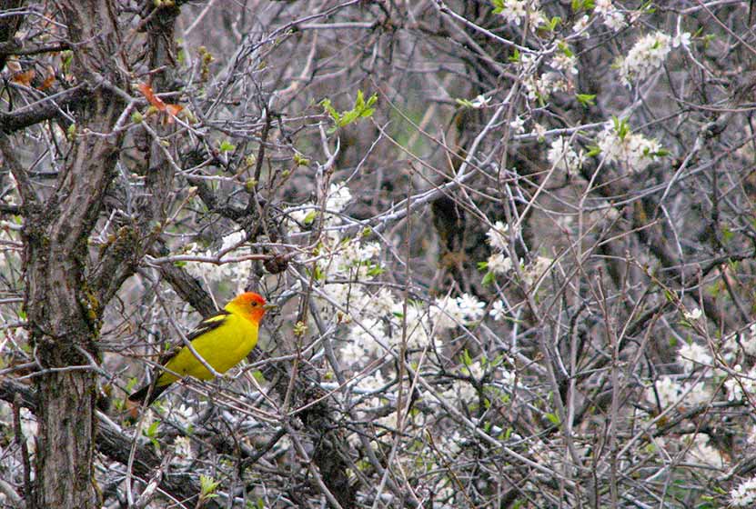
A birdwatcher's paradise. Roxborough State Park is Denver's twin sister of Garden of the God's in Colorado Springs. The park has cataloged over 140 species of birds that have been viewed in the park. On our first hike in the park, we encountered several Western Tanager's among the scrub oak.
On our first visit, we brought our dog and had to turn the car around. Roxborough State Park has quite a bit of wildlife and sensitive plant life, so pets are not allowed. Mountain biking and camping are also not permitted.
This would be in our top 5 for visiting family and friends because this Douglas County hike stays at a lower elevation, is easy, and offers awe inspiring views. This is one of our favorite places to visit in the mornings.
Tips & Resources for Hiking Willow Creek Trail at Roxborough State Park :
- To get the best views of wildlife: Go when there is less traffic: Evenings, Mornings, and Weekdays.
- TIP: There is a picnic area with tables just outside the Visitors' Center.
- TIP: Be on the lookout for poison ivy along the sides of the trail. Know how to identify it, so that you can avoid it. But don’t let that deter you from the park. You just need to keep an eye out. See our post on how to identify and treat poison ivy.
- Trail Map for Roxborough State Park: Trail Map Link
- Colorado Road Conditions: Colorado Road Conditions
- After the Hike: Enchanted Grounds Coffee Shop
- Roxborough State Park Brochure
- Roxborough State Park Site
Weather
Map & Driving Directions
Click for Driving Directions
Fountain Valley Trail at Roxborough State Park
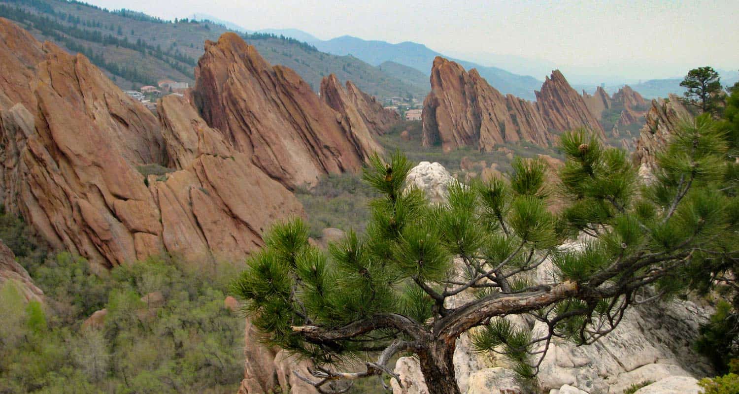
The Fountain Valley trail in Colorado's Roxborough State Park is the Garden of the God's of Denver. It's more secluded than Red Rocks park, and features several trails that take you beyond the park boundaries and into the foothills. The Fountain Valley Trail is a perfect place to start because it features the best part of the park, it's towering slabs of red rock. Explore the hiking profile below for all the trail details, trail map link, and driving directions to the trailhead for this easy Colorado hike.
Trail Snapshot: Fountain Valley Trail at Roxborough State Park
| Hike Distance | 2.3 miles |
|---|---|
| Difficulty | Easy |
| Duration | Approx 1.5 hr |
| Trail Type | Loop |
| Seasons | All Year |
| Dogs | Not Allowed in Roxborough State Park |
| Hike Trail Map | Click for a Map of Roxborough State Park |
| Denver Drive Time | 45 min |
| Driving Directions to Fountain Valley Trail at Roxborough State Park | Click for Google Map |
| Town Nearest Hike | Littleton, Colorado |
| Beauty | Red rock formations, meadows, wildlife: mule deer, eagles, foxes, birds |
| Activities | Hiking, birdwatching, Visitors' Center |
| Fee | Entrance Fee or State Parks Pass Required |
Roxborough State Park is Denver's twin sister of Garden of the God's in Colorado Springs. The beautiful Lyons and Fountain formations climb from the valley floor and create a wonderful space for a quiet hike, birdwatching, and viewing wildlife.
The trail is a loop. You can start on the valley floor, then work your way up to the high trail that looks down and across the fountain formation (photo above was taken from around the midpoint of the high trail). On our visit we encountered several whitetail deer and a variety of birds flitting about in the scrub oak that grows in the valley. The initial part of the trail are handicap accessible, but the trail soon becomes a more narrow dirt trail.
There are some ruins of an old estate along the trail and interpretive signs telling about the history of the valley. We would recommend this trail for families with small children and especially for folks visiting Denver and looking for something fun to do. The low elevation is great for out of towners who may not have the time or capacity to get up into the mountains. Dogs are not permitted, so be sure to leave fido at home. Because this trail is in Roxborough State Park, a fee or Colorado state parks pass is required. See the Roxborough State Park Fees page for details.
Tips & Resources for Hiking Fountain Valley Trail at Roxborough State Park :
- TIP: There is a picnic area with tables just outside the Visitors' Center.
- TIP: Be on the lookout for poison ivy along the sides of the trail. Know how to identify it, so that you can avoid it. But don’t let that deter you from the park. You just need to keep an eye out. See our post on how to identify and treat poison ivy.
- Trail Map for Roxborough State Park: Trail Map Link
- Colorado Road Conditions: Colorado Road Conditions
- After the Hike: Waterton Tavern in Roxborough
- Roxborough State Park Brochure
- Brochure for Roxborough State Park: Brochure Link
Weather
Map & Driving Directions
Click for Driving Directions