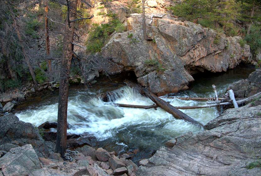
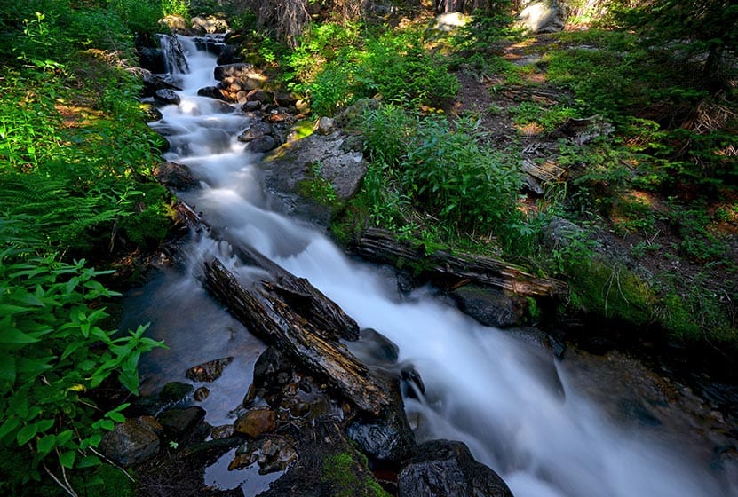
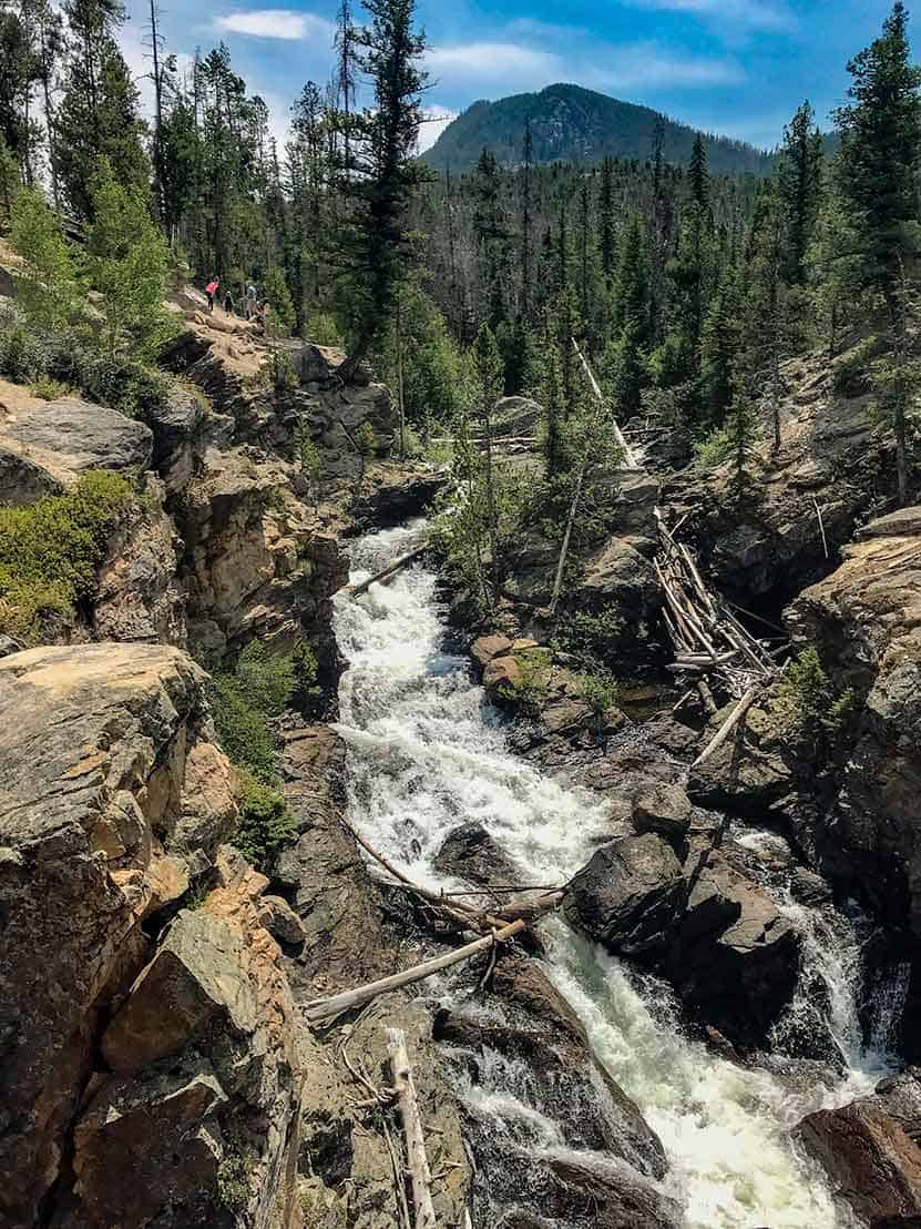
The Pool in Rocky Mountain National Park
It's a 1.7 mile hike in to The Pool, a series of turbulent cascades and deep green-blue waters formed by the confluence of the Big Thompson River and Fern Creek. This is another popular and easy hike from the Fern Lake trailhead in Rocky Mountain National Park, and a great destination along the Fern Lake Trail. Explore the full hiking trail profile below for trail map, driving directions, and more of the details you need to enjoy this adventure in Rocky Mountain National Park.
Note: Rocky Mountain National Park now requires timed entry permits from May 27th through October 10th. See the RMNP permits page for more information.
Trail Snapshot: The Pool in Rocky Mountain National Park
| Hike Distance | 3.4 miles Round Trip (from Fern Lake TH) |
|---|---|
| Difficulty | Easy |
| Duration | Approx 2 hr Round Trip |
| Trail Type | Out and Back |
| Starting Elevation | 8155' |
| Elevation Gain | Approx. +245' |
| Seasons | Spring through Fall |
| Dogs | Prohibited in RMNP |
| Hike Trail Map | Click for a Map of The Pool RMNP |
| Denver Drive Time | 1 hr 40 min |
| Driving Directions to Fern Lake Trailhead | Click for Google Map |
| Driving Directions to Fern Lake Bus Stop Parking | Click for Google Map |
| Driving Directions to Park & Ride Trailhead | Click for Google Map |
| Town Nearest Hike | Estes Park, Colorado |
| Beauty | Sub-alpine lakes, mountain views, river, wildflowers, aspen trees, ponderosa pine, wildlife: Abert's squirrel, elk, deer, moose, duck, beaver, chipmunk, bear |
| Activities | Picnicking, hiking trails, snowshoeing, fishing |
| Fee | Park Pass Required |
Parking & Trailhead Information for The Pool in RMNP
Parking is more limited in this area of Rocky Mountain National Park, and you'll likely have to park at the Park & Ride then take the shuttle to the Fern Lake Trailhead. You'll find driving directions above to The Fern Lake Trailhead (closest to this hike), the Fern Lake Bus Stop Parking area (very limited parking), and for the Park & Ride lot. See the RMNP Shuttle page for dates and times of service. Avoid parking along Fern Lake road as this damages the road side. If you park or are dropped off at the Fern Lake Bus Station, the hike from the station to the trailhead will add and additional .8 mile, one-way, to your hike.
The Hike: The Pool in RMNP
The hike to The Pool, and other destinations along this initial stretch of the Fern Creek trail--such as Arch Rocks and Windy Gulch Cascades--follows the Big Thompson River as it courses through a rocky, but verdant, valley. There are great places to stop to fish along the banks of the Big Thompson for trout.
At approx 1.5 mile, you'll encounter a huge rock, split in two segments that bridges over the trail. Arch Rock likely broke off the cliff side above and tumbled down into the valley eons ago. It's a remarkable site.
Another .7 miles further, hikers will arrive at The Pool, an unusual set of cascades formed by the confluence of Fern Creek and the Big Thompson River. Here, the waters collide and swirl, and have carved out a deep pool of chaotic--but beautiful--waters. Don't be fooled by the name, The Pool is not a place to swim. The current is powerful and dangerous; so, stay out of the water and be sure to exercise caution along the slick rock edges of the Pool.
At the Pool, there is a footbridge that crosses the river. It's a great spot to stop and take in the sights.
Tips & Resources for Hiking to The Pool in Rocky Mountain National Park
- TIP: It is advisable to arrive early as parking is limited. Hikers may opt to ride a shuttle that drops you off at the trailhead.
- Bring A Picnic Lunch: The banks along the Big Thompson River can be a great place for picnics.
- Trail Map for Bear Lake Corridor: Trail Map Link
- Packing List: Always pack the 10 Essentials. Download our Hiking Guide to get list and dayhiking packing checklist.
- Colorado Road Conditions: Colorado Road Conditions
- Photo: We would like to express our gratitude to Charlie Stein for sharing such an amazing photograph of this hike to the Pool in Rocky Mountain National Park.
- After the Hike: Baba's Burgers & Gyros
Weather
Map & Driving Directions
Click for Driving Directions

Bierstadt Lake in Rocky Mountain National Park
Bierstadt Lake is a short destination hike in Rocky Mountain National Park to a sub-alpine lake with great panoramic views. At Bierstadt Lake, the trail forms a 1 mile loop along its shores, making it a perfect leisurely hike with friends. Bierstadt lake can be accessed from several different trailheads with differing terrain and demand. Explore the full Bierstadt Lake hike profile below for trail map, driving directions, and more of the details you need to enjoy this adventure in Rocky Mountain National Park.
Note: Rocky Mountain National Park now requires timed entry permits from May 27th through October 10th. See the RMNP permits page for more information.
Trail Snapshot: Bierstadt Lake in Rocky Mountain National Park
| Hike Distance | 3.2 to 4.8 miles Round Trip (depending on trailhead and adding loop) |
|---|---|
| Difficulty | Easy to Moderate |
| Duration | Approx 2 hrs Round Trip |
| Trail Type | Out and Back or Lollipop Loop |
| Starting Elevation | 8850′ |
| Elevation Gain | +566' from Bierstadt TH, +255' from Bear Lake TH |
| Seasons | Spring through Fall, Winter Snowshoeing |
| Dogs | Dogs Prohibited in RMNP |
| Hike Trail Map | Click for a Trail Map |
| Denver Drive Time | 2 hr |
| Driving Directions to Bierstadt Lake Trailhead | Click for Google Map |
| Driving Directions to the Bear Lake Trailhead | Click for Google Map |
| Driving Directions to Park & Ride Trailhead | Click for Google Map |
| Town Nearest Hike | Estes Park, Colorado |
| Beauty | Sub-alpine lakes, mountain views, wildlife: Abert's squirrel, elk, deer, waterfowl, moose; aspen trees |
| Activities | Picnicking, Hiking Trails, Snowshoeing |
| Fee | Park Pass Required |
Parking & Trailhead Information for Bierstadt Lake Trail
Bierstadt Lake can be accessed from several trailheads in Rocky Mountain National Park. Driving directions to all of these trailheads are available in the Bierstadt Lake trail snapshot above. Review the options below to find the best fit for your hiking plans.
From the Bierstadt Trailhead: Limited parking and the most difficult route because of the elevation gain traversing Bierstadt Moraine. This route is 1.4 miles to the lake with +566' elevation gain.
From Bear Lake Trailhead: Recommended for those looking for a less demanding hike to Bierstadt Lake. This way is 1.6 miles to the lake with about +255' elevation gain.
From the Park & Ride lot in RMNP: There is a trail on the northwestern edge of the parking lot that leads directly to Bierstadt Lake. It is approximately 1.5 miles from the parking lot to Bierstadt Lake and a less demanding route than hiking from the Bierstadt Trailhead.
The Hike: Bierstadt Lake Trail in RMNP
The hike to Bierstadt Lake will be different depending on your starting point. I've hiked the trail starting at the Bierstadt Trailhead. It's demanding. The Bierstadt Moraine will require a lot from your quads. So, if you take this route, be sure to bring some trekking poles.
The route from Bear Lake can be accessed by hiking the paved path from the trailhead to Bear Lake, then taking the first right-hand trail, which is the one that leads to Flattop Mountain. You may be thinking, "Flattop is in the west, and Bierstadt Lake is in the east." You're right, and the trail will soon (after approx. 1/2 mile) split. At this first junction, the right-hand path will take you Northeast into the Mill Creek Basin area.
Down in Mill Creek Basin, a spur trail, to the right, will lead to Bierstadt Lake. If you want to make your hike a bit longer, you can pass this spur trail, and hike further through the basin for about another 1/2 mile until you encounter a 2nd spur trail that leads (to the right/east) over to Lake Bierstadt.
Hikers can pick a spot to rest and enjoy the sites of the lake, or they can continue around the 1 mile loop trail that encircles it. The best views are from the east side, and are worth the extra distance to take in some incredible views of the Rocky Mountains.
Tips & Resources for Hiking to Bierstadt Lake in RMNP
- Trekking Poles: For most hikes in RMNP, especially if you are traveling on unmaintained trails, we recommend using Trekking Poles. They take a lot of weight off the knees and help in navigating uneven terrain.
- TIP: The Bierstadt Lake trailhead has limited parking. You can opt to park at Bear Lake, or the Park & Ride trailhead instead.
- Fishing: Bierstadt Lake is not on the list of fishable lakes in RMNP.
- Trail Map for Bear Lake Corridor Trails: Trail Map Link
- Packing List: Always pack the 10 Essentials. Download our Hiking Guide to get list and dayhiking packing checklist.
- Colorado Road Conditions: Colorado Road Conditions
- Photo: We would like to express our gratitude to Chris for sharing such an amazing photograph of this hike to Bierstadt Lake in RMNP.
- After the Hike: Baba's Burgers & Gyros
Weather
Map & Driving Directions
Click for Driving Directions
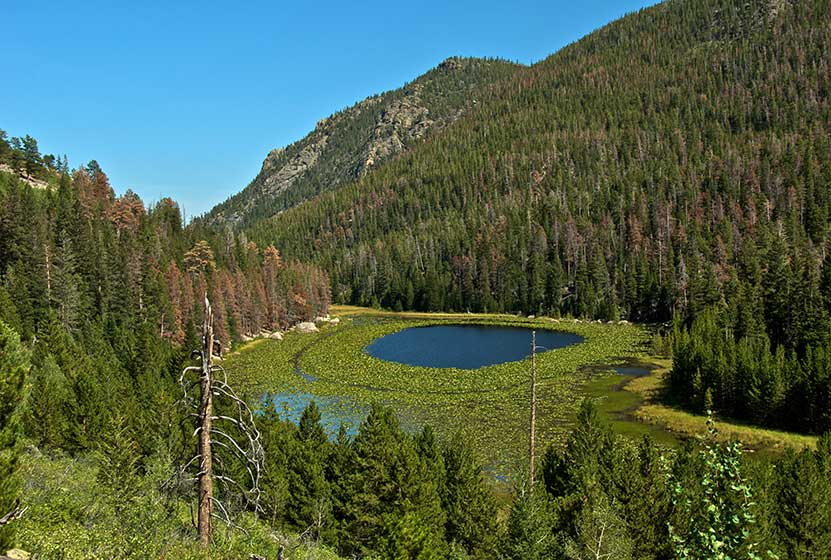
Cub Lake in Rocky Mountain National Park
Cub Lake, in Rocky Mountain National Park, is known for its unusual halo of lily pads. The 4.6 mile, roundtrip hike dazzles with its variety - especially the wildflowers. You'll pass through wetlands, glacial formations, and meadows before arriving at the lake. Explore the full Cub Lake hike profile below for trail map, driving directions, and all the details you need to enjoy this adventure in Rocky Mountain National Park.
| Hike Distance | 4.6 miles Round Trip |
|---|---|
| Difficulty | Moderate |
| Duration | Approx 3 hrs Round Trip |
| Trail Type | Out and Back |
| Starting Elevation | 8080' |
| Elevation Gain | Approx. +540' |
| Seasons | Spring through Fall, Winter Snowshoeing |
| Dogs | Prohibited in RMNP |
| Hike Trail Map | Click for a Map of Cub Lake RMNP |
| Denver Drive Time | 1 hr 40 min |
| Driving Directions to Cub Lake Trailhead | Click for Google Map |
| Driving Directions to Fern Lake Trailhead | Click for Google Map |
| Driving Directions to Park & Ride Trailhead | Click for Google Map |
| Town Nearest Hike | Estes Park, Colorado |
| Beauty | Sub-alpine lakes, mountain views, meadows, river, wildlife: Abert's squirrel, elk, deer, moose, duck, bear; yellow pond lilies and wildflowers |
| Activities | Picnicking, Hiking Trails, Snowshoeing |
| Fee | Park Pass Required |
Parking & Trailhead Information for Cub Lake
The Cub Lake Trailhead in Rocky Mountain National Park has a very small parking area where only 7 to 8 vehicles can park. Chances are, if you don't arrive early in the morning, you'll need to park just .3 mile further down the road at the Fern Lake Bus Stop parking area. If both lots are full, then your best bet is to park in the RMNP Park & Ride lot and use the shuttle service to get to the Cub Lake Trailhead. Please do not park alongside the road. This causes significant erosion and damage to roadside--and you might get a ticket.
The Hike to Cub Lake in RMNP
One of the things we love about Rocky Mountain National Park is the diversity of landscapes. The Cub Lake trail is a great example. Over the course of the 2.3 mile journey to the lake, you'll encounter plenty of sights that you will want to take in. The trail begins in the wetland meadows of Moraine Park, replete with willows and other wetland shrubs. It's a perfect habitat for a variety of birds, including western tanagers and warblers.
The trail crosses several bridges, including one over the Big Thompson River, (just a mountain stream at this point) then begins a climb into stands of evergreens, and then into an unusual area scraped by an ancient glacier, riddled with unusual boulders and rock. Leaving this strange landscape, the trail goes down to another meadow area and meets up with the horse trail that runs along the southern border of Moraine Park. The local YMCA offers horseback rides along this area, so keep your eyes out for horses. At this trail junction, the trail that leads up to Cub Lake is the one to the right.
Soon, the trail goes from easy to quite demanding, working its way up a series of switchbacks before reaching Cub Lake. Two things will catch your eye at Cub Lake. First is the strange halo formation made by the yellow pond lilies that grow around the inside of the lake. The middle of the lake, open to reflect the sky, looks like a big, blue eye staring into the heavens. The second thing you may notice is a large stand of dead trees from a forest fire in the 1970s.
Tips & Resources for Hiking to Cub Lake in Rocky Mountain National Park
- TIP: It is advisable to arrive early as parking is limited. One may opt to ride a shuttle that drops you off at the trailhead.
- Trail Map for Bear Lake Corridor: Trail Map Link
- Packing List: Always pack the 10 Essentials. Download our Hiking Guide to get list and dayhiking packing checklist.
- Colorado Road Conditions: Colorado Road Conditions
- Photo: We would like to express our gratitude to Jeff Livingston for sharing such an amazing photograph of this hike to Cub Lake in RMNP.
- After the Hike: Baba's Burgers & Gyros
Weather
Map & Driving Directions
Click for Driving Directions
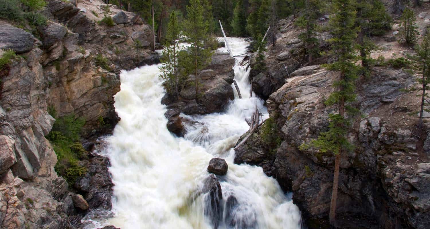
Chaos Canyon Cascades in Rocky Mountain National Park
Chaos Canyon Cascades in Rocky Mountain National Park is formed as Chaos Creek tumbles through the forest below Lake Haiyaha. This 4.2 mile round trip hike is on the east side of RMNP to one of the lesser visited cascade waterfalls in the park. Explore the full Chaos Canyon Cascades hike profile below for trail map, driving directions, and some important tips and resources for this adventure in Rocky Mountain National Park.
Note: Rocky Mountain National Park now requires timed entry permits from May 27th through October 10th. See the RMNP permits page for more information.
Trail Snapshot: Chaos Canyon Cascades in Rocky Mountain National Park
| Hike Distance | 4.2 miles Round Trip |
|---|---|
| Difficulty | Easy to Moderate |
| Duration | Approx 2-3hrs Round Trip |
| Trail Type | Out and Back |
| Starting Elevation | 9475' |
| Elevation Gain | Approx. +700' |
| Seasons | Spring through Fall |
| Dogs | Prohibited in RMNP |
| Hike Trail Map | National Geographic Trails Illustrated Map |
| Denver Drive Time | 2 hr |
| Driving Directions to Bear Lake Trailhead | Click for Google Map |
| Town Nearest Hike | Estes Park, Colorado |
| Beauty | Sub-alpine lakes, mountain views, wildlife: Abert's Squirrel, Elk, Bear |
| Activities | Picnicking, Hiking Trails, Photography |
| Conditions at Bear Lake Trailhead | Click Here |
| Fee | Park Pass Required |
Parking & Trailhead Information for Chaos Canyon Cascades
The trail to Chaos Canyon Cascades begins at the Bear Lake Trailhead (driving directions). In the event the parking lot at Bear Lake is full, you'll then need to park at the Park & Ride near the Bierstadt Trailhead and take the bus into the trailhead. This service runs 7am to 7PM and more information on the RMNP shuttle bus routes can be found at this link. The trail is located on your way to Bear Lake, off to the left, just before reaching the shore viewing area of Bear Lake. It follows the same main trail that leads hikers up to both Nymph and Dream Lakes.
The Hike to Chaos Canyon Cascades
From the Bear Lake Trailhead, hikers will reach Nymph Lake at .5 mile. After continuing on the trail for approximately another .5 mile, hikers will come upon a trail split. Be sure to first hike the additional .1 mile (right-hand trail) up to Dream Lake first. Dream Lake is not to be missed. After returning to this trail split, the trail to Chaos Canyon Cascades is the same trail leading up towards Lake Haiyaha. After traveling .8 mile, the trail crosses a footbridge going over Chaos Creek. After crossing the footbridge, hikers should be able to locate an unmaintained social trail on the left-hand (east) side of the main trail.
The trail will descend and follow Chaos Creek, but will soon enter a steep area where the brush is dense and the trail is difficult to discern. Exercise caution in this area The cascades should come into view after just a few short minutes, as they are only about 1/10th of a mile from the footbridge. Because this is an unmaintained trail, be sure to tread lightly. Take care not to disturb the flowers and undergrowth, and the pristine environment of the cascades.
Hikers can add another Lake to this hike by returning to the main trail via the same route to the cascades, then continuing south to the Lake Haiyaha trail junction. A short spur trail to Haiyaha (on the right) leads to another great high mountain lake in RMNP. Adding Haiyaha to the hike would make this an approximately 4.6 mile round-trip hike.
Tips & Resources for Hiking to Chaos Canyon Cascades in Rocky Mountain National Park
- Explore More: Make this a loop hike and see 4 Lakes and another great Waterfall
- Trail Map for Rocky Mountain National Park: Trail Map Link
- Packing List: Always pack the 10 Essentials. Download our Hiking Guide to get list and dayhiking packing checklist.
- Colorado Road Conditions: Colorado Road Conditions
- Trekking Poles: For most hikes in RMNP--especially if you are traveling on unmaintained trails--we recommend using Trekking Poles. They take a lot of weight off the knees and help in navigating uneven terrain.
- Photo: We would like to express our gratitude to photographer Aaron Cooper for this the photo of Chaos Canyon Cascades. Be sure to check out his extensive gallery of Colorado landscape photography.
- After the Hike: Poppy's Pizza in Estes Park, CO
Weather
Map & Driving Directions
Click for Driving Directions

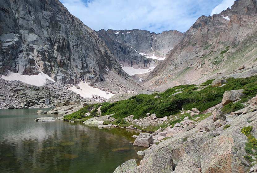
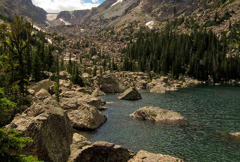
Solitude Lake Hike in Rocky Mountain National Park
Solitude Lake is an alpine lake situated in the heart of Rocky Mountain National Park. Solitude is aptly named, as it is hidden from the main trail system, situated high above Glacier Gorge in the shadow of Thatchtop and Arrowhead Peak. Because the hike to Solitude and its twin sister, Shelf Lake, require travel on unmaintained trails, it is best suited for more experienced hikers who are familiar with Rocky Mountain National Park and who are have honed their land navigation skills. Full details can be found in the trail profile for Shelf Lake. Explore the full Solitude Lake hike profile below for trail map, driving directions, and all the tips and resources for this hike in Rocky Mountain National Park.
Note: Rocky Mountain National Park now requires timed entry permits from May 27th through October 10th. See the RMNP permits page for more information.
Trail Snapshot: Solitude Lake in Rocky Mountain National Park
| Hike Distance | 9 miles Round Trip |
|---|---|
| Difficulty | Difficult |
| Duration | Approx 5-7 hrs Round Trip |
| Trail Type | Out and Back |
| Starting Elevation at Glacier Gorge Trailhead | 9240′ |
| Elevation Gain | Approx +2400′ |
| Seasons | Mid-Summer-September |
| Dogs | Prohibited in RMNP |
| Hike Trail Map | National Geographic Trails Illustrated Map |
| Denver Drive Time | 2 hr |
| Driving Directions to Glacier Gorge Trailhead | Click for Google Map |
| Town Nearest Hike | Estes Park, Colorado |
| Beauty | Waterfalls, wildlife: elk, deer, marmots; meadows, lakes, streams, wildflowers |
| Activities | Hiking, photography, fishing |
| Fee | Park Pass Required |
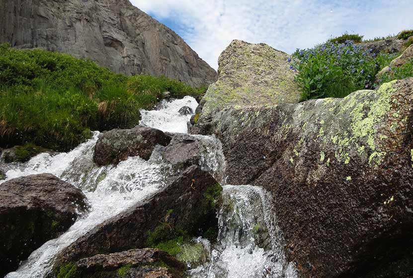
Solitude Lake is located about a quarter mile beyond Shelf Lake. Between the Shelf and Solitude are an unusual set of cascades, Shelf Lake Falls. Above the falls, you'll find a beautiful array of alpine wildflowers and breathtaking views of Longs Peak, Keyboard of the Winds, and the broad valley of Glacier Gorge. The hike up to Solitude take hikers past Alberta Falls, Mills Lake, and Shelf Creek Falls.
A final reminder: This hike is not on maintained trails, is a long hike, and demanding. Hikers should be familiar with RMNP and developed the skills needed for backcountry travel. A more detailed trail profile for locating the trail and a brief description of its course and hazards are can be found on the Shelf Lake hike profile page. If you are looking for a demanding hike on maintained trails in Rocky Mountain National Park, we would recommend exploring trail profiles for Sky Pond and Black Lake.

Tips & Resources for Hiking to Solitude Lake in Rocky Mountain National Park
- Recommended Map for Rocky Mountain National Park: The trail maps provided by Rocky Mountain National Park are usually sufficient. However, if you plan to hike RMNP often, we recommend purchasing a National Geographic Trails Illustrated Map.
- Packing List: Always pack the 10 Essentials. Download our Hiking Guide to get list and dayhiking packing checklist.
- Colorado Road Conditions: Colorado Road Conditions
- After the Hike: Inkwell & Brew Coffee
Weather
Map & Driving Directions
Click for Driving Directions
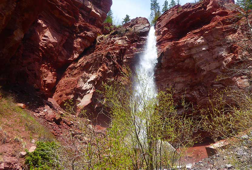
Silver Falls Near Pagosa Springs Colorado
Silver Falls near Pagosa Springs Colorado is an easy hike of less than a quarter mile to a spectacular waterfall. The distance of the drive from Denver requires more than the hike! Explore the full Silver Falls hike profile for driving directions and all the details you need to enjoy this Colorado waterfall trail.
Trail Snapshot: Silver Falls Near Pagosa Springs, Colorado
| Hike Distance | 0.4 mile Round Trip |
|---|---|
| Difficulty | Easy to Moderate |
| Duration | Approx 30 min |
| Trail Type | Out and Back |
| Starting Elevation | 8200′ |
| Elevation Gain | Approx +230′ |
| Seasons | May-September |
| Dogs | Allowed On Leash |
| Denver Drive Time | 5.5 hr |
| Driving Directions to Silver Falls, Pagosa Springs | Click for Google Map |
| Town Nearest Hike | Pagosa Springs, Colorado |
| Beauty | Waterfall |
| Activities | Hiking |
Directions & Trailhead Information for Silver Falls
The parking area for Silver Falls is located about 19 miles from Pagosa Springs along Forest Road 667. Because FR667 is a dirt road, expect washboard and wash areas. The road crosses multiple creeks, and in the late Spring, when the snowmelt is flowing, many of these creeks rise and cover the road. Because of this, it's a good idea to make the drive to the Silver Falls trailhead in a vehicle with higher clearance, such as a truck or SUV. The small parking area is located about 8 miles up 667 on the left-hand side of the road. You'll find an old guard station marking the spot.
The Hike to Silver Falls
The hike up to Silver Falls is short and sweet. It's approximately 1/8th of a mile from the trailhead to the waterfall. The trail starts out easy, then becomes increasingly steep before the emerging from the woods to the spectacular site of Silver Falls. The waterfall plunges first from the orange cliffs above the trail, then tumbles down in a series of dazzling cascades.
Tips & Resources for Hiking Silver Falls, Pagosa Springs, CO
- Visit on a Weekday: This stretch of road is a popular spot for campers and fisherman because of its proximity to the San Juan River. Go on a weekday if you would like to experience solitude and only the sounds of tumbling water.
- Parking: Parking is limited in the small lot. Hikers can also park alongside the road; just be courteous to other drivers and be sure to park in such a way that you don't to get stuck.
- Packing List: Though it's a short hike, you always want to pack the 10 Essentials. Download our Hiking Guide to get list and hiking gear checklist.
- Colorado Road Conditions: Colorado Road Conditions
- Photo: We would like to express our gratitude to Steve Schmickle of Explore the Light Photography for sharing such an amazing photograph of this hike to Silver Falls. I love landscape photography, and Steve's work is my absolute favorite. Check out his gallery and available prints.
- After the Hike: Pagosa Baking Company in Pagosa Springs

Weather
Map & Driving Directions
Click for Driving Directions
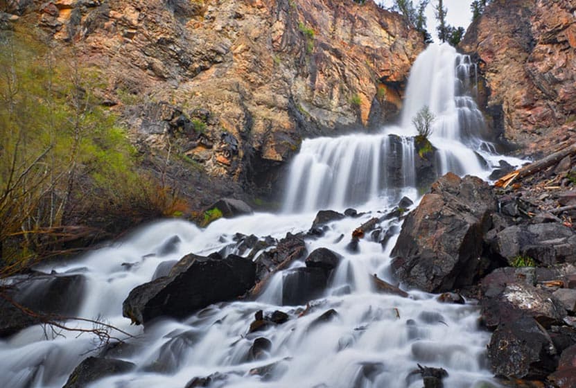
Cornet Falls Near Telluride Colorado
Cornet Falls in Telluride, Colorado, is an 80 foot waterfall and requires a short 1/4 mile hike to experience. The hike begins in town and affords views down into this beautiful Colorado mountain town. Explore the full Cornet Falls hike profile below for trail map, driving directions, and all the details you need to enjoy this hike in Telluride, CO.
Trail Snapshot: Cornet Falls Near Telluride, Colorado
| Hike Distance | 1/2 mile Round Trip |
|---|---|
| Difficulty | Easy |
| Duration | Approx 30 min |
| Trail Type | Out and Back |
| Starting Elevation | 8900′ |
| Elevation Gain | +220′ |
| Seasons | May-September |
| Dogs | Allowed On Leash |
| Hike Trail Map | Click for a Map of Telluride Area Trails |
| Denver Drive Time | 6.5 hrs |
| Driving Directions to Cornet Falls, Telluride | Click for Google Map |
| Town Nearest Hike | Telluride, Colorado |
| Beauty | Waterfalls, Views into Town of Telluride |
| Activities | Hiking |
Parking & Trailhead Information for Cornet Falls
The hike to Cornet Falls begins at the the Jud Weibe Trailhead in Telluride, Colorado. There is no designated parking area for this trailhead, so hikers will need to find acceptable parking along the streets or at public parking in town.
Tips & Resources for Hiking Cornet Falls Colorado
The hike from the Jud Weibe Trailhead to Cornet Falls is only a 1/4 mile. The trail makes its way through a lot of loose and slippery rock before it opens out to a backdrop of vermillion cliffs with 80 foot Cornet Falls jetting over the side. Stay to the right side of the creek for the proper trail leading to the waterfall.
- Wear Good Footwear: Because of the loose rock and slippery surfaces, be sure to wear a durable pair of shoes or boots that will give you good traction for this hike. Need a new pair of boots? Then be sure to check out our boot review of 3 recommended hiking boots.
- Explore More: For a longer adventure, hikers can stay on the Jud Wiebe trail and complete the 3 mile loop that features expansive views into the town of Telluride and ovf Bridal Veil Falls in the distance.
- Trail Map for Telluride Area: Trail Map Link
- Packing List: Always pack the 10 Essentials. Download our Hiking Guide to get list and dayhiking packing checklist.
- Colorado Road Conditions: Colorado Road Conditions
- After the Hike: Between the Covers Bookstore & Espresso Bar
- Photo: We would like to express our gratitude to Dan Wilnai for sharing such an amazing photograph of this hike to Cornet Falls.
Weather
Map & Driving Directions
Click for Driving Directions
Looking for more waterfalls near Denver? Explore our more than 50 Colorado Waterfall Hikes, our favorite Waterfall Hikes in Rocky Mountain National Park, or 7 Waterfalls within One Hour of Denver.
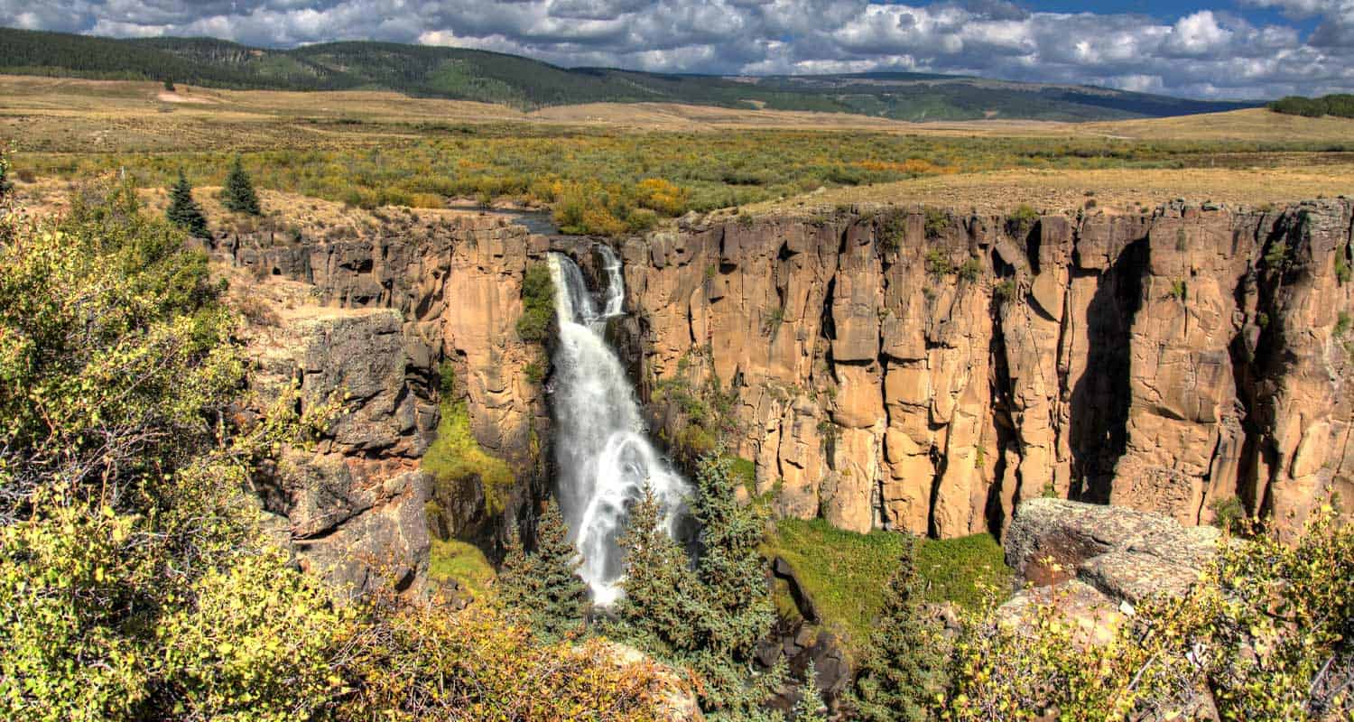
North Clear Creek Falls in Colorado
North Clear Creek Falls is a 100+ foot waterfall carved into the landscape of southwestern Colorado. This is not so much a hike as a great place to pull off for a picnic and take in views of what become the most famous waterfall in the Rocky Mountain State. Explore the full North Clear Creek Falls profile below for driving directions, and all the details you need to experience this scenic landmark in the far reaches of Colorado.
Trail Snapshot: North Clear Creek Falls Near Lake City, Colorado
| Hike Distance | 0.1 mile Round Trip |
|---|---|
| Difficulty | Easy |
| Duration | Approx 5 min |
| Trail Type | Pull-off Observation Area |
| Starting Elevation | 10,000′ |
| Elevation Gain | +0′ |
| Seasons | June to September |
| Dogs | Allowed On Leash |
| Denver Drive Time | 5 hrs |
| Driving Directions to North Clear Creek Falls | Click for Google Map |
| Town Nearest Hike | Lake City, Colorado |
| Beauty | Waterfall Observation area |
| Activities | picnic facilities, photography |
Its hard to believe that what may be the most beautiful waterfall in Colorado requires no hike to see. The North Clear Creek Falls observation area is accessible via a short drive off of Forest Road 510, part of the Silver Thread Scenic Byway. The USFS does not plow this section during the winter, so it may be inaccessible until Spring. Because of the vertical drop into Willow Canyon, the observation area has been fenced. The area has new toilet and picnic facilities, and is considered handicap accessible.
Tips & Resources for North Clear Creek Falls
- TIP: Because North Clear Creek Falls faces east, some of the best time for photography will be in the early morning moments as the sun is rising.
- TIP: Bring a picnic lunch. The observation area near the falls has new picnic facilities.
- Packing List: Always pack the 10 Essentials. Download our Hiking Guide to get list and dayhiking packing checklist.
- Colorado Road Conditions: Colorado Road Conditions
- After the Hike: Tommyknocker Tavern in Creede
- Photo: We would like to express our gratitude to Scott Ingram for sharing such an amazing photograph of this hike.
Weather
Map & Driving Directions
Click for Driving Directions
Adams Falls in Rocky Mountain National Park
Adams Falls is a short .6-mile round-trip hike near Grand Lake, Colorado. The waterfall borders Rocky Mountain National Park and its trail begins at the same trailhead for the East Inlet Trail. Explore the full Adams Falls hike profile below for trail map, driving directions, and all the details you need for this short waterfall Hike in Rocky Mountain National Park.
Note: Rocky Mountain National Park now requires timed entry permits from May 27th through October 10th. See the RMNP permits page for more information.
Trail Snapshot: Adams Falls in Rocky Mountain National Park
| Hike Distance | 0.6 mile Round Trip |
|---|---|
| Difficulty | Easy |
| Duration | Approx 30 min Round Trip |
| Trail Type | Out and Back |
| Starting Elevation | 8400' |
| Elevation Gain | +79' |
| Seasons | May-September |
| Dogs | Prohibited in Rocky Mountain National Park |
| Hike Trail Map | Click for a Trail Map |
| Denver Drive Time | 2 hr 15 min |
| Driving Directions to Adams Falls, Colorado | Click for Google Map |
| Town Nearest Hike | Grand Lake, Colorado |
| Beauty | Waterfall, East Inlet Creek |
| Activities | Hiking, picnicking, photography |
Adams Falls is named after Jay E. Adams, an early settler of Grand Lake, Colorado. This hike is on the quieter western side of Rocky Mountain National Park. However, it's still a popular trail, so expect to encounter a lot of hikers. Go on a weekday or early morning for the experience of quiet and solitude. After hiking the .3 mile segment of trail, you'll arrive at Adams Falls. There is an observation area that grants the best and safest views of the falls.
The hike to Adams Falls is perfect for families with young children who may not be able to hike as far. As with all streams and waterfalls, have children exercise caution and stay away from the streambank. Rocks are slippery and the hydraulic force of the creek can be incredibly powerful. About 1/4 mile beyond Adams Falls, there are spectacular views of the East Meadows, making the short distance a worth addition to this easy waterfall hike.
Tips & Resources for Hiking to Adams Falls, Grand Lake, CO
- Wear Good Footwear: The trail has a lot of rocks and roots, so be sure to have shoes or boots that can handle slick surfaces.
- Explore More: Hike about a quarter mile past the falls to where the meadows open up and East Inlet creek meanders through the tall grass. It's an amazing sight.
- Trail Map for Rocky Mountain National Park: Trail Map
- Packing List: Always pack the 10 Essentials. Download our Hiking Guide to get list and dayhiking packing checklist.
- Colorado Road Conditions: Colorado Road Conditions
- After the Hike: The Hub Coffee
- Photo: We would like to express our gratitude to Kimon Berlin for sharing such an amazing photograph of this hike.
Weather
Map & Driving Directions
Click for Driving Directions
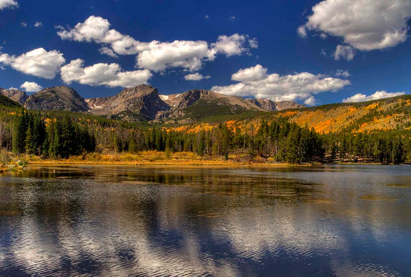
Sprague Lake Loop Hike in Rocky Mountain National Park
At Sprague Lake you'll find an easy loop hike with some stunning views of the mountains that make Rocky Mountain National Park famous. It's a perfect hike in RMNP for young families because the trail is short and has no real elevation gain. With diverse wildlife and a beautiful, peaceful lake, this is one of those spots you should not miss in RMNP. Explore the full Sprague Lake hiking profile below for trail map, driving directions, and all the details you need to enjoy this Colorado adventure in Rocky Mountain National Park.
Trail Snapshot: Sprague Lake Loop in Rocky Mountain National Park
| Hike Distance | 1/2 mile |
|---|---|
| Difficulty | Easy |
| Duration | Approx 30 min |
| Trail Type | Loop |
| Starting Elevation | 8690' at Trailhead |
| Elevation Gain | Approx +20′ |
| Seasons | Spring through Fall, Winter Snowshoeing |
| Dogs | Prohibited in RMNP |
| Hike Trail Map | Click for a Map of Sprague Lake RMNP |
| Denver Drive Time | 2 hr |
| Driving Directions to Sprague Lake Trailhead | Click for Google Map |
| Town Nearest Hike | Estes Park, Colorado |
| Beauty | Sub-alpine lake, mountain views, wildlife: Abert's squirrel, elk, bear, beavers, waterfowl, moose, ducks, Canadian geese |
| Activities | Picnicking, hiking trails, snowshoeing |
| Conditions at Bear Lake Trailhead | Click Here |
| Fee | Park Pass Required |
Sprague Lake Loop Hike
Sprague Lake is a 13-acre lake named after Abner Sprague, an early resident of the Estes Park area who ran a game lodge on the this property which is now part of Rocky Mountain National Park. To access the 1/2 mile loop hike around Sprague Lake, cross the bridge near the parking area. Be sure to pause at the bridge to look for trout. We've spotted an enormous brown trout motoring in these waters near the bridge. It's a regular spawning area in the autumn, so this little segment of water can become quite crowded with fish.
After the bridge, the trail can be hiked to either the left or the right around the perimeter of Sprague Lake. Keep your eyes peeled for Beaver and Moose, both residents of the area. You will be more likely to spot wildlife in the early morning hours.
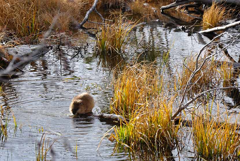
A Beaver at Sprague Lake RMNP
In the early spring, the trail will likely still be under snow. However, this is such a popular area that it should be easy to spot the trail left by others. As you make your way to the northeastern rim of Sprague Lake, you'll gain views of the continental divide, including Hallett Peak. This is a perfect spot to set up your camera for an iconic photo of RMNP.
In the Fall, this is one of the better spots in Rocky Mountain National Park to view the aspen trees changing on the distant mountains.
Tips & Resources for Hiking to Sprague Lake :
- TIP: Hiking shoes are recommended if you hike during early spring or late winter as you might need to pass through snow on the trail.
- TIP: If you get out early on a spring morning, you might be lucky enough to spot a moose or more.
- Rocky Mountain National Park Trail Conditions: Click for RMNP Trail Conditions
- Trail Map for Bear Lake Corridor: Trail Map Link
- Colorado Road Conditions: Colorado Road Conditions
- After the Hike: Poppy's Pizza
- Photo: We would like to express our gratitude to Tim Stacks for sharing such a beautiful photograph of this hike at Sprague Lake.
Weather
Map & Driving Directions
Click for Driving Directions