Mallory Cave is a 1.4-mile, moderate hike up into red rock formations of the Boulder Flatirons to a gated cave. Just 40 minutes from Denver, the trail to Mallory Cave was one of the earliest established recreational trails along the Front Range of Colorado. Explore the full trail profile for trail map, driving direcitons, photos, and tips for his hike in Boulder.
Trail Snapshot: Mallory Cave
| Hike Distance | 2.8 miles Round Trip |
|---|---|
| Difficulty | Moderate – Requires Scramble |
| Duration | Approx 2-3 hrs |
| Trail Type | Out-and-Back |
| Starting Elevation | 6080′ |
| Elevation Gain | Approx +1000′ |
| Seasons | Trail open Year Round, Cave Entrance has permanent closure, Buffer area near cave closures April 1 – Sept. 1 |
| For Closure Updates: | Boulder Open Space Closures |
| Dogs | Allowed On Leash, but Not Recommended because of difficult terrain |
| Hike Trail Map | Click for Trail Map of Mallory Cave |
| Denver Drive Time | 40 min |
| Driving Directions to NCAR Trailhead | Click for Google Map |
| Town Nearest Hike | Boulder, Colorado |
| Beauty | Cave, Canyon, Creek, Wildflowers, Meadows, Wildlife: Mule deer |
| Activities | Hiking, Photography, Birding, Running |
Parking & Trailhead Information for Mallory Cave
The National Center for Atmospheric Research (NCAR) Trailhead is located about 40 minutes North of Denver. From Denver, follow U.S. Route 36 to Boulder. Take the exit for Table Mesa Drive and follow it West. It will wind through a neighborhood to the end as it winds through the neighborhood and past Bear Creek Elementary School. The road will turn into the Drive for NCAR which winds up and around to a large parking area at the lab.
The Hike: Mallory Cave
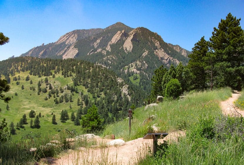
The hike to Mallory Cave begins on the Watler Orr Roberts Trail on the west side of the NCAR parking area. Take the trail west for about 1/2 a mile until it intersects with the Mesa Trail. The Mesa trail runs along the base of the foothills and is the north/south major artery for most of the trails in the Flatirons. For a more detailed trail profile of this southern segment Mesa Trail, check out our South Mesa Trail to Bear Canyon trail profile.
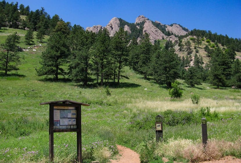
Take a left (heading south) onto the Mesa Trail. Soon you’ll encounter the Mallory Cave Trail on your right (west). The Mallory Cave trail is uphill all the way to the cave, becoming more demanding on your legs as it climbs the broad rigde into the Flatirons. You’ll encounter red rock formations along the trailas it makes its way deeper and higher up into the foothills.
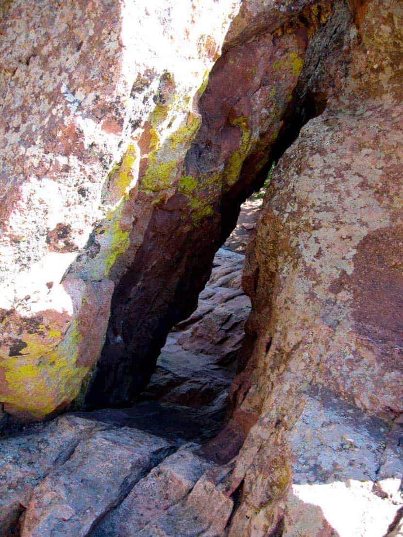
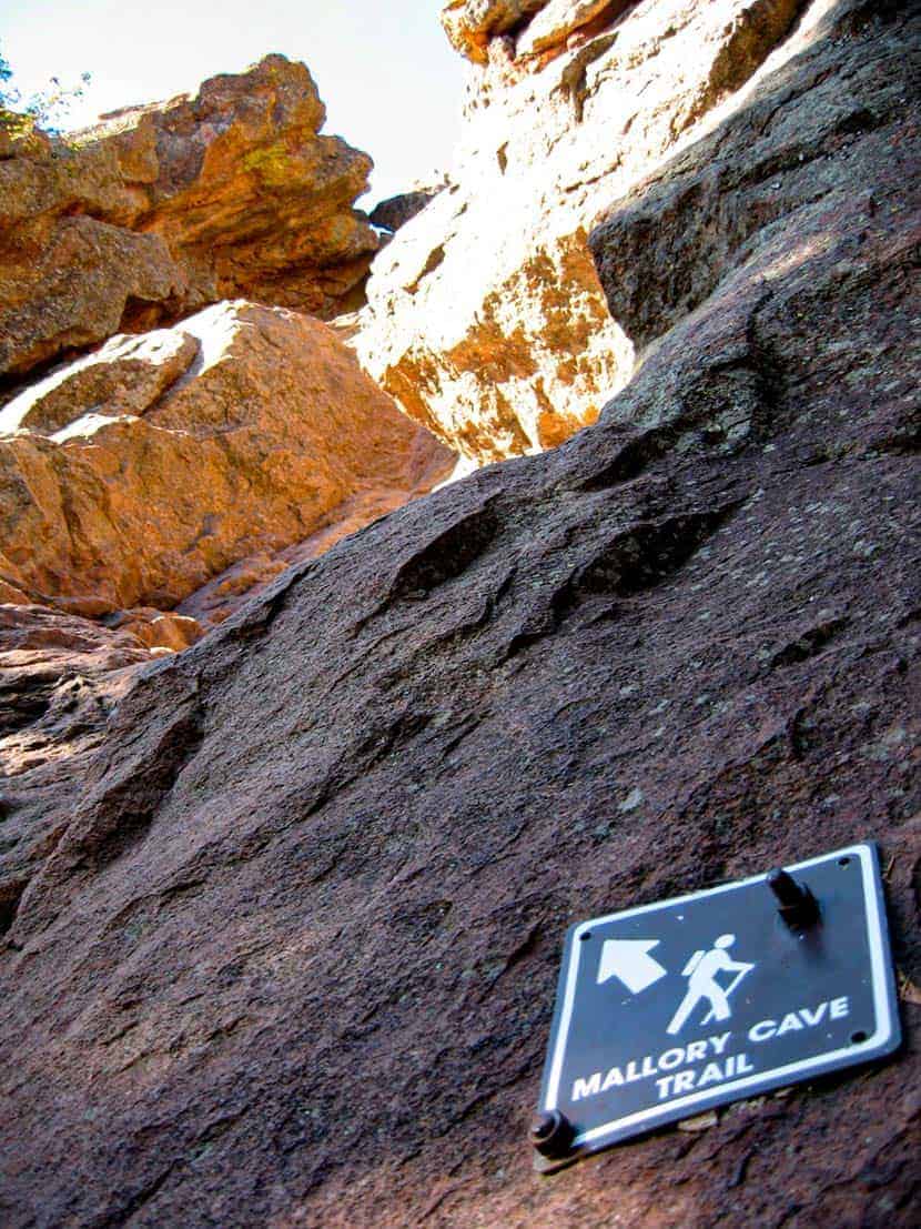
The trail is well-marked, so be alert for signs. The last segment of the hike is a scramble, and one that can be quite dangerous if there is snow, ice, or or water on the rock. Be sure to test the grip of the shoes, just like you might test your braking and tires on your car in snowy or icy weather. And remember, the scramble down is almost always more difficult than the way up. Signage will point you in the right direction (see photo below).
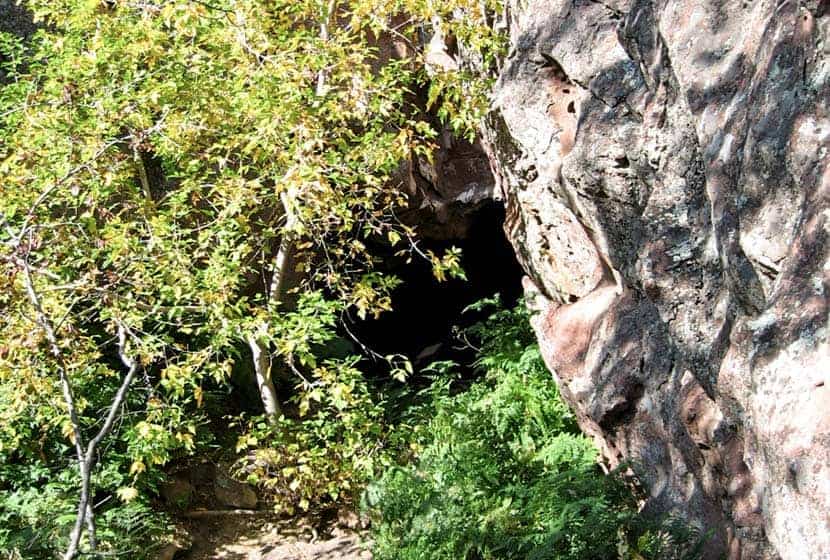
At the cave, you’ll be able to peer into the gated entrance. Why is Mallory Cave Closed? Many caves across the state have been closed because of a strange fungal disease that’s had an adverse impact on the bat populations of Colorado and the West. It appears humans are the ones somehow bringing the disease into the caves. (Cave entrance pictured below).
Hike back to NCAR via the same route you took up to Mallory Cave. Give care to your scramble down the slick rock. A final note: we don’t recommend hiking this with your dog because of this final scramble up to the cave.
Tips & Resources for Hiking Mallory Cave
- Wildlife Aware: Like many of the trails in the Boulder area, keep alert because mountain lions and black bears frequent the area. Know what to do if you encounter a Mountain Lion or a Black Bear.
- Trail Map: Mallory Cave Trail Map
- Packing List: Always pack the 10 Essentials. Download our Hiking Guide to get the list and dayhiking packing checklist.
- Explore More Flatirons Hikes in Boulder: First Flatiron Hike, Gregory Canyon Hike, Green Mountain, Enchanted Mesa Hike, and Royal Arch Trail.
- Colorado Road Conditions: Colorado Road Conditions
- Photo: We would like to express our gratitude to Eric Wendelin and McWillimediafor sharing photographs of this hike to Mallory Cave.
- After the Hike: The Parkway Cafe
Weather
Map & Driving Directions
Click for Driving Directions


