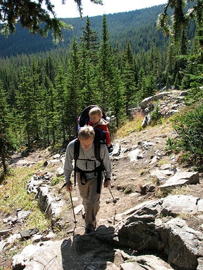
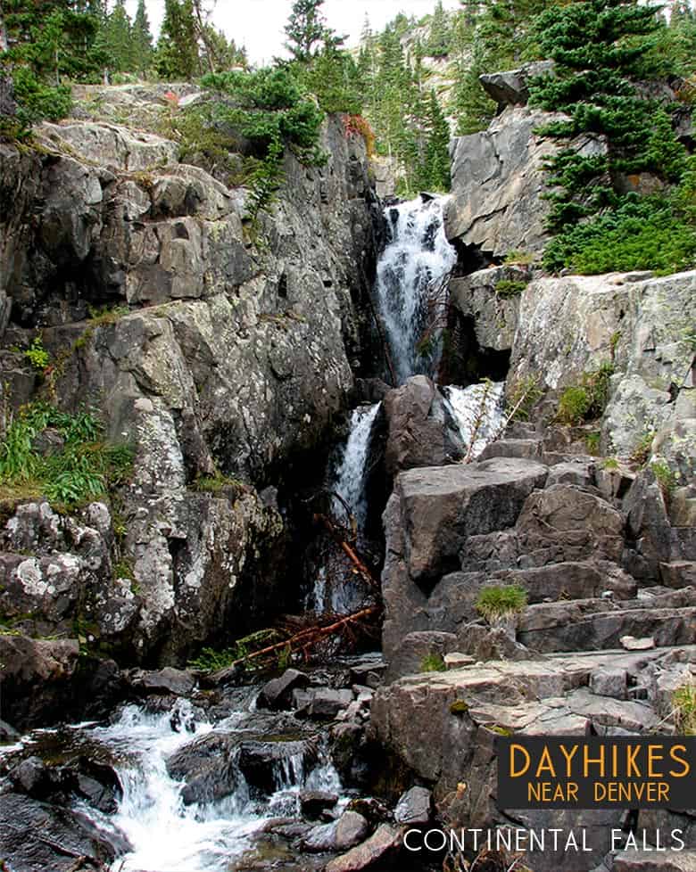
Continental Falls crashes through cracks in the granite sides of the mountains near Breckenridge Colorado. It’s a moderate 2.5 mile uphill hike to the base of the waterfall. The 1000+ feet of elevation gain require some bodily exertion, but it’s worth the effort. Located on the eastern slopes of the Mosquito Range, waterfall finds its source in the high mountain Mohawk Lakes as they spill out into Spruce Creek and make their way down the mountainside. The trail boasts spectacular mountain views, lakes, and the ruins of an old mining operation. Explore the full Continental Falls hike profile below for trail map, driving directions, and more tips and details to help you enjoy this hike near Breckenridge.
Trail Snapshot: Continental Falls Trail near Breckenridge, Colorado
| Hike Distance | Approx 5 miles Round Trip |
|---|---|
| Difficulty | Moderate |
| Duration | Approx 4 hrs |
| Trail Type | Out and Back |
| Starting Elevation | 10380′ |
| Elevation Gain | +1070′ |
| Seasons | Year Round |
| Dogs | Allowed On Leash |
| Hike Trail Map for Continental Falls | Click for a Map |
| Denver Drive Time | 1 hr 40 min |
| Driving Directions to Spruce Creek Trailhead | Click for Google Map |
| Town Nearest Hike | Breckenridge, Colorado |
| Beauty | waterfall, lakes, cabin ruins, creek, mountain views |
| Activities | Hiking, photography, horseback riding, fishing |
Parking & Trailhead Information for Continental Falls Hike
From Breckenridge, follow CO 9 South to The Spruce Creek Road. This is found on the right/west approximately 2.5 miles from the south end of town (junction of Main and South Park Ave). The trailhead for this hike to Continental Falls is located approximately 1.1 mile up Spruce Creek Road.
The Hike: Continental Falls Trail
The hike up to Continental Falls follows the Spruce Creek Trail. It’s marked with blue diamond blazes making the trail easy to find and follow. Just shy of a 1/2 mile into the hike, the trail will cross Spruce Creek via a footbridge. At this point, the forest opens up a bit to views of my Helen in the distant west.
About 1.7 miles into the hike, the Spruce Creek trail will intersect with the Wheeler Trail. At this junction, continue straight on Spruce Creek Trail. At approximately 2 miles, the Spruce Creek trail will join up with the 4WD road, for a short jaunt past a small dam, then will connect back in with the Spruce Creek trail.
At about 2.5 miles into the hike, the trails reaches another junction. The left-hand trail leads up to Continental Falls and beyond to Mohawk Lakes. This segment of the trail is one of my favorites, as it leads past the ruins of a mining operation complete with cabins, mine shaft, and old mining equipment. Be sure to exercise caution and read the warning signs around such areas. At approximately 2.6 miles into the hike, the trail will arrive at Continental Falls. After taking in the waterfall, hikers often opt to go further up to gain incredible mountain peak and mountain range views at Mohawk Lakes.
Tips & Resources for Hiking the Continental Falls Trail
- TIP: There is a mine ruins off trail nearby. Be careful as there is a warning sign that it could collapse and may produce dangerous gases.
- Trail Map for Continental Falls: Trail Map
- Packing List: Always pack the 10 Essentials. Download our Hiking Guide to get the list and dayhiking packing checklist.
- Colorado Road Conditions: Colorado Road Conditions
- After the Hike: The Crown
Weather
Map & Driving Directions
Click for Driving Directions

Looking for more waterfalls near Denver? Explore our more than 50 Colorado Waterfall Hikes, our favorite Waterfall Hikes in Rocky Mountain National Park, or 7 Waterfalls within One Hour of Denver.


