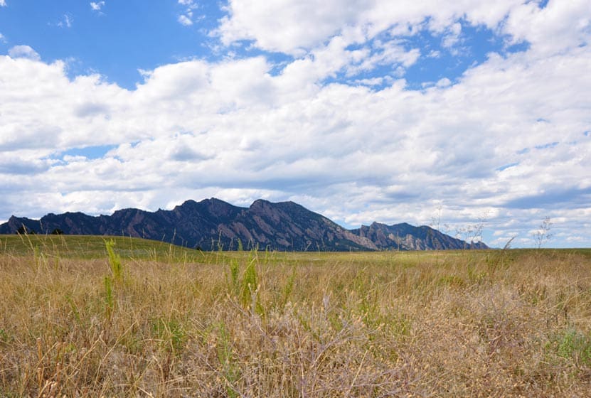
Flatirons Vista Loop Trail
If you are yearning for wide open spaces, the Flatirons Vista trail near Boulder, Colorado makes for a perfect hike. The trail has two loop options and links up to other hiking trails along the Flatirons. Explore the trail profile of this classic Colorado hike for a trail map and all the details like driving directions, trail difficulty rating, and distances.
Trail Snapshot: Flatirons Vista Loop Trail
| Hike Distance | 1.9 or 3.3 Miles |
|---|---|
| Difficulty | Easy to Moderate |
| Duration | 1 to 2.5 hrs |
| Trail Type | Loop |
| Seasons | All Season |
| Dogs | Allowed on Leash |
| Hike Trail Map | Click for a Trail Map |
| Denver Drive Time | 40 min |
| Directions | Click for Google Map |
| Town Nearest Hike | Boulder, Colorado |
| Beauty | Views of the Flatirons, Meadows, Ponderosa Pines, Wildlife: Bobcat, Bear, Mule Deer, Eagles (in winter), & coyote |
| Activities | Hiking Trails, Horseback Riding, Mountain Biking, Birdwatching, & Trail Running |
| Fee | $5 Parking fee or $25 Annual Pass |
You've got options. The Flatiron Vista Loop trail offers 2 loops. One is 3.3 miles and the other is just 1.9 miles. They will wind you through the ponderosa pines and meadows that skirt of the famous Flatirons just south of Boulder. It's an easy hike and a trail runner's dream. The Flatiron Vista Loops are a great destination for winter hikes as well. That's the time of year that you are likely to spot both Golden and Bald Eagles.
The Loops:
-
Longer Flatiron Vista Loop -3.3 miles:
Take the South Flatiron Vista trail (about .2 miles down the trailhead connector trail). After 2.4 miles, bear right onto the North Flatiron Vista Trail. Then, after 1 mile, take the connector trail you came in on back to the trailhead. (reverse this if you like).
-
Shorter Flatiron Vista Loop -1.9 miles:
Take the South Flatiron Vista trail (about .2 miles down the trailhead connector trail). After approx. 1 miles bear right onto Prairie Vista Trail. Continue about 1 mile, then take the connector trail you came in on back to the trailhead

Tips & Resources for Hiking at Flatirons Vista:
- No Shade: The trails at Flatirons Vista are very exposed. Bring a hat and use the sunscreen.
- Trail Map for Flatirons Vista Trail: Trail Map Link
- Colorado Road Conditions: Colorado Road Conditions
- After the Hike: Windy Saddle Cafe
Weather
Map & Driving Directions
Click for Driving Directions

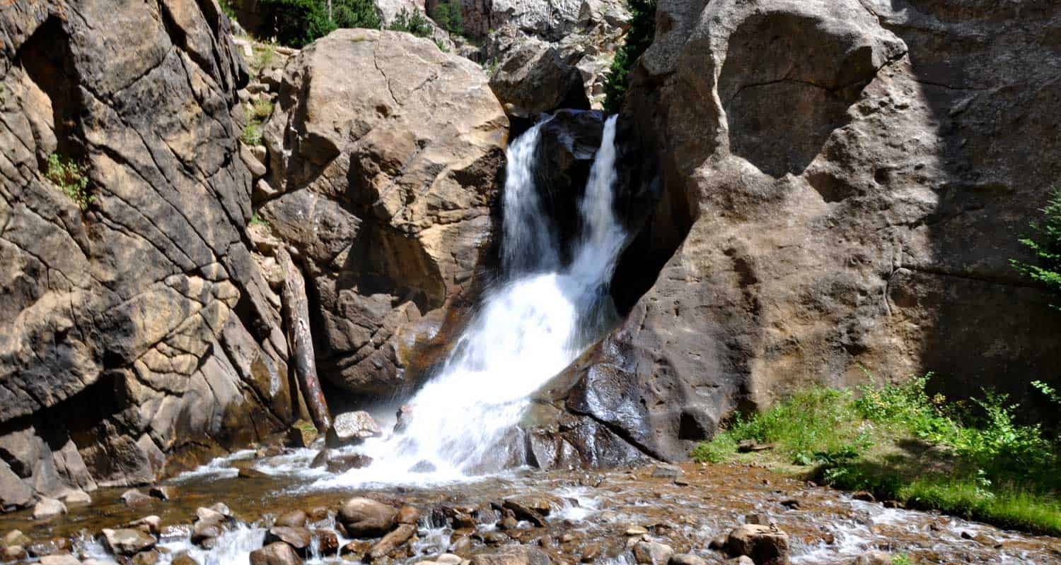
Boulder Falls
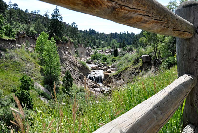
Boulder falls is a quick hike with big reward. This 100 yard hiking trail just outside Boulder, Colorado leads you into a cliff lined notch in Boulder Canyon where the creek gushes out to form one of the best waterfalls near Denver. Since it's not much of a hike, add one of the suggested hikes below to complete your hiking adventure. Boulder Falls reopened in June of 2018 and features repaired and widened trails as well as more durable and stable terrain.
Trail Snapshot: Boulder Falls Hike
| Hike Distance | 100 yards |
|---|---|
| Difficulty | Easy |
| Duration | 10 min |
| Trail Type | Out and Back |
| Seasons | Closed from Nov. 1 to May 1 |
| Dogs | Allowed on Leash |
| Hike Trail Map | Click for a Trail Map |
| Denver Drive Time | 50 min |
| Directions | Click for Google Map |
| Town Nearest Hike | Boulder, Colorado |
| Beauty | Waterfall, Boulder Creek, Cliff |
| Activities | Short Trail |
Boulder Falls is only about 70 feet high, but it's really breathtaking. The combination of the tight canyon, giant ponderosa pines, and the pouring waterfall makes it a great place to take visiting friends and family. This may be the shortest Colorado hike you ever set out to explore; so, we recommend combining your visit to Boulder Falls with a hike at either Betasso Preserve, Mt. Sanitas, or Forsythe Canyon.
Tips & Resources for Hiking Boulder Falls:
- Check for Closings: The Boulder Falls trail appears to need a lot of maintenance, especially after the winter thaw. It also gets a lot of foot traffic, so that's probably a contributing factor. All that to say, be sure to check out Boulder's trail area closures page for details before making the drive out to the falls. Seasonally closed from Nov. 1 to May 1 each year for trail maintenance.
- Narrow Trail: The trail to Boulder Falls is narrow and busy, so the best times to visit are early and around sunset.
- Busy Road: Take care in crossing the road: Parking is across the street from the waterfall, on a pretty tight canyon curve. Cars whip by fast.
- Leave Fido at Home: We love our dog and take her on many of our hikes, but this trail is so busy and rocky that it makes the trail difficult to navigate at times. Basically, it's an easy way to make the hike more enjoyable for others who may not be up for getting clotheslined or their feet taken out from under them by a dog leash :).
- Don't Climb: Hikers have been injured from trying to scale areas on and near Boulder Falls. Pay attention to the signage, it appears that there's just a lot of loose rock along this short trail that can get easily get kicked loose.
- Trail Map for Boulder Falls Trail: Trail Map Link
- Colorado Road Conditions: Colorado Road Conditions
- After the Hike: Ozo Coffee in Boulder, Colorado

Weather
Map & Driving Directions to Boulder Falls
Click for Driving Directions

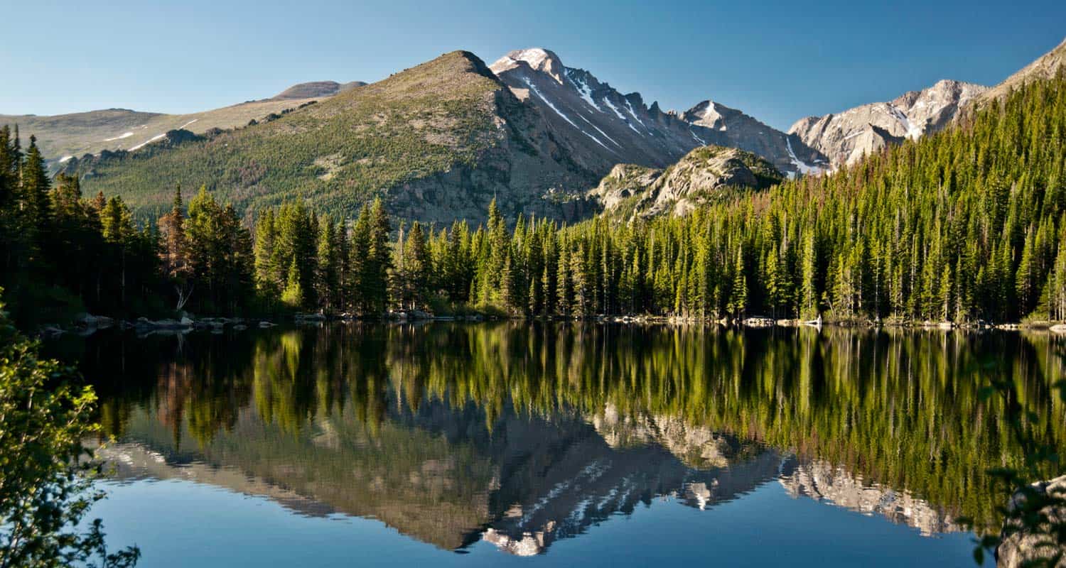
Bear Lake Hike at Rocky Mountain National Park
From Bear Lake in Rocky Mountain National Park (just 2 hours from Denver), you can launch out on dozens of hiking adventures, trails that range from less than a mile to full day treks back into Glacier Gorge or Andrews Creek. If you are visiting Colorado and looking for a high variety of trails or just a good place to start your vacation, this is one of the best places in the state. For details on the trail, see the hiking trail profile below, and download the trail map to get an idea of the different hikes that begin at Bear Lake.
Note: Rocky Mountain National Park now requires timed entry permits from May 27th through October 10th. See the RMNP permits page for more information.
Trail Snapshot: Bear Lake in Rocky Mountain National Park
| Hike Distance | 0.6 mile loop |
|---|---|
| Difficulty | Easy |
| Duration | Approx 30 min |
| Trail Type | Loop |
| Starting Elevation | 9475′ |
| Elevation Gain | +20′ |
| Seasons | Year Round |
| Dogs | Dogs Prohibited in RMNP |
| Hike Trail Map | Click for a Trail Map |
| Denver Drive Time | 2 hours |
| Driving Directions to Bear Lake Trailhead | Click for Google Map |
| Town Nearest Hike | Estes Park, Colorado |
| Beauty | Sub-Alpine Lake, Mountain Views, Wildlife: Abert's Squirrel, Elk, Bear |
| Activities | Picnicking, Snowshoeing, Hiking Trails |
| Conditions at Bear Lake Trailhead | Click Here |
| Fee | Park Pass Required |
Bear lake is the epicenter of Rocky Mountain National Park. This means that you can access a ton of trails from here, but it also means a lot of traffic. So, we always recommend getting there early, on weekdays, and to go during the off-season - if you can. The Bear Lake Trail is a short 0.6 mile loop around a beautiful lake with views of the Rocky Mountains. The hike is considered handicap accessible; however, the trail is not paved.
Tips & Resources for Hiking Bear Lake In Rocky Mountain National Park :
- For Disabled Visitors: Check out the Disabled Travelers' Companion Website for great info and pictures on more accessible trails in RMNP
- Check out: See our Handicap Accessible Hikes Page for more hikes as well
- Visiting Family & Friends: This is a great place to take visiting family and friends because it's not too difficult, and you have a lot of options if you want to explore the park
- Bring a Lunch: Getting this far into the park, even just driving, is quite a trip from the outside world. We suggest packing a lunch so that you can stay longer. And food just tastes better outside anyway.
- Trail Map for Rocky Mountain National Park: Trail Map Link
- Colorado Road Conditions: Colorado Road Conditions
- Photo Courtesy of Ben Grey.
- After the Hike: Poppy's Pizza
Weather
Map & Driving Directions
Click for Driving Directions
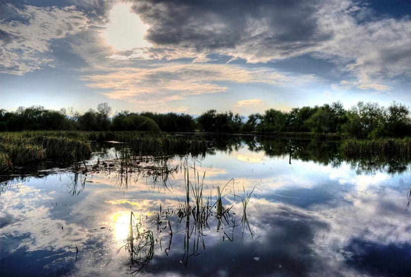
Crown Hill Lake Trails
Jefferson County seems to turn to gold about every park they touch here in Colorado. Crown Hill Lake Park is a prime example. It's an oasis in the midst of the busy city of Denver. The park has beautiful views of the Front Range mountains, including the Flatirons down in Boulder.
Crown Hill Lake Park has three miles of paved trails and .7 of them are considered ADA accessible, all in the heart of Denver. On the northwest side of the park, you'll find a wildlife sanctuary for migratory birds. Explore the full trail profile below for all the details: hiking trails, trail map, and detailed directions to the trailhead.
Trail Snapshot: Crown Hill Lake Trails
| Hike Distance | 1.2 miles+ |
|---|---|
| Difficulty | Easy |
| Duration | Approx 45mins+ |
| Trail Type | Loop |
| Seasons | All |
| Dogs | Allowed on Leash in Most Areas |
| Hike Trail Map | Click for a Map of Crown Hill Lake Trails |
| Denver Drive Time | 17 min |
| Driving Directions to Crown Hill Lake Trails | Click for Google Map |
| Town Nearest Hike | Lakewood, Colorado |
| Beauty | Lake, wildlife sanctuary, Front Range views, wildlife: ducks, geese |
| Activities | Horseback riding, cycling, fishing, hiking, picnic areas |
Hikes at Crown Hill Park:
- Loop Trail - 1.2miles - goes around the lakeside
- Perimeter Trail - 2 miles - goes around the edge of the park
- Nature Preserve Trail / Wildlife Sanctuary Trail - .7 mile - Hiker Only and ADA accessible trail
- Link to the Park's Map
Tips & Resources for Hiking Crown Hill Lake Trails :
- TIP: It's a busy park, so try earlier and later in the day.
- TIP: The wildlife preserve is hiker only. No dogs in this area.
- TIP: There is a lot of multi-use traffic on the trails, so be alert and yield when appropriate.
- Trail Map for Crown Hill Park: Trail Map Link
- Colorado Road Conditions: Colorado Road Conditions
- After the Hike: Danny's Carnation Restaurant
- Photo: We would like to express our gratitude to Kasey Cline for sharing such an amazing photograph of this hike.
Weather
Map & Driving Directions
Click for Driving Directions
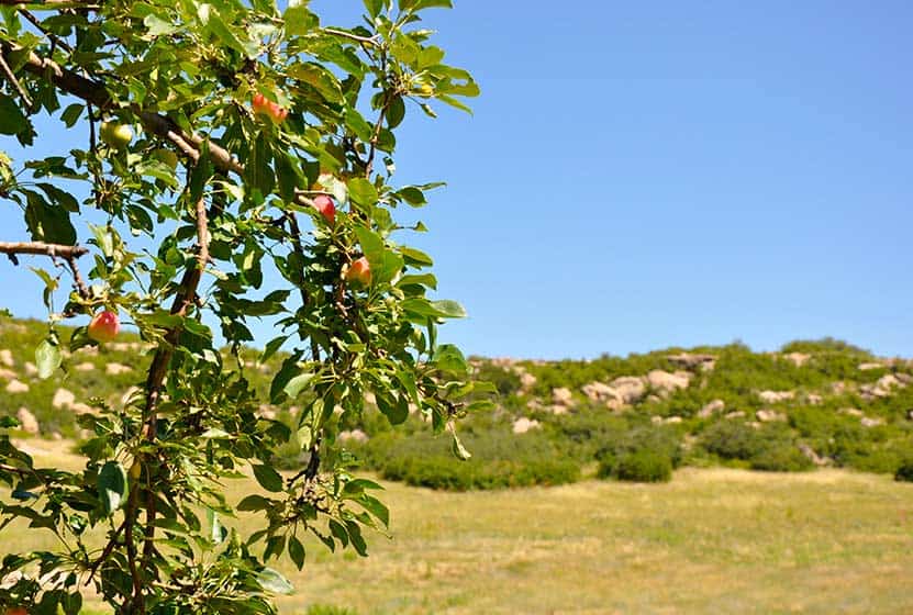
Glendale Farm Trail - Douglas County Open Space
Glendale Farm is a short hiking trail near Littleton, Colorado, that offers a seventeen-acre off-leash dog park. This makes for a great after-work trail run or a leisurely hike when the sun is setting over the mountains and the day is cooling down. Glendale Farm Open space is situated on a prairie plateau between Lone Tree and Castle Pines, Colorado. From the high point on the trail you'll gain views of Pikes Peak in the south, Devil's head in the west, and Rocky Mountain's Longs Peak in the North. It's just a 1.6 mile loop trail, so it makes for a great run or hike. There's not much shade on this trail, so bring sunscreen--or better yet, hit the trail as the sunsets.
Trail Snapshot: Glendale Farm Trail - Douglas County Open Space
| Hike Distance | 1.6 mile |
|---|---|
| Difficulty | Easy |
| Duration | Approx 45 min |
| Trail Type | Loop |
| Seasons | All Year |
| Dogs | Allowed On Leash |
| Hike Trail Map | Click for a Map of Glendale Farm Trail - Douglas County Open Space |
| Denver Drive Time | 35 min |
| Driving Directions to Glendale Farm Trail - Douglas County Open Space | Click for Google Map |
| Town Nearest Hike | Littleton, Colorado |
| Beauty | Grassland, Front Range views, Cherry Creek, wildlife: pronghorn antelope, rattlesnakes, prairie dogs, deer, rabbits, scrub jays, & spotted towhees |
| Activities | Picnic areas, horseback riding, mountain biking, adjacent dog park |
This is another one of those great hikes with your Dog near Denver. Leashes are required on the trail, but after doing the loop, you can let your dog loose in the adjacent 17 acre off-leash dog park. Greenland Open Space Trail has a similar off-leash dog park of 17 acres.
Tips & Resources for Hiking Glendale Farm Trail - Douglas County Open Space :
- An off-leash dog area: Located southwest of the main trailhead is a 17-acre parcel designated park that is fenced-in, and the only area where dogs are allowed off-leash.
- Watch your step: Prickly pear cacti grow along the trail and there are rattlesnakes present in the area.
- Trail Map for Glendale Farm Open Space: Trail Map Link
- Colorado Road Conditions: Colorado Road Conditions
- After the Hike: Crowfoot Valley Coffee
- Rules: For the most up-to-date rules and info in Douglas County dog parks, see this brochure.
Weather
Map & Driving Directions
Click for Driving Directions
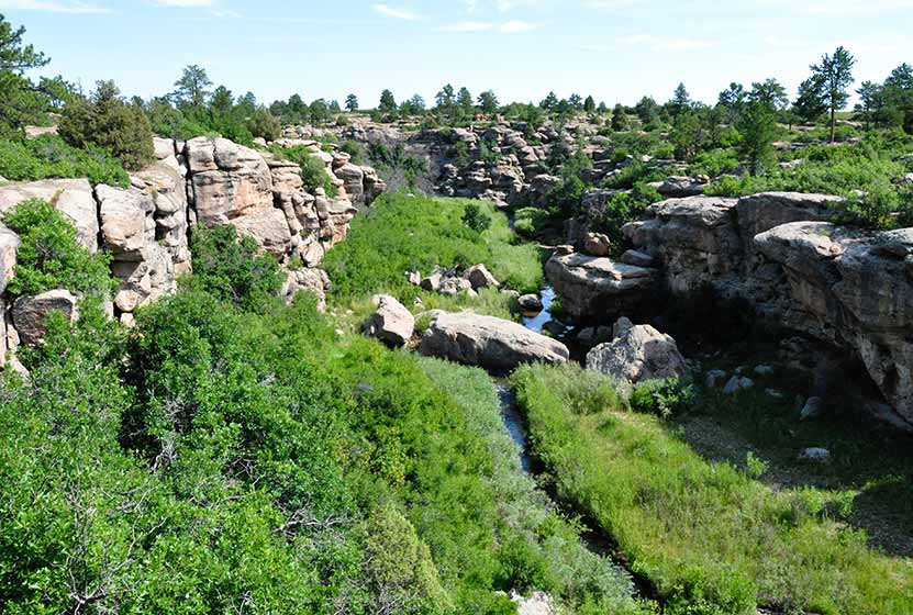
Canyon View Nature Trail at Castlewood Canyon
Castlewood Canyon cuts a unique and green landscape into the plains near Denver. It's not the mountains, but it's worth the drive. Castlewood Canyon State Park has created this beautiful paved trail that follows the canyon rim.
The Canyon Rim Trail also offers an audio tour and is a great way for children to learn more about the plains habitat that covers much of Colorado. Explore this full trail profile for driving directions, trail map, and all the details and tips you'll need to plan your trip to this Colorado State Park.
Trail Snapshot: Canyon View Nature Trail at Castlewood Canyon
| Hike Distance | 1.2 mi (2.4 mi RT) |
|---|---|
| Difficulty | Easy |
| Duration | Approx 1 hr or less |
| Trail Type | Out and Back |
| Seasons | All |
| Dogs | Allowed on Leash in Most Areas, But Not on the East Canyon Trail |
| Hike Trail Map | Click for a Map of Canyon View Nature Trail at Castlewood Canyon |
| Denver Drive Time | 50 min |
| Driving Directions to Canyon View Nature Trail at Castlewood Canyon | Click for Google Map |
| Town Nearest Hike | Castle Rock, Colorado |
| Beauty | Interesting geology, canyon views, interpretive trail, wildflowers, birdwatching |
| Activities | Guided audio nature tour, hiking, picnic areas, visitors center |
| Fee Required | Visit Colorado State Parks Site |
One of the best handicap accessible trails near Denver, the Canyon View Nature Trail at Castlewood Canyon State Park is a 1.2 mile interpretive trail. It runs along the western edge of the top of the canyon and weaves through ponderosa pine and a wonderful variety of wildflowers. The entire trail is a concrete walkway, making the area very accessible to wheelchairs. The trail ends at the Bridge Canyon overlook. Don't miss the view, it's wonderful.
Tips & Resources for Hiking Canyon View Nature Trail at Castlewood Canyon
- TIP: Pick up a brochure so that you can find the various access points for the trail and can take advantage of the side trails.
- Audio Tour: Begin at the visitor's center where you can pick up an audio tour player which guides you through the 5 different ecosystems that are found in Castlewood Canyon.
- Wildflowers: Late June and Early July are the best times to view the wildflowers in Castlewood Canyon.
- Bring Sunscren: Hikes in Castlewood Canyon can be quite exposed to the sun, so bring the sunscreen.
- TIP: Poison Ivy: We've been surprised how poison ivy flourishes in this park, often along the edge of the trail. Know how to identify it, so that you can avoid it. But don't let that deter you from the park. You just need to keep an eye out. See our post on how to identify and treat poison ivy.
- Trail Map for Castlewood Canyon: Trail Map Link
- Additional Maps: Castlewood Canyon State Park Trails
- Colorado Road Conditions: Colorado Road Conditions
- After the Hike: Crowfoot Valley Coffee
Weather
Map & Driving Directions
Click for Driving Directions
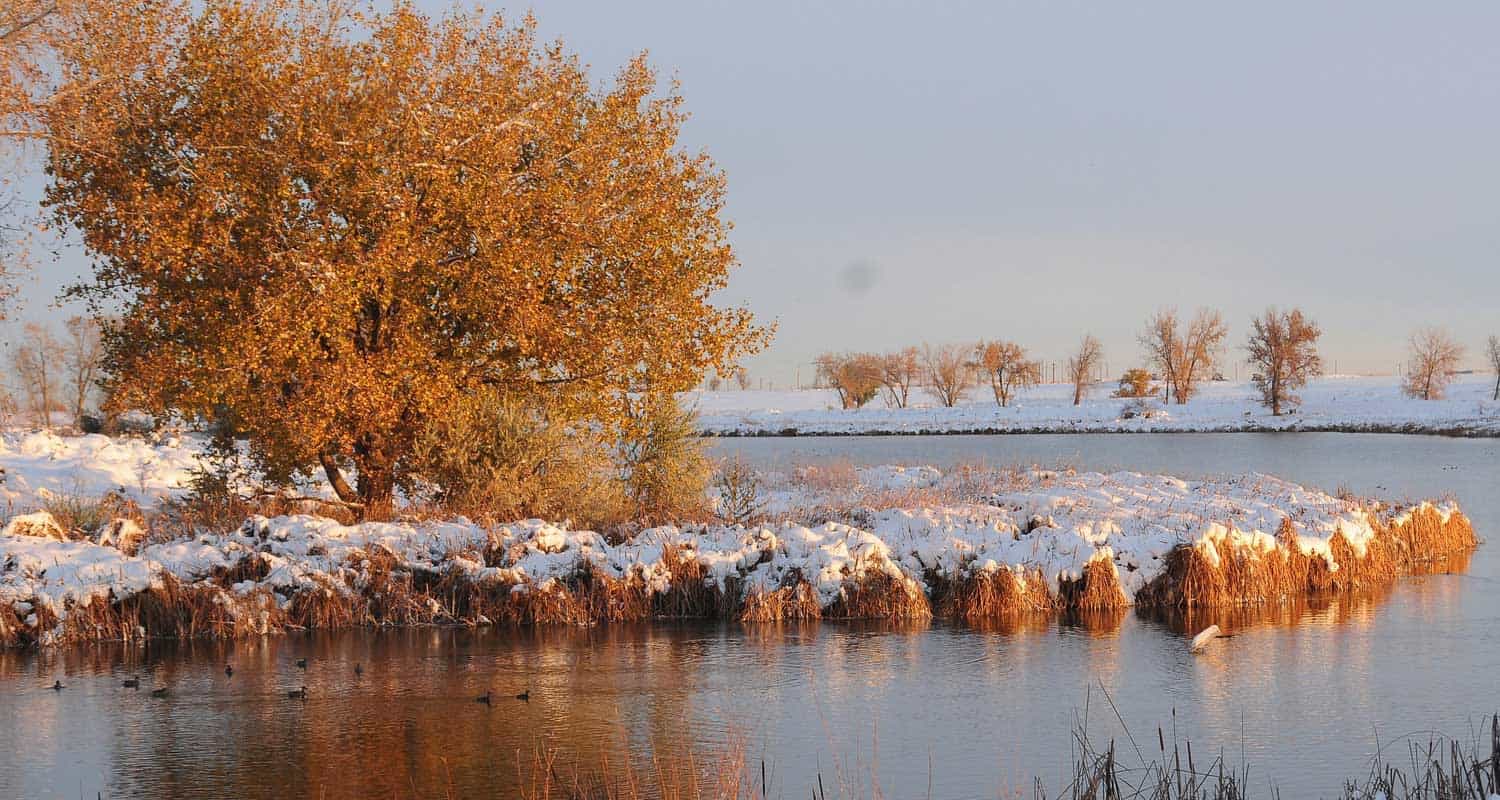
Lakes Loop Trail at Rocky Mountain Arsenal
An arsenal turned into a Wildlife Refuge. What a great idea! The refuge boasts over 15,000 acres and over 300 species of wildlife. It also hosts three lakes and Denver lake hikes. The Lakes Loop Trail at the Rocky Mountain Arsenal Wildlife Refuge is a 1.7 mile loop that winds along the shores of two lakes in the park, Lake Mary and Lake Ladora. Explore the full trail profile for all the details: hiking trails, trail map, and detailed directions to the trailhead.
Trail Snapshot: Lakes Loop Trail at Rocky Mountain Arsenal
| Hike Distance | 1.8 mile Round Trip |
|---|---|
| Difficulty | Easy |
| Duration | Approx 1hr+ Round Trip |
| Trail Type | Loop |
| Seasons | All |
| Dogs | Prohibited in the Refuge |
| Hike Trail Map | Click for a Trail Map |
| Denver Drive Time | 30 min |
| Driving Directions to Lakes Loop Trail at Rocky Mountain Arsenal | Click for Google Map |
| Town Nearest Hike | Commerce City, Colorado |
| Beauty | Grassland, Front Range views, lakes wildlife: wild bison, deer, coyotes, bald eagles and burrowing owls |
| Activities | Hiking trails, wildlife viewing, seasonal fishing |
How to Hike the Loop: Check in and begin your hike at the visitors center. Follow the Lake Mary Trail along the northwest of the lake until it merges with the the Prairie Trail. Follow the Prairie Trail to the south until it merges with the Ladora Trail which will take you back to the visitors center and along the shore of Lake Ladora.
Tips & Resources for Hiking Lakes Loop Trail at Rocky Mountain Arsenal :
- TIP: Hiking and site seeing are open 7 days a week. However, the visitors center is closed on Mondays and Tuesdays, and pets are prohibited (makes sense - it's a wildlife refuge).
- TIP: Trolley Tours are available on the weekends. Check out this tours link or call 303/289-0250.
- Trail Map for Rocky Mountain Arsenal National Wildlife Refuge: Trail Map Link
- Colorado Road Conditions: Colorado Road Conditions
- After the Hike: Butcher Block Cafe
- Photo: We would like to express our gratitude to Ray Fetherman for sharing such a beautiful photograph of this hike.
Weather
Map & Driving Directions
Click for Driving Directions
Waterfall Hike at Castlewood Canyon
This may be the most accessible waterfall near Denver. If you hit the right parking lot, it's a 10 minute hike.So, grab a park brochure and find the Northernmost trailhead for the Creek Bottom Trail (Homestead Trailhead). This will add close to 1 mile to your hike. Then you can loop back via the Cherry Creek Trail for a total of about 2 miles.
Trail Snapshot: Waterfall Hike at Castlewood Canyon
| Hike Distance | 1/4 mile Round Trip (see trail options below) |
|---|---|
| Difficulty | Easy to Moderate |
| Duration | 20 min |
| Trail Type | Out & Back and Loop |
| Seasons | All Season |
| Dogs | Allowed on Leash in Most Areas |
| Denver Drive Time | 50 min |
| Directions | Click for Google Map |
| Beauty | Cherry Creek, waterfall, interesting geology, canyon views, ruins |
| Activities | Rock climbing, hiking, picnic areas, birdwatching, wildlife viewing |
| Fee Required | Visit Colorado State Parks Site |
Tips & Resources for Hiking to the Castlewood Canyon Waterfall
- Easy to Miss: The West Side entrance can be hard to find. Usually, Colorado state parks have brown signs indicating the park roads. The west side doesn't. But the name of the road you're looking for is "Castlewood Canyon" - easy to remember.
- Shortest Access: The shortest way to access the falls is by parking at the Waterfall Parking Lot, then taking the Waterfall Spur to the Creek Bottom Trail. Head South, and you'll hear the waterfall in just a few moments.
- Exposed: Hikes in Castlewood Canyon can be quite exposed to the sun, so bring the sunscreen
- Poison Ivy: We've been surprised how poison ivy flourishes in this park, often along the edge of the trail. Know how to identify it, so that you can avoid it. But don't let that deter you from the park. You just need to keep an eye out. See our post on how to identify and treat poison ivy.
- Trail Map for Castlewood Canyon State Park: Trail Map Link
- Colorado Road Conditions: Colorado Road Conditions
- After the Hike: Crowfoot Valley Coffee
Weather
Click for Driving Directions
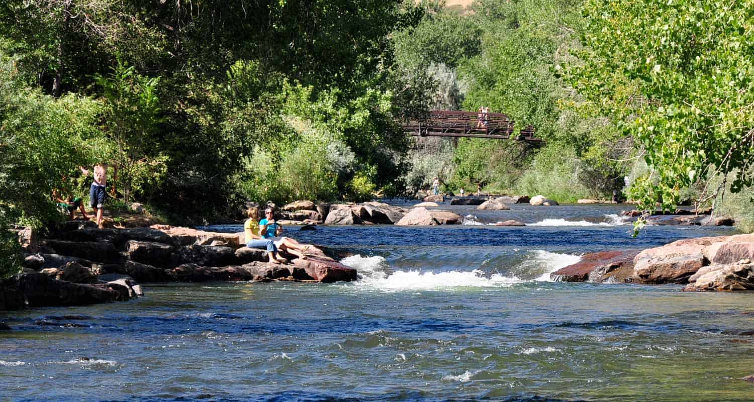
Clear Creek Trail in Downtown Golden
Want a hike to please everyone?The Clear Creek Trail in Golden, Colorado is it! It's got shade, the kids can bring their bikes, and you can finish your hike with a stroll around downtown. We might get some flack for calling this a hike, because it runs through the business district of Golden, CO.But you can wear the soles of your shoes down on this one. Jefferson County even has plans to expand the trail several miles into Clear Creek Canyon. Explore the full trail profile for all the details: hiking trails, trail map, and detailed directions to the trailhead.
Trail Snapshot:Clear Creek Trail in Downtown Golden
| Hike Distance | 1.8 Miles |
|---|---|
| Difficulty | Easy (super easy) |
| Duration | 1 hr |
| Trail Type | Out and Back |
| Seasons | All Season |
| Denver Drive Time | 30 min |
| Directions | Click for Google Map |
| Town Nearest Hike | Golden, Colorado |
| Beauty | Clear Creek, Cliff Swallows, Tree lined river |
| Activities | Parks, Shops, Kayaking, People Watching, Rollerblading, and Biking |
| Handicap Accessible | This Trail is Handicap Accessible |
When you have small children, some mornings can be harder than others to get through the foothills and into the mountains. This trail is made for those mornings. We like to park downtown, grab coffee at the Windy Saddle, then stroll down the trail. A local training school is often seen near the Washington Street Bridge doing water rescue training. It's highly entertaining and a great opportunity. Visiting family and friends will find this trail accessible, easy, and refreshing.
- Bring a Picnic and throw down a blanket at one of the several parks along the way (see map)
- You can start outside of town at the 6th Ave parking area and you have two options: Hike into town, or hike west in Clear Creek Canyon for .7 miles of the Grant Terry Trail
- Don't miss the cliff swallows that have built their nests along the 6th Ave. bridge.
- The Windy Saddle Cafe, on Washington Street offers a kids' playroom and their coffee is fantastic.
Tips & Resources for Hiking the Clear Creek Trail:
City of Golden Trail Map Link
City of Golden Open Space Map Link
Colorado Road Conditions
Weather
Map & Driving Directions
Click for Driving Directions
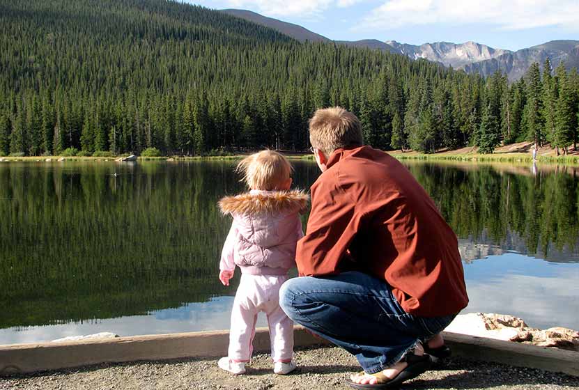
Echo Lake Trail Near Mt. Evans
Colorado's Echo Lake is looped by an easy hiking trail and serves as a trailhead to even more classic Colorado hikes. When we have friends and family visiting Colorado from out of town, this is one of best destinations for a great views. Go early to Echo Lake to get perfect photos of Mount Evans reflected in the water. Explore the full hike profile below that will give you driving directions from Denver, a trail map, and all the information you need to launch out on this adventure.
Trail Snapshot: Echo Lake Near Mt. Evans
| Hike Distance | Less than 1/4 Mile |
|---|---|
| Difficulty | Easy (but consider altitude) |
| Duration | 15 min |
| Trail Type | Out and Back |
| Elevation | 10,600′ |
| Seasons | Spring to Fall |
| Dogs | Dogs Allowed on Leash |
| Hike Trail Map | Click Here for a Trail Map |
| Denver Drive Time | 1 hr |
| Directions | Click for Google Map |
| Town Nearest Hike | Idaho Springs, Colorado |
| Beauty | Lakes, Mountain Peak Views, Wildlife: Ducks and Geese |
| Activities | Fishing, Picnic Areas, Hiking, Connections to other hikes, Visitor Center, Camping |
Echo Lake Area
A great Colorado park to take visiting family and friends. It's an hour from Denver and has very short trail, but it's a great place to introduce others to the beauty of the Rocky Mountains and to take in a high Colorado lake. The trail circles Echo Lake and connects to several other trails: Chicago Lakes, Bear Track Lakes trails, which give you access to Mount Evans Wilderness Area which is full of other great hiking trails,and Mt. Evans summit.
Near the parking area, you'll find a stone picnic shelter which was built in 1937. When the weather is getting hot, it's a great place for a picnic or a wonderful place to break out the hot chocolate on a snowy winter day.
If you are looking for more Colorado lake hikes, be sure to check out our Lake Hikes Near Denver page.
Echo Lake Colorado Camping
There are great camping opportunities at the Echo Lake Campground near the lake. Near the shores is a spruce forest. For detailed information on camping near Echo Lake in Mt. Evans, see the Recreation.gov page.
Tips & Resources for Hiking Echo Lake, Colorado :
- TIP: Early morning means that Echo lake is still, providing no windy weather, and is a perfect time to photograph or just to observe the rocky mountains reflected in the water.
- TIP: A nice short Colorado hike can be made by parking at the parking lot (see map above & below), and hiking around the lake to the Historic Echo Lake Lodge. Visit there, then turn around and enjoy the lake on the way back again.
- TIP: When you finish, drive up to the summit and enjoy the view from the top of Mt. Evans. Or visit Summit Lake Park
- TIP: One of our favorite day-trips with visitors who are not from Colorado, is to take them to Echo Lake, Mt. Evans Summit (by car), then into Evergreen for Pizza at Beaujos Pizza
- TIP: In regards to driving to the top of Mt. Evans: We avoid bringing friends who are not in good health. Be sure to have your guests drink plenty of water, and make sure they have had a day or two to get used to the altitude in the mile-high city.
- Weather: The Weather link below is for Idaho Springs. Weather at the altitude of Echo Lake may be very different, and Weather at the summit will definitely be different. Check this National Weather Service Link for more accurate forecasts.
- After the Hike: After The Hike: Beaujos in Evergreen
- Looking for something more adventurous? Try the Chicago Lakes Hike. It starts in the same parking lot.
- Trail Map for Echo Lake Park: Trail Map Link
- Colorado Road Conditions: Colorado Road Conditions
Weather
Map & Driving Directions
Click for Driving Directions