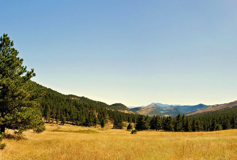
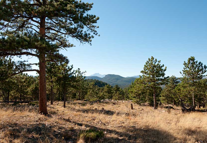
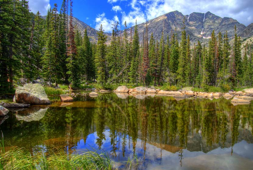
Heil Valley Ranch Ponderosa Loop Hike
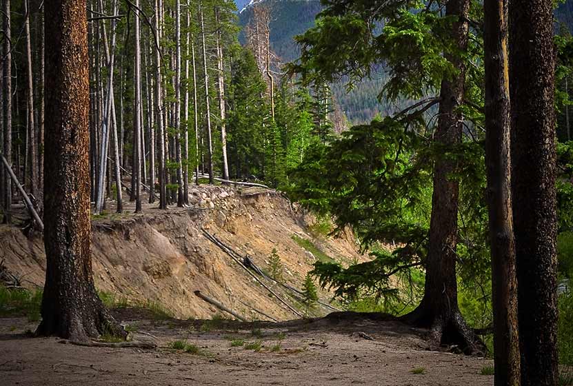
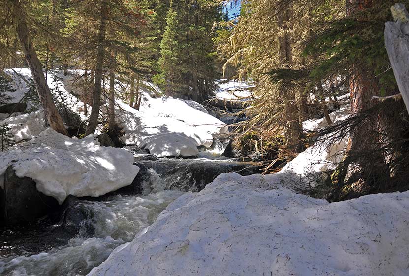
Heil Valley Ranch near Boulder offers this rewarding lollipop-loop hike which features views of distant snowcapped mountains and geological features unique to this section of Colorado. Nestled in the foothills between Boulder and Lyons this singletrack trail is a great destination for both hikers and mountain bikers. However, soil erosion has required occasional trail closures, so be sure to check out the Boulder County Open Space Twitter feed for trail conditions. Explore the full Heil Valley Ranch hike profile below for trail map, driving directions, and more tips and details to help you enjoy this adventure in the Boulder County, Colorado.
Trail Snapshot: Heil Valley Ranch Ponderosa Loop
| Hike Distance | 7.6 miles Round Trip |
|---|---|
| Difficulty | Moderate |
| Duration | Approx 4 hrs |
| Trail Type | Lollipop-Loop |
| Starting Elevation | 6000′ |
| Elevation Gain | Approx +1000′ |
| Seasons | Year Round |
| Dogs | Dogs Not Allowed |
| Hike Trail Map | Click for a Map of Heil Valley Ranch |
| Denver Drive Time | 50 min |
| Driving Directions to Heil Valley Ranch Trailhead | Click for Google Map |
| Town Nearest Hike | Boulder, Colorado |
| Beauty | Views to snowcapped peaks, unique geology, wildlife: deer, coyote, squirrel |
| Activities | Hiking, mountain biking, and photography |
Parking & Trailhead Information for Heil Valley Ranch Hike
From Boulder, follow US 36 West toward Lyons, turn left onto Left Hand Canyon Drive. After 0.7 mile, turn right onto Geer Canyon Drive. After approx. 1.2 miles, you'll come around a curve and see a sign for Heil Valley Ranch. The parking area is on the right/North side of the roach.
The Hike: Ponderosa Loop at Heil Valley Ranch Trail
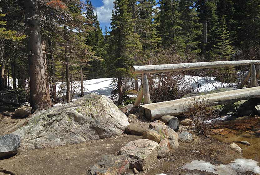
There are two trails located at the north end of the parking area, the Wapiti and the Lichen. For this longer loop hike, we'll be taking the Wapiti up to the Ponderosa loop. This trail is found just to the left/west of the Lichen Loop trail. These should be well-marked by signs and the Lichen loop trail will immediately cross a footbridge. The Lichen loop is a great option for families with small children being just 1.3-mile loop with about 230' of elevation gain over the course of the hike.
Taking the Wapiti trail, hikers will head North through a broad valley punctuated with Ponderosa Pine. After passing an intersection with the Lichen Loop, the Wapiti will soon enter the shade of more ponderosa pines as it makes its way through more rocky and steep terrain. At 2.5 miles in, the Wapiti will meet up with the Ponderosa Loop Trail.
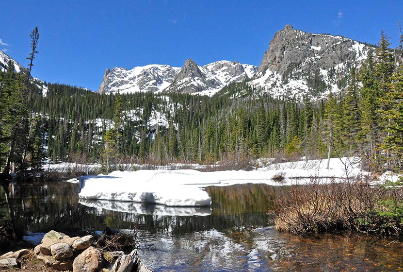
The Ponderosa loop segment offers a great set of views, beginning with views of snowcapped peaks in the west. We recommend taking the Ponderosa loop counter-clockwise, which will take you up to a high point then back down into a beautiful meadow with views all the way out to Left-Hand Reservoir. A second overlook is gained after this section, providing great views out to Indian Peaks Wilderness and Longs Peak in the North. The trail will meet back up with the Wapiti trail for a descent back to the trailhead.
Tips & Resources for Hiking the Heil Valley Ranch Trail
- TIP: Keep alert for mountain bikers as much of the trail is singletrack and a popular mountain biking area..
- Trail Map for Heil Valley Ranch Trail near Boulder: Trail Map Link
- Packing List: Always pack the 10 Essentials. Download our Hiking Guide to get the list and dayhiking packing checklist.
- Colorado Road Conditions: Colorado Road Conditions
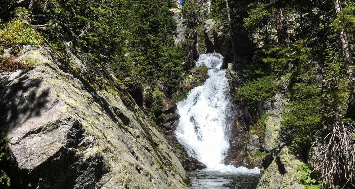
- Photo: We would like to express our gratitude to Jonathan Reyes for sharing such great photographs of this hike at Heil Valley Ranch.
- After the Hike: The Parkway Cafe
Weather
Map & Driving Directions
Click for Driving Directions

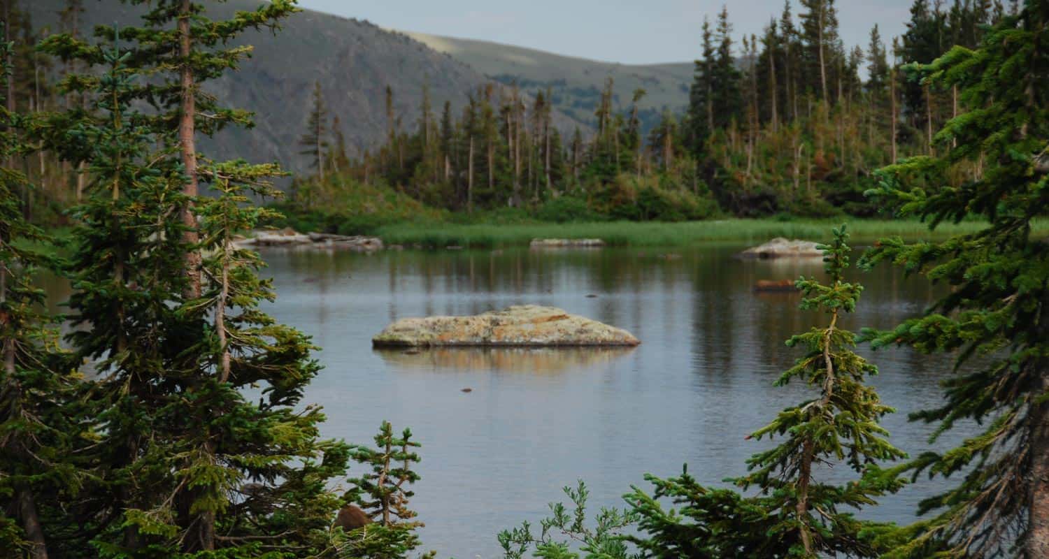
Diamond Lake Hike
The Diamond Lake Trail leads hikers to a high alpine lake nestled in the forest below Jasper Peak in Indian Peaks Wilderness. This 3.5 mile, moderately demanding trail leads to good fishing at Diamond Lake, past a waterfall and multiple cascades, and opens up to the incredible views that make Colorado's high-country famous. Explore the full Diamond Lake hike profile below for trail map, driving directions, and more tips and details to help you enjoy this adventure in the Indian Peaks Wilderness.
Trail Snapshot: Diamond Lake Trail
| Hike Distance | 7.0 miles Round Trip |
|---|---|
| Difficulty | Moderate |
| Duration | Approx 3-4 hrs |
| Trail Type | Out and Back |
| Starting Elevation | 10150′ |
| Elevation Gain | +850′, with additional elevation dip and gain |
| Seasons | Year Round |
| Dogs | Allowed On Leash |
| Hike Trail Map | Click for a Map of Diamond Lake Trail near Nederland |
| Denver Drive Time | 1 hr 30 min |
| Driving Directions to 4th of July Trailhead | Click for Google Map |
| Town Nearest Hike | Nederland, Colorado |
| Beauty | lake, waterfalls, wildflowers, streams, wildlife: moose, deer, squirrel, chipmunk |
| Activities | Hiking, snowshoeing, skiing, camping, fishing |
Directions to Diamond Lake Trail & Trailhead
Drive for approximately for 1hr from Denver to Nederland, Colorado. From Nederland, drive south on CO 119 for about half a mile. Turn right onto CR 130 towards Eldora, then proceed westward through the town of Eldora on Eldorado Avenue which will turn into Hessie Road as it leaves town. At the intersection with CR 111 (4th of July Road) turn right; this will take you to the Fourth of July Trailhead. On the way to the trailhead, you'll pass Buckingham Campground. Though this looks like a trailhead and parking area, drive past it to the actual trailhead. It is important to note that 4th of July Road is a dirt road and only useable by passenger vehicles during the Summer months, and rain and snow can cause the road conditions to be unpredictable. Washouts can make this a 4WD road.
The Hike to Diamond Lake
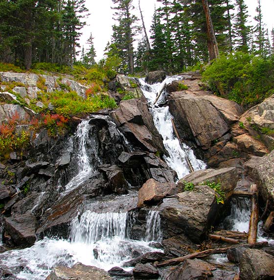
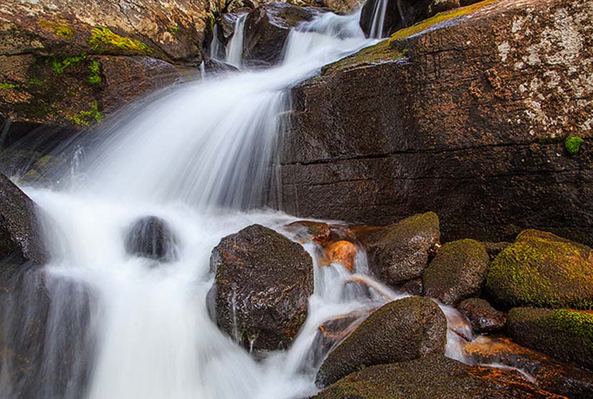
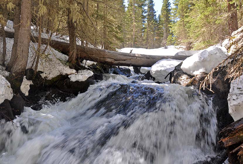
The hike to Diamond Lake begins at the 4th of July Trailhead by taking the Arapaho Pass Trail #904. The Arapaho Pass trail ascends quickly into Indian Peaks Wilderness area. New views open up about every quarter mile featuring distant waterfalls, trailside cascades, creeks, wildflowers, and expansive mountain views. Hikers will encounter the first trail junction at 1.2 miles in. The correct trail, the Diamond Lake Trail (easy to remember) is to the left/west. The first 1/2 mile on the Diamond Lake Trail heads west along a drainage then descends to Middle Boulder Creek. At approximately 1.7 miles into the hike, the trail follows a bridge over Middle Boulder Creek. This a great place to stop and take in Diamond Lake Falls (pictured below).
After the waterfall, the trail crosses two more creeks then begins a steep ascent through a series of switchbacks. This final trail segment is approximately 1 mile, making the entire one-way hike to Diamond Lake approximately 3.5 miles. This segment from the waterfall to the lake is often covered with snow into early Summer, so orienteering and snow-travel skills are recommended for those who decide to negotiate the snow-covered trail.
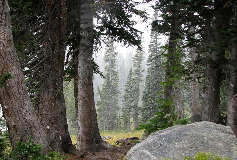 Snow and Fog on the Forest near Diamond Lake
Campfires are prohibited at Diamond Lake, but camping is allowed by permit and in the designated sites. For more details on backcountry travel and permits in the Indian Peaks Wilderness area, see the Indian Peaks Wilderness Alliance. The Diamond Lake Trail continues past Diamond Lake into the high country where it meets up with the Devils Thumb trail. Hikers in Indian Peaks should always prepare by packing the 10 Essentials, and have a plan in case they encounter rapidly changing weather conditions. In the summer, this means thunderstorms and lightning that rapidly form, and un-forecasted snowstorms from Fall to early Summer.
Tips & Resources for Hiking the Diamond Lake Trail
- TIP: Go there early (especially during the weekends) to avoid an overcrowded parking area.
- TIP: Bring bug spray for mosquitoes.
- Trail Map: Diamond Lake Trail
- Packing List: Always pack the 10 Essentials. Download our Hiking Guide to get the list and dayhiking packing checklist.
- Colorado Road Conditions: Colorado Road Conditions
- After the Hike: Happy Trails Cafe
- Photo Credit: A Place to Ponder by Let Ideas Complete
Weather
Map & Driving Directions
Click for Driving Directions

Finch Lake Hike in Rocky Mountain National Park
Finch Lake is a 4.5 mile hike through pines, aspen glades, and wildflower laden meadows to a sub-alpine lake where the forest surrounds its shores. The Finch Lake trail is a great choice for those who prefer solitude as it's one of the lesser traveled trails in the Wild Basin region of RMNP. Explore the full Finch Lake hike profile below for trail map, driving directions, and more tips and details to help you enjoy this adventure in Rocky Mountain National Park.
Note: Rocky Mountain National Park now requires timed entry permits from May 27th through October 10th. See the RMNP permits page for more information.
Trail Snapshot: Finch Lake in Rocky Mountain National Park
| Hike Distance | 9 miles Round Trip |
|---|---|
| Difficulty | Moderate |
| Duration | Approx 5-6 hr Round Trip |
| Trail Type | Out and Back |
| Starting Elevation | 8470' |
| Elevation Gain | Approx. +1442' |
| Seasons | Spring through Fall |
| Dogs | Prohibited in RMNP |
| Hike Trail Map | Click for a Map of Finch Lake RMNP |
| Denver Drive Time | 1 hr 30 min |
| Driving Directions to Finch Lake Trailhead | Click for Google Map |
| Town Nearest Hike | Allenspark, Colorado |
| Beauty | Waterfall, mountain views, meadows, aspen, river, wildlife: blue dragonfly, jackrabbit, mallard, Abert’s squirrel, elk, deer, moose, bear; wildflowers |
| Activities | Picnicking, hiking trails, snowshoeing, horseback riding, backcountry camping (with a permit), photography |
| Fee | Park Pass Required |
Parking & Trailhead Information for Finch Lake
The Finch Lake Trailhead is located approximately 1/5th of a mile east of the larger Wild Basin Trailhead near Allenspark, Colorado. Because there is very limited parking at the Finch Lake Trailhead, most hikers will need to park at the Wild Basin Trailhead and add the 1000' feet of trail between the Wild Basin Trailhead and the Finch Lake Trailhead to their journey. There is an alternative approach via the Allenspark Trailhead. However, the route described in this trail profile will be from the Finch Lake Trailhead nearest to the Wild Basin Trailhead.
- Map and Driving Directions to the Finch Lake Trailhead
- Map and Driving Directions to the Wild Basin Trailhead
The Hike: Finch Lake Trail in RMNP
The hike up to the Lake is a steady climb through a forest of pine, aspen, spruce, and meadows laden with wildflowers. It begins with a set of switchbacks then follows the contours of a moraine. After gaining the ridge of the moraine, the trail begins a gentle descent through one of Rocky Mountain National Park's most stunning displays of wildflowers. Near the bottom of the moraine, just above Fox Creek, the trail will come to its first junction. The the trail to the right/west leads towards both the lake (the left/east trail leads to the Allenspark Trailhead). Climbing higher, the trail will pass an overlook with views of the distant mountain peaks and the greater Wild Basin area.
The next trail junction--at approx. 2.5 miles--has been named "Confusion Junction" because of its power to confound hikers. Pause and study the trail signage in order to choose the correct trail. The correct way is the trail labeled "Pear Lake" and/or "Finch Lake."
After approximately 1/4 mile, the trail works its way through a burn area from a 1978 fire, now in full recovery mode and blanketed with summer wildflowers. Continuing to work uphill, the trail makes several stream crossings before a descent to the lake, which begins at 3.8 miles. Then, at approximately 4.25 miles, the trail makes a hard right-turn. This part of the trail is often obscured by snow as late as as midsummer and early as the first signs of autumn.
At the Lake the trail wraps around the eastern edge, then the northern shore of the lake. During midsummer, swarms of bright blue dragonflies dance along its waters. The Finch Lake backcountry camping sites are located on the north and northwestern side. These backcountry camping sites can be reserved through the RMNP Backcountry Offices.
Finch Lake is not a good fishing destination. However, Pear Lake, just 2 miles further up the trail, is a much better destination for anglers and offers spectacular views of the rugged peaks surrounding it.
Finch Lake - Another View

Tips & Resources for Hiking to Finch Lake in RMNP
- Prepare: It's a long and demanding hike, so bring lots of water and high-energy food.
- Packing List: Always pack the 10 Essentials. Download our Hiking Guide to get list and dayhiking packing checklist.
- Get there early: Parking lot might get full even early in the morning. Hikers should expect to have to park at the Wild Basin Trailhead and add approximately 1/2 mile to their round trip hike (1000' one-way to the Finch Lake Trailhead).
- You’re in Bear Country: Black Bears live in the Wild Basin area and are active on the months of April through November. Be aware, dispose of your food responsibly, and don’t food or anything else with a strong scent in your vehicle.
- Trail Map for Wild Basin Area: Trail Map Link
- Colorado Road Conditions: Colorado Road Conditions
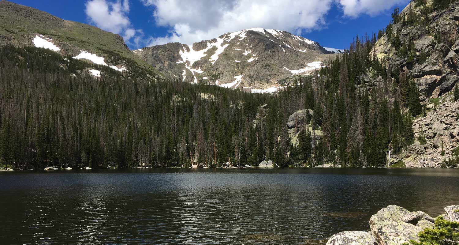
- Photo: We would like to express our gratitude to Shea Oliver for sharing such amazing photographs of this hike.
- After the Hike: Rock Creek Tavern & Pizzeria
Weather
Map & Driving Directions
Click for Driving Directions

Lyric Falls Hike in Rocky Mountain National Park
Lyric Falls is a beautiful stair-step waterfall that spills over the moss-covered granite slabs of Hunters Creek in Rocky Mountain National Park. A lesser-known waterfall, Lyric Falls requires a 3/4 mile segment on the unmaintained social trail that winds along Hunters Creek. Locating the falls may be a bit challenging and land navigation skills are needed for this hike in the Wild Basin area of RMNP. Explore the full Lyric Falls hike profile below for trail map, driving directions, and more tips and details to help you enjoy this adventure in Rocky Mountain National Park.
Note: Rocky Mountain National Park now requires timed entry permits from May 27th through October 10th. See the RMNP permits page for more information.
| Hike Distance | Approx 8 miles Round Trip |
|---|---|
| Difficulty | Moderate |
| Duration | 6-8 hr Round Trip |
| Trail Type | Out and Back |
| Starting Elevation | 8430' |
| Elevation Gain | Approx. +1730' |
| Seasons | Spring through Fall |
| Dogs | Prohibited in RMNP |
| Hike Trail Map | Click for a Map of Wild Basin Area |
| Trails Illustrated Map | Recommended Topo Map Noting Location of Lyric Falls |
| Denver Drive Time | 1 hr 30 min |
| Driving Directions to Sandbeach Lake Trailhead | Click for Google Map |
| Town Nearest Hike | Allenspark, Colorado |
| Beauty | Mountain views, aspen, ponderosa, limber pine, creek, wildlife: Abert’s squirrel, elk, deer, moose, bear; wildflowers |
| Activities | Picnicking, hiking trails, winter snowshoeing, horseback riding, backcountry camping (with a permit), photography |
| Fee | Park Pass Required |
Parking & Trailhead Information for Lyric Falls
The Sandbeach Lake Trailhead is located off of County Road 84 near, just about 1/2 mile west from its junction with Highway 7. See the driving directions link above for the detailed route. The trailhead is across the street from the Wild Basin Lodge and Event Center. The trailhead has toilet facilities and parking capacity of about 25 cars (includes gravel side-lot).
The Hike: Lyric Falls Trail in RMNP
The first segment of the hike to Lyric Falls follows the Sandbeach Lake Trail for approximately 3.2 miles to the footbridge crossing Hunter's Creek. An indistinct social trail is located near the bridge on the east side of Hunter's creek. This second trail segment is 3/4 of a mile is unmaintained, which means that hikers should have a sufficient level of land navigation skills (map reading and proficiency with a compass/gps unit) to negotiate the terrain to Lyric Falls.
This .75 mile section follows the course of Hunter's Creek Northwest and uphill to the location of Lyric Falls. There is no marker for Lyric Falls, but it can be located on the National Geographic Trails Illustrated Map of Rocky Mountain National Park. Hikers will likely hear several smaller cascades along the way. In the same way, the cascades of Lyric Falls will be heard before seen, and the sounds of its splash and spray will be the best way to locate the falls.
A meadow bright with wildflowers can be found just bit further up Hunter's Creek beyond Lyric Falls.
Campsites Along the Lyric Falls Trail
Stay overnight and explore the larger Hunter's Creek Drainage. There are several Backcountry Camping sites along the Sandbeach Lake Trail: Hole-in-the-Wall, Campers Creek, Beaver Mill, and Sandbeach Lake. These backcountry camping sites can be reserved through the RMNP Backcountry Offices. Staying overnight, hikers can then explore Lyric Falls, Sandbeach Lake, and this lesser hiked area of the Wild Basin in Rocky Mountain National Park.
Tips & Resources for Hiking to Lyric Falls in RMNP
- Packing List: Always pack the 10 Essentials. Download our Hiking Guide to get list and dayhiking packing checklist.
- Recommended Trail Map: We recommend the National Geographic Trails Illustrated Map which indicates the location of the Backcountry Camping Sites, and provides topo information, too.
- Get there early: Parking is limited. Arrive early to secure a parking spot at the trailhead.
- You’re in Bear Country: Black Bears live in the Wild Basin area and are active on the months of April through November. Be aware, dispose of your food responsibly, and don’t food or anything else with a strong scent in your vehicle.
- Colorado Road Conditions: Colorado Road Conditions
- Photo: We would like to express our gratitude to Thomas Mangan for sharing such great photos of this hike to Lyric Falls in RMNP. Tom leads photography tours in Rocky Mountain National Park. Check out his site thomasmagan.com for details.
- After the Hike: Meadow Mountain Cafe in Allenspark, Colorado
Weather
Map & Driving Directions
Click for Driving Directions
Ypsilon Falls in Rocky Mountain National Park
Ypsilon Falls is a tiered waterfall hidden along the northern shore of Ypsilon Lake in Rocky Mountain National Park. The 4.5 mile hike to this secluded waterfall follows the Ypsilon Lake trail, a demanding trek through the thick woods of the Mummy Range. Explore the full Ypsilon Falls hike profile below for trail map, driving directions, and more tips and details to help you enjoy this adventure in Rocky Mountain National Park.
Note: Rocky Mountain National Park now requires timed entry permits from May 27th through October 10th. See the RMNP permits page for more information.
Trail Snapshot: Ypsilon Falls in Rocky Mountain National Park
| Hike Distance | 9 miles Round Trip |
|---|---|
| Difficulty | Difficult |
| Duration | Approx 5-6 hr Round Trip |
| Trail Type | Out and Back |
| Starting Elevation | 8540′ |
| Elevation Gain | Approx +2180′ |
| Seasons | Spring through Fall |
| Dogs | Prohibited in RMNP |
| Hike Trail Map | Click for a Map of Ypsilon Falls RMNP |
| Recommended Trail Map | We recommend the National Geographic Trails Illustrated Map - topographic with detailed information. |
| Denver Drive Time | 1 hr 40 min |
| Driving Directions to Lawn Lake Trailhead | Click for Google Map |
| Town Nearest Hike | Estes Park, Colorado |
| Beauty | Lake, waterfall, mountain views, aspen, ponderosa, meadows, river, wildlife: elk, Abert's squirrel; wildflowers |
| Activities | Picnicking, hiking trails, fishing, snowshoeing, horseback riding, backcountry camping (with a permit), photography |
| Fee | Park Pass Required |
Parking & Trailhead Information for Ypsilon Falls
The hike to Ypsilon Lake begins at the Lawn Lake Trailhead. Several other destinations in this lesser visited section of RMNP known as the Mummy Range, can be accessed from the Lawn Lake Trailhead, including Ypsilon Falls, Lawn Lake, Chipmunk Lake, and the Spectacle Lakes. The parking area is located on Old Fall River Road, just north of the intersection of Old Fall River Road and Highway 34.
The Hike: Ypsilon Falls Trail in RMNP
The hike begins on a 1.4 mile stretch of the Lawn Lake trail before the intersection with the Ypsilon Lake Trail. This initial segment climbs a series of switchbacks. While it may be tempting to cut the switchbacks, they are there for a couple important purposes: to control erosion, and to preserve your energy. Because this area of RMNP has been severely damaged by floods, it's all the more important to stay the trail. Because of the floods, there are also areas of unstable terrain.
At 1.4 mile, the Ypsilon Lake trail junction will emerge on the left-hand side of the Lawn Lake trail. Here, the trail crosses the Roaring River--but the bridge has been washed out by a flood in the Spring of 2013. At the time of writing this trail profile (June 2016) the bridge has not been replace. However, the river can be crossed at low water. It's easy to underestimate the hydraulic force of a river, so exercise care in crossing. If you're planning to hike to Ypsilon Lake, it's important to have a back plan, just in case you run into high water levels at the ford. Typically, the water levels are low, but both snowmelt and heavy rains can change levels quickly.
Approximately 0.5 mile after crossing the Roaring River (@ 2 miles), the trail begins a sustained climb along the ridge of a moraine. This longest segment of the hike leads through thick timber, then crests at 3.8 miles before descending to Chipmunk Lake @ 4.0 miles. The mountain peak reflections in Chipmunk Lake make this worth stopping for a photo.
There is a backcountry camping area with two individual sites just past Chimpmunk Lake at 10,640'. Camping permits can be obtained through the RMNP Wilderness offices. The trail from Chipmunk Lake to Ypsilon lake is just 0.5 mile, arriving at Ypsilon's western shore. Hikers who pause to listen may hear the sounds of Ypsilon Falls. This segmented and tiered cascade can be accessed by crossing a small footbridge, then hiking toward the sounds of the falls along Ypsilon's northwestern shore.
The return hike follows the same route back to the Lawn Lake trailhead, making this a 9-mile, round-trip journey.
Tips & Resources for Hiking to Ypsilon Falls in RMNP
- Packing List: Always pack the 10 Essentials. Download our Hiking Guide to get list and dayhiking packing checklist.
- Bridge Out: Due to the damage caused by a flood in September 2013, the bridge over Roaring River is missing. Cross only during low water, and see the RMNP flood closures page for updates.
- Get there early: Parking may be somewhat limited as with many hikes in RMNP area and can get full even early in the morning.
- Recommended Trail Map: We recommend the National Geographic Trails Illustrated Map which indicates the location of the Upper Chipmunk Backcountry Camping Site, and provides topo information.
- Colorado Road Conditions: Colorado Road Conditions
- Photo: We would like to express our gratitude to Aaron Cooper for sharing such an amazing photograph of this hike to Ypsilon Falls in RMNP.
- After the Hike: Mountain Home Café
Weather
Map & Driving Directions
Click for Driving Directions
Sandbeach Lake Hike in Rocky Mountain National Park
Sandbeach Lake features great fishing and a beach! The lake got its name from its sandy shore that resembles that of a beach--making it one of best camping spots in Rocky Mountain National Park. It's a 4.5 mile moderate hike that climbs Copeland Moraine and crosses two creeks before arriving at this beautiful subalpine lake. With several reservable campsites along the way, Sandbeach Lake makes for a great initial multi-day backpacking trip for young families. Explore the full Sandbeach Lake hike profile below for trail map, driving directions, and more tips and details to help you enjoy this adventure in Rocky Mountain National Park.
Note: Rocky Mountain National Park now requires timed entry permits from May 27th through October 10th. See the RMNP permits page for more information.
Trail Snapshot: Sandbeach Lake in Rocky Mountain National Park
| Hike Distance | 8.4 miles Round Trip |
|---|---|
| Difficulty | Moderate |
| Duration | Approx 6 hr Round Trip |
| Trail Type | Out and Back |
| Starting Elevation | 8430′ |
| Elevation Gain | Approx +1971′ |
| Seasons | Spring through Fall, Winter Snowshoeing |
| Dogs | Prohibited in RMNP |
| Hike Trail Map | Click for a Map of Sandbeach Lake RMNP |
| Denver Drive Time | 1 hr 30 min |
| Driving Directions to Sandbeach Lake Trailhead | Click for Google Map |
| Town Nearest Hike | Allenspark, Colorado |
| Beauty | Lake, mountain views, aspen, ponderosa, limber pine, creek, wildlife: Abert’s squirrel, elk, deer, moose, bear; wildflowers |
| Activities | Picnicking, hiking trails, fishing, snowshoeing, horseback riding, backcountry camping (with a permit), photography |
| Fee | Park Pass Required |
Parking & Trailhead Information for Sandbeach Lake
The Sandbeach Lake Trailhead is located off of County Road 84 near, just about 1/2 mile west from its junction with Highway 7. See the driving directions link above for the detailed route. The trailhead is across the street from the Wild Basin Lodge and Event Center. The trailhead has toilet facilities and parking capacity of about 25 cars (includes gravel side-lot).
The Hike: Sandbeach Lake Trail in RMNP
The 4.5 mile hike (one-way) to Sandbeach Lake first heads north out of the Sandbeach Lake Trailhead, then begins a moderate climb to gain the ridge of the Copeland Moraine. The trail then follows the ridgeline west until it crosses Campers Creek at 2.3 miles. Here, the trail makes a short, but sharp, bend to the the south before continuing west/northwest. At 3.3 miles, the trail crosses a second creek, Hunters Creek, then makes a steady climb to the northern shores of Sandbeach Lake.
Campsites Along the Sandbeach Lake Trail
There are several backcountry campsites along the Sandbeach Lake Trail, making the hike up to Sandbeach Lake, a great opportunity for young families and first-time backpackers who want to do their first multi-day trip. Camping permits must be obtained through the RMNP Wilderness offices. A basic itinerary would be to drive into the park's Wilderness Office in the late morning, grab lunch, then hike to one of the campsites listed below. For a two-night trip, families could elect to camp at one of the earlier campsites: Hole in the Wall or Campers Creek. Then, day two would be a short hike up to Sandbeach Lake, a perfect place for a second night under an expanse of stars. Day three would consist of a 4.5 mile hike out to the trailhead. Be sure to call ahead to the Wilderness Office to book your sites.
Tips & Resources for Hiking to Sandbeach Lake in RMNP
- Packing List: Always pack the 10 Essentials. Download our Hiking Guide to get list and dayhiking packing checklist.
- Recommended Trail Map: We recommend the National Geographic Trails Illustrated Map which indicates the location of the Backcountry Camping Sites, and provides topo information, too.
- Get there early: Parking is limited. Arrive early to secure a parking spot at the trailhead.
- You’re in Bear Country: Black Bears live in the Wild Basin area and are active on the months of April through November. Be aware, dispose of your food responsibly, and don’t food or anything else with a strong scent in your vehicle.
- Trail Map for Wild Basin Area: Trail Map Link
- Colorado Road Conditions: Colorado Road Conditions
- Photo: We would like to express our gratitude to Reese Lloyd for sharing such great photos of this hike to Sandbeach Lake in RMNP.
- After the Hike: Meadow Mountain Cafe in Allenspark, Colorado
Weather
Map & Driving Directions
Click for Driving Directions
Ypsilon Lake Hike in Rocky Mountain National Park
The hike to Ypsilon Lake is a 9-mile round-trip journey along a heavily forested trail in the Mummy Range of Rocky Mountain National Park. Ypsilon Lake sits in a wooded basin along the eastern slopes of Ypsilon Mountain and Mount Chiquita. On this hike, you'll enjoy views of rugged mountains and Roaring River, a waterfall, and the two lakes found at the end of the trail. Explore the full Ypsilon Lake hike profile below for trail map, driving directions, and more tips and details to help you enjoy this adventure in Rocky Mountain National Park.
Note: Rocky Mountain National Park now requires timed entry permits from May 27th through October 10th. See the RMNP permits page for more information.
Trail Snapshot: Ypsilon Lake in Rocky Mountain National Park
| Hike Distance | 9 miles Round Trip |
|---|---|
| Difficulty | Difficult |
| Duration | Approx 5-6 hr Round Trip |
| Trail Type | Out and Back |
| Starting Elevation | 8540′ |
| Elevation Gain | Approx +2180′ |
| Seasons | Spring through Fall |
| Dogs | Prohibited in RMNP |
| Hike Trail Map | Click for a Map of Ypsilon Lake RMNP |
| Recommended Trail Map | We recommend the National Geographic Trails Illustrated Map - topographic with detailed information. |
| Denver Drive Time | 1 hr 40 min |
| Driving Directions to Lawn Lake Trailhead | Click for Google Map |
| Town Nearest Hike | Estes Park, Colorado |
| Beauty | Lake, waterfall, mountain views, aspen, ponderosa, meadows, river, wildlife: elk, Abert's squirrel; wildflowers |
| Activities | Picnicking, hiking trails, fishing, snowshoeing, horseback riding, backcountry camping (with a permit), photography |
| Fee | Park Pass Required |
Parking & Trailhead Information for Ypsilon Lake
The hike to Ypsilon Lake begins at the Lawn Lake Trailhead. Several other destinations in this lesser visited section of RMNP known as the Mummy Range, can be accessed from the Lawn Lake Trailhead, including Ypsilon Falls, Lawn Lake, Chipmunk Lake, and the Spectacle Lakes. The parking area is located on Old Fall River Road, just north of the intersection of Old Fall River Road and Highway 34.
The Hike: Ypsilon Lake Trail in RMNP
The hike begins on a 1.4 mile stretch of the Lawn Lake trail before the intersection with the Ypsilon Lake Trail. This initial segment climbs a series of switchbacks. While it may be tempting to cut the switchbacks, they are there for a couple important purposes: to control erosion and to preserve your energy. Because this area of the park has been severely damaged by floods, it's all the more important to stay the trail. There are areas of unstable terrain.
At 1.4 mile, the Ypsilon Lake trail junction will emerge on the left-hand side of the Lawn Lake trail. Here, the trail crosses the Roaring River--but the bridge has been washed out by a flood in the Spring of 2013. At the time of writing this trail profile (June 2016) the bridge has not been replaced. However, the river can be crossed at low water. It's easy to underestimate the hydraulic force of a river, so exercise care in crossing. If you're planning to hike to Ypsilon Lake, it's important to have a back plan, just in case you run into high water levels at the ford. Typically, the water levels are low, but both snowmelt and heavy rains can change levels quickly.
Approximately 0.5 mile after crossing the Roaring River (@ 2 miles), the trail begins a sustained climb along the ridge of a moraine. This longest segment of the hike leads through thick timber, then crests at 3.8 miles before descending to Chipmunk Lake @ 4.0 miles. The mountain peak reflections in Chipmunk Lake make this worth stopping for a photo.
There is a backcountry camping area with two individual sites just past Chimpmunk Lake at 10,640'. Camping permits can be obtained through the RMNP Wilderness offices. The trail from Chipmunk Lake to Ypsilon lake is just 0.5 mile, arriving at Ypsilon's western shore. Hikers who pause to listen may hear the sounds of Ypsilon Falls. This segmented and tiered cascade can be accessed by crossing a small footbridge, then hiking toward the sounds of the falls along Ypsilon's northwestern shore.
The return hike follows the same route back to the Lawn Lake trailhead, making this a 9-mile, round-trip journey.
Tips & Resources for Hiking to Ypsilon Lake in RMNP
- Packing List: Always pack the 10 Essentials. Download our Hiking Guide to get list and dayhiking packing checklist.
- Bridge Out: Due to the damage caused by a flood in September 2013, the bridge over Roaring River is missing. Cross only during low water, and see the RMNP flood closures page for updates.
- Get there early: Parking may be somewhat limited as with many hikes in RMNP area and can get full even early in the morning.
- Recommended Trail Map: We recommend the National Geographic Trails Illustrated Map which indicates the location of the Upper Chipmunk Backcountry Camping Site, and provides topo information.
- Colorado Road Conditions: Colorado Road Conditions
- Photo: We would like to express our gratitude to Roger Dellinger for sharing such an amazing photograph of this hike to Ypsilon Lake in RMNP.
- After the Hike: Mountain Home Café
Weather
Map & Driving Directions
Click for Driving Directions
Flattop Mountain in Rocky Mountain National Park
Hiking the Flattop Mountain Trail and reaching its summit offers 360 degrees of stunning panoramas in Rocky Mountain National Park. The trail begins at the Bear Lake Trailhead and traces its way through a varied alpine landscape. The hike to Flattop Mountain also provides access to both Hallett Peak and Otis Peak. Explore the full Flattop Mountain hike profile below for trail map, driving directions, and more of the details and tips you need to enjoy this adventure in Rocky Mountain National Park.
Note: Rocky Mountain National Park now requires timed entry permits from May 27th through October 10th. See the RMNP permits page for more information.
Trail Snapshot: Flattop Mountain in Rocky Mountain National Park
| Hike Distance | 8.8 miles Round Trip (from Bear Lake TH) |
|---|---|
| Difficulty | Moderate (but demanding) |
| Duration | Approx 6 hr Round Trip |
| Trail Type | Out and Back |
| Starting Elevation | 9475' |
| Elevation Gain | Approx. +2880' |
| Seasons | Year Round |
| Dogs | Prohibited in RMNP |
| Hike Trail Map | Click for a Map of Flattop Mountain RMNP |
| Denver Drive Time | 2 hr |
| Driving Directions to Bear Lake Trailhead | Click for Google Map |
| Town Nearest Hike | Estes Park, Colorado |
| Beauty | Sub-alpine lake, mountain views, panoramic view, wildflowers, aspen trees, ponderosa pine, wildlife: Abert's squirrel, elk, deer, moose, bear |
| Activities | Hiking trails, snowshoeing, photography |
| Conditions at Bear Lake Trailhead | Click Here |
| Fee | Park Pass Required |
Parking & Trailhead Information for Flattop Mountain in RMNP
The hike up Flattop Mountain in RMNP begins at the Bear Lake Trailhead (driving directions) In the event that parking at Bear Lake is full, you'll then need to park at the Park & Ride near the Bierstadt Trailhead and take the bus into the trailhead. This service runs 7am to 7PM and more information on the RMNP shuttle bus routes can be found at this link.
The Hike: Flattop Mountain in RMNP
Beginning at the Bear Lake trailhead, a paved trail will run along the eastern shore of the lake. Look for signs for the trail leading towards Flattop Mountain. This .4 mile connector trail leads through stands of quaking aspens to the first trail junction. The right-hand trail leads to the Bierstadt Moraine and Lake Bierstadt. The left-hand trail leads toward Flattop Mountain and Odessa Gorge.
After hiking .5 mile on this second trail segment, the trail will fork again. The trail to the left, leads up to Flattop Mountain and the trail to the right leads down into the Odessa Gorge area. This third and final segment is the longest, 3.2 miles. Here, the Flattop Mountain trail begins a series of switchbacks through Spruce Forest. Soon, hikers will come to the Dream Lake overlook with breathtaking views of Hallett Peak and the sheer north face of Longs Peak. Further up the trail, a second overlook reveals Emerald Lake deep in the bottom of Tyndall Gorge.
Near the Emerald Lake overlook, the trees begin to change shape, into what's called Krummholz forest. It's a German term meaning "crooked" or "twisted wood". These windswept pines look like they've been sculpted by a master bonsai artist. The trail gets a bit more steep as it climbs above treeline, running through rock and tundra, with cairns (stacked-rock markers) noting the trail where it might become difficult to discern.
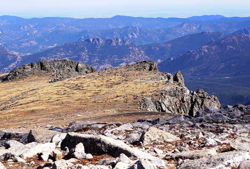
At the top, it will make sense how Flattop Mountain got it's name. It's less of a peak and more of a broad field of tundra and rock. But the effort to get to the top is worth the views. Hikers can see the Mummy Range to the North as well as Lumpy Ridge. To the Southeast lay peak after jagged peak, with Longs Peak's leaden north face set against the sky.
From the top of Flattop Mountain, hikers can follow a trail through the tundra to the true peak of Hallett, which is approximately .4 mile away to the south with another approximately 400' in elevation gain. Be sure to read the tips section below for making this hike up Flattop Mountain as there are a few important aspects to this more demanding hike in Rocky Mountain National Park.
Tips & Resources for Hiking to Flattop Mountain in RMNP
- Start early in the morning: Afternoon thunderstorms appear suddenly during the summer hiking season. For this reason, hikers are urged to start early enough to be down off the mountain by early afternoon. Many people have ignored this and been caught in really nasty, weather up on this trail. There have been weather-related fatalities here.
- Take it Easy: It's a demanding walk up Flattop, and should not be approached as a sprint to the summit. Be sure to pace yourself and take breaks as needed.
- Layer: It gets colder as you hike toward the top of Flattop. Be sure to have warm clothing. Hikers are also very exposed to the sunlight and risk sunburn, so be sure to wear sunscreen.
- Food & Water: It probably goes without saying, but be sure to bring plenty of snacks and water to fuel your body for this demanding hike.
- Trekking Poles & Traction Devices are Recommended in Spring and Winter: During this time of year, there can be patches and even longer segments of snow and ice on the trail. Because of this, we recommend Trekking Poles and/or Traction Devices for this trail.
- Trail Map for Bear Lake Corridor: Trail Map Link
- Packing List: Always pack the 10 Essentials. Download our Hiking Guide to get list and dayhiking packing checklist.
- Colorado Road Conditions: Colorado Road Conditions
- Photo: We would like to express our gratitude to Dick Rochester for sharing such an amazing photograph of this hike to Flattop Mountain in RMNP.
- After the Hike: Baba's Burgers & Gyros
Weather
Map & Driving Directions
Click for Driving Directions
Grace Falls Hike in Rocky Mountain National Park
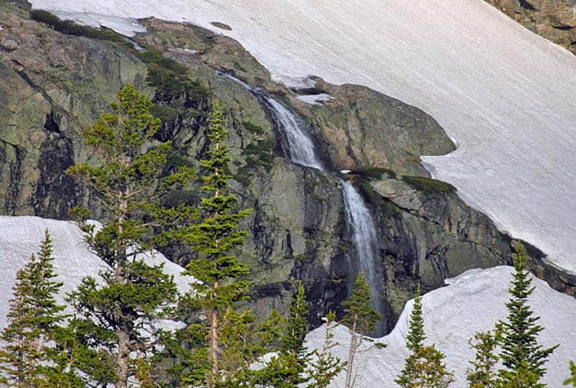
The hike to view Grace Falls, high in the rock cliffs and ledges of Odessa Gorge, is one of several waterfalls and scenic waypoints along the Fern Lake Trail. Grace Falls drops nearly a hundred feet from Notchtop Mountain, tumbling over a series of ledges, eventually making its way into Fern Creek. Explore the full Grace Falls hike profile below for trail map, driving directions, and more of the details and tips you need to enjoy this adventure in Rocky Mountain National Park.
Note: Rocky Mountain National Park now requires timed entry permits from May 27th through October 10th. See the RMNP permits page for more information.
Trail Snapshot: Grace Falls in Rocky Mountain National Park
| Hike Distance | 12+ miles Round Trip (from Fern Lake TH) |
|---|---|
| Difficulty | Difficult |
| Duration | Approx 7 to 8 hr Round Trip |
| Trail Type | Out and Back |
| Starting Elevation | 8155' |
| Elevation Gain | Approx. +2355' |
| Seasons | Spring through Fall |
| Dogs | Prohibited in RMNP |
| Hike Trail Map | Click for a Map of Bear Lake Corridor |
| Recommended Trail Map with Location of Grace Falls | National Geographic Trails Illustrated Map |
| Denver Drive Time | 1 hr 40 min |
| Driving Directions to Fern Lake Trailhead | Click for Google Map |
| Driving Directions to Fern Lake Bus Stop Parking | Click for Google Map |
| Driving Directions to Park & Ride Trailhead | Click for Google Map |
| Town Nearest Hike | Estes Park, Colorado |
| Beauty | Sub-alpine lakes, mountain views, river, wildflowers, aspen trees, ponderosa pine, waterfalls, wildlife: Abert's squirrel, elk, deer, moose, duck, bear |
| Activities | Picnicking, hiking trails, snowshoeing |
| Fee | Park Pass Required |
Parking & Trailhead Information for Grace Falls in RMNP
Parking is more limited in this area of Rocky Mountain National Park, and you'll likely have to park at the Park & Ride then take the shuttle to the Fern Lake Trailhead. You'll find driving directions above to The Fern Lake Trailhead (closest to this hike), the Fern Lake Bus Stop Parking area (very limited parking), and for the Park & Ride lot. See the RMNP Shuttle page for dates and times of service. Avoid parking along Fern Lake road as this damages the road side. If you park or are dropped off at the Fern Lake Bus Station, the hike from the station to the trailhead will add and additional .8 mile, one-way, to your hike.
The Hike: Grace Falls in RMNP
The journey up to view Grace in Falls Rocky Mountain National Park takes hikers past or near 5 different waterfalls and several other scenic sites. Refer to the sites and waypoints list below for the full set. Because the last stretch of trail from the western shore of Odessa lake to Grace Falls is unmaintained and difficult to discern, the falls are best viewed from the stretch of trail between Odessa and Lake Helene (more detailed directions are below).
Grace falls freezes over in the winter, attracting ice climbers to the area. The size of the falls and volume depends very much on the melting snowpack from Ptarmigan Glacier. The best time of year to view the falls is in the Spring-Early Summer. The area near the base of Grace Falls is prone to avalanches--especially during this time of year--which is another good reason to elect to view Grace Falls from the Fern Lake trail, rather than attempting the difficult hike and scramble to its base.
The best place to view Grace Falls is about .8 mile beyond the Odessa Lake junction where the trail begins to climb toward the top of Odessa Gorge making its way toward Lake Helene. This brings the journey to approximately the 6 mile point, or 12 miles round trip. An alternative and very scenic return route is to continue on the trail until it joins up with the Flattop Trail connector which leads east and down into the Bear Lake Trailhead. This makes for a 9.6 mile total hike. At the Bear Lake Trailhead, a shuttle system can transport hikers back to the Fern Lake bus stop. If you are considering this option, be sure to check the shuttle times and details. At the time of this writing, a shuttle transfer at the park-n-ride will be necessary to get back to the Fern Lake bus stop.
Sights & Waypoints Along the Fern Lake Trail:
- Windy Gulch Cascades - @.4 mile from Fern Lake Trailhead
- Arch Rocks - @1.5 miles from Fern Lake Trailhead
- The Pool - @1.7 miles from Fern Lake Trailhead
- Fern Falls - @2.7 miles from Fern Lake Trailhead
- Fern Lake - @3.9 miles from Fern Lake Trailhead
- Odessa Lake - @4.9 miles from Fern Lake Trailhead
- Grace Falls Viewpoint - @ approx. 6 miles from Fern Lake Trailhead
Tips & Resources for Hiking to Grace Falls Viewpoint in RMNP
- TIP: It is advisable to arrive early at the Fern Lake Trailhead as parking is limited. If the lot is full, the best option is to use the park-n-ride shuttle that drops you off at the bus stop near the Fern Lake trailhead.
- Begin Early: As with all longer hikes in the Colorado Mountains, it's important to start very early in the morning to avoid the thunderstorms that form in the early afternoon.
- Trekking Poles & Traction Devices or Snowshoes are Necessary in Spring and Winter: During this time of year, there can be patches and even longer segments of snow and ice on the trail. Because of this, we recommend Trekking Poles and/or Traction Devices for this trail. Snow it thick above Fern Lake until Mid-Summer, because of this snowshoes are also recommended.
- Recommended Trail Map with Location of Grace Falls: National Geographic Trails Illustrated Map
- Packing List: Always pack the 10 Essentials. Download our Hiking Guide to get list and dayhiking packing checklist.
- Colorado Road Conditions: Colorado Road Conditions
- Photo: We would like to express our gratitude to Stacey Bender for sharing such an amazing photograph of this hike to Grace Falls in RMNP.
- After the Hike: Baba's Burgers & Gyros
Weather
Map & Driving Directions
Click for Driving Directions
Marguerite Falls in Rocky Mountain National Park
Marguerite Falls is a set of casacades with upper and lower leaps, just below Fern Lake in Rocky Mountain National Park. After the 3.9 mile hike up to Fern Lake, a social trail leads into the woods along Fern Creek to the falls. Explore the full Marguerite Falls hike profile below for trail map, driving directions, and more of the details and tips you need to enjoy this adventure in Rocky Mountain National Park.
Note: Rocky Mountain National Park now requires timed entry permits from May 27th through October 10th. See the RMNP permits page for more information.
Trail Snapshot: Marguerite Falls in Rocky Mountain National Park
| Hike Distance | 7.8+ miles Round Trip (from Fern Lake TH) |
|---|---|
| Difficulty | Moderate |
| Duration | Approx 5hr Round Trip |
| Trail Type | Out and Back |
| Starting Elevation | 8155' |
| Elevation Gain | Approx. +1285' |
| Seasons | Summer through Early Fall |
| Dogs | Prohibited in RMNP |
| Hike Trail Map | Click for a Map of Marguerite Falls RMNP |
| Recommended Trail Map with Location of Marguerite Falls | National Geographic Trails Illustrated Map |
| Denver Drive Time | 1 hr 40 min |
| Driving Directions to Fern Lake Trailhead | Click for Google Map |
| Driving Directions to Fern Lake Bus Stop Parking | Click for Google Map |
| Driving Directions to Park & Ride Trailhead | Click for Google Map |
| Town Nearest Hike | Estes Park, Colorado |
| Beauty | Sub-alpine lakes, mountain views, river, wildflowers, aspen trees, ponderosa pine, waterfalls, wildlife: Abert's squirrel, elk, deer, moose, duck |
| Activities | Picnicking, hiking trails, snowshoeing, fishing, photography |
| Fee | Park Pass Required |
Parking & Trailhead Information for Marguerite Falls in RMNP
Parking is more limited in this area of Rocky Mountain National Park, and you'll likely have to park at the Park & Ride then take the shuttle to the Fern Lake Trailhead. You'll find driving directions above to The Fern Lake Trailhead (closest to this hike), the Fern Lake Bus Stop Parking area (very limited parking), and for the Park & Ride lot. See the RMNP Shuttle page for dates and times of service. Avoid parking along Fern Lake road as this damages the road side. If you park or are dropped off at the Fern Lake Bus Station, the hike from the station to the trailhead will add and additional .8 mile, one-way, to your hike.
The Hike: Marguerite Falls in RMNP
After hiking the 3.9 miles up to Fern Lake from the Fern Lake Trailhead--see the full Fern Lake Trail Profile--a social trail can be found just before the bridge that crosses over where Fern Creek pours out of Fern Lake.
The social trail down to Marguerite Falls is just to the left before crossing the footbridge.
The social trail is steep at first, then weaves through a tangle of trees along Fern creek. Hikers should exercise caution, especially when the meltwater is high and the creek is swift. The trail may quickly become difficult to discern and hikers may need to navigate their way alongside the creek until the the cascades come into site.
Marguerite Falls has two sets of cascades, the first, upper leaps, are located about 1/10th of a mile downstream from the lake. The second are approximately 1/10th of a mile further downstream.
The best route back is to trace the creek back up to the mouth of Fern Lake where it meets up with the main Fern Lake Trail.
Tips & Resources for Hiking to Marguerite Falls in Rocky Mountain National Park
- TIP: Parking fills up fast. To avoid having to take the shuttle, we advise arriving at the Fern Lake Trailhead before 7:30 AM
- Trekking Poles & Traction Devices are Recommended in Spring and Winter: During this time of year, there can be patches and even longer segments of snow and ice on the trail. Because of this, we recommend Trekking Poles and/or Traction Devices for this trail.
- Bring a snack or picnic lunch: The rocks near the Big Thompson River and the shores of Fern Lake can be a great place for picnics. Plus, you're going to need some fuel for this hike.
- Trail Map for Bear Lake Corridor: Trail Map Link
- Packing List: Always pack the 10 Essentials. Download our Hiking Guide to get list and dayhiking packing checklist.
- Colorado Road Conditions: Colorado Road Conditions
- After the Hike: Baba's Burgers & Gyros
Weather
Map & Driving Directions
Click for Driving Directions