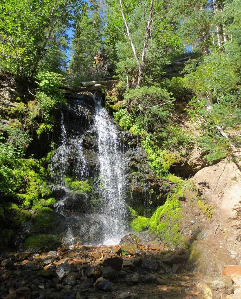
The Pole Creek Falls trail near Granby, Colorado is an easy out-and-back destination hike to a waterfall that courses down a huge dark slab of moss-covered rock. Purple mountain asters and active beaver dams can be observed along this family-friendly trail. Explore the full Pole Creek Falls hike profile below for trail map, driving directions, and more tips and details to help you enjoy this adventure near Granby.
Trail Snapshot: Pole Creek Falls Trail near Granby, Colorado
| Hike Distance | 2.2 miles Round Trip |
|---|---|
| Difficulty | Easy |
| Duration | Approx 1 Hour |
| Trail Type | Out and Back and Loop |
| Starting Elevation | 8925′ |
| Elevation Gain | Approx Total +400′ on Loop |
| Seasons | Year Round |
| Dogs | Allowed On Leash |
| Hike Trail Map | Click for a Pole Creek Falls |
| Denver Drive Time | 1 Hour 50 Min |
| Driving Directions to Pole Creek Falls Trailhead | Click for Google Map |
| Town Nearest Hike | Frasier, Colorado |
| Beauty | creek, buckwheat, larkspur; wildlife: beaver, brook trout, moose, bear |
| Activities | Hiking, photography |
| Fee: | Free for YMCA of the Rockies Members and Paid Guests or Day-Pass purchase required (see details below) |
Parking, Trailhead, & Fee Information for Pole Creek Falls Hike
The trailhead for Pole Creek Falls is located on the YMCA Snow Mountain Ranch property just south of Granby, Colorado. To start out from Denver, take Interstate 70 to Highway 40. Highway 40 is a windy drive up and over Berthoud Pass, but the views make it worthwhile. You have the option of stopping at the top of Berthoud Pass to take in the alpine landscape. Then, stay on Hwy 40 through Winter Park, Fraser, and Tabernash. Turn left onto CR 53 (a sign for Snow Mountain Ranch will mark the road). As you drive into the property, look for the flagpole. This will mark your first stop, which is the Program office, the building immediately to the right of the flagpole/stone marquee entrance sign. This is where you’ll need to purchase your day-pass (one for each person).
So, this is the real thing you have to consider for this hike: Is it worth the cost? The day-pass fees are $20 per adult and $10 per child 6-12. Kids 5 and under are free. The day-pass gets you access to all the hiking trails, biking trails, rec center, mini-golf, and swimming pool. However, if you’re a guest at the ranch and paying for lodging, your day-use is included in the price.
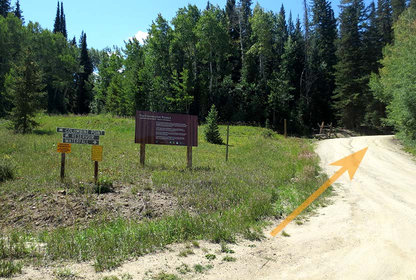
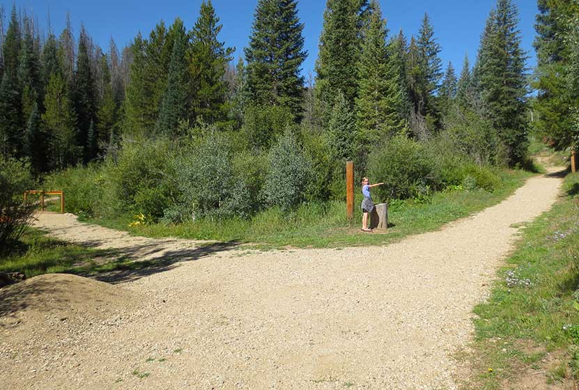
After getting your passes, drive back out and turn right onto CR 53. Stay on CR53 as it turns into a dirt road and passes the riding stables. Just after the stables it will bear left (you’ll notice on the Google map that the road name at this point is CR53/Blue Ridge Rd). At the fork, there will be signage for the waterfall trailhead that points you to the right (see photo below).
The trailhead parking is just a short distance further down the road from this fork. Here you’ll find a toilet, picnic tables, and trash receptacles.
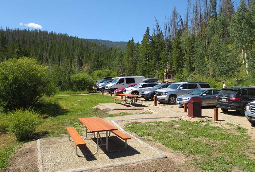
The trailhead is located at the end of the parking area on the right-hand side of the lot (pictured below).
Pole Creek Falls Trailhead
The Hike: Pole Creek Falls Trail
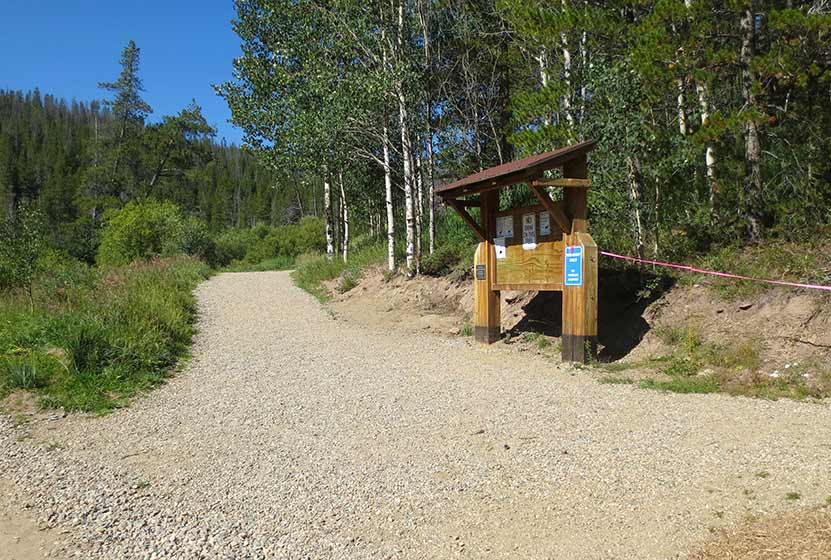
My oldest daughter and I hiked to Pole Creek Falls in the middle of August, and the falls were still at a nice flow. I would think that the waterfall really gushes in the late-Spring and early-Summer. The trail was gradual and enjoyable all the way up to the falls. Early on the trail, hikers will encounter a fork with a small footbridge to the left (picture below). Here you’ll want to bear right to keep on the main trail.
Eventually, the trail will enter a wooded area and cross over a couple footbridges as it follows Pole Creek up to the base of the waterfall.
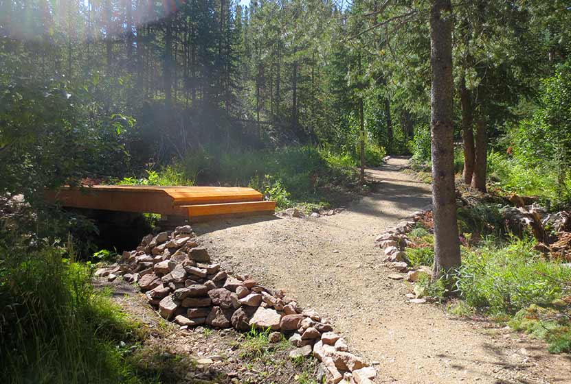
Finally, the bridge pictured above, hikers will stay on the right-hand trail segment to access the base of the falls. The trail to the left leads around to a higher viewing area, but the best views of the waterfall are at the bottom.

Tips & Resources for Hiking the Pole Creek Falls Trail
- TIP: After paying the daily access fee at the Program building in YMCA of the Rockies at Snow Mountain Ranch, obtain a map which leads to the trailhead along Blue Ridge Road, and marks the other trails on the property.
- TIP: Wear Sunscreen as much of this hike is without shade.
- Trail Map: Pole Creek Falls Trail near Granby
- Packing List: Always pack the 10 Essentials. Download our Hiking Guide to get the list and dayhiking packing checklist.
- Colorado Road Conditions: Colorado Road Conditions
- After the Hike: The Ditch in Winter Park
Weather
Map & Driving Directions
Click for Driving Directions