Eldorado Canyon State Park Hikes
Eldorado Canyon State Park is a hiking and climbing Mecca tucked into the Front Range near Boulder and Denver, Colorado. In this hiking profile of Eldorado Canyon, we quickly give you the 4 main trails and some tips for your time in the canyon. Explore the full trail profile below to get all the details.
Trail Snapshot: Hiking In Eldorado Canyon
| Hike Distance | 4 Trails: .5 mile to 3.5 miles (one way) |
|---|---|
| Difficulty | Easy to Moderate |
| Duration | 1-2.5 hrs |
| Trail Type | Out and Back |
| Seasons | Spring, Summer, Fall |
| Dogs | Allowed on Leash |
| Hike Trail Map | Click Here for a Map of Eldorado Canyon State Park |
| Denver Drive Time | 45 min |
| Directions | Click for Google Map |
| Town Nearest Hike | Eldorado Springs, Colorado |
| Beauty | Canyon, Cascades, Cliff Swallows, Cliff-Top Views, Geologic Features |
| Activities | Picnic Areas, Horseback Riding, Mountain Biking, Rock Climbing, Fishing |
| Video | Click For Video |
| Fee | Link to Fees Page |
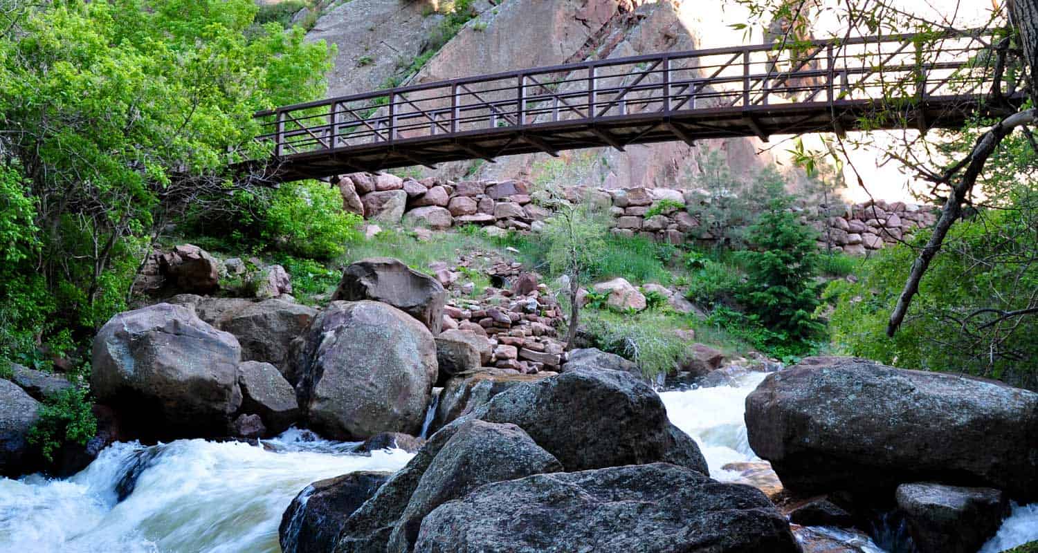
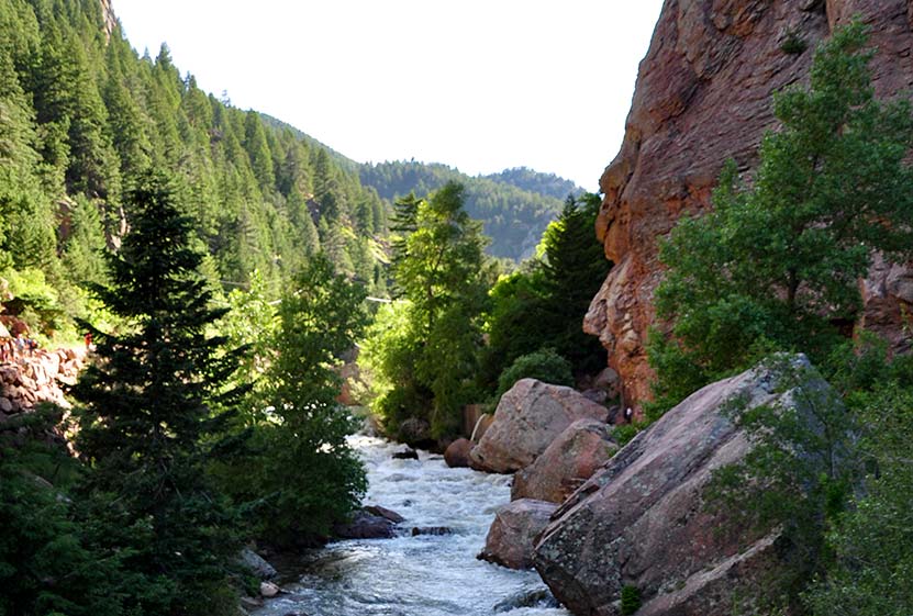
Eldorado Canyon is an oasis just about 45 minutes from Denver. Kids will love hiking over rocks along the streamside trail, peering into caves, and gazing up at the climbers on the towering canyon walls. The park features one of the best picnic areas in the state with shallow areas of boulder creek which quickly fill with kids. Close attention is needed in any situation involving water and children. South Boulder Creek can be swift, especially after rains and during the early melts. During these times, the canyon gushes and roars. The sounds are as great as the views.
Fishing at Eldorado Canyon State Park could potentially yield you fish that are eight inches to an average about eight inches to about twenty inches long. For a more detailed guide on fishing here, check out the one at Colorado Parks and Wildlife here.
There is no camping at Eldorado Canyon State Park, although there are nearby areas to do so.
4 Trail Options in Eldorado Canyon State Park
#1 - The Streamside Trail is the shortest (.5 mile one way) and follows close to the sides of the creek and canyon walls.
#2 - The Fowler Trail takes you .7 miles (one way) and provides great views of the canyon.
#3 - The Rattlesnake Gulch Trail is more difficult, traveling 1.4 miles up to the ruins of the Crags Hotel that burned to in 1912. Another trail goes from the hotel another .8 mile loop and features a view of Colorado's continental divide.
#4 - The Eldorado Canyon Trail is the longest, 3.5 miles (one way), eventually intersecting with the Walker Ranch Loop Trail.
Tips & Resources for Hiking Eldorado State Park:
- Go On a Weekday: Eldorado Canyon is a climbing mecca and can reach capacity on the weekends.
- Picnic: There is a great picnic area at the back of Eldorado Canyon, so pack a lunch or dinner for after the hike.
- Driving Note: Take care in driving through the town of Eldorado Springs, there are many bikers, pedestrians, and pot holes!
- After the Hike: Ozo Coffee in Boulder, Colorado
- Trail Map for Eldorado Canyon State Park: Trail Map Link
- Climbing in Eldorado Canyon
- Colorado Road Conditions: Colorado Road Conditions
Weather
Map & Driving Directions

South Valley Park Trails
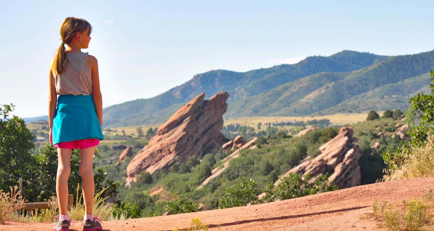
The trails of South Valley Park are perfect for an after work hike or run in South Denver. The expansive valley near the neighborhood of Ken Caryl is enclosed on its eastern side by the exposed red rock formations of the hogback and the green foothills to the west. Views to the south are incredible, making South Valley Park especially enchanting during the early morning hours and at twilight.. Explore the full hiking profile below for full trail details, driving directions and more.
Trail Snapshot: South Valley Park Trails
| Hike Distance | 0.5 mile to 3 miles |
|---|---|
| Difficulty | Easy |
| Duration | Approx 1 to 2 hrs |
| Trail Type | Out & Back and Loop |
| Seasons | All Year |
| Dogs | Allowed On Leash |
| Hike Trail Map | Click for a Map of South Valley Park Trails |
| Denver Drive Time | 30 min |
| Driving Directions to South Valley Park Trails | Click for Google Map |
| Town Nearest Hike | Littleton, Colorado |
| Beauty | Red rock formations, meadows, elk, deer, birdwatching, great sunsets |
| Activities | Hiking, horseback riding, mountain biking |
| Video | Click For Video |
Red Rock towers along the eastern wall of South Valley Park and the foothills begin to the west. Almost 1000 acres of meadow and rock offer a near perfect escape from the sounds of the city. The time lapse below shows a great example of a South Valley Park sunrise.
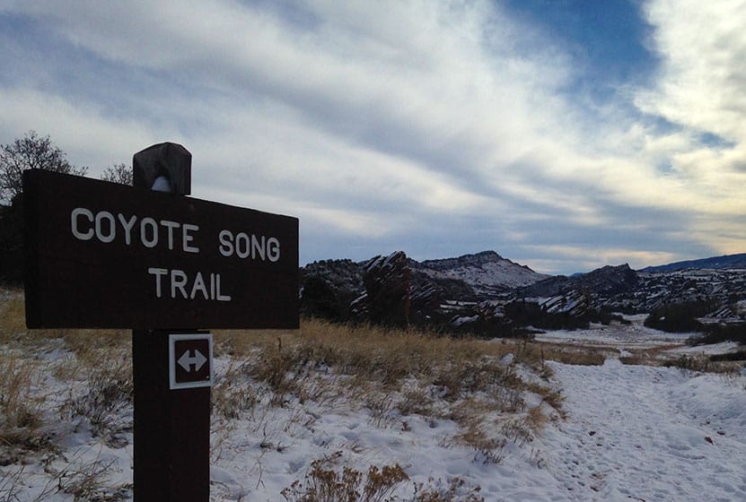
6 Trails wind through the park. The best place to start is with the South Valley Park Coyote Song Trail. It's a an out an back trail that takes you right through the main meadow. It also connects with the Swallow Trail to form a loop, making your hike about 1.8 miles. The Lyons Back Trail takes you from the Coyote Song Trail and up over the red rock where you can hike trails developed by the Ken-Caryl Ranch foundation.
Tips & Resources for Hiking South Valley Park Trails :
- Don't miss the Coyote Song Trail: The sunsets are wonderful and the park tends to be quiet in the evenings. The Coyote Song Trail is a great way to begin or wind down the day.
- TIP: The Parking area on our map link is the larger of the two. However, you can also begin at the south lot off of Deer Creek Canyon Road. Click here for directions. This gives you a closer connection to the Elk Grazing Trail (seasonal) area and Deer Creek Canyon Park.
- TIP: The red rock calls to be climbed, but climbing is prohibited in this park.
- South Valley Park Trail Map: Trail Map Link
- Colorado Road Conditions: Colorado Road Conditions
- After the Hike: Atlas Coffee in Littleton
Weather
Map & Driving Directions
Click for Driving Directions
