Booth Creek Falls is a 60-foot waterfall located in the Eagles Nest Wilderness near Vail, Colorado. The journey to the waterfall requires a strenuous, 2-mile hike along the banks of Booth Creek. Explore the full Booth Creek Falls hike profile below for trail map, driving directions, and tips and details to help you enjoy this adventure near Vail.
Trail Snapshot: Booth Creek Falls Near Vail
| Hike Distance | 4 miles Round Trip |
|---|---|
| Difficulty | Moderate |
| Duration | Approx 2-3 hrs |
| Trail Type | Out and Back |
| Starting Elevation | 8460′ |
| Elevation Gain | Approx +1290′ |
| Seasons | March to October |
| Dogs | Allowed On Leash |
| Hike Trail Map | Click for a Map of Booth Creek Falls |
| Denver Drive Time | 2 hr |
| Driving Directions to Booth Creek Falls Trailhead | Click for Google Map |
| Town Nearest Hike | Vail, Colorado |
| Beauty | Waterfall, Lake, Cascades, Creek, Aspen Trees, Wildflowers |
| Activities | Hiking, Photography, Birding |
Parking & Trailhead Information for Booth Creek Falls Hike
To get to the Booth Creek Falls Trailhead from Denver, follow interstate 70 West until you reach East Vail. Take exit 180. At the first intersection, make a right, then an almost immediate left onto the I-70 Frontage Road. After about 1 mile on Frontage road, turn right onto Booth Falls Road. Follow Booth Falls road for about 1/4 mile until it terminates at the trailhead parking area. Space is limited and the trailhead parking likely fills early in the day. The trailhead is near a residential area so please be courteous of those living in the vicinity.
The Hike: Booth Creek Falls Hike
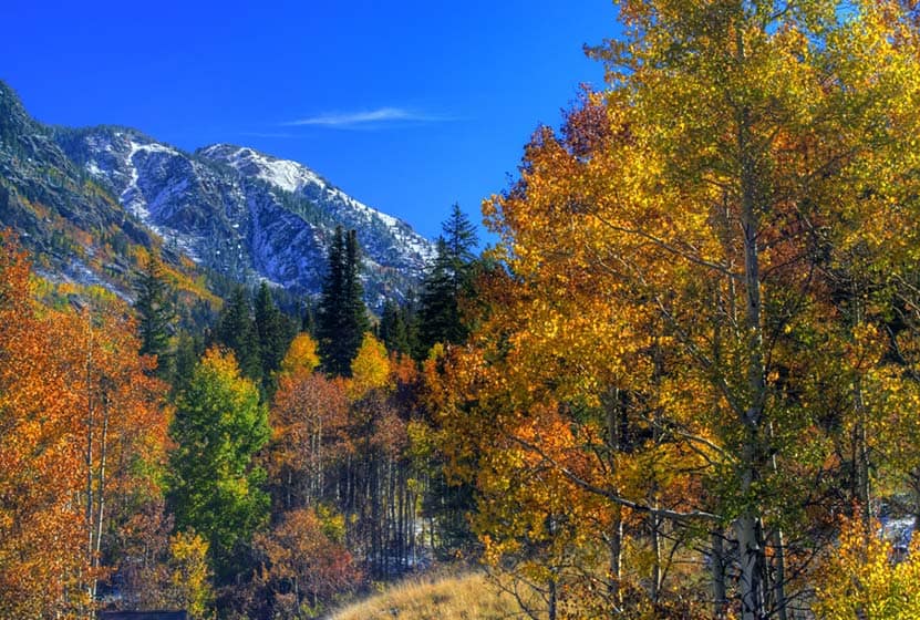
From the trailhead, the trail starts at a steep incline as it follows the course of Booth Creek and passes through the aspen forests and glades of wildflowers that make this part of Colorado famous. In the fall, the changing leaves of the aspens make this hike a favorite. The trail continues on this steady ascent for the first mile, then becomes more gradual.
At around 1.8 miles be on the lookout for a trail sign indicating a side-trail for Booth Creek Falls. You may opt to view the falls from the overlook or proceed down the social trails for a closer experience of the falls. Exercise caution, however, because the area around the falls is steep and social trails are not maintained. As with all trails, conditions can change quickly after rains and weather.

Tips & Resources for Hiking Booth Falls Hike
- TIP: The trailhead may not be directly visible from the parking lot, so walk up the road and find it. It will be located just past the gate.
- TIP: Hike further up the trail to Booth Lake. This adds 2.4 miles (round trip).
- Trail Map: Booth Creek Falls Map
- Packing List: Always pack the 10 Essentials. Download our Hiking Guide to get the list and dayhiking packing checklist.
- Colorado Road Conditions: Colorado Road Conditions
- Photo: We would like to express our gratitude to Shannon Dizmang and Brandon Bombaci for sharing such an amazing photograph of this hike to Booth Falls.
- After the Hike: Loaded Joe’s
Weather
Map & Driving Directions
Click for Driving Directions


