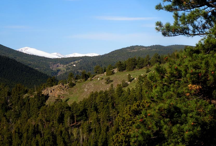
Windy Peak is a summit hike in Golden Gate Canyon State Park. A moderate to difficult 6.4-mile loop hike that follows meltwater creeks, crosses green meadows replete with wildflowers, and offers great views at the summit of the snow-capped Rocky Mountains in the West. Explore the full Windy Peak Hike profile for trail map, driving directions, and many of the details you need to enjoy this adventure in Golden Gate Canyon State Park.
Trail Snapshot: Windy Peak in Golden Gate Canyon State Park
| Hike Distance | 6.4 miles Round Trip |
|---|---|
| Difficulty | Moderate |
| Duration | Approx 2-3 hrs |
| Trail Type | Lollipop-Loop with Spur to Summit |
| Starting Elevation | 7860′ |
| Elevation Gain | Approx +1300′ |
| Seasons | Best hiked May to October |
| Dogs | Allowed on 6′ Leash |
| Hike Trail Map | Click for a Map of Golden Gate Canyon Trails |
| Denver Drive Time | 50 min |
| Driving Directions to Bridge Creek Trailhead | Click for Google Map |
| Town Nearest Hike | Golden, Colorado |
| Beauty | Panoramic views of snow-capped mountains, wildflowers, meadow, spruce, aspen |
| Activities | Hiking, photography, snowshoeing in winter, picnic area |
| Fee | Colorado State Parks Pass Required |
Parking & Trailhead Information for the Windy Peak Hike
From Denver, take US-6 West to Golden. Just outside Golden, US-6 will turn left (West) into Clear Creek Canyon; it’s at this intersection that you’ll continue North (not turning left) on 93. After 1.3 miles on 93, turn left onto Golden Gate Canyon Road. Now, prepare for the rest of your drive being pretty windy. About 4 miles down Golden Gate Canyon Road, you have the option of taking Crawford Gulch road to the Right or to stay on Golden Gate Canyon Road. Both routes will get you there.
I believe that Google Maps from Denver is going to default to Crawford Gulch Road. Do take your time and be alert for cyclists and motorcycles, especially on the weekend, as both Golden Gate Canyon Road and Crawford Gulch Roads are popular roads for riding. Eventually, Crawford Gulch Road will turn into Drew Hill Road, which runs through the heart of Golden Gate Canyon State Park. If you decide to take the Golden Gate Canyon Road option, it will intersect with Crawford Gluch/Drew Hill at the visitor center (on your right, just after the intersection on Crawford Gulch). If you take this route, the Bridge Creek Trailhead will be 2.3 miles down the road and on your left (north). One last thing to note is that Crawford Gulch Road has yet one more name, Ralston Creek Road. So, if you see that on any signage, just know you are on the right track.
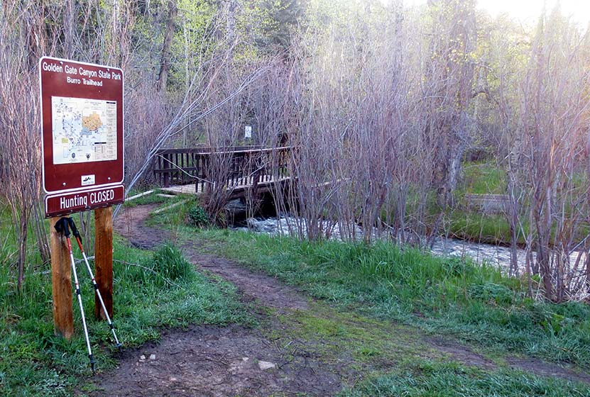
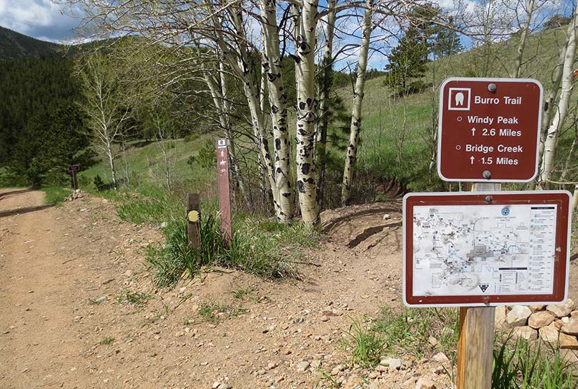
The Bridge Creek Trailhead is a bit unusual because it’s composed of several parking areas along the on the north side of the road. However, all parking areas have trails that will lead hikers to the footbridge that crosses the trail and serves as the official start of the Burro trail and this hike. A sign (pictured above) reads “Burro Trailhead.”
The Hike: The Windy Peak Hike in Golden Gate Canyon
This is a Lollipop-loop trail with a spur trail at the end that leads up to the summit. There are several trail junctions, which can make this the route a bit confusing. I’ve provided photos below of the trail junctions, but it’s important to remember that weather can change the landscape and signage. The description here hikes the loop portion of the trail in a clockwise direction. We’ve classified this as moderate/medium in difficulty. However, its right on the edge because of the over 1000′ elevation gain and more than 5 miles of trail. For some, this will be difficult. It’s also on our list of dog-friendly hikes, but it’s important to know that the peak is all rocky terrain that may be a bit tough on your dog’s paws. As always, if you are taking your best friend, be sure to keep them on a leash out of respect for the wildlife, environment, and other hikers.
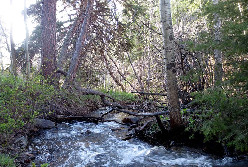
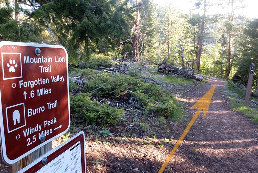
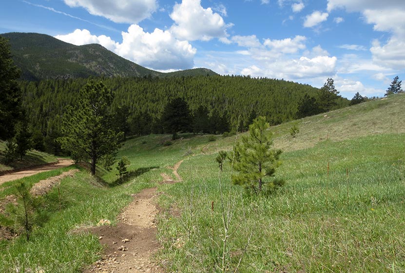
After crossing Ralston Creek, the trail makes its way up a gentle slope into the trees. At the first trail junction, stay on the Burro Trail (left). The second trail junction leads either straight on the Mountain Lion Trail to Forgotten Valley or right toward Windy Peak on the Burro Trail. The trail will make its way along a creek. Look for Calypso flowers, also called Pink Lady Slippers in this area. They grow along the creeks in Golden Gate Canyon State Park.
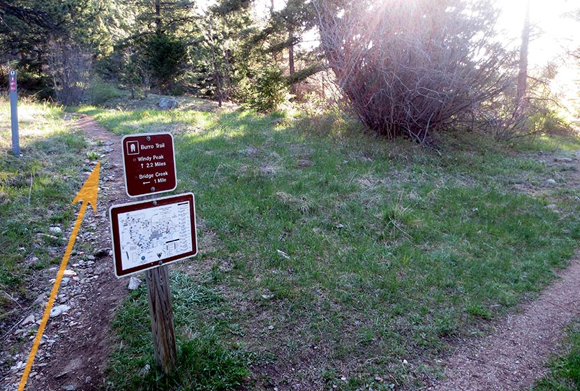
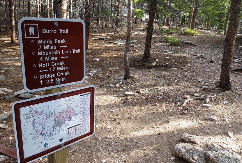
The loop begins at the third junction (pictured above), the way up to Windy Peak is clearly marked as the left-hand trail. From this point, it’s 2.2 miles to the peak. Here the trail begins a steeper climb through an area with prominent chalk colored cliffs.

As you gain altitude, you’ll gain views out to the Continental Divide rising above the green foothills of Golden Gate. The trail will then enter the shade of lodgepole forest.
At the top of the loop, hikers will encounter the junction for the .7 mile spur trail that leads to the summit of Windy Peak (pictured below). There will be one more sign pointing the way at 0.4-mile below the summit.
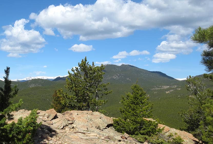
The summit of Windy Peak is one of my favorite places to read and journal. Be sure to bring a picnic lunch with you, because you’ll want to spend some time here resting and refueling for the hike back to the trailhead. The spur trail will lead back to the main Burro loop trail. At this point, you can return the way you hiked in to the spur trail (a slightly shorter way back), or continue on the rest of the loop toward Nott Creek. The landscape on this back end of the loop is riddled with wildflowers, so it’s well worth doing the full loop hike.
The trail will weave its way down into a valley with a dirt service road. Here, hikers will want to follow the Burro trail towards the Bridge Creek Trailhead as it makes its way on and off the service roads.
The trail will work its way through a green meadow, then along Nott creek, following it West until retracing the trails that lead back to Bridge Creek Trailhead.
Tips & Resources for Hiking to Windy Peak
- TIP: Don’t forget to bring food and water along this hike for refuelling.
- TIP: We advise picking up a paper map of Golden Gate Canyon State Park at the visitor center before embarking on this hike.
- Trail Map: Golden Gate Canyon Trail Map
- Packing List: Always pack the 10 Essentials. Download our Hiking Guide to get the list and dayhiking packing checklist.
- Colorado Road Conditions: Colorado Road Conditions
- After the Hike: Windy Saddle Cafe in Golden, Colorado
Weather
Map & Driving Directions
Click for Driving Directions to Bridge Creek Trailhead


