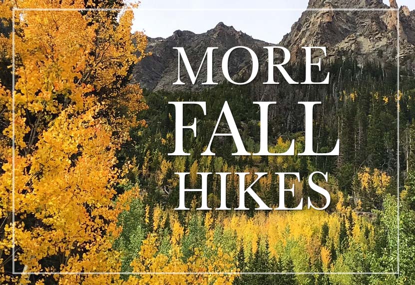
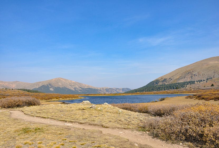
Kenosha Pass Hiking Trails
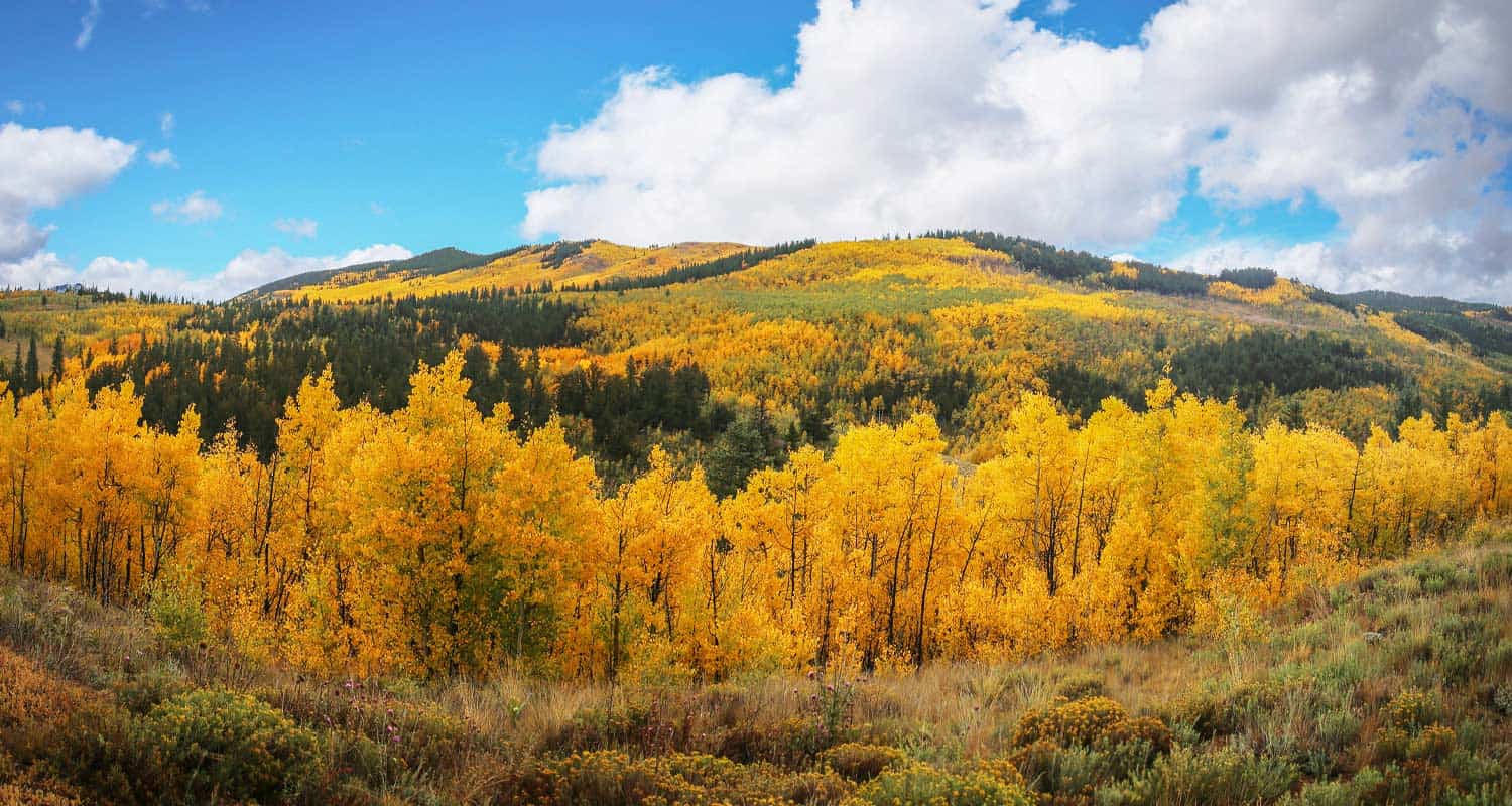
Kenosha Pass is probably the best place to view the changing aspens near Denver. It offers both an East and West trail option with gradual ascents to stunning views. Starting at 10,000' the initial elevation gain on the trails make for easy to moderately strenuous hikes, all depending on how far one decides to travel on these beautiful segments of the Colorado Trail. Vantage points can be accessed about 1/2 mile up both trails offering views down into the high country plains of South Park and out to the Rocky Mountains. Explore the full Kenosha Pass hike profile below for trail map, driving directions, and more tips and details to help you enjoy this Colorado hike.
Trail Snapshot: Kenosha Pass Colorado
| Hike Distance | <1 to 14.4 miles Round Trip |
|---|---|
| Difficulty | Easy to Moderate |
| Duration | Depends on Segment Hiked |
| Trail Type | Out and Back |
| Starting Elevation | 10,000′ |
| Elevation Gain | Approx +400' for shorter hikes |
| Seasons | Year Round |
| Dogs | Allowed On Leash |
| Hike Trail Map | Click for a Map of Kenosha Pass |
| Denver Drive Time | 1 hr 30 min |
| Driving Directions to Kenosha Pass East Parking Area | Click for Google Map |
| Town Nearest Hike | Grant, Colorado |
| Beauty | aspen groves, creek, wildflowers, mountain range views, views of South Park, wildlife: moose |
| Activities | Hiking, mountain biking, horseback riding, photography, snowshoeing, camping |
Parking & Trailhead Information for Kenosha Pass Hike
Kenosha Pass is located about 65 miles southwest of Denver along US 285. From Denver, take US 285 towards Bailey, Colorado. From Bailey, continue driving approximately 19 miles on 285 to the Kenosha Pass Trailhead. The trailhead parking area is located on both East (left when coming from Denver) and West (right side when coming from Denver) of 285. There is additional parking on the East side after crossing a cattle gate. Parking can get tight in the Autumn when the aspens are at their peak, so be considerate of others and the land as you park your vehicle. It's about a 90 minute drive from Denver. Restrooms can be found on both trailheads.
Hiking the Kenosha Pass Trail
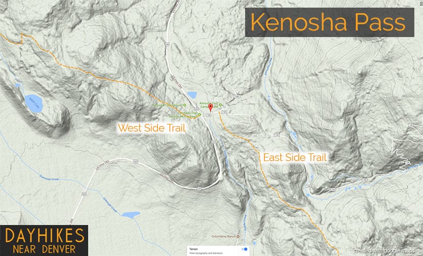
Two Hiking Options and Where the Trails Begin
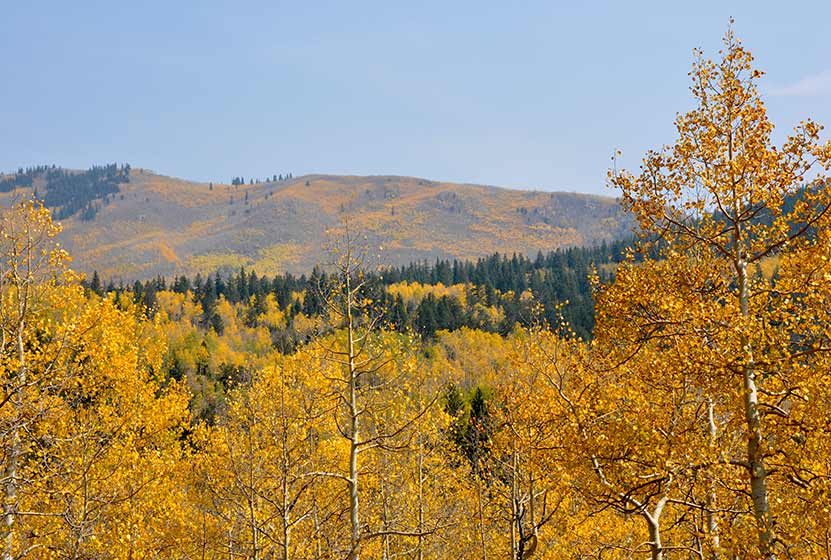
The hiking trails at Kenosha Pass easy to moderate in difficulty and can be done by hikers of all experience levels. At Kenosha Pass, the Colorado Trail, which goes from Denver to Durango, intersects with US Highway 285. This creates an East side trail option and an West side trail option. Both offer incredible views down into the South Park plains of Colorado and out to the often snow-capped peaks of the Mosquito Range.
Hiking the East Side of Kenosha Pass
Hikers can pick up the Colorado Trail after crossing the cattle gate (if parked along 285) and hiking along the dirt road that leads to the restrooms that are near the 2nd parking area (after the cattle gate). The Trailhead is located just before the 2nd parking area, and will be located on the right (south). While most visitors park, take a jaunt into the aspens, snap a few photos and leave, the more stunning views await those who venture further south along the trail. The initial trail segment enters with a gradual ascent into the aspens, then at 1/2 a mile into the hike the woods opens up to incredible views into South Park.
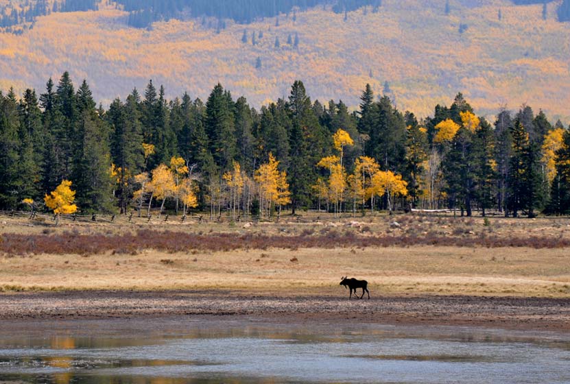
South Park is a high mountains plains area that stretches out mile-upon-mile to its western and norther mountain borders, the Collegiate Peaks and the Mosquito Range of the Rocky Mountains. The climb continues at a gradual pace and hikers will emerge to a second panorama at 1.5 miles. This is a great place to turn-around, making it into a 3 mile out-ant-back hike. Of course, hikers can continue on the trail all the way back into Denver, but that requires a multi-day backpacking trip. As always, keep eyes peeled for changing weather, and pack the 10 Essentials. If you are wondering what should be in your daypack, be sure to download our free Dayhike Hiking and Packing Guide. As for wildlife, moose are often spotted on this side along the lake near the trailhead.
Hiking the West Side of Kenosha Pass
The West Side Trail at Kenosha Pass can be picked up immediately on the West side of 285. The trail enters conifer and aspen forest, making a gentle climb toward the northwest until popping out of the trees to breathtaking views down into South Park and the Mosquito Range. After this viewpoint, the trail travels a short distance uphill, then makes its way down toward Guernsey Creek. The distance from the trailhead to Guernsey Creek is approximately 3 miles, making this a 6 mile out-and-back adventure. Because this is the Colorado Trail, it does continue west, offering multi-day backpacking options that lead all the way to Durango, Colorado.
Tips & Resources for Hiking the Kenosha Pass Trail
- TIP: Bring sunscreen for protection against the sun.
- TIP: One the east side of the highway, there is another parking lot with a lot of bathrooms.
- Trail Map: Map for Trailhead Locations
- Trails Illustrated Kenosha Pass Map: Trails Illustrated Map Link
- Packing List: Always pack the 10 Essentials. Download our Hiking Guide to get the list and dayhiking packing checklist.
- Colorado Road Conditions: Colorado Road Conditions
- Photo: We would like to express our gratitude to Ed Ogle for sharing such an amazing photograph of this hike on Kenosha Pass.
- After the Hike: The Shaggy Sheep
Weather
Map & Driving Directions to Kenosha Pass
Click for Driving Directions

First and Second Flatirons Hike in Boulder
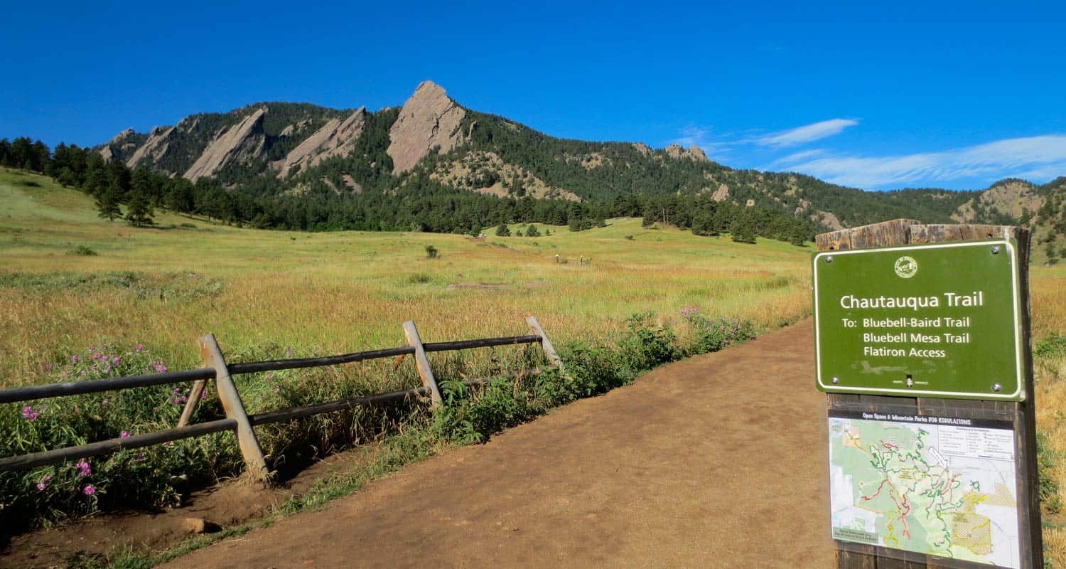
Hiking the Flatirons near Boulder, Colorado is a must. The trail draws you across an green meadow, then up through a notch between the First and Second Flatiron. You'll find the best part of this hike in the Flatirons at the end of the trail: some breathtaking and unmatched views of Colorado's Rocky Mountains. There's even more though. Explore the trail profile below to get links to the Flatirons map, hiking tips, trail details, and driving directions to the Chautauqua Park trailhead.
First and Second Flatiron Hike Trail Snapshot
| Hike Distance | 2.6 miles Round Trip |
|---|---|
| Difficulty | Moderate |
| Duration | Approx 2 hrs |
| Trail Type | Out and Back |
| Elevation Gain | +1400′ |
| Seasons | All Year |
| Dogs | Allowed on Leash |
| Hike Trail Map | Click for Map for Boulder Colorado's Flatirons Hike |
| Denver Drive Time | 45 min |
| Directions | Click for Google Map |
| Town Nearest Hike | Boulder, Colorado |
| Beauty | Views of Continental Divide, Expansive Meadows, Wildflowers, Flatirons Rock Formations, Cliffs |
| Activities | Hiking, Rock Climbing, Picnic Areas |
| Video | Click For Video |
The Flatirons are the most prominent feature of Boulder Colorado's landscape. They are beautiful to take in from a distance, but they are even better to explore. Here I'll give you a some options on how to make the most of the First and Second Flatiron trail, and some details on what to expect.
The Flatirons Trailheads at Chautauqua
#1 - Chautauqua Trailhead: You can start your hike from a couple different places. I chose Boulder's Chautauqua Park trailhead. The parking lot will fill up fast, by 8:30 on the weekend, but you can park along Baseline Road. The city of Boulder is doing some improvements on the parking area beginning September 3rd, 2013 and it looks like the lot will be closed. Here's a link for construction updates. But don't let that deter you, just park out on Baseline. The Chautauqua trailhead features an historic Ranger Cottage (link for hours of operation), and you'll find free trail maps for the flatirons in a box attached to the sign at the entrance to meadow.
#2 - Enchanted Mesa Trailhead: This is a lesser known trailhead (but probably well known by locals). Here's a google map to help you find it. From here, you can walk across to Chautauqua Park and pick up the Chatauqua Trail, or you can make a longer trip out of it by following the McClintock Upper Trail in. See the Chautauqua Area Hiking Map for details.
Get our Dayhikes Near Denver Hiking Guide. It includes our favorite hikes near Denver, packing lists, hiking food and snack ideas, and tips for hiking the Front Range of Colorado.
The Flatirons Panorama:
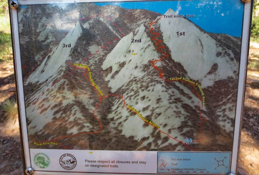
In the panorama video above, you'll see that the first flatiron is the most prominent. It's on the far right (North) and the second and third flatirons follow it to the south. There is an impressive canyon between the second and third flatirons that you'll get to peer down into towards the end of the trail. But let's start this hike profile at the trailhead.
The First Flatirons Trail Sequence
Here's the basic set of trails I'd recommend just because it's the most direct approach: Chautauqua Trail to First and Second Flatiron Trail. On the way back, I'd recommend the Bluebird Mesa trail; it takes you through a pine glade along the spine of a Bluebird Mesa, then gently drops back down to the Chautauqua trail near the trailhead. This makes for a roughly 2.5 mile hike.
Make it a loop. Deb Stanley details an interesting loop by taking a little known trail down the back side of the flatirons that hooks back into the Saddle Rock Trail. Looks like fun, but it also looks like it could be easy to get turned around in there if you're not careful. Check out the details on her loop trail profile if you're interested in taking this route.
First and Second Flatirons Hike Details
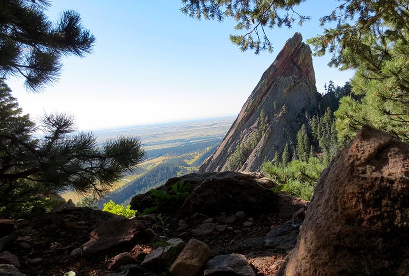
This photo gives you the best overview of the Flatirons one and two trail. Basically, once you break out of the meadow and start on the 1st and 2nd Flatirons trail, your going to ride the ridge of the 2nd flatiron up to a notch between the 1st and 2nd Flatirons. The trail continues behind the flatirons, then bends north and takes you up into a canopy formed by the back of the first flatiron.
 Starting at the Chautauqua Trail, you'll hike through the spectacular meadows at the base of the flatirons. If it's after a rain, be prepared for a lot of rain along what is essentially a fire road. The sides of the trail here have a good bit of poison ivy that tries to reach out and touch your calves, so keep an eye out for it. What I found most interesting about this section of the trail was the diversity of both plants and trees along the trail. There is a greater variety of deciduous trees and shrubs that I've seen anywhere on the front range.
After taking the Bluebird-Baird Trail (left), you'll encounter a fork in the trail. Follow the signage towards the 1st and 2nd Flatirons trail (see photo below). Soon the trail will fork again and you'll want to take the 1st and 2nd Flatirons trail. The signage is really good in the Chautauqua/Flatirons area.
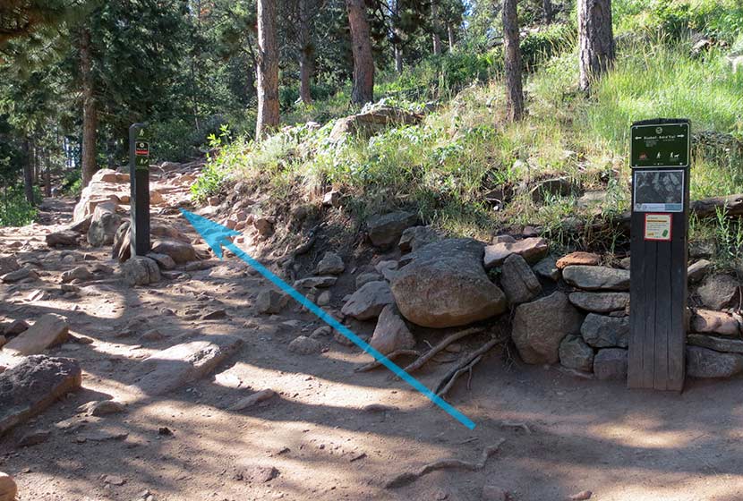
Emerging from the woods, you'll hike up through a long talus field, but the trail is well-constructed through this gigantic pile of rock. Be sure to look back at the views that open to Boulder.
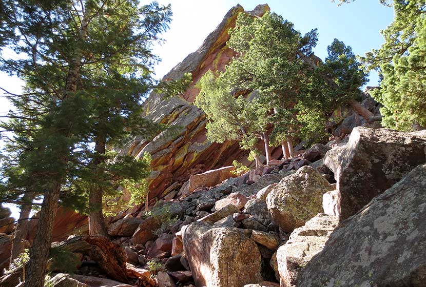
 The trail goes in and out of the shade, over a lot of rock, and eventually to a short scramble over some larger rock to regain the trail. The next landmark you'll reach is the notch between the first and second flatiron; you'll see the angled outcrop of the second flatiron just below the notch (photo below). This is a great place to stop and relax.
 The notch between the first and second flatiron offers more views of Boulder and a birds-eye view of the CU campus, it's terracotta roofs against the green of the city lawns.
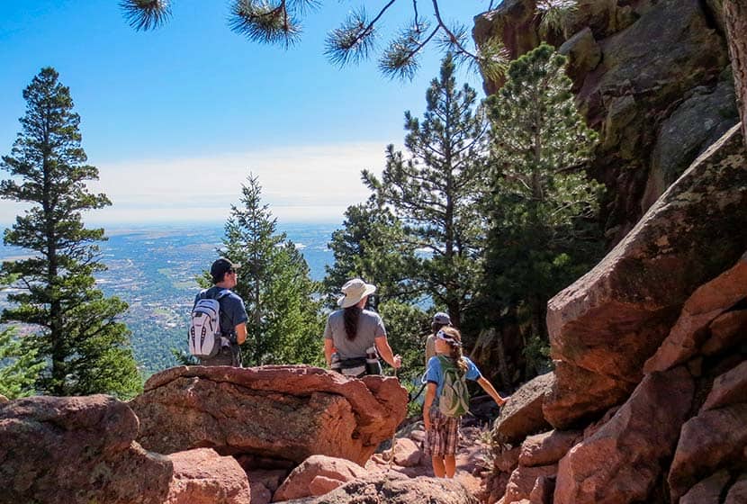
But the better place to take a break is just behind the notch. Here, you'll be able to look down into canyon that runs between flatiron two and three, and you get a great view of the imposing profile of flatiron three.
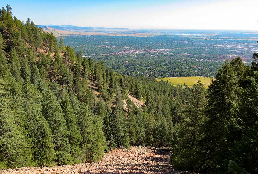
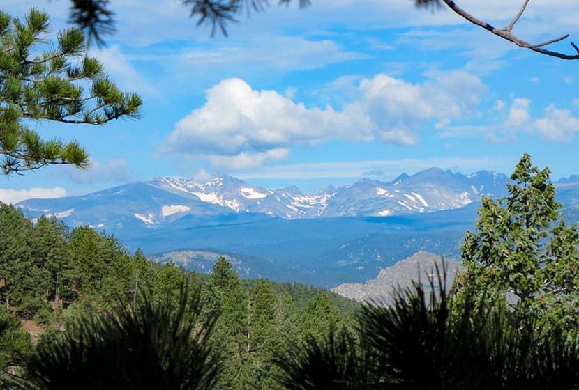
 Then take the trail up a few switchbacks as it bends north. You'll hit a saddle but the trail will continue to bend to the right, until you find yourself in the shade of the massive top of the first flatiron. Back here you'll find all kinds of rock shelves and nooks to sit and take in some of fantastic views of Colorado's Rocky Mountains to the West.
 Tips & Resources for Hiking the First and Second Flatirons:
- TIP: This hike gets really crowded, so start early (before 8:30 AM).
- TIP: Take a lunch or breakfast and coffee with you. The first flatiron nooks are perfect for just sitting and enjoying a picnic.
- TIP: Weather can come up fast on the flatirons in the summer. Just be aware that it can change fast and bring a rain jacket.
- TIP: Dogs are allowed if they are leashed. Boulder does have a special tag you can get for your dog to allow it off leash in the park. It's called the Voice and Sight Control tag and you can get more information here.
- After the Hike: Ozo Coffee Roasters in Boulder
- Trail Map for Chautauqua Park: Trail Map Link
- Colorado Road Conditions: Colorado Road Conditions
Weather
Driving Directions to First Flatiron Trailhead
Click for Driving Directions
Mt. Bierstadt Trail on Guanella Pass
Summit a Fourteener, Mount Bierstadt, or go for an easy hike with your family high in Colorado's Rocky Mountains. In short, you've got options on this trail near the top of Guanella Pass. You can choose an easy stroll or a difficult hike. Explore the trail snapshot and profile below for hiking, camping, and trail map info.
Trail Snapshot: Mr. Bierstadt Hike at Guanella Pass
| Hike Distance | 1 to 7 miles Round Trip |
|---|---|
| Difficulty | Easy to Difficult |
| Duration | 1 to 6 hours |
| Trail Type | Out and Back |
| Elevation Gain | Up to 2400' |
| Seasons | Best Late Spring to Fall |
| Dogs | Allowed on Leash (avoid b/c of fragile ecosystem) |
| Hike Trail Map | Click for a Trail Map |
| Denver Drive Time | 1 hr 30 min |
| Directions | Click for Google Map |
| Town Nearest Hike | Georgetown, Colorado |
| Beauty | 14ers, high country tundra, peak top views, lakes |
| Activities | Hiking, camping, summit Mt. Bierstadt, picnic |
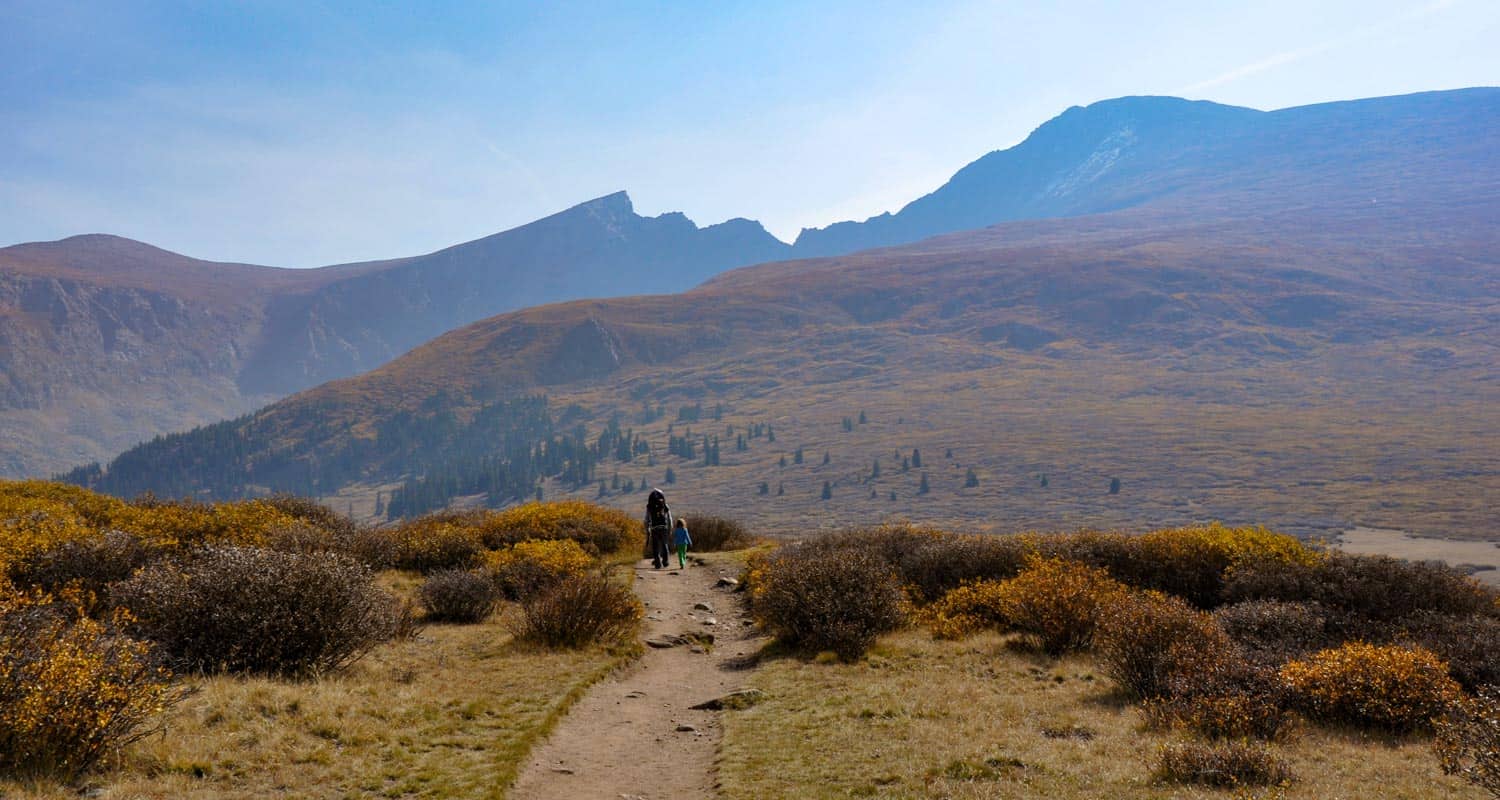
You've got options with the Mount Bierstadt trail. First, we'll profile the hike to the summit. Below that, you'll find some information on how to just explore the area with your family or friends, making this an easy hike high in the Colorado mountain.
Climb Your First Colorado Fourteener
Mt. Bierstadt is popular, not just because it's so close to Denver, but it's also one of the easier and more accessible of Colorado's 54 fourteen thousand foot peaks. The Mount Bierstadt trail can be accessed on the south side of Guanella Pass from the Mt Bierstadt trailhead (click here for map and directions from Denver). It's important to be aware that the weather can change in an instant in the mountains, and that snow can come in fast even in the late Spring and early Fall. As with any Day Hike, be sure to (at least) pack the 10 Essentials.
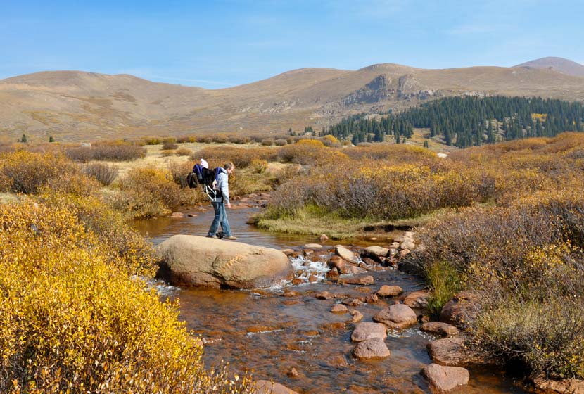
The Bierstadt trail is well marked; you'll follow signs down to a boardwalk, then to Scott Gomer Creek. After crossing the creek, the trail will become more steep, and the steepness will increase as you make your way to the summit. The trail winds gently through the tundra until you are about three miles in when the green and brown gives way to rock. Follow the west ridge up to the summit of Mount Bierstadt. For a detailed trace and profile of the Mt.Bierstadt route, see this Route #1 Bierstadt profile on 14ers.com.
Make it an Easy Family Hike
Hiking Colorado's Bierstadt trail doesn't mean that you have to summit. In fact, the first mile of trail is really tame. It takes you over a creek, through willows, and by two small high mountain lakes. If you want to gain additional views, you can add another half mile of moderate hiking that will take you above the valley floor.
We took our 4 1/2 year old, 2 year old with us in the Fall and they loved it. Dog's on the Mount Bierstadt trail must be kept on a leash and need to be kept 100' from water sources (in short, they aren't allowed to play in the lakes and streams). In fact, because we'd recommend that you leave Fido at home because of the fragile alpine tundra ecosystem. In August of 2012, Missy, a German Shepherd, was rescued after being stranded on the peak for eight days. You can read more about her ordeal and the rescue in this Denver Post article.
Camping Near the Mt. Bierstadt Trail
There are a lot of campground sites along both sides of Guanella pass that are managed by the forest service (fee required) and dispersed camping is allowed on US Forest and wilderness areas. Below you'll find a few important links to camping information for the Mt. Bierstadt and Guanella Pass Area.
- Mt. Evans Wilderness Hiking and Camping Regulations.
- Camping Information and Regulations for the US Forest Service
- Guanella Pass Campground
- Burning Bear Campground Near Mt. Bierstadt Trail: Jennifer Mason does a nice job profiling both the Burning Bear and Whiteside campgrounds on her site.(note: Whiteside has been permanently closed)
- For More Campgrounds along Guanella Pass, use the Recreation.gov site and do a search for Guanella Pass Road
Tips & Resources for Hiking the Mt. Bierstadt Trail:
- TIP: Go Early; the parking lot at the Mt. Bierstadt Trailhead fills fast.
- TIP: If you've never summited a 14er before, be sure to read this great article by Lindsey Koehler of 5280 Magazine.
- TIP: If you plan to summit Mount Bierstadt, start early so that you can be back at the trailhead before the almost daily summer thunderstorms role in. I'd recommend starting around 6am, so that you're back at your car around 11am.
- TIP: Hiking times vary. Those who frequently make the assault on Mt. Bierstadt (even trail run it), can make it up and back in 3 hours. The average is 5hrs, but adjust for experience and how good of shape you're in
- After the Hike: Tommy Knocker Brewery
- TIP: The weather will be cooler at the trailhead than the posted Georgetown, Colorado temperature below. It will be even cooler at the summit of Mt. Beirstadt.
- Trail Map for Guanella Pass: Trail Map Link
- Colorado Road Conditions: Colorado Road Conditions
Weather
Map & Driving Directions to Trailhead for Mt. Bierstadt
Click for Driving Directions

Canyon Loop Trail - Betasso Preserve, Boulder
This hike at Betasso Preserve near Boulder, Colorado makes for a perfect evening escape to watch the sunset over the town below. You'll cross through meadows dotted with wildflowers then under stands of Ponderosa pine that eventually open up to views to east. Explore the hiking trail profiles and map link below for details.
Trail Snapshot: Canyon Loop Trail at Betasso Preserve
| Hike Distance | 3.3 Miles |
|---|---|
| Difficulty | Moderate |
| Duration | Approx 1.5 hr |
| Trail Type | Loop |
| Seasons | All Season |
| Dogs | Allowed on Leash |
| Hike Trail Map | Click Here for a Trail Map |
| Denver Drive Time | 50 min |
| Directions | Click for Google Map |
| Town Nearest Hike | Boulder, Colorado |
| Beauty | Views of Boulder, Wildlife: Aberts Squirrel & Deer, Ponderosa Forest, Meadows |
| Activities | Picnic Area, Horseback Riding, Mountain Biking, Hiking Trails |
Tips & Resources for Hiking the Canyon Loop at Betasso Preserve :
- Easier Approach: Make your hike at Betasso Preserve a bit easier by starting from the East Trailhead
- Mountain Bikers: Each month the direction of travel required for Mountain Bikers is switched. Check the sign at the trailhead. Additionally, biking is not allowed on Wed. & Sat.
- Hikers: Check the sign at the trailhead as well and try to hike the opposite direction of the bike traffic.
- Trail Map for Betasso Preserve: Trail Map Link
- Colorado Road Conditions: Colorado Road Conditions
- After the Hike: Ozo Coffee in Boulder
Weather
Map & Driving Directions
Click for Driving Directions

Echo Lake Trail Near Mt. Evans
Colorado's Echo Lake is looped by an easy hiking trail and serves as a trailhead to even more classic Colorado hikes. When we have friends and family visiting Colorado from out of town, this is one of best destinations for a great views. Go early to Echo Lake to get perfect photos of Mount Evans reflected in the water. Explore the full hike profile below that will give you driving directions from Denver, a trail map, and all the information you need to launch out on this adventure.
Trail Snapshot: Echo Lake Near Mt. Evans
| Hike Distance | Less than 1/4 Mile |
|---|---|
| Difficulty | Easy (but consider altitude) |
| Duration | 15 min |
| Trail Type | Out and Back |
| Elevation | 10,600′ |
| Seasons | Spring to Fall |
| Dogs | Dogs Allowed on Leash |
| Hike Trail Map | Click Here for a Trail Map |
| Denver Drive Time | 1 hr |
| Directions | Click for Google Map |
| Town Nearest Hike | Idaho Springs, Colorado |
| Beauty | Lakes, Mountain Peak Views, Wildlife: Ducks and Geese |
| Activities | Fishing, Picnic Areas, Hiking, Connections to other hikes, Visitor Center, Camping |
Echo Lake Area
A great Colorado park to take visiting family and friends. It's an hour from Denver and has very short trail, but it's a great place to introduce others to the beauty of the Rocky Mountains and to take in a high Colorado lake. The trail circles Echo Lake and connects to several other trails: Chicago Lakes, Bear Track Lakes trails, which give you access to Mount Evans Wilderness Area which is full of other great hiking trails,and Mt. Evans summit.
Near the parking area, you'll find a stone picnic shelter which was built in 1937. When the weather is getting hot, it's a great place for a picnic or a wonderful place to break out the hot chocolate on a snowy winter day.
If you are looking for more Colorado lake hikes, be sure to check out our Lake Hikes Near Denver page.
Echo Lake Colorado Camping
There are great camping opportunities at the Echo Lake Campground near the lake. Near the shores is a spruce forest. For detailed information on camping near Echo Lake in Mt. Evans, see the Recreation.gov page.
Tips & Resources for Hiking Echo Lake, Colorado :
- TIP: Early morning means that Echo lake is still, providing no windy weather, and is a perfect time to photograph or just to observe the rocky mountains reflected in the water.
- TIP: A nice short Colorado hike can be made by parking at the parking lot (see map above & below), and hiking around the lake to the Historic Echo Lake Lodge. Visit there, then turn around and enjoy the lake on the way back again.
- TIP: When you finish, drive up to the summit and enjoy the view from the top of Mt. Evans. Or visit Summit Lake Park
- TIP: One of our favorite day-trips with visitors who are not from Colorado, is to take them to Echo Lake, Mt. Evans Summit (by car), then into Evergreen for Pizza at Beaujos Pizza
- TIP: In regards to driving to the top of Mt. Evans: We avoid bringing friends who are not in good health. Be sure to have your guests drink plenty of water, and make sure they have had a day or two to get used to the altitude in the mile-high city.
- Weather: The Weather link below is for Idaho Springs. Weather at the altitude of Echo Lake may be very different, and Weather at the summit will definitely be different. Check this National Weather Service Link for more accurate forecasts.
- After the Hike: After The Hike: Beaujos in Evergreen
- Looking for something more adventurous? Try the Chicago Lakes Hike. It starts in the same parking lot.
- Trail Map for Echo Lake Park: Trail Map Link
- Colorado Road Conditions: Colorado Road Conditions
Weather
Map & Driving Directions
Click for Driving Directions