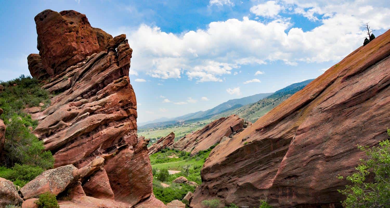
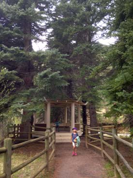
Trading Post Trail at Red Rocks Park
Ready for a hike around Colorado's Red Rocks Park and famous amphitheater? The Trading Post trail at Red Rocks takes you around 10 of the park's giant red rock formations. It's a short, 1.4-mile loop hike just 25 minutes from downtown Denver. Check out our full hiking trail profile below for all the details.
Trail Snapshot: Trading Post Loop Trail
| Hike Distance | 1.4 Mile |
|---|---|
| Difficulty | Easy |
| Duration | 1 hr |
| Trail Type | Loop |
| Elevation Gain | +500′ |
| Seasons | Year Round |
| Dogs | Allowed on Leash |
| Hike Trail Map | Click for a Trail Map |
| Denver Drive Time | 30 min |
| Directions | Click for Google Map |
| Town Nearest Hike | Morrison, Colorado |
| Beauty | Red rocks, meadows, Front Range views, Bluff Overlooks, wildlife: red fox, and mule deer |
| Activities | Picnic areas, hiking trails |
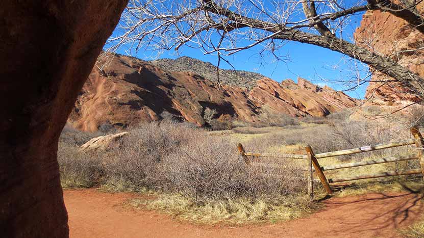
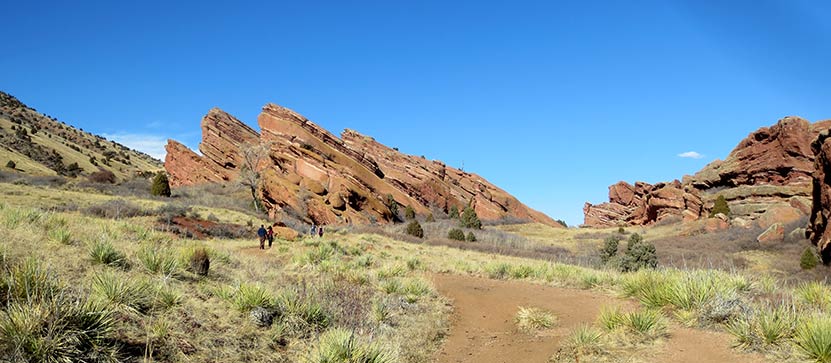
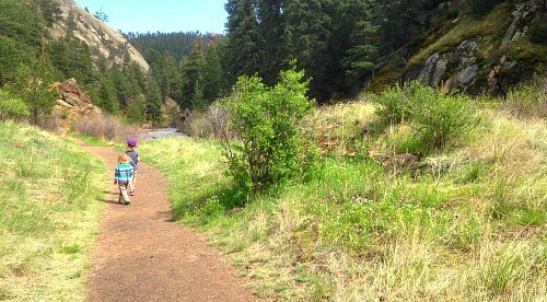
If you are looking for a family adventure that's quick to get to, this hiking trail at Red Rocks is a great option. The Trading Post trail weaves through some of Colorado's most majestic red rock formations, into meadows, and great views of Red Rocks park. Because the trail is narrow and has some steep areas, keep a good eye on the kiddos.
We hiked the Trading Post Trail on a sunny Saturday in February with our children, ages 7 and 4. They loved it, but were definitely tired at the end. However, after we finished the 1.4 mile loop, it was their idea to hike up to the amphitheater, then all the way to the top.
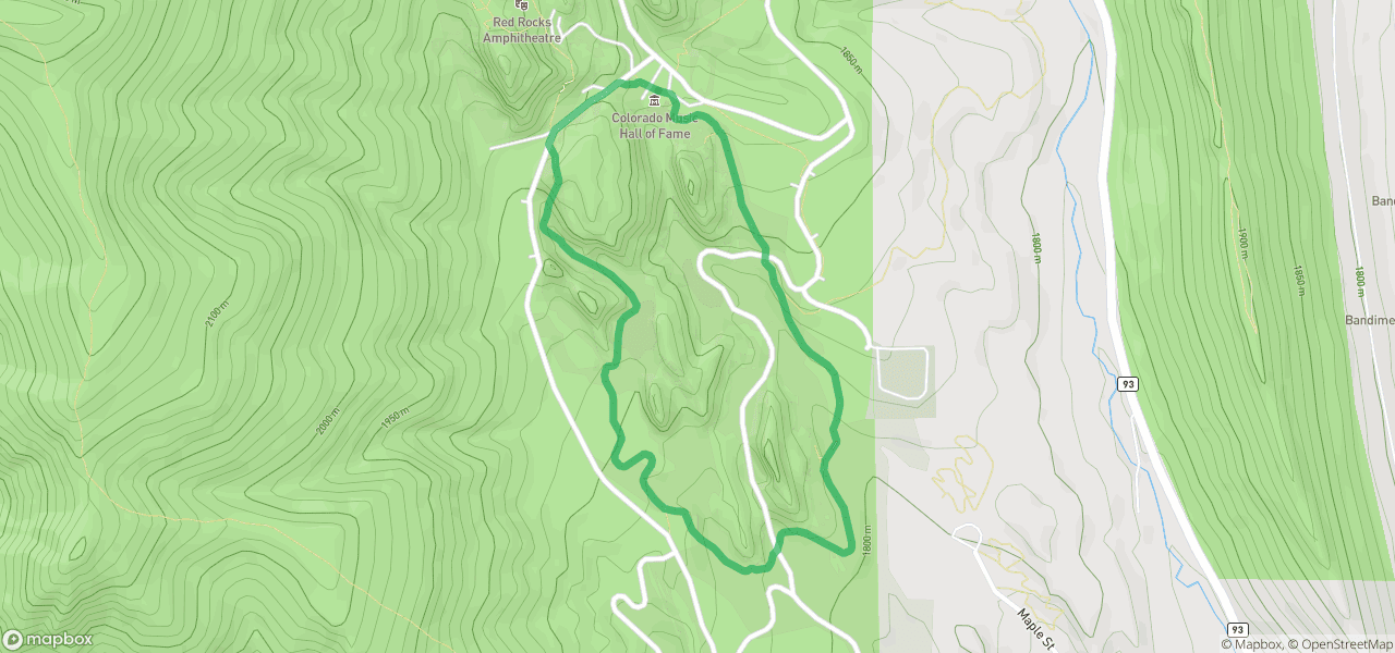
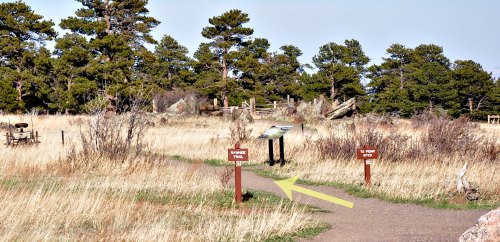
Trail Map for Trading Post Trail
The Hike: The Trading Post Trail at Red Rocks
We started at the trading post, and hiked the loop counter-clockwise. I'd recommend hiking it this way because it gives you the move favorable views, and offers a bit of shade about 3/4 of the way through the hike--right when you need it the most. The sand and grave on the rock surface of the trail can cause your feet to slip, but as long as you are aware and take your time, it makes for a perfect leisurely hike.
You can bring your dog on this hike, however, we haven't added this trail to our list of best trails for hiking with your dog near Denver because the trail can be narrow and can be high traffic. So, if you are bringing Fido, we recommend going early in the morning, or taking the Red Rocks trail, which is more open and has fewer people on it.
I get a lot of emails from people who are only in Denver for a few days, limited when it comes to their transportation, and want to experience the outdoors. This is the hike I send them to. Why?
- The Trading Post is gorgeous year-round.
- Red Rocks is super close to Denver, and while it's still expensive, you could take a Lyft or Uber there from downtown. Get a group of friends to share the cost and you're golden.
- The elevation is less of an issue for out-of-towners, and it's a relatively easy hike. It's short, but long still long enough to get a workout.
Tips & Resources for Hiking the Trading Post Trail at Red Rocks :
- Sunscreen: There's not much shade on this hike, so bring the sunscreen
- Rattlesnakes: There are rattlesnakes in Red Rocks, as there are in many parks along the front range. Like us, they love to sunbathe, but on rocks and other warm areas. Don't let their presence deter you from enjoying this hike, but keep an eye out for the varmints.
- Climbing: Rock Climbing is Prohibited at Red Rocks
- View of Denver: After your hike around the Trading Post loop, walk up into the Red Rocks Amphitheater. It's worth climbing all the stairs to the top for a great view of Denver.
- Hours: The hiking trails at Red Rocks open one hour before sunrise and close one hour after sunset
- After the Hike: Ice Cream @ The Blue Cow
- Trail Map for Red Rocks Park: Trail Map Link
- Colorado Road Conditions: Colorado Road Conditions
Weather
Map & Driving Directions to the Trading Post Trail at Red Rocks
Click for Driving Directions

Pine Valley Ranch Park Hike
Pine Valley Ranch Park has become one of our family's favorite parks near Denver. Pine Valley Ranch Park boasts several hikes, a beautiful lake, a lot of history, a small island with a gazebo, and the best picnic area on the Front Range of Colorado. If that's not enough, the North Fork of the Platte River runs through the park, lined with enormous spruce trees and granite cliffs. Explore the trail profile below for hiking options, trail map, driving directions and more.
Trail Snapshot: Pine Valley Ranch Park Trail
| Hike Distance | 1.2 to 3.2 miles Round Trip |
|---|---|
| Difficulty | Easy to Moderate |
| Duration | Approx 45 min to 2 hr |
| Trail Type | Loops and Out-and-Back |
| Elevation Gain | +500′ |
| Seasons | Best April to November |
| Dogs | Allowed on Leash in the Park |
| Hike Trail Map | Click for a Map of Pine Valley Park |
| Denver Drive Time | 1 hr |
| Directions | Click for Google Map |
| Town Nearest Hike | Pine, Colorado |
| Beauty | Pine Lake, Platte River, bridges, island with gazebo, waterfowl and other birds |
| Activities | Mountain bike trails, fishing, ice skating in winter, pavilions, picnic tables and grills |
| Video | Click For a Video of Pine Valley Ranch Park |
Hiking Options at Pine Valley Ranch Park
#1 - Park View Out-and-Back Hike - Approx. 2 Miles Round Trip
The Park View trail can be located on the other side of Pine Lake (not the far side). Take the narrow gauge trail across the bridge and you'll locate the trailhead just on the other side of a shelter that sits along Pine lake. The trail is moderate to strenuous and will take you up to some great views of the surrounding Pike National forest and the Platte River. You'll get views of the extensive Hayman Burn, the burn scars left from the 2000 fire.
#2 - Full Park View Loop - Approx. 2.5 Miles
If you would like to take a longer loop hike, take the Park view trail (.8 mile) up to the strawberry jack trail (.5), which will connect you to the Buck Gulch trail (.4) which will take you back down to Pine Lake. The Strawberry Jack trail will take you out into Pike National Forest. Be sure to have a map you--which you can pick up at the park--because a wrong turn onto the Buck Gulch Trail can take you far out of the way.
#3 - Pine Lake Loop Hike - Approx. .7 mile
You can take a leisurely hike around Pine Lake at Pine Valley Ranch. Go early (before 7:30AM) to catch site of the birds and wildlife around the lake.
#4 - Narrow Gauge Trail Hike - .5 to 3.8 miles
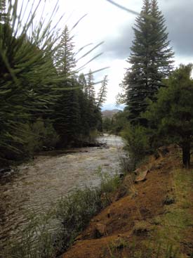
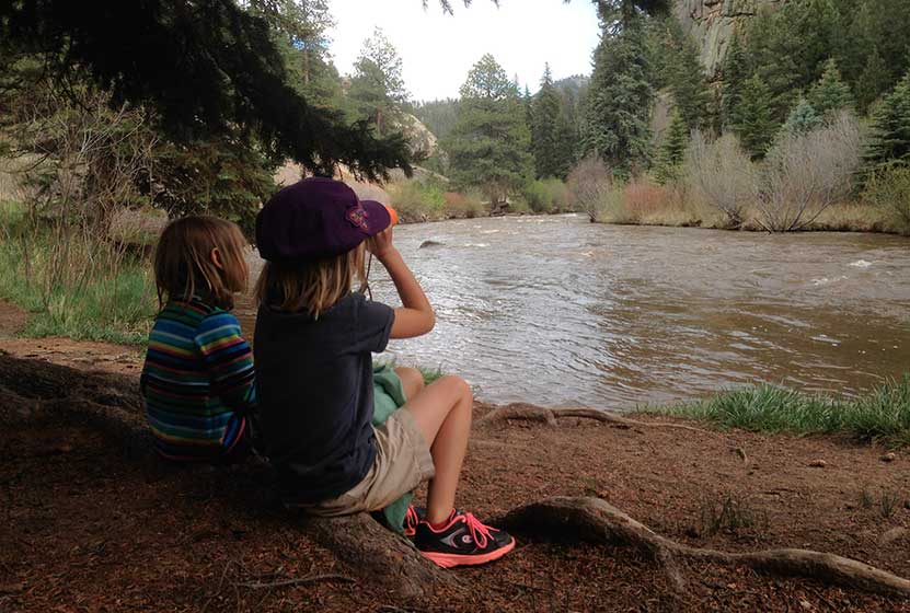
This is the hike that our kids most enjoy. We like to hike the southeast segment that takes you along the North Fork of the South Platte River. There are willows to pass through, and probably some good trout fishing along the banks. The Narrow Gauge trail stretches about half a mile in this direction and is surrounded by granite cliffs, pine, and spruce.
If you hike the Narrow Gauge trail to the West, you'll follow the river past Pine lake for about 1.5 miles, then can hike it back.
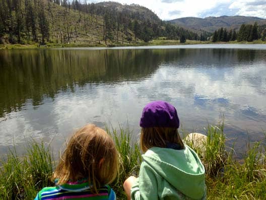
Pine Lake at Pine Valley Ranch Park
Pine Lake packs out with fisherman on the weekend but can be a great quiet escape on the weekdays, especially in the mornings and evenings. The lake has a fishing pier and a great shelter. In the winter months, there is ice fishing and skating. The shoreside shelter at Pine Lake has several picnic tables and a fireplace.
The Best Picnic Area Near Denver
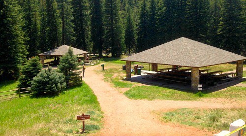
As our family explores hikes and parks near Denver, we get to see a lot of picnic areas. See our Seven Great Picnic Areas Near Denver post. The picnic area at Pine Valley Ranch Park is hands down our favorite. A few reasons why: 1) It's along a river, 2) it's surrounded and shaded by enormous spruce trees, 3) has great facilities: two large covered shelters, and 4) there are a lot of activity options for families.

Tips & Resources for Hiking the Pine Valley Ranch Park:
- Gazebo: There are some hidden treasures at Pine Valley Ranch. One you can't miss is the gazebo. Behind the large picnic shelters you'll find a small trail that leads to a bridge. The bridge leads to an small island in the Platte River and a beautiful old gazebo. The island is man-made and was created to contain the domesticated goats that used to roam the ranch.
- River's edge: The Platte river can swell and be quite dangerous, especially in the Spring and after heavy rains, so keep a close eye on children along the river's edge.
- Eagles: Keep your eyes peeled for bald eagles and osprey
- Use sunscreen: Though there are a lot of trees, like most Colorado hikes, most areas are exposed to the sun, so hike early and use sunscreen.
- Handicap accessibility: This would be a great place for family with physical limitations or who are wheelchair bound. I should point out that the park is not built around handicap accessibility, but we saw several people fishing from wheelchairs along the lake, and there is a lot of beauty to take in without having to go far or negotiate obstacles.
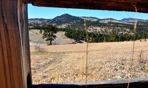
- Historical significance: Pine Valley Ranch is replete with historical significance. The best place to start is to take a tour of Baehrden Lodge, a 27 room estate perched over the top of Pine Valley Ranch Park that is now in the care of Jefferson County Parks.
- Carved initials: Look for initials carved into trees a long the paths of Pine Valley Ranch. These go back many decades to when Pine Valley Ranch was a resort and folks would take the train from Denver to escape into the mountains.
- Dr. Robert Dudley: We want to express our gratitude to Dr. Robert Dudley, who in the 1970's kept the park from being parceled out to the highest bidder, and to the Jefferson County Parks staff for the care they give to keep Pine Valley Ranch Park available to the public.
- After the Hike: Aspen Perk Cafe
- Colorado Road Conditions: Colorado Road Conditions
- Trail Map for Pine Valley Ranch Park: Trail Map Link
Weather
Map & Driving Directions
Click for Driving Directions
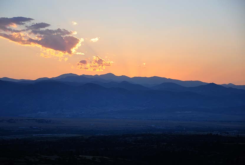
White Ranch Sunset Loop Near Golden, Colorado
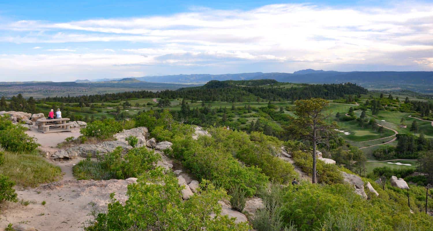
This loop hike in White Ranch Park is a great escape, a place to watch the glow of twilight on the city of Denver as the sun sets in the West. This Colorado trail is set at the very beginning of the foothills. You'll journey across a tranquil meadow punctuated with ponderosa pine and decorated with Spring and early Summer wildflowers. In the trail profile below, we'll show you how to create what we are calling the Sunset Loop by putting together a series of short trails. To get the details on this hike near Denver, Colorado, scroll down and take a look at the detailed trail profile, map, hiking trail tips, and the video panorama.
Trail Snapshot: White Ranch Park Sunset Loop Trail
| Hike Distance | Approx 2 miles |
|---|---|
| Difficulty | Easy |
| Duration | Approx 2 hr |
| Trail Type | Loop |
| Elevation Gain | Approx +1400′ |
| Seasons | All Year |
| Dogs | Allowed on Leash |
| Hike Trail Map | Click for a Map of White Ranch Park Golden, CO |
| Denver Drive Time | 45 min |
| Directions | Click for Google Map |
| Town Nearest Hike | Golden, Colorado |
| Beauty | Wild flowers,View of the front range landscape |
| Activities | Hiking, Biking, Equestrian |
| Video | Click For Video of White Ranch Loop Trail - Golden, Colorado |
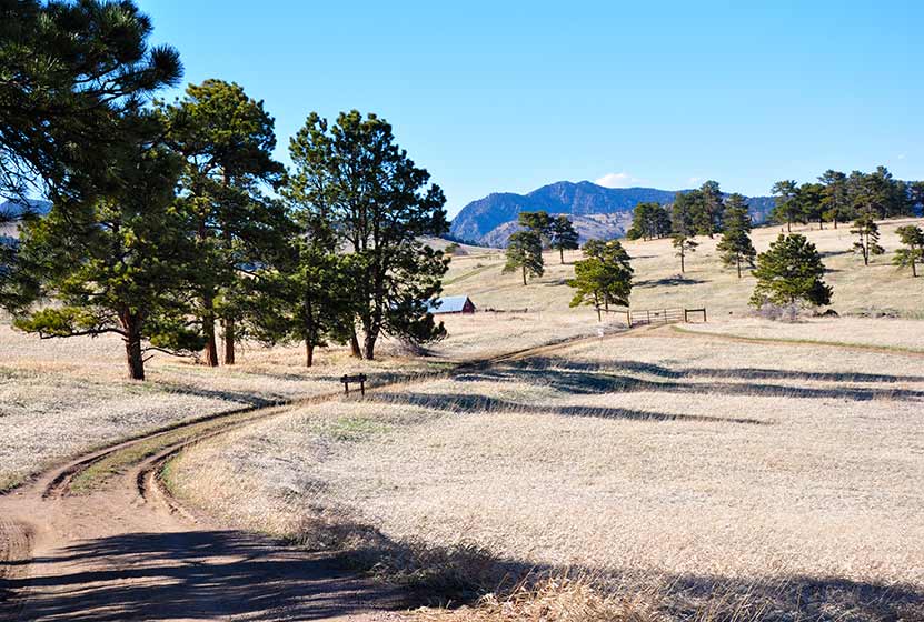
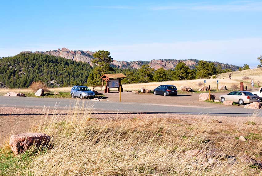
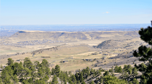
Ifyou are looking for a great family hike or for a mountain biking experience in the foothills, White Ranch Park offers you a network of trails, with enough variety to please anyone. There are two parking lots .3 miles apart. The second parking at White Ranch has more capacity. We went on a Friday afternoon and only a handful of folks were on the trails, but we hear that it gets much more traffic on the weekends. The Ralston Buttes, a unique geologic formation, dominates the landscape in the distant northeast region of the park. It's a protected area because of its sensitive ecosystem. Though it's not accessible by trail, you'll get a lot of great views of the Buttes at various points of this loop hike.
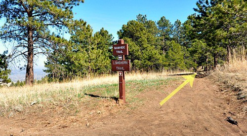
Start your adventure at the second parking lot with the Rawhide Trail.
Rawhide trail lays on the edge of a vast meadow. The complete trail is 4.5 miles long, but to form this loop, you'll only hike a segment, before you join up with the Longhorn trail. It can be tricky to find the Rawhide trail, but it's the first one to the east at the trailhead (on your right, if you are facing the trailhead sign). See the photo just below.
In the distance you will have a chance to see some old ranch buildings and farm machinery. You can imagine what it might have been like to farm this rugged area perched above Denver. While cattle no longer graze these meadows, White Ranch Park is home to several species of wildlife including elk, deer, mountain lions, bears, wild turkeys, and bobcats.
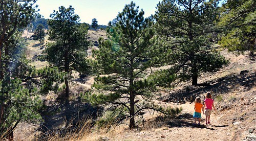
When you get to the intersection with the Longhorn trail, you'll turn right and enter the second part of the hike. Open meadows are replaced with shade and the distinct perfume of Ponderosa pine as you walk along the trail.
The trail itself is pretty clear and very well-kept. After about of a mile of ups and downs with some nice and easy inclines you can stop and enjoy the view before you turn right again and take the Maverick trail.
Maverick Trail is good for riders and hikers of all skill levels. It's 0.9 miles long and it is primarily used for hiking. While hiking on this trail your eyes may be drawn to the beauty of the high plains, but watch out for the shallow roots that make their way into this part of the trail. It is not technically challenging but some riders have found themselves on their backs on this segment, and I'm sure a few hikers have tripped.
After some great views of Denver and out to the horizon in the East you will reach the end of the Maverick trail and an intersection with Belcher Hill trail. Turn right on the trail split and take a short path to the next intersection. Looking from right to left in front of you will be three roads - Sawmill trail (0.5 mi) that will take you back to the parking lot where you started your trail, Belcher Hill trail (0.6 mi) and Sawmill trail (0.8 mi) that can take you to Sawmill Hicker Camp. Take the Sawmill Trail to complete the Sunset Loop hike.
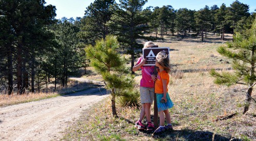
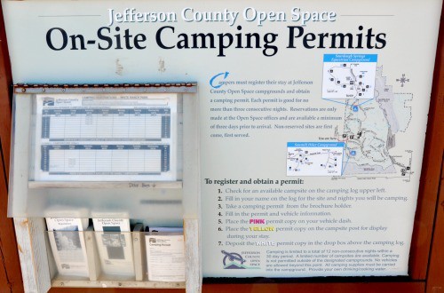
White Ranch is one of just two Jefferson County parks with campsites.
There are 10 campsites available on this site, each has a picnic table, a metal fire ring, and some food storage poles. Also there is a maximum of three tents and eight people per site. Camping permits are free and valid for a maximum stay of up to three nights. Click here for more details on camping in White Ranch Park and the most up to date regulations.
Tips & Resources for Hiking the The Sunset Loop at White Ranch Park
- Drinking Water: Keep in mind that drinking water hand pump at the campsite is only seasonally available (it is closed in winter).
- Ice in Spring: If you decide to hike this loop before April watch out for the slick spots of ice in the shade.
- Gets Windy: Because of its unique location, it can get pretty windy up in White Ranch Park. Might not want to wear your favorite hat.
- After the Hike: After the Hike: Bob's Atomic Burgers in Golden, Colorad
- Colorado Road Conditions: Colorado Road Conditions
- Trail Map for White Ranch Park: Trail Map Link
Weather
Map & Driving Directions
Click for Driving Directions
Daniel's Park Hikes
Best sunsets in Denver! You can see mountains upon mountains of Colorado's Front Range. Take a picnic dinner and pull off at one of the many picnic areas along Daniels Park Road. There are several hiking options detailed below for Daniel's park. To get all the details, scroll down and explore the trail snapshot, profile, and tips below.
Trail Snapshot: Daniel's Park Hike
| Hike Distance | 0.2, 3, or 5.4 Miles |
|---|---|
| Difficulty | Easy |
| Duration | 20 min to 2.5 hrs |
| Trail Type | Out and Back |
| Seasons | All Season |
| Dogs | Allowed on Leash |
| Hike Trail Map | Click for a Trail Map |
| Denver Drive Time | 35 min |
| Directions | Click for Google Map |
| Town Nearest Hike | Littleton, Colorado |
| Beauty | Front Range Views, Rock Formations, Bison |
| Activities | Picnic Areas, Shelter House with Fireplace, Bison viewing area, Hiking |
We are featuring Daniel's Park ,not for it's trails, but because it has one of the best views of the Front Range near Denver. From the park, you can see Pikes Peak in the South, Mt. Evans in the West, and Longs Peak in the North. The trails are not handicap accessible, but the shelter house is (after a bit of a bump trail), and is a perfect place to watch the sun set.
Here is the lowdown on the trails at Daniel's Park: They are undeveloped. The park has been around for nearly 100 years but has somehow escaped being developed. However, it's close to south Denver and has some great features, so we've come up with a few different hiking options below.
The Short Daniel's Park Hike - Park at the Shelter House and begin walking north through the undeveloped trails along the top of the bluff. We like to take a picnic dinner up here and a lot of folks bring firewood and enjoy the sunset by the fire. There are about a quarter mile of trails that weave through the rock and back out towards the road.
3 Mile Daniel's Park Hike - Again, start at the Shelter House and head North following the top of the bluff as it parallels the road. You can extend your hike by hiking North along the road until it intersects with Grigs Road - About 1.5 Miles. Hike back to Daniel's Park Shelter House for a 3 Mile round trip hike.
5.4 Mile Daniel's Park Hike - Continue the 1.5 mile hike by taking a left onto Grigs road. Cross to the Northeast side of the Grigs, then shortly after you cross, you'll come upon a green fence and the Douglas County East/West Trail. Your can take that trail West (left) to the Grigs Road Trailhead, adding an additional 1.2 miles to your hike (5.4 Miles Round Trip). Click Here for a Google Map that traces the route along Daniel's Park and Grigs Road.
Douglas County plans to build this East/West trail into a 26 mile system linking Chatfield Reservoir to the town of Parker, Colorado. Click here for the map of the East/West Trail and proposed trails in Douglas County. Denver Mountain Parks and Douglas County have developed a master plan to improve both the park and the roads in the area. You can find an overview at the Douglas County Park site.
Tips & Resources for Visiting Daniel's Park:
- TIP: Keep an eye on the skies - Douglas County has one of the highest lightning strike rates in the country and Daniel's Park is one of the higher points.
- TIP: Bison Viewing - The Bison can be found in an enclosed pasture on both sides of the road.However, the Bison are usually found grazing in the section of the park that is directly across the street from the shelter house.
- Trail Map for Daniel's Park: Trail Map Link
- Colorado Road Conditions: Colorado Road Conditions
Weather
Map & Driving Directions
Click for Driving Directions

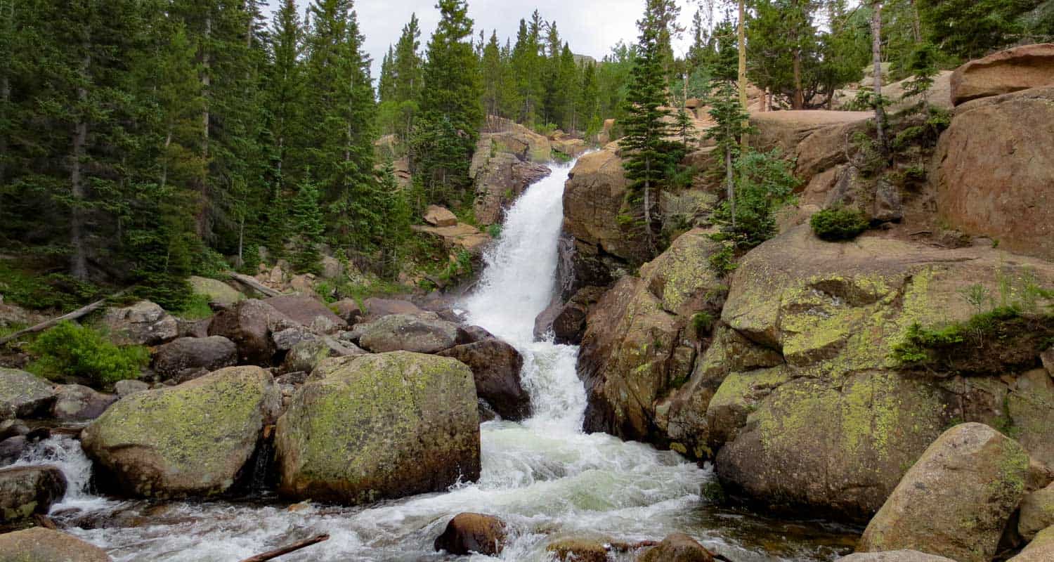
Alberta Falls Hike at Rocky Mountain National Park
Colorado's Rocky Mountain National Park is full of waterfalls and this hike takes you to one of the most accessible waterfalls in the park. Alberta Falls is one of the most popular, short destination hikes in the park, and for good reason. If you only have time for one short hike on the East Side of RMNP, this is a great choice. To get to Alberta Falls, park at the Bear Lake Trailhead (see google directions below), then follow the signs south for Glacier Gorge and Alberta Falls. The waterfall is .8 miles down the trail from the parking area, make this a 1.6 mile out-and-back hike. Start early and hike the full 2.8 miles of trail in to stunning Mills lake inside Glacier Gorge.
Note: Rocky Mountain National Park now requires timed entry permits from May 27th through October 10th. See the RMNP permits page for more information.
| Hike Distance | 1.6 miles Round Trip |
|---|---|
| Difficulty | Medium |
| Duration | Approx 1 hr |
| Trail Type | Out and Back |
| Seasons | Spring thru Fall |
| Dogs | Prohibited in the Park |
| Hike Trail Map | Click Here for a Trail Map |
| Denver Drive Time | 2 hrs |
| Driving Directions to Alberta Falls, Colorado | Click for Google Map |
| Town Nearest Hike | Estes Park, Colorado |
| Beauty | Sub-Alpine Lake, Mountain Views, Wildlife: Abert's Squirrel, Elk, Bear |
| Activities | Picnicking, Hiking Trails, Snowshoeing |
| Fee | Park Pass Required |
Tips & Resources for Hiking to Alberta Falls
- Visitors and Vacationers: Alberta Falls is a great place to take visiting family and friends because it's not too difficult, and you have a lot of options if you want to explore the park
- Bring a Lunch: Getting this far into the park, even just driving, is quite a trip from the outside world. We suggest packing a lunch so that you can stay longer. And food just tastes better outside anyway.
- Trail Map for Bear Lake Corridor: Trail Map
- Rocky Mountain National Park Maps: Maps Link
- Colorado Road Conditions: Colorado Road Conditions
- After the Hike: Poppy's Pizza
 Looking for more waterfalls near Denver? Explore our more than 50 Colorado Waterfall Hikes, our favorite Waterfall Hikes in Rocky Mountain National Park, or 7 Waterfalls within One Hour of Denver.
Weather
Map & Driving Directions
Click for Driving Directions