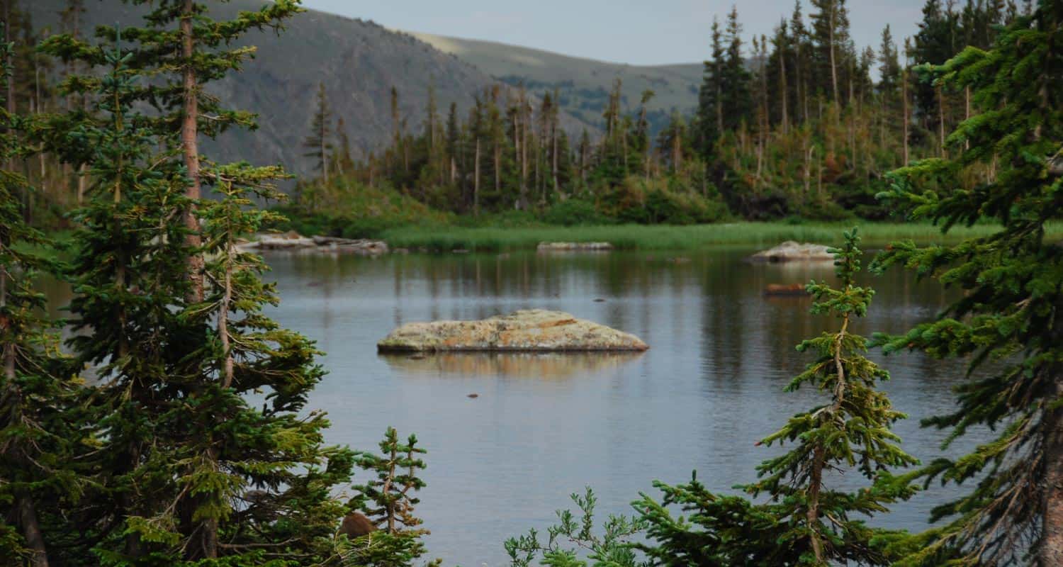
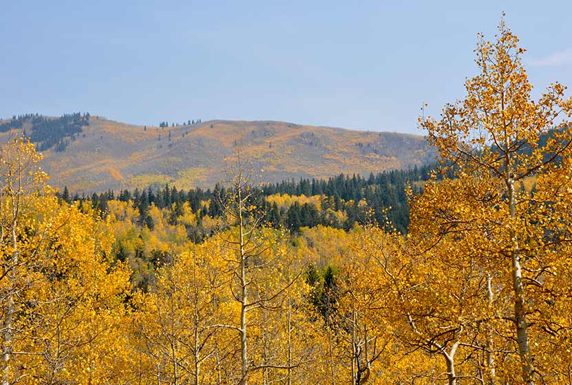
Diamond Lake Hike
The Diamond Lake Trail leads hikers to a high alpine lake nestled in the forest below Jasper Peak in Indian Peaks Wilderness. This 3.5 mile, moderately demanding trail leads to good fishing at Diamond Lake, past a waterfall and multiple cascades, and opens up to the incredible views that make Colorado's high-country famous. Explore the full Diamond Lake hike profile below for trail map, driving directions, and more tips and details to help you enjoy this adventure in the Indian Peaks Wilderness.
Trail Snapshot: Diamond Lake Trail
| Hike Distance | 7.0 miles Round Trip |
|---|---|
| Difficulty | Moderate |
| Duration | Approx 3-4 hrs |
| Trail Type | Out and Back |
| Starting Elevation | 10150′ |
| Elevation Gain | +850′, with additional elevation dip and gain |
| Seasons | Year Round |
| Dogs | Allowed On Leash |
| Hike Trail Map | Click for a Map of Diamond Lake Trail near Nederland |
| Denver Drive Time | 1 hr 30 min |
| Driving Directions to 4th of July Trailhead | Click for Google Map |
| Town Nearest Hike | Nederland, Colorado |
| Beauty | lake, waterfalls, wildflowers, streams, wildlife: moose, deer, squirrel, chipmunk |
| Activities | Hiking, snowshoeing, skiing, camping, fishing |
Directions to Diamond Lake Trail & Trailhead
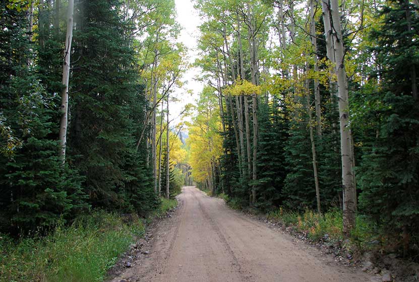
Drive for approximately for 1hr from Denver to Nederland, Colorado. From Nederland, drive south on CO 119 for about half a mile. Turn right onto CR 130 towards Eldora, then proceed westward through the town of Eldora on Eldorado Avenue which will turn into Hessie Road as it leaves town. At the intersection with CR 111 (4th of July Road) turn right; this will take you to the Fourth of July Trailhead. On the way to the trailhead, you'll pass Buckingham Campground. Though this looks like a trailhead and parking area, drive past it to the actual trailhead. It is important to note that 4th of July Road is a dirt road and only useable by passenger vehicles during the Summer months, and rain and snow can cause the road conditions to be unpredictable. Washouts can make this a 4WD road.
The Hike to Diamond Lake
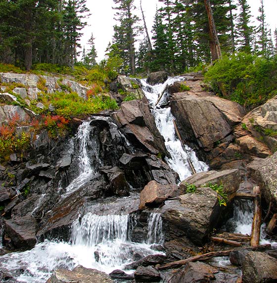
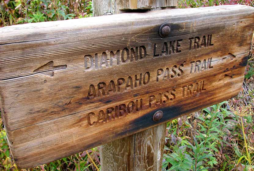
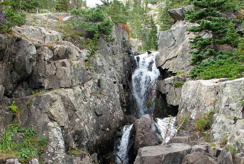
The hike to Diamond Lake begins at the 4th of July Trailhead by taking the Arapaho Pass Trail #904. The Arapaho Pass trail ascends quickly into Indian Peaks Wilderness area. New views open up about every quarter mile featuring distant waterfalls, trailside cascades, creeks, wildflowers, and expansive mountain views. Hikers will encounter the first trail junction at 1.2 miles in. The correct trail, the Diamond Lake Trail (easy to remember) is to the left/west. The first 1/2 mile on the Diamond Lake Trail heads west along a drainage then descends to Middle Boulder Creek. At approximately 1.7 miles into the hike, the trail follows a bridge over Middle Boulder Creek. This a great place to stop and take in Diamond Lake Falls (pictured below).
After the waterfall, the trail crosses two more creeks then begins a steep ascent through a series of switchbacks. This final trail segment is approximately 1 mile, making the entire one-way hike to Diamond Lake approximately 3.5 miles. This segment from the waterfall to the lake is often covered with snow into early Summer, so orienteering and snow-travel skills are recommended for those who decide to negotiate the snow-covered trail.
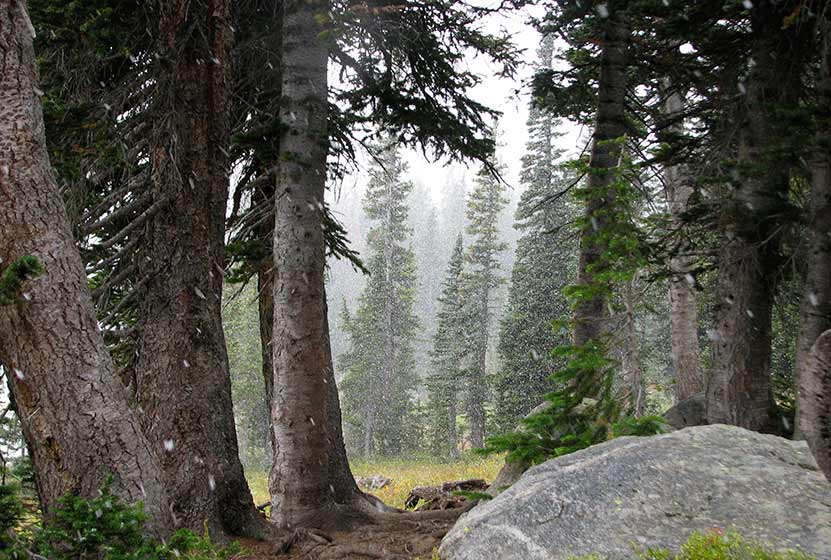 Snow and Fog on the Forest near Diamond Lake
Campfires are prohibited at Diamond Lake, but camping is allowed by permit and in the designated sites. For more details on backcountry travel and permits in the Indian Peaks Wilderness area, see the Indian Peaks Wilderness Alliance. The Diamond Lake Trail continues past Diamond Lake into the high country where it meets up with the Devils Thumb trail. Hikers in Indian Peaks should always prepare by packing the 10 Essentials, and have a plan in case they encounter rapidly changing weather conditions. In the summer, this means thunderstorms and lightning that rapidly form, and un-forecasted snowstorms from Fall to early Summer.
Tips & Resources for Hiking the Diamond Lake Trail
- TIP: Go there early (especially during the weekends) to avoid an overcrowded parking area.
- TIP: Bring bug spray for mosquitoes.
- Trail Map: Diamond Lake Trail
- Packing List: Always pack the 10 Essentials. Download our Hiking Guide to get the list and dayhiking packing checklist.
- Colorado Road Conditions: Colorado Road Conditions
- After the Hike: Happy Trails Cafe
- Photo Credit: A Place to Ponder by Let Ideas Complete
Weather
Map & Driving Directions
Click for Driving Directions

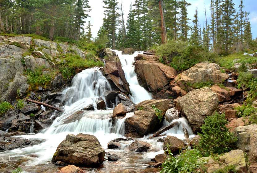
Diamond Lake Falls Hike
Diamond Lake Falls requires a 1.7 mile one-way hike into Indian Peaks Wilderness. Many hikers choose to hike the 1 mile further up to Diamond Lake. Wildflowers, cascades, and expansive mountain views are just a few of the features that make hiking to Diamond Lake Falls worthwhile. Explore the full trail profile below for trail map, driving directions, and more tips and details to help you enjoy this adventure in the Indian Peaks Wilderness.
Trail Snapshot: Diamond Lake Falls Trail
| Hike Distance | 3.4 miles Round Trip |
|---|---|
| Difficulty | Moderate |
| Duration | Approx 2.5 hrs |
| Trail Type | Out and Back |
| Starting Elevation | 10150′ |
| Elevation Gain | +800′ |
| Seasons | Late Spring through Fall |
| Dogs | Allowed On Leash |
| Hike Trail Map | Click for a Map of Diamond Lake Falls Trail near Nederland |
| Denver Drive Time | 1 hr 30 min |
| Driving Directions to 4th of July Trailhead | Click for Google Map |
| Town Nearest Hike | Nederland, Colorado |
| Beauty | waterfalls, lake, wildflowers, streams, wildlife: moose, deer, squirrel, chipmunk |
| Activities | Hiking, snowshoeing, skiing, camping, fishing |
Directions & Trailhead Information for 4th of July Trailhead
Travel for approximately for 1hr from Denver to Nederland, Colorado. From Nederland, travel south on CO 119 for about half a mile. Turn right onto CR 130 towards Eldora. Proceed westward through the town of Eldora on Eldorado Avenue which will turn into Hessie Road as it leaves town. At the intersection with CR 111 (4th of July Road) turn right and proceed to the Fourth of July Trailhead. On the way to the trailhead, you'll pass Buckingham Campground. Though this looks like a trailhead and parking area, drive past it to the actual trailhead. It is important to note that 4th of July Road is a dirt road and only useable by passenger vehicles during the Summer months, and rain and snow can cause the road conditions to be unpredictable.
On the Way to 4th of July Trailhead
The Hike: Diamond Lake Falls Trail
Diamond Lake Falls is actually an unnamed waterfall situated in Indian Peaks Wilderness about 1 mile below Diamond Lake where the trail crosses the North Fork of Middle Boulder Creek. Most hikers will include a stop at the falls on their way up to Diamond Lake (2.7 miles one-way). The hike begins at the 4th of July Trailhead on the Arapaho Pass Trail #904. This first segment on the Arapaho Pass trail climbs into Indian Peaks Wilderness and is adorned with wildflowers in the early and mid-Summer.
At 1.2 miles, the trail will come to a junction. The way up to Diamond Lake Falls and Diamond Lake will follow the left-hand trail. The Diamond Lake Trail first heads west along a drainage then descends to Middle Boulder Creek. This segment from the trail junction to the bridge and waterfall is 0.5 mile.

Tips & Resources for Hiking the Diamond Lake Falls Trail
- TIP: Go there early (especially during the weekends) to avoid an overcrowded parking area.
- TIP: Bring bug spray for mosquitoes.
- Trail Map: Diamond Lake Falls Trail
- Packing List: Always pack the 10 Essentials. Download our Hiking Guide to get the list and dayhiking packing checklist.
- Colorado Road Conditions: Colorado Road Conditions
- Photo: We would like to express our gratitude to Brandon Bombaci for sharing such an amazing photograph of this hike on Diamond Lake Falls.
- After the Hike: Happy Trails Cafe
Weather
Map & Driving Directions
Click for Driving Directions

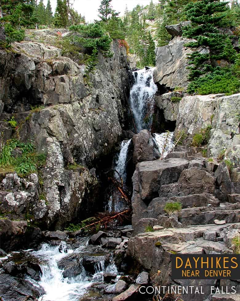
Continental Falls Hike Near Breckenridge
Continental Falls crashes through cracks in the granite sides of the mountains near Breckenridge Colorado. It's a moderate 2.5 mile uphill hike to the base of the waterfall. The 1000+ feet of elevation gain require some bodily exertion, but it's worth the effort. Located on the eastern slopes of the Mosquito Range, waterfall finds its source in the high mountain Mohawk Lakes as they spill out into Spruce Creek and make their way down the mountainside. The trail boasts spectacular mountain views, lakes, and the ruins of an old mining operation. Explore the full Continental Falls hike profile below for trail map, driving directions, and more tips and details to help you enjoy this hike near Breckenridge.
Trail Snapshot: Continental Falls Trail near Breckenridge, Colorado
| Hike Distance | Approx 5 miles Round Trip |
|---|---|
| Difficulty | Moderate |
| Duration | Approx 4 hrs |
| Trail Type | Out and Back |
| Starting Elevation | 10380′ |
| Elevation Gain | +1070′ |
| Seasons | Year Round |
| Dogs | Allowed On Leash |
| Hike Trail Map for Continental Falls | Click for a Map |
| Denver Drive Time | 1 hr 40 min |
| Driving Directions to Spruce Creek Trailhead | Click for Google Map |
| Town Nearest Hike | Breckenridge, Colorado |
| Beauty | waterfall, lakes, cabin ruins, creek, mountain views |
| Activities | Hiking, photography, horseback riding, fishing |
Parking & Trailhead Information for Continental Falls Hike
From Breckenridge, follow CO 9 South to The Spruce Creek Road. This is found on the right/west approximately 2.5 miles from the south end of town (junction of Main and South Park Ave). The trailhead for this hike to Continental Falls is located approximately 1.1 mile up Spruce Creek Road.
The Hike: Continental Falls Trail
The hike up to Continental Falls follows the Spruce Creek Trail. It's marked with blue diamond blazes making the trail easy to find and follow. Just shy of a 1/2 mile into the hike, the trail will cross Spruce Creek via a footbridge. At this point, the forest opens up a bit to views of my Helen in the distant west.
About 1.7 miles into the hike, the Spruce Creek trail will intersect with the Wheeler Trail. At this junction, continue straight on Spruce Creek Trail. At approximately 2 miles, the Spruce Creek trail will join up with the 4WD road, for a short jaunt past a small dam, then will connect back in with the Spruce Creek trail.
At about 2.5 miles into the hike, the trails reaches another junction. The left-hand trail leads up to Continental Falls and beyond to Mohawk Lakes. This segment of the trail is one of my favorites, as it leads past the ruins of a mining operation complete with cabins, mine shaft, and old mining equipment. Be sure to exercise caution and read the warning signs around such areas. At approximately 2.6 miles into the hike, the trail will arrive at Continental Falls. After taking in the waterfall, hikers often opt to go further up to gain incredible mountain peak and mountain range views at Mohawk Lakes.
Tips & Resources for Hiking the Continental Falls Trail
- TIP: There is a mine ruins off trail nearby. Be careful as there is a warning sign that it could collapse and may produce dangerous gases.
- Trail Map for Continental Falls: Trail Map
- Packing List: Always pack the 10 Essentials. Download our Hiking Guide to get the list and dayhiking packing checklist.
- Colorado Road Conditions: Colorado Road Conditions
- After the Hike: The Crown
Weather
Map & Driving Directions
Click for Driving Directions
Looking for more waterfalls near Denver? Explore our more than 50 Colorado Waterfall Hikes, our favorite Waterfall Hikes in Rocky Mountain National Park, or 7 Waterfalls within One Hour of Denver.
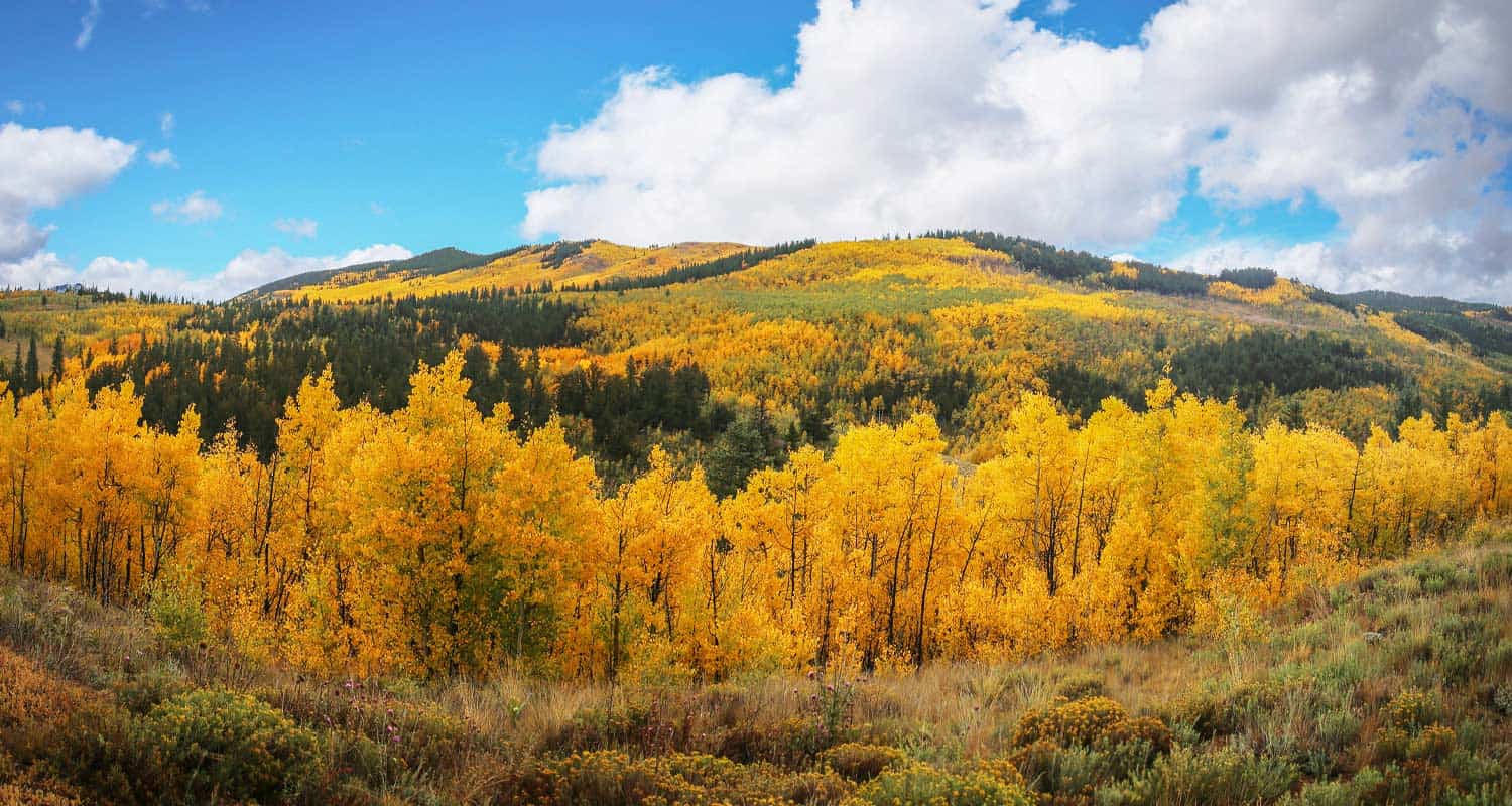
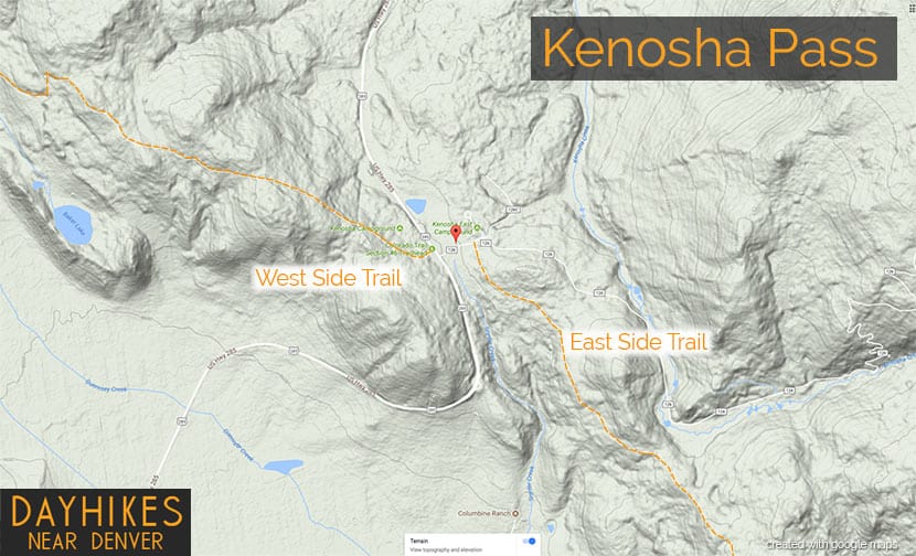
Kenosha Pass Hiking Trails
Kenosha Pass is probably the best place to view the changing aspens near Denver. It offers both an East and West trail option with gradual ascents to stunning views. Starting at 10,000' the initial elevation gain on the trails make for easy to moderately strenuous hikes, all depending on how far one decides to travel on these beautiful segments of the Colorado Trail. Vantage points can be accessed about 1/2 mile up both trails offering views down into the high country plains of South Park and out to the Rocky Mountains. Explore the full Kenosha Pass hike profile below for trail map, driving directions, and more tips and details to help you enjoy this Colorado hike.
Trail Snapshot: Kenosha Pass Colorado
| Hike Distance | <1 to 14.4 miles Round Trip |
|---|---|
| Difficulty | Easy to Moderate |
| Duration | Depends on Segment Hiked |
| Trail Type | Out and Back |
| Starting Elevation | 10,000′ |
| Elevation Gain | Approx +400' for shorter hikes |
| Seasons | Year Round |
| Dogs | Allowed On Leash |
| Hike Trail Map | Click for a Map of Kenosha Pass |
| Denver Drive Time | 1 hr 30 min |
| Driving Directions to Kenosha Pass East Parking Area | Click for Google Map |
| Town Nearest Hike | Grant, Colorado |
| Beauty | aspen groves, creek, wildflowers, mountain range views, views of South Park, wildlife: moose |
| Activities | Hiking, mountain biking, horseback riding, photography, snowshoeing, camping |
Parking & Trailhead Information for Kenosha Pass Hike
Kenosha Pass is located about 65 miles southwest of Denver along US 285. From Denver, take US 285 towards Bailey, Colorado. From Bailey, continue driving approximately 19 miles on 285 to the Kenosha Pass Trailhead. The trailhead parking area is located on both East (left when coming from Denver) and West (right side when coming from Denver) of 285. There is additional parking on the East side after crossing a cattle gate. Parking can get tight in the Autumn when the aspens are at their peak, so be considerate of others and the land as you park your vehicle. It's about a 90 minute drive from Denver. Restrooms can be found on both trailheads.
Hiking the Kenosha Pass Trail
Two Hiking Options and Where the Trails Begin
The hiking trails at Kenosha Pass easy to moderate in difficulty and can be done by hikers of all experience levels. At Kenosha Pass, the Colorado Trail, which goes from Denver to Durango, intersects with US Highway 285. This creates an East side trail option and an West side trail option. Both offer incredible views down into the South Park plains of Colorado and out to the often snow-capped peaks of the Mosquito Range.
Hiking the East Side of Kenosha Pass
Hikers can pick up the Colorado Trail after crossing the cattle gate (if parked along 285) and hiking along the dirt road that leads to the restrooms that are near the 2nd parking area (after the cattle gate). The Trailhead is located just before the 2nd parking area, and will be located on the right (south). While most visitors park, take a jaunt into the aspens, snap a few photos and leave, the more stunning views await those who venture further south along the trail. The initial trail segment enters with a gradual ascent into the aspens, then at 1/2 a mile into the hike the woods opens up to incredible views into South Park.
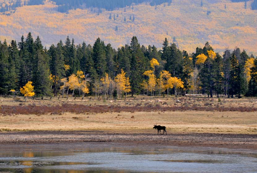
South Park is a high mountains plains area that stretches out mile-upon-mile to its western and norther mountain borders, the Collegiate Peaks and the Mosquito Range of the Rocky Mountains. The climb continues at a gradual pace and hikers will emerge to a second panorama at 1.5 miles. This is a great place to turn-around, making it into a 3 mile out-ant-back hike. Of course, hikers can continue on the trail all the way back into Denver, but that requires a multi-day backpacking trip. As always, keep eyes peeled for changing weather, and pack the 10 Essentials. If you are wondering what should be in your daypack, be sure to download our free Dayhike Hiking and Packing Guide. As for wildlife, moose are often spotted on this side along the lake near the trailhead.
Hiking the West Side of Kenosha Pass
The West Side Trail at Kenosha Pass can be picked up immediately on the West side of 285. The trail enters conifer and aspen forest, making a gentle climb toward the northwest until popping out of the trees to breathtaking views down into South Park and the Mosquito Range. After this viewpoint, the trail travels a short distance uphill, then makes its way down toward Guernsey Creek. The distance from the trailhead to Guernsey Creek is approximately 3 miles, making this a 6 mile out-and-back adventure. Because this is the Colorado Trail, it does continue west, offering multi-day backpacking options that lead all the way to Durango, Colorado.
Tips & Resources for Hiking the Kenosha Pass Trail
- TIP: Bring sunscreen for protection against the sun.
- TIP: One the east side of the highway, there is another parking lot with a lot of bathrooms.
- Trail Map: Map for Trailhead Locations
- Trails Illustrated Kenosha Pass Map: Trails Illustrated Map Link
- Packing List: Always pack the 10 Essentials. Download our Hiking Guide to get the list and dayhiking packing checklist.
- Colorado Road Conditions: Colorado Road Conditions
- Photo: We would like to express our gratitude to Ed Ogle for sharing such an amazing photograph of this hike on Kenosha Pass.
- After the Hike: The Shaggy Sheep
Weather
Map & Driving Directions to Kenosha Pass
Click for Driving Directions

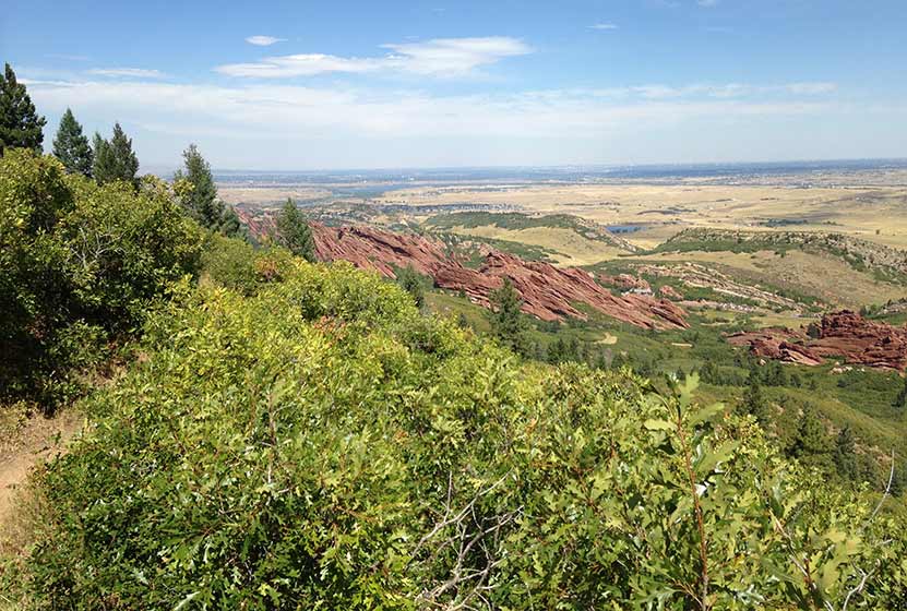
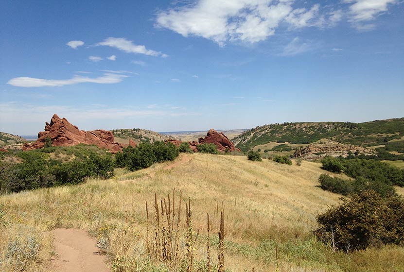
Elk Valley Trail in Roxborough State Park
The Elk Valley Trail in Roxborough State Park climbs to a lesser visited valley in the park. Incredible views of the red rock formations of Roxborough make this a great moderate hike near Denver. The hike to Elk Valley is a 4.8 mile out-and-back journey, but can be turned into one of two more strenuous loop hikes. Explore all the details below for trail map, driving directions, trailhead info, and photos of this hike near Littleton, Colorado.
Trail Snapshot: Elk Valley Trail at Roxborough State Park
| Hike Distance | 4.8 Mile with options |
|---|---|
| Difficulty | Moderate |
| Duration | 2-3hrs |
| Trail Type | Out-and-Back with Loop Options |
| Starting Elevation | 6200′ |
| Elevation Gain | +640′ |
| Seasons | Year Round |
| Dogs | Prohibited in the Park |
| Hike Trail Map | Click for a Trail Map |
| Denver Drive Time | 45 min |
| Driving Directions to Roxborough State Park | Click for Google Map |
| Town Nearest Hike | Littleton, Colorado |
| Beauty | Red rock formations, meadows, wildlife: mule deer, eagles, foxes, birds |
| Activities | Hiking, birdwatching, Visitors’ Center |
| Fee | Entrance Fee or State Parks Pass Required |
Roxborough State Park Parking Trailhead Information
Roxborough State Park is located south of Littleton, Colorado, at the base of the foothills near Pike National Forest. The last two miles of access road into Roxborough State Park are a maintained dirt road. This segment of road can get washboarded and can be tough on the car. Undulating green hills can be seen to the east where deer and antelope graze. Roxborough can fill up during the busy weekend hours. If that's the case, you can wait in line at the gatehouse until vehicles and a ranger gives you the signal to drive in. My guess is that the peak times are around 10AM-2PM. If the line looks long, you can always turn around and head over to Waterton Canyon or to South Valley Park--both are great options.
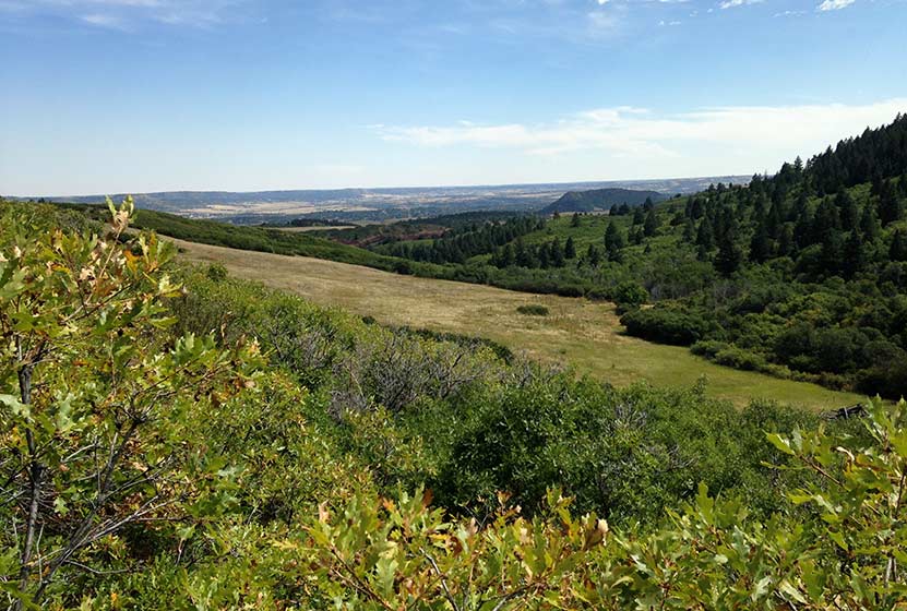
The 2.4 mile, one-way hike up to Elk Valley in Roxborough State Park begins at the main connector trail that runs south from the visitor center. Pictured above, this nearly 1/2 mile connector takes hikers through a passageway created by the scrub oak trees overarching the trail. The undergrowth in this segment of the hike contains a lot of poison ivy. While the poison ivy is off to the side of the trail, it's still easy to brush up against. So, be aware as you make your way through this part of your hike. Also, keep alert for the many birds that make this thicket their home, especially the Western Tanagers that visit in the Spring.
The trail emerges from the shade of the scrub oak into a meadow framed by red rock and yellow cliff bands. A lone cottonwood with a bench stands in the open field of tall grass. One of the great things about Roxborough State Park is the strategic placement of benches, many of them offering shade and wonderful views into the park. At the meadow, the trail will pass through a junction with the South Rim trail and cross a dirt service road. At this point, the trail becomes more demanding, working up a series of switchbacks that lead in and out of the forested sides of the foothills.
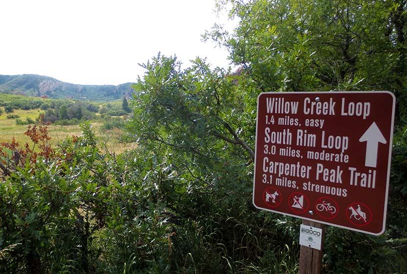
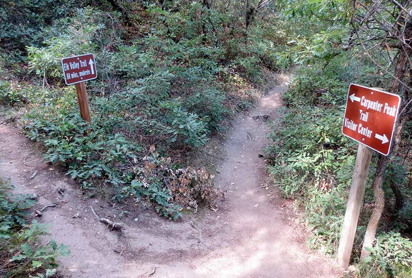
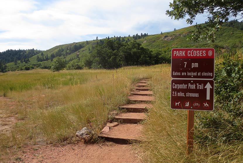
At 1.7 mile into the hike, the trail comes to a Y intersection (pictured below). The trail up the Carpenter Peak takes hikers to the right. The route to Elk Meadows and the Douglas Country Trails beyond it, lead off to the left.
The trail climbs through the forest then opens back to the oaks thickets where, in Autumn you'll hear the continual crunch of of acorns underfoot. Elk Valley comes into view before the trail comes to its end. Another bench sits in the shade of a pine tree and overlooks Elk Valley below. This is a quieter and less visited pat of Roxborough State Park and an ideal spot for viewing wildlife--especially in the early morning or at dusk.
Though the official Elk Valley hike ends at 2.4 miles in, the trail terminates at a junction with a set of Douglas County Trails and USFS trails. These can be used to create two different loop hike options.
Loop Hike Option #1: At the intersection, a 1.75 mile USFS Powerline Trail leads to the right, working its way North where it comes to a junction with the Carpenter Peak Trail. Here hikers can take a right, and hike approximately 1/2 mile to the summit of Carpenter Peak. From the summit, return to the visitor center by following the Carpenter Peak trail back down into the valley floor. This makes for a 7.7 mile strenuous loop hike.
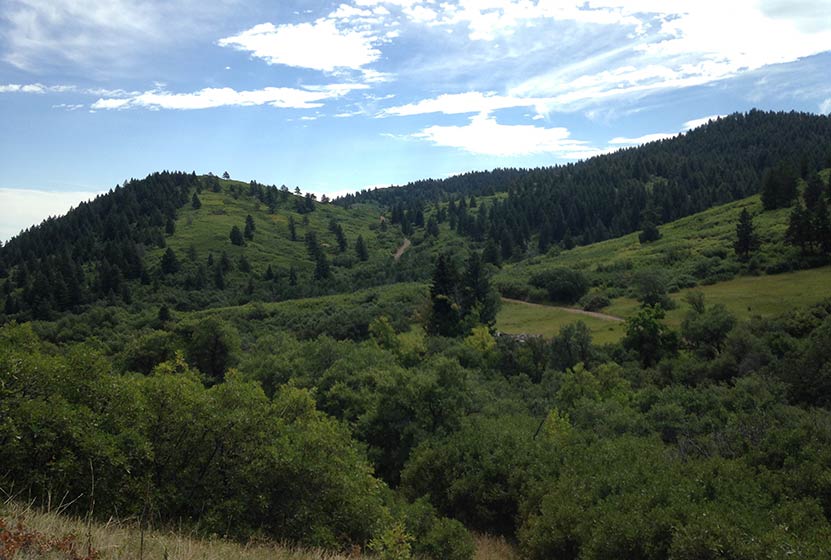
Loop Hike Option #2: At the intersection, a 1.28 stretch of Douglas County Trail leads off to the left. The trail works its way East over a small peak (pictured below), then descends to a junction with the Sharptail and Swallowtail trails. The route back into Roxborough State Park requires taking a left onto a dirt road, Iron Bark Drive. This .88 mile segment (pictured on the trail map) leads northwest back into the heart of the park. Back in the park, hikers can rejoin the trails that lead back to the visitor center. This demanding loop hike totals approximately 5.3 miles.
Tips & Resources for Hiking to Elk Valley in Roxborough
- Packing List: Always pack the 10 Essentials. Download our Hiking Guide to get list and dayhiking packing checklist.
- Dealing with Poison Ivy: You don't have to come into direct contact with poison ivy to get it. Often, it transfers from your clothing to your skin. So be sure to wash your clothing when you get home, if you think you have brushed up against it during your hike in Roxborough.
- Hiking in Winter: If you plan to hike Elk Valley in the winter, it is advised that you have traction devices like YakTrax because much of the trail will be in shadow, and ice will likely form on the trail.
- Trail Map for Roxborough State Park: Trail Map Link
- Colorado Road Conditions: Colorado Road Conditions
- After the Hike: Waterton Tavern in Roxborough
Weather
Map & Driving Directions
Click for Driving Directions
Carpenter Peak Hike in Roxborough State Park
The hike up Carpenter Peak in Roxborough State Park is a strenuous 3.1 mile journey (one-way) to a foothill summit that overlooks the red rock formations of Fountain Valley. You'll also gain 360 degree panoramic views of Denver, east to the plains, and west to distant snow-capped peaks. In this Colorado trail profile, you'll find driving directions, trail map, and more tips and details to help you enjoy this adventure in Roxborough State Park.
Trail Snapshot: Carpenter Peak Hike at Roxborough State Park
| Hike Distance | 6.2 Mile Round Trip |
|---|---|
| Difficulty | Moderate |
| Duration | 3-4 hours |
| Trail Type | Out and Back |
| Starting Elevation | 6200' |
| Elevation Gain | Approx. +960' |
| Seasons | Year Round |
| Dogs | Prohibited in Roxborough State Park |
| Hike Trail Map | Click for a Map of Roxborough State Park |
| Denver Drive Time | 45 min |
| Driving Directions to Roxborough State Park | Click for Google Map |
| Town Nearest Hike | Littleton, Colorado |
| Beauty | Red rock formations, meadows, wildlife: mule deer, eagles, foxes, birds |
| Activities | Hiking, birdwatching, Visitors’ Center |
| Fee | Entrance Fee or State Parks Pass Required |
Parking and Trailhead Information
The last two miles of access road into Roxborough State Park are a maintained dirt road, but it can get washboarded and can be tough on the car. Still, it's not a long drive in. Undulating green hills can be seen in the east where deer and antelope graze. Roxborough State Park can fill up during it's busiest hours on the weekend. If that's the case, you can wait until enough vehicles exit the park then drive in. The peak times appear to be are around 10AM-2PM on the weekends. If the line looks long, you can always turn around and head over to Waterton Canyon or to South Valley Park--both are great options.
The hike up to Carpenter Peak begins just southwest of the Roxborough State Park visitor center. Clear signage marks this access to Carpenter Peak, the Willow Creek, and South Rim Trails (pictured above). Soon the trail enters a corridor of scrub oak which provides shade for this first short segment of the hike. There is a great deal of poison ivy in this corridor, so be sure to avoid going off trail. Just short of 0.5 mile into the hike, the trail will open up to a large meadow among the red rock. Continue following the signs for Carpenter Peak.
The trail will soon cross a dirt road and begin its way west. This is the most steep and demanding segment of trail. We've classified this as a moderate hike in difficulty, but for those who are from out-of-town or who are not in the best of shape, it may be considered difficult.
At 1.7 mile, the trail will come to a Y intersection (pictured above). The trail to the left leads to Elk Meadows, and the trail for Carpenter Peak leads to the right. The trail now winds along the hillsides with switchbacks that open up to expansive views of the red rock formations that make Roxborough Park Denver's Garden of the Gods.
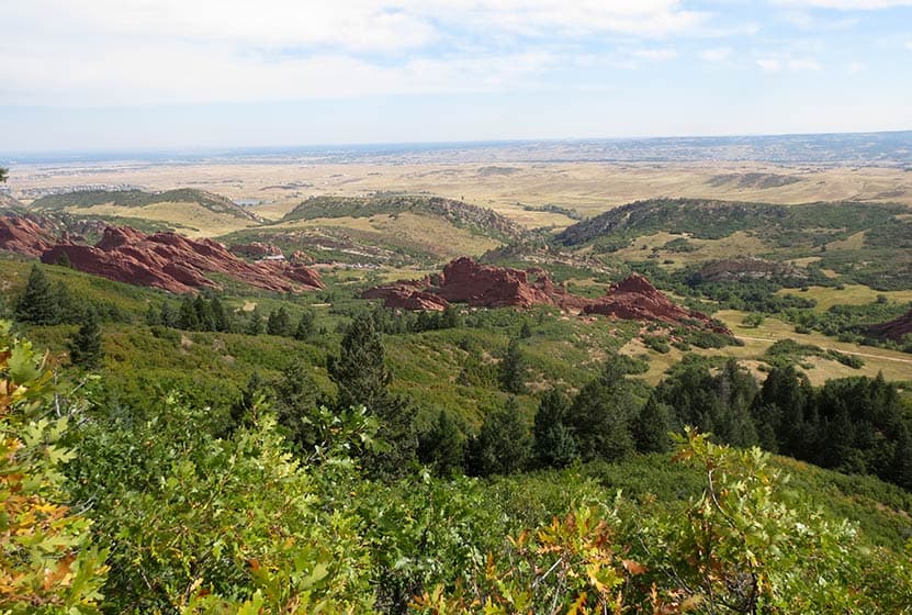
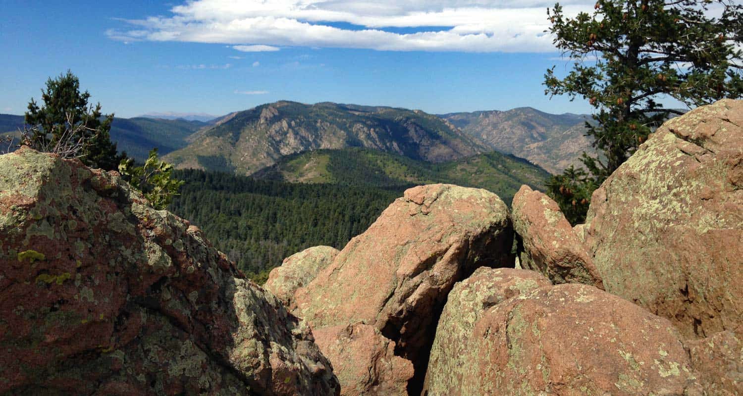
After gaining the ridge at mile 3, hikers will encounter a final intersection. Again, there is clear signage pointing the way right to Carpenter peak, now just a few hundred yards further. At the summit, you'll be able to take in a 360 degree panorama of Denver, Roxborough State Park, the plains, and distant mountains in the west. I particularly enjoy the views from here over to the mountains that surround Waterton Canyon. In the Spring and early Summer, a few western peaks will still still show their snow caps.
The return route follows the same trails back down to the visitor center.
Tips & Resources for Hiking to Carpenter Peak in Roxborough
- Posion Ivy: Because there is a significant amount of poison ivy that grows out to the edges of parts of this trail, it's wise to wash your clothing soon after your return home as poison ivy can affect people by indirect contact.
- Hiking in Winter: If you plan to hike Carpenter Peak in the winter, it is advised that you have traction devices like YakTrax because much of the trail will be in shadow, and ice will likely form on the trail.
- Trail Map for Roxborough State Park: Trail Map Link
- Packing List: Always pack the 10 Essentials. Download our Hiking Guide to get list and dayhiking packing checklist.
- Colorado Road Conditions: Colorado Road Conditions
- After the Hike: Waterton Tavern in Roxborough
Weather
Map & Driving Directions
Click for Driving Directions


Lost Falls Hike in Rocky Mountain National Park
The hike to Lost Falls is a demanding 15.6 mile trek into into a lesser traveled, northern reaches of Rocky Mountain National Park. The trail follows the North Fork of the Big Thompson River through stands of lodgepole, the pinch of a rugged canyon, and past aspen laden meadows before reaching this hidden waterfall. Explore the full Lost Falls hike profile below for trail map, driving directions, and more tips and details to help you enjoy this adventure in Rocky Mountain National Park.
Note: Rocky Mountain National Park now requires timed entry permits from May 27th through October 10th. See the RMNP permits page for more information.
Trail Snapshot: Lost Falls in Rocky Mountain National Park
| Hike Distance | 15.6 miles Round Trip |
|---|---|
| Difficulty | Difficult |
| Duration | Approx 7+ hr Round Trip |
| Trail Type | Out and Back |
| Starting Elevation | 7800' |
| Elevation Gain | Approx. +2250' |
| Seasons | Late Spring through Early Fall |
| Dogs | Prohibited in RMNP |
| Hike Trail Map | Click for a Map of Lost Falls RMNP |
| Trails Illustrated Map | Recommended Topo Map Noting Location of Lost Falls |
| Denver Drive Time | 1 hr 40 min |
| Driving Directions to Dunraven Trailhead | Click for Google Map |
| Town Nearest Hike | Estes Park, Colorado |
| Beauty | Waterfall, aspen, mountain views, wildlife: Abert’s squirrel, elk, deer, moose, bear; wildflowers |
| Activities | Picnicking, hiking trails, snowshoeing, horseback riding, backcountry camping (with a permit), photography |
| Fee | Park Pass Required |
Parking & Trailhead Information for Lost Falls
The Dunraven Trailhead is located in the northeast corner of Rocky Mountain National Park, just outside the town of Glen Haven. From Estes Park, drive north on MacGregor Avenue. The road eventually turns into Devils Gulch Road. The next road is Dunraven Glade, and will be on the left 1.7 miles past the small hamlet of Glen Haven. Follow Dunraven Glade Road for 2.2 miles to the Dunraven Trailhead.
The Hike: Lost Falls Trail in RMNP
This scenic hike to Lost Falls in Rocky Mountain National Park is a demanding 15.6 mile round-trip hike with over 2000' of elevation gain. Because the waterfall is located off the main trail and in a dense tangle of undergrowth and deadfall, hikes should possess a sufficient level of land navigation skills (map reading and proficiency with a compass and/or GPS unit) to negotiate the terrain. It is also advisable to have a Trails Illustrated map of RMNP or a USGS Pingree Park Quadrangle map of the area.
The Dunraven/North Fork Trail heads west out of the trailhead following the North Fork of the Big Thompson River through a segment of the Comanche Peak Wilderness. For a quarter mile, the trail will cross the private property of a summer camp (please be mindful to stay the trail). At 4.6 miles, the Dunraven Trail will cross the wilderness boundary and into Rocky Mountain National Park. The trail will continue to cross the river via several footbridges before arriving at the intersection with the North Boundary Trail at 5.5 miles. Here, hikers will stay on the Dunraven trail as it winds its way west, following the North Fork of the Big Thompson River up the valley. The established campsites are in this stretch. Several years back, I hiked in and stayed the weekend at Happily Lost, which has become one of my favorite sites in the park. While still near the trail, it's proximity to the Big Thompson gives you the sounds of water and access to some great fishing for brook trout in its pools.


Tips & Resources for Hiking to Lost Falls in RMNP
- Great Fishing: After the Spring melt, the North Fork of the Big Thompson River offers some great fishing for brook trout. We recommend terrestrials and small elk hair caddis flies.
- Bring plenty of food and water: It's a long and demanding hikes, so be sure to carry plenty of water and food to fuel your hike. Better yet, reserve one of the campsites and enjoy exploring the area around Lost Lake.
- Trail Map for Lost Falls in RMNP: Trail Map Link. See marker near the intersection with the North Boundary Trail
- Trails Illustrated Map: Recommended Topo Map Noting Location of Lost Falls
- Packing List: Always pack the 10 Essentials. Download our Hiking Guide to get list and dayhiking packing checklist.
- Colorado Road Conditions: Colorado Road Conditions
- After the Hike: Notchtop Bakery & Cafe
Weather
Map & Driving Directions
Click for Driving Directions

Rainbow Falls Hike in Colorado Springs
The hike to Rainbow Falls is a short easy walk to the waterfall and a historic bridge. The waterfalls is located in Manitou Springs, just west Colorado Springs. The waterfall and bridge had been neglected for decades, but the area is now being restored by local government and local citizens. Explore the full Rainbow Falls hike profile below for trail map, driving directions, and more tips and details to help you enjoy this waterfall hike near Colorado Springs.
Trail Snapshot: Rainbow Falls in Colorado Springs
| Hike Distance | 0.2 mile Round Trip |
|---|---|
| Difficulty | Easy |
| Duration | Less than 1 hr |
| Trail Type | Out and Back |
| Starting Elevation | 6480′ |
| Elevation Gain | Approx +40′ |
| Seasons | Year Round, but best in Spring |
| Dogs | Allowed On Leash |
| Denver Drive Time | 1 hr 20 min |
| Driving Directions to Rainbow Falls Trailhead | Click for Google Map |
| Town Nearest Hike | Manitou Springs, Colorado |
| Beauty | Waterfall, creek |
| Activities | Hiking, photography |
Parking & Trailhead Information for Rainbow Falls
The Rainbow Falls trailhead is located approximately 6 miles from interstate 25, just west of the city of Colorado Springs. From I-25 in Colorado Springs, take the exit for 24/Cimarron. Heading west on 24/Cimarron for 5.5 miles. Turn left onto Serpentine Drive (across from the entrance to Cave of the Winds). The Rainbow Falls Recreation area trailhead is located 0.3 mile up Serpentine Drive, on the right side of a switchback. The trail is found far end of the parking area by the gate.
The Hike: Rainbow Falls Trail in Colorado Springs
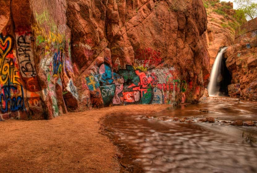
It's just a short 1/10th of a mile hike (one-way) to the waterfall. This easy trail takes hikers along the orange and golden rock faces that surround fountain creek, underneath the bridge to the base of the falls. Constructed in 1934, the bridge is on the National Register of Historic Places.
Locals remember when this area before it became clogged with erosion, spoiled by graffiti, and littered with trash. The floods of 2013 brought renewed attention to this hidden area, and a concerned group of citizens put a plan together and pursued grant funding to restore and expand what is now named the Rainbow Falls Recreation Area. In 2016, the state began repair on Rainbow Falls Bridge. After the bridge repair, work on restoring the trail will begin in earnest. The grafitti will be removed, and efforts will be set in place to prevent vandalism of this natural area. Future projects are slated over the next few years, including, the stabilization of the surrounding slopes, construction of picnic overlooks, restoration of habitat and fishing, and connectors to other trails in the Pikes Peak region.
It's important to note that swimming is prohibited and the parking area and Rainbow Falls Recreation area do not allow overnight vehicles or camping. Dogs are allowed on leash, but due to the present state of fountain creek, it is advisable that both pets and their owners refrain from wading into the water; glass and other sharp objects may be littering the creek bed and could cause injury.
Significant progress on the restoration of the Rainbow Falls Recreation area should be completed by the Summer of 2017. More more details, see the Rainbow Falls Recreation Area Master Plan.
Tips & Resources for Hiking to Rainbow Falls in Colorado Springs
- Packing List: Always pack the 10 Essentials. Download our Hiking Guide to get the list and dayhiking packing checklist.
- Colorado Road Conditions: Colorado Road Conditions
- Photo: We would like to express our gratitude to Casey Reynolds for sharing such an amazing photograph of this hike to Rainbow Falls in Colorado Springs.
- After the Hike: The Mate Factor in Manitou Springs
Weather
Map & Driving Directions
Click for Driving Directions
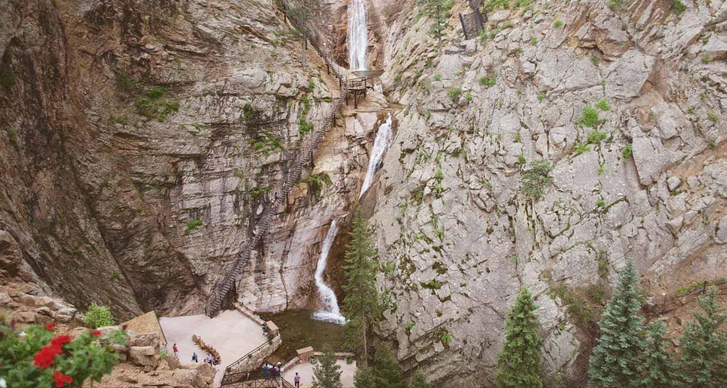
Seven Falls Hike in Colorado Springs
The hike to Seven Falls in Colorado Springs follows a paved canyon trail 0.8 mile to this famous tiered 181-foot waterfall. After severe damage by the floods in 2013, the Broadmoor Resort purchased the property and has made significant improvements, including trail and site repairs, as well as creating an on-site restaurant. As in the past, there is an access fee to this historic Colorado Springs attraction. Explore our full Seven Falls hike profile for 4 different hike options, driving directions, trail map, and tips for making the most of your trip to Seven Falls.
Trail Snapshot: Seven Falls in Colorado Springs
| Hike Distance | 0.4 to 3 miles |
|---|---|
| Difficulty | Easy |
| Duration | Less than 1 hr up to 4 hours |
| Trail Type | Out & Back and Loop Option |
| Seasons | See Site for Dates/Hours of Operation |
| Dogs | Allowed On Leash |
| Hike Trail Map | Click for a Map of Seven Falls Colorado Springs |
| Denver Drive Time | 1 hr 20 min |
| Driving Directions to Seven Falls Parking | Click for Google Map |
| Town Nearest Hike | Colorado Springs, Colorado |
| Beauty | Waterfall, canyon, creek |
| Activities | Hiking, photography, zipline tours |
| Fee | See the Seven Falls Website for current fees |
Parking & Trailhead Information for Seven Falls
The parking and shuttle service for Seven Falls is located at 1045 Lower Gold Camp Road in Colorado Springs. Visitors take the free shuttle from the parking area to the Seven Falls entrance. From here, it’s a 0.8 mile (one-way) hike through the canyon up to Seven Falls. Visitors have the option of taking a tram service to the base of the falls; however, the tram is prioritized for those who have physical limitations that may prevent them from making the journey up to the falls and back. So, on busy days, availability may be limited.
Driving Directions for Seven Falls Parking:
You must take a shuttle from the Norris Penrose building. To access the shuttle from Denver, take I-25 South to exit 141 onto North Cimarron St. Go right/west onto Cimarron St./24 West. At the first intersection, turn left onto 8th Street. After just 0.4 mile on 8th street, turn right onto Lower Gold Camp Road. After 0.4 mile on Lower Gold Camp Road, take a left into the Penrose Equestrian Center. Parking is in the dirt lot to the north of the Norris Penrose building (look for 7 Falls signs). There is no parking at Seven Falls.
Fee:
While parking itself is free of charge for patrons, there is a fee required to visit Seven Falls. For the most up-to-date prices and hours, access the Seven Falls site or contact the Seven Falls Office at 1-855-923-7272.
The Hike: Seven Falls Trail in Colorado Springs
There are three different hike options for visitors to Seven Falls in Colorado Springs.
#1 – Entrance to Base of Seven Falls
Visitors to Seven Falls can walk the 0.8-mile paved trail from the entrance to the base of the falls. The paved, private road winds through South Cheyenne Canyon and under the shadows cast by the Pillars of Hercules, a set of twin rock towers that soar nearly 1000 feet above the floor of the canyon.
At the base of the waterfall, you can choose to take the staircase of 224 steps that provide an opportunity to view the unique segments of this tiered waterfall and give visitors access to the additional three hikes above Seven Falls. At the falls, visitors can also take an elevator to an observation point, which is perhaps the best place to photograph the falls.
A Great Place to Rest and Relax
The path to the base of the falls is wheelchair accessible, and there is a sheltered viewing area (pictured here) and rocking chairs for visitors. If you’re hiking along Cheyenne Creek from the entrance, you’ll also find benches and picnic tables along the trail where you can take a break and soak in the sights and sounds of the canyon.
#2 – Midnight Falls Loop Hike
After climbing the steps to the area above Seven Falls, a short 0.35-mile trail leads south along Cripple Creek to another small waterfall, Midnight Falls. Round trip, this hike takes approximately 30 minutes and is a total distance out-and-back of 0.7 mile.
#3 – Inspiration Point Out-and-Back Hike
Once above the Falls, visitors will follow the Midnight Falls Trail until its first intersection with the Inspiration Point Trail. Taking a left onto the Inspiration Point Trail, it will lead east, then north to the Helen Hunt Jackson Memorial and to the Inspiration Point observation area. Here, hikers can take in views of the Great Plains as they stretch out to the East and of views of the city of Colorado Springs below. The hike to Inspiration Point is about 1.5-mile round-trip and takes approximately one hour to complete from the top of the falls.
Adventure Report – June 2023
In June of 2023, my teenage daughters and I hiked the winding canyon road up to Seven Falls, climbed the steep set of stairs to the top, and explored the trails above the falls. We enjoyed a wonderful lunch at 1858 restaurant, explored the gift shops, and made some memories.
A front had moved in, bringing rain to Colorado Springs, but it didn’t ruin our adventure. In fact, the clouds and mist added to the enchantment of Cheyenne Canyon. I was impressed by the established trees lining the creek: thick Ponderosa Pines and tall Douglas Fir. The White Fir trees were especially beautiful in the rain. When wet, their needles turn a glossy white and shimmer when they catch the light.
Along the road, toward the top, there’s a food truck and picnic pavilion. At this point, what stood out most to me was the care taken to preserve and maintain the property. From the lawns to the flowers, and paint to the lighting, the grounds were immaculate. We experienced the same thing at the Cog Railway in Manitou Springs. I love places with historical significance, and I’m always encouraged to see them so well cared for.
Lunch at 1858 Restaurant
The walls of 1858 are decorated with Western artwork and memorabilia documenting the history of Seven Falls and Cheyenne Canyon. Compared to a lunch down in Colorado Springs, you’ll pay a bit of a premium to eat here next to the falls. However, like every establishment managed by the Broadmoor, you’ll get fantastic food and top-notch service. Our girls both eat gluten-free, and 1858 provided a GF bun for their burgers–and the fries were perfect.
Reservations are recommended for dinner, and you’ll want allow about an hour before your reservation for taking the shuttle and walking the road up to the restaurant. More info is available at: https://www.sevenfalls.com/dine/restaurant-1858/
After lunch, we climbed the 224 steps to the top of the falls. Along the way, we enjoyed the more up-close experience of the upper leaps that make up the seven segments of the waterfall.
The trails above the falls were well-marked, and it was easy to find our way to Midnight Falls and then over to Inspiration Point. Midnight Falls is a quaint waterfall, and was worth the short hike through the forest.
While the girls took the steps back down to the gift shop, I hiked the trail up to Inspiration Point. I actually found some of the lookouts along the way more enjoyable than the final destination. Distant lightning and some loud thunder were moving in from the west, so I high-tailed it back down to the base of the Falls.
Though it was a misty and foggy day, we were all smiles. The hike through the canyon to the falls, our lunch, and our time being together as a family was another chance to make memories and enjoy this unique site in our beautiful state of Colorado.
Tips & Resources for Hiking to Seven Falls in Colorado Springs
- Expect Crowds in Summer and on Weekends: Because Seven Falls is a popular tourist destination, it can become quite crowded on weekends and during the vacation season of Mid-May through Labor Day Weekend.
- Operating Hours Vary: The open and close times, as well as shuttle service, varies during different seasons. Inclement weather can also close Seven Falls, so be sure to call ahead for hours 1-855-923-7272.
- Trail Map for Seven Falls in Colorado Springs: Trail Map Link
- Packing List: Always pack the 10 Essentials. Download our Hiking Guide to get the list and dayhiking packing checklist.
- Colorado Road Conditions: Colorado Road Conditions
- Photo: We would like to express our gratitude to Tim Caynes and John Folwer for sharing their photographs of Seven Falls in Colorado Springs.
- After the Hike: Restaurant 1858 at Seven Falls: The lunch menu is more than what you might pay at a similar place in town, but quality of food and beautiful location make it worth it. Dinner menu is more expensive. No dogs, except service animals, allowed at the restaurant.
Weather
Map & Driving Directions
Looking for more waterfalls near Denver? Explore our more than 50 Colorado Waterfall Hikes, our favorite Waterfall Hikes in Rocky Mountain National Park, or 7 Waterfalls within One Hour of Denver.
Catamount Falls Hike Near Colorado Springs
The hike to Catamount Falls is a moderate 2.8-mile loop hike about 25 minutes outside of Colorado Springs. This waterfall hike takes hikers to three different waterfalls and over two different creeks that spill down from the heights of Pikes Peak. It makes for a great weekend adventure, coupled with a great opportunity for brunch at the Pantry in Green Mountain Falls. Explore the full Catamount Falls hike profile below for driving directions, trail route description, and more tips and details to help you enjoy this adventure near Colorado Springs.
NOTICE: Catamount Trail access is closed from 8/4/21 to 9/1/21. For Details see Trails and Open Space Coalition Website.
Trail Snapshot: Catamount Falls in Colorado Springs
| Hike Distance | 2.8 miles |
|---|---|
| Difficulty | Moderate |
| Duration | Approx 1-2 hr |
| Trail Type | Loop |
| Starting Elevation | 7720' |
| Elevation Gain | Approx. +560' |
| Seasons | April through October |
| Dogs | Allowed On Leash |
| Denver Drive Time | 1 hr 30 min |
| Driving Directions to Ute Pass Avenue-Lake Street Trailhead | Click for Google Map |
| Town Nearest Hike | Green Mountain Falls, Colorado |
| Beauty | Waterfall, creek, mountain views, wildflowers |
| Activities | Hiking, photography |
Parking & Trailhead Information for Catamount Falls
The hike to Catamount Falls starts at Thomas Trailhead in the quaint mountain village of Green Mountain Falls. However, since there is no parking available at the Thomas trailhead, the hike must be started from the Gazebo Lake parking area in town. To get to Gazebo Lake, from interstate 25, take exit 141 and go west on Cimarron Avenue/US 24 for 13.5 miles to the Chipita Park/Green Mountain Falls exit. Following Green Mountain Falls Rd/Ute Pass Avenue for approximately 0.7 miles. Take a left onto Lake Street. Here you will find the parking area that lines the north side of the small lake.
The Hike: Catamount Falls Trail in Colorado Springs
The loop route below requires two segments along the streets of Green Mountain Falls. The first 0.4 mile segment of the hike will takes hikers from Gazebo Lake to the Thomas Trailhead. Beginning at Gazebo Lake, walk the roadside of Ute Pass Avenue that follows the southern edge of Gazebo Lake. Take a right at the first intersection onto Hotel Street. The streets can be a bit confusing in Green Mountain falls, and Hotel Street will soon turn into Park Avenue. Follow Park avenue as it winds up to its intersection with Boulder Street, a dirt (and sometimes muddy) road that terminates at the Thomas Trailhead.
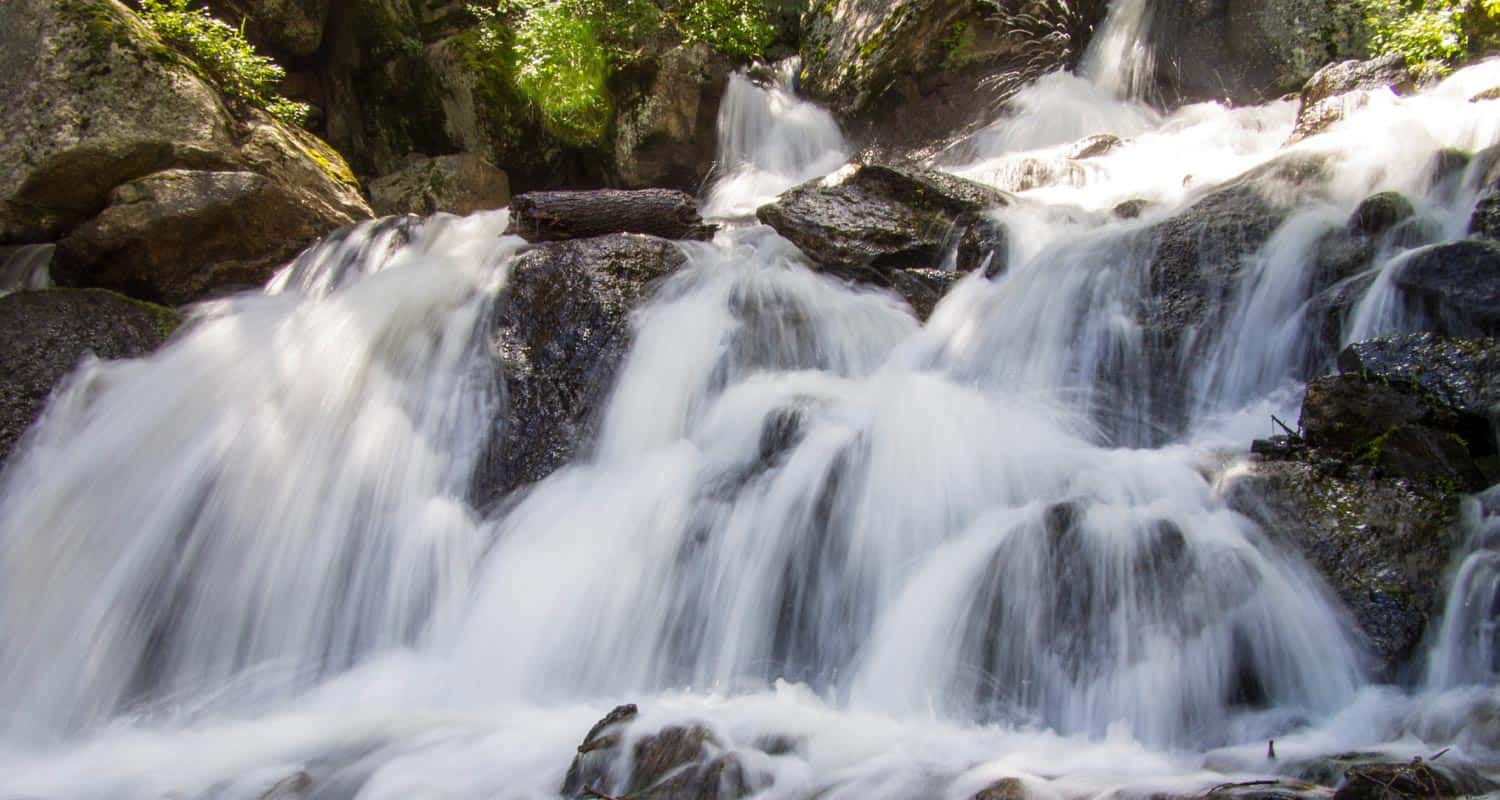
Once on the Thomas Trail, yellow circle blazes mark the way. The initial stretch of trail leads to the base of the first waterfall on this hike, Crystal Falls @ 0.5 mile. This set of cascades is formed by Crystal Creek as it runs down the mountainside from a Crystal Creek Reservoir, one of the lakes situated above Green Mountain Falls on the flanks of Pikes Peak. A bit further up the trail, there is an observation area for taking in the larger leaps of the falls.
The next 0.7 mile segment of the Thomas Trail leads to the second waterfall, Catamount Falls, and is the more demanding portion of the hike. The trail climbs west/northwest until it arrives at Thomas Trail Memorial. After the memorial, Catamount Falls is just a short ways further up the trail. A spur trail leads from the left/south to the site of Catamount falls.
From Catamount Falls, the next segment of trail goes north to take hikers back into Green Mountain Falls. Yellow blazes mark the way across the creek and back to the Thomas Trail. Soon the trail will encounter an intersection with the Catamount trail at the Catamount Trailhead. Staying on the Thomas Trail, it will cross a small footbridge where a third small waterfall can be viewed. The trail then terminates at Belvedere Avenue.
Here, the final 1-mile segment of this loop hike begins. Taking a right onto paved Belvedere Avenue, it will lead east, back into town. Belvedere Avenue will eventually merge with Ute Pass Avenue. Going South/Right on Ute Pass Avenue then leads back to Gazebo Park.
You may be wondering, "What is a 'catamount?'" A catamount is a mountain lion, also known as a cougar. The Catamount Reservoir and Catamount Creek are both named after this creature that lives in the wilds of Colorado.
Looking for more waterfalls near Denver? Explore our more than 50 Colorado Waterfall Hikes, our favorite Waterfall Hikes in Rocky Mountain National Park, or 7 Waterfalls within One Hour of Denver.
Tips & Resources for Hiking to Catamount Falls in Colorado Springs
- Watch for yellow markers: These will guide you along the Thomas Trail.
- Get there early: This can be a crowded hike on the weekends.
- Parking: Out of respect for the residents of Green Mountain Falls, refrain from parking along the roads near the trailhead. Instead, park at Gazebo Lake and follow the trail description above.
- A Shorter Option: For those looking for a less demanding hike to just one waterfall, follow the route above to take in Crystal Falls only. This makes for a less demanding 1 mile, out-and-back hike.
- Packing List: Always pack the 10 Essentials. Download our Hiking Guide to get the list and dayhiking packing checklist.
- Colorado Road Conditions: Colorado Road Conditions
- Photo: We would like to express our gratitude to Ethan Beute for sharing such an amazing photograph of this hike to Catamount Falls in Colorado Springs.
- After the Hike: The Pantry Restaurant: One of our favorite breakfast places in all of Colorado
Weather
Map & Driving Directions
Click for Driving Directions