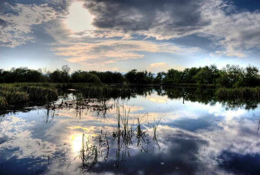
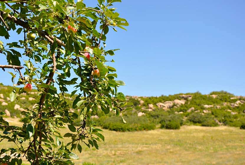
Crown Hill Lake Trails
Jefferson County seems to turn to gold about every park they touch here in Colorado. Crown Hill Lake Park is a prime example. It's an oasis in the midst of the busy city of Denver. The park has beautiful views of the Front Range mountains, including the Flatirons down in Boulder.
Crown Hill Lake Park has three miles of paved trails and .7 of them are considered ADA accessible, all in the heart of Denver. On the northwest side of the park, you'll find a wildlife sanctuary for migratory birds. Explore the full trail profile below for all the details: hiking trails, trail map, and detailed directions to the trailhead.
Trail Snapshot: Crown Hill Lake Trails
| Hike Distance | 1.2 miles+ |
|---|---|
| Difficulty | Easy |
| Duration | Approx 45mins+ |
| Trail Type | Loop |
| Seasons | All |
| Dogs | Allowed on Leash in Most Areas |
| Hike Trail Map | Click for a Map of Crown Hill Lake Trails |
| Denver Drive Time | 17 min |
| Driving Directions to Crown Hill Lake Trails | Click for Google Map |
| Town Nearest Hike | Lakewood, Colorado |
| Beauty | Lake, wildlife sanctuary, Front Range views, wildlife: ducks, geese |
| Activities | Horseback riding, cycling, fishing, hiking, picnic areas |
Hikes at Crown Hill Park:
- Loop Trail - 1.2miles - goes around the lakeside
- Perimeter Trail - 2 miles - goes around the edge of the park
- Nature Preserve Trail / Wildlife Sanctuary Trail - .7 mile - Hiker Only and ADA accessible trail
- Link to the Park's Map
Tips & Resources for Hiking Crown Hill Lake Trails :
- TIP: It's a busy park, so try earlier and later in the day.
- TIP: The wildlife preserve is hiker only. No dogs in this area.
- TIP: There is a lot of multi-use traffic on the trails, so be alert and yield when appropriate.
- Trail Map for Crown Hill Park: Trail Map Link
- Colorado Road Conditions: Colorado Road Conditions
- After the Hike: Danny's Carnation Restaurant
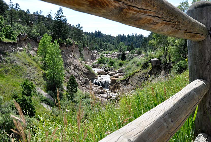
- Photo: We would like to express our gratitude to Kasey Cline for sharing such an amazing photograph of this hike.
Weather
Map & Driving Directions
Click for Driving Directions

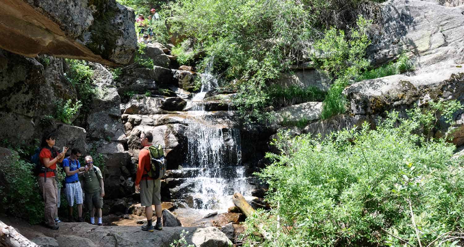
Maxwell Falls Near Evergreen, Colorado
The Maxwell Falls hike is our most popular hike near Denver. Why? Because it's a perfect Colorado family hike with a variety of terrain, and it takes you to one of the closest waterfalls to Denver. Below, you'll find three different hike options: a one-mile hike, a three-mile loop, and a four-mile trek--all taking you to Maxwell Falls.
IMPORTANT NOTES:
#1: While this is a moderate hike, a significant number of novice and unprepared hikers have found themselves in challenging circumstances while hiking these trails: dehydration, heat exhaustion, altitude sickness, etc., and have had to call for emergency and rescue services. Evergreen Fire and Rescue urges novice and out-of-town hikers to seriously consider your fitness level before attempting the hike, to wear shoes that will help you navigate loose gravel, and to pack water for your trip.
#2: In the last few years, Maxwell Falls has become one of the most popular destination hikes near Denver, and it's having a negative impact. In other words, Maxwell Falls is being loved to death. Please read through the Help Care for Maxwell Falls segment for basic trail etiquette that will help protect this beautiful place.
Trail Snapshot: Maxwell Falls Hike
| Hike Distance | 1.6 to 4 Miles |
|---|---|
| Difficulty | Moderate |
| Duration | 45 min to 2 hr 30 min+ |
| Trail Type | Out & Back and Loop |
| Seasons | Summer through Fall |
| Dogs | Allowed on Leash |
| Denver Drive Time | 50 min |
| Directions | Lower Parking Area - Upper Parking Area |
| Town Nearest Hike | Conifer, Colorado |
| Beauty | Waterfall, overlooks, creek, woodlands |
| Activities | Picnicking, hiking trails |
When we were moving to Denver, we were looking for a great house and for great hikes, and our favorite hikes end with a waterfall. Waterfalls close to Denver, Colorado don't have a lot of wow-factor, but they make great for great destination hikes. There are 3 ways to hike to Maxwell falls. Our favorite is the Cliff Trail loop because it gives you the falls a reward at the end. The falls are more of a series cascades, but are worth the hike. If you want to explore more waterfalls near Denver, check out our Waterfall Hikes Near Denver page.
Hike Options for Maxwell Falls Trails.
1. The Short Version:
Less than 1 mile round trip - Begin at the Upper Trailhead and follow the signs to the falls. It's just under half a mile, one way.
2. The Cliff Trail Loop:
3 Miles - Start at the upper trailhead lot. The trail will split a couple times and you'll want to bear left, following the signs that point you down the Cliff Trail. You'll climb a bit to a rock promontory that gives you beautiful views of the valley below. You will begin a descent to the creek bed, then the trail will turn and head upstream. Follow it until you hear the falls. After the falls, follow the trail back up to the upper lot.
3. Lower Maxwell Falls Hike
- 4 Miles Round Trip - Begin at the lower parking area and hike up the valley and along Maxwell Creek for about 2 miles. About 1.7 miles along the trail, you'll cross to the other side of the creek. Shortly after that, you'll hear the falls. Return the same way you came.
We've had some inquiries about whether or not there is camping at Maxwell Falls. Because this area gets so much traffic, we recommend camping elsewhere. It is permissible to camp on USFS land, but it's important to take into consideration our impact, and the Maxwell Falls area is getting loved to death. I'd recommend checking out Reserve America for other camping ideas.
So, strap on your hiking boots, grab a picnic lunch and your trekking poles, then hit the trail to Maxwell Falls.
Help Care for Maxwell Falls Area
Maxwell Falls and the surrounding trails get an incredible amount of traffic, and in recent years, hikers have really harmed the area. So, during your visit (and as always), follow Leave No Trace principles and the following:
- Pick up trash on your hike (especially your own). There is no trash service at this trailhead.
- Pack out dog droppings
- Keep Dogs on a Leash
- No fires or digging fire-pits. Fires pose an extreme danger to nearby residents.
- If parking is full, come back later, or find a different hike. Roadside parking is causing erosion and safety hazards.
Tips & Resources for Hiking Maxwell Falls:
- TIP: This trail gets a ton of use, so make an effort to pick up a few pieces of trash while you are making your trek to the falls.
- TIP: Be on alert for the signage. It's easy to miss, and sometimes in disrepair. I'd recommend reading through the comments section below for details.
- After the Hike: Beaujos Pizza in Evergreen
- Colorado Road Conditions: Colorado Road Conditions
Weather
Map & Driving Directions
Click for Driving Directions for Upper Lot

Looking for more waterfalls near Denver? Explore our more than 50 Colorado Waterfall Hikes, our favorite Waterfall Hikes in Rocky Mountain National Park, or 7 Waterfalls within One Hour of Denver.
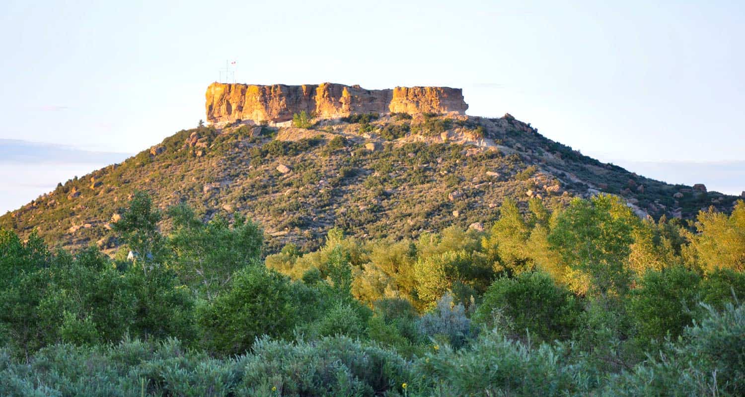
Castle Rock Trail
Rock Park in Castle Rock, Colorado is the trailhead for a 1.4 mile loop within a loop hike that climbs to the base of the town's famous Castle Rock. Click here for the Castle Rock trail map. Explore Dayhikes Near Denver for more hikes in Colorado with impressive rock formations.
Trail Snapshot: Castle Rock Trail
| Hike Distance | 1.4 Miles+Spurs |
|---|---|
| Difficulty | Moderate (can be difficult over rocks) |
| Duration | Approx. 1 hr+ |
| Trail Type | Loop |
| Starting Elevation | 6220' |
| Elevation Gain | Approx. +370' |
| Seasons | All |
| Dogs | Allowed On Leash |
| Hike Trail Map | Click for a Map of Castle Rock Trail |
| Denver Drive Time | 35 min |
| Driving Directions to Castle Rock Trail | Click for Google Map |
| Town Nearest Hike | Castle Rock, Colorado |
| Beauty | Historical monument, rock formations, Front Range views, wildlife: rock squirrels and cliff swallows |
| Activities | Hiking trails, picnic areas, no bikes or horses are allowed |
Tips & Resources for Hiking Castle Rock Trail :
- TIP: There is a panoramic view of Castle Rock at the top. Pike's Peak can be seen to the southwest, and Long's Peak to the northwest.
- TIP: A wide, flat path encircles the rock with a picnic area. Tables are available.
- Trail Map for Castle Rock Trail: Trail Map Link
- Colorado Road Conditions: Colorado Road Conditions
- After the Hike: Crowfoot Valley Coffee
Weather
Map & Driving Directions
Click for Driving Directions

Glendale Farm Trail - Douglas County Open Space
Glendale Farm is a short hiking trail near Littleton, Colorado, that offers a seventeen-acre off-leash dog park. This makes for a great after-work trail run or a leisurely hike when the sun is setting over the mountains and the day is cooling down. Glendale Farm Open space is situated on a prairie plateau between Lone Tree and Castle Pines, Colorado. From the high point on the trail you'll gain views of Pikes Peak in the south, Devil's head in the west, and Rocky Mountain's Longs Peak in the North. It's just a 1.6 mile loop trail, so it makes for a great run or hike. There's not much shade on this trail, so bring sunscreen--or better yet, hit the trail as the sunsets.
Trail Snapshot: Glendale Farm Trail - Douglas County Open Space
| Hike Distance | 1.6 mile |
|---|---|
| Difficulty | Easy |
| Duration | Approx 45 min |
| Trail Type | Loop |
| Seasons | All Year |
| Dogs | Allowed On Leash |
| Hike Trail Map | Click for a Map of Glendale Farm Trail - Douglas County Open Space |
| Denver Drive Time | 35 min |
| Driving Directions to Glendale Farm Trail - Douglas County Open Space | Click for Google Map |
| Town Nearest Hike | Littleton, Colorado |
| Beauty | Grassland, Front Range views, Cherry Creek, wildlife: pronghorn antelope, rattlesnakes, prairie dogs, deer, rabbits, scrub jays, & spotted towhees |
| Activities | Picnic areas, horseback riding, mountain biking, adjacent dog park |
This is another one of those great hikes with your Dog near Denver. Leashes are required on the trail, but after doing the loop, you can let your dog loose in the adjacent 17 acre off-leash dog park. Greenland Open Space Trail has a similar off-leash dog park of 17 acres.
Tips & Resources for Hiking Glendale Farm Trail - Douglas County Open Space :
- An off-leash dog area: Located southwest of the main trailhead is a 17-acre parcel designated park that is fenced-in, and the only area where dogs are allowed off-leash.
- Watch your step: Prickly pear cacti grow along the trail and there are rattlesnakes present in the area.
- Trail Map for Glendale Farm Open Space: Trail Map Link
- Colorado Road Conditions: Colorado Road Conditions
- After the Hike: Crowfoot Valley Coffee
- Rules: For the most up-to-date rules and info in Douglas County dog parks, see this brochure.

Weather
Map & Driving Directions
Click for Driving Directions
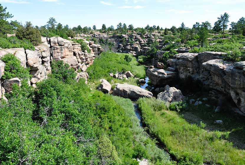
Canyon View Nature Trail at Castlewood Canyon
Castlewood Canyon cuts a unique and green landscape into the plains near Denver. It's not the mountains, but it's worth the drive. Castlewood Canyon State Park has created this beautiful paved trail that follows the canyon rim.
The Canyon Rim Trail also offers an audio tour and is a great way for children to learn more about the plains habitat that covers much of Colorado. Explore this full trail profile for driving directions, trail map, and all the details and tips you'll need to plan your trip to this Colorado State Park.
Trail Snapshot: Canyon View Nature Trail at Castlewood Canyon
| Hike Distance | 1.2 mi (2.4 mi RT) |
|---|---|
| Difficulty | Easy |
| Duration | Approx 1 hr or less |
| Trail Type | Out and Back |
| Seasons | All |
| Dogs | Allowed on Leash in Most Areas, But Not on the East Canyon Trail |
| Hike Trail Map | Click for a Map of Canyon View Nature Trail at Castlewood Canyon |
| Denver Drive Time | 50 min |
| Driving Directions to Canyon View Nature Trail at Castlewood Canyon | Click for Google Map |
| Town Nearest Hike | Castle Rock, Colorado |
| Beauty | Interesting geology, canyon views, interpretive trail, wildflowers, birdwatching |
| Activities | Guided audio nature tour, hiking, picnic areas, visitors center |
| Fee Required | Visit Colorado State Parks Site |
One of the best handicap accessible trails near Denver, the Canyon View Nature Trail at Castlewood Canyon State Park is a 1.2 mile interpretive trail. It runs along the western edge of the top of the canyon and weaves through ponderosa pine and a wonderful variety of wildflowers. The entire trail is a concrete walkway, making the area very accessible to wheelchairs. The trail ends at the Bridge Canyon overlook. Don't miss the view, it's wonderful.
Tips & Resources for Hiking Canyon View Nature Trail at Castlewood Canyon
- TIP: Pick up a brochure so that you can find the various access points for the trail and can take advantage of the side trails.
- Audio Tour: Begin at the visitor's center where you can pick up an audio tour player which guides you through the 5 different ecosystems that are found in Castlewood Canyon.
- Wildflowers: Late June and Early July are the best times to view the wildflowers in Castlewood Canyon.
- Bring Sunscren: Hikes in Castlewood Canyon can be quite exposed to the sun, so bring the sunscreen.
- TIP: Poison Ivy: We've been surprised how poison ivy flourishes in this park, often along the edge of the trail. Know how to identify it, so that you can avoid it. But don't let that deter you from the park. You just need to keep an eye out. See our post on how to identify and treat poison ivy.
- Trail Map for Castlewood Canyon: Trail Map Link
- Additional Maps: Castlewood Canyon State Park Trails
- Colorado Road Conditions: Colorado Road Conditions
- After the Hike: Crowfoot Valley Coffee
Weather
Map & Driving Directions
Click for Driving Directions
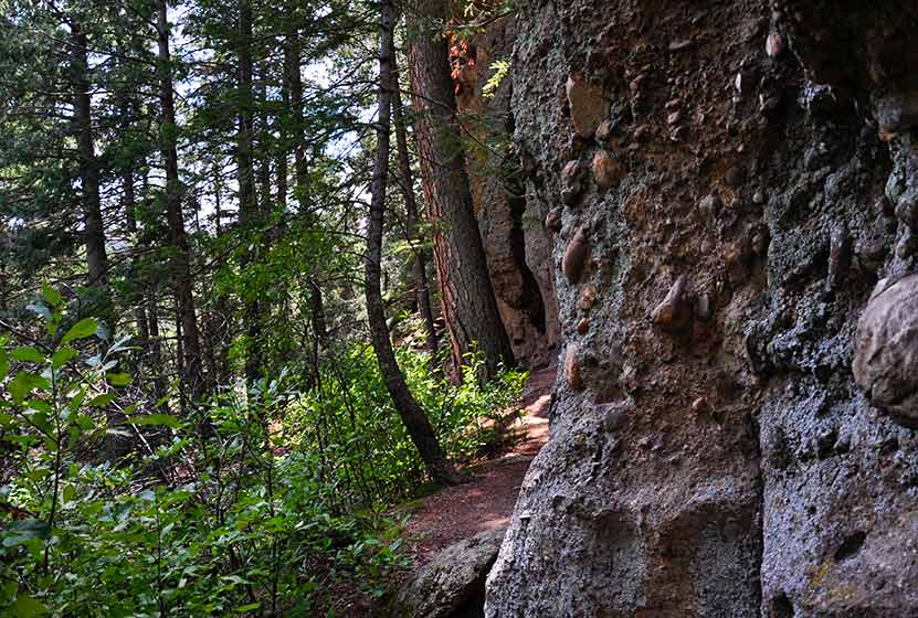
Cliff & Climber's Trails at Castlewood Canyon
If you want to explore the crags and hidden pockets of Castlewood Canyon State Park, this combination of trails makes for a fun adventure in a part of Colorado that a lot of hikers miss. The park is nestled into the plains Southeast of Denver, and has a lot of hiking options. Check out the trail profile below to get driving directions, link to a map for the hike, tips, and all the details on this trail.
Trail Snapshot: Cliff & Climber’s Trails at Castlewood Canyon
| Hike Distance | 0.32mi (0.64mi RT) |
|---|---|
| Difficulty | Moderate due to terrain |
| Duration | Approx 30-40min Round Trip |
| Trail Type | Out and Back |
| Seasons | All |
| Dogs | Allowed, But Not on the East Canyon Trail |
| Hike Trail Map | Click for a Map of Cliff & Climber’s Trails at Castlewood Canyon |
| Denver Drive Time | 1 hr |
| Driving Directions to Cliff & Climber’s Trails at Castlewood Canyon | Click for Google Map |
| Town Nearest Hike | Castle Rock, Colorado |
| Beauty | Cliffs, cave, mature ponderosa pines |
| Activities | Rock climbing, hiking, picnic areas, nearby waterfall |
| Fee Required | Visit Colorado State Parks Site |
These two trails can be combined to get a full hike along the cliff band that runs along the western edge of Castlewood Canyon State Park. A cave can be found near the middle of the trail. It is a kind of large crack in the rock that leads to a larger chamber. I wish I could describe it better, but my 2 1/2 year old, when I asked if she wanted to go inside, was concerned that the "bears might not be sleeping."
Tips & Resources for Hiking Cliff & Climber’s Trails at Castlewood Canyon :
- Finding the Trail: The cave trail can be accessed by hiking across the dirt road from the parking lot. The Google Map is very specific and should be helpful in finding the correct parking area.
- Add the Waterfall: The Waterfall Hike can be added to your trip.
- Finding the Traihead: The West Side entrance can be hard to find. Usually, Colorado state parks have brown signs indicating the park roads. The west side doesn't. But the name of the road you're looking for is "Castlewood Canyon" - easy to remember.
- Short but Steep Hike: The hike is easy when you consider the distance, but we rated this one as difficult because the trail can be quite uneven and very steep. Watch your footing.
- Make it a Loop Hike: You can make an even larger loop out of the hike by exiting on either the north or south end of the trail, then crossing the road east to one of the parking areas. From there, take the West Side Spur or the Creek Bottom Trail back to your car. See the Castlewood Canyon Map below for details.
- TIP: Hikes in Castlewood Canyon can be quite exposed to the sun, so bring the sunscreen.
- TIP: Poison Ivy: We've been surprised how poison ivy flourishes in this park, often along the edge of the trail. Know how to identify it, so that you can avoid it. But don't let that deter you from the park. You just need to keep an eye out. See our post on how to identify and treat poison ivy.
- Trail Map for Castlewood Canyon: Trail Map Link
- Additional Maps: Castlewood Canyon State Park Trails
- Colorado Road Conditions: Colorado Road Conditions
- After the Hike: Crowfoot Valley Coffee
Weather
Map & Driving Directions
Click for Driving Directions
Lakes Loop Trail at Rocky Mountain Arsenal
An arsenal turned into a Wildlife Refuge. What a great idea! The refuge boasts over 15,000 acres and over 300 species of wildlife. It also hosts three lakes and Denver lake hikes. The Lakes Loop Trail at the Rocky Mountain Arsenal Wildlife Refuge is a 1.7 mile loop that winds along the shores of two lakes in the park, Lake Mary and Lake Ladora. Explore the full trail profile for all the details: hiking trails, trail map, and detailed directions to the trailhead.
Trail Snapshot: Lakes Loop Trail at Rocky Mountain Arsenal
| Hike Distance | 1.8 mile Round Trip |
|---|---|
| Difficulty | Easy |
| Duration | Approx 1hr+ Round Trip |
| Trail Type | Loop |
| Seasons | All |
| Dogs | Prohibited in the Refuge |
| Hike Trail Map | Click for a Trail Map |
| Denver Drive Time | 30 min |
| Driving Directions to Lakes Loop Trail at Rocky Mountain Arsenal | Click for Google Map |
| Town Nearest Hike | Commerce City, Colorado |
| Beauty | Grassland, Front Range views, lakes wildlife: wild bison, deer, coyotes, bald eagles and burrowing owls |
| Activities | Hiking trails, wildlife viewing, seasonal fishing |
How to Hike the Loop: Check in and begin your hike at the visitors center. Follow the Lake Mary Trail along the northwest of the lake until it merges with the the Prairie Trail. Follow the Prairie Trail to the south until it merges with the Ladora Trail which will take you back to the visitors center and along the shore of Lake Ladora.
Tips & Resources for Hiking Lakes Loop Trail at Rocky Mountain Arsenal :
- TIP: Hiking and site seeing are open 7 days a week. However, the visitors center is closed on Mondays and Tuesdays, and pets are prohibited (makes sense - it's a wildlife refuge).
- TIP: Trolley Tours are available on the weekends. Check out this tours link or call 303/289-0250.
- Trail Map for Rocky Mountain Arsenal National Wildlife Refuge: Trail Map Link
- Colorado Road Conditions: Colorado Road Conditions
- After the Hike: Butcher Block Cafe
- Photo: We would like to express our gratitude to Ray Fetherman for sharing such a beautiful photograph of this hike.
Weather
Map & Driving Directions
Click for Driving Directions
Waterfall Hike at Castlewood Canyon
This may be the most accessible waterfall near Denver. If you hit the right parking lot, it's a 10 minute hike.So, grab a park brochure and find the Northernmost trailhead for the Creek Bottom Trail (Homestead Trailhead). This will add close to 1 mile to your hike. Then you can loop back via the Cherry Creek Trail for a total of about 2 miles.
Trail Snapshot: Waterfall Hike at Castlewood Canyon
| Hike Distance | 1/4 mile Round Trip (see trail options below) |
|---|---|
| Difficulty | Easy to Moderate |
| Duration | 20 min |
| Trail Type | Out & Back and Loop |
| Seasons | All Season |
| Dogs | Allowed on Leash in Most Areas |
| Denver Drive Time | 50 min |
| Directions | Click for Google Map |
| Beauty | Cherry Creek, waterfall, interesting geology, canyon views, ruins |
| Activities | Rock climbing, hiking, picnic areas, birdwatching, wildlife viewing |
| Fee Required | Visit Colorado State Parks Site |
Tips & Resources for Hiking to the Castlewood Canyon Waterfall
- Easy to Miss: The West Side entrance can be hard to find. Usually, Colorado state parks have brown signs indicating the park roads. The west side doesn't. But the name of the road you're looking for is "Castlewood Canyon" - easy to remember.
- Shortest Access: The shortest way to access the falls is by parking at the Waterfall Parking Lot, then taking the Waterfall Spur to the Creek Bottom Trail. Head South, and you'll hear the waterfall in just a few moments.
- Exposed: Hikes in Castlewood Canyon can be quite exposed to the sun, so bring the sunscreen
- Poison Ivy: We've been surprised how poison ivy flourishes in this park, often along the edge of the trail. Know how to identify it, so that you can avoid it. But don't let that deter you from the park. You just need to keep an eye out. See our post on how to identify and treat poison ivy.
- Trail Map for Castlewood Canyon State Park: Trail Map Link
- Colorado Road Conditions: Colorado Road Conditions
- After the Hike: Crowfoot Valley Coffee
Weather
Click for Driving Directions

Arthur's Rock Trail in Lory State Park
The Arthurs Rock trail in Lory State Park near Fort Collins, Colorado ends with a beautiful panoramic views. You'll pass through meadows, forest, then end your hike with a scramble to the top of Arthur's Rock. Dogs are allowed on a leash, just be sure to bring plenty of water as there are not many places to access drinking water.
| Hike Distance | 3.4 miles RT |
|---|---|
| Difficulty | Moderate |
| Duration | Approx 1 hr 15 min Round Trip |
| Trail Type | Out and Back |
| Starting Elevation | 5600′ |
| Elevation Gain | +1180′ |
| Seasons | Spring to Fall |
| Dogs | Allowed On Leash |
| Hike Trail Map | Click for a Map of Arthur’s Rock Trail in Lory State Park |
| Denver Drive Time | 1 hr 25 min |
| Driving Directions to Arthur’s Rock Trail in Lory State Park | Click for Google Map |
| Town Nearest Hike | Fort Collins, Colorado |
| Beauty | Views of Horsetooth Lake, views of the Front Range, forests, and meadows, wildlife: elk, bobcat, and many bird species |
| Activities | Hiker only trail, but park offers picnic areas, horseback riding, mountain biking, canoeing, & kayaking |
Arthur's Rock History
The place got its name from Arthur Howard who was the one who, along with his brother, Charlie, sold this piece of land. For more information on the history of Arthur's Rock and Lory State Park, visit this page.
Tips & Resources for Hiking Arthur’s Rock Trail in Lory State Park :
- TIP: There is a visitor's center near the Lory State Park entrance.
- TIP: At the summit of Arthur's Rock, there is a beautiful view of Horsetooth Reservoir and the Front Range available.
- Trail Map for Lory State Park: Trail Map Link
- Colorado Road Conditions: Colorado Road Conditions
- After the Hike: The Colorado Room
- Photo: We would like to express our gratitude to Luci Westphal for sharing a great photo of her hike to Arthur's Rock at Lory State Park. Check out her video from this hike.
Weather
Map & Driving Directions
Click for Driving Directions to Lory State Park
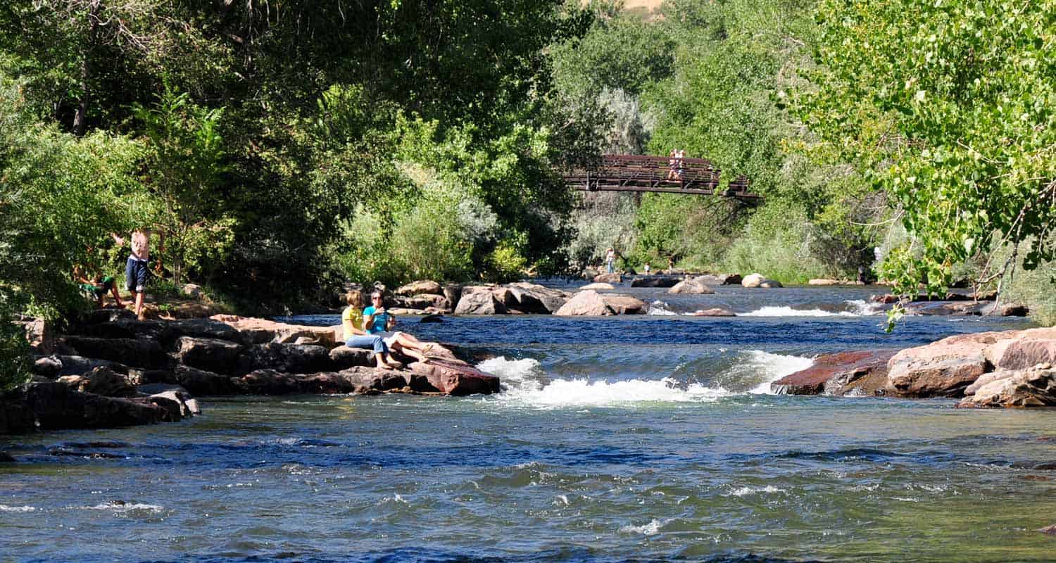
Clear Creek Trail in Downtown Golden
Want a hike to please everyone?The Clear Creek Trail in Golden, Colorado is it! It's got shade, the kids can bring their bikes, and you can finish your hike with a stroll around downtown. We might get some flack for calling this a hike, because it runs through the business district of Golden, CO.But you can wear the soles of your shoes down on this one. Jefferson County even has plans to expand the trail several miles into Clear Creek Canyon. Explore the full trail profile for all the details: hiking trails, trail map, and detailed directions to the trailhead.
Trail Snapshot:Clear Creek Trail in Downtown Golden
| Hike Distance | 1.8 Miles |
|---|---|
| Difficulty | Easy (super easy) |
| Duration | 1 hr |
| Trail Type | Out and Back |
| Seasons | All Season |
| Denver Drive Time | 30 min |
| Directions | Click for Google Map |
| Town Nearest Hike | Golden, Colorado |
| Beauty | Clear Creek, Cliff Swallows, Tree lined river |
| Activities | Parks, Shops, Kayaking, People Watching, Rollerblading, and Biking |
| Handicap Accessible | This Trail is Handicap Accessible |
When you have small children, some mornings can be harder than others to get through the foothills and into the mountains. This trail is made for those mornings. We like to park downtown, grab coffee at the Windy Saddle, then stroll down the trail. A local training school is often seen near the Washington Street Bridge doing water rescue training. It's highly entertaining and a great opportunity. Visiting family and friends will find this trail accessible, easy, and refreshing.
- Bring a Picnic and throw down a blanket at one of the several parks along the way (see map)
- You can start outside of town at the 6th Ave parking area and you have two options: Hike into town, or hike west in Clear Creek Canyon for .7 miles of the Grant Terry Trail
- Don't miss the cliff swallows that have built their nests along the 6th Ave. bridge.
- The Windy Saddle Cafe, on Washington Street offers a kids' playroom and their coffee is fantastic.
Tips & Resources for Hiking the Clear Creek Trail:
City of Golden Trail Map Link
City of Golden Open Space Map Link
Colorado Road Conditions
Weather
Map & Driving Directions
Click for Driving Directions