Hiking Beautiful Waterton Canyon
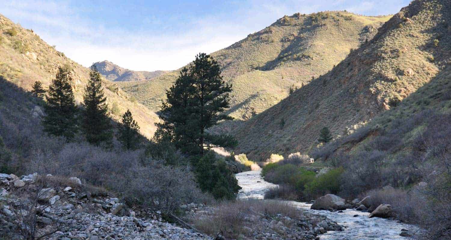
The winding dirt road trail of Waterton Canyon takes you along the South Platte River and into a canyon where you might spy some Bighorn sheep or catch the sight of massive eagles soaring on the warm air currents rising from the rock. It's an out-and-back hike, and you have a lot of options, from a short hike in to have a picnic, all to way to 12.4-mile round-trip adventure to the Strontia Springs Dam. You can hike, bike, and fish on this hike near Denver. Explore the five different options we have detailed below. We'll describe the location of a few destinations, including the best places to rest and have a picnic, and some of the other trails that join up with this Colorado canyon hike.
Waterton Canyon will be closed from June 1st 2021 through June 11th 2021. It will be open on Saturday, June 5, and Sunday, June 6th. See the Denver Water Waterton Canyon page for updates and details.
Trail Snapshot: Hiking Beautiful Waterton Canyon
| Hike Distance | A variety of trail lengths depending on your goals. It is a 6.2-mile trail to the Strontia Springs Dam, or 12.4 round trip. |
|---|---|
| Difficulty | Easy to Moderate |
| Duration | Approx 2 to 6 hours |
| Trail Type | Out and Back |
| Elevation Gain | Approx +700′ |
| Seasons | All Year |
| Dogs | Not Allowed |
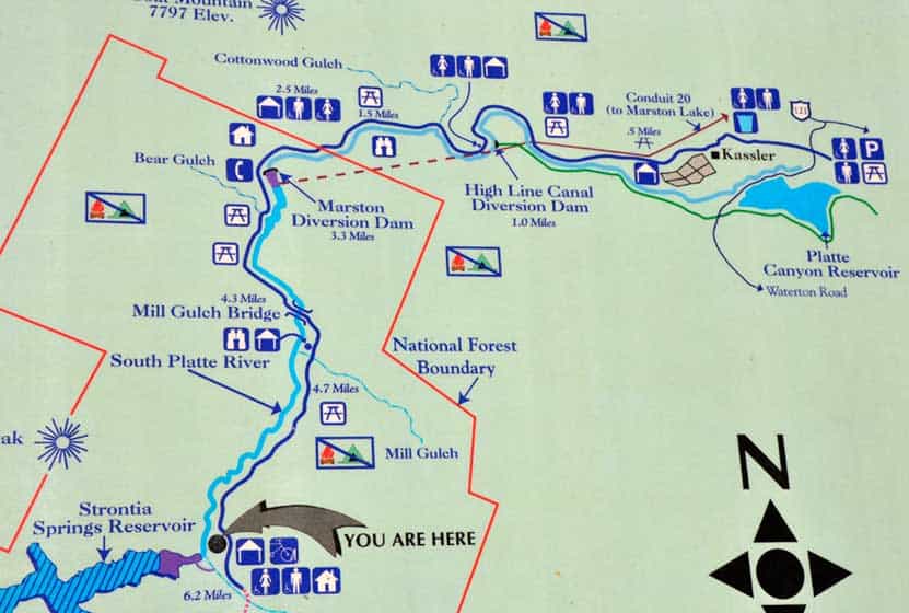
| Hike Trail Map | Click for a Trail Map of Waterton Canyon |
| Denver Drive Time | 35 min |
| Directions | Click for Google Map |
| Town Nearest Hike | Littleton, Colorado |
| Beauty | Bighorn sheep, Views of a lake and a river |
| Activities | Hiking, mountain biking, fishing, horseback riding, picnicking, and nature viewing |
When you set out to explore Waterton Canyon, there are plenty of things that you can expect. We've hiked this three times and have spotted Bighorns on two of those hikes. The trail is a wide dirt road that gives Denver Water access to the dam at the top end of the canyon. So, this makes for a great stroller hike, if your stroller has a way to give the kids some shade from the sun. It's also a really enjoyable mountain bike ride because it's not too steep--well, at least not until just past the dam--and the downhill ride back down is easy and fun. Here are over five different ways you can hike this great hike near Denver, Colorado.
Hike Options at Waterton Canyon Trail
1. The Shorter Hike in Waterton Canyon
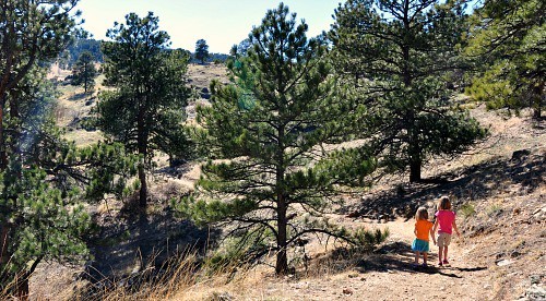
The first mile or two of Waterton Canyon takes you to an old water conduit pipe that juts out over the trail, and your best chance to catch the site of Bighorn Sheep and Golden Eagles. The trail quickly goes from a paved road to a dirt fire road, then begins following the course of the South Platte river. The canyon itself starts low and shallow, and grows higher and more rugged the deeper you venture into Waterton.
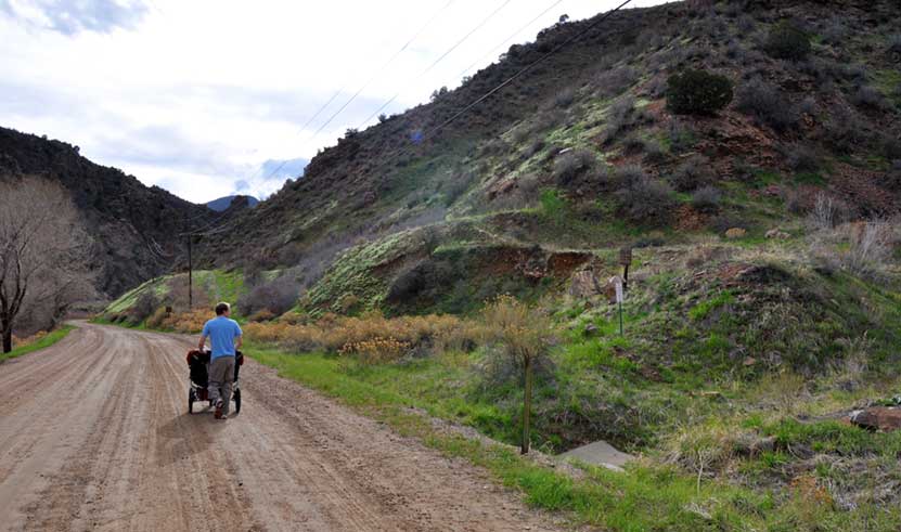
After about 15 minutes of hiking, keep your eyes peeled on the green hillsides on your right (see photo above). This is where we most often spot bighorn sheep and their lambs. Scan the skies, too, for gigantic golden eagles that hover on the hot air that rises from the canyon walls in the afternoons. You'll find the first picnic area just about 1/2 of a mile into Waterton Canyon.
2. Waterton Canyon Picnic Area - 3 Miles Round Trip
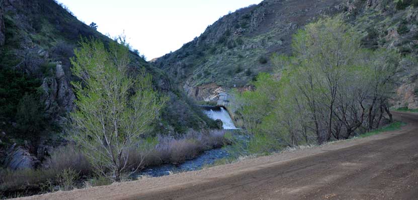
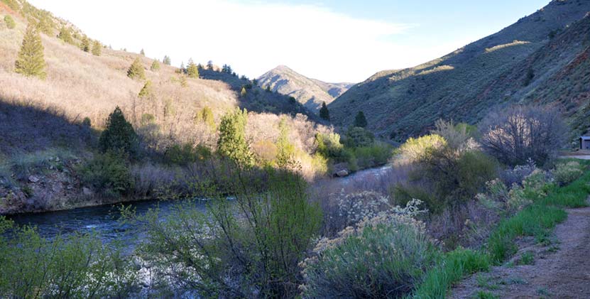
This section of Waterton makes for a great evening picnic. You'll find it on your left just after the Highline Canal Diversion Dam. It's a great place to skip rocks with the kids and to watch the light soften on the canyon walls as the sun sets over the distant mountains. Continuing past this picnic area, the next feature you'll pass is the Marston Dam. There is another picnic area at approximately 3.75 miles into Waterton Canyon (see the pdf map), that's also a great little spot, but if you get in that far, you'll want to keep exploring.
If you hike further up into Waterton Canyon, the river grows both wider and wilder. Cedars and pines grow along the banks and canyon sides, and the cliffsides become steep and jagged. It's here, around mile 4, that things start to get interesting.

3. Fishing Hole and Picnic Table at Mile 4.5
The next destination worth mentioning is a secluded spot on the river where you'll find a deep fishing hole on the right side of the road. There is a picnic table hidden down among the willows (it's hidden well enough that it doesn't show up in the photo below). There is a restroom just about 150 yards upriver from the spot.
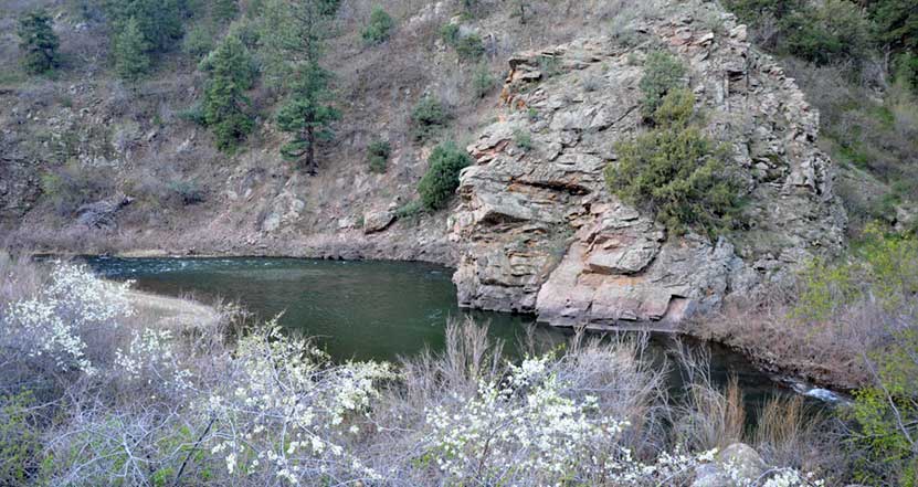
The trail just keeps getting better after you pass this fishing hole. At mile five, we saw a lot of bighorn sheep sign, flowering bushes, and wildflowers. Hummingbirds were buzzing along the trail in a furious search for nectar. Folks who fish Waterton Canyon often ride their bikes in and start fishing at the dam, then work their way back downstream.
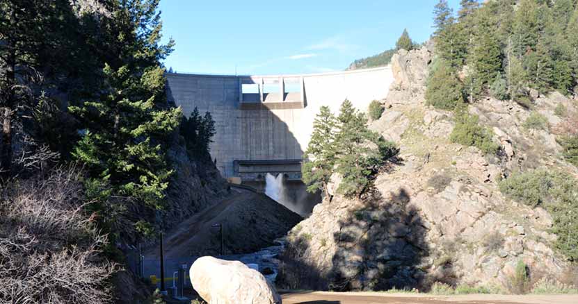
4. Hike the Entire Trail to the Strontia Springs Dam - 6.2 Miles
The Strontia Springs Dam is an imposing structure, looming over 200 feet high above the trail with water gushing from its release pipes into the river. Accessing the 7700 acre Strontia Springs Reservoir is extremely difficult, though not impossible. However, its banks drop straight off into the water making it a pretty inhospitable place, but it can be fished for perch, trout, and walleye. One fisherman on a Colorado fishing forum commented that you have to really "WANT to get there" because it's so tough to access.
5. Hike the Colorado Trail
Most people turn around at Strontia Springs, but the trail doesn't end there. In fact, Waterton Canyon is the eastern gateway to the close to 500 mile Colorado Trail. The Colorado Trail starts here in Denver, then weaves its way all the way to Durango. You can download a Trail Map of the Colorado Trail here. You really have several options at this point. You can continue onto segment one of the Colorado Trail on Trail #1776.
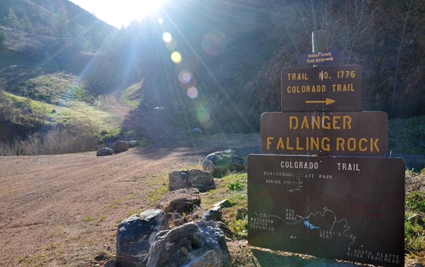
Segment one of the Colorado Trail will take you out of the canyon and onto US Forest Service land where you can camp near Lenny's Rest. It's important to note that camping is prohibited in Waterton Canyon, so this area at Lenny's rest should be your goal if you plan to overnight. Another option is that you can hike down into Roxborough State Park on the Roxborough Connector section of the Indian Creek Trail #800. Yet another option--and this option is way more than a dayhike being well over 28 miles--would be to hike the full Indian Creek Trail Loop, then to exit at either Roxborough or back down through Waterton Canyon. However, Indian Creek does have its own campground, so you could make it a long weekend trip. Of course, your final option is to hike out the way you came through Waterton Canyon. Click here for a PDF map of the first segment of the Colorado Trail that shows the connections to both Roxborough and the Indian Creek Campsite.
Tips & Resources for Hiking Waterton Canyon :
- No Dogs: Because of the bighorn sheep and other wildlife, dogs are not allowed in Waterton Canyon.
- Fishing: If your goal is to go fishing in Waterton Canyon, then start early and ride your mountain bike the 6.2 miles up to the dam and fish your way down.
- It Gets Hot: Don't hike this in the middle of the day. Waterton Canyon is close to 100% exposed to the sun, so it's best to start very early or to hike later when the sun is moving itself to end the day.
- Did I Mention It Gets Hot? Bring sunscreen and a hat
- Bring Water: Bring plenty of water. You can say this about every hike, but it's especially important because of the sun and heat.
- Dusk: It gets dark quickly after sunset. Because you're in a canyon, once the sun sets beyond the foothills, the canyon becomes a land of shadows.
- Watch for Bikes: Watch for mountain bikes, especially those headed down and out of the canyon. The road is wide enough to accommodate a lot of traffic in Waterton Canyon, but you want to be sure that you are staying to the right as you hike so that you can give a wide berth to the bikes that are letting it rip as they leave the canyon.
- Trail Map for Waterton Canyon: Trail Map Link
- Colorado Road Conditions: Colorado Road Conditions
- After the Hike: Spur Coffee in Littleton
Weather
Map & Driving Directions
Click for Driving Directions

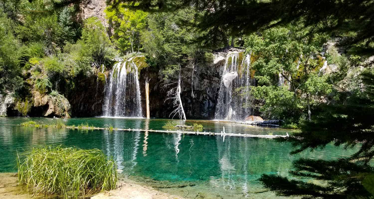
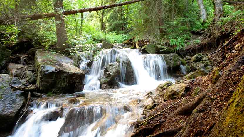
Guide for Hiking Hanging Lake in Colorado
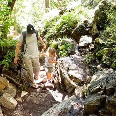
Hanging Lake is a short hike to two waterfalls and one of the most beautiful lakes in Colorado. On the same hike, you can explore Spouting Rock Falls, and even walk behind the waterfall. Reservations are required to hike Hanging Lake so don't leave home without booking (see info in trail snapshot below). It’s not a day hike near Denver, but it’s definitely worth the nearly three-hour drive to the Hanging Lake Trailhead just outside of Glenwood Springs.
We've attempted to create the definitive guide to hiking the Hanging Lake Trail. In this guide, you'll find: how to make reservations for hiking hanging lake, 10 hiking tips, notes on driving directions to Hanging Lake. You can download the Hanging Lake trail map, find tips on photography at the lake, and some notes on hiking this trail with kids. If you are planning a Colorado vacation, there is helpful information for planning both your hike and trip to this Colorado destination. This guide is extensive, so we have created a table of contents help you navigate your way around.
Hanging Lake Guide Contents
- Trail Snapshot
- Reservations and Permits
- Driving Directions
- Parking & Trailhead
- Hiking the Trail
- At Hanging Lake
- Spouting Rock Falls
- Photography
- Hiking Hanging Lake with Kids
- For Out-of-State Hikers
- Ten Hiking Tips
- Fishing Prohibited
- Dogs Prohibited
- Camping Nearby
- Lodging Nearby
- Things to Do Nearby
- Proposing at Hanging Lake
- History and Geology of Hanging Lake
Trail Snapshot: Hanging Lake Trail
| Permit Required | Visit Link for Reservations |
|---|---|
| Hike Distance | 2.4 miles Round Trip |
| Difficulty | Moderate to Difficult |
| Duration | Approx 2 hr Round Trip |
| Trail Type | Out and Back |
| Elevation Gain | +1096', -160' |
| Seasons | All Year |
| Dogs | Dogs are Prohibited on Hanginng Lake Trail |
| Hanging Lake Trail Map | Click for a Map of Hanging Lake |
| Denver Drive Time | 2 hr 45 min |
| Hanging Lake Driving Directions - Off Peak Season Parking | Click for Google Map |
| Town Nearest Hike | Glenwood Springs, Colorado |
| Beauty | Waterfalls, Lake, Cascades, and Canyon |
| Activities | Falls Viewing Area, Hiking |
| Video | Click For a Video of Hanging Lake |
Hanging Lake Reservations
Reservations are required to hike Hanging Lake. You can purchase your permit and schedule your reservation slot online at https://visitglenwood.com/hanginglake/
You might be wondering why reservations are necessary? The trail receives over 100,000 visitors each year, which is common for some areas in the National Parks system, but there are two other factors at play: first, hanging lake is a sensitive area and because of the sheer volume of visitors, the ecosystem was becoming threatened by the impact; second, the trailhead parking area is in a canyon alongside interstate 70, so it would be incredibly difficult and expensive to expand the parking and trailhead facilities. Not to mention that by expanding, we would end up expanding the problem of impact. In short, Hanging Lake was getting loved to death. Then, in 2020 the Grizzly Creek Fire burned through the area that required repairs before reopening the trai. The city of Glenwood Springs and the Forest Service have teamed up to preserve this natural wonder, so that future generations will get to enjoy it, too.
Hanging Lake Driving Directions
Driving to Hanging Lake from Denver (the east) can be a bit confusing. Here’s why: you have to drive past the trailhead because there is no westbound exit, then take exit #121, go under interstate 70 and get back on eastbound I-70. Then you’ll take exit #125 to the Hanging lake Trailhead. I’ve posted a map below that shows all this in detail.
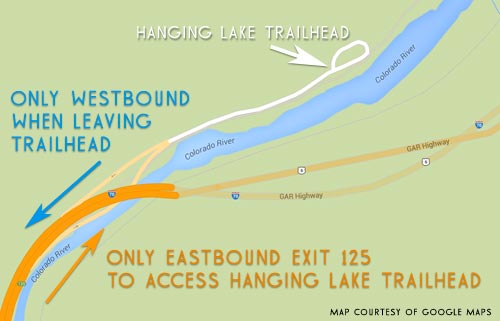
When leaving the Hanging Lake Trailhead, you can only exit onto the Westbound lane of interstate 70. So, you’ll have to do the same thing and take exit 121 again to double-back and head back to Denver. If you are coming from Glenwood Springs or the west, then things are pretty straightforward. Driving from Denver, this maps out as a 2.5 hour drive using Google maps, but be sure to add time for construction.
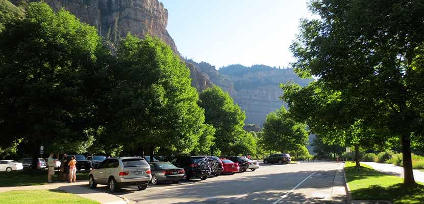
Parking and Facilities at Hanging Lake Trailhead
We arrived at the Hanging Lake Trailhead parking lot at 8AM on a Saturday morning in July. The first parking lot was full, and by 8:30, the second lot was nearly full. Beginning in 2015, a gate has been installed to close the lot when it is full. The restroom facilities were large enough to serve the number of people who frequent this popular Colorado hike, and were well kept. This is important: if you get there when the lot is full, you will either need to try again later, or make other plans. An alternative is to rent bikes in Glenwood Springs, to bike in, and lock up your bikes at the trailhead (be sure to get locks at the rental shop).
There were a few shaded picnic areas near the parking area, and some unshaded ones along the river. On our way out, the parking lot was at full capacity with cars having to turn around and leave because there was no place to park. Parking is prohibited along the the I-70 exit ramp, so if the parking lot is full, your best bet is to drive into Glenwood Springs, grab something to eat, and try back later. Don't wait idling or clog the ramp, it prevents emergency vehicles from accessing folks who really need their help. It's also important to note that recreational vehicles and trailers are prohibited from parking at the hanging lake parking lots as there is not sufficient space to turn around.
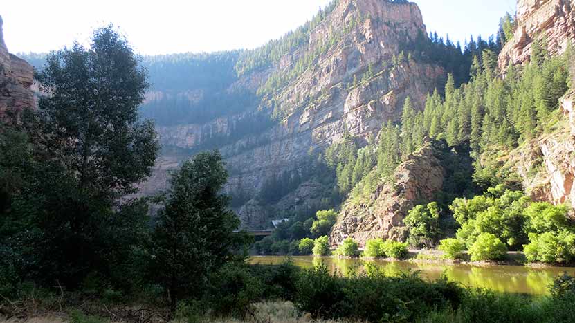
Hiking the Hanging Lake Trail
The Trailhead begins along the Colorado River with a paved bike path surrounded by the banded rock walls of Glenwood Canyon. The morning air was cool, and steam was lifting from the warm surface of the Colorado River. After about a quarter-mile you’ll see a bike rack and the Hanging Lake Trail on your left. This is the beginning of Dead Horse Creek Canyon, the canyon that you’ll follow for about 1 mile up to Hanging Lake, then to Spouting Rock Falls.
Depending on your pace, it may take you anywhere from 40 minutes to an hour and a half to get to the top.Though the prize at the end of this hike are two breathtaking Colorado waterfalls, one of our favorite features of the Hanging Lake trail is that it follows and crosses a mountain stream all the way up to the lake. In fact you’ll cross seven bridges on your journey up to Hanging Lake. You’ll be refreshed by the sights and sounds of cascades and the cool air of the canyon.
Most of the hike is in the shade of towering spruce, cedar, and fir trees. You’ll find several benches and rocks where you can stop and rest. If you are acclimated to the altitude, the hike up the Hanging Lake is relatively easy and short, but it is steep and there are a lot of rocks to negotiate, so we have categorized the Hanging Lake trail as a moderate hike.
If you are not acclimated to the altitude, or not a regular hiker, this Colorado hike will be a real workout, so you may classify it as difficult. If this is you, then be sure to read our Tips for For Out-of-State Hikers. The piece you may find most challenging is just how slippery some of the rock can get. I hiked this in Chaco sandals, which had great grip, but I got a few blisters on the descent. I’d recommend wearing a shoe or a boot that you know won’t be prone to slipping.The piece you may find most challenging is just how slippery some of the rock can get. I’d recommend wearing a shoe or a boot that you know won’t be prone to slipping.
At bridge three you’ll come across a beautiful cascade. The canyon soon opens to display clifftops that look like the ancient ruins of some abandoned castle. In areas where the sunlight breaks through, you may find raspberries along the trail in the latter half of the Summer. You’ll find more cascades near bridge number five. Dead Horse Canyon is a particularly lush ecosystem packed with spruce trees, moss, lichen, ferns, and sweet woodruff. As our six-year old daughter hiked into this part of the trail, she looked up to me and said, “It’s a rainforest, Dad!”
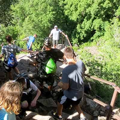
Close to the one-mile point, you’ll climb a steep staircase of rock complete with handrails. While the handrails are helpful, it would be easy for a child to slip over one.So, we’d recommend that you keep smaller children on the inside of the steps as you ascend and hold their hand. It’s a sheer drop on the other side of the handrail.At the top of the stairs follow the path about 100 yards to Hanging Lake. On the way, just before Hanging Lake, you’ll notice a sign to Spouting Rock. We’ll detail this trail in a moment, but you absolutely must hike this short 200 yard trail to this waterfall hidden behind Hanging Lake.
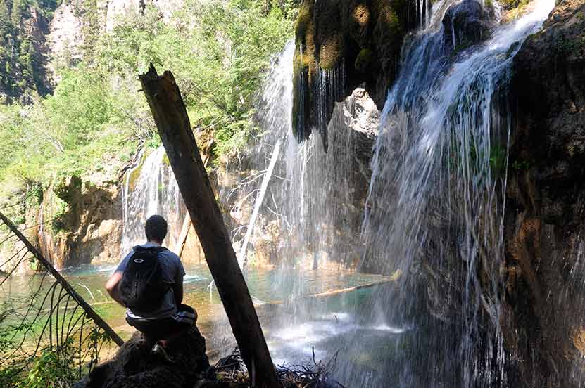
At Hanging Lake
Hanging Lake is a masterpiece of the natural world. You could spend the entire morning staring into its waters and discovering new things. We spotted trout in its green and blue waters, and dippers, little birds that create nests right on the rocks along the water. There are a variety of moss, ferns, and wildflowers all along the lake. Because of all the traffic at the lake, we saw a bit of trash floating at the base of the waterfall. Dayhikes Near Denver would like to challenge you to look for a piece of trash at the lake and to pack it out with you. Of course, don't go in for it, but pick up what is along the trail and edge of the lake. If we all do this, we can do a little part to help keep this natural wonder beautiful. With over 130,000 people visiting a year, the impact adds up fast.
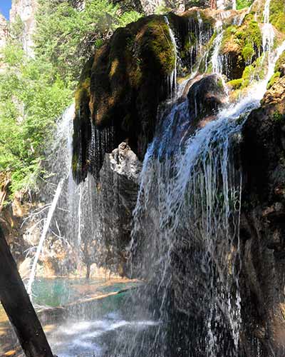
The back side of Hanging Lake was my favorite spot. The light play and the water spray made for great photos (see our photographing hanging lake tips below), and it gives you a real stunning perspective of the waterfalls pouring into the lake.
You may notice what looks like a huge chain-link cage along the canyon wall above Hanging Lake. It’s there to hold back the rocks that are prone to pile up and roll downhill toward the lake.
Stay off the Log
There is a log that stretches out into the lake, and its tempting to walk out onto it. However, it’s important to know that the oils and detergents on our bodies and clothing--even our shoes just touching the water--can damage the sensitive ecosystem of Hanging Lake. So, as cool as it might be to get that pic of you out on the log, it’s even cooler to help preserve this place for the next generation who gets to see it.
So, as cool as it might be to get that pic of you out on the log, it’s even cooler to help preserve this place for the next generation who gets to see it.
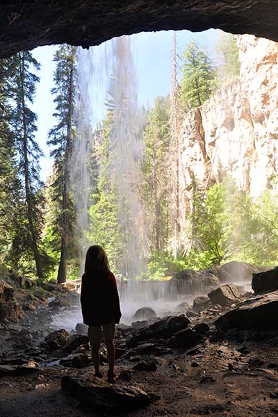
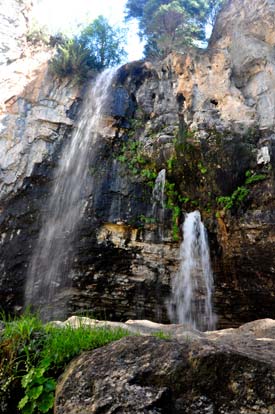
Spouting Rock Waterfalls
On your return, be sure to hike the short spur (about 200 yards) up to Spouting Rock Falls. That’s right, it’s plural--there are multiple falls. This set of waterfalls is much higher than the Bridal Veil falls at Hanging Lake, and instead of pouring over the cliffside, the falls shoot out from holes that the water has carved through a sheer wall of limestone. When the water is really flowing (which is most of the time), an additional gusher of a falls spills out from the heights above Spouting Rock, creating a breathtaking series of waterfalls.
Photography: How to Get Great Photos of Hanging Lake
The key to getting the best photos of Hanging Lake is to go very early or later in the afternoon when the sun is close to setting. We hit the trail around 8:30 AM, and by the time we got to the lake, there was direct sun on the waterfalls pouring into Hanging Lake.
The real problem is that part of the waterfalls and lake are in direct sun and part in in the shadow of the canyon walls. This makes for two very different exposures within the same frame. So, that’s why we recommend that you go earlier or much later when the sunlight is still indirect and diffused. For some incredible shots, be sure to walk over to the back side of hanging lake where you can take photos that reveal the area carved out under the falls--but be sure to keep out of the water.
You will find the light at Spouting Rock Falls much more forgiving. Spouting rock is shaded more by both the canyon walls and trees that surround it. However, I would expect that light might be a bit harsh around midday.
Hiking with Kids at Hanging Lake
The trail is steep and the rock steps are high, so if you are bringing your kids, be prepared to hike at a slower pace and for a lot of people to be passing you. Be aware that there is a lot of slippery rock along the trail, so both good hiking shoes with grip and close supervision of kiddos are important. We brought our 4-year old and 6-year old with us and they did fine. Take into account that we have been hiking with our kids since they were a few weeks old, so this is more normal for us. We read an online comment where another family recommended this hike only for kids 10 and up. If your kids are young, I wouldn’t recommend this as a first hike.
The experience of hiking the Hanging Lake trail with our four-year old was a bit like hiking with a marionette. A lot of the rock steps on the trail were above her knees, so we were helping her up most of the way. This eventually turned into a game of leapfrog, as there were a lot of folks visiting from out-of-state who quickly became winded and needed to take stops, too.
The trail got busy quickly, so we found ourselves stopping often and stepping aside to let others pass us. Our children were particularly taken with the snails we found along the trail when we took breaks. The snails are easy to miss, but if you just stop and look around for a moment, they seem to appear from out of nowhere.
Visiting Hanging Lake From Out-of-State
- Be ready to feel winded by the altitude change. You can help yourself adjust to altitude and to have a successful hike up to Hanging Lake by getting a good nights rest, drinking lots of water, and by going at a slower pace than you may be used to. This is good basic advice for anyone vacationing in Colorado.
- As I mentioned earlier, the rock on the trail can be wet and slippery, so make sure that you have footwear that can grip the rock.
- If you are overweight or have knee or ankle problems, then trekking poles are an absolute necessity. Coming down the trail is tough on the joints, and you’ll be weary at that point, so it’s easy to turn an ankle (I did, but that was probably because I was wearing Chaco sandals).
- Don’t give up. We saw several people about 400 yards shy of the lake talking about turning around and heading back. They were so close. Of course, if you think that your health would be compromised by continuing, or if a bad lightning storm is rolling in, then it’s always wise to turn around.
- If you are from out-of-state, or just not in the best of shape, plan for your hike to take longer. And definitely get to the parking lot early, 7AM, to avoid the heat and crowds. If you would consider yourself very out-of-shape, I’d recommend building up to this hike. See our Easy Hikes Near Denver or Short Hikes Near Denver pages for a good place to start.

Ten Hiking Tips for Hiking Hanging Lake
Because there are a lot of first-time hikers on this trail (and you might be one), we wanted to share a few tips.
- If you find that you are going at a slow pace, step off to the edge of the trail to let other groups pass.
- If you are going at a faster pace, simply say, “Pardon us as we pass on your left.” Just like driving, always pass on the left.
- Take your time and don’t pass folks on the handrail section. It gets crowded here, but it’s just a short jaunt, so take your time so that everyone can make a safe passage of it.
- Don’t feed Bucky: We encountered one woman who had tried to feed an almond to a squirrel, but the squirrel mistook her finger for the nut. As a rule, you don’t want to be feeding wildlife because it makes them dependent upon an unnatural food source (especially fingers), but it’s also not a good idea because you could get bit.
- Make sure to bring a snack and some water. Be sure to pack out your plastic water bottles and other trash.
- Hike the Hanging Lake Trail early in the morning, not just because of parking and traffic, but to cut down on the heat and humidity of the day. Depending on when you hike this trail, it can feel like two completely different experiences. If you hike in the early morning, the canyon is cool and refreshing. Hike it after 11am in the summer and it can feel more like a sauna.
- This is one of the most popular if not the most popular hike in Colorado, so avoid holiday weekends. Or go very early, by 7am, if you want a parking spot.
- Don't forget to bring a camera.
- There will likely be snow on the trail in the Spring, Fall, and of course Winter, so we advise bringing a traction device like YakTrax and trekking poles.
- Don’t cut through the switchbacks, these are here to cut down on erosion, which can be significant with around 130,000 visitors hiking the trail each year.
Can I Fish at Hanging Lake?
There are trout at Hanging Lake, but fishing is NOT allowed because of the lake’s unique and fragile ecosystem. However, if you would like to add fishing to your day, I’d recommend fishing the Colorado River along the Hanging Lake trailhead. I’ve not fished this section of the Colorado River, but I saw trout rising while we were walking past, and there looks to be some pretty good access to the river banks.
Are Dos Allowed at Hanging Lake
You’ll have to leave Fido at home for this one because dogs prohibited on the Hanging Lake Trail and at Hanging Lake. In fact, the forest service sites that dogs, and the trash left by visitors, are biggest threat to the sensitive environment of Hanging Lake. A lot of people ask if you can swim in Hanging Lake, and for the same reasons swimming is prohibited. In fact, the US Forest service details that there is to be "no bodily contact" with the water.
Camping Near Hanging Lake
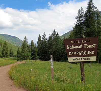
We decided to camp with our family on Friday night, then to get up early on Saturday to do the Hanging Lake hike. I was surprised by how difficult it was to find a campground near Glenwood Springs.
However, we eventually found and reserved amazing campground. In fact, it’s so good that I’m hesitant to share it. We booked a campsite at Bogen Flats Campground along the Crystal River. It was a 1 hour drive from the campground to the hanging lake trailhead. Though, not as beautiful, you could camp at Redstone Campground, which is a bit closer. We would also recommend (if you have a good clearance 2WD vehicle), the Avalanche Creek site--no reservations required. There is a KOA near Glenwood Springs that gets great reviews, too.
Lodging near Hanging Lake
If you don’t want to rough it, there are plenty of lodging options in Glenwood Springs and great places to stay.
- You can rent a private cabin or home using VRBO - Vacation Rentals By Owner
- The Glenwood Springs Inn gets some really good reviews online, and it’s close a lot of the attractions in Glenwood Springs. This place is family owned and operated, a rare find these days.
- The Glenwood Hot Springs Lodge is upscale, right there at the hot springs, and more pricey. Again, we’ve not stayed here but it looks great.
- The Hanging Lake Inn The Hanging Lake Inn is a locally-owned and family operated business. Be sure to read their TripAdvisor reviews; they get excellent ratings.
- The Caravan Inn in Glenwood Springs is an affordable, family-owned option that has a solid reputation with TripAdvisor.
Other things to Do in Nearby Glenwood Springs
If you are driving from the east, there is a good chance that you may want to spend the weekend or a couple vacation days in Glenwood Springs. If you are looking for some things to do, here are a few suggestions.
- The Hot Springs at Glenwood Springs - Sit back and soak in the main attraction and namesake of Glenwood Springs, Colorado. This is a perfect way to recover after your hike up to Hanging Lake.
- Glenwood Caverns Cave Tours and Adventure Park - Go on one of the many different cave tours, or seek some above ground thrills on the parks many rides and attractions.
- Rafting - There are a ton of rafting outfits in the Glenwood Springs area. Check out this Glenwood Springs page for a listing of Colorado guided rafting tours.
- A Whole Lot More - Glenwood Springs was voted as one of the best vacation spots in the West--there is just a surprising amount of fun to be had in this Colorado town. The best place to really explore and find out more about the area’s attractions, see the Visit Glenwood site and begin planning your trip.
Proposing at Hanging Lake
Hanging Lake is a picture perfect place for an engagement. The downside is that there is a lot of traffic on this popular Colorado trail. So, here are three tips that should help you out.
- Go early on the weekend, on a weekday, or off-season. By early, I mean parking the car by 6:45 AM.
- Hanging Lake is great, but Spouting Falls is, in my opinion an even more spectacular spot for an engagement, especially because you can walk underneath the waterfall.
- There are some rocks on the back side of Hanging Lake that you could scramble up with your significant other and get engaged under the spray and sound of the waterfall along Hanging Lake.
- For a great example of engagement photos, check out Kristen Hakes Photography's photo shoot at Hanging Lake and Spouting Rock.
History and Geology of Colorado’s Hanging Lake
Hanging Lake was formed in a really interesting way. At some point in it’s geologic history, about 1.5 acres of the valley floor dropped out and formed the bed of the lake. This happened because it sits right on a fault line. The blue and green colors in the lake is a result of the carbonates, minerals that have dissolved in the water. Most of the rock in this area is travertine, a kind of limestone that often precipitates out of hot springs and mineral springs.
It was supposedly first discovered by an early pioneer prospecting for gold in the area. He and his family lived on the real estate near Glenwood Springs for some years before the city of Glenwood Springs purchased it as a park. Hanging Lake is now under the authority and management of the White River National Forest. In 2011, Hanging Lake was declared a National Natural Landmark.
Links & Resources for Hiking Hanging Lake :
- After the Hike: After the Hike: Burgers at Grind Glenwood
- Colorado Road Conditions: Colorado Road Conditions
- Hike Trail Map for Hanging Lake: Trail Map Link
Video of Hanging Lake
Weather Near Hanging Lake

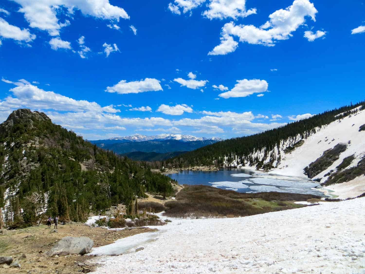
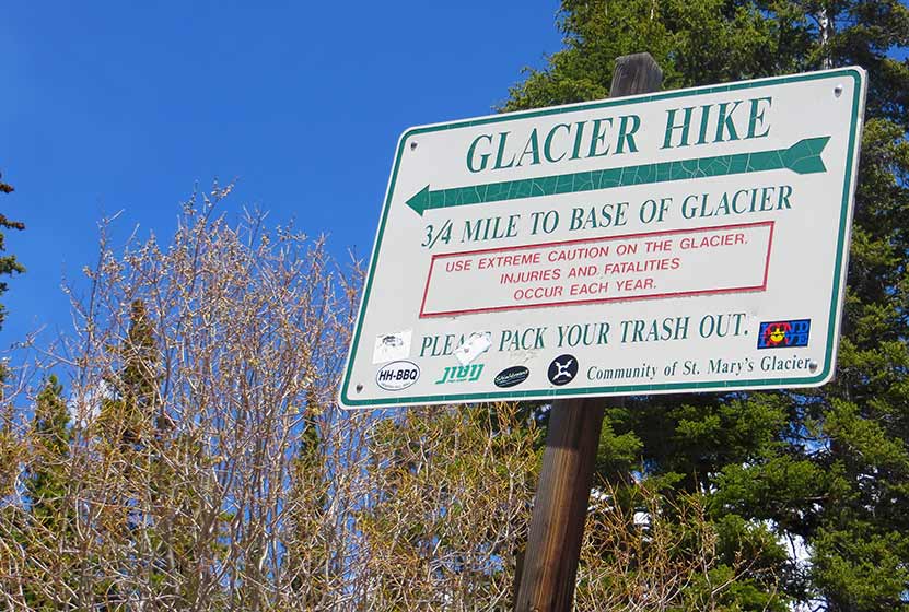
St. Mary’s Glacier near Idaho Springs, Colorado
The hike up to St. Mary’s Glacier ascends through a beautiful forest and ends with stunning panoramic views--the kind you expect from a perfect short hike in Colorado. If you walk around St. Mary's lake then hike up the glacier, you will gain incredible views of the Rocky Mountains to the west. It is a quick hike--1.5 miles round-trip if you climb to the top, but only about 1 mile round trip if you only hike the lake and back. The St. Mary's Glacier trailhead is about an hour from Denver and a great way to beat the summer heat, as there’s snow above the lake year-round.
ST. MARY'S GLACIER TRAIL SNAPSHOT
| Hike Distance | Approx. 1.5 mile Round Trip |
|---|---|
| Difficulty | Easy to Moderate |
| Duration | Approx 2 hr Round Trip |
| Trail Type | Out and Back |
| Elevation Gain | Approx. +1200' to base of the Glacier |
| Seasons | Late Spring to Early Fall |
| Dogs | Allowed On Leash |
| Hike Trail Map | Click for a Map of St. Mary’s Glacier near Idaho Springs, Colorado |
| Denver Drive Time | 55 min |
| Driving Directions to St. Mary’s Glacier near Idaho Springs, Colorado | Click for Google Map |
| Town Nearest Hike | Idaho Springs, Colorado |
| Beauty | Forest hike, year-round snow, glacier, lake, bristlecone pine, mountain range views |
| Activities | Hiking, picnics, mountain biking, skiing and snowboarding on glacier, snowshoeing in the winter |
| Video | Click For a Video of St. Mary’s Glacier hike |
| Fee | $20 Parking Fee |
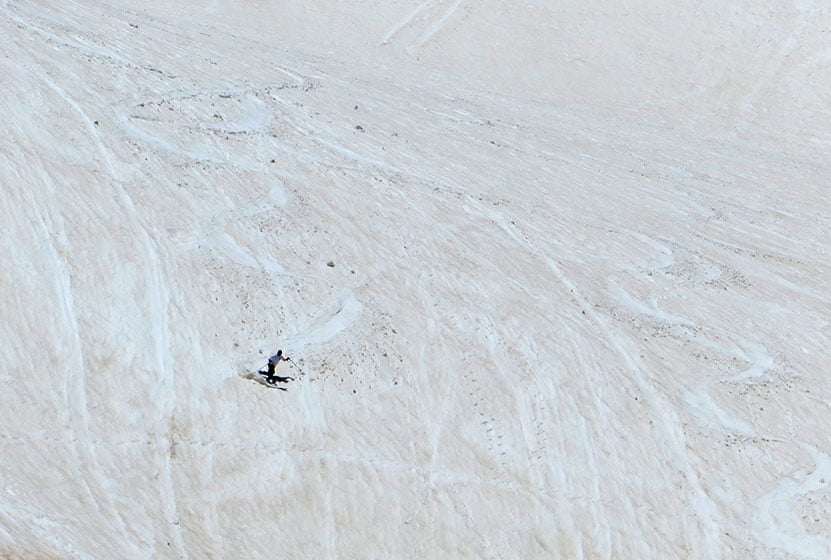
It was the first day of June, and when I arrived at the base of St. Mary's Glacier, I could see snowboarders and skiers zig-zagging their way down its slopes! Even the trail up to St. Mary's lake was still decorated with snow. We only made it about halfway up the glacier as it was very slick and I didn’t have my Yaktrax, but the views we got from (almost to) the saddle at top of the glacier were incredible.
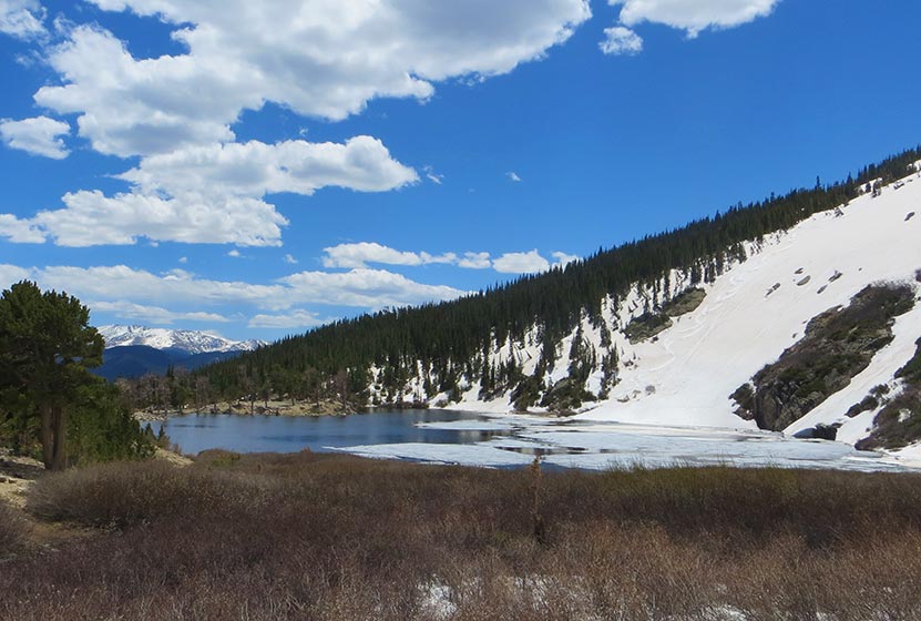
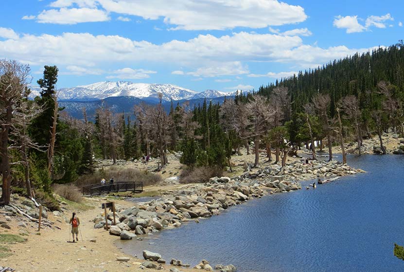
Just St. Mary's Lake alone is breathtaking – especially in the morning calm, as it reflects the glacier in its mirror surface. It's a wonderful place to have a picnic before beginning the rocky descent back down the mountain. If you walk around the right side of St. Mary's Lake, you'll come to a bridge that takes you over a small stream – this is how you pick up the trail to hike up the glacier.
How to Get the Best Experience when Hiking to St. Mary's Glacier
First is parking at the St. Mary's Glacier Trailhead (this is important): There are two parking lots for the trailhead (one south of the trailhead which is fairly large and one north of it that’s smaller) and both require you to pay a $20 fee and display a permit on your windshield. Permits are easily obtained from marked posts in both parking lots, but you’ll need to bring your own pen to write down your license plate number on the fee envelope. Restrooms in the parking lots are a giant bonus and seemed (today, at least) to be very well-maintained. Do not park along the road as it interferes with access to homes and heavy fines are assessed.
The trail up to St. Mary's Glacier is surprisingly short - just about three-quarters of a mile to the top of the glacier - but the route is extremely rocky, and at times, it could be difficult for smaller children to scramble over larger rocks. The lower portion of the trail is quite dry, but as you ascend to the glacier there is a lot of wet and deep snow to traverse through. I’d recommend wearing hiking boots, or at the very least wearing water-resistant/treated shoes with good traction. The winter season at St. Mary's would surely demand snowshoes. If you are hiking in the winter, exercise real caution. Because this hike feels short and is accessible from the interstate, it's easy to forget that you are in an alpine environment. Be sure to stay the trail because this is an area where avalanches are possible on the neighboring slopes.
The trailhead to the St. Mary’s Glacier is well-marked, but after that there are no more signs for the trail itself. I’ve heard folks on the trail say that as long as you’re climbing upwards you’ll eventually reach the glacier, but this type of unmarked trail may be a bit intimidating for less experienced hikers. Personally, in the winter I just follow footsteps in the snow and in the summer I follow the small stream upwards (reduces to a light trickle of water in the late Summer) and I have always made it to the glacier just fine.
Dogs are allowed on the trail on leashes. They should really be kept leashed on the ascent and descent as the land the trail runs through is on private property. Be sure to bring some doggie bags to pick up after your best friend.
Tips & Resources for Hiking St. Mary’s Glacier near Idaho Springs, Colorado:
- Picnic Area: Pack a picnic! The St. Mary's lake is truly a stunning setting for a quick bite.
- Snowboarding Area: Bring in skis/snowboards/sleds and have a blast on the glacier.
- Ask for direction: The trail can pretty confusing of you've not hiked it before, so don’t be afraid to ask hikers coming down if you’re headed in the right direction.
- Trail Map for St. Mary’s Glacier near Idaho Springs, Colorado: Trail Map Link
- Colorado Road Conditions: Colorado Road Conditions
- After the Hike: Beau Jo's Pizza Idaho Springs
- Hike Profile Credit: We would like to express our gratitude to Leslie W., a member of the Dayhikes Near Denver Pathfinder Team, who did this hike, wrote the trip report, and took the photos you see above. Thanks, Leslie!
Weather
Map & Driving Directions
Click for Driving Directions
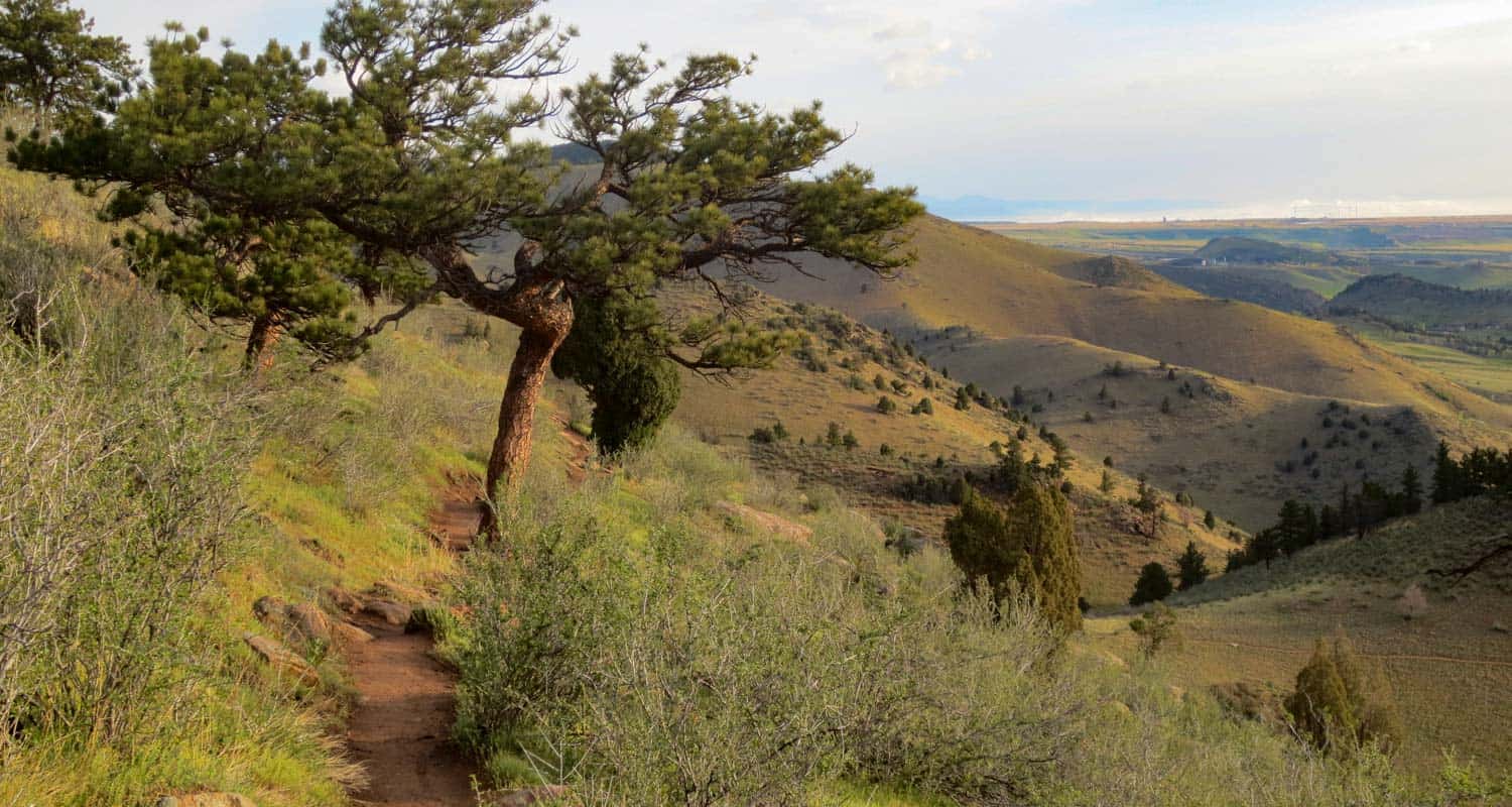
Mt. Galbraith Loop via the Cedar Gulch Trail
Hiking Mt. Galbraith near Golden, Colorado will spoil you with it's views into two canyons and into the City of Golden. Mount Galbraith is about 25 minutes from downtown Denver, so it makes for a quick escape from the bustle of life in town to take in the fresh air of the foothills. This Colorado hiking trail is a moderate loop great for avid hikers but still accessible for beginners. Explore the full Mt. Galbraith Loop hike profile below for trail map, driving directions, and more tips and details to help you enjoy this adventure near Golden.
Trail Snapshot: Mt. Galbraith Loop Trail Near Golden
| Hike Distance | 4.9 miles |
|---|---|
| Difficulty | Moderate |
| Duration | Approx 2 hr |
| Trail Type | Lollipop |
| Elevation Gain | Approx +1100′ |
| Seasons | Spring, Summer and Fall |
| Dogs | Allowed on Leash |
| Hike Trail Map | Click for a Map of Mount Galbraith Park |
| Denver Drive Time | 26 min |
| Driving Directions to Mt. Galbraith Trailhead | Click for Google Map |
| Town Nearest Hike | Golden, Colorado |
| Beauty | cliff-nesting golden eagle, views into Golden, big horn sheep |
| Activities | Hiking, picnics, mountain biking |
| Video | Click For a Video of Mt. Galbraith Loop |
TMt. Galbraith Loop Hike via the Cedar Gulch Trail
The Mt. Galbraith hike profiled here is a lollipop loop, and the out-and-back section of the Cedar Gulch trail starts in Cedar gulch along a stream. I hiked this in the early morning when the sounds of hummingbirds could be heard all along the stream bed. It makes for a perfect sunrise hike.
After crossing the stream, it's a steady, moderate climb with views into Golden Gate Canyon. In the Spring and early Summer, wildflowers will be blooming trailside.
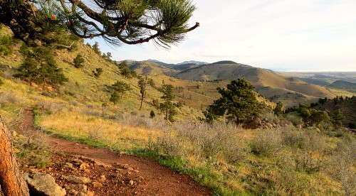
The Cedar Gulch trail runs for 1.3 miles skirting the side of Mt. Galbraith until it hits the intersection with the loop. At this point, you can choose to take the Mt. Galbraith loop trail to the left (clockwise), or to the right (counter-clockwise). We recommend taking the clockwise (left) route which will make for a nice shaded downhill hike off the mountain.
Before you hike to the backside of Mt. Galbraith, you'll get some great views into Golden, Colorado with the Coors Brewery dominating the landscape below, and views to the southwest of Clear Creek Canyon. The video below gives a short panorama from the overlook where you can look down into Golden.
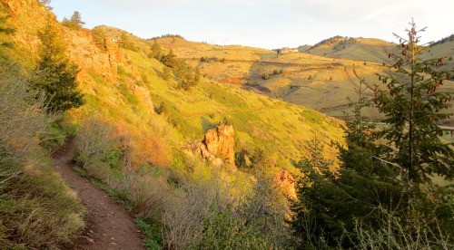
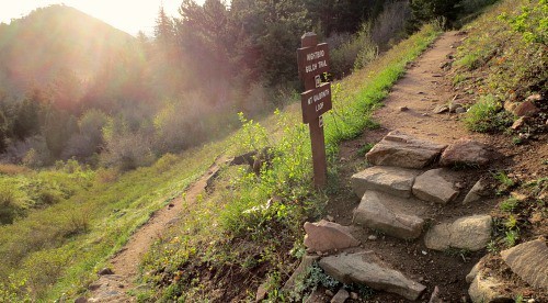
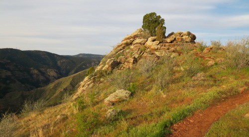
As you continue on the Mt. Galbraith, the trail will take you west until you encounter a rock outcrop (pictured below). I scrambled up to the top and got some great views of the sides of Mt. Galbraith and far down into Clear Creek Canyon. If you are hoping to see wildlife, this is where I'd recommend stopping for a while and breaking out the binoculars.
The back side of Mt. Galbraith provides a bit of shade under ponderosa pines. You'll enter a burn area, and that's when the rest of the hikes shifts to going gradually downhill. As the trail enters the canyon again the pines will transition to spruce and fir, and the trail will become more rocky. I talked with a volunteer ranger and he mentioned that this section can be a bit harrowing when it's covered with snow and ice, but on the May morning I hiked it, only small patches of snow were left.
Soon, you'll emerge from the canyon and be back on the hillside. You'll see the familiar trail intersection where you'll want to take a sharp left onto the Cedar Gulch trail which will take you back down Mt. Galbraith to the trailhead.

Tips & Resources for Hiking the Mt. Galbraith Loop Near Golden
- Packing List: Always pack the 10 Essentials. Download our Hiking Guide to get list and dayhiking packing checklist.
- TIP: The Mt. Galbraith trailhead is on the south side of the road. Be aware as you pull out and back onto Golden Gate Canyon Road, as it’s difficult to see cars coming around the bend.
- TIP: If you’re taking your dog to hike Mt. Galbraith with you, it’s a good idea to bring extra water because there is only one stream at the entrance of the trail and no where else for them to drink. However, after a rain, near the rock outcrop, you should be able to find water pooled the rock alongside the trail.
- TIP: Bring the sunscreen. Although there are a lot of trees on the western and northern sections of the loop, most of the trail is exposed to the sun.
- Keep and Eye Out for Rattlesnakes: Like many of the trails in the foothills and along the Front Range, hikers should keep their eyes out for Rattlesnakes as they will often sun themselves to keep warm on the path or along the path.
- TIP: Take it easy at the beginning of the trail. Hiking Mt. Galbraith is most challenging at the start and the rest of the trail is more peaceful and relaxing after that initial incline.
- Trail Map for Mount Galbraith Park: Trail Map Link
- Colorado Road Conditions: Colorado Road Conditions
- After the Hike: Big Daddy Bagels
Weather
Map & Driving Directions to Mt. Galbraith Trailhead
Click for Driving Directions
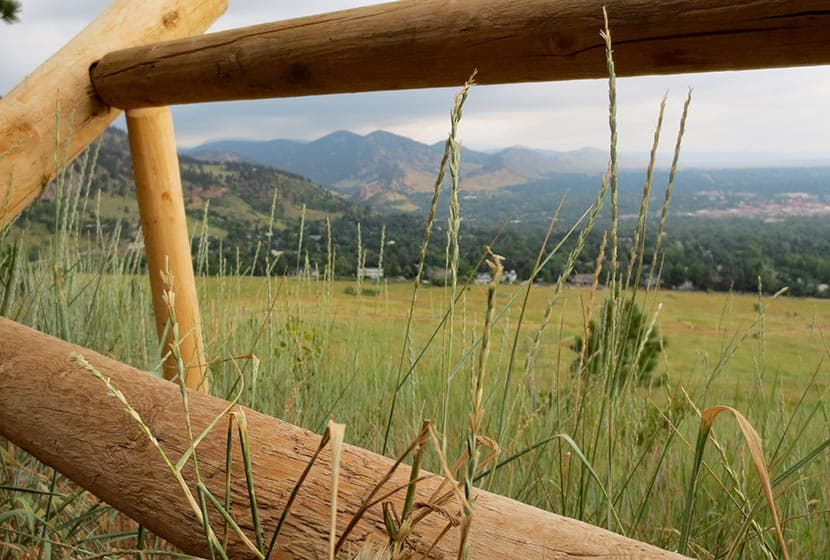
White Ranch Sunset Loop Near Golden, Colorado
This loop hike in White Ranch Park is a great escape, a place to watch the glow of twilight on the city of Denver as the sun sets in the West. This Colorado trail is set at the very beginning of the foothills. You'll journey across a tranquil meadow punctuated with ponderosa pine and decorated with Spring and early Summer wildflowers. In the trail profile below, we'll show you how to create what we are calling the Sunset Loop by putting together a series of short trails. To get the details on this hike near Denver, Colorado, scroll down and take a look at the detailed trail profile, map, hiking trail tips, and the video panorama.
Trail Snapshot: White Ranch Park Sunset Loop Trail
| Hike Distance | Approx 2 miles |
|---|---|
| Difficulty | Easy |
| Duration | Approx 2 hr |
| Trail Type | Loop |
| Elevation Gain | Approx +1400′ |
| Seasons | All Year |
| Dogs | Allowed on Leash |
| Hike Trail Map | Click for a Map of White Ranch Park Golden, CO |
| Denver Drive Time | 45 min |
| Directions | Click for Google Map |
| Town Nearest Hike | Golden, Colorado |
| Beauty | Wild flowers,View of the front range landscape |
| Activities | Hiking, Biking, Equestrian |
| Video | Click For Video of White Ranch Loop Trail - Golden, Colorado |
Ifyou are looking for a great family hike or for a mountain biking experience in the foothills, White Ranch Park offers you a network of trails, with enough variety to please anyone. There are two parking lots .3 miles apart. The second parking at White Ranch has more capacity. We went on a Friday afternoon and only a handful of folks were on the trails, but we hear that it gets much more traffic on the weekends. The Ralston Buttes, a unique geologic formation, dominates the landscape in the distant northeast region of the park. It's a protected area because of its sensitive ecosystem. Though it's not accessible by trail, you'll get a lot of great views of the Buttes at various points of this loop hike.
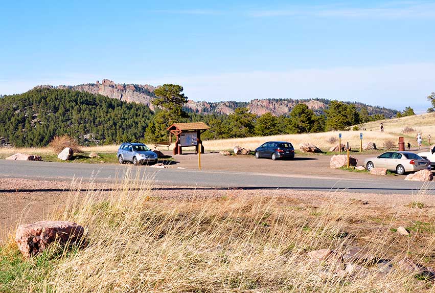
Start your adventure at the second parking lot with the Rawhide Trail.
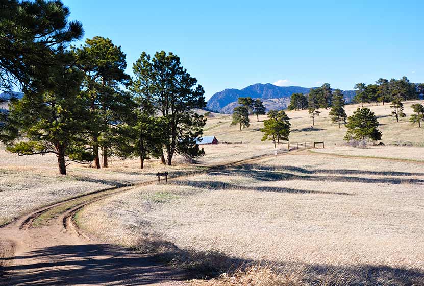
Rawhide trail lays on the edge of a vast meadow. The complete trail is 4.5 miles long, but to form this loop, you'll only hike a segment, before you join up with the Longhorn trail. It can be tricky to find the Rawhide trail, but it's the first one to the east at the trailhead (on your right, if you are facing the trailhead sign). See the photo just below.
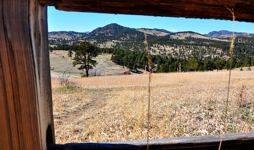
In the distance you will have a chance to see some old ranch buildings and farm machinery. You can imagine what it might have been like to farm this rugged area perched above Denver. While cattle no longer graze these meadows, White Ranch Park is home to several species of wildlife including elk, deer, mountain lions, bears, wild turkeys, and bobcats.
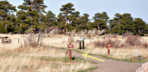
When you get to the intersection with the Longhorn trail, you'll turn right and enter the second part of the hike. Open meadows are replaced with shade and the distinct perfume of Ponderosa pine as you walk along the trail.
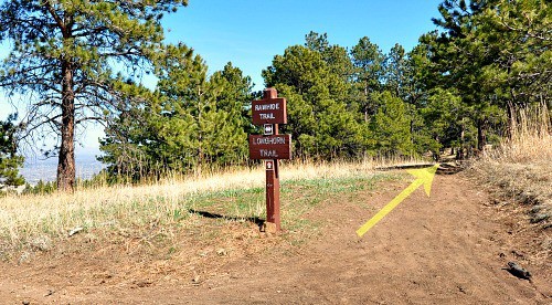
The trail itself is pretty clear and very well-kept. After about of a mile of ups and downs with some nice and easy inclines you can stop and enjoy the view before you turn right again and take the Maverick trail.
Maverick Trail is good for riders and hikers of all skill levels. It's 0.9 miles long and it is primarily used for hiking. While hiking on this trail your eyes may be drawn to the beauty of the high plains, but watch out for the shallow roots that make their way into this part of the trail. It is not technically challenging but some riders have found themselves on their backs on this segment, and I'm sure a few hikers have tripped.
After some great views of Denver and out to the horizon in the East you will reach the end of the Maverick trail and an intersection with Belcher Hill trail. Turn right on the trail split and take a short path to the next intersection. Looking from right to left in front of you will be three roads - Sawmill trail (0.5 mi) that will take you back to the parking lot where you started your trail, Belcher Hill trail (0.6 mi) and Sawmill trail (0.8 mi) that can take you to Sawmill Hicker Camp. Take the Sawmill Trail to complete the Sunset Loop hike.
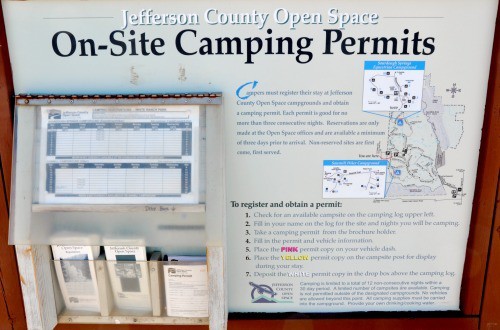
White Ranch is one of just two Jefferson County parks with campsites.
There are 10 campsites available on this site, each has a picnic table, a metal fire ring, and some food storage poles. Also there is a maximum of three tents and eight people per site. Camping permits are free and valid for a maximum stay of up to three nights. Click here for more details on camping in White Ranch Park and the most up to date regulations.
Tips & Resources for Hiking the The Sunset Loop at White Ranch Park
- Drinking Water: Keep in mind that drinking water hand pump at the campsite is only seasonally available (it is closed in winter).
- Ice in Spring: If you decide to hike this loop before April watch out for the slick spots of ice in the shade.
- Gets Windy: Because of its unique location, it can get pretty windy up in White Ranch Park. Might not want to wear your favorite hat.
- After the Hike: After the Hike: Bob's Atomic Burgers in Golden, Colorad
- Colorado Road Conditions: Colorado Road Conditions
- Trail Map for White Ranch Park: Trail Map Link
Weather
Map & Driving Directions
Click for Driving Directions
Enchanted Mesa Trail Near Boulder, Colorado
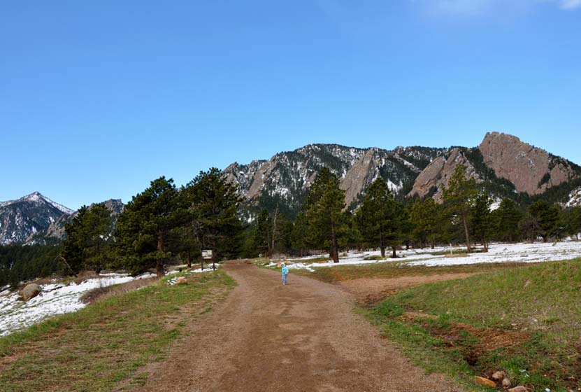
Boulder's Chautauqua park boasts some of the best hiking in Colorado, especially if you are looking for accessibility--many of the trailheads are right in town. The Enchanted Mesa trail lives up to its name. The dense pine forest and the wide curving path looks like something out of a fairy tale. It's a fairly easy hike, with a surprising amount of shade, great views of the Flatirons, and close to Denver. Before you launch out to explore Enchanted Mesa, be sure to check out our detailed description of the hike, the Chautauqua Park trail map, and our hiking tips for this great Boulder Hike.
Trail Snapshot: Enchanted Mesa Trail - Chautauqua Park
| Hike Distance | 1.8-2 miles |
|---|---|
| Difficulty | Easy |
| Duration | Approx 1.5 hr |
| Trail Type | Loop |
| Elevation Gain | +437′ |
| Seasons | All Year |
| Dogs | Allowed on Leash |
| Hike Trail Map | Click for a Trail Map |
| Denver Drive Time | 40 min |
| Directions | Click for Google Map |
| Town Nearest Hike | Boulder, Colorado |
| Beauty | Ponderosa pine forest, views of Boulder’s famous Flatirons |
| Activities | Hiking, Running, Picnics |
Start your hike at parking lot near the Chautauqua Auditorium Trailhead. There is limited parking at the trailhead picnic shelter, but you can find more space around the auditorium and in side streets. Keep in mind that parking in the Chautauqua park area fills up fast.
There are a few options you can consider before starting the hike.
1# Enchanted Mesa - McClintock Loop - 1.4 mile loop
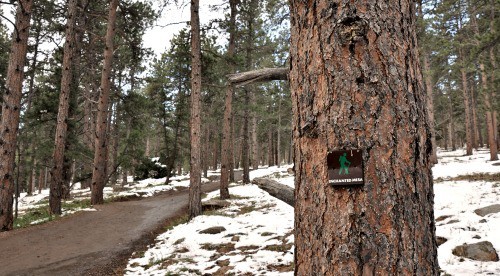
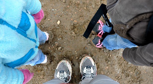
Your first possibility is to hike the trail clockwise by taking the Enchanted Mesa trail out, then returning on the McClintock trail, making it into a loop. You'll head out on the wide path of the Enchanted Mesa Trail which leads you gradually uphill, across a stone bridge, and onto the Mesa. Once you get on the Mesa, walk into a pine forest. The trees get thicker and taller as you go until you feel like you have walked into an enchanted forest. My kids, who are six and 3, hiked this early one Saturday in April (you'll see our muddy shoes at the end of the post), when snow still covered parts of the trail and the city was still asleep. It did feel like stepping, just for a moment, into another world.
When you get to where the Enchanted Mesa Trail intersects with the McClintock trail, turn right and take the the McClintock Trail. Because it's so narrow, this part of the trail doesn’t allow dogs. The return trail at least one steep section, but you'll find stairs cut into the hillside to help you on your way. The Mclintock trail was very muddy coming down, so we expect this trail to be muddy in the warmer days of winter, a lot of spring, and after the Summer rains. We've got a great tip below to help you with that.
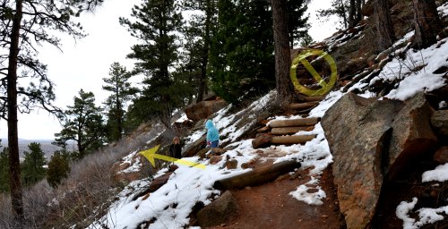
About halfway back along the McClintock trail, you’ll encounter an intersection where a rough set of steps lead up to the right, and on your left, you’ll see the path leading back down toward the creek valley. Go left/down (see the photo) to stay on the McClintock trail. On the way down, you will see the flood damage in the ravine caused by the 2013 flood.
2# - McClintock to Enchanted Mesa - Loop - 1.4 mile loop
This is simply hiking the same loop, but counter-clockwise. The benefit to this is that you get better views of the Flatirons hiking West on the McClintock trail. The McClintock Trailhead starts right from the picnic pavilion behind the Chautauqua Amphitheater. It is 0.7 miles long and ascends 335 feet to where it ties in with Enchanted Mesa.
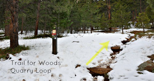
#3 - Enchanted Mesa + Quarry Loop - 1.8 miles
Quarry Loop is beautiful little jaunt off of the top of the Enchanted Mesa trail. If you wish to add 0.4 mile to your hike and enjoy the more of the mesa forest, follow either of the directions above, and look for the Quarry loop near the intersection of the two main trails. This turns your hike into a figure-eight. You will head uphill until you see an old stone cabin. When you get to the cabin, turn right and enter the short and steep stair-step climb to the quarry. When you get on the top you can relax in the hand-crafted chairs and take in the scenery of Chautauqua park.
If you add the Kohler Mesa trail to option #3 you can make your hike close to 2 miles long, giving you the chance to explore even more of the mesa.
This is a great hike any time of year, but is especially great in the Spring. We always find the people of Boulder very friendly, so expect good company. People will be out with their dogs, trail running, and talking with friends. Particularly in the early hours of the morning, it's idyllic.
Tips & Hiking the Enchanted Mesa Trail:
- It Can Be Muddy: Bring an extra pair of shoes or sandals, so that you’re not getting mud all over the floor of your car. There are bags at the trailhead for disposal of dog poop. Our kids shoes were covered with mud, and we used the bags to keep from getting mud all over the back of the car. An even better solution would be to bring plastic shopping bags with you.
- Dog Restriction: Dogs are not allowed on the Lower & Upper McClintock Trail. So, you'll have to return on the Enchanted Mesa trail with Fido, or check the map for other options.
- No Bikes: Bicycles are prohibited on the trails in the Chautauqua area.
- Bring a picnic or a snack: There are some great picnic spots along the Enchanted Mesa hike.
- Trail Map for Chautauqua Park: Trail Map Link
- Colorado Road Conditions: Colorado Road Conditions
- After the Hike: Lollicup Boulder Coffe&Tea
Weather
Map & Driving Directions
Click for Driving Directions
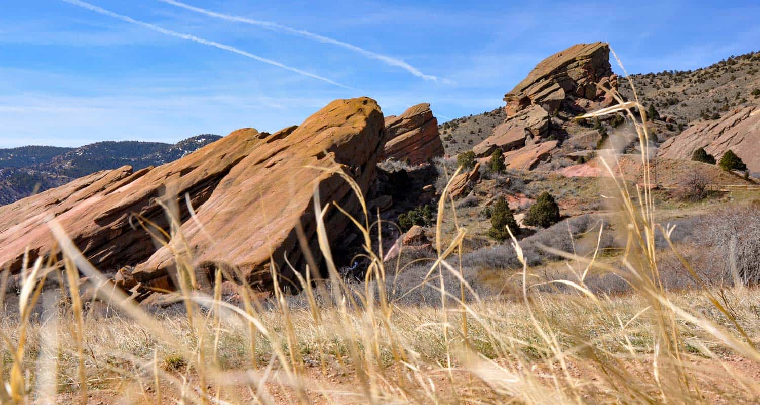
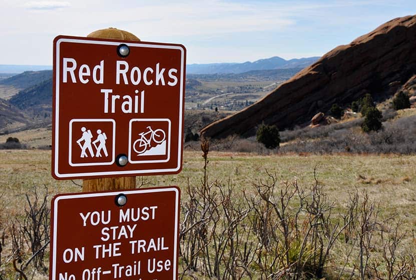
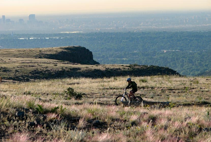
Red Rocks Trail at Red Rocks Park
The Red Rocks Trail at Red Rocks park gives you a chance to wander through the meadows just east of the imposing red monoliths that this Denver Mountain Park is named after. Close to Denver, the Red Rocks Trail is great for a sunrise hike, an inspiring trail run or a challenging bike ride. There's more: a cave carved into the sandstone a great geological overlook. Read our full trail profile below to get all the information you need on this Colorado hike: trail description, driving directions, Red Rocks Hiking Map, a video panorama of the park and more.
Trail Snapshot of Red Rocks Trail at Red Rocks Park
| Hike Distance | 6 miles Round Trip |
|---|---|
| Difficulty | Moderate |
| Duration | Approx 3 hr Round Trip |
| Trail Type | Loop |
| Elevation Gain | +1300'/-1500' |
| Seasons | All Year |
| Dogs | Allowed On Leash |
| Hike Trail Map | Click for a Map of Red Rocks Trail at Red Rocks Park |
| Denver Drive Time | 25 min |
| Driving Directions to Red Rocks Trail at Red Rocks Park | Click for Google Map |
| Town Nearest Hike | Morrison, Colorado |
| Beauty | Rock formations |
| Activities | Hiking, mountain biking |
| Video | Click For a Video of Red Rocks |
This 6 mile loop trail actually spans across two parks. First is the Red Rocks Park which is a Denver Mountain Park, and the second is Matthews/Winters Park which is part of Jefferson County Open Space. Because of this, you should check out two different maps to connect all the trails together into one.
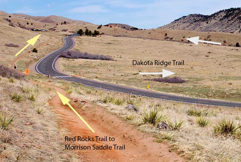
Start your trail at Lower North Lot (our directions above will take you right there). As you can see on the picture above, the actual trailhead is a little difficult to see from the parking lot. To find the Red Rocks Trail trailhead, go to the northeast corner of the lot, cross the street (east), and you will see the beginning of the trail just on the other side of the road.
After a few minutes of hiking, you'll come to a trail junction Dakota Ridge Hogback (see photo below). We recommend you take a right and ascend the Dakota Hogback. Here are a couple reasons for this approach: First, you get one of the more difficult sections of the trail out of the way at the beginning of the hike. Second, you can get a visual of your return trail from the top of the hogback. This will help when you are descending into Matthew's Winter's park and are trying to match the map up to the connecting route. The yellow arrows on the photo below will be your return route (just imagine the arrows going the opposition direction).
Ahead of you is about a mile of rock-strewn path followed by another mile on a wider path. Good hiking boots or shoes are a necessity, especially on this part of the hike. Eventually, you'll bear left and let the trail take you off the mountain and to County Road 93. Here you will cross the street and enter Matthews/Winters park. You'll find restrooms here and a bit of shade under the cottonwood trees that line the creek.
Before you cross the Mt. Vernon Creek, you can pick up park brochure and map. Take the Village Walk trail which is a hiker & equestrian-only if you are on foot. If you are biking this, you'll want to take the Village Ride trail (0.6 mi) which is a bikes only trail. After .3 mile on the Village Walk Trail you will pick up the Red Rocks Trail again. This section isn't very demanding. You'll travel for 2.8 mi back to the trailhead where the hike began. If you want more of a workout on your return, turn right after 0.8 miles and take the Morrison Slide Trail, which will add an additional 0.4 mile and some elevation to your hike or run.
Overall this loop hike gives you great expansive views of Red Rocks, but if you want something closer in to the rock and shorter, then you should check out the Trading Post Trail in Red Rocks Park.
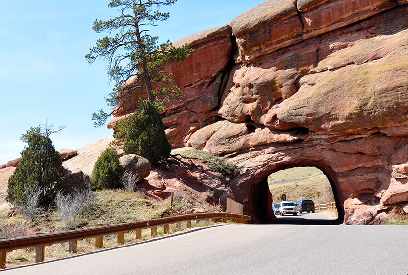
Jaunt #1 - Shallow Cave at Red rocks
From the lower north parking lot, take the stairs up to the road, then walk left up the road about 50 yards to check out a shallow cave carved into the ancient sandstone. There is also a tunnel carved out of the rock that the road passes through. It’s a great place for photos, but be sure to keep aware of the cars.
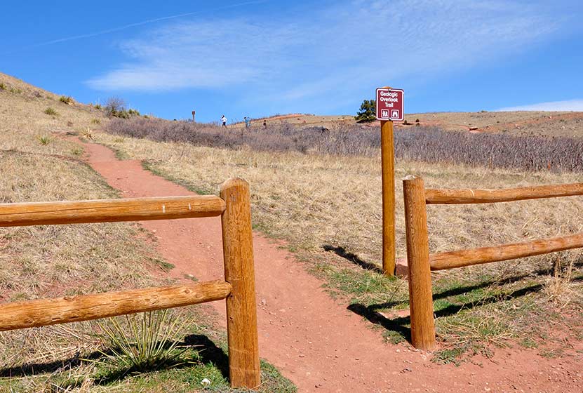
Jaunt #2 - Geologic Overlook at Red Rocks
As you can see on the photo below, on the north side of the parking area, just east of the stairs, you’ll find another trail marker that reads “Geologic Overlook”. It’s just a short hike, maybe a few hundred yards but it will take you to a great overlook in Red Rocks Park.
Tips & Resources for Hiking Red Rocks Trail at Red Rocks Park :
- TIP: There is no shade at all, so we recommend that you bring sunscreen and hats. This trail should be hiked in the morning before the sun is bearing down on you.
- TIP: Be aware of mountain bikers, especially if you have small kiddos who love to wander around on the trail. We passed several cyclists along the trail, and like most Colorado mountain bikers, they were kind and considerate.
- Trail Map for Red Rocks Park: Trail Map Link
- Additional Map: Matthews/Winters Park Trail Map Link
- Colorado Road Conditions: Colorado Road Conditions
- After the Hike: Morrison Joe
Weather
Map & Driving Directions
Click for Driving Directions
North Table Mountain Hike Near Golden, Colorado
When the sun rises over the North Table Mountain, you'll see this mesa rising above the town of Golden, Colorado. A vast network of trails awaits hikers, mountain bikers, and nature photographers. This is a perfect hike near Denver for when you don’t have much time on your hands but need some fresh air. While the trails on Table Mountain are accessible all year round, the best time to hike it is in the Spring and early Summer when wild flowers start to bloom. Check out our detailed description of the hike, the Table Mountain trail map, driving directions so that you can explore this unique Colorado hike.
Trail Snapshot: North Table Mountain Near Golden
| Hike Distance | 2.7 to 7.7 miles |
|---|---|
| Difficulty | Moderate |
| Duration | Approx 1-4 hrs |
| Trail Type | Loop |
| Seasons | All Year |
| Dogs | Allowed on Leash |
| Hike Trail Map | Click for a Map of North Table Mountain Park |
| Denver Drive Time | 25 min |
| Directions | Click for Google Map |
| Town Nearest Hike | Golden, Colorado |
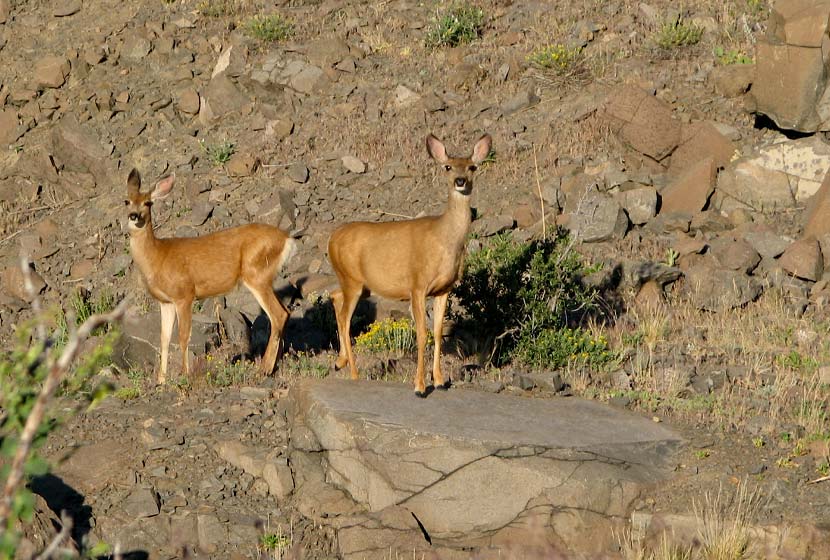
| Beauty | Views of Denver and Golden, wildflowers, deer, golden eagles |
| Activities | Hiking, mountain biking, nature photography, climbing |
Start your tour of North Table Mountain (really it's a mesa) a few hours after the daybreak by entering the main parking lot off of Highway 93, just north of Golden, Colorado. At the trailhead, you'll find a kiosk with trail maps, and a public restroom. There are three ways you can explore the North Table Mountain, so scroll down to read the details on all three options.
Hiking North Table Mountain
#1 The (short) North Table Loop trail - 3.2 Miles
The first part of the trail starts with a wide path, a long ramp up to the top of the mesa. It's a bit of a challenge, but when you get to the top, the paths level off and are much easier. Leaving the parking lot, take the North Table Loop trail south for 0.7 miles until you reach a trail intersection. Take a left onto the Tilting Mesa trail. Follow Tilting Mesa trail for approximately 1 mile until the next trail junction. Take a left onto the Mesa Top Trail, hiking on it until it intersects with the North Table Loop trail again. Take a left onto the North Table loop trail which skirts the sides of North Table Mountain and takes you back to the trailhead.
#2 The Longer North Table Loop Routes - 6-8 Miles
Shake it up a bit: This is a longer route that combines a tour of the top of Table Mountain and a hike around the perimeter. Start the same way you would start the short table loop trail by taking the North Table Loop for 0.7 miles until you reach the Tilting Mesa trail. Follow the trail to the first unmarked intersection and then turn right. On your next intersection turn right again onto the Mesa Top trail. After about .6 mile, you'll encounter a trail intersection with the Rim Rock Trail which is closed seasonally (March 1 through July 31). Continue on the Mesa Top trail until it intersects with the North Table Loop trail which will take you all the way back to the west side of the mountain and to the parking area. This is approximately a 6 mile loop.
Adapt to a Closure Route: At the time of this post, April 2014, a segment of the Mesa Top trail is closed due to flood damage. An alternate route adds some mileage and difficulty to this loop, but that just may be what you are looking for. Here's the route: Same as above, but when on the Mesa Top Trail, take the Cottonwood Canyon Trail (right) until it links you back up with the North Table Loop trail. Then take a left back on to the North Table Loop trail which will then take you on a tour of roughly 3/4 of the perimeter of North Table Mountain. Here's a link to the North Table Mountain Trail Closure map that should help you plan this route. This Route is approximately a 7.5 mile loop.
The Straighforward Approach: The final route is pretty straightforward, just take the North Table Mountain Loop all the way around the perimeter of the mountain. This results in an approximate 7.7 mile loop.
#3 The Golden Cliffs Trail - 2.7 miles RT
If you are a climber or just looking for a shorter hike, you can take North Table Mountain trail to the Golden Cliffs trail. The Golden Cliffs are very popular Colorado rock climbing attraction. This area is actually a preserve managed by the Access fund. For more information on rock climbing the Golden Cliffs, see the Golden Cliffs page on the Mountain Project and Access Fund Sites. This is a 2.7 mile (Round Trip) out-and-back trip.
Tips for Hiking North Table Mountain:
- Wear sunscreen because there is no shade once you are atop Table Mountain.
- Camping and open fires are not permitted at North Table Mountain Park.
- Don’t forget to bring your camera. You can get some very interesting wildlife images.
- Rattlesnakes: Jefferson County Open Space notes that North Table Mountain is a known Rattlesnake habitat. They recommend downloading their Snakebite Prevention and First Aid Guide to better understand this native reptile of Colorado.
 Weather
Map and Directions to North Table Mountain West Trailheaad
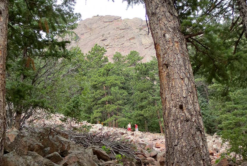
Royal Arch Trail
The hike up to Royal Arch in Boulder's Chautauqua Park is a serious workout, but the beauty of Bluebell canyon and the view of Royal Arch make it worth the journey. Our most important tip for making this an enjoyable hike is to go when it's not so crowded, during the early morning or on weekdays. Scroll down to get all the details you need for this hike in Boulder, Colorado: trail map link, driving directions, weather forecast, and more tips.
Trail Snapshot: Royal Arch Trail in Chautauqua Park
| Hike Distance | 3.5 miles Round Trip |
|---|---|
| Difficulty | Moderate to Difficult |
| Duration | 2-3hrs |
| Trail Type | Out and Back |
| Elevation Gain | Approx +1400′ |
| Seasons | All Year |
| Dogs | Allowed on Leash |
| Hike Trail Map | Click for a Trail Map of Royal Arch Area |
| Denver Drive Time | 40 min |
| Directions | Click for Google Map |
| Town Nearest Hike | Boulder, Colorado |
| Beauty | Rock formations, Bluebell Canyon, raptors, natural spring |
| Activities | Hiking, rock climbing |
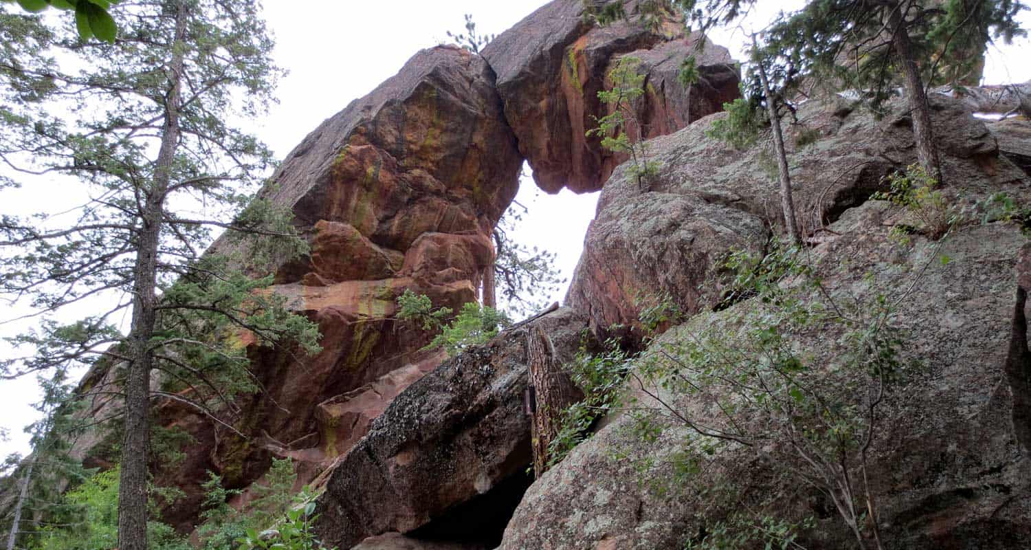
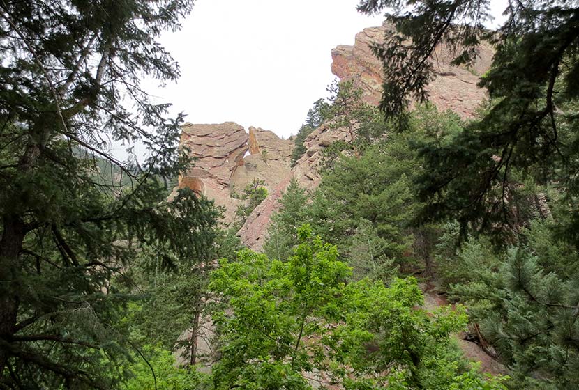
If you talk with someone who has hiked the trail up to Boulder's Royal Arch, they will tell you two things: 1) The Royal Arch, though not as grand as some of the arches in Utah's backcountry, is really a beautiful sight, and 2) That the hike is a real challenge.
While the trail is relatively short - 3.5 miles round trip - the hike up through Bluebell Canyon to Royal Arch has a lot of uphill and downhill, making the elevation gain around 1400' over the course of the trip. Because the trail has a lot of rock steps and is heavily used, the latter half of the hike requires some negotiation. It's still a good trail, just don't expect a walk in the park.
The Hike to Royal Arch
Beginning at the Chautauqua Park Trailhead, take the Bluebell Road Trail through the meadows and up to the Bluebell Shelter (see trail map here). You'll come to a junction near the Bluebell Shelter, and will see signs pointing you to the Royal Arch Trail.
Soon, you'll enter Bluebell Canyon. The Royal Arch trail will descend before beginning its climb to the top. This section of the hike is especially alive and enchanting during the early morning hours. Bluebell Canyon is home to raptors and is seasonally protected when the birds are hatching. The trail is still accessible during those times, but signs are posted to keep the canyon drainage clear of hikers.
The higher you hike, the more stairs you'll encounter. It's nothing like hiking the Incline in Colorado Springs, but it's still a real workout. If you hike to the Royal Arch on the weekend, this is where you'll begin to experience the trail congestion. In fact, I'd have to say that this was the most overcrowded trail I've hiked in Colorado. A lot of hikers had stopped to rest, huffing and puffing trailside. Others gathered right in the middle of the trail. I overheard several people deliberating whether or not to keep going, and watched others turn around without making it to the top. So, our first and most important tip would be to hike to Royal Arch early in the morning by getting on the trail before 8AM, or hiking the Royal Arch trail on a weekday.
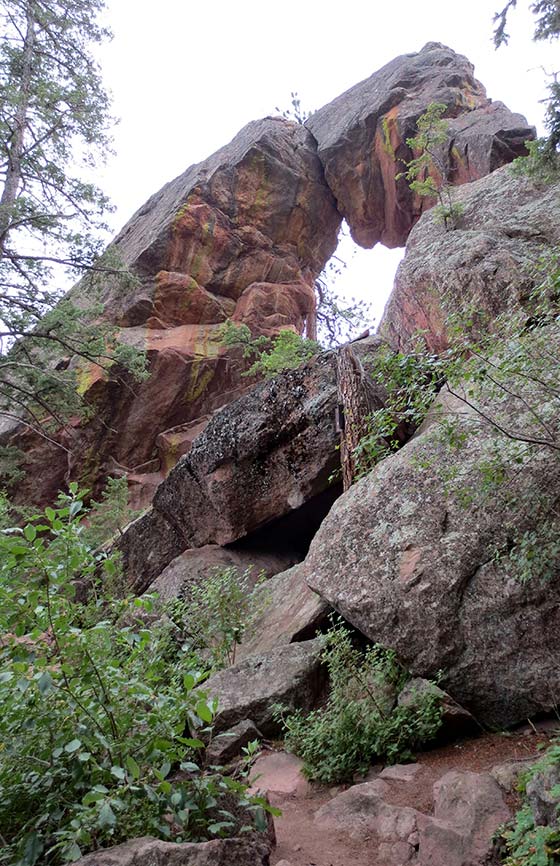
After pushing up to Royal Arch, be sure to walk around it and go through it. The views of Boulder are incredible. On a clear day, you can see all the way to Denver. I'd recommend taking a picnic or at least a snack, and kick back for a while. There is supposedly a way to make this hike more of a loop by taking a trail down the backside of the arch, but it's an unmarked trail and one hiker who took it warned against it. So, we recommend taking the marked Royal Arch trail back down to the shelter. From there, you have some trail options.
On my way back, I decided to take the Bluebell Mesa trail down to the Chautauqua trail, which led me home to the trailhead and ranger cottage. I'd highly recommend this route back. It takes you through a stand of pines on a mesa above the meadows of Chautauqua Park. You can pick up the Bluebell Mesa trail near the Bluebell Shelter soon after you exit the canyon.
Tips & Resources for Hiking to Royal Arch in Boulder:
- Leave Fido At Home: I love dogs; in fact, I took our Dog, Francine, on the hike up to Royal Arch. But it was so congested that it made it difficult for her and I to navigate the trail together. Other dog owners with long leashes nearly tripped several hikers along the trail. If you want to bring your dog on this hike, I'd recommend going early or going on a weekday.
- Bring Snacks and Water: It probably goes without saying, but be sure to bring food and water to refill your tank. This hike demands it.
- Bring Trekking Poles: The trail up to Royal Arch can be hard on the knees--especially the descent--so bring trekking poles if you have them. The trail is heavily shaded, so my guess is that it will ice up in the winter. Just another reason to bring something that will help you get traction.
- Take Time at the Top: Build time into your hike to rest and maybe have a picnic under the Royal Arch.
- Keep and Eye on the Weather: Talking to one of the rangers, he shared that storms can come up quickly along the Flatirons, which will catch hikers unawares. Because you are hiking through a densely wooded canyon and are so close to the mountain, it makes it difficult to really judge the skies. But the Flatirons area is like a lot of other mountain hikes, storms typically roll in during the early afternoon.
- Trail Map for Chautauqua Park: Trail Map Link
- Colorado Road Conditions: Colorado Road Conditions
- After the Hike: Ozo Coffee in Boulder, Colorado
Weather
Map & Driving Directions
Click for Driving Directions
Greenland Open Space Trail Near Larkspur, Colorado
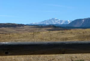
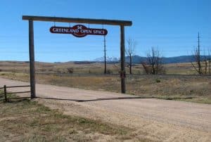
Rolling meadows stretch to spectacular views of Pikes Peak on this easy Colorado hike near Larkspur. The Greenland Trail takes you across the stunning grasslands near Larkspur, Colorado, a Douglas County Open Space that spreads across 3,600 acres of sun-drenched fields.The Greenland Open Space trailhead can be easily accessed from I-25. Check out the full trail profile below for detailed descriptions, trail map, and driving directions to this great hike along Colorado's Front Range.
Trail Snapshot: Greenland Open Space Trail Near Larkspur, Colorado
| Hike Distance | Up to 10 miles |
|---|---|
| Difficulty | Easy |
| Duration | Approx 1 to 3 hrs |
| Trail Type | Loop |
| Starting Elevation | 6908′ |
| Elevation Gain | +500′ |
| Seasons | All Year |
| Dogs | Allowed On Leash |
| Hike Trail Map | Click for a Map of Greenland Open Space Trail Near Larkspur, Colorado |
| Denver Drive Time | 46 min |
| Driving Directions to Greenland Open Space Trail Near Larkspur, Colorado | Click for Google Map |
| Town Nearest Hike | Larkspur, Colorado |
| Beauty | Grasslands, ponds and ponderosa pine forests |
| Activities | Bicycling, trail running, hiking |
| Video | Click For Video |
Greenland open space has one main trail, the Greenland Trail (appropriately named) that forms a 10 mile loop. However, your not stuck hiking the entire thing, you’ve got options. We’ll briefly profile three different ways you can hike the Greenland trail and customize it for you and your family (scroll past the video panorama for the three options).
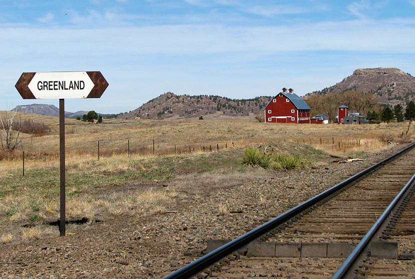
It’s a perfect place for horseback riding. In fact, when I-25 disappears from view, you may think you’ve time-traveled back to the early 1800‘s. You can leave your trailer on the parking area, but keep in mind that Greenland open space can get very crowded on the weekends. So, get there early to make sure you’ve got a place to park.
There is also a great 17 acre off-leash dog park just to the east of the trailhead. The open space area requires fido to be on a leash. Click here for more info on the Devon Theune off-leash dog park and for a list of the others in Douglas County.
Hike Options at Greenland Open Space
#1 - Greenland Trailhead to the Santa Fe Trailhead in Palmer Lake - 5.6 Miles One Way
At the first fork in the trail, stay straight (right) on the Greenland Trail. You’ll pass a small pond and work your way through scrub oak and pines as the trail rises. At 3.5 miles you’ll see the option to turn left onto Kipps Loop. Instead of going left onto Kipps Loop, continue straight (South) on the trail. You’ll cross County Line road around 4.6 miles, then you’ll have one mile left until you arrive at the New Santa Fe Trailhead in Palmer Lake, Colorado. Out and back, this is an 11.2 mile trek across Greenland Open Space. The views of Pikes Peak and the neighboring Buttes of Spruce and Eagle Mountain mean a lot of beautiful scenery to soak in.
#2 - The Greenland Open Space Loop Trail - Approx. 10 Mile Loop
Our first tip on hiking Kipps loop is hike it counter-clockwise. This will give you a nice long and gradual two-mile descent as you are coming back into the trailhead. There’s only about 500’ of elevation gain on this hike, but your knees will be grateful at the end of the trip. Follow the same directions above, but when you get to the Kipps Loop option after 3.5 miles, take a left (East) onto the Kipps Loop of the Greenland Trail (your still officially on the Greenland Trail). The first 5 miles of the hike are uphill until you reach the high point which is at 7,400 feet. This is a great place to stop and enjoy the view. You’ll pass the gravesite of E. Kipp, and an unusual white rock formation along this eastern side of the loop. As we said before, the rest of your hike will be pretty much downhill from there back to the trailhead.
#3 - Just Explore - Approx. 1-3 Miles
Just because it’s a big loop doesn’t mean that you have to hike the entire thing. If you are hiking this as a sunset hike, you’ll likely want to keep it short. You can take either the eastern or western sides of the loop and hike until you are ready to turn around. Sunrises and sunsets are quite glorious in Greenland, and this is a great way to enjoy them.
Tips & Resources for Hiking Greenland Open Space Trail :
- TIP: There is no water on this trail so bring more than one bottle just in case. Don’t forget, dogs need plenty of water too!
- TIP: You are very exposed to lightning. Douglas County has some of the worst stats in the nation when it comes to lightning strikes, so really pay attention to the weather. Dark clouds moving over the edge of the foothills means that you should be headed back to the car.
- TIP: Bring the Sunscreen - you are also very exposed to the sun - no shade in Greenland. If you are hiking mid-day, then be sure to bring a hat and sunscreen.
- TIP: If you are snowshoeing or cross-country skiing, or even hiking in winter, be aware that drifts form along the Greenland Trail.
- TIP: There is a fantastic picnic area on the other side of the facade of the old Greenland general store.
- Trail Map for Greenland Open Space: Trail Map Link
- Photo: We would like to express our gratitude to Christopher Rosenberger for sharing such an amazing photograph of this hike to Greenland Open Space.
- Colorado Road Conditions: Colorado Road Conditions
- After the Hike: Charito’s House

Weather
Map & Driving Directions
Click for Driving Directions