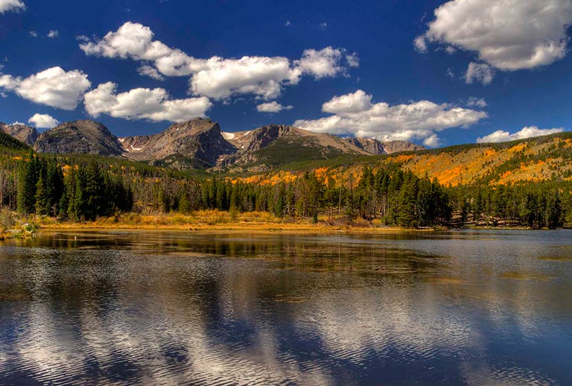
Sprague Lake Loop Hike in Rocky Mountain National Park
At Sprague Lake you'll find an easy loop hike with some stunning views of the mountains that make Rocky Mountain National Park famous. It's a perfect hike in RMNP for young families because the trail is short and has no real elevation gain. With diverse wildlife and a beautiful, peaceful lake, this is one of those spots you should not miss in RMNP. Explore the full Sprague Lake hiking profile below for trail map, driving directions, and all the details you need to enjoy this Colorado adventure in Rocky Mountain National Park.
Trail Snapshot: Sprague Lake Loop in Rocky Mountain National Park
| Hike Distance | 1/2 mile |
|---|---|
| Difficulty | Easy |
| Duration | Approx 30 min |
| Trail Type | Loop |
| Starting Elevation | 8690' at Trailhead |
| Elevation Gain | Approx +20′ |
| Seasons | Spring through Fall, Winter Snowshoeing |
| Dogs | Prohibited in RMNP |
| Hike Trail Map | Click for a Map of Sprague Lake RMNP |
| Denver Drive Time | 2 hr |
| Driving Directions to Sprague Lake Trailhead | Click for Google Map |
| Town Nearest Hike | Estes Park, Colorado |
| Beauty | Sub-alpine lake, mountain views, wildlife: Abert's squirrel, elk, bear, beavers, waterfowl, moose, ducks, Canadian geese |
| Activities | Picnicking, hiking trails, snowshoeing |
| Conditions at Bear Lake Trailhead | Click Here |
| Fee | Park Pass Required |
Sprague Lake Loop Hike
Sprague Lake is a 13-acre lake named after Abner Sprague, an early resident of the Estes Park area who ran a game lodge on the this property which is now part of Rocky Mountain National Park. To access the 1/2 mile loop hike around Sprague Lake, cross the bridge near the parking area. Be sure to pause at the bridge to look for trout. We've spotted an enormous brown trout motoring in these waters near the bridge. It's a regular spawning area in the autumn, so this little segment of water can become quite crowded with fish.
After the bridge, the trail can be hiked to either the left or the right around the perimeter of Sprague Lake. Keep your eyes peeled for Beaver and Moose, both residents of the area. You will be more likely to spot wildlife in the early morning hours.
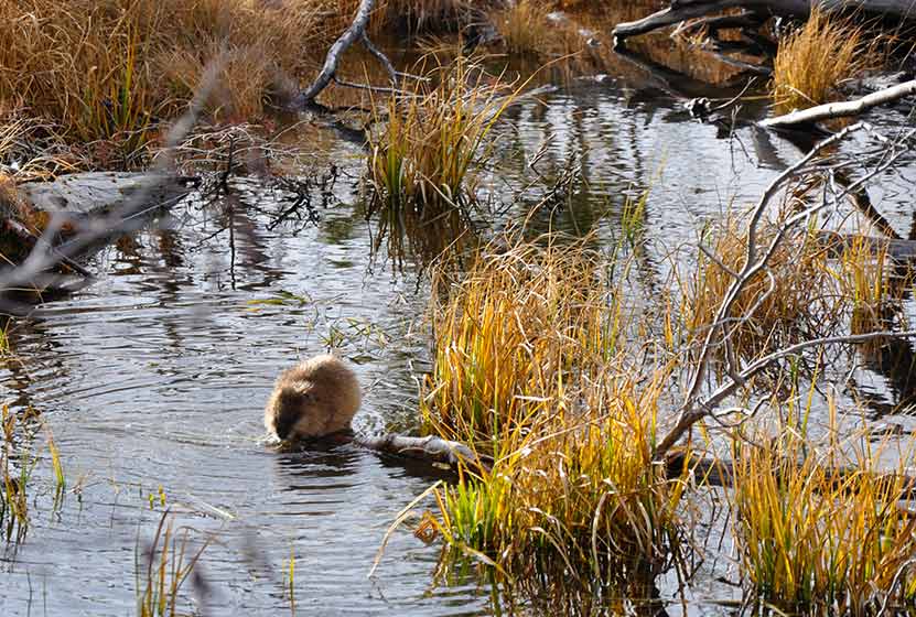
A Beaver at Sprague Lake RMNP
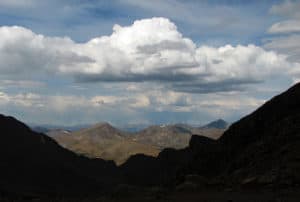
In the early spring, the trail will likely still be under snow. However, this is such a popular area that it should be easy to spot the trail left by others. As you make your way to the northeastern rim of Sprague Lake, you'll gain views of the continental divide, including Hallett Peak. This is a perfect spot to set up your camera for an iconic photo of RMNP.
In the Fall, this is one of the better spots in Rocky Mountain National Park to view the aspen trees changing on the distant mountains.

Tips & Resources for Hiking to Sprague Lake :
- TIP: Hiking shoes are recommended if you hike during early spring or late winter as you might need to pass through snow on the trail.
- TIP: If you get out early on a spring morning, you might be lucky enough to spot a moose or more.
- Rocky Mountain National Park Trail Conditions: Click for RMNP Trail Conditions
- Trail Map for Bear Lake Corridor: Trail Map Link
- Colorado Road Conditions: Colorado Road Conditions
- After the Hike: Poppy's Pizza
- Photo: We would like to express our gratitude to Tim Stacks for sharing such a beautiful photograph of this hike at Sprague Lake.
Weather
Map & Driving Directions
Click for Driving Directions

Buffalo Creek Falls at Wellington Lake
This waterfall isn't even on the map, and it's become my favorite waterfall hike near Denver. In fact, this is the only post that I'm tempted to keep to myself, because not only is there great hiking, but Wellington Lake may be the best camping spot within 90 minutes of Denver.
There is a hitch though: it's a privately held recreation area and requires a day-use fee of $14 per adult (age 13+) and a fee of $6 fee per child. Fees have gone up so, (depending on the size of your party) it probably makes more sense to pay the camping fee, stay for at least one night, and make the waterfall hike a part of your adventure. Explore the full trail profile below for this beautiful waterfall hike near Denver.
Trail Snapshot: Buffalo Creek Falls at Wellington Lake
| Hike Distance | 0.5 mile RT |
|---|---|
| Difficulty | Easy |
| Duration | approx. 30 minutes |
| Trail Type | Out and Back |
| Elevation Gain | Approx. +500' |
| Seasons | Year Round |
| Dogs | Allowed On Leash |
| Hike Trail Map | Click for a Map of Buffalo Creek Falls |
| Denver Drive Time | 1 hr 45 min |
| Directions | Click for Google Map |
| Town Nearest Hike | Bailey, Colorado |
| Beauty | Waterfall, Lake, Castle Mountain, Osprey, Waterfowl |
| Activities | Hiking, camping, boating (non-motorized), fishing |
| Fee | 14$ per adult, 6$ per child ages 6-12. See Castle Mountain Rec site for up-to-date fees |
You'll find Buffalo Creek Falls at the backside of Lake Wellington and just under the shadow of The Castle, a granite mountain that rises off the lake and is named--you guessed it--because it looks like a fortress. Read on to get a detailed set of driving directions, a description of Buffalo Creek Falls, places to explore beyond the falls, and some details on camping at Wellington Lake.
Driving Directions to the Trailhead:
You'll drive 285 to Bailey, then hang a left onto 68/Wellington Lake Road. 68 is a dirt road and relatively smooth. Still, rain can change things in an instant, so we advise being alert for potholes and washboard. When you arrive at the lake, pull up to the office building, and pay your day-use fee. We have been incredibly impressed by the folks who work here, they are hospitable and kind. If you decide to camp, this is where you pay your campsite fees and get firewood. Put the day-use tag in your car where it's visible, then take the road around the lake. Be aware of kids running and playing because the road runs right through the campground. The Google maps provided in this post only go about halfway around the lake. You'll want to continue further, all the way to the scout camp, and that's where you'll find the large dirt parking area and the trailhead.
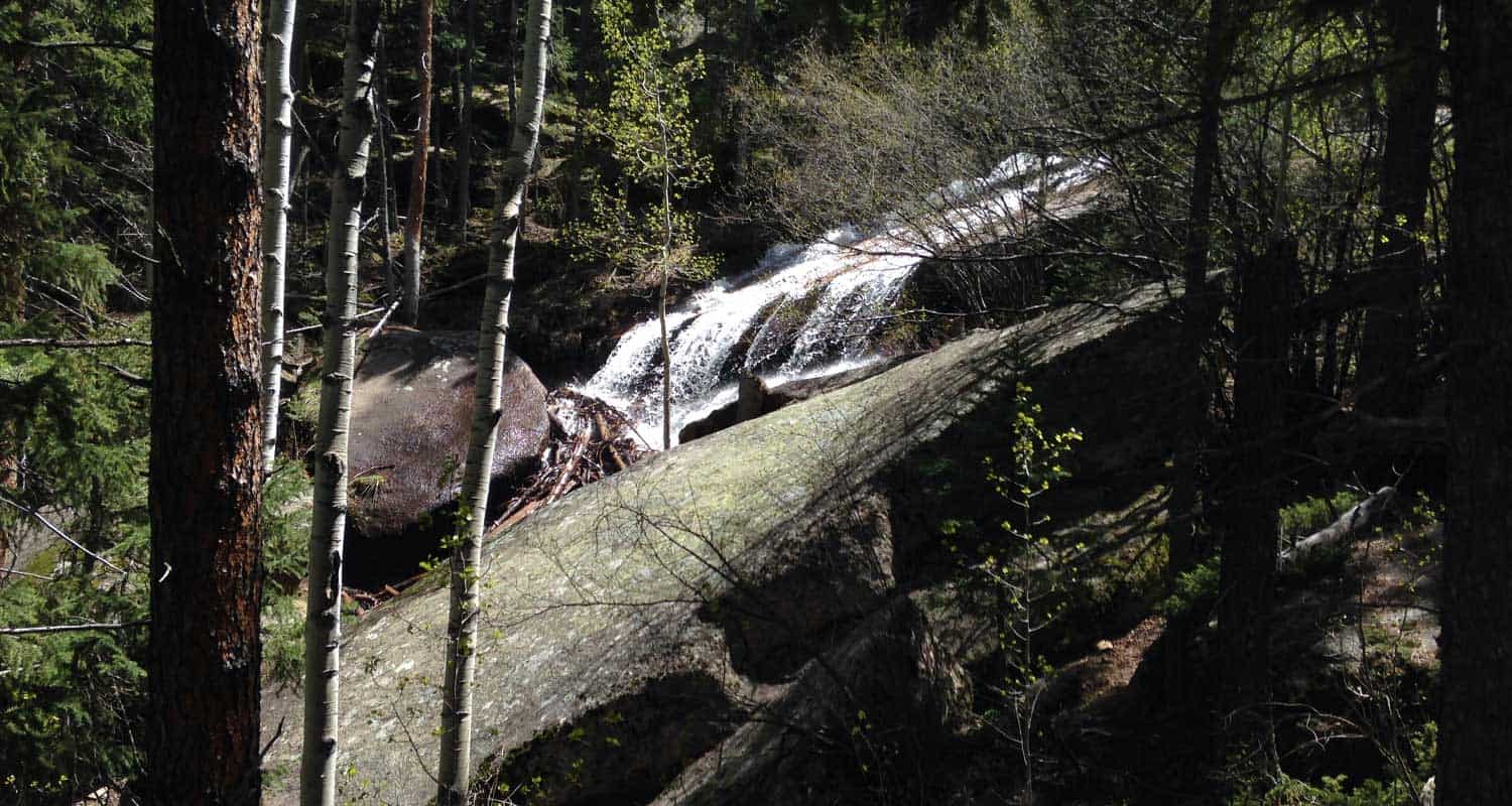
The Hike to Buffalo Creek Falls
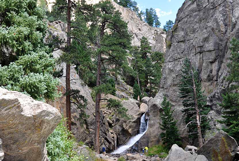
My friend Matt and I took our two 4 1/2-year-old daughters with us on this hike and they did great. Look for the trailhead that begins just to the left of the Scout Camp sign. It's been raining almost every day this year (2015) so there was a lot of mud and puddles at the start. This gives way to a trail that climbs about 400 yards or less up to the base of the falls.
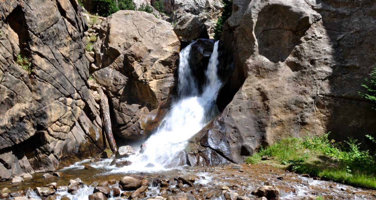
Here, at the bottom of the waterfall, the creek spills itself into a fan of cascades. Look for the trail that runs to your right and goes to a falls overlook bridge. The trail and steps are in need of some repair, but it's a short jaunt to the top. The waterfall is really unique. It's a shelf waterfall, but the water, over time, has scalloped out the rock to create ripples. So, when the water is really flowing, such as in early Summer or after a good rain, the waterfall creates a spray of waves. It's not enormous or breathtaking, but it's got a really unusual character about it. Watch the video to see what I'm trying to describe with words that an image can better tell. In my opinion, it's much better than Maxwell Falls, which is probably the most popular waterfall hiking destination near Denver.
But the waterfall isn't even the best part. The creek above the falls is nothing but cascade after cascade. I scrambled around and explored about 100 yards further up South Buffalo Creek and found some shallow caves and hidden spots with pools and miniatures falls. I'm looking forward to going back to hike the creek as far as I can manage, possibly all the way to the ridgeline. I should make a few of recommendations at this point: 1) hike on durable areas to prevent erosion, 2) it's an easy place to slip and twist an ankle, so wear good shoes or boots and be mindful, and 3) pick up any trash you see and pack it out with you.
Finally, it's important to note that this waterfall will likely be a trickle by midsummer. The best time to go will we mid-May through July 1. However, it should also be a great midsummer after a good rain.
Camping at Wellington Lake
There are 75 camping sites at Wellington Lake, including group sites, and many of them right on the shore. You can camp with everything from tents to larger RVs, though it depends on the site you pick. To make sure you will have enough room at a particular site, be sure to give Castle Mountain Rec a call at 303.838.5496 before you book online. We love this place because we can paddleboard, fish, the kids catch minnows and crawdads, and there more hikes beyond the waterfall hike. We even watched an osprey dive into the water and snag a fish from the lake. There are restrooms, water sources, but no showers and no cell service (but that's why you're camping).

Tips & Resources for Hiking Buffalo Creek Falls:
- You've Got to Camp Here: You can book your campsite online at the Castle Mountain Recreation Reservation Page. This place packs out in the Summer, so make your reservations early. There are also First Come, First Served sites.
- Dogs: If you bring your dog on this hike, be sure to keep them on a leash. If they get out on the rock, it's slick, and they can tumble into the cascades. We heard a story of a dog getting swept away down the falls. Of course, the same thing can be said for children. Well, you don't need them on a leash, but keep a close eye on them around the steep and slick terrain around the waterfall.
- Trail Map for Buffalo Creek Falls Trailhead: Trail Map Link
- Colorado Road Conditions: Colorado Road Conditions
- After the Hike: Crow Hill Cafe, Bailey, Colorado
Weather
Map & Driving Directions
Click for Driving Directions

Cascades Near Berthoud Falls
Looking for a place to stop and stretch your legs on your way to Winter Park? These cascades along US 40 will refresh your spirit and are immediately accessible right off the road.There are some unmaintained trails to explore, so check out the full profile below to discover more.
Trail Snapshot: Cascades Near Berthoud Falls
| Hike Distance | 0.1 mile |
|---|---|
| Difficulty | Easy |
| Duration | 5 min |
| Trail Type | Out and Back |
| Seasons | Summer & Fall |
| Dogs | Allowed on Leash |
| Denver Drive Time | 1 hr |
| Directions | Click for Google Map |
| Town Nearest Hike | Berthoud Falls, Colorado |
| Beauty | Cascades and Mountain Views |
| Activities | Falls Viewing Area |
| Video | Click For Video |
Our family drives Highway 40 over Berthoud pass about once a month, and this little side stop is a great place to stretch your legs and listen to the water gushing down the mountainside. This beautiful cascade and stone bridge are located on the second switchback curve on highway 40 as you head towards Winter Park from Denver (south side of Berthoud pass). It's not a formal parking area (I think it's used for snow removal), but it can hold several cars after the snow has melted away in late May/early June. A small hiking trail can be discerned on the right side of the Hoop Creek, but it's not maintained. I've not hiked it, so I'm not sure how far it goes.
There are some great views looking South to Engelmann Peak and Red Mountain. There is no picnic area, and the ground is soaked in early Summer, but my guess is that you could bring a blanket in late summer and Fall and enjoy a picnic lunch by the falls.
It's unclear if this falls is where the small settlement of Berthoud Falls got its name. My guess is that this is not Berthoud Falls. Here are my two guesses on the correct location. Click here for the Google map pin locations.
1 - Where a creek runs about 1200' feet down into the settlement of Berthoud Falls. This is not a sheer drop, but it is quite steep terrain. The proximity to the settlement makes this the best choice.
2 - Where Hoop Creek and another creek meet then drop into a very steep ravine. This is a more sheer drop and is located about a mile east of the settlement of Berthoud Falls. Because it's so far from the town, it's not likely that this is the namesake However, because of the steep terrain, it may contain a legitimate waterfall, or some amazing cascades.
I'm hoping to explore these more sometime and will plan to update this post when we have more information.
If you know the history of the area or have additional information about the Berthoud Falls Waterfall, I'd appreciate it if you left a comment in the trail reports below.
Tips & Resources for Viewing the Cascades Near Berthoud Falls:
- Be Safe: The pull-off can sneak up with you and there can be a lot of traffic on the weekends. Be alert for cars.
- Picnic Areas: There are some great picnic areas at Jones Pass, bottom of US 40 near the settlement of Berthoud Falls, and along Clear Creek just east of Berthoud Falls.
- Colorado Road Conditions: Colorado Road Conditions
- After the Hike: Rocky Mountain Roastery in Winter Park
Weather
Map & Driving Directions
Click for Driving Directions
Looking for more waterfalls near Denver? Explore our more than 50 Colorado Waterfall Hikes, our favorite Waterfall Hikes in Rocky Mountain National Park, or 7 Waterfalls within One Hour of Denver.
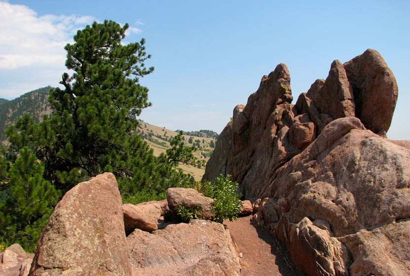
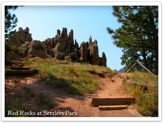
Red Rocks Trail at Settlers Park in Boulder
A giant underground sandstone formation runs from Ft. Collins all the way through Garden of the Gods in Colorado Springs. Here at Red Rocks Trail in Boulder, the rock juts out of the ground to transform the landscape. It makes for an inspiring short hike. Explore the hike snapshot and detailed trail profile below to get a feel for this great hike near Boulder.
Trail Snapshot: Red Rocks Trail at Settlers Park
| Hike Distance | 1 mile Loop + 0.4 mile spur |
|---|---|
| Difficulty | Easy |
| Duration | 45 min |
| Trail Type | Loop with Spur |
| Elevation Gain | +300′ |
| Seasons | All Year |
| Dogs | Allowed on Leash |
| Hike Trail Map | Click for a Map of Red Rocks & Anemone Trail |
| Denver Drive Time | 45 min |
| Directions | Click for Google Map |
| Town Nearest Hike | Boulder, Colorado |
| Beauty | Red Rock Formations |
| Activities | Picnic area, no bikes, hiking trails, rock climbing |
The trails of Red Rocks at Settlers Park in Boulder interconnect to form more of a labyrinth than a straightforward hike. But there is a way around all that---literally. Pull up the Boulder Open Space & Parks Map and follow the outer perimeter trail to form an approximately 1 mile loop around the sandstone red rock formations that jut out of the ground in the center of the park.
You can add an additional .8 mile to your hike by taking the Anemone trail to the west, rising another 400ft where it tops out on a hill to give you views of the City of Boulder, the Red Rocks Park, and the Colorado Front Range. Even with the Anemone trail spur, it's a short hike, so you might want to add one of the Mt. Sanitas hiking trail options to your adventure. The Mt. Sanitas trail is just North of the Centennial Trailhead.
Tips & Resources for Hiking the Red Rocks Trail at Settlers Park :
- This trail is not to be confused with Red Rocks in Denver. If you are interested in hiking at Red Rocks in Denver, you can access a trail profile for the Trading Post Trail here.
- Getting There: You can access Boulder's Red Rocks Trails from either the Centennial Trailhead or Settlers Park Trailhead parking areas.
- For information on rock climbing the rock formations in Settlers Park see the Mountain Project's page.
- Trail Map for Settlers Park Boulder: Trail Map Link
- Colorado Road Conditions: Colorado Road Conditions
- After the Hike: Ozo Coffee

Weather
Map & Driving Directions
Click for Driving Directions

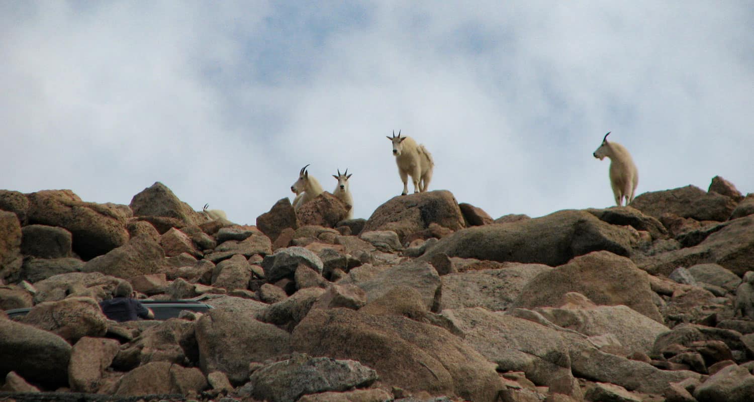
Mt. Evans Summit Hike
Mount Evans is one of Colorado's Front Range Fourteeners, and like Pikes Peak, Mt. Evans has a road that takes you to a trail just a few hundred feet shy of the summit where you are likely to see both Bighorn Sheep and Mountain Goats. The key to exploring Mount Evans is knowing the stops along the way. View our full trail profile for a suggested itinerary. Explore the full trail profile below for all the details: hiking trails, trail map, and detailed directions to the trailhead.
Trail Snapshot: Mt. Evans Summit Hike
| Hike Distance | 1/4 mile |
|---|---|
| Difficulty | Easy (but consider altitude) |
| Duration | Approx. 15-20 min |
| Trail Type | Out and Back |
| Seasons | Open early summer through Fall, Check Sites for Closure: #1 - #2 |
| Dogs | Allowed On Leash; Not Recommended bc will disturb wildlife |
| Hike Trail Map | Click for a Map of Mt. Evans Summit Hike |
| Denver Drive Time | 1 hr 40 min |
| Driving Directions to Mt. Evans Summit Hike | Click for Google Map |
| Town Nearest Hike | Idaho Springs, Colorado |
| Beauty | Lakes, mountain peak views, high country tundra, wildlife: mountain goats, bighorn sheep, marmots, & pika |
| Activities | Picnics, hiking, viewing wildlife |
| Fee Required | See Fee Schedule Link |
What it lacks in challenge Mt. Evans makes up in breathtaking panoramic views of the Rocky Mountains and opportunities to view wildlife up close. It isn't much of a hike, because you can summit this 14,265 foot peak in just a few minutes. Yet your trip to Mount Evans can include several stops at high mountains lakes, to view wildflowers, and to take in the expansive scenery (See our itinerary below). This is one of the best attractions near Denver for visiting friends and family, especially if you don't have the luxury or equipment to take them into the Colorado backcountry. The views are stunning and there is a good chance that you'll encounter wildlife that would usually require hours of hiking to see. Still, you are at fourteen thousand feet, so be aware of the effects of altitude, drink plenty of water, and keep an eye on the weather.
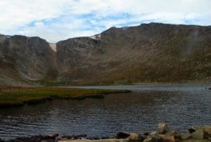
Here is our suggested Mt. Evans Adventure Itinerary
- Take The I-70 Route for a shorter Drive: Click for Directions
- Take the a bit more scenic route: Click for Directions
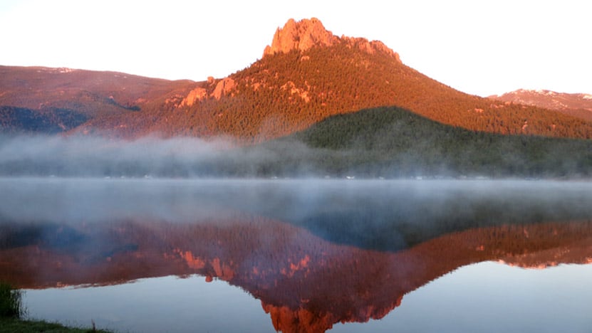
- First Stop, Echo Lake - We like to arrive here early in the morning when the water is like glass and before other visitors arrive. Check out our full profile on Echo Lake
- Second Stop, Mt. Goliath - After passing through the toll booth, you'll begin a drive up the winding Mt. Evans Highway. After a few miles you'll encounter a nature center Dos Chappell Nature Center at Mt. Goliath. Stop here for a short wildflower hike and to take in the views. Click for Google Map
- Third Stop, Summit Lake- Grey cliff bands drop to the base of Summit Lake. It's breathtaking. Keep your eyes out for Bighorn Sheep and Mountain Goats as well. Click Here for Google Map
- Finally, the Summit of Mt. Evans.
Tips & Resources for Hiking Mt. Evans Summit Hike :
- A Better Itinerary? Because weather comes in during the early afternoon, we suggest that you start early, make a short stop at Echo Lake, then drive straight to the summit. On your way down, stop at Summit lake, then make your last stop at the nature center at Mt. Goliath.
- Do consider altitude. We avoid bringing friends who are not in good health. Be sure to have your guests drink plenty of water, and make sure they have had a day or two to get used to the altitude in the mile-high city.
- The Weather link below is for Idaho Springs. Weather at the altitude of Echo Lake may be very different, and Weather at the summit will definitely be different. Check this National Weather Service Link for more accurate forecasts.
- Looking for a more challenging Hike? Try the Chicago Lakes Hike. The trail begins at the Echo Lake Parking Lot.
- Trail Map for Mount Evans Wilderness: Trail Map Link
- Colorado Road Conditions: Colorado Road Conditions
- After the Hike: Echo Lake Lodge
Weather
Map & Driving Directions for Mount Evans
Click for Driving Directions
Homestead Trail at Castlewood Canyon
his trail is great place to begin if you plan to explore the west side of Castlewood Canyon. It's a short hike, but the Homestead Trail can be used to link up to other hiking trails in this Colorado State Park. Scroll down to get all the hiking info you need in the trail snapshot, trail options descriptions and tips.
Trail Snapshot: Homestead Trail at Castlewood Canyon
| Hike Distance | 2 or 4 mile options RT (see trail options below) |
|---|---|
| Difficulty | Easy to Moderate |
| Duration | Approx 30 min+ Round Trip |
| Trail Type | Out & Back and Loop Options |
| Seasons | All |
| Dogs | Allowed on Leash in Most Areas, But Not on the East Canyon Trail |
| Hike Trail Map | Click for a Map of Homestead Trail at Castlewood Canyon |
| Denver Drive Time | 45 min |
| Driving Directions to Homestead Trail at Castlewood Canyon | Click for Google Map |
| Town Nearest Hike | Castle Rock, Colorado |
| Beauty | Cherry Creek, waterfall, interesting geology, canyon views, ruins |
| Activities | Hiking, great picnic facilities, mountain biking, horseback riding |
| Fee Required | Visit Colorado State Parks Site |
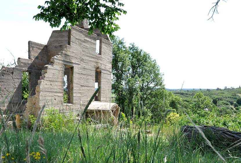
The Homestead Trail in Castlewood Canyon is the first trail you will encounter as you enter the west side of the park. Park at the first lot and you'll immediately see the ruins of the old Lucas Homestead, an unusual concrete structure built in the late 1800's.
The trail is less than a mile round trip, but it links up with several other trails which form 2 loops. Download the Castlewood Canyon Brochure & Trail Map to get a better idea of how these two loops work.
4 Mile Loop: Hike the Rim Rock Trail for 2.14 miles to enjoy the east side of Cherry Creek. Eventually, you will meet with the Creek bottom trail. Take that North for 1.7 miles until you have returned to the Homestead Trail.
2 Mile Loop: When the Homestead Trail meets the Creek Bottom Trail, take the Creek Bottom Trail south for about .7 mile until it intersects with the Cherry Creek Trail. Take this North for 1 mile back to the Lucas Homestead.
Tips & Resources for Hiking Homestead Trail at Castlewood Canyon :
- Finding the Trailhead: The West Side entrance can be hard to find. Usually, Colorado state parks have brown signs indicating the park roads. The west side doesn't. But the name of the road you're looking for is "Castlewood Canyon" - easy to remember.
- TIP: Hikes in Castlewood Canyon can be quite exposed to the sun, so bring the sunscreen.
- TIP: Poison Ivy: We've been surprised how poison ivy flourishes in this park, often along the edge of the trail. Know how to identify it, so that you can avoid it. But don't let that deter you from the park. You just need to keep an eye out. See our post on how to identify and treat poison ivy.
- Trail Map for Castlewood Canyon State Park: Trail Map Link
- Additional Castlewood Canyon State Park Maps: Other Trails
- Colorado Road Conditions: Colorado Road Conditions
- After the Hike: Crowfoot Valley Coffee
Weather
Map & Driving Directions
Click for Driving Directions
Daniel's Park Hikes
Best sunsets in Denver! You can see mountains upon mountains of Colorado's Front Range. Take a picnic dinner and pull off at one of the many picnic areas along Daniels Park Road. There are several hiking options detailed below for Daniel's park. To get all the details, scroll down and explore the trail snapshot, profile, and tips below.
Trail Snapshot: Daniel's Park Hike
| Hike Distance | 0.2, 3, or 5.4 Miles |
|---|---|
| Difficulty | Easy |
| Duration | 20 min to 2.5 hrs |
| Trail Type | Out and Back |
| Seasons | All Season |
| Dogs | Allowed on Leash |
| Hike Trail Map | Click for a Trail Map |
| Denver Drive Time | 35 min |
| Directions | Click for Google Map |
| Town Nearest Hike | Littleton, Colorado |
| Beauty | Front Range Views, Rock Formations, Bison |
| Activities | Picnic Areas, Shelter House with Fireplace, Bison viewing area, Hiking |
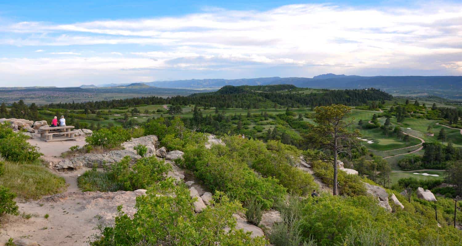
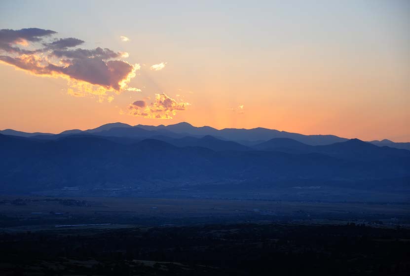
We are featuring Daniel's Park ,not for it's trails, but because it has one of the best views of the Front Range near Denver. From the park, you can see Pikes Peak in the South, Mt. Evans in the West, and Longs Peak in the North. The trails are not handicap accessible, but the shelter house is (after a bit of a bump trail), and is a perfect place to watch the sun set.
Here is the lowdown on the trails at Daniel's Park: They are undeveloped. The park has been around for nearly 100 years but has somehow escaped being developed. However, it's close to south Denver and has some great features, so we've come up with a few different hiking options below.
The Short Daniel's Park Hike - Park at the Shelter House and begin walking north through the undeveloped trails along the top of the bluff. We like to take a picnic dinner up here and a lot of folks bring firewood and enjoy the sunset by the fire. There are about a quarter mile of trails that weave through the rock and back out towards the road.
3 Mile Daniel's Park Hike - Again, start at the Shelter House and head North following the top of the bluff as it parallels the road. You can extend your hike by hiking North along the road until it intersects with Grigs Road - About 1.5 Miles. Hike back to Daniel's Park Shelter House for a 3 Mile round trip hike.
5.4 Mile Daniel's Park Hike - Continue the 1.5 mile hike by taking a left onto Grigs road. Cross to the Northeast side of the Grigs, then shortly after you cross, you'll come upon a green fence and the Douglas County East/West Trail. Your can take that trail West (left) to the Grigs Road Trailhead, adding an additional 1.2 miles to your hike (5.4 Miles Round Trip). Click Here for a Google Map that traces the route along Daniel's Park and Grigs Road.
Douglas County plans to build this East/West trail into a 26 mile system linking Chatfield Reservoir to the town of Parker, Colorado. Click here for the map of the East/West Trail and proposed trails in Douglas County. Denver Mountain Parks and Douglas County have developed a master plan to improve both the park and the roads in the area. You can find an overview at the Douglas County Park site.
Tips & Resources for Visiting Daniel's Park:
- TIP: Keep an eye on the skies - Douglas County has one of the highest lightning strike rates in the country and Daniel's Park is one of the higher points.
- TIP: Bison Viewing - The Bison can be found in an enclosed pasture on both sides of the road.However, the Bison are usually found grazing in the section of the park that is directly across the street from the shelter house.
- Trail Map for Daniel's Park: Trail Map Link
- Colorado Road Conditions: Colorado Road Conditions
Weather
Map & Driving Directions
Click for Driving Directions

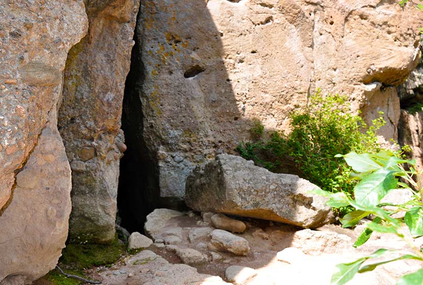
Cave Trail at Castlewood Canyon
Colorado's Castlewood Canyon State Park has several caves hidden in the park, but this set has their own trail. It's a short trail, just a 1/8 mile one-way, but can be combined with other hiking trails--one that takes you to a waterfall--to create a real adventure. Check out the trail snapshot to get the map, driving directions to Castlewood Canyon, and tips for exploring the Cave Trail in Castlewood Canyon.
Trail Snapshot: Cave Trail at Castlewood Canyon
| Hike Distance | 0.14mi (.28mi RT) |
|---|---|
| Difficulty | Moderate due to terrain |
| Duration | Approx 30min Round Trip |
| Trail Type | Out and Back |
| Seasons | All |
| Dogs | Allowed on Cave Trail, But Not on the East Canyon Trail |
| Hike Trail Map | Click for a Map of Cave Trail at Castlewood Canyon |
| Denver Drive Time | 1 hr |
| Driving Directions to Cave Trail at Castlewood Canyon | Click for Google Map |
| Town Nearest Hike | Castle Rock, Colorado |
| Beauty | Cliffs, caves, mature ponderosa pines |
| Activities | Rock climbing, hiking, picnic areas, nearby waterfall |
| Fee Required | Visit Colorado State Parks Site |
Looking for caves close to Denver? They may not be extensive, but they are still fun to explore. There are actually two caves along the top of the trail. One is a kind of large crack in the rock that leads to a larger chamber. I wish I could describe it better, but my 2 1/2 year old, when I asked if she wanted to go inside, was concerned that the "bears might be awake." There are more caves hidden in Castlewood Canyon waiting to be found, but that is for another post.
Tips & Resources for Hiking Cave Trail at Castlewood Canyon :
- Finding the Trail: The cave trail can be accessed by hiking across the dirt road from the parking lot. The Google Map is very specific and should be helpful in finding the correct parking area.
- Add the Waterfall: The Waterfall Hike can be added to your trip. Midsummer raspberries can be found above the falls along the trail.
- Finding the Traihead: The West Side entrance can be difficult to find. Usually, Colorado State Parks have brown signs indicating the park roads. The west side doesn't. But the name of the road you're looking for is "Castlewood Canyon" - easy to remember.
- Short but Steep Hike: The hike is easy when you consider the distance, but we rated this one as difficult because the trail can be quite uneven and very steep. Watch your footing.
- Make it a Loop Hike: You can make an even larger loop out of the hike by exiting on either the north or south end of the Cliff Base or Climber's Trails, then crossing the road east to one of the parking areas. From there, take the West Side Spur or the Creek Bottom Trail back to your car. See the Castlewood Canyon Map below for details.
- TIP: Hikes in Castlewood Canyon can be quite exposed to the sun, so bring the sunscreen.
- TIP: Poison Ivy: We've been surprised how poison ivy flourishes in this park, often along the edge of the trail. Know how to identify it, so that you can avoid it. But don't let that deter you from the park. You just need to keep an eye out. See our post on how to identify and treat poison ivy.
- Trail Map for Castlewood Canyon: Trail Map Link
- Additional Maps: Castlewood Canyon State Park Trails
- Colorado Road Conditions: Colorado Road Conditions
- After the Hike: Crowfoot Valley Coffee
Weather
Map & Driving Directions
Click for Driving Directions
Meadow & Forest Loop Trails at Lookout Mountain Nature Center
If you are looking for a family hike near Denver, this is a perfect trail, especially if you are getting started hiking with your kids in Colorado and want to guarantee a good experience. It's short, there's wildlife, and the Lookout Mountain Nature Center. Take a picnic lunch, just watch out for the squirrels; they'll run of with your dessert if you don't watch them closely. Explore the full Meadow & Forest Loop Trails hike profile below for trail map, driving directions, and more tips and details to help you enjoy this family adventure.
| Hike Distance | 0.6 & 0.8 Mile Loops |
|---|---|
| Difficulty | Easy |
| Duration | Approx 30 min |
| Trail Type | Loop |
| Seasons | Hours Vary |
| Dogs | Not Allowed |
| Hike Trail Map | Click for a Map of Meadow & Forest Loop Trails at Lookout Mountain Nature Center |
| Denver Drive Time | 30 min |
| Driving Directions to Lookout Mountain Nature Center | Click for Google Map |
| Town Nearest Hike | Golden, Colorado |
| Beauty | Front Range views, ponderosa pine, wildlife: Abert's squirrels, and deer |
| Activities | Hiking, nature center, picnic area, birdwatching |
Lookout Mountain Nature Center has 2 short loop hikes. If you have young children, this is a perfect trip. The trails at Lookout Mountain are short loops: 1- The Meadow Loop (.8 mile) & 2 - Forest Loop Trail (.6 mile). If you are looking for a longer hike, you can cross the street and take the Lookout Mountain Trail which connects to several other Jefferson County Parks and trails.
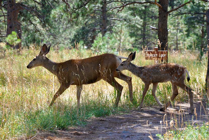
The nature center is a great place for your kids to learn about Colorado wildlife. The playroom has texture sames of bark, fur, animal tracks, and the biggest box of stuffed animal puppets you'll ever see. The last time we visited, our daughter didn't want to leave. Take a lunch and have a picnic under the towering Ponderosa Pines. We encountered 2 deer with their fawns along the Forest Loop trail. The immediate area around the nature center is handicap accessible.
Tips & Resources for Hiking Meadow & Forest Loop Trails at Lookout Mountain Nature Center
- TIP: If you take Lookout Mountain Road from Golden, it's a beautiful drive. However, on the weekends, this road has a ton of cycling traffic. So, plan for a slow drive.
- TIP: Visit the Boettcher Mansion next door
- Trail Map for Lookout Mountain Nature Center: Trail Map Link
- Packing List: Always pack the 10 Essentials. Download our Hiking Guide to get the list and dayhiking packing checklist.
- Colorado Road Conditions: Colorado Road Conditions
- After the Hike: Louis’ Cafe
Weather
Map & Driving Directions
Click for Driving Directions
Boulder Falls
Boulder falls is a quick hike with big reward. This 100 yard hiking trail just outside Boulder, Colorado leads you into a cliff lined notch in Boulder Canyon where the creek gushes out to form one of the best waterfalls near Denver. Since it's not much of a hike, add one of the suggested hikes below to complete your hiking adventure. Boulder Falls reopened in June of 2018 and features repaired and widened trails as well as more durable and stable terrain.
Trail Snapshot: Boulder Falls Hike
| Hike Distance | 100 yards |
|---|---|
| Difficulty | Easy |
| Duration | 10 min |
| Trail Type | Out and Back |
| Seasons | Closed from Nov. 1 to May 1 |
| Dogs | Allowed on Leash |
| Hike Trail Map | Click for a Trail Map |
| Denver Drive Time | 50 min |
| Directions | Click for Google Map |
| Town Nearest Hike | Boulder, Colorado |
| Beauty | Waterfall, Boulder Creek, Cliff |
| Activities | Short Trail |
Boulder Falls is only about 70 feet high, but it's really breathtaking. The combination of the tight canyon, giant ponderosa pines, and the pouring waterfall makes it a great place to take visiting friends and family. This may be the shortest Colorado hike you ever set out to explore; so, we recommend combining your visit to Boulder Falls with a hike at either Betasso Preserve, Mt. Sanitas, or Forsythe Canyon.
Tips & Resources for Hiking Boulder Falls:
- Check for Closings: The Boulder Falls trail appears to need a lot of maintenance, especially after the winter thaw. It also gets a lot of foot traffic, so that's probably a contributing factor. All that to say, be sure to check out Boulder's trail area closures page for details before making the drive out to the falls. Seasonally closed from Nov. 1 to May 1 each year for trail maintenance.
- Narrow Trail: The trail to Boulder Falls is narrow and busy, so the best times to visit are early and around sunset.
- Busy Road: Take care in crossing the road: Parking is across the street from the waterfall, on a pretty tight canyon curve. Cars whip by fast.
- Leave Fido at Home: We love our dog and take her on many of our hikes, but this trail is so busy and rocky that it makes the trail difficult to navigate at times. Basically, it's an easy way to make the hike more enjoyable for others who may not be up for getting clotheslined or their feet taken out from under them by a dog leash :).
- Don't Climb: Hikers have been injured from trying to scale areas on and near Boulder Falls. Pay attention to the signage, it appears that there's just a lot of loose rock along this short trail that can get easily get kicked loose.
- Trail Map for Boulder Falls Trail: Trail Map Link
- Colorado Road Conditions: Colorado Road Conditions
- After the Hike: Ozo Coffee in Boulder, Colorado
Weather
Map & Driving Directions to Boulder Falls
Click for Driving Directions