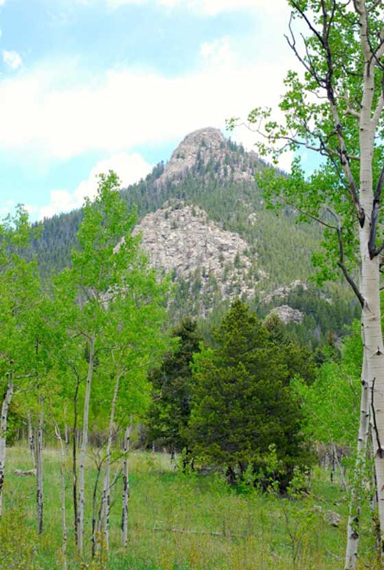
Pine Valley Ranch Park Hike
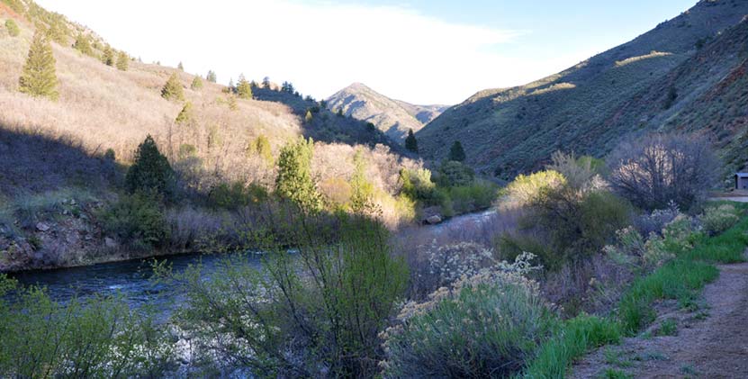
Pine Valley Ranch Park has become one of our family's favorite parks near Denver. Pine Valley Ranch Park boasts several hikes, a beautiful lake, a lot of history, a small island with a gazebo, and the best picnic area on the Front Range of Colorado. If that's not enough, the North Fork of the Platte River runs through the park, lined with enormous spruce trees and granite cliffs. Explore the trail profile below for hiking options, trail map, driving directions and more.
Trail Snapshot: Pine Valley Ranch Park Trail
| Hike Distance | 1.2 to 3.2 miles Round Trip |
|---|---|
| Difficulty | Easy to Moderate |
| Duration | Approx 45 min to 2 hr |
| Trail Type | Loops and Out-and-Back |
| Elevation Gain | +500′ |
| Seasons | Best April to November |
| Dogs | Allowed on Leash in the Park |
| Hike Trail Map | Click for a Map of Pine Valley Park |
| Denver Drive Time | 1 hr |
| Directions | Click for Google Map |
| Town Nearest Hike | Pine, Colorado |
| Beauty | Pine Lake, Platte River, bridges, island with gazebo, waterfowl and other birds |
| Activities | Mountain bike trails, fishing, ice skating in winter, pavilions, picnic tables and grills |
| Video | Click For a Video of Pine Valley Ranch Park |
Hiking Options at Pine Valley Ranch Park
#1 - Park View Out-and-Back Hike - Approx. 2 Miles Round Trip
The Park View trail can be located on the other side of Pine Lake (not the far side). Take the narrow gauge trail across the bridge and you'll locate the trailhead just on the other side of a shelter that sits along Pine lake. The trail is moderate to strenuous and will take you up to some great views of the surrounding Pike National forest and the Platte River. You'll get views of the extensive Hayman Burn, the burn scars left from the 2000 fire.
#2 - Full Park View Loop - Approx. 2.5 Miles
If you would like to take a longer loop hike, take the Park view trail (.8 mile) up to the strawberry jack trail (.5), which will connect you to the Buck Gulch trail (.4) which will take you back down to Pine Lake. The Strawberry Jack trail will take you out into Pike National Forest. Be sure to have a map you--which you can pick up at the park--because a wrong turn onto the Buck Gulch Trail can take you far out of the way.
#3 - Pine Lake Loop Hike - Approx. .7 mile
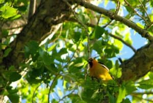
You can take a leisurely hike around Pine Lake at Pine Valley Ranch. Go early (before 7:30AM) to catch site of the birds and wildlife around the lake.
#4 - Narrow Gauge Trail Hike - .5 to 3.8 miles
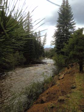
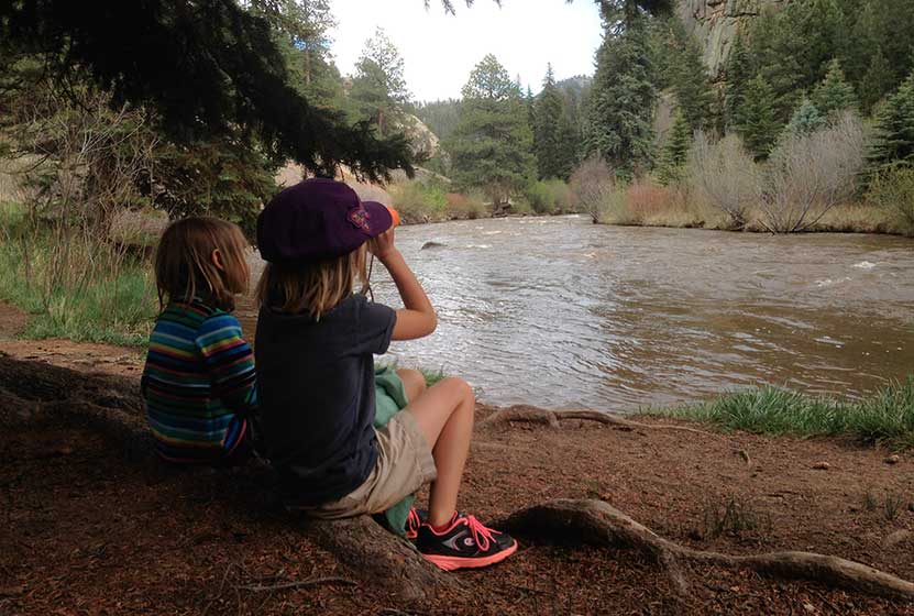
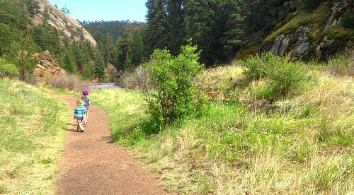
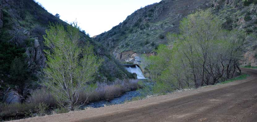
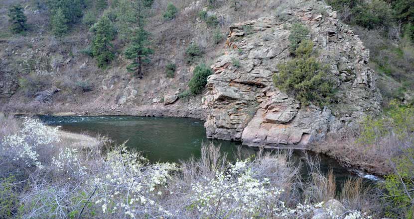
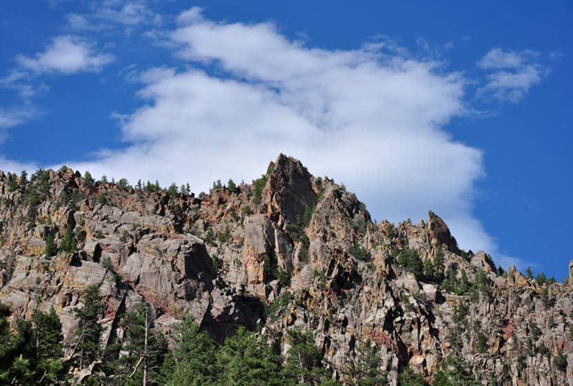
This is the hike that our kids most enjoy. We like to hike the southeast segment that takes you along the North Fork of the South Platte River. There are willows to pass through, and probably some good trout fishing along the banks. The Narrow Gauge trail stretches about half a mile in this direction and is surrounded by granite cliffs, pine, and spruce.
If you hike the Narrow Gauge trail to the West, you'll follow the river past Pine lake for about 1.5 miles, then can hike it back.
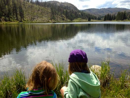
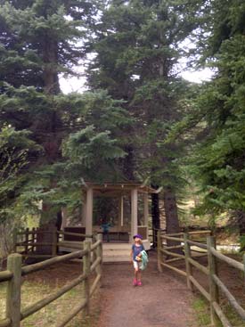
Pine Lake at Pine Valley Ranch Park
Pine Lake packs out with fisherman on the weekend but can be a great quiet escape on the weekdays, especially in the mornings and evenings. The lake has a fishing pier and a great shelter. In the winter months, there is ice fishing and skating. The shoreside shelter at Pine Lake has several picnic tables and a fireplace.
The Best Picnic Area Near Denver
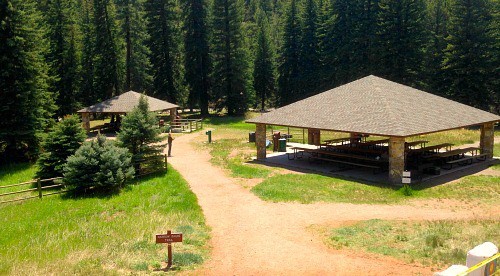
As our family explores hikes and parks near Denver, we get to see a lot of picnic areas. See our Seven Great Picnic Areas Near Denver post. The picnic area at Pine Valley Ranch Park is hands down our favorite. A few reasons why: 1) It's along a river, 2) it's surrounded and shaded by enormous spruce trees, 3) has great facilities: two large covered shelters, and 4) there are a lot of activity options for families.

Tips & Resources for Hiking the Pine Valley Ranch Park:
- Gazebo: There are some hidden treasures at Pine Valley Ranch. One you can't miss is the gazebo. Behind the large picnic shelters you'll find a small trail that leads to a bridge. The bridge leads to an small island in the Platte River and a beautiful old gazebo. The island is man-made and was created to contain the domesticated goats that used to roam the ranch.
- River's edge: The Platte river can swell and be quite dangerous, especially in the Spring and after heavy rains, so keep a close eye on children along the river's edge.
- Eagles: Keep your eyes peeled for bald eagles and osprey
- Use sunscreen: Though there are a lot of trees, like most Colorado hikes, most areas are exposed to the sun, so hike early and use sunscreen.
- Handicap accessibility: This would be a great place for family with physical limitations or who are wheelchair bound. I should point out that the park is not built around handicap accessibility, but we saw several people fishing from wheelchairs along the lake, and there is a lot of beauty to take in without having to go far or negotiate obstacles.
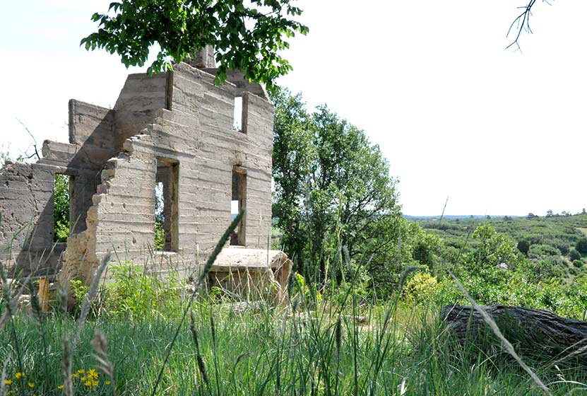
- Historical significance: Pine Valley Ranch is replete with historical significance. The best place to start is to take a tour of Baehrden Lodge, a 27 room estate perched over the top of Pine Valley Ranch Park that is now in the care of Jefferson County Parks.
- Carved initials: Look for initials carved into trees a long the paths of Pine Valley Ranch. These go back many decades to when Pine Valley Ranch was a resort and folks would take the train from Denver to escape into the mountains.
- Dr. Robert Dudley: We want to express our gratitude to Dr. Robert Dudley, who in the 1970's kept the park from being parceled out to the highest bidder, and to the Jefferson County Parks staff for the care they give to keep Pine Valley Ranch Park available to the public.
- After the Hike: Aspen Perk Cafe
- Colorado Road Conditions: Colorado Road Conditions
- Trail Map for Pine Valley Ranch Park: Trail Map Link
Weather
Map & Driving Directions
Click for Driving Directions

Horseshoe Trail at Golden Gate Canyon Park
The Horseshoe Trail in Golden Gate Canyon State Park is a wonderful hike for older kids, experienced and non-experienced hikers. It's a great trail for spotting wildlife, from birds to deer, viewing fall colors and wildflowers, and taking in the beautiful scenic view along the trail. Several of the backcountry campsites areas are also accessible from the Horseshoe trail. We'll detail those locations, provide links to a trail map, driving directions and more in the trail profile on this Colorado hike.
Trail Snapshot: Horseshoe Trail at Golden Gate Canyon Park
| Hike Distance | 3.6 miles Round Trip |
|---|---|
| Difficulty | Moderate |
| Duration | Approx 2 hr |
| Trail Type | Out and Back |
| Elevation Gain | +910′ |
| Seasons | Spring through fall, depending on snow fall |
| Dogs | Allowed on Leash |
| Hike Trail Map | Click for a Map of Golden Gate Canyon Park |
| Denver Drive Time | 50 min |
| Directions | Click for Google Map |
| Town Nearest Hike | Golden, Colorado |
| Beauty | Wildflowers, spruce and fir trees, aspen meadows, big boulders, wildlife, mountain views and running stream along trail |
| Activities | Hiking only trail |
| Video | Click For a Video of Golden Gate Canyon Park |
| Pass Required | Daily Pass Link Annual State Parks Pass Link |
Golden Gate Canyon's Horseshoe Trail is a 3.6 mile out-and-back hike (1.8 miles one-way). We've rated it as moderate in difficulty because of the 900+ feet of elevation gain. The Horseshoe Trail is popular because it follows the beds of several small streams, winds through groves of aspen trees, and leads to beautiful meadows, as well as three of Golden Gate Canyon State Park's backcountry camping areas.
To get to the trailhead (first,use our driving directions). Once in the park, exit to the right out of the Visitors Center--you'll want to stop here first to pick up a map. You'll find the Frazer Meadows parking area and trailhead for the Horseshoe Trail on the left-hand side of the road. Keep in mind that parking is limited, so it would be best to arrive early. There are also restrooms at the Horseshoe trail trailhead and we found them to be kept up and clean.
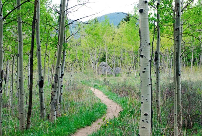
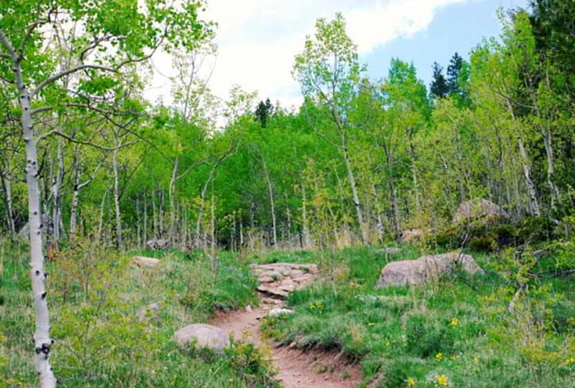
One of the highlights of this trail are the streams that run along it. You'll find that there are several small bridges to cross as you make your way up the trail. Seasonal streams also mean that sections of the Horseshoe trail will get muddy on after rains and during the Spring melt-water runoff. But water also means wildflowers, and this trail comes alive with them in late Spring through the Summer.
The Horseshoe Trail also leads you to access trails for three of the five Golden Gate Canyon backcountry camping areas. Use this link to the backcountry camping brochure to get details on cost per night and how to make campsite reservations in Golden Gate Canyon State Park. The first campsite access trail is at 1.1 miles and will take you to Greenfield Meadows, which has 4 campsites. Continuing on the same spur, you can hike further in to the Frazer Meadow campsite which has 4 campsites and one backcountry shelter. If you continue on the Horseshoe trail, you'll come upon the access trail for Rim Meadow campsite at 1.3 miles. Rim Meadow also has 4 campsites.
Tips & Resources for Hiking the Horseshoe Trail:
- Park Pass: A Colorado State Park Pass is required to enter Golden Gate Canyon State Park. Check the Golden Gate Canyon Fees page for details on park passes. Some trails offer passes at self-serve dispensers.
- Printed map: The trail forks to the left, make sure to have a printed map on hand which you can pick up at the Visitors Center.
- Bug spray: for hot summer days not a bad idea.
- Sun protection: The trail is often shaded--a rare thing for Front Range hikes--but be sure to bring sun protection because it is almost 4 miles round trip and there are areas exposed to the sun.
- No cell phone: There is no cell phone coverage at Golden Gate Canyon State Park.
- Download our Dayhikes Hiking Guide for a day hike packing checklist
- After the Hike: Windy Saddle Cafe in Golden
- Road Conditions: Colorado Road Conditions
- Trail Map for Golden Gate Canyon State Park: Trail Map Link
A big thanks goes out to Lisa Palmer, a member of our Dayhikes Pathfinder Team, who hiked this trail with her family, gathered the information for the trail profile, and took the photos for this post.
Weather
Map & Driving Directions
Click for Driving Directions

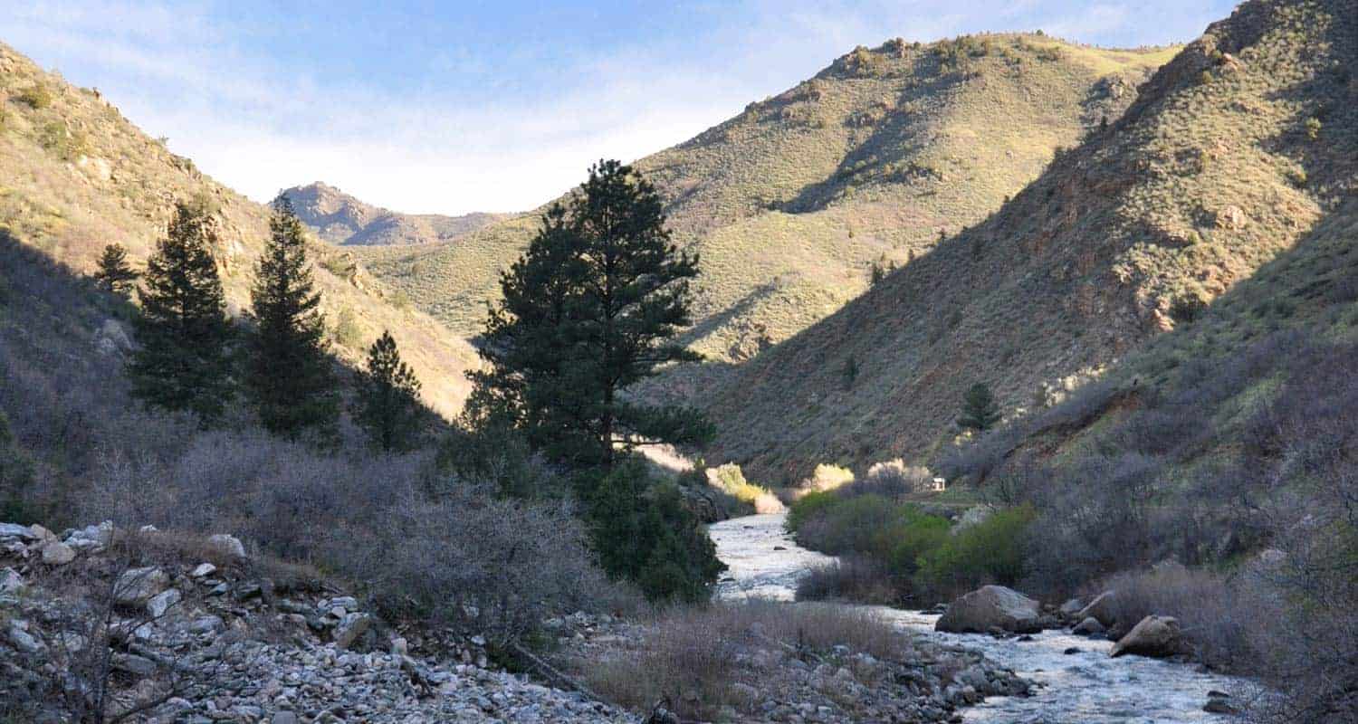
Hiking Beautiful Waterton Canyon
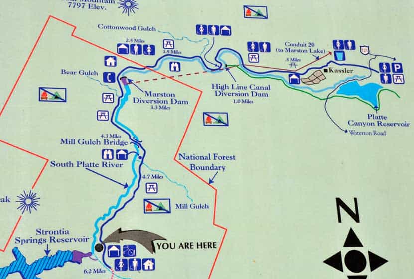
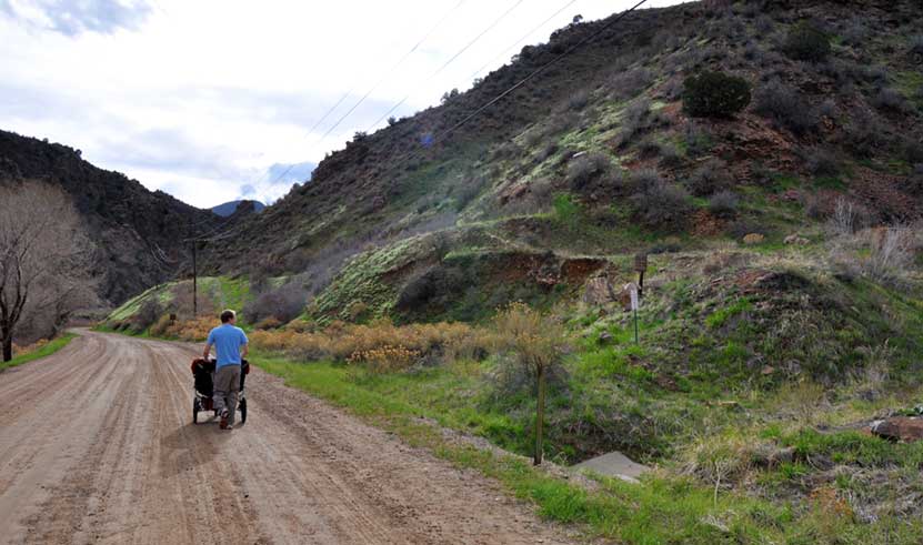
The winding dirt road trail of Waterton Canyon takes you along the South Platte River and into a canyon where you might spy some Bighorn sheep or catch the sight of massive eagles soaring on the warm air currents rising from the rock. It's an out-and-back hike, and you have a lot of options, from a short hike in to have a picnic, all to way to 12.4-mile round-trip adventure to the Strontia Springs Dam. You can hike, bike, and fish on this hike near Denver. Explore the five different options we have detailed below. We'll describe the location of a few destinations, including the best places to rest and have a picnic, and some of the other trails that join up with this Colorado canyon hike.
Waterton Canyon will be closed from June 1st 2021 through June 11th 2021. It will be open on Saturday, June 5, and Sunday, June 6th. See the Denver Water Waterton Canyon page for updates and details.
Trail Snapshot: Hiking Beautiful Waterton Canyon
| Hike Distance | A variety of trail lengths depending on your goals. It is a 6.2-mile trail to the Strontia Springs Dam, or 12.4 round trip. |
|---|---|
| Difficulty | Easy to Moderate |
| Duration | Approx 2 to 6 hours |
| Trail Type | Out and Back |
| Elevation Gain | Approx +700′ |
| Seasons | All Year |
| Dogs | Not Allowed |
| Hike Trail Map | Click for a Trail Map of Waterton Canyon |
| Denver Drive Time | 35 min |
| Directions | Click for Google Map |
| Town Nearest Hike | Littleton, Colorado |
| Beauty | Bighorn sheep, Views of a lake and a river |
| Activities | Hiking, mountain biking, fishing, horseback riding, picnicking, and nature viewing |
When you set out to explore Waterton Canyon, there are plenty of things that you can expect. We've hiked this three times and have spotted Bighorns on two of those hikes. The trail is a wide dirt road that gives Denver Water access to the dam at the top end of the canyon. So, this makes for a great stroller hike, if your stroller has a way to give the kids some shade from the sun. It's also a really enjoyable mountain bike ride because it's not too steep--well, at least not until just past the dam--and the downhill ride back down is easy and fun. Here are over five different ways you can hike this great hike near Denver, Colorado.
Hike Options at Waterton Canyon Trail
1. The Shorter Hike in Waterton Canyon
The first mile or two of Waterton Canyon takes you to an old water conduit pipe that juts out over the trail, and your best chance to catch the site of Bighorn Sheep and Golden Eagles. The trail quickly goes from a paved road to a dirt fire road, then begins following the course of the South Platte river. The canyon itself starts low and shallow, and grows higher and more rugged the deeper you venture into Waterton.
After about 15 minutes of hiking, keep your eyes peeled on the green hillsides on your right (see photo above). This is where we most often spot bighorn sheep and their lambs. Scan the skies, too, for gigantic golden eagles that hover on the hot air that rises from the canyon walls in the afternoons. You'll find the first picnic area just about 1/2 of a mile into Waterton Canyon.
2. Waterton Canyon Picnic Area - 3 Miles Round Trip
This section of Waterton makes for a great evening picnic. You'll find it on your left just after the Highline Canal Diversion Dam. It's a great place to skip rocks with the kids and to watch the light soften on the canyon walls as the sun sets over the distant mountains. Continuing past this picnic area, the next feature you'll pass is the Marston Dam. There is another picnic area at approximately 3.75 miles into Waterton Canyon (see the pdf map), that's also a great little spot, but if you get in that far, you'll want to keep exploring.
If you hike further up into Waterton Canyon, the river grows both wider and wilder. Cedars and pines grow along the banks and canyon sides, and the cliffsides become steep and jagged. It's here, around mile 4, that things start to get interesting.
3. Fishing Hole and Picnic Table at Mile 4.5
The next destination worth mentioning is a secluded spot on the river where you'll find a deep fishing hole on the right side of the road. There is a picnic table hidden down among the willows (it's hidden well enough that it doesn't show up in the photo below). There is a restroom just about 150 yards upriver from the spot.
The trail just keeps getting better after you pass this fishing hole. At mile five, we saw a lot of bighorn sheep sign, flowering bushes, and wildflowers. Hummingbirds were buzzing along the trail in a furious search for nectar. Folks who fish Waterton Canyon often ride their bikes in and start fishing at the dam, then work their way back downstream.
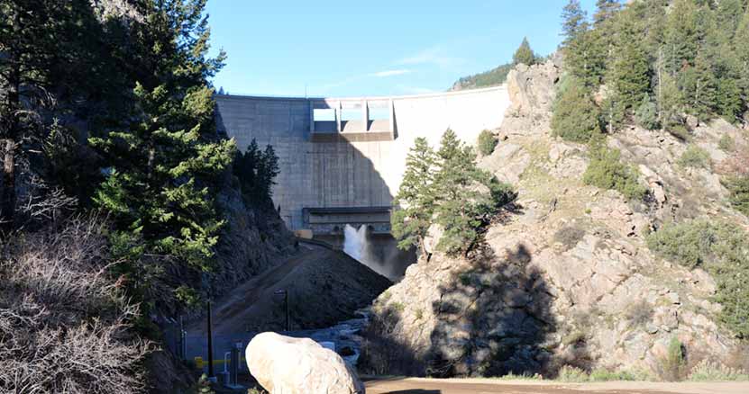
4. Hike the Entire Trail to the Strontia Springs Dam - 6.2 Miles
The Strontia Springs Dam is an imposing structure, looming over 200 feet high above the trail with water gushing from its release pipes into the river. Accessing the 7700 acre Strontia Springs Reservoir is extremely difficult, though not impossible. However, its banks drop straight off into the water making it a pretty inhospitable place, but it can be fished for perch, trout, and walleye. One fisherman on a Colorado fishing forum commented that you have to really "WANT to get there" because it's so tough to access.
5. Hike the Colorado Trail
Most people turn around at Strontia Springs, but the trail doesn't end there. In fact, Waterton Canyon is the eastern gateway to the close to 500 mile Colorado Trail. The Colorado Trail starts here in Denver, then weaves its way all the way to Durango. You can download a Trail Map of the Colorado Trail here. You really have several options at this point. You can continue onto segment one of the Colorado Trail on Trail #1776.
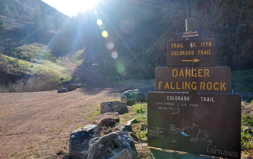
Segment one of the Colorado Trail will take you out of the canyon and onto US Forest Service land where you can camp near Lenny's Rest. It's important to note that camping is prohibited in Waterton Canyon, so this area at Lenny's rest should be your goal if you plan to overnight. Another option is that you can hike down into Roxborough State Park on the Roxborough Connector section of the Indian Creek Trail #800. Yet another option--and this option is way more than a dayhike being well over 28 miles--would be to hike the full Indian Creek Trail Loop, then to exit at either Roxborough or back down through Waterton Canyon. However, Indian Creek does have its own campground, so you could make it a long weekend trip. Of course, your final option is to hike out the way you came through Waterton Canyon. Click here for a PDF map of the first segment of the Colorado Trail that shows the connections to both Roxborough and the Indian Creek Campsite.
Tips & Resources for Hiking Waterton Canyon :
- No Dogs: Because of the bighorn sheep and other wildlife, dogs are not allowed in Waterton Canyon.
- Fishing: If your goal is to go fishing in Waterton Canyon, then start early and ride your mountain bike the 6.2 miles up to the dam and fish your way down.
- It Gets Hot: Don't hike this in the middle of the day. Waterton Canyon is close to 100% exposed to the sun, so it's best to start very early or to hike later when the sun is moving itself to end the day.
- Did I Mention It Gets Hot? Bring sunscreen and a hat
- Bring Water: Bring plenty of water. You can say this about every hike, but it's especially important because of the sun and heat.
- Dusk: It gets dark quickly after sunset. Because you're in a canyon, once the sun sets beyond the foothills, the canyon becomes a land of shadows.
- Watch for Bikes: Watch for mountain bikes, especially those headed down and out of the canyon. The road is wide enough to accommodate a lot of traffic in Waterton Canyon, but you want to be sure that you are staying to the right as you hike so that you can give a wide berth to the bikes that are letting it rip as they leave the canyon.
- Trail Map for Waterton Canyon: Trail Map Link
- Colorado Road Conditions: Colorado Road Conditions
- After the Hike: Spur Coffee in Littleton
Weather
Map & Driving Directions
Click for Driving Directions
Royal Arch Trail
The hike up to Royal Arch in Boulder's Chautauqua Park is a serious workout, but the beauty of Bluebell canyon and the view of Royal Arch make it worth the journey. Our most important tip for making this an enjoyable hike is to go when it's not so crowded, during the early morning or on weekdays. Scroll down to get all the details you need for this hike in Boulder, Colorado: trail map link, driving directions, weather forecast, and more tips.
Trail Snapshot: Royal Arch Trail in Chautauqua Park
| Hike Distance | 3.5 miles Round Trip |
|---|---|
| Difficulty | Moderate to Difficult |
| Duration | 2-3hrs |
| Trail Type | Out and Back |
| Elevation Gain | Approx +1400′ |
| Seasons | All Year |
| Dogs | Allowed on Leash |
| Hike Trail Map | Click for a Trail Map of Royal Arch Area |
| Denver Drive Time | 40 min |
| Directions | Click for Google Map |
| Town Nearest Hike | Boulder, Colorado |
| Beauty | Rock formations, Bluebell Canyon, raptors, natural spring |
| Activities | Hiking, rock climbing |
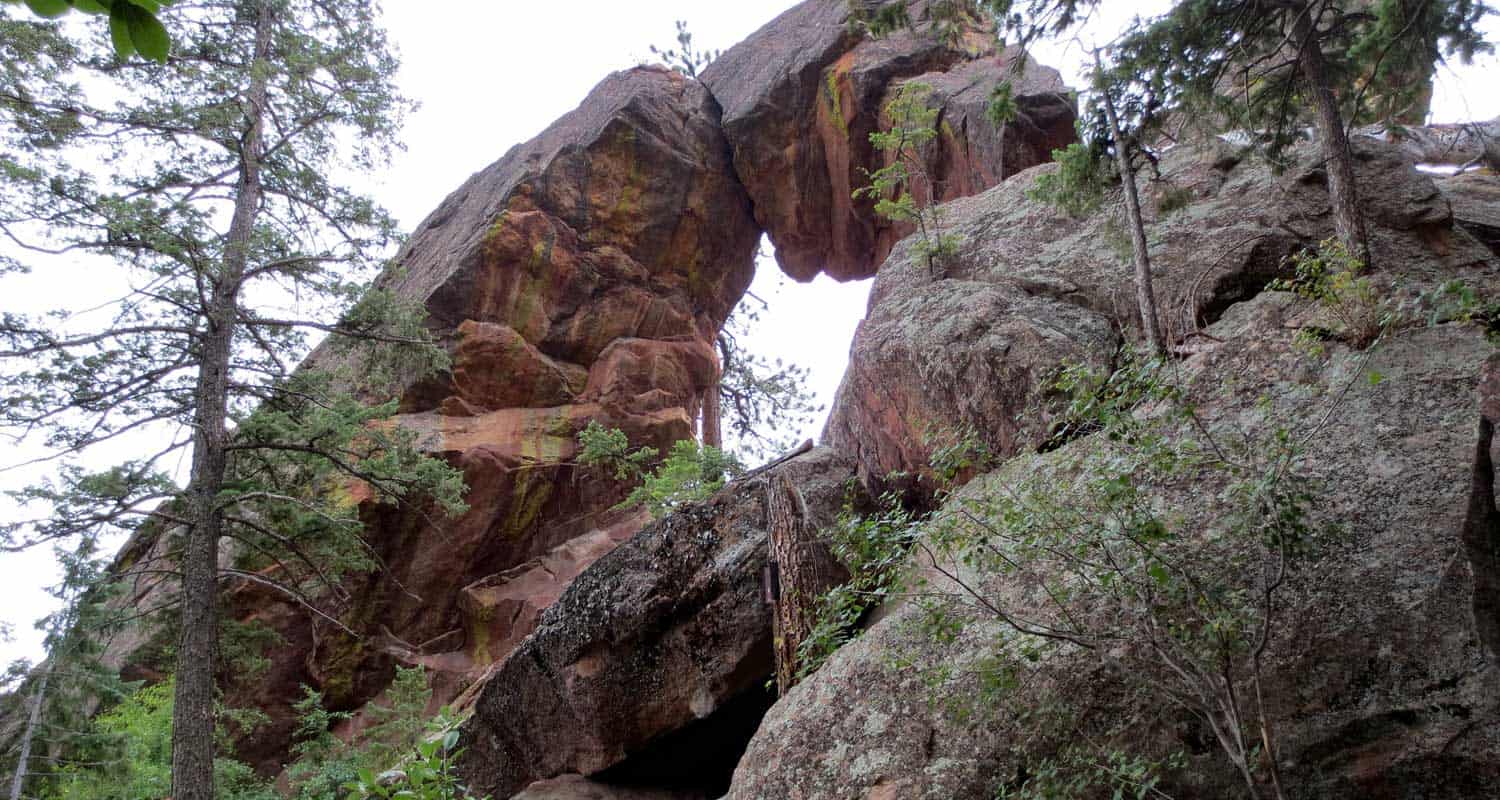
If you talk with someone who has hiked the trail up to Boulder's Royal Arch, they will tell you two things: 1) The Royal Arch, though not as grand as some of the arches in Utah's backcountry, is really a beautiful sight, and 2) That the hike is a real challenge.
While the trail is relatively short - 3.5 miles round trip - the hike up through Bluebell Canyon to Royal Arch has a lot of uphill and downhill, making the elevation gain around 1400' over the course of the trip. Because the trail has a lot of rock steps and is heavily used, the latter half of the hike requires some negotiation. It's still a good trail, just don't expect a walk in the park.
The Hike to Royal Arch
Beginning at the Chautauqua Park Trailhead, take the Bluebell Road Trail through the meadows and up to the Bluebell Shelter (see trail map here). You'll come to a junction near the Bluebell Shelter, and will see signs pointing you to the Royal Arch Trail.
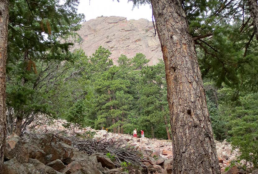
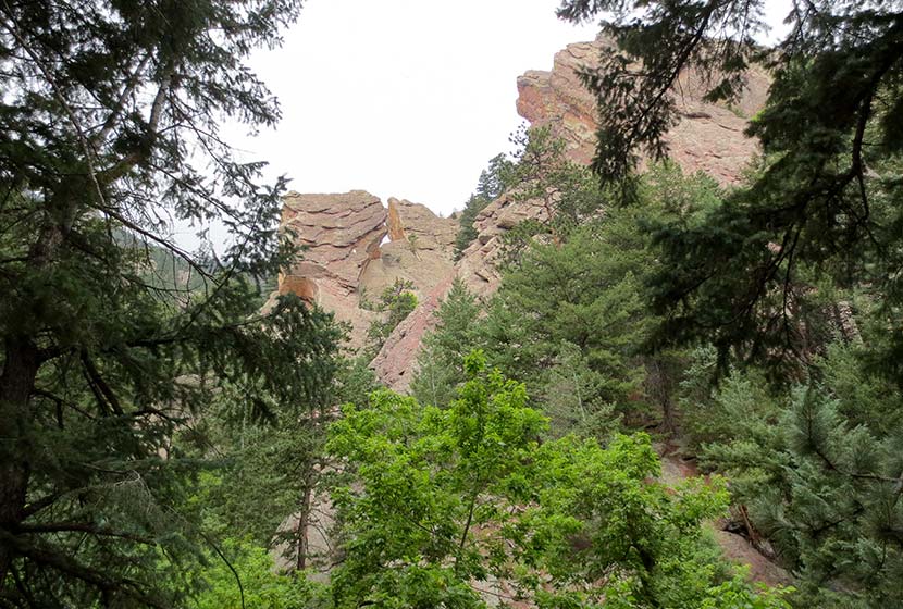
Soon, you'll enter Bluebell Canyon. The Royal Arch trail will descend before beginning its climb to the top. This section of the hike is especially alive and enchanting during the early morning hours. Bluebell Canyon is home to raptors and is seasonally protected when the birds are hatching. The trail is still accessible during those times, but signs are posted to keep the canyon drainage clear of hikers.
The higher you hike, the more stairs you'll encounter. It's nothing like hiking the Incline in Colorado Springs, but it's still a real workout. If you hike to the Royal Arch on the weekend, this is where you'll begin to experience the trail congestion. In fact, I'd have to say that this was the most overcrowded trail I've hiked in Colorado. A lot of hikers had stopped to rest, huffing and puffing trailside. Others gathered right in the middle of the trail. I overheard several people deliberating whether or not to keep going, and watched others turn around without making it to the top. So, our first and most important tip would be to hike to Royal Arch early in the morning by getting on the trail before 8AM, or hiking the Royal Arch trail on a weekday.
After pushing up to Royal Arch, be sure to walk around it and go through it. The views of Boulder are incredible. On a clear day, you can see all the way to Denver. I'd recommend taking a picnic or at least a snack, and kick back for a while. There is supposedly a way to make this hike more of a loop by taking a trail down the backside of the arch, but it's an unmarked trail and one hiker who took it warned against it. So, we recommend taking the marked Royal Arch trail back down to the shelter. From there, you have some trail options.
On my way back, I decided to take the Bluebell Mesa trail down to the Chautauqua trail, which led me home to the trailhead and ranger cottage. I'd highly recommend this route back. It takes you through a stand of pines on a mesa above the meadows of Chautauqua Park. You can pick up the Bluebell Mesa trail near the Bluebell Shelter soon after you exit the canyon.
Tips & Resources for Hiking to Royal Arch in Boulder:
- Leave Fido At Home: I love dogs; in fact, I took our Dog, Francine, on the hike up to Royal Arch. But it was so congested that it made it difficult for her and I to navigate the trail together. Other dog owners with long leashes nearly tripped several hikers along the trail. If you want to bring your dog on this hike, I'd recommend going early or going on a weekday.
- Bring Snacks and Water: It probably goes without saying, but be sure to bring food and water to refill your tank. This hike demands it.
- Bring Trekking Poles: The trail up to Royal Arch can be hard on the knees--especially the descent--so bring trekking poles if you have them. The trail is heavily shaded, so my guess is that it will ice up in the winter. Just another reason to bring something that will help you get traction.
- Take Time at the Top: Build time into your hike to rest and maybe have a picnic under the Royal Arch.
- Keep and Eye on the Weather: Talking to one of the rangers, he shared that storms can come up quickly along the Flatirons, which will catch hikers unawares. Because you are hiking through a densely wooded canyon and are so close to the mountain, it makes it difficult to really judge the skies. But the Flatirons area is like a lot of other mountain hikes, storms typically roll in during the early afternoon.
- Trail Map for Chautauqua Park: Trail Map Link
- Colorado Road Conditions: Colorado Road Conditions
- After the Hike: Ozo Coffee in Boulder, Colorado

Weather
Map & Driving Directions
Click for Driving Directions
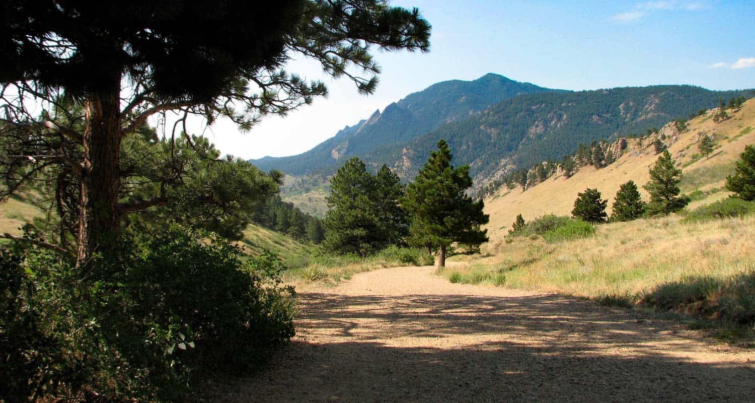
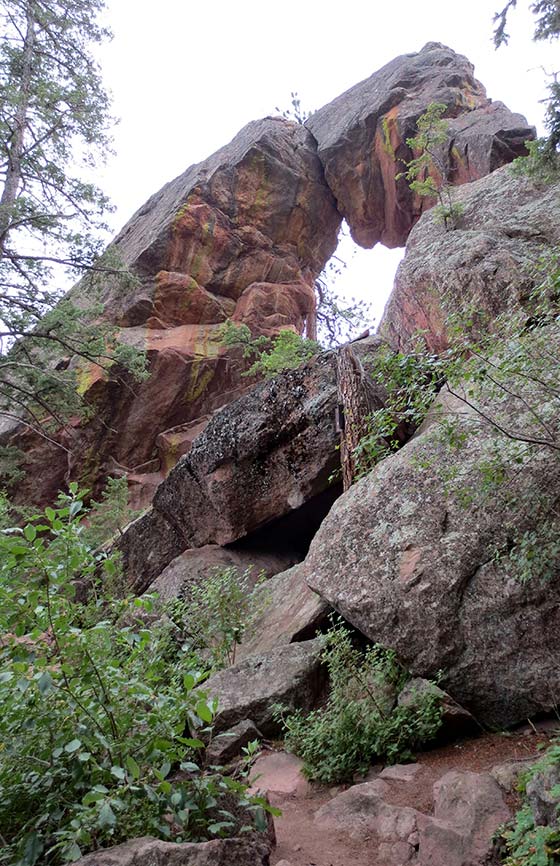
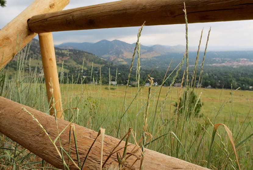
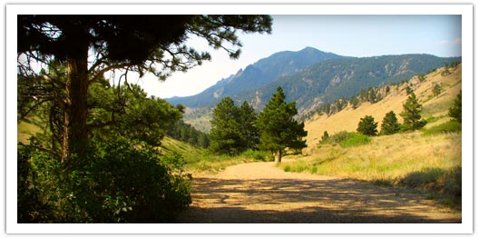
Mt. Sanitas Hike Near Boulder
If you are visiting Boulder, this is a great Colorado hike. Mt. Sanitas gives you several trail options ranging from an easy stroll along a meandering brook to a demanding trail up the mountainside. Explore the trail profile below for all the info you need on this hike near Boulder.
Trail Snapshot: Mt. Sanitas Hike in Boulder
| Hike Distance | 3.1 miles or 2 miles |
|---|---|
| Difficulty | Medium+ with Easier Options |
| Duration | Approx 2 hr |
| Trail Type | Loop |
| Elevation Gain | Approx +1343′ |
| Seasons | Year Round |
| Dogs | Allowed on Leash |
| Hike Trail Map | Click for a Trail Map |
| Denver Drive Time | 45 min |
| Directions | Click for Google Map |
| Town Nearest Hike | Boulder, Colorado |
| Beauty | Front Range mountain views, views of Boulder, wildlife: mule deer, raptors, foxes, and coyotes |
| Activities | Picnic area, horseback riding, hiking trails, climbing, No Bikes Allowed |
Mt. Sanitas offers three different hike options, ranging from the more difficult climb up the mountain, to an easy walk through a peaceful valley. Sanitas is Latin for "health", and this hike may either get you in better shape (the 3.1 mile loop), or restore your sanity (the easier options). If you are visiting Boulder, this is a great Colorado hike.
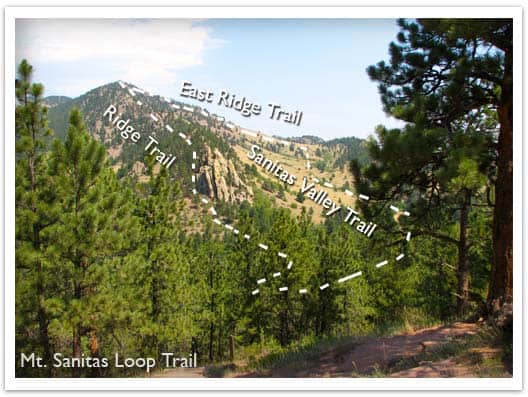
3 Hike Options at Mt. Sanitas in Boulder, Colorado
1 - The Mt. Sanitas Loop - 3.1 Mile Loop - Medium+
This is the classic hike at Boulder's Mt. Sanitas, and it's the most difficult of the three hike options because it involves a series of log and rock steps that will leave your quads and knees either thanking your for the workout or aching for a couple days afterwards. Because of this, we would give it a Medium+ difficulty rating. The prize of this Front Range Hike are the views at the top. You'll be able to look down into Boulder and get some great views of Colorado's Front Range.
2 - Mt. Sanitas Valley Hike - 2 Mile Out-and-Back - Easy
Here's the easiest option; 1 mile straight up the valley and back. The two words that best describe the Sanitas Valley trail: idyllic and busy. Dogs run about and jump in the creek that runs along the beginning of the path, runners fly by, and families talk and stroll together. The trail rises gently at first, then goes into more of an incline. We took our stroller; it worked fine, but was tough pushing the kids up the last 1/4 mile uphill. We turned around just after the Dakota Ridge Trail junction, making it a 2 mile out-and-back hike.
3 - Dakota Ridge Trail at Mt. Sanitas - 2 Mile Loop - Easy to Medium
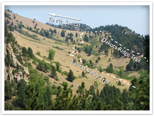
You'll find side trails running East/West off of the Sanitas Valley trail which will take you up onto the Dakota ridge, a hogback that boxes in the Sanitas Valley. You can make this an out-and-back hike, or turn it into a loop by hiking back through the valley (see photo above and the Mt. Sanitas Trail Map for the route).
Tips & Resources for Hiking Mt. Sanitas in Boulder:
- Parking: This is kind of a no-brainer, but get to the trailhead early. I think we arrived around 8am on a Saturday and grabbed the last parking spot. However, we noticed that many people were walking to the trailhead from town, so there are other parking options.
- No Shade: Bring your sunscreen; the trail is mostly exposed.
- Lots of People: If you are looking for solitude, I'd recommend trying another hike. The Mt. Sanitas trail is essentially in Boulder, and its great location means that it's quite busy.
- Trail Map for Mt. Sanitas Trail: Trail Map Link
- Colorado Road Conditions: Colorado Road Conditions
- After the Hike: Ozo Coffee
Weather
Map & Driving Directions
Click for Driving Directions
Meyer Ranch Open Space Hikes
Meyer Ranch is just 30 minutes outside of Denver, Colorado and offers three different hiking trail options, ranging from 2.4 to 4.8 mile, easy to moderate hikes. Check out the three different hiking trail options for this hike near Conifer, Colorado.
| Hike Distance | 2.4 to 4.8 miles Round Trip |
|---|---|
| Difficulty | Easy to Moderate |
| Duration | Approx 1 hr to 2.5 hr Round Trip |
| Trail Type | Loops and Out & Back |
| Seasons | All Season |
| Dogs | Allowed On Leash |
| Hike Trail Map | Click for a Map of Meyer Ranch Open Space Hikes |
| Denver Drive Time | 30 min |
| Driving Directions to Meyer Ranch Open Space Hikes | Click for Google Map |
| Town Nearest Hike | Conifer, Colorado |
| Beauty | Meadows, overlooks, wildflowers, wildlife: deer & elk |
| Activities | Picnic area, hiking trails, mountain biking |
Meyer Ranch Open Space offers 3 great hiking options only 30 minutes from Denver. They range from easy to moderate in difficulty and 2.4 to 4.8 miles in length. Meyer Ranch has expansive meadows and patches of wildflowers, grazing deer & elk, and trails that take you to overlooks.
1. Lodgepole Loop: 2.4 miles - Easy - Take the Owl's Perch Trail South and continue straight (left) down the trail, at the next junction go right and continue on the Lodgepole loop for 1.2 miles until you arrive back at the Owl's Perch trail and take (left ) that back to the parking lot.
2. Sunny Aspen Trail Loop: 3 Miles - Moderate - Take the Owl's Perch Trail South and continue straight (left) down the trail, at the next junction go right and continue on the Lodgepole loop, go .6 miles and take a right onto the Sunny Aspen Trail, continue on the Sunny Aspen Trail for .8 miles until it joins again with the Lodgepole Loop (go right), follow this back to the Owl's Perch trail and back to the parking lot.
3. Old Ski Run Trail 4.8 Miles - Moderate - Take the Owl's Perch Trail South and continue straight (left) down the trail, at the next junction go left again for .2 mile until you find your next junction, go left onto the Sunny Aspen Trail taking that for .5 mile until you reach the junction with the Old Ski Run Trail. The Ski Run trail is an out & back trail with a loop at the end. The Ski Run section is 2 miles out and back (including loop). Return the way you came via the Sunny Aspen Trail.
Tips & Resources for Hiking Meyer Ranch Open Space Hikes :
- Picnic areas: There are picnic areas close to the trailhead as you go along Owl's Perch Trail.
- TIP: Initially you will hear noise from the road below. This will fade as you hike further into the park.
- Trail Map for Meyer Ranch Open Space: Trail Map Link
- Colorado Road Conditions: Colorado Road Conditions
- After the Hike: Aspen Perk Cafe
Weather
Map & Driving Directions
Click for Driving Directions
High Line Canal Hike - County Line to Fly'n B Park
The High line Canal starts in the foothills and meanders over 60 miles through Denver, creating a treelined hiking and biking thoroughfare in the middle of the city. This stretch in Littleton, Colorado takes you past Fly'n B Park. Take the path south and you'll find yourself in Writer's Park. Scroll down for the trail snapshot, and for further details and tips for hiking this great segment of Denver's High Line Canal.
Trail Snapshot: High Line Canal Hike - County Line to Fly'n B Park
| Hike Distance | 3.7 miles Round Trip |
|---|---|
| Difficulty | Easy |
| Duration | Approx 2 hr Round Trip |
| Trail Type | Out and Back |
| Seasons | All Year |
| Dogs | Allowed On Leash |
| Hike Trail Map | Click for a Map of High Line Canal Hike - County Line to Fly'n B Park (see A6 to A2) |
| Denver Drive Time | 30 min |
| Driving Directions to High Line Canal Hike - County Line to Fly'n B Park | Click for Google Map |
| Town Nearest Hike | Littleton, Colorado |
| Beauty | Giant cottonwood trees, Highline Canal, wetlands, waterfowl, pond at the Fly'n B Park |
| Activities | Hiking, cycling, birdwatching, pond, picnic shelter |
Denver's Highline Canal was designed as an irrigation stream, but it has become a 66 mile long hiking and biking trail running through the heart of Denver. This particular hiking trail section is in the Littleton & Highlands Ranch area. There are two parking lots from which you can start the hike: the Countyline Road Trailhead, or the Fly'n B Park lot. Round Trip, this segment is about 4 miles. From the Countyline Trailhead, cross over the first footbridge and head South (left). You'll run into an intersection about 200 yards up. Take a right to continue following the Highline.
Water flows in the highland canal about 90 days a year. Because the canal only drops two feet per mile, the water, even when it is flowing fast, appears calm. This is part of what gives this trail such a pastoral feel, even though it is close to 470. Immense Cottonwood trees arch over the path, and all sorts of birds decorate the bushes and wetlands that have grown up wild along its edges.
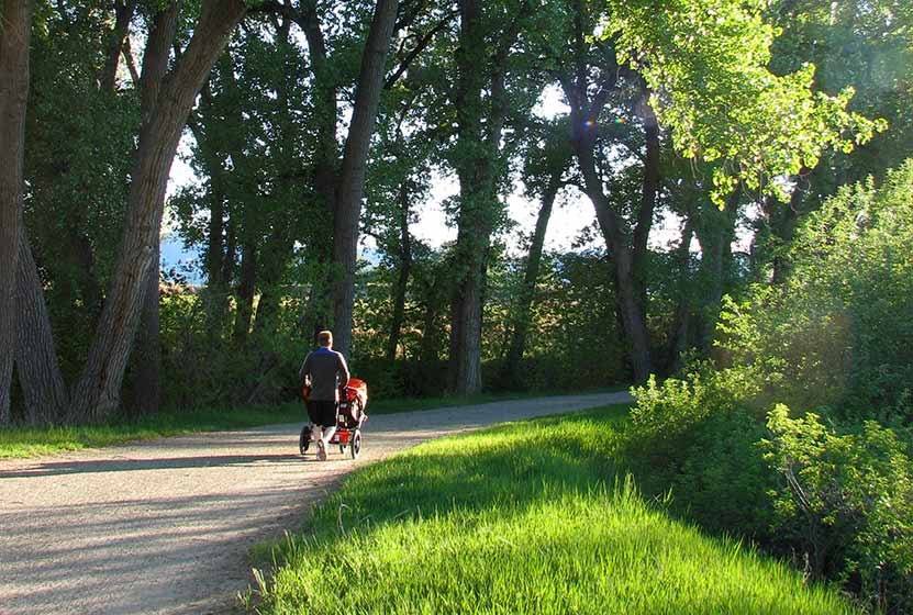
The trail is great for a stroller hike and for wheelchairs. After about 2 miles of trail, you'll walk through a tunnel that goes under 470. You'll then emerge to find yourself at Fly'n B Park. It looks like it is an old ranch that has been converted into a great park near Highlands Ranch. It features a small pond with boat dock, and a fantastic shelter house. The pond looks like a perfect place to take kids fishing in Denver. We haven't tried it out yet, so we would love your feedback if you have. The Highlands Ranch Metro District Parks is currently (Spring 2014) renovating the home on the property. Outdoor restrooms and some parking is available. However, we recommend parking at the Countyline Road Trailhead for this hike.
Tips & Resources for Hiking High Line Canal Hike - County Line to Fly'n B Park :
- TIP: A detailed guide to of the Highline Canal Trail can be ordered from Denver Water.
- TIP: Take some snacks and extra water. The Highline continues well beyond this section and you're likely to want to explore more of it.
- TIP: From the Countyline Trailhead, you can also go North towards for views of McLellan Reservoir and the Front Range.
- Trail Map for High Line Canal Hike: Trail Map Link
- Colorado Road Conditions: Colorado Road Conditions
- After the Hike: Enchanted Grounds Coffee Shop
- Denver Water Highline Canal Site
Weather
Map & Driving Directions
Click for Driving Directions
Rattlesnake Gulch Trail at Eldorado State Park
The Rattlesnake Gulch trail takes you up the sides of Eldorado Canyon, one of Colorado's historic State Parks. This lollipop trail takes you past the ruins of the Crags Hotel, then on to gain views of the Continental Divide. Scroll down to look over the trail snapshot, then explore the trail details and tips below for this rewarding hike in Eldorado Canyon State Park.
Trail Snapshot: Rattlesnake Gulch Trail at Eldorado Canyon
| Hike Distance | Approx 2.5 to 4 miles |
|---|---|
| Difficulty | Moderate |
| Duration | 1.5-2.5 hrs |
| Trail Type | Lollipop w/Spur Option |
| Seasons | Spring, Summer, Fall |
| Dogs | Allowed on Leash |
| Hike Trail Map | Click for a Trail Map |
| Denver Drive Time | 45 min |
| Directions | Click for Google Map |
| Town Nearest Hike | Boulder, Colorado |
| Beauty | Canyon, waterfalls and cascades, cliff swallows, cliff-top views, geologic features |
| Activities | Picnic areas, horseback riding, mountain biking, rock climbing |
| Fee | Link to Fees Page |
If your legs are ready to gain some quick elevation to some rewarding views, the Rattlesnake Gulch trail will give you just that. This trail starts at the west trailhead of the Fowler Trail about 1/2 a mile into Eldorado Canyon. The hike first takes you about 1.2 miles to the site of the Crags Hotel. The hotel was built in 1908 and visitors could reach it by taking an incline railroad and by an old wagon trail. In 1912, the hotel burnt to the ground, and just a few ruins remain. The parks department has put up interpretive signs to give you an idea of what the site was like in the early 1900's.
If you continue past the Crags Hotel site, you can add on an additional 1.4 miles by hiking the Rattlesnake Gulch Loop. A spur along the trail takes you to the Continental Divide overlook, where you can look out to the plains and towards a few peaks to the west. If you don't want to hike the entire loop, but you want to catch the view from the overlook, take the trail to the right after the hotel site and hike about 10 more minutes. See the map link above for the exact location of the spur that leads to the overlook.
The picture above is looking northeast towards the Cadillac Rock area. If you take a pair of binoculars, scan the formation for rock-climbers. Eldorado Canyon makes for some great Denver area hiking. It's one of those places with so many unique features, that you'll find yourself drawn back there time and time again.
Tips & Resources for Hiking the Rattlesnake Gulch Trail at Eldorado State Park:
- Exact Trail Length: Exact trail lengths are approximate until we can GPS this one. We've noticed discrepancies on maps and reports. So, be sure to add some buffer time on to this hike.
- Parking: Parking fills up fast at Eldorado Canyon. So, we suggest you go early in the day, or as the crowds are filtering out of the park in the late afternoon. As well, you'll find weekdays less crowed. Eldorado Canyon is open from sunrise to sunset year round.
- Directions: Use the driving directions on this page. They will lead you to the nearest parking area to the Rattlesnake Gulch Trailhead.
- Fee: There is an $8 parking fee per car or you can use your Colorado State Parks Annual Pass
- Trail Map for Eldorado Canyon State Park: Trail Map Link
- Colorado Road Conditions: Colorado Road Conditions
- After the Hike: Boxcar Coffee Roasters in Boulder
Weather
Map & Driving Directions
Click for Driving Directions
Homestead Trail at Castlewood Canyon
his trail is great place to begin if you plan to explore the west side of Castlewood Canyon. It's a short hike, but the Homestead Trail can be used to link up to other hiking trails in this Colorado State Park. Scroll down to get all the hiking info you need in the trail snapshot, trail options descriptions and tips.
Trail Snapshot: Homestead Trail at Castlewood Canyon
| Hike Distance | 2 or 4 mile options RT (see trail options below) |
|---|---|
| Difficulty | Easy to Moderate |
| Duration | Approx 30 min+ Round Trip |
| Trail Type | Out & Back and Loop Options |
| Seasons | All |
| Dogs | Allowed on Leash in Most Areas, But Not on the East Canyon Trail |
| Hike Trail Map | Click for a Map of Homestead Trail at Castlewood Canyon |
| Denver Drive Time | 45 min |
| Driving Directions to Homestead Trail at Castlewood Canyon | Click for Google Map |
| Town Nearest Hike | Castle Rock, Colorado |
| Beauty | Cherry Creek, waterfall, interesting geology, canyon views, ruins |
| Activities | Hiking, great picnic facilities, mountain biking, horseback riding |
| Fee Required | Visit Colorado State Parks Site |
The Homestead Trail in Castlewood Canyon is the first trail you will encounter as you enter the west side of the park. Park at the first lot and you'll immediately see the ruins of the old Lucas Homestead, an unusual concrete structure built in the late 1800's.
The trail is less than a mile round trip, but it links up with several other trails which form 2 loops. Download the Castlewood Canyon Brochure & Trail Map to get a better idea of how these two loops work.
4 Mile Loop: Hike the Rim Rock Trail for 2.14 miles to enjoy the east side of Cherry Creek. Eventually, you will meet with the Creek bottom trail. Take that North for 1.7 miles until you have returned to the Homestead Trail.
2 Mile Loop: When the Homestead Trail meets the Creek Bottom Trail, take the Creek Bottom Trail south for about .7 mile until it intersects with the Cherry Creek Trail. Take this North for 1 mile back to the Lucas Homestead.
Tips & Resources for Hiking Homestead Trail at Castlewood Canyon :
- Finding the Trailhead: The West Side entrance can be hard to find. Usually, Colorado state parks have brown signs indicating the park roads. The west side doesn't. But the name of the road you're looking for is "Castlewood Canyon" - easy to remember.
- TIP: Hikes in Castlewood Canyon can be quite exposed to the sun, so bring the sunscreen.
- TIP: Poison Ivy: We've been surprised how poison ivy flourishes in this park, often along the edge of the trail. Know how to identify it, so that you can avoid it. But don't let that deter you from the park. You just need to keep an eye out. See our post on how to identify and treat poison ivy.
- Trail Map for Castlewood Canyon State Park: Trail Map Link
- Additional Castlewood Canyon State Park Maps: Other Trails
- Colorado Road Conditions: Colorado Road Conditions
- After the Hike: Crowfoot Valley Coffee
Weather
Map & Driving Directions
Click for Driving Directions
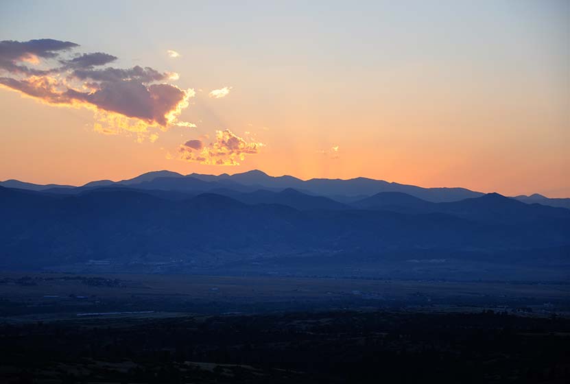
Daniel's Park Hikes
Best sunsets in Denver! You can see mountains upon mountains of Colorado's Front Range. Take a picnic dinner and pull off at one of the many picnic areas along Daniels Park Road. There are several hiking options detailed below for Daniel's park. To get all the details, scroll down and explore the trail snapshot, profile, and tips below.
Trail Snapshot: Daniel's Park Hike
| Hike Distance | 0.2, 3, or 5.4 Miles |
|---|---|
| Difficulty | Easy |
| Duration | 20 min to 2.5 hrs |
| Trail Type | Out and Back |
| Seasons | All Season |
| Dogs | Allowed on Leash |
| Hike Trail Map | Click for a Trail Map |
| Denver Drive Time | 35 min |
| Directions | Click for Google Map |
| Town Nearest Hike | Littleton, Colorado |
| Beauty | Front Range Views, Rock Formations, Bison |
| Activities | Picnic Areas, Shelter House with Fireplace, Bison viewing area, Hiking |
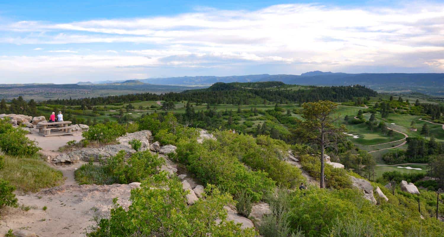
We are featuring Daniel's Park ,not for it's trails, but because it has one of the best views of the Front Range near Denver. From the park, you can see Pikes Peak in the South, Mt. Evans in the West, and Longs Peak in the North. The trails are not handicap accessible, but the shelter house is (after a bit of a bump trail), and is a perfect place to watch the sun set.
Here is the lowdown on the trails at Daniel's Park: They are undeveloped. The park has been around for nearly 100 years but has somehow escaped being developed. However, it's close to south Denver and has some great features, so we've come up with a few different hiking options below.
The Short Daniel's Park Hike - Park at the Shelter House and begin walking north through the undeveloped trails along the top of the bluff. We like to take a picnic dinner up here and a lot of folks bring firewood and enjoy the sunset by the fire. There are about a quarter mile of trails that weave through the rock and back out towards the road.
3 Mile Daniel's Park Hike - Again, start at the Shelter House and head North following the top of the bluff as it parallels the road. You can extend your hike by hiking North along the road until it intersects with Grigs Road - About 1.5 Miles. Hike back to Daniel's Park Shelter House for a 3 Mile round trip hike.
5.4 Mile Daniel's Park Hike - Continue the 1.5 mile hike by taking a left onto Grigs road. Cross to the Northeast side of the Grigs, then shortly after you cross, you'll come upon a green fence and the Douglas County East/West Trail. Your can take that trail West (left) to the Grigs Road Trailhead, adding an additional 1.2 miles to your hike (5.4 Miles Round Trip). Click Here for a Google Map that traces the route along Daniel's Park and Grigs Road.
Douglas County plans to build this East/West trail into a 26 mile system linking Chatfield Reservoir to the town of Parker, Colorado. Click here for the map of the East/West Trail and proposed trails in Douglas County. Denver Mountain Parks and Douglas County have developed a master plan to improve both the park and the roads in the area. You can find an overview at the Douglas County Park site.
Tips & Resources for Visiting Daniel's Park:
- TIP: Keep an eye on the skies - Douglas County has one of the highest lightning strike rates in the country and Daniel's Park is one of the higher points.
- TIP: Bison Viewing - The Bison can be found in an enclosed pasture on both sides of the road.However, the Bison are usually found grazing in the section of the park that is directly across the street from the shelter house.
- Trail Map for Daniel's Park: Trail Map Link
- Colorado Road Conditions: Colorado Road Conditions
Weather
Map & Driving Directions
Click for Driving Directions