Eagles View Hike in Reynolds Park
The Eagles View Loop hike in Reynolds Park is a 4-mile, moderate, loop trail to a scenic outlook. The trail ascends through meadows and ponderosa pine forest to views of Pikes Peak and the sawtooth spires and peaks of the Rampart Range. Explore the full Reynolds Park Eagle View Loop hike profile below for trail map, driving directions, and more tips and details to help you enjoy this adventure near Conifer, Colorado.
Trail Snapshot: Reynolds Park Eagle View Loop
| Hike Distance | 4 or 4.4 miles Round Trip |
|---|---|
| Difficulty | Moderate |
| Duration | Approx. 2 hours |
| Trail Type | Loop |
| Starting Elevation | 7,250'′ |
| Elevation Gain | Approx +900′ |
| Seasons | Year Round |
| Dogs | Allowed On Leash |
| Hike Trail Map | Click for a Map of Eagles View Loop at Reynolds Park |
| Denver Drive Time | Approx. 50 min |
| Driving Directions to Reynolds Park | Click for Google Map |
| Town Nearest Hike | Conifer, Colorado |
| Beauty | Scenic Overlook, Aspen woodlands, Views of Pikes Peak and Cathedral Spires |
| Activities | Hiking, Trail Running, Equestrian Trails, Photography |
Parking & Trailhead Information for Reynolds Park
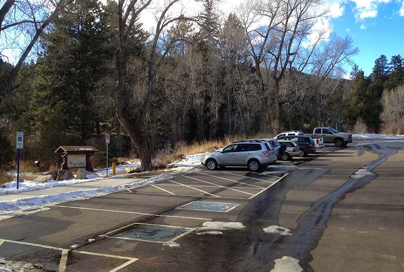
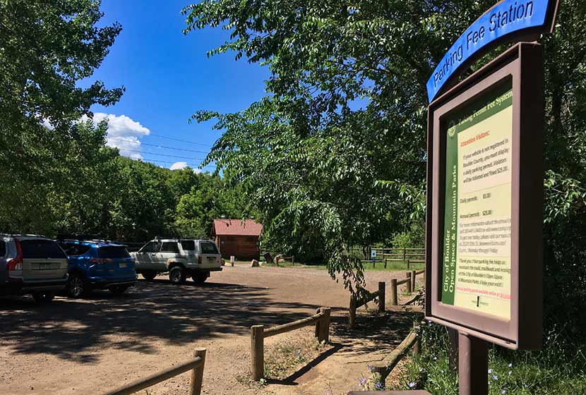
I really enjoy the drive into Reynolds Park, particularly for the last stretch descending to the trailhead. The trailhead is about 50 minutes from downtown Denver. From Denver, take 285 South to Conifer, Colorado taking the Kennedy Gulch exit. At the exit, you'll take a left onto Kennedy Gulch Road, which will go under the 285 overpass. At the next stop sign, you'll see a red barn in front of you and an entrance to 285 on your right. Here, you'll take a left onto Foxton Road. This is where that beautiful stretch of road begins. Drive for about 5 miles and the Reynolds Park parking area will be on your right. The parking area can hold about 45 vehicles. There are restrooms, picnic tables, and grills at the trailhead.
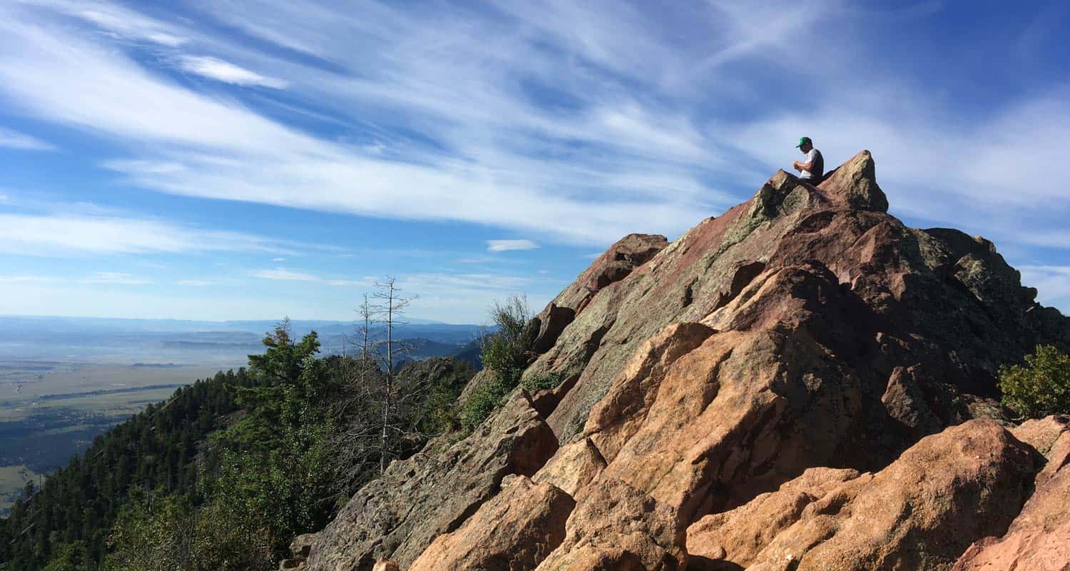
The Hike: Eagles View Loop at Reynolds Park
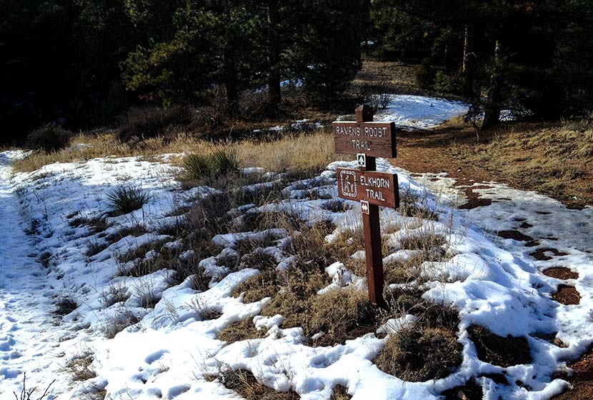
This loop hike gives hikers the most extensive exploration of the larger West side of Reynolds park. Begin by taking the main trail found on the south end of the parking lot (near the restrooms). It's wider than the other trails. At the first junction, take a right onto the Elkhorn Trail. This will lead through a mix of wooded areas and meadow.
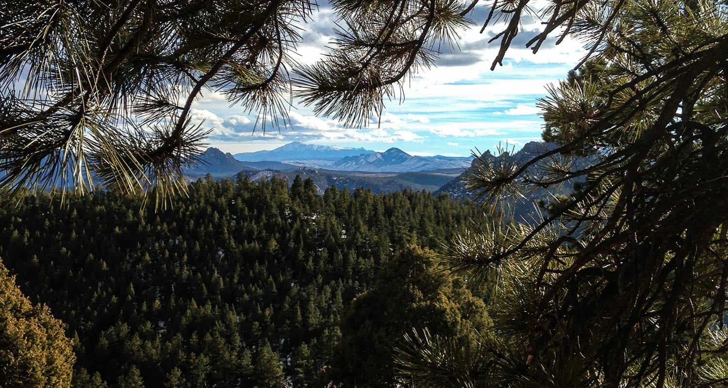
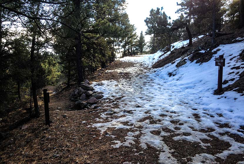
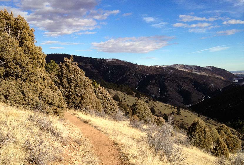
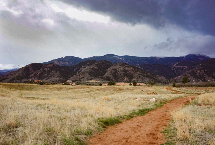
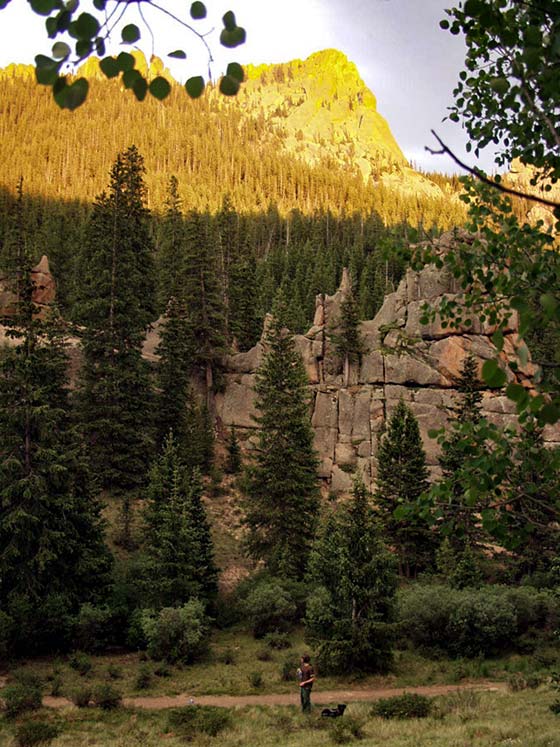
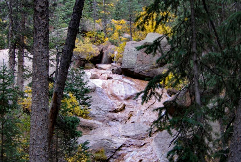
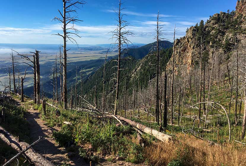
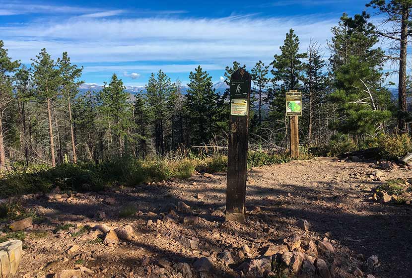
Hikers will travel about 0.3 mile on this segment of the Elkhorn Trail until it intersects with the Ravens Roost Trail. Here, take the Ravens Roost trail which is more steep, ascending for 0.6 of a mile up to the next junction with the Eagles View Trail. Both the Ravens Roost and Eagles View trails are Hiker and Equestrian Only (no bikes, but dogs are allowed). You'll travel through stands of ponderosa pine. Look for Clarks Nutcracker and Stellar Jays as you hike. At the junction, the Eagles View Trail will bear to the right (pictured below).
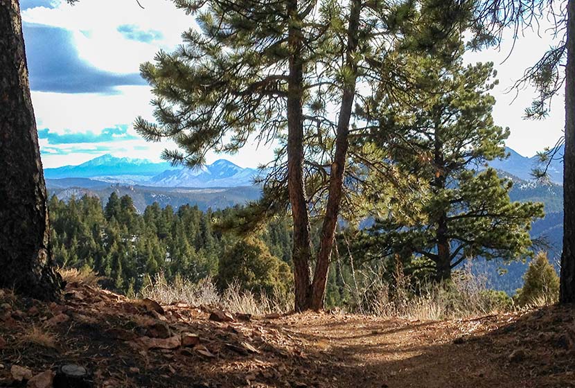
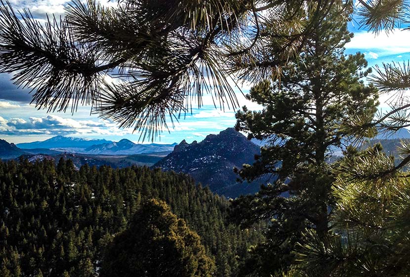
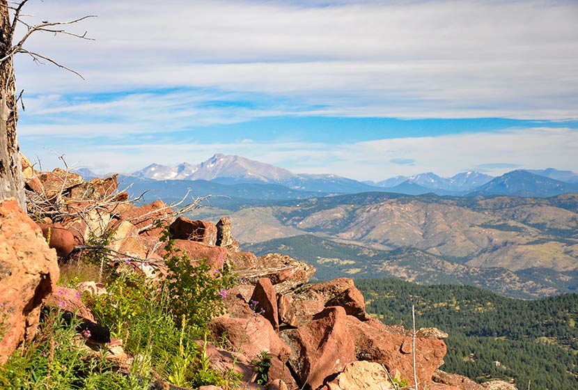
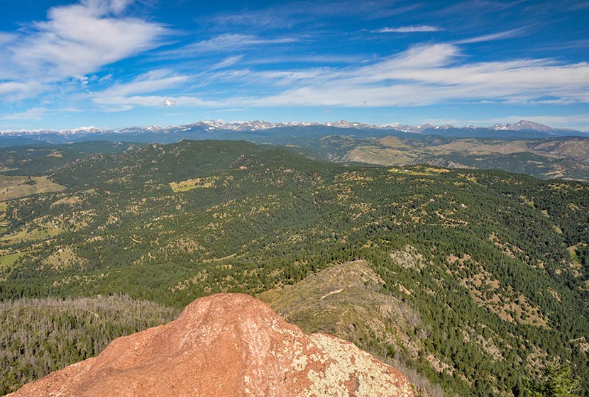
The trail will eventually open up to panoramic views, with the Eagles View scenic viewpoint being the best.
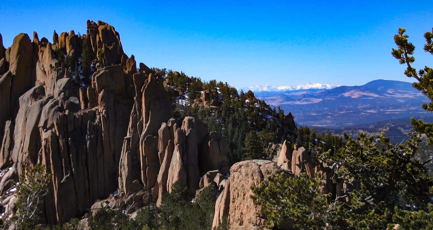
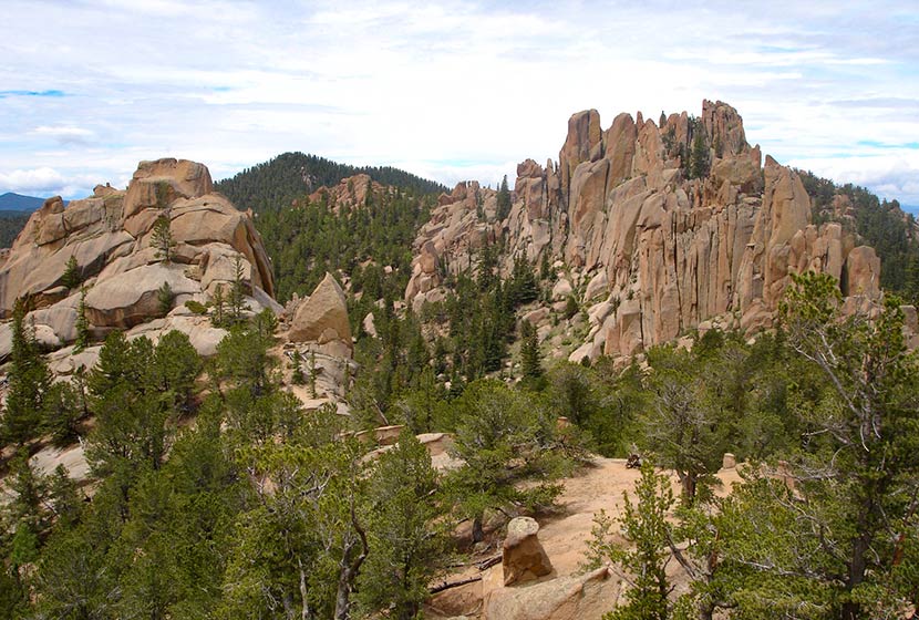
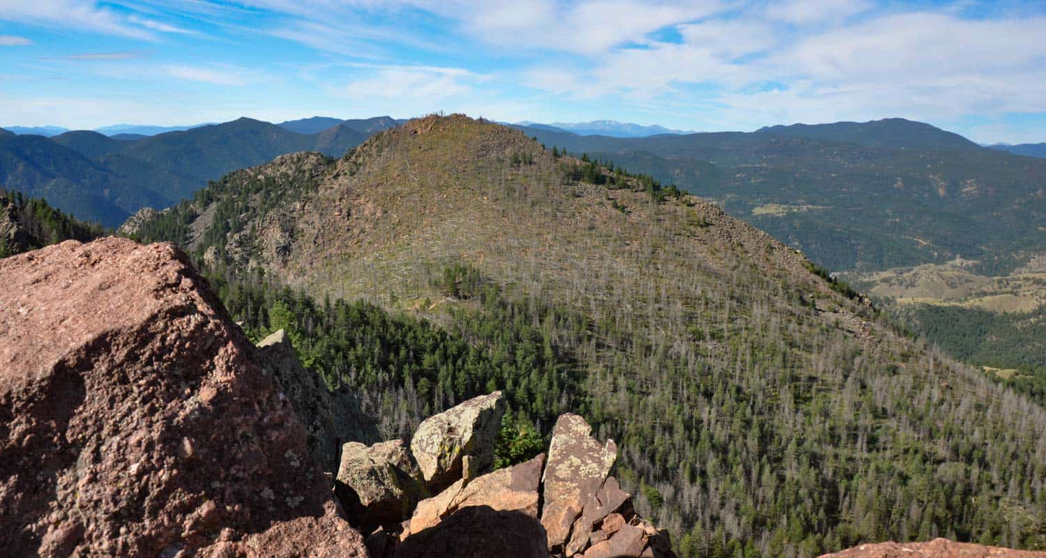
At the viewpoint, there are expansive views of the Rampart Range, and pikes Peak to the South. The Rampart Range is a low mountain range that stretches from south of Denver to Colorado Springs. The range is characterized by scraggy granite peaks jutting out of green forested foothills. At sunrise the granite rock formations light up orange and pink, and look like a series of castles or the rampart wall of a giant ancient fortress. My favorite view of the Rampart Range is from the Devils Head trail and from the Fire Lookout Tower up on Devils Head. It's the tallest peak in the range with an elevation of 9632 feet.
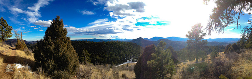
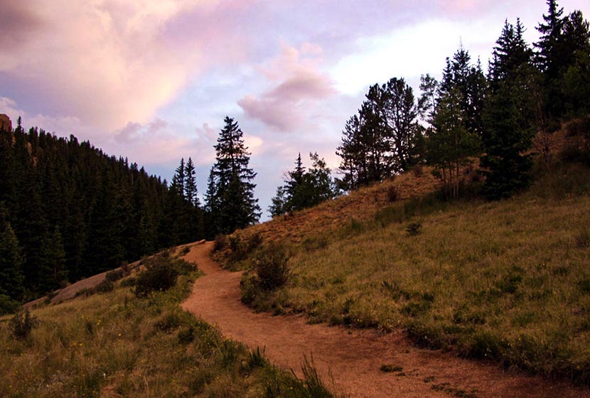
From the scenic point at Eagles View, the trail begins to descend and wind its way north. Pause on this segment to take in the views into the valley below and out to the distant plains in the East.
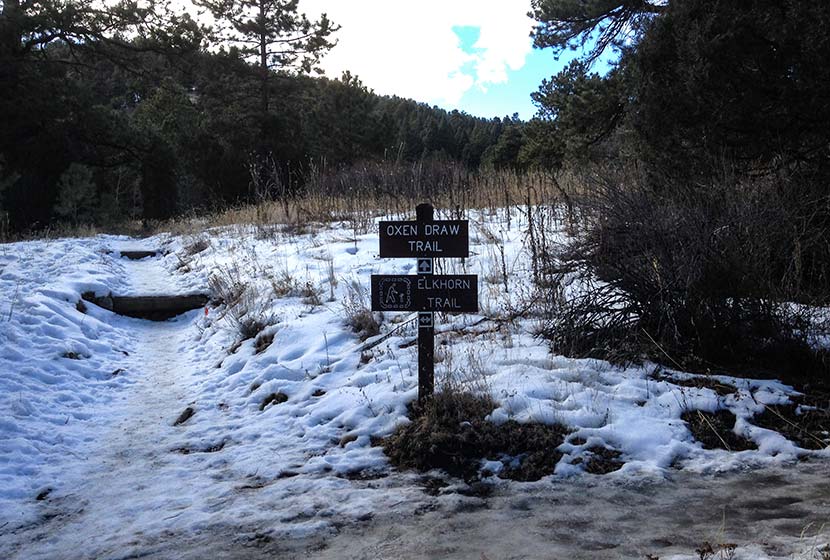
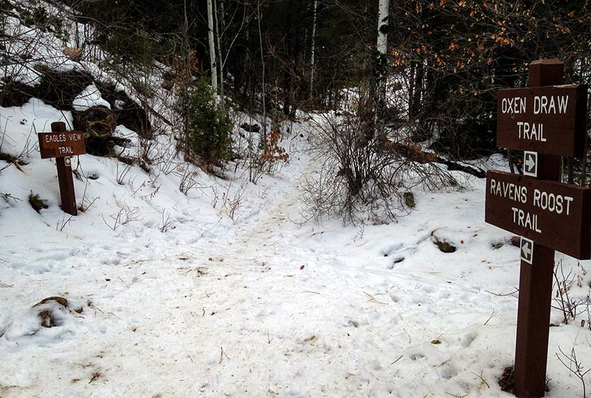
Eventually, the trail will come to another juncture with the Ravens Roost (south segment) and the Oxen Draw Trail. Both are options back to the Trailhead. Taking the Ravens Roost trail makes for a longer 4.4 miles total. Taking the Oxen Draw trail will make your total trip around 4 miles.
When I hikes this in the Winter, the Oxen Draw Trail got quite icy from a recent thaw and freeze. I'm assuming this is pretty normal for this shaded area of the park during the cold months. I wish I had brought my traction devices because the trail had some steep and sketchy, ice-coated segments. I had my trekking poles, and they helped, but it was difficult to navigate.
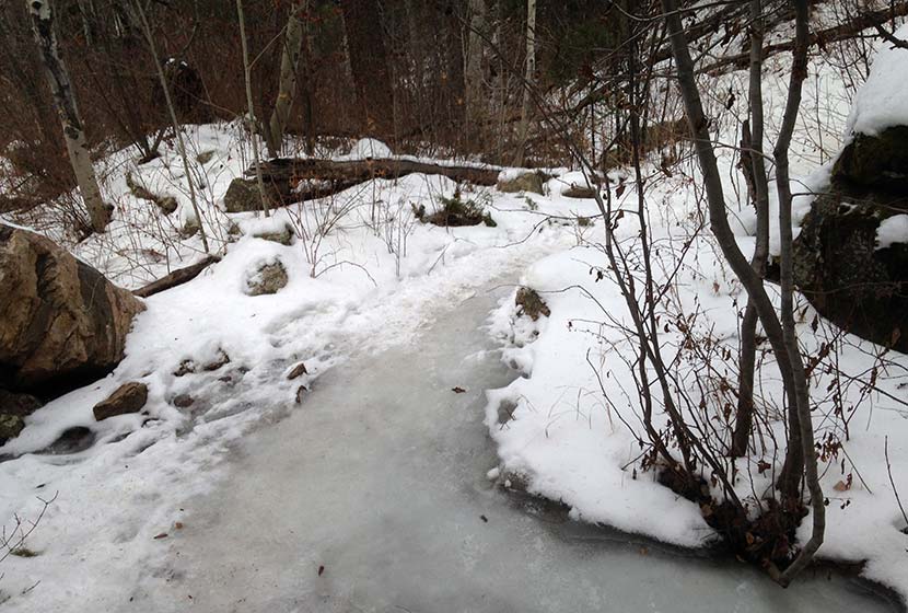
You may notice that I've marked this as a dog-friendly hike. Most of the year that's true, but these icy segments of the Oxen Draw Trail in the Winter may not be the best for your best friend. Overall, though this hike has proven to be one of the lesser traveled trails near Denver--especially on a weekday. Be sure to watch the video below to get a feel for the hike.

Tips & Resources for Hiking at Reynolds Park in Jefferson County
- Trekking Poles and Traction: If you are hiking in the Winter or Spring, the this trail (as you can see from the photos above) can get icy and muddy. Trekking Poles and Traction Devices are recommended for these seasons. I'm a huge fan of trekking poles because they take so much impact off the knees when hiking and backpacking, and they allow us to navigate more demanding terrain. Check out Trekking Pole options at REI.
- Camping: There are 5 tent camping areas on the East end of Reynolds Park that require only a short hike in and make for a good way to introduce your kids or family to a weekend camping trip without having to travel far from Denver. You can reserve a campsite at the Idylease Campground at the Jefferson County Parks Reservations Page. The campground is just a 1/2 mile hike in and has restrooms--but no drinking water--available at the site.
- Trail Map: Reynolds Park in Jefferson County Park Map
- Packing List: Always pack the 10 Essentials. Download our Hiking Guide to get the list and dayhiking packing checklist.
- Colorado Road Conditions: Colorado Road Conditions
- After the Hike: Scooters Smokehouse BBQ
Weather
Map & Driving Directions to Reynolds Park
Click for Driving Directions
Red Rock Canyon Hikes
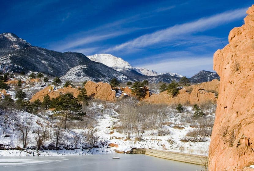
Red Rock Canyon Open Space features miles of easy hiking trails just a few miles west of Colorado Springs with views of Pikes Peak to the West and Garden of the Gods to the North. The park has two off-leash dog trails and most other trails are accessible to and shared by hikers, trail runners, and mountain bikers. Check out the full Red Rock Canyon Open Space hike profile below for trail map, driving directions, and more five different hike options to explore at this park near Colorado Springs.
Trail Snapshot: Red Rock Canyon Open Space
| Hike Distance | 1 to 3.3 miles Round Trip |
|---|---|
| Difficulty | Easy |
| Duration | Approx 1-2 hours |
| Trail Type | Loops and Out and Back Options |
| Starting Elevation | 6100′ |
| Elevation Gain | Approx +100′to +900' |
| Seasons | Year Round |
| Dogs | Allowed On Leash, Off Leash in Designated Areas |
| Hike Trail Map | Click for a Map of Red Rock Canyon Open Space |
| Denver Drive Time | 1hr 15min |
| Driving Directions to Red Rock Canyon Open Space | Click for Google Map |
| Town Nearest Hike | Colorado Springs, Colorado |
| Beauty | Red rock formations, migratory birds, ruins of red rock quarry, pond area, and deer. |
| Activities | hiking, mountain biking, trail running, snowshoeing, photography |
Parking & Trailhead Information for Red Rock Canyon Open Space
From Denver, take Interstate 25 south to Colorado Springs, taking the Cimarron St/24 West. Proceed about 3 miles West on Cimarron/24 and take a left onto Ridge Road. At the roundabout, take a left (by going around 3/4 of the roundabout). The parking lot and trailhead for Red Rock Canyon will be on your right.
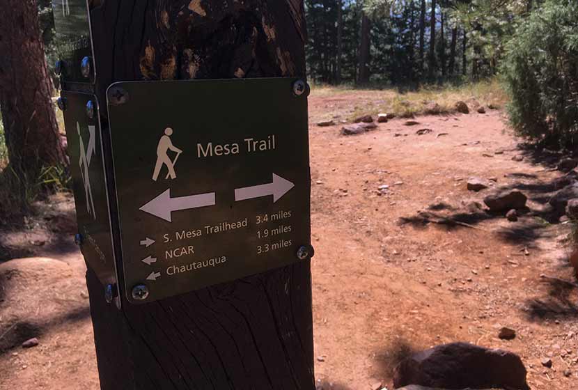
From the trailhead hikers can pick up two of the main trail arteries, the Mesa Trail that works its way through the middle of the park, and the Red Rock Canyon Trail, which runs along the east side. Both lead toward the most popular destination, the quarry.
5 Hike Options in Red Rock Canyon Open Space
-
-
The Dog Loops: 1/2 and 1 mile
-
The upper dog loop is an approximately one-mile curcuit, while the lower is about 1/2mile. Both are great options for a quick walk with the dog after work in a space set aside for off-leash exercise and play. You'll find these two off-leash dog trails immediately South of the parking lot.
-
-
Contemplative-Sand Canyon Loop: 1.75 miles
-
This short loop hike offers more peace and quite because it's tucked away along some of the red rock formations, and the Contemplative Trail segment is designated a hiker-only trail. Pick up the Contemplative trail by starting at the Sand Canyon Trail (West end of the parking lot). This will lead to the Contemplative Trail. You can hike the Contemplative Trail out-and-back, but hikers also have a loop option by joining back up with the Sand Canyon Trail and taking it back to the parking lot.
-
-
The Quarry Loop: 2 Miles
-
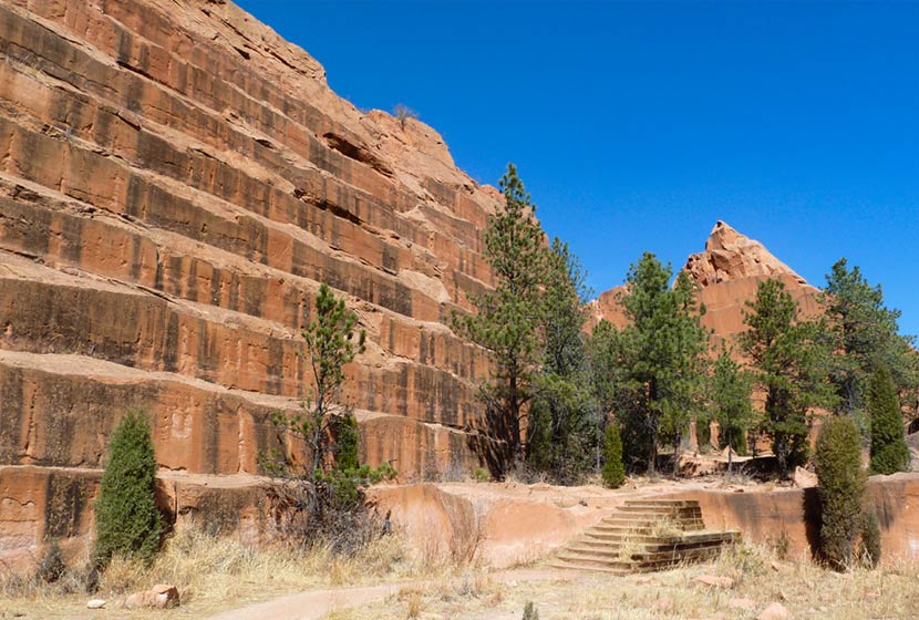
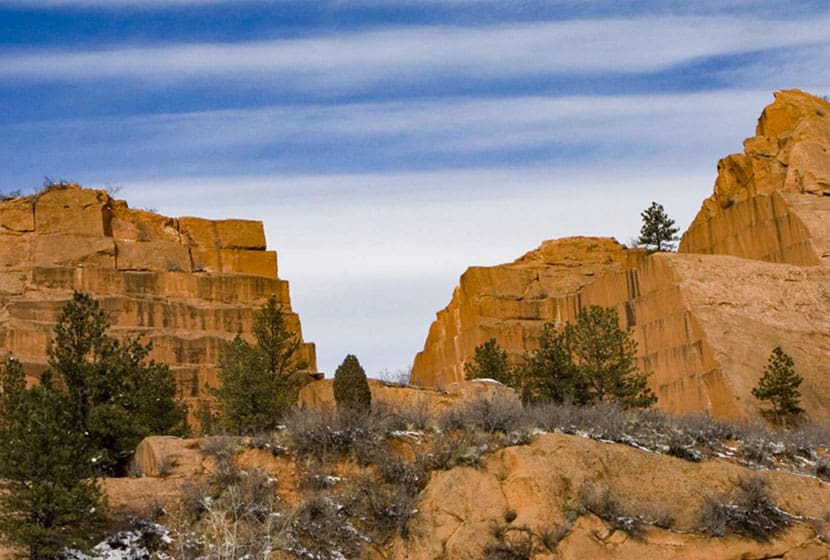
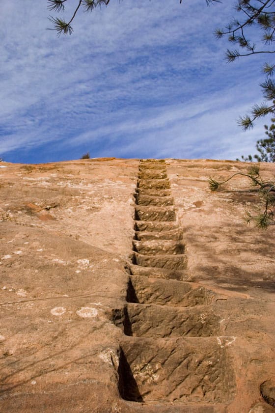
The most interesting destination in Red Rock Canyon is the old Quarry. If you've been in downtown Denver or Colorado Springs, you've probably seen old houses and buildings built with Red Rock cut from quarries like this one. One 2-mile loop option starts by taking the Red Rock Canyon trail to the east side of the Quarry (pick this trail up from the East end of the parking lot). This will run along to the back side of the quarry where you can take the old miner's steps up the side of the red rock. Once up and over, take the Quarry Pass Trail to the Mesa Trail, and hike the Mesa Trail North back to the parking area.
-
-
Hogback Valley-Lion Loop: 3.3 Miles
-
Starting at the east parking lot, pick up the Lower Hogback Tail. The trail will lead up to the Red Rock Rim Trail, then the Hogback Valley Trail taking you into a mesa of meadows with views into Colorado Springs and of Pikes Peak. Take a trail map with you as several trails will tie in together. Connect with the Lion Trail (the upper Codell Trail is more demanding, so be aware of this if choosing that option). Taking the Lion Trail North (right), it will lead back towards the parking area.
-
-
Mesa-Greenlee Loop: 3 Miles
-
This is probably the best hike in the park because it takes hikers through the heart of Red Rock Canyon along the gentle ridge of mesa where you can take in expansive views up to Pikes Peak and out to Garden of the Gods. Start at the Mesa Trail, taking it to the Southern end of the park where it connects with the Greenlee Trail. Return North via the Greenlee Trail to make this a 3 mile loop hike.

Tips & Resources for Hiking Red Rock Canyon Open Space
- TIP: The Southern end trails at Red Rock Canyon connect up with the following area trails: Intemann Trail, and Palmer Red Rock Trail, and others that lead south into Bear Creek Park.
- Nearby Hikes: The Crags Hike, Garden of the Gods Trails, and Helen Hunt Falls.
- Trail Map: Red Rock Canyon Open Space
- Packing List: Always pack the 10 Essentials. Download our Hiking Guide to get the list and dayhiking packing checklist.
- Colorado Road Conditions: Colorado Road Conditions
- Photo: We would like to express our gratitude to Brian Schultze, Sfgamchick, and Cody Wellons for sharing such an amazing photographs of this hike in Colorado Springs.
- After the Hike: Bristol Brewing Company
Weather
Map & Driving Directions
Click for Driving Directions
Crags Hike Near Colorado Springs
The Crags Trail takes hikers up a 2-mile gradual hike to the the dramatic granite pinnacles on the shoulders of Pikes Peak to take in views of snowcapped peaks. A shaded creekside hike great for families and out-of-town guests, the Crags shows off summer wildflowers in mountain meadows. Explore the full Crags hike profile below for trail map, driving directions, and more tips and details to help you enjoy this adventure in the Pikes Peak region.
Trail Snapshot: The Crags near Colorado Springs
| Hike Distance | 4.5 miles Round Trip |
|---|---|
| Difficulty | Moderate |
| Duration | Approx 2 hours |
| Trail Type | Out and Back |
| Starting Elevation | 10,900′ |
| Elevation Gain | Approx +800′ |
| Seasons | Year Round/Snow in Winter |
| Dogs | Allowed On Leash |
| Hike Trail Map | Click for a Map of The Crags |
| Denver Drive Time | 2 hr |
| Driving Directions to The Crags Trailhead | Click for Google Map </a |
| Town Nearest Hike | Divide, Colorado |
| Beauty | Rock Formations, Views to Snowcapped Mountains, Vistas, Wildflowers, and Creek. |
| Activities | Hiking, trail running, snowshoeing, photography |
Parking & Trailhead Information for The Crags
From Denver, you can get to the Crags by driving a direct route via I25 and HWY 24 or you can take a more Scenic Route through the foothills on 67.
The Direct Route
Take interstate 25 south to Colorado Springs, exit at 141 onto US 24 West. You'll drive for about 25 miles into the mountains and through the small town of Divide. Turn left/south onto Hwy 67. Signs should point the way to Mueller State park, which is also on this stretch of road. Just after the entrance to Mueller (on the left), the road you need for the Crags is on the left, CO RD 62. Taking a left onto 62, and drive for about 3 miles. The parking area for the Crags will be on the right side of the road and the trail will start on the left side of the road. Note that this last segment of road is improved dirt road, so the quality of the drive will depend on the current conditions, and may require 4WD in the Winter months.
The Scenic Route
From Denver, take Hwy 285 South toward Pine Junction. Take a left onto Pine Valley road. Here your journey becomes scenic and the roads curvy. Pay close attention while driving and be prepared for the drive to take longer than the 2 hours and 15 minutes posted by mapping software. You'll have some beautiful segments in here, especially the drive along the South Platte River. Cell service is spotty out here, so I always recommend having on hand the Colorado Gazetteer Map printed by DeLorme. The Road changes names to Deckers Road when it passes through the Buffalo Creek area. Eventually, it Deckers road will weave its way down into Deckers. There is a small restaurant here where we've stopped for ice cream. In Deckers, you'll continue straight (south) on 67, passing through Westcreek, until it ends at a stoplight in Woodland Park. Go right at the light, West on 24, until you come again to Hwy 67 just outside of Divide. Then follow the directions above on 67 to the Crags Trailhead.
The Hike: The Crags
This is my favorite hike in the Pikes Peak Region because it's relatively easy, shows off a variety of landscapes, and has incredible views at the top. The trail starts off at the end of the Crags Campground loop and follows the drainage of Fourmile creek. Early on, hikers will come to a fork in the trail. The left-side branch is a more demanding hike, gaining elevation more quickly and has less shade. This trail profile will follow the right-branch, which is more gradual and offers more shade than the left branch. The left branch and right branch can be connected via a scramble at the top to form a loop trail. If taking this route, be aware of the conditions (snow and ice accumulate October through June). Scrambling is fun, but it's also easy to find yourself in a difficult and dangerous circumstance.
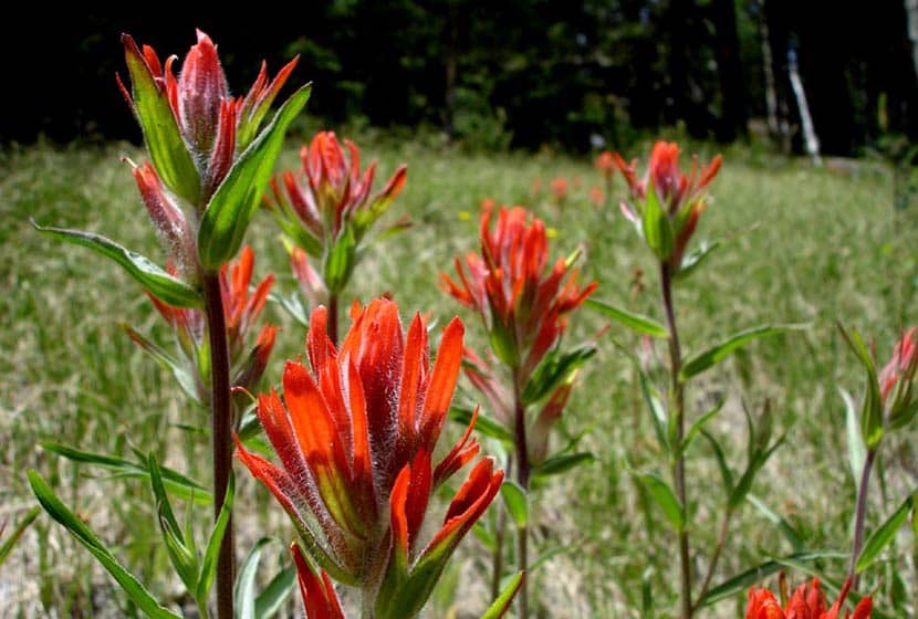
Taking the right branch, the trail will follow alongside Fourmile creek through evergreens and aspens until it opens out into a broad valley surrounded by orange and pink granite cliffs. Wildflowers, like the Indian Paintbrush, bloom in these meadows during the summer months. An interesting fact about Indian Paintbrush: the "flowers" are actually its leaves and there are oranges, reds, and even yellow types of this plant in Colorado.
In the valley, the trail will come to another fork. The main route goes straight up a gradual ascent to the crags and the right-branch is more steep, leading to another vista point. Continuing on the main route, the trail makes its way up gentle slopes, the grassy terrain giving way to cubic granite rock.
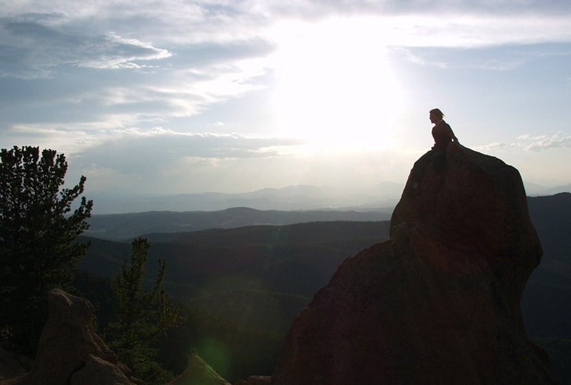
The pink and orange granite pinnacles come into view and the ground eventually opens up to a broad area where hikers gain views of the Sangre De Cristo Mountains in the south, of Pikes Peak, and Mueller State Park. This hike is great for families, but do keep a close eye on children as the rock gives way to steep segments of cliffs at the edges.
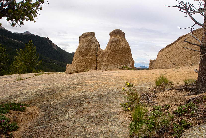
I'm not sure what the locals have named this formation pictured below, but I think of it as the Twin Bears, because it looks like a couple bears sitting on their haunches taking in the views.
I considered grading this an easy hike because the trail is so gradual, the total elevation gain is under 1000 feet. However, those who are hiking with kids or out-of-town guests, should consider it more moderate because it's almost 5 miles total and does gain 800 feet. It makes for a perfect picnic hike with friends.
If hiking in the later hours of the day, it's important to know that because most of the hike is in the folds of the mountain, it gets dark quickly. I always pack my headlamp, but it's especially relevant if you are hiking during these hours.


Tips & Resources for Hiking The Crags
- Dogs: While a dog friendly hike, the granite rock up top is jagged and can impact your dogs padded feet.
- Options: See the different trail options above to take in different unique views of the surrounding landscapes.
- Trail Map: The Crags Trail Map
- Packing List: Always pack the 10 Essentials. Download our Hiking Guide to get the list and dayhiking packing checklist.
- Colorado Road Conditions: Colorado Road Conditions
- After the Hike: Swirl Wine Bar in Manitou Springs
Weather
Map & Driving Directions
Click for Driving Directions
Incline at Castle Rock
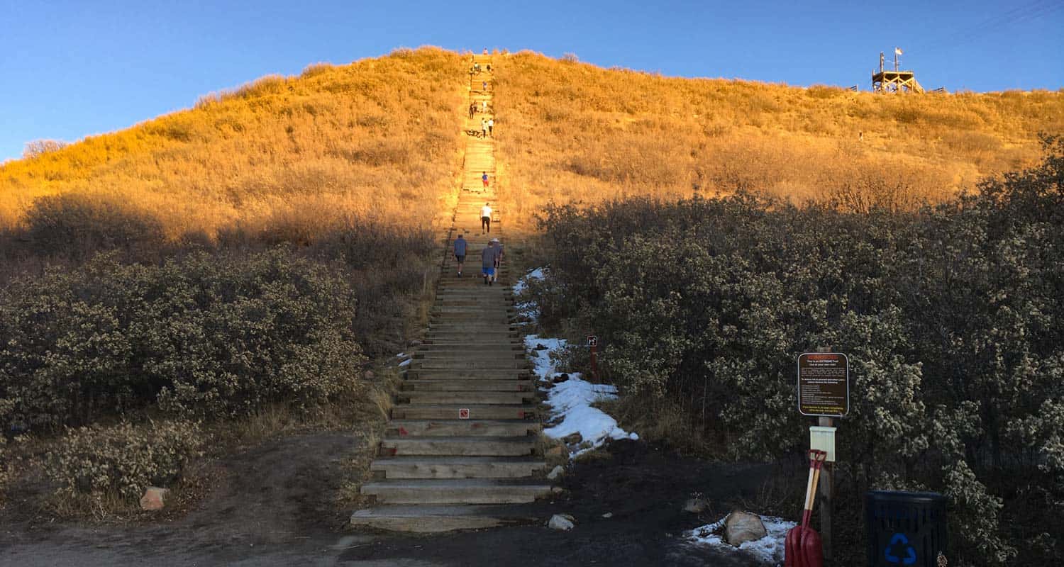
The Incline at Castle Rock is a 0.6 mile loop that begins with a 200 step climb up the Challenge Hill to the top of a promontory. From the top, a trail winds down the side of the mesa for 1/2 a mile back to the bottom. It makes for a great workout in the outdoors, and is about 30 minutes south of the center of Denver. Explore the full Castle Rock Incline hike profile below for trail map, driving directions, and more tips and details to help you get active and enjoy the beauty of Colorado
Trail Snapshot: Incline at Castle Rock
| Hike Distance | 0.6 Mile |
|---|---|
| Difficulty | Moderate |
| Duration | Approx 30 min |
| Trail Type | Loop |
| Starting Elevation | Approx 6400′ |
| Elevation Gain | Approx +178′ |
| Seasons | Year Round |
| Dogs | Dogs Prohibited on Challenge Hill |
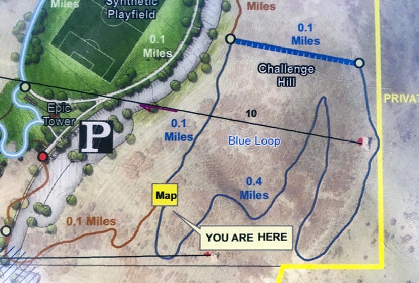
| Hike Trail Map | Click for a Map of Trails at Phillip S Miller Park |
| Denver Drive Time | 35 min |
| Driving Directions to Challenge Hill Parking Area | Click for Google Map |
| Town Nearest Hike | Castle Rock, Colorado |
| Beauty | Views of Pikes Peak to the South and Longs Peak and the Front Range to the North, Great Sunsets, Deer in Valley below. |
| Activities | Hiking and Trail Running, nearby playground and Zipline Tours. |
Parking & Trailhead Information for Incline at Castle Rock
Take interstate 25 south from Denver to the town of Castle Rock, exiting at Wilcox/Wolfensberger exit, taking a right onto Wolfensberger. At the roundabout, go around and take the left-hand exit (3rd option on the roundabout) onto West Plum Creek Parkway. Go 0.7 mile on West Plum Creek Parkway and the Phillip S. Miller Park entrance will be on the right. After entering the park, go left to the area behind the MAC facility and the parking area for the incline will be at the base of the incline.
The Hike: Incline at Castle Rock
Officially, these 200 steps are called The Challenge Hill, but the locals call it "the incline," and rightly so, because it's inspired by the Manitou Incline near Colorado Springs. Because it's just 5 minutes down the road, we've turned this into a regular family workout. It's a perfect place to get in some exercise and take in amazing sunsets over the Colorado Front Range.
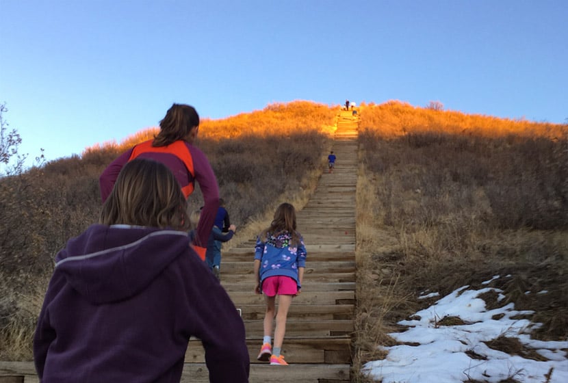
The first segment of the Castle Rock Incline is a 1/10th of a mile climb up 200 steps with close to 200' of elevation gain. This will kick your butt, especially if you take the steps back down. We prefer to run down the 1/2 mile loop trail, usually doing the loop a couple times. We've categorized this as a moderate trail because it has under 500' of total elevation gain and is only 0.6 miles, but many will find it difficult because of the grade of the ascent.
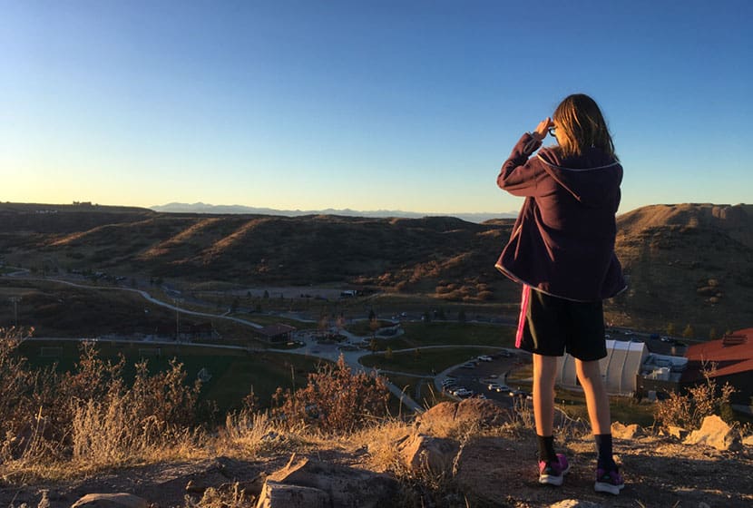
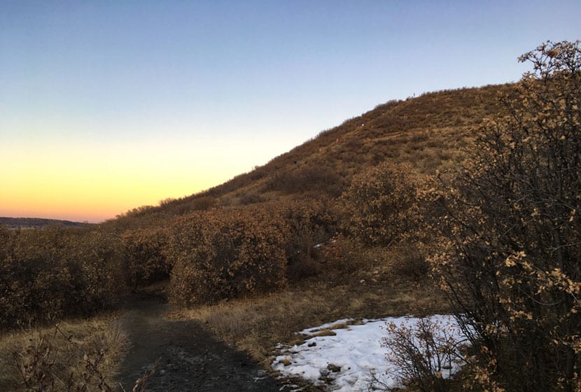
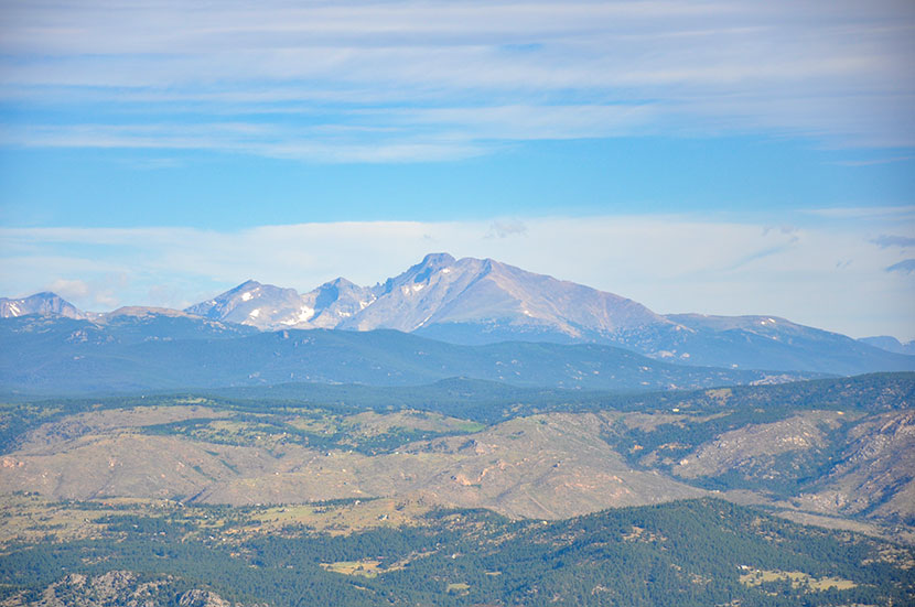
At the top of the Challenge Hill, you can take in views to the north and west of Longs Peak and Devil's Head. There's a wood bench if you want to rest or use it for stretching your legs after the climb. If you decide to descend via the steps be aware that the late afternoon sun can make it very difficult to see the steps.
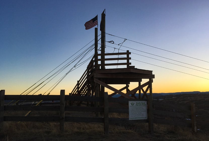
A Zipline platform stands at the peak of this promontory. It's fun to watch zipliners fly through the air across the park. The Zipline tours are operated by Castle Rock Zipline Tours. But don't keep your eyes on the sky because the trail down has a lot of loose gravel and the trail demands your attention.
The trail wraps around the mesa back to the West facing side. Snow and ice can take a while to melt free from the trail, especially in shaded spots. You can check on the trail conditions using the Castle Rock Trail Conditions Map online.
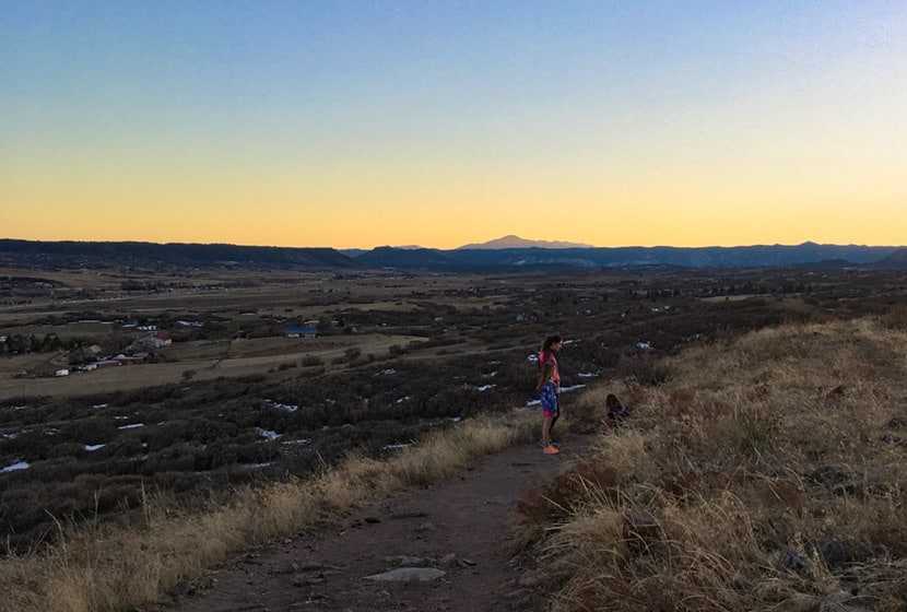
On the back side of the hill, you'll find panoramic views of Pikes Peak and the broad rolling country to the South of Castle Rock. This segment starts out rock then gives way to a gravel trail.
Trail Etiquette at the Castle Rock Incline
- The trail is popular with trail runners, so be aware of approaching runners and keep right to allow them to pass.
- Dogs are prohibited on the challenge hill, because--well, you can imagine why.
- Keep to the right on steps and in single file, especially when others are trying to pass or are coming the opposite direction.
- Let others know when you intend to pass them.
- Descent via the steps is not discourage by the park signage because it's easier to get injured.
- Hours are Dawn to Dusk
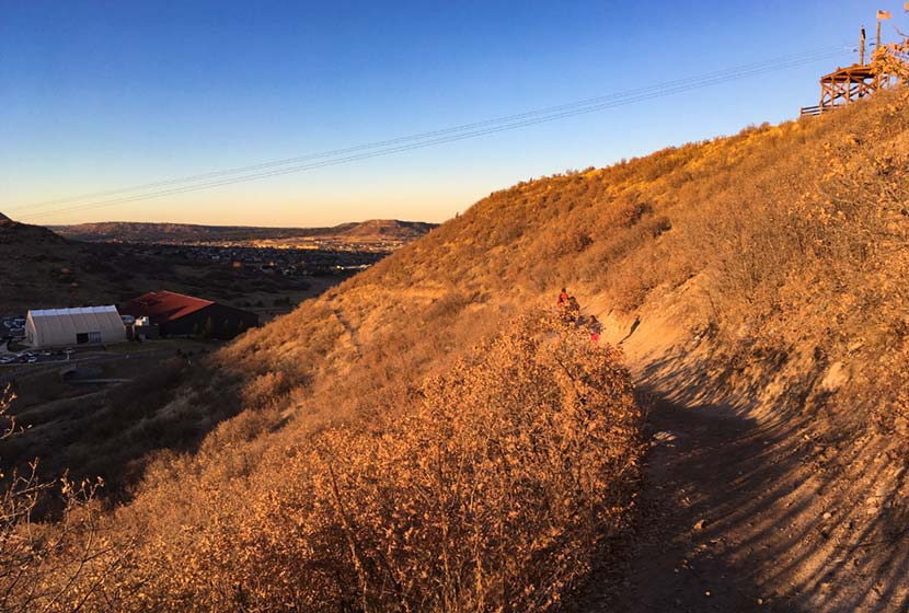
From the photo above, you can get a feel for the scale of the Challenge Hill. Much of the lower trail is in scrub oaks, and this next part may seem a bit overly cautious, but after reading a ton mountain lions, I always keep my kids close. As a local ranger told me, "On the Front Range, where there are deer, there are mountain lions." And a kid running fast through an area like this can incite the instincts of a lion. That I know of, we've not had any attacks in this area, but this is just a protocol our family follows on any hike or run--kids and adults always stay together.
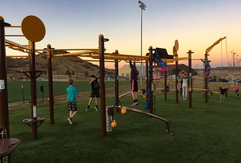
Speaking of the kids, the Phillip Miller park complex recently added (2019) a workout playground that looks like something out of Ninja Warrior competitions. After running the loop a couple times, we spend some time with the kids catching our breath and stretching at the playground.

Tips & Resources for Hiking the Incline at Castle Rock
- Check out Trail Conditions: Before going, check the trail conditions at the Challenge Hill at the Castle Rock Trail Conditions page.
- Pace Yourself: On the ascent, start with a sustainable pace. It gets way more steep and challenging at step 140.
- Trail Map: Incline at Castle Rock
- Packing List: Always pack the 10 Essentials. Download our Hiking Guide to get the list and dayhiking packing checklist.
- Colorado Road Conditions: Colorado Road Conditions
- After the Hike: Since I'm a local, I've got two absolute favorite spots for after the hike. The first is CRAVE Burgers. We love the Love Stinks Burger and the Not Yo Mamma's Burger (on the hidden menu) Crave Burgers in Castle Rock. The second is Manna, a a restaurant in the local hospital. But this is by no means hospital food! It's locally sourced food at great prices. Manna in Castle Rock
Weather
Map & Driving Directions
Click for Driving Directions
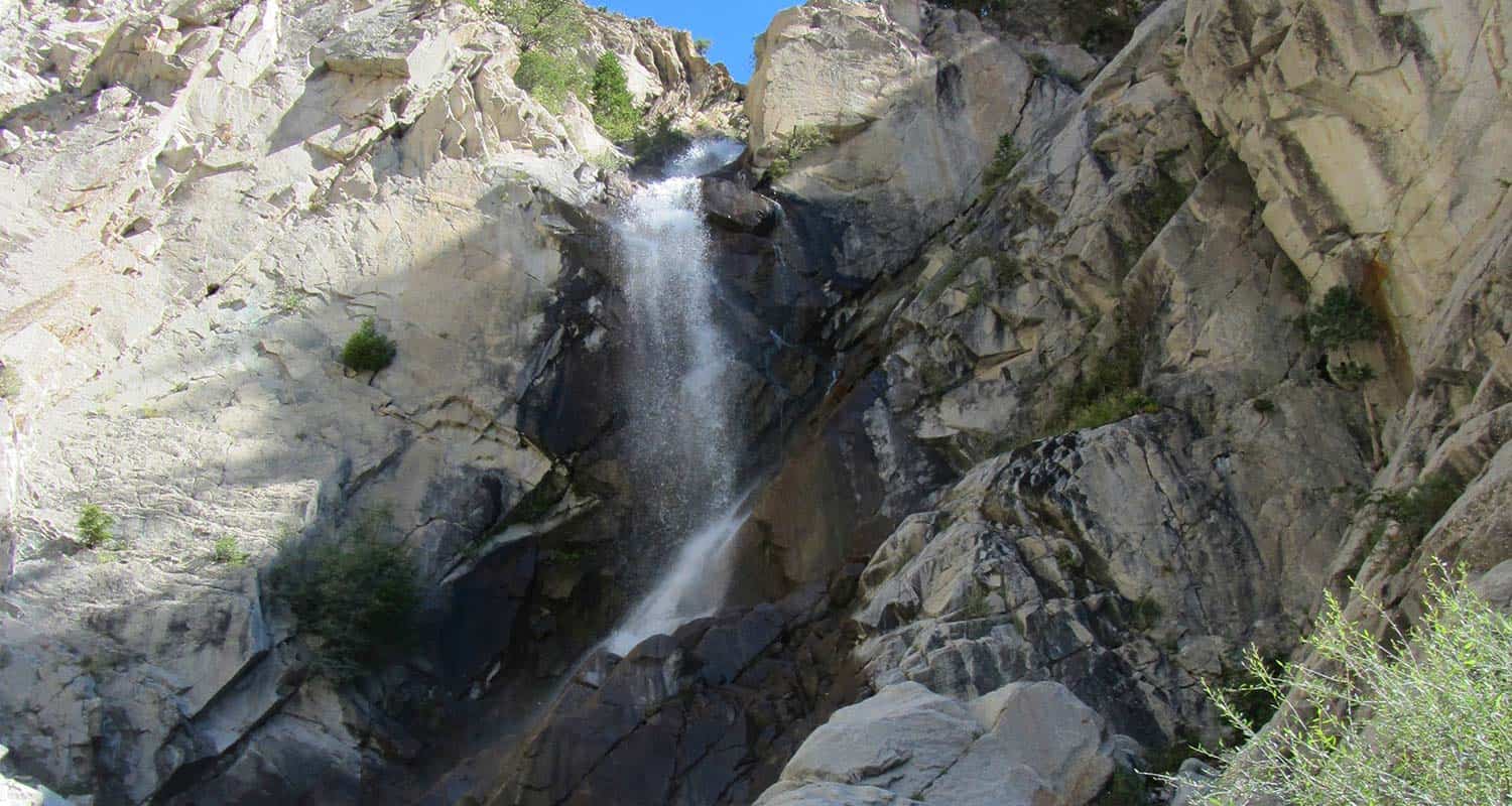
Agnes Vaille Falls Hike
Agnes Vaille falls is viewed on this 1 mile, easy, loop hike just south of Buena Vista, Colorado. Take in snow-capped Mt. Princeton and the white Chalk Cliffs of the canyon on what makes for a great family hike in the Arkansas River valley of Colorado.
Trail Snapshot: Agnes Vaille Falls
| Hike Distance | Approx. 1 mile |
|---|---|
| Difficulty | Easy to Moderate |
| Duration | Approx 1 hour |
| Trail Type | Loop |
| Starting Elevation | 9000′ |
| Elevation Gain | Approx +500′ |
| Seasons | Year Round |
| Dogs | Allowed On Leash |
| Hike Trail Map | Click for a USFS Map of Cascade Creek Loop |
| Denver Drive Time | 2hr 40min |
| Driving Directions to Agnes Vaille Falls | Click for Google Map |
| Town Nearest Hike | Buena Vista, Colorado |
| Beauty | Waterfall, Creek, Chalk Cliffs, Mountain Goats |
| Activities | Hiking, photography, USFS interpretive signs |
Parking & Trailhead Information for Agnes Vaille Falls
From Denver, take HWY 285 South for 124 Miles to Nathrop, Colorado. Take Chalk Creek Drive/CO-162 West for 8.7 miles into Chalk Creek Canyon. On this 8.7 mile segment, you'll Pass the Mt. Princeton Hot Springs Resort, then the Mt. Princeton USFS Campground. Just after the campground, the Cascade Creek Trailhead will be on the right, directly across from the Chalk Lake Campground. This whole segment of road, going up to St. Elmo has several camping options. Parking is limited at the Cascade Creek trailhead to about 12 vehicles. It's easy to miss the trailhead, so be sure to slow down and keep an eye out after you pass the Mt. Princeton Campground. The trail starts at the "Agnes Vaille" sign.
The Hike: Agnes Vaille Falls
The trail to Agnes Vaille Falls used to be a 1.2 mile out-and-back trip. Now, the upper segment is closed, so hikers are directed to take the approximately 1-mile loop hike on the Cascade Creek trail that still offers a view of the waterfall. Why did the upper trail to Agnes Vaille close? Sadly, in 2013, while on a family hike, a rockslide broke loose, tumbled down the canyon below the falls and killed 5 members of the hiking party. Plans are underway to rebuild the out-and-back trail, but no dates are posted for when it will be reopened. Follow the USFS regulations in this area as posted on the signage. The closed area of the trail may still be unstable and should not be hiked.
The Cascade Creek Loop creek still makes for a great family hike and offers views to the waterfall, and Mt. Princeton. The Chalk Cliffs surround the loop and look like something out of a storybook. In the fall, the aspen trees and cottonwoods glow with golden hues along the top bend of the loop. Mountain goats and bighorn sheep can be spotted along the rock above the trail.
Be sure to stop and read the USFS interpretive signs describing the history of the area, and the historical figures of of Agnes Vaille and Chief Antero for whom the waterfall and nearby 14er mountain, Mt. Antero, are named.
Tips & Resources for Hiking Agnes Vaille Falls
- Waterfall Peak: The best time of year to see Agnes Vaille falls will be in the early summer months of May and June, when the snowmelt is at it's highest volume. Some years, if we have a heavy snowpack or late snows, flows can still be high into July.
- Unstable Rock: While the areas is repaired and trail rerouted, this entire area is known for its unstable rock. Just a good look at the chalk cliffs gives you an idea of the geologic variety and instability of the area. Large boulders can shift and rocks accidentally knocked loose can injure hikers below. So, stay the trail, be alert, and follow the USFS regulations.
- Hike, Camp, and Soak: Because there is camping nearby, more hiking, and amazing hot springs, make a weekend visit fo the area to take in the sights and relax. Drive up further on Cascade Creek road to take in Alpine Lake and the Colorado ghost town of St. Elmo.
- Trail Map: Agnes Vaille Falls
- Packing List: Always pack the 10 Essentials. Download our Hiking Guide to get the list and dayhiking packing checklist.
- Colorado Road Conditions: Colorado Road Conditions
- Photo: We would like to express our gratitude to Brad Patterson for sharing such an amazing photograph of this hike at Agnes Vaille Falls.
- After the Hike: Soak at Mt. Princeton Hot Springs Resort

Weather
Map & Driving Directions
Click for Driving Directions
Horsethief Falls Hike Near Colorado Springs
Horsethief Falls is a small slab waterfall located 45 minutes from Colorado Springs on the West side of Pikes Peak. The Horsetheif Falls trail requires a 1.4-mile easy hike (one-way) to the falls. This hike, along with nearby Pancake Rocks make for great fall hiking and a scenic falls drive to see the golden aspens of the Colorado Front Range. The Horsethief Falls Trails joins up with two other trails if you would like to add more time to your adventure and explore the rock formations of this unique area. See the full Horsethief Falls hike profile below for trail map, driving directions, and more tips and details to help you enjoy this adventure near Colorado Springs.
Trail Snapshot: Horsethief Falls Hike
| Hike Distance | 2.8 miles Round Trip |
|---|---|
| Difficulty | Easy |
| Duration | Approx 2 hrs |
| Trail Type | Out and Back |
| Starting Elevation | 580′ |
| Elevation Gain | Approx +750′ |
| Seasons | May to October |
| Dogs | Allowed On Leash |
| Hike Trail Map | Horsethief Falls and Pancake Rocks Trail Map |
| Denver Drive Time | 2 hr |
| Driving Directions to Horsethief Falls Trailhead | Click for Google Map |
| Town Nearest Hike | Cripple Creek, Colorado |
| Beauty | waterfall, creek, pine, beaver ponds, rock formations, fall colors |
| Activities | Hiking, photography, mountain biking, snowshoeing, camping |
Horsethief Falls Trailhead Directions
Horsethief Falls trailhead is located just off of Highway 67 about halfway between Divide and Cripple Creek, Colorado. From Divide, turn south on Highway 67 and drive approximately 9.3 miles until you spot a closed railroad tunnel on the left side of the road. Just past the tunnel the road will bend and the trailhead parking area is on the left side of the road. Zoom in on the driving directions map at the bottom of this post to get a better visual on the parking area.
The Hike: Horsethief Falls Trail
The Horsethief Falls Trail begins on right side of the old tunnel exit, following a wide dirt path steadily uphill before eventually flattening out. The elevation gain for this hike is just a bit over 500', so we considered grading its difficulty-level as moderate. However, because it's just 1.4 miles one-way, we kept it in the Easy hikes category.
The trail will cross the shallow creek at about 0.7 mile in. Here, hikers will encounter the first intersection. The Ring the Peak Trail (marked "Horsethief Park Trail" on the map) bears to the left, but the way up to Horsethief Falls is to continue straight on the Horsethief Falls Trail. Crossing the creek again the trail will soon intersect, at about 0.9 mile, with the Pancake Rocks Trail (on the right). Again, continue straight on the Horsetheif Falls trail. In this area, you'll be able to take in views to the northeast of Sentinel Point. This is an almost perfect area to take in the changing aspens along the forests surrounding Pikes Peak.
The trail will bend to the right (south) and cross over the creek once again and make its way up to the base of Horsethief Falls.
Tips & Resources for Hiking Horsethief Falls Hike
- TIP: To make the trail longer, you may opt to proceed to the Ring the Peak Trail to Putney Gulch via Horsethief Park, or hike up to Pancake Rocks Trail.
- Go Early: Parking is limited and that can be a problem.
- Trail Map: Horsethief Falls Trail Map
- Packing List: Always pack the 10 Essentials. Download our Hiking Guide to get the list and dayhiking packing checklist.
- Colorado Road Conditions: Colorado Road Conditions
- After the Hike: Home Café in Cripple Creek
Weather
Map & Driving Directions
Click for Driving Directions
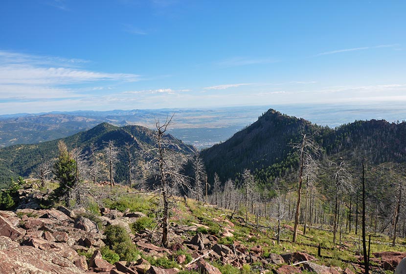
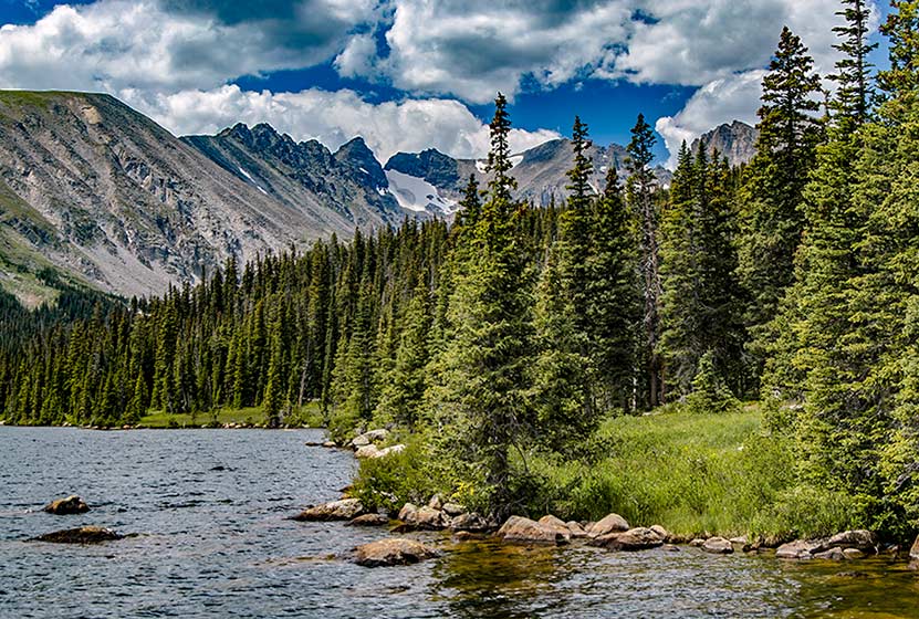
South Boulder Peak
South Boulder Peak is a demanding 3.7-mile hike (one-way) situated above the South Mesa in the famous Flatirons region near Boulder Colorado. Hikers can bag nearby Bear Peak on the same trip and return via Fern Canyon to make an 8.7 mile loop. Explore the full South Bolder Peak hike profile below for the trail map, driving directions, and more tips and details to help you enjoy this adventure near Boulder, Colorado.
South Boulder Peak Trail Snapshot
| Hike Distance | 7.4 Miles Round Trip or approx. 8.7 Mile Loop |
|---|---|
| Difficulty | Difficult |
| Duration | Approx 3-5 hrs |
| Trail Type | Out and Back or Loop Option |
| Starting Elevation | 5650′ |
| Elevation Gain | Approx +2900′ South Boulder Peak 8550' |
| Seasons | Year Round |
| Dogs | Allowed On Leash |
| Hike Trail Map | Click for a Map South Boulder Peak and South Mesa Trailhead |
| Denver Drive Time | 45 Minutes |
| Driving Directions to South Boulder Peak via South Mesa Trailhead | Click for Google Map |
| Town Nearest Hike | Boulder, Colorado |
| Beauty | Peak Top Views, Canyon, Wildflowers, Sunrise, Meadows, Wildlife: Deer, Bear, Birding. |
| Activities | Hiking, Trail Running, Photography |
Parking & Trailhead Information for South Boulder Peak
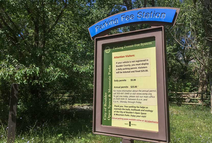
The trail to South Boulder Peak begins at the South Mesa Trailhead off of Eldorado Springs Drive just South of Boulder, Colorado. From Denver, drive North on interstate 25 to 36 toward Boulder. Take the McCaslin Blvd exit and then go South/West onto McCaslin. At the intersection of McCaslin and Marshall, take a right onto Marshall Road. Marshall will eventually intersect with Eldorado Springs Drive. Take a left onto Eldorado Springs Drive. About two miles down the road, you'll find the South Mesa Trailhead on the right. The South Mesa Trailhead is a part of the Boulder County Open Space and requires a daily parking fee, or an annual pass. I went online and bought an annual parking pass through the Open Space website. This gives you access to all the southern fee parking areas as well as the parking areas on Flagstaff Mountain. There are restrooms at the trailhead but not potable water.
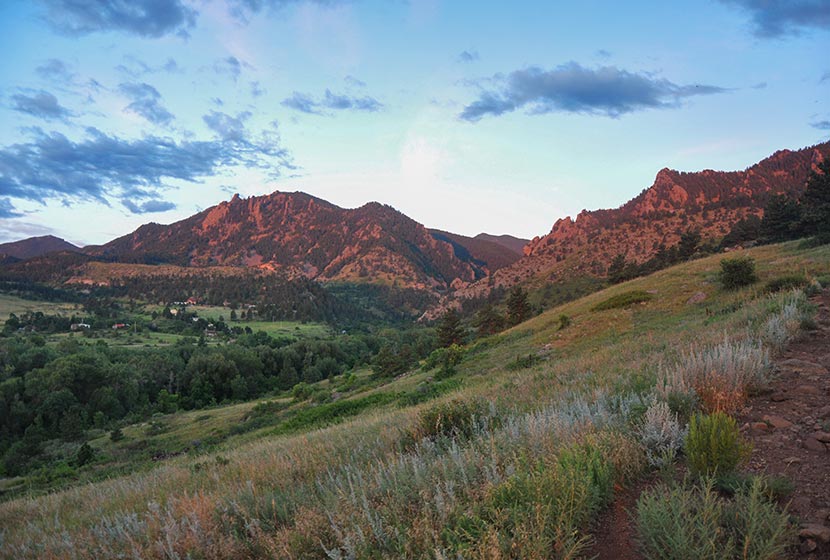
The Hike: South Boulder Peak
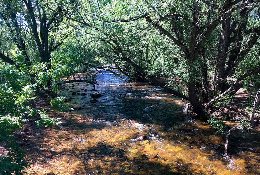
If you study a map of the South Mesa area, you'll notice that it's a complex network of trails. Tis is great for exploring the mesa, but when summiting a peak, you'll want to preserve as much energy as possible by taking the most direct route. The first trail choice presents itself after crossing the bridge over small bridge that spans Boulder Creek.
We took the Homestead Trail, a 1.3 mile segment to a connector segment of the Mesa Trail. It will be marked "Mesa Trail" and have an arrow pointing left to the Shadow Canyon Trail and Right to the Towhee Trail. The way to South Boulder Peak will be to head left toward Shadow Canyon. During this first segment, you'll gain great views down into the entrance of Eldorado Canyon .
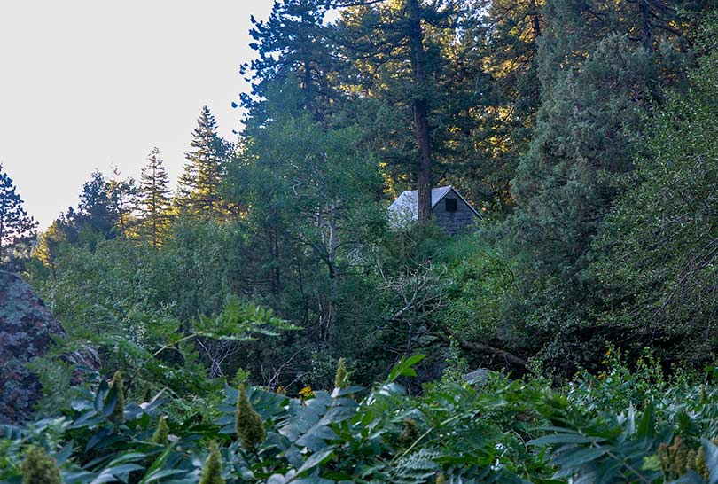
The first 0.4-mile segment of the Shadow Canyon South Trail is gradual. At any of the other trail intersections keep taking those marked "Shadow Canyon." Eventually, the trail leads into a densely wooded ravine where an old cabin is tucked away in the undergrowth
You'll know when you've entered Shadow Canyon because the trail becomes steep and demanding. It's more humid, too, so the rock can get slippery. Be mindful of your steps and prepared to ascend over a mile of fairly rugged terrain.
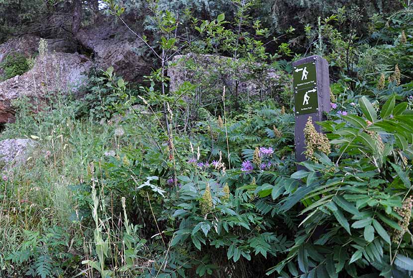
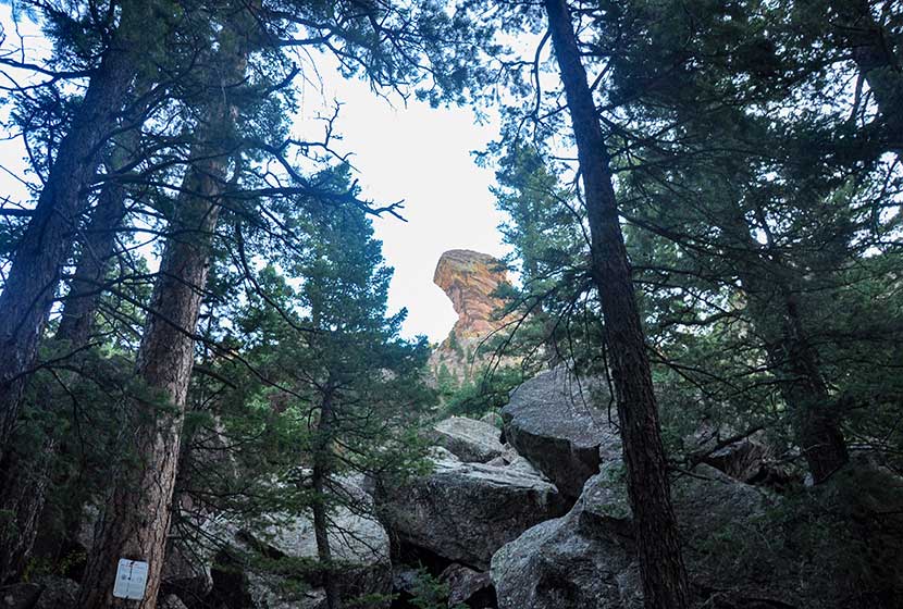
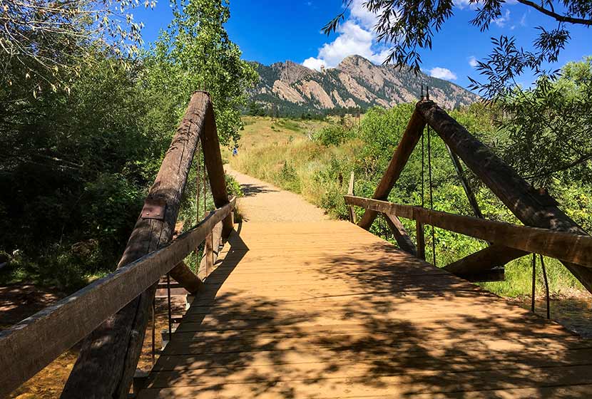
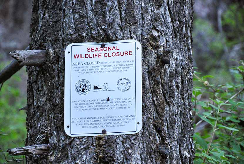
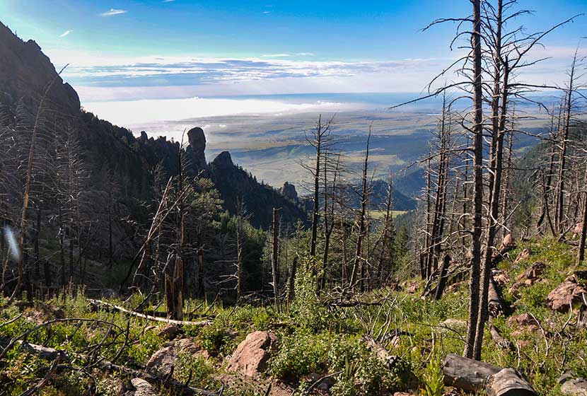
Shadow canyon is an access point for a prominent rock formation, Devils Thumb. Seasonal closures (see photo below) protect nesting raptors. Be sure to stay out of this area from Feb. 1st to July 31st. The Shadow Canyon Trail is not closed during this time, but refrain from going off-trail or taking social trails in the closure area during these periods.
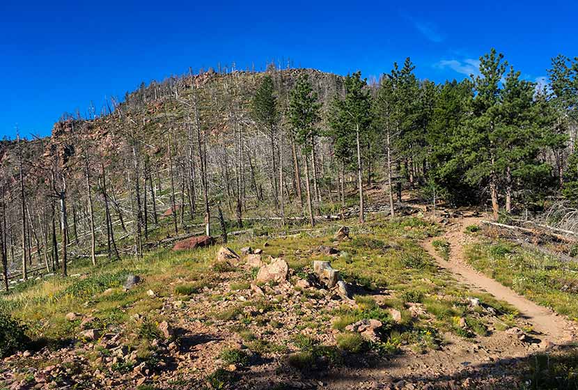
The trail pops out of the canyon onto saddle between South Boulder Peak and Bear Peak. The first thing you'll notice is a burn area that stretches all the way to the top of South Boulder Peak. It's the result of the 2012 Flagstaff fire.
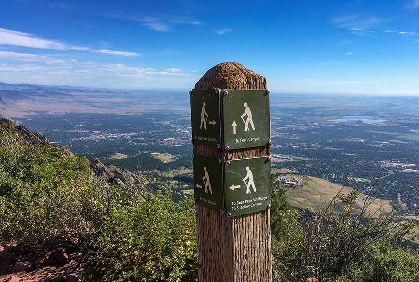
At the saddle ridge, another trail sign notes the way to South Boulder Peak, a 0.3 mile trail climbs to the summit. You'll notice that the trail to the right leads the same distance to Bear Peak.
At points, the trail becomes difficult to discern and requires a little bit of bouldering to make it to the top. Whenever I'm in these rocky segments, I try to be mindful of those behind me. It's easy to inadvertently cause a rock to shift and tumble toward the hikers below. Most of the rock is stable, but it's smart to be aware as you navigate these kinds of areas. The back side of the summit is exposed, so do not approach or descend the peak via this route. And be mindful of the exposure while on the peak.
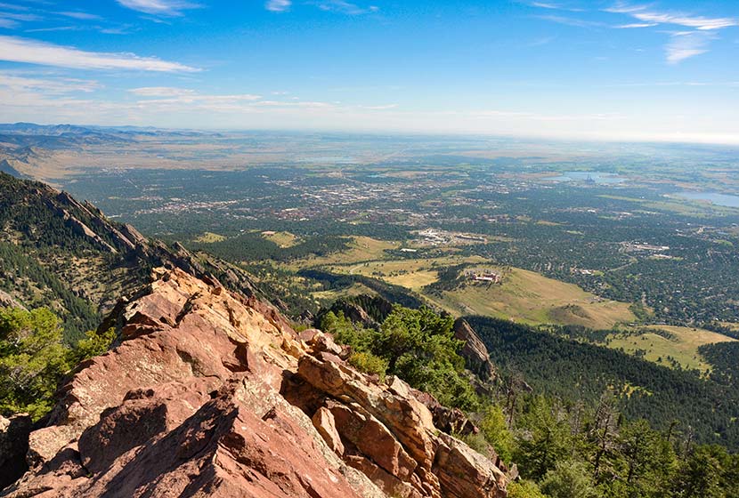
The pink granite summit offers 360 degree panoramic views (see the video below).
You can also see the summit of Bear Peak just 0.6-mile to the Northeast. If you want to summit Bear Peak, be sure to review our Bear Peak Hike Profile.
From the summit of South Boulder Peak your options are to 1) Descend via the approach route (7.4 miles round trip), 2) Summit Bear Peak and return via the approach route (8 miles total), or 3) Summit Bear Peak and return via Fern Canyon (approx. 8.7 miles). It's important to know that the descent into Fern Canyon is more demanding than the return via Shadow Canyon. For the loop route via Fern Canyon, explore our Bear Peak Trail Profile.
Tips & Resources for Hiking to South Boulder Peak
- Hiking with Your Dog: Though dogs are allowed on leash, I wouldn't put South Boulder Peak on the dog-friendly list because of the rocky area at the summit and the ascent up fern canyon.
- TIP: Be ready for the hike down to be demanding on your knees and ankles, especially if you choose to descend via Fern Canyon. Trekking poles would be helpful.
- Weather: As with all hikes on the Front Range, especially peak hikes, be weather aware. Thunderstorms can emerge suddenly, especially in the early afternoon in the Summer months.
- Trail Map: South Boulder Peak Map from South Mesa Trailhead
- Packing List: Always pack the 10 Essentials. Download our Hiking Guide to get the list and dayhiking packing checklist.
- Colorado Road Conditions: Colorado Road Conditions
- After the Hike Cafe: Walnut Cafe in Boulder
- After the Hike Brewery: Sanitas Brewing Company
Weather
Map & Driving Directions
Click for Driving Directions

Bear Peak Near Boulder
Bear Peak is a demanding 7.4-mile hike (round trip) through the broad meadows of South Mesa, up through the rocky trail of shadow canyon, to the granite summit with sweeping 360 degree views of the Colorado Front Range. Hikers can summit South Boulder Peak on your way and make a loop hike out of your adventure by returning via Fern Canyon. Explore the full Bear Peak hike profile below for the trail map, driving directions, and more tips and details to help you enjoy this adventure near Boulder, Colorado.
Bear Peak Trail Snapshot
| Hike Distance | 7.4 Miles Round Trip or 8.4 Mile Loop |
|---|---|
| Difficulty | Difficult |
| Duration | Approx 3-5 hrs |
| Trail Type | Out and Back and Loop Option |
| Starting Elevation | 5650′ |
| Elevation Gain | Approx +2800′ Bear Peak 8461' |
| Seasons | Year Round |
| Dogs | Allowed On Leash |
| Hike Trail Map | Click for a Map Bear Peak and South Mesa Trailhead |
| Denver Drive Time | 45 Minutes |
| Driving Directions to Bear Peak from South Mesa Trailhead | Click for Google Map |
| Town Nearest Hike | Boulder, Colorado |
| Beauty | Peak Top Views, Canyon, Wildflowers, Sunrise, Meadows, Wildlife: Deer, Bear, Birding. |
| Activities | Hiking, Trail Running, Photography |
Parking & Trailhead Information for Bear Peak
Access to Bear Peak is from the South Mesa Trailhead off of Eldorado Springs Drive just South of Boulder. From Denver, drive North on interstate 25 to 36 toward Boulder. Take the McCaslin Blvd exit and then go South/West onto McCaslin. At the intersection of McCaslin and Marshall, take a right onto Marshall Road. Marshall will intersect with Eldorado Springs Drive. Here, take a left onto Eldorado Springs Drive. About two miles down the road, you'll find the South Mesa Trailhead on your right. The South Mesa Trailhead is a part of the Boulder County Open Space and requires a daily parking fee, or an annual pass. I went online and bought an annual parking pass through the Open Space website. This gives you access to all the southern fee parking areas as well as the parking areas on Flagstaff Mountain. There are restrooms at the trailhead.
The Hike: Bear Peak
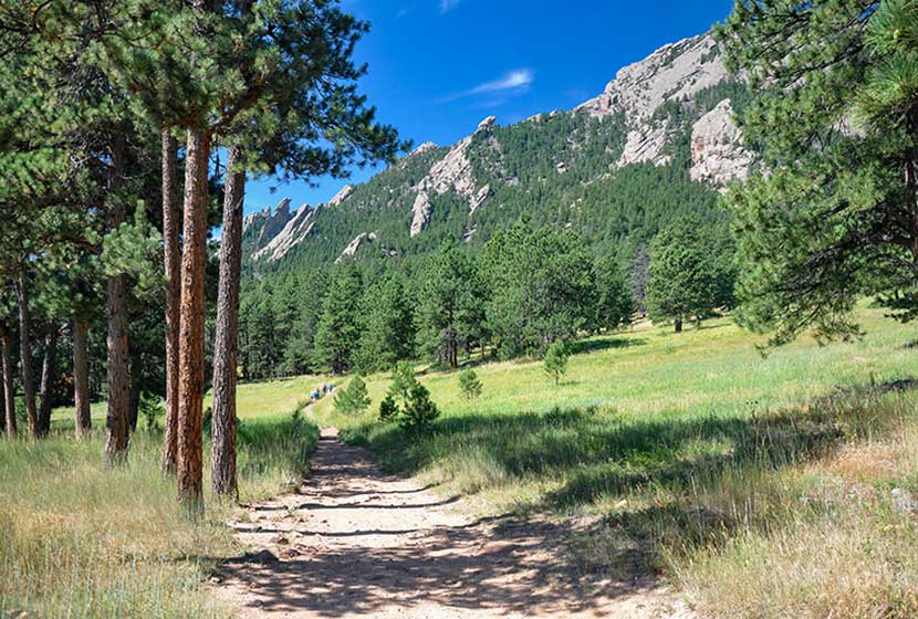
From the South Mesa Trailhead, the trail leads across a small bridge spanning over Boulder Creek. Willow trees arch over the stream making it worth a short pause to take in the sounds of water before you set off across the meadows of South Mesa. There are many trail options, but the most direct is to take the Homestead Trail, which heads West across a gentle grade toward Shadow Canyon.
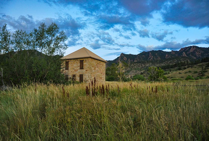
This first mile or so of the hike is easy and offers stunning views of the Flatirons and views of the entrance of Eldorado Canyon. An old stone building, part of an early homestead is the first marker you'll pass early in the hike.
After about 1.3 miles, the trail will split. Take the left (West) trail, which leads to the South Shadow Canyon Trail. After about a 1/2 mile, you'll encounter a 2nd trail split. The Shadow Canyon Trail will again bear to the left and begin heading up steeper terrain.
As the trail ascends, you soon leave the meadow and enter into more dense ponderosa pine forest. The vegetation in the understory grows tall and green at the entrance to the canyon. You'll see another cabin with a metal roof (pictured below). Soon past the cabin will be another important trail juncture. Again, the trail up Shadow Canyon will bear left (West).
Once in Shadow Canyon, the trail now becomes much more steep and requires navigating over rock and tree roots. This segment of the trail traveling up through the canyon is over a mile, so be ready for a steady and demanding climb.
The canyon is an access route for Devils Thumb, a prominent rock formation along this ridge. There are seasonal closures (see photo below) because of nesting raptors. Be sure to stay out of this area from Feb. 1st to July 31st. You are welcome to stay on the Shadow Canyon trail--it's not closed during this time--but refrain from going off-trail or taking social trails during this time up to Devils Thumb.
Eventually, the trail emerges from the canyon onto the saddle between South Boulder Peak and Bear Peak. This area is marked by a burn area, and in the late summer, raspberry plants grow trailside full of ripe berries. The burn was ignited by lightning in June of 2012. Named the Flagstaff Fire, it consumed about 300 acres before being contained by firefighters.
Another trail sign notes the way to Bear Peak, a 0.3 mile trail segment curving North up the back of the summit.
You'll notice more burn area on the left (West) side of the trail. The rock on the trail becomes increasingly brittle as you go, so be aware of those hiking below you and be sure to hike on the most secure and durable surfaces.
The final segment requires a scramble along about 25 yards of angled rock. Take your time and scope out the safest route to the summit. Most peaks along the Front Range have broad tops, but Bear Peak is tapered to a point with exposure on all sides. Several USGS markers are set into the rock (I think I counted 3--which is unusual). The views are great, both to the East and to the mountains in the West.
There are two options for the return hike: 1) to hike the 3.7 miles back through Shadow Canyon, retracing the same trails, or 2) to make a loop out of the hike by descending via Fern Canyon (about 4.7-mile return). The rest of this profile will follow the Fern Canyon to Mesa Trail return.
A sign marking the trail down Fern Canyon is located right at the base of Bear Peak (where the trail turns into a scramble up the summit). The descent into Fern Canyon is very steep and the rock is very loose. Hikers will also encounter people making their way up the trail, so be sure to move off to the side and grant right-of-way to hikers who are doing the harder work of ascending the trail. I would not recommend hiking up to Bear Peak from this route because the trail is way more demanding than the Shadow Canyon approach.
After about 1/2 of a mile descending this steep saddle, the trail will bear right (East) into Fern Canyon via a series of switchbacks. Eventually, the trail will emerge from Fern Canyon back onto the more gentle slopes of South Mesa. Look for signs for the Mesa Trail, and follow them South back to the South Mesa Trailhead.
The hike back on the Mesa Trail travels in and out of the shade of Ponderosa pines and along the pink and orange Flatiron mountains that make this area so spectacular. We took the Upper Bluestem trail to some small connector trails leading back to the trailhead. Another approach is stay on the Mesa Trail (see map) until it connects back to the Homestead Trail.
Tips & Resources for Hiking to Bear Peak
- Weather: As with all hikes on the Front Range, especially peak hikes, be weather aware. Thunderstorms can emerge suddenly, especially in the early afternoon in the Summer months.
- Hiking with Your Dog: Though dogs are allowed on leash, and I've encountered people hiking with their dogs on the trails up to Bear Peak, I wouldn't put Bear Peak on the dog-friendly list because of the steep rock at the summit summit and the difficulty of the terrain leading up through the canyons.
- TIP: Be ready for a hike that is really demanding on your legs, especially the descent through Fern or Shadow Canyon. Trekking poles would be helpful on the descent.
- TIP: Hike to South Boulder Peak. It adds just 0.6 mile to your trip.
- Trail Map: Bear Peak Map from South Mesa Trailhead
- Packing List: Always pack the 10 Essentials. Download our Hiking Guide to get the list and dayhiking packing checklist.
- Colorado Road Conditions: Colorado Road Conditions
- After the Hike Cafe: Walnut Cafe in Boulder
- After the Hike Brewery: Sanitas Brewing Company
Weather
Map & Driving Directions
Click for Driving Directions

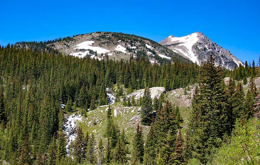
Jasper Lake Hike in Indian Peaks
Jasper Lake requires a 5.5-mile (one-way) hike into the mountainous, wildflower-laden Indian Peaks Wilderness. Just 40 minutes outside of Boulder Colorado and about 1hr 15 minutes from Denver, the trail to Jasper Lake gets its start at the Hessie Trailhead. Travel an additional mile beyond Jasper to see Devils Thumb, a striking rock formation that looms above Devil's Thumb Lake. Explore the full Jasper Lake hike profile below for trail map, driving directions, and more tips and details to help you enjoy this adventure in the Indian Peaks Wilderness.
JASPER LAKE TRAIL SNAPSHOT
| Hike Distance | 11 Miles Round Trip |
|---|---|
| Difficulty | Difficult |
| Duration | Approx 6-7 hrs |
| Trail Type | Out and Back |
| Starting Elevation | 8642′ |
| Elevation Gain | Approx +2175′ |
| Seasons | May through Sept. |
| Dogs | Allowed On Leash |
| Hike Trail Map | Click for a Map of Jasper Lake in Indian Peaks Wilderness |
| Denver Drive Time | 1 hr 15min |
| Driving Directions to Hessie Trailhead | Click for Google Map |
| Driving Directions to Shuttle Parking in Nederland | Click for Google Map |
| Hessie Shuttle Details | @ Boulder County Hessie Page |
| Town Nearest Hike | Nederland, Colorado |
| Beauty | alpine lakes, waterfalls, meadows, creek, wildflowers, aspen groves, fall colors, wildlife: moose |
| Activities | Hiking, snowshoeing, cross-country skiing, camping (by permit only), fishing |
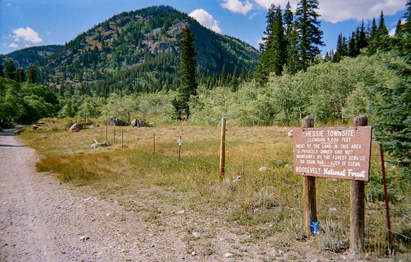
Parking & Trailhead for Jasper Lake Hike
The parking at Hessie Trailhead is limited, so be sure to take some time to review these details before departing for your hike to Jasper Lake. There is a free shuttle that runs from Nederland every 15-20 minutes on weekends during the Summer months and on some holidays. For full details on the Hessie Trailhead Shuttle, please visit the Boulder County page for the Hessie Trailhead shuttle service. This shuttle departs from the RTD Park-n-Ride in Nederland, CO.
Directions to Hessie Trailhead
At the roundabout in Nederland, Colorado, drive south onto CO-119/South Bridge St. Take a right onto Eldora Road which will take you to Elodora Colorado. The road continues through Eldora, and changes to Eldorado Road. It proceeds out of town and changes its name to Hessie Road. About 3/4 of a mile outside of Eldora, the road will split, 4th of July Road goes to the right, and Hessie will turn to the left. The 2WD Hessie Trailhead Parking area is at this split. Do not park alongside the road, as you will likely be fined. If the parking area is full, then go back to Nederland for the shuttle (weekends and holidays). There is parking for 4WD vehicles further up the dirt road and closer to the beginning of the official trail. It's important to know that rains can quickly flood this segment of Hessie Road between the 2WD and 4WD trailheads.
The Hike: Jasper Lake Trail
Most hikers will begin the hike up to Jasper lake at the Hessie 2WD parking area. This adds about 1 mile to the total hike distance, making this an 11-mile hike (round-trip). It's also where the shuttle drops off hikers. At the 2WD parking area, pick up the trail that runs along the north side of the 4WD dirt road. The trail will take you within view of a small pond. Moose frequent the wetlands on this segment of the trail, so be alert--you may get a chance to snap some photos of them.
At approximately 1/2 mile from the shuttle drop, a sign marks the site of the old mining town of Hessie, Colorado. The trail then crosses a footbridge over Middle Boulder Creek. Soon after the bridge, you'll find the official trailhead signage. Because this is a longer hike into demanding terrain, we recommend Trails Illustrated: Indian Peaks Wilderness map for this hike.
After crossing the bridge near the trailhead, the trail climbs the mountainside via an old mining road. After 1/4 mile, the forest gives way to a meadow and opens up to panoramic views of the peaks of Indian Peaks. At the first trail intersection, both trail options will take hikers to Jasper Lake, and both options are approximately the same length. The right-hand trail is called the "Devils Thumb Bypass trail" and was created for Spring and Early Summer hikers to help avoid the mud and pools of water created by early season snowmelt. However, the trail leading to the left, the Devils Thumb Trail, will be a more scenic choice.
Small waterfalls and cascades are spotted along the trail as it follows the course of Middle Boulder creek. Indian Peaks Wilderness is known for its brilliant wildflowers that bloom from early to mid-summer. If traveling on the the Devils Thumb (main trail) then you'll encounter a second intersection marked by signage pointing left to Lost Lake and King Lake, and right for Devils Thumb Lake, Jasper Lake, and Woodland Lake. Taking the right-hand trail continues alongside Middle Boulder Creek and leads up to Jasper Lake.
The next intersection will have a left-hand trail that leads to Woodland Lake and a right-bearing trail that leads to Devils Thumb and Jasper Lakes. This is where the bypass trail joins up to the main trail from the southeast. Now, the terrain becomes more demanding.
About 1/2 mile before arriving at Jasper Lake, a trail sign will point the way northeast to Diamond Lake. However, Diamond Lake is best accessed via the 4th of July Trailhead. Be mindful of the sky when emerging from the forest into the open sections of high-country meadows and tundra. Thunderstorms, during in the Summer months, can come up quickly due to orographic lift, a phenomenon caused by the heated rock faces of our mountains thrusting moisture into the skies along the Front Range.
If the weather is looking good and you're up to adding two more miles and approximately 1hr to your hike, then continue up the trail to Devils Thumb Lake to gain views and get photos another alpine lake and the rock formation of Devils Thumb that protrudes from the ridgeline.
Tips & Resources for Hiking to Jasper Lake
- Camping: Camping is allowed by permit only and in designated spots. See the Indian Peaks Alliance page for details.
- USFS Indian Peaks: Camping is allowed by permit only and in designated spots. See the Indian Peaks USFS Page page for details.
- Trekking Poles: Because it's an 11-mile trek over rocky terrain, we recommend Trekking Poles.
- Parking: Parking is very limited at the Hessie trailhead, so try to arrive before 7am to find a space. Review trailhead information above for seasonal weekend and holiday shuttle service from Nederland.
- Trail Map: Jasper Lake near Nederland
- Packing List: Always pack the 10 Essentials. Download our Hiking Guide to get the list and dayhiking packing checklist.
- Colorado Road Conditions: Colorado Road Conditions
- Photo: We would like to express our gratitude to The John and Belinda Bosleyfor sharing photographs of this hike to Jasper Lake
- After the Hike: Train Cars Coffee
Weather
Map & Driving Directions
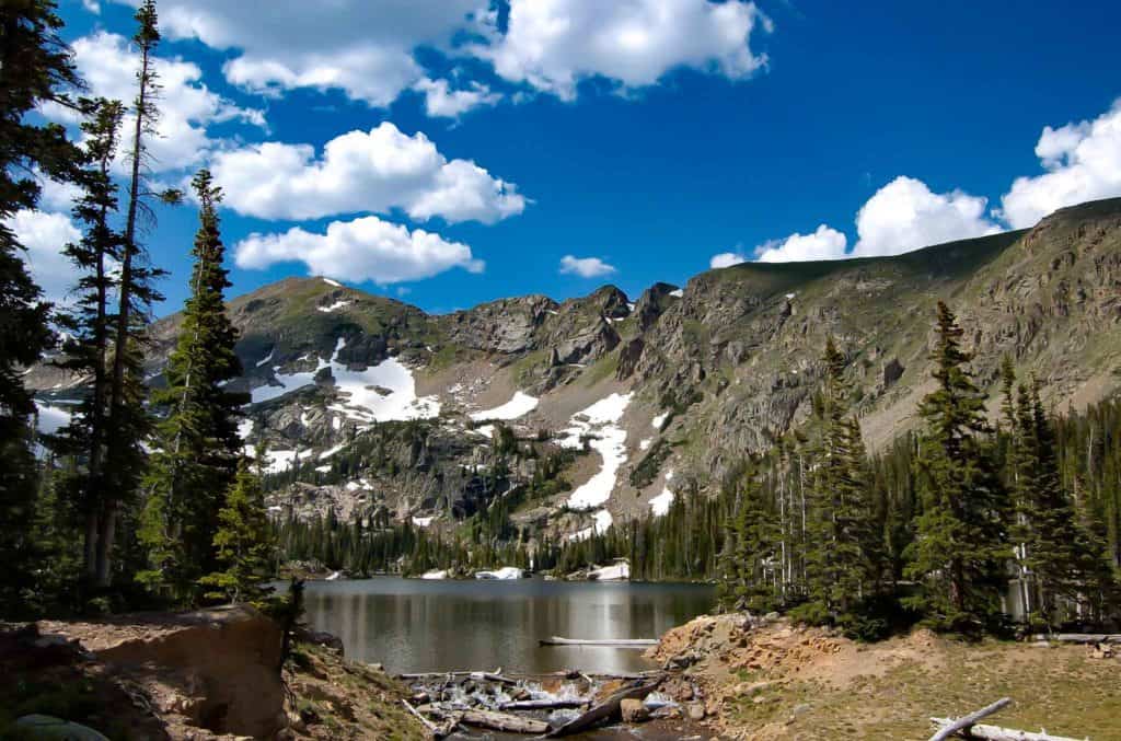
Long Lake Loop in Indian Peaks
Long Lake offers an easy 1.5 mile loop hike in Indian Peaks Wilderness. Located about 1 hour West of Boulder, Colorado, Long Lake is an easy-to-access alpine lake with stunning scenery. It's a popular spot, especially in the Summer months, so be sure to read the details on access fees and the notes below on the Long Lake Trailhead. Explore the full trail profile for trail maps, driving directions to Long Lake and more.
Long Lake in Indian Peaks - Trail Snapshot
| Hike Distance | 0.6 mile or 1.5 miles |
|---|---|
| Difficulty | Easy |
| Duration | Approx 1 hr |
| Trail Type | Out and Back & Loop |
| Starting Elevation | 10,500′ |
| Elevation Gain | Approx +100′ |
| Seasons | Mid-June to Mid-Oct. Depending on Weather |
| Dogs | Dog Prohibited in specific Brainard Rec. areas and on Jean Lunning and Pawnee Pass Trails. See USFS page for details. |
| Hike Trail Map | Click for a Map of Long Lake Area in Indian Peaks |
| Denver Drive Time | 1hr 30min |
| Driving Directions to Meyer Homestead Trailhead | Click for Google Map |
| Town Nearest Hike | Ward, Colorado |
| Fee: | Entrance Fee to Brainard Rec. Area Required |
| Beauty | Lake, mountain peak views, wildflowers, moose/td> |
| Activities | Hiking, cross-country skiing, snowshoeing, photography |
Parking & Trailhead Information for Long Lake Loop
Note: This trailhead can only be reached by using Brainard Lake Road, which has seasonal closures. Because the Brainard Lake Recreation area is extremely popular, this entrance road experiences high amounts of traffic during weekends on the Summer. See the USFS page for details. For Brainard Lake Road closure status, see the Boulder Ranger District roads page.
From Boulder, Colorado, head North on US36/28th Street. Take a left onto Lee Hill Road. Lee Hill Road will dead-end at an intersection with Left-Hand Canyon Road. Take a left onto Left-Hand Canyon Road heading West. Eventually, Left-Hand Canyon Road will turn into Indiana Gulch Road and will turn into Utica Road upon entering the town of Ward, Colorado. Utica turns into Nelson Road (lots of name changes on this trip) then ends at an intersection with 72/Peak to Peak Highway. Take a right onto 72, then the almost immediate next turn will be on your left for the Brainard Lake Road. Travel on Brainard Lake Road 2.2 miles to the entry station where you will need to pay the fee for the recreation area. As you approach the lake, bear right to continue on the Brainard Lake Road for another 1/2 mile, then turn right onto Mitchell lake Road. Go less than 1/10th of a mile, then turn left onto Long Lake Road. After about 1/3 of a mile, you will have arrived at the Long Lake Trailhead and parking area.
In the winter, the Brainard Lake Recreation area is a popular snowshoeing and cross-country skiing destination. However, all parking is at the Brainard Lake Gateway Trailhead (near the access gate). It is approx. 4-miles one-way from the Brainard Lake Gateway Trailhead to the Long-Lake Trailhead.
The Hike: Long Lake Loop Hike
From the Long Lake Trailhead, it's an easy and short 0.3-mile hike to Long Lake. Returning via this trail makes this a 0.6-mile out-and-back trip. However, to really take in the best of the Rocky Mountain Scenery, we recommend doing the full 1.5-mile loop.
Having reached the northeastern edge of Long Lake, head south over a footbridge and pick up the Jean Lunning Trail. The Jean Lunning trail travels alongside the southern perimeter of Long Lake and offers stunning views of the jagged mountain peaks surrounding the lake. Eventually, the Jean Lunning trail will intersect with the Pawnee Pass Trail. Take a right on the Pawnee Pass trail to head east and back to the short connector trail that leads back to the trailhead.
Tips & Resources for Hiking Long Lake
- TIP: During the Summer, avoid the traffic by visiting Long Lake during the weekdays. Arrive at the trailhead in the early morning to secure a parking place.
- Trail Map: Brainard Lake Area, Long Lake Trail Map
- Packing List: Always pack the 10 Essentials. Download our Hiking Guide to get the list and dayhiking packing checklist.
- Colorado Road Conditions: Colorado Road Conditions
- Photo: We would like to express our gratitude to Matt Lewis and Max and Dee Berntfor sharing photographs of this hike on Long Lake
- After the Hike: Marrocco’s
Weather
Map & Driving Directions
Click for Driving Directions