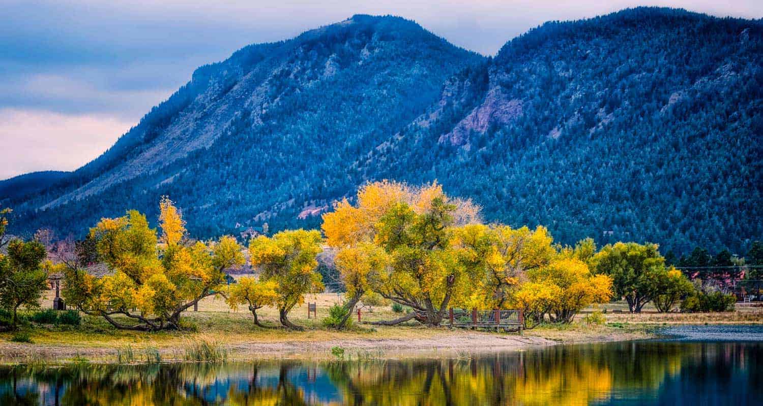
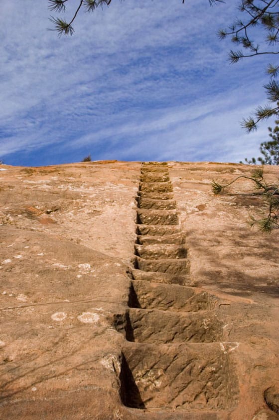
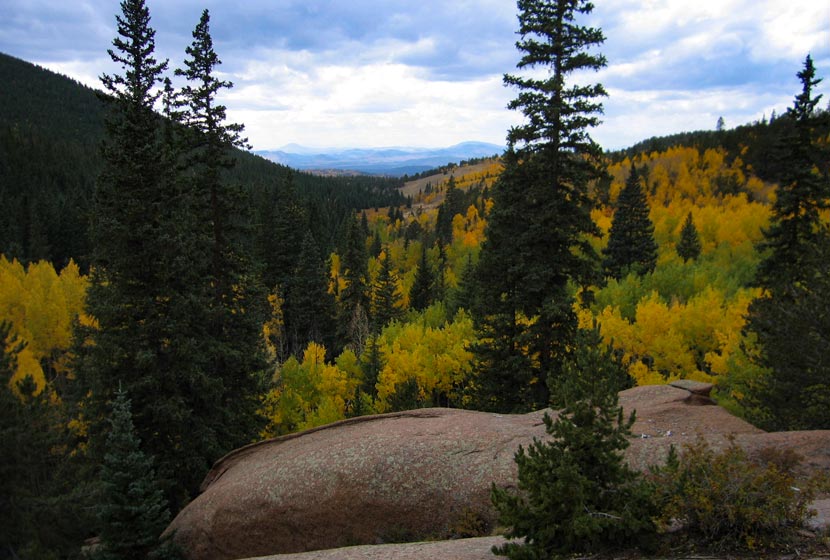
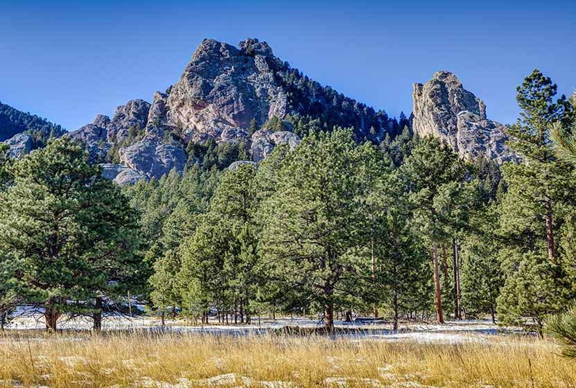
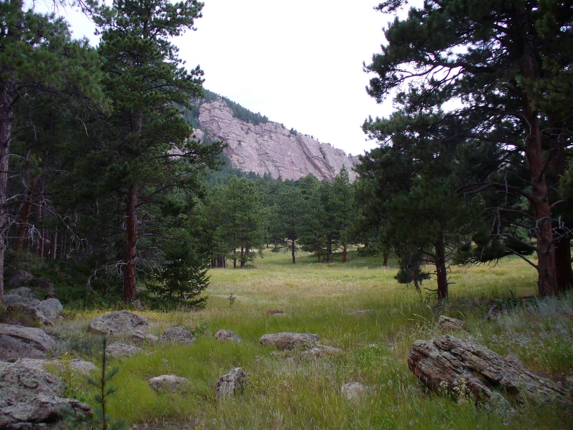
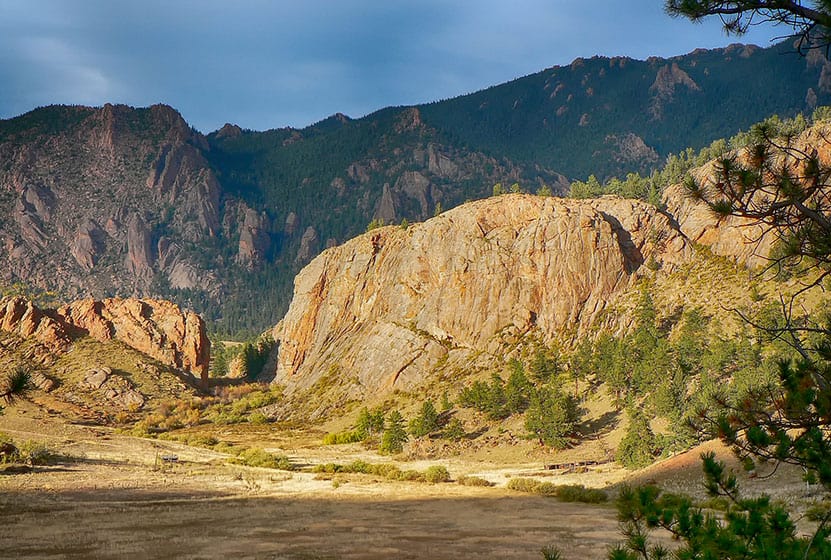
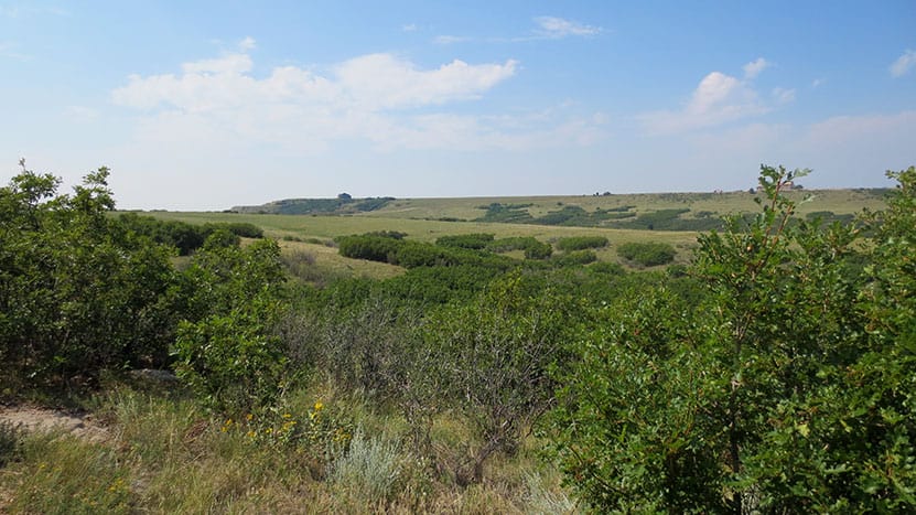
Santa Fe Regional Trail in Palmer Lake
The Santa Fe Regional Trail begins in Palmer Lake, Colorado, about 1 hour South of Denver. It's an easy trail with 17 miles from Palmer Lake to Colorado Springs along the old path of the Santa Fe Railroad. Explore the full Santa Fe Regional Trail hike profile below for trail map, driving directions, and more tips and details to help you enjoy this hike or bike adventure near Colorado Springs.
Trail Snapshot: Santa Fe Regional Trail
| Hike Distance | 1 to 17 miles one-way |
|---|---|
| Difficulty | Easy |
| Duration | Approx 1 hour+ |
| Trail Type | Out-and Back |
| Starting Elevation | 7200′ |
| Elevation Gain | Approx -900′ from Palmer Lake to Edmondson Trailhead |
| Seasons | Year Round |
| Dogs | Allowed On Leash |
| Hike Trail Map | Click for Trail Map of Santa Fe Regional Trail |
| Denver Drive Time | 1 hr |
| Driving Directions to Santa Fe Regional Trail Trailhead | Click for Google Map |
| Town Nearest Hike | Palmer Lake, Colorado and Colorado Springs |
| Beauty | Air Force Academy, Views of Pikes Peak |
| Activities | Hiking, Cycling, Trail Running |
Parking & Trailhead Information: Santa Fe Regional Trail
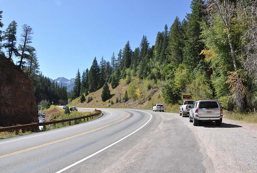
From Denver, take Interstate 25 south through Castle Rock and Larkspur, exiting onto County Line Road/Palmer Divide Road at exit 163, taking a right onto County Line Road. Stay on County Line Road for about 2.5 miles. Just before crossing the railroad tracks, the entrance to Palmer Lake Regional Recreation Area will be on your left. You'll see a sign and the first parking area. Drive past this parking lot to the larger lot. Here, at this south lot, you'll find restrooms, a playground, and the trailhead for the Santa Fe Regional Trail.
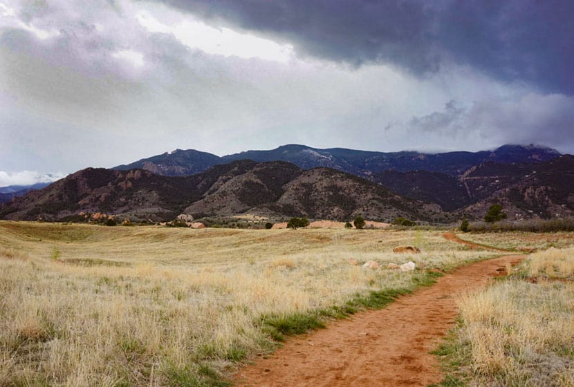
The Hike: Santa Fe Regional Trail
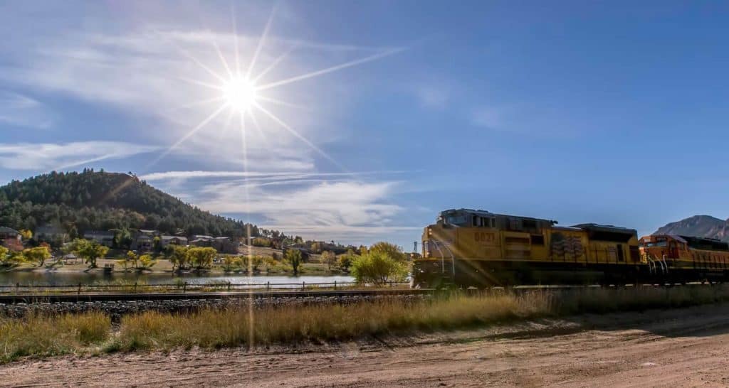
The Santa Fe Regional Trail begins in Palmer Lake and runs South for 17 miles where it merges with the Pikes Peak Greenway Trail. Because the trail follows the railroad grade of an abandoned railroad line, its relatively level, descending about 900 feet on its 17 mile course into Colorado Springs. This makes for a nice family bike ride, especially if you take two cars and drop a shuttle car off at the Edmondson Trailhead on the northern end of Colorado Springs. Here's a map link of both trailheads , and a link to the Edmondson Trailhead with driving directions from Denver.
North Trail Segment
In Palmer Lake, you have North and South hiking options. You can go North via the Santa Fe to Greenland Trail Link to pick up the Greenland Trail which winds through the wild green meadows and towering buttes south of Larkspur. That stretch from Palmer Lake to the Greenland Open Space Trailhead is 5.4 miles.
South Trail Segment
The South Trail segment of the Santa Fe Regional Trail runs through Palmer Lake and the town of Monument. Just south of Baptist Road the trail enters the Air Force Academy and runs parallel for a while with interstate 25. Then the trail makes a hard bend to the west, taking hikers and bikers away from the noise of the roads and winding
through into the draw of Monument Creek. It then bends its way behind (West of) the Air Force Academy airfield. This segment gives visitors a unique view of the Academy seen by few people. The trail then exits the Academy and enters the City of Colorado Springs. Just south of the Edmondson Trailhead, the Santa Fe Regional Trail merges onto the Pikes Peak Greenway.

Tips & Resources for Hiking Santa Fe Regional Trail
- TIP: Bike helmets are required on the Air Force Academy segment of the Santa Fe Regional Trail
- TIP: Be sure to pack the sunscreen because there is no shade on the trail.
- Trail Map: Santa Fe Regional Trail
- Packing List: Always pack the 10 Essentials. Download our Hiking Guide to get the list and dayhiking packing checklist.
- Colorado Road Conditions: Colorado Road Conditions
- Photo: We would like to express our gratitude to Christopher Rosenberger for sharing such an amazing photographs of this hike to in Palmer Lake.
- After the Hike: Rock House Ice Cream in Palmer Lake
Weather
Driving Directions
Map to Santa Fe Regional Trailhead
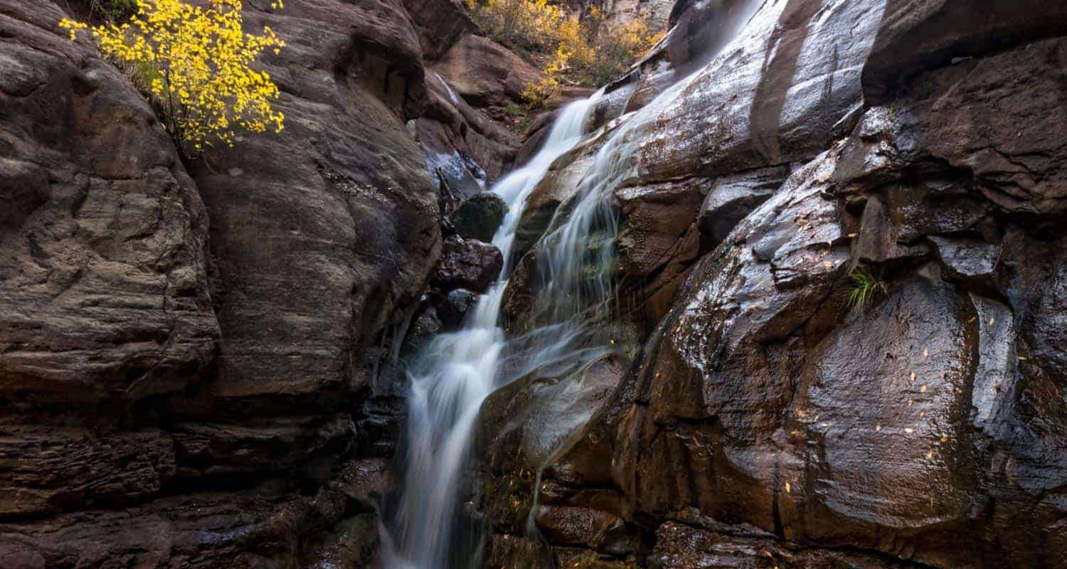
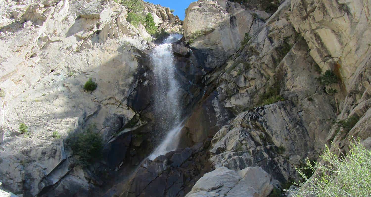
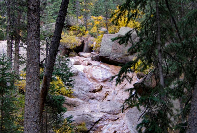
Hayes Creek Falls Waterfall
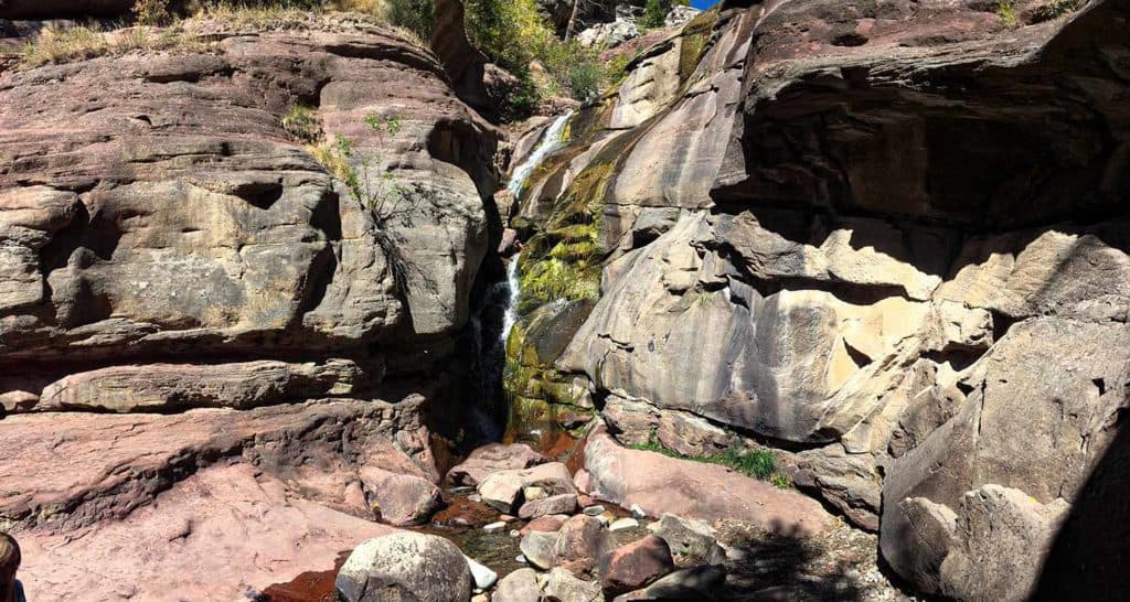
Hayes Creek Falls is a 40' waterfall with multiple cascades located just off CO-133 along the Crystal River near Redstone, Colorado. Accessed via a roadside pull-off, Hays Creek Falls makes for a refreshing stop along the West Elk Scenic Loop, on of the most beautiful scenic drives in Colorado.
Trail Snapshot: Hayes Creek Falls
| Hike Distance | 0.1 miles Round Trip |
|---|---|
| Difficulty | Easy |
| Duration | Approx 10 minutes |
| Trail Type | Out-and-Back |
| Starting Elevation | 7450′ |
| Elevation Gain | Approx +10′ |
| Seasons | Year Round |
| Dogs | Allowed On Leash |
| Denver Drive Time | 3.5 hrs |
| Driving Directions to Hays Creek Falls | Click for Google Map |
| Town Nearest Hike | Carbondale, Colorado |
| Beauty | Waterfall, local redstone rock, nearby hot springs, bighorn sheep, Crystal River |
| Activities | Hiking, waterfall viewpoint, photography, picnic |
Parking & Trailhead Information for Hayes Creek Falls
Hays Creek Falls is located along a stretch of scenic Colorado 133 just south of Carbondale and the Historic Redstone District and a popular viewpoint along the West Elk Loop Scenic Byway. From Denver, take Interstate 70 West into the mountains. Exit in Glenwood Springs via exit 116, taking CO-82 South toward Carbondale, Colorado. In Carbondale, take a right onto CO-133. At the traffic circle, go straight through (second turn), staying on CO-133. The road will follow the Crystal River south into some absolutely beautiful country. As you drive through the Historic Redstone District, you'll notice the Redstone Inn on your left, a historic retreat that stands out because of its unusual architecture. From this waypoint, the pulloff parking area for the falls is just 1.7 miles further.
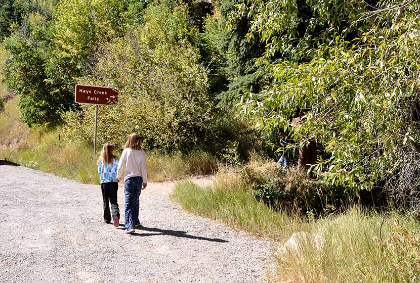
The is marked by a Hays Creek Falls sign. This may be a misspelling as signage and online maps have it named both "Hayes Creek Falls" and "Hays Creek Falls." That's why this trail profile alternates between the spellings. There is enough room for a handful of cars. Be sure to park well off the road and to be aware of cars traveling at highway speeds.
The Hike: Hayes Creek Falls
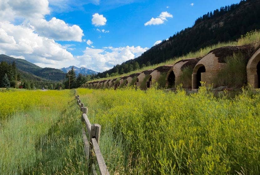
Hayes Creek Falls is more of a scenic stop than a hike, one of the places you visit while on this scenic countryside drive. Our family took in the waterfall on our return from one of our Fall Scenic Drives and camping trips. Along this same stretch of road, just two miles you'll also want to stop at the Redstone Historic Coke Ovens (pictured below). These are what remains from a turn-of-the-century coke operation that has been resorted by Pitkin County. These beehive structures look like something out of a fantasy novel or ancient Ireland.
The hike to the falls is just about 25 yards from the roadside sign. In early Summer the cascades of the waterfall gush with water. In the winter, Hayes Creek Falls is a popular ice-climbing destination as the waterfall turns into a giant layered sculpture of ice. There are no developed trails at Hays Creek Falls, with the exception of the short entrance trail. I noticed a few trails on the south side of the falls, and one may lead to the area above the falls, which looks to have a series of cascades. If exploring this area, be aware that it's easy to fall or to inadvertently kick rock and debris down and injure people below. A young man was killed at Boulder Falls while trying the to climb up unstable rock near the waterfall. So, be wise when exploring.
Looking for more waterfalls near Denver? Explore our more than 50 Colorado Waterfall Hikes, our favorite Waterfall Hikes in Rocky Mountain National Park, or 7 Waterfalls within One Hour of Denver.

Tips & Resources for Visiting Hays Creek Waterfall
- Stay in the Crystal Valley: There are a lot of camping options in the Crystal Valley and more places to visit. Nearby Avalanche Ranch has cabin rentals and hot springs, and the Redstone Inn offers great getaway packages.
- Packing List: Always pack the 10 Essentials. Download our Hiking Guide to get the list and dayhiking packing checklist.
- Colorado Road Conditions: Colorado Road Conditions
- Photo: We would like to express our gratitude to Glenn Merritt for sharing such an amazing photograph of this hike to Hays Creek Falls.
- After the Hike: The Village Smithy in Carbondale
Weather
Map & Driving Directions
Click for Driving Directions
Red Rock Canyon Hikes
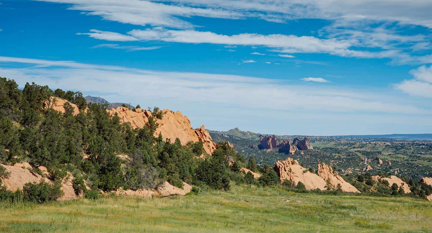
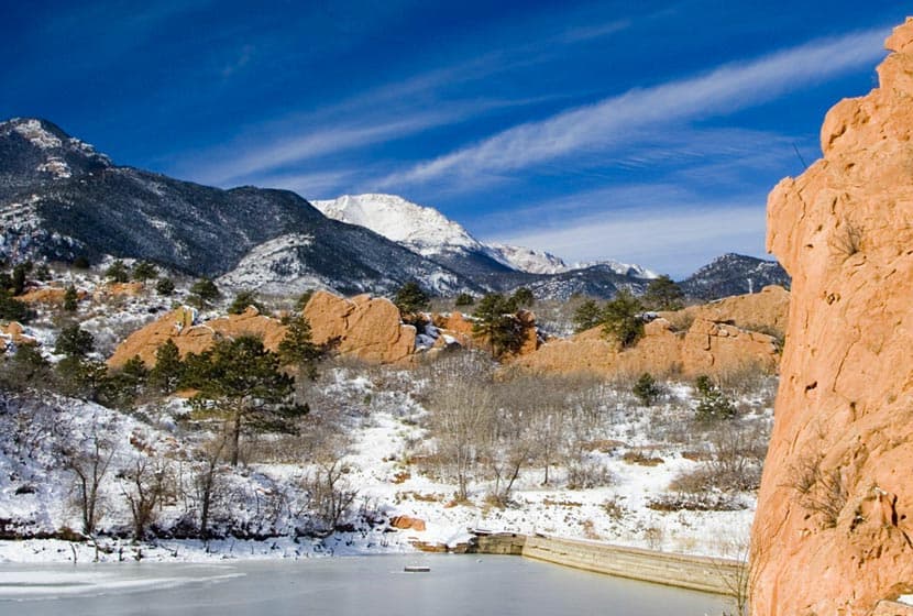
Red Rock Canyon Open Space features miles of easy hiking trails just a few miles west of Colorado Springs with views of Pikes Peak to the West and Garden of the Gods to the North. The park has two off-leash dog trails and most other trails are accessible to and shared by hikers, trail runners, and mountain bikers. Check out the full Red Rock Canyon Open Space hike profile below for trail map, driving directions, and more five different hike options to explore at this park near Colorado Springs.
Trail Snapshot: Red Rock Canyon Open Space
| Hike Distance | 1 to 3.3 miles Round Trip |
|---|---|
| Difficulty | Easy |
| Duration | Approx 1-2 hours |
| Trail Type | Loops and Out and Back Options |
| Starting Elevation | 6100′ |
| Elevation Gain | Approx +100′to +900' |
| Seasons | Year Round |
| Dogs | Allowed On Leash, Off Leash in Designated Areas |
| Hike Trail Map | Click for a Map of Red Rock Canyon Open Space |
| Denver Drive Time | 1hr 15min |
| Driving Directions to Red Rock Canyon Open Space | Click for Google Map |
| Town Nearest Hike | Colorado Springs, Colorado |
| Beauty | Red rock formations, migratory birds, ruins of red rock quarry, pond area, and deer. |
| Activities | hiking, mountain biking, trail running, snowshoeing, photography |
Parking & Trailhead Information for Red Rock Canyon Open Space
From Denver, take Interstate 25 south to Colorado Springs, taking the Cimarron St/24 West. Proceed about 3 miles West on Cimarron/24 and take a left onto Ridge Road. At the roundabout, take a left (by going around 3/4 of the roundabout). The parking lot and trailhead for Red Rock Canyon will be on your right.
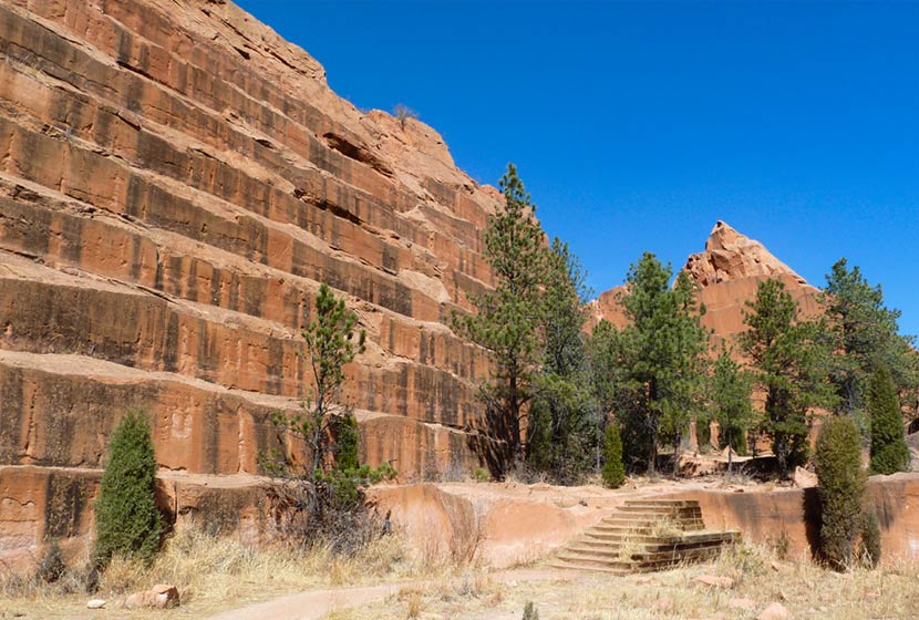
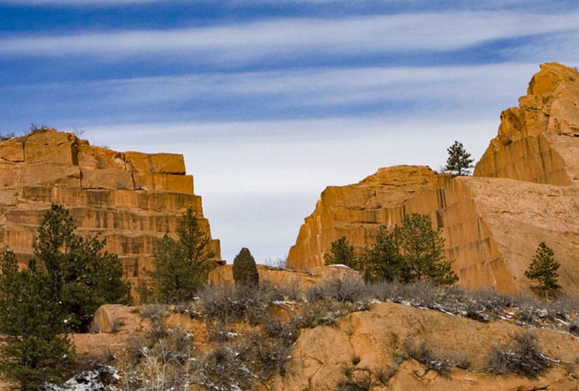
From the trailhead hikers can pick up two of the main trail arteries, the Mesa Trail that works its way through the middle of the park, and the Red Rock Canyon Trail, which runs along the east side. Both lead toward the most popular destination, the quarry.
5 Hike Options in Red Rock Canyon Open Space
-
-
The Dog Loops: 1/2 and 1 mile
-
The upper dog loop is an approximately one-mile curcuit, while the lower is about 1/2mile. Both are great options for a quick walk with the dog after work in a space set aside for off-leash exercise and play. You'll find these two off-leash dog trails immediately South of the parking lot.
-
-
Contemplative-Sand Canyon Loop: 1.75 miles
-
This short loop hike offers more peace and quite because it's tucked away along some of the red rock formations, and the Contemplative Trail segment is designated a hiker-only trail. Pick up the Contemplative trail by starting at the Sand Canyon Trail (West end of the parking lot). This will lead to the Contemplative Trail. You can hike the Contemplative Trail out-and-back, but hikers also have a loop option by joining back up with the Sand Canyon Trail and taking it back to the parking lot.
-
-
The Quarry Loop: 2 Miles
-
The most interesting destination in Red Rock Canyon is the old Quarry. If you've been in downtown Denver or Colorado Springs, you've probably seen old houses and buildings built with Red Rock cut from quarries like this one. One 2-mile loop option starts by taking the Red Rock Canyon trail to the east side of the Quarry (pick this trail up from the East end of the parking lot). This will run along to the back side of the quarry where you can take the old miner's steps up the side of the red rock. Once up and over, take the Quarry Pass Trail to the Mesa Trail, and hike the Mesa Trail North back to the parking area.
-
-
Hogback Valley-Lion Loop: 3.3 Miles
-
Starting at the east parking lot, pick up the Lower Hogback Tail. The trail will lead up to the Red Rock Rim Trail, then the Hogback Valley Trail taking you into a mesa of meadows with views into Colorado Springs and of Pikes Peak. Take a trail map with you as several trails will tie in together. Connect with the Lion Trail (the upper Codell Trail is more demanding, so be aware of this if choosing that option). Taking the Lion Trail North (right), it will lead back towards the parking area.
-
-
Mesa-Greenlee Loop: 3 Miles
-
This is probably the best hike in the park because it takes hikers through the heart of Red Rock Canyon along the gentle ridge of mesa where you can take in expansive views up to Pikes Peak and out to Garden of the Gods. Start at the Mesa Trail, taking it to the Southern end of the park where it connects with the Greenlee Trail. Return North via the Greenlee Trail to make this a 3 mile loop hike.
Tips & Resources for Hiking Red Rock Canyon Open Space
- TIP: The Southern end trails at Red Rock Canyon connect up with the following area trails: Intemann Trail, and Palmer Red Rock Trail, and others that lead south into Bear Creek Park.
- Nearby Hikes: The Crags Hike, Garden of the Gods Trails, and Helen Hunt Falls.
- Trail Map: Red Rock Canyon Open Space
- Packing List: Always pack the 10 Essentials. Download our Hiking Guide to get the list and dayhiking packing checklist.
- Colorado Road Conditions: Colorado Road Conditions
- Photo: We would like to express our gratitude to Brian Schultze, Sfgamchick, and Cody Wellons for sharing such an amazing photographs of this hike in Colorado Springs.
- After the Hike: Bristol Brewing Company
Weather
Map & Driving Directions
Click for Driving Directions
Agnes Vaille Falls Hike
Agnes Vaille falls is viewed on this 1 mile, easy, loop hike just south of Buena Vista, Colorado. Take in snow-capped Mt. Princeton and the white Chalk Cliffs of the canyon on what makes for a great family hike in the Arkansas River valley of Colorado.
Trail Snapshot: Agnes Vaille Falls
| Hike Distance | Approx. 1 mile |
|---|---|
| Difficulty | Easy to Moderate |
| Duration | Approx 1 hour |
| Trail Type | Loop |
| Starting Elevation | 9000′ |
| Elevation Gain | Approx +500′ |
| Seasons | Year Round |
| Dogs | Allowed On Leash |
| Hike Trail Map | Click for a USFS Map of Cascade Creek Loop |
| Denver Drive Time | 2hr 40min |
| Driving Directions to Agnes Vaille Falls | Click for Google Map |
| Town Nearest Hike | Buena Vista, Colorado |
| Beauty | Waterfall, Creek, Chalk Cliffs, Mountain Goats |
| Activities | Hiking, photography, USFS interpretive signs |
Parking & Trailhead Information for Agnes Vaille Falls
From Denver, take HWY 285 South for 124 Miles to Nathrop, Colorado. Take Chalk Creek Drive/CO-162 West for 8.7 miles into Chalk Creek Canyon. On this 8.7 mile segment, you'll Pass the Mt. Princeton Hot Springs Resort, then the Mt. Princeton USFS Campground. Just after the campground, the Cascade Creek Trailhead will be on the right, directly across from the Chalk Lake Campground. This whole segment of road, going up to St. Elmo has several camping options. Parking is limited at the Cascade Creek trailhead to about 12 vehicles. It's easy to miss the trailhead, so be sure to slow down and keep an eye out after you pass the Mt. Princeton Campground. The trail starts at the "Agnes Vaille" sign.
The Hike: Agnes Vaille Falls
The trail to Agnes Vaille Falls used to be a 1.2 mile out-and-back trip. Now, the upper segment is closed, so hikers are directed to take the approximately 1-mile loop hike on the Cascade Creek trail that still offers a view of the waterfall. Why did the upper trail to Agnes Vaille close? Sadly, in 2013, while on a family hike, a rockslide broke loose, tumbled down the canyon below the falls and killed 5 members of the hiking party. Plans are underway to rebuild the out-and-back trail, but no dates are posted for when it will be reopened. Follow the USFS regulations in this area as posted on the signage. The closed area of the trail may still be unstable and should not be hiked.
The Cascade Creek Loop creek still makes for a great family hike and offers views to the waterfall, and Mt. Princeton. The Chalk Cliffs surround the loop and look like something out of a storybook. In the fall, the aspen trees and cottonwoods glow with golden hues along the top bend of the loop. Mountain goats and bighorn sheep can be spotted along the rock above the trail.
Be sure to stop and read the USFS interpretive signs describing the history of the area, and the historical figures of of Agnes Vaille and Chief Antero for whom the waterfall and nearby 14er mountain, Mt. Antero, are named.
Tips & Resources for Hiking Agnes Vaille Falls
- Waterfall Peak: The best time of year to see Agnes Vaille falls will be in the early summer months of May and June, when the snowmelt is at it's highest volume. Some years, if we have a heavy snowpack or late snows, flows can still be high into July.
- Unstable Rock: While the areas is repaired and trail rerouted, this entire area is known for its unstable rock. Just a good look at the chalk cliffs gives you an idea of the geologic variety and instability of the area. Large boulders can shift and rocks accidentally knocked loose can injure hikers below. So, stay the trail, be alert, and follow the USFS regulations.
- Hike, Camp, and Soak: Because there is camping nearby, more hiking, and amazing hot springs, make a weekend visit fo the area to take in the sights and relax. Drive up further on Cascade Creek road to take in Alpine Lake and the Colorado ghost town of St. Elmo.
- Trail Map: Agnes Vaille Falls
- Packing List: Always pack the 10 Essentials. Download our Hiking Guide to get the list and dayhiking packing checklist.
- Colorado Road Conditions: Colorado Road Conditions
- Photo: We would like to express our gratitude to Brad Patterson for sharing such an amazing photograph of this hike at Agnes Vaille Falls.
- After the Hike: Soak at Mt. Princeton Hot Springs Resort

Weather
Map & Driving Directions
Click for Driving Directions
Horsethief Falls Hike Near Colorado Springs
Horsethief Falls is a small slab waterfall located 45 minutes from Colorado Springs on the West side of Pikes Peak. The Horsetheif Falls trail requires a 1.4-mile easy hike (one-way) to the falls. This hike, along with nearby Pancake Rocks make for great fall hiking and a scenic falls drive to see the golden aspens of the Colorado Front Range. The Horsethief Falls Trails joins up with two other trails if you would like to add more time to your adventure and explore the rock formations of this unique area. See the full Horsethief Falls hike profile below for trail map, driving directions, and more tips and details to help you enjoy this adventure near Colorado Springs.
Trail Snapshot: Horsethief Falls Hike
| Hike Distance | 2.8 miles Round Trip |
|---|---|
| Difficulty | Easy |
| Duration | Approx 2 hrs |
| Trail Type | Out and Back |
| Starting Elevation | 580′ |
| Elevation Gain | Approx +750′ |
| Seasons | May to October |
| Dogs | Allowed On Leash |
| Hike Trail Map | Horsethief Falls and Pancake Rocks Trail Map |
| Denver Drive Time | 2 hr |
| Driving Directions to Horsethief Falls Trailhead | Click for Google Map |
| Town Nearest Hike | Cripple Creek, Colorado |
| Beauty | waterfall, creek, pine, beaver ponds, rock formations, fall colors |
| Activities | Hiking, photography, mountain biking, snowshoeing, camping |
Horsethief Falls Trailhead Directions
Horsethief Falls trailhead is located just off of Highway 67 about halfway between Divide and Cripple Creek, Colorado. From Divide, turn south on Highway 67 and drive approximately 9.3 miles until you spot a closed railroad tunnel on the left side of the road. Just past the tunnel the road will bend and the trailhead parking area is on the left side of the road. Zoom in on the driving directions map at the bottom of this post to get a better visual on the parking area.
The Hike: Horsethief Falls Trail
The Horsethief Falls Trail begins on right side of the old tunnel exit, following a wide dirt path steadily uphill before eventually flattening out. The elevation gain for this hike is just a bit over 500', so we considered grading its difficulty-level as moderate. However, because it's just 1.4 miles one-way, we kept it in the Easy hikes category.
The trail will cross the shallow creek at about 0.7 mile in. Here, hikers will encounter the first intersection. The Ring the Peak Trail (marked "Horsethief Park Trail" on the map) bears to the left, but the way up to Horsethief Falls is to continue straight on the Horsethief Falls Trail. Crossing the creek again the trail will soon intersect, at about 0.9 mile, with the Pancake Rocks Trail (on the right). Again, continue straight on the Horsetheif Falls trail. In this area, you'll be able to take in views to the northeast of Sentinel Point. This is an almost perfect area to take in the changing aspens along the forests surrounding Pikes Peak.
The trail will bend to the right (south) and cross over the creek once again and make its way up to the base of Horsethief Falls.
Tips & Resources for Hiking Horsethief Falls Hike
- TIP: To make the trail longer, you may opt to proceed to the Ring the Peak Trail to Putney Gulch via Horsethief Park, or hike up to Pancake Rocks Trail.
- Go Early: Parking is limited and that can be a problem.
- Trail Map: Horsethief Falls Trail Map
- Packing List: Always pack the 10 Essentials. Download our Hiking Guide to get the list and dayhiking packing checklist.
- Colorado Road Conditions: Colorado Road Conditions
- After the Hike: Home Café in Cripple Creek
Weather
Map & Driving Directions
Click for Driving Directions
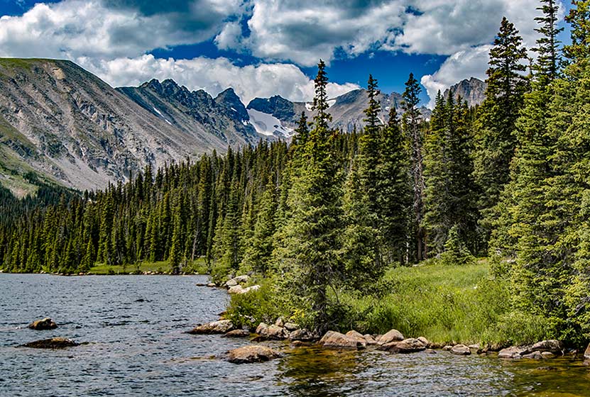
Long Lake Loop in Indian Peaks
Long Lake offers an easy 1.5 mile loop hike in Indian Peaks Wilderness. Located about 1 hour West of Boulder, Colorado, Long Lake is an easy-to-access alpine lake with stunning scenery. It's a popular spot, especially in the Summer months, so be sure to read the details on access fees and the notes below on the Long Lake Trailhead. Explore the full trail profile for trail maps, driving directions to Long Lake and more.
Long Lake in Indian Peaks - Trail Snapshot
| Hike Distance | 0.6 mile or 1.5 miles |
|---|---|
| Difficulty | Easy |
| Duration | Approx 1 hr |
| Trail Type | Out and Back & Loop |
| Starting Elevation | 10,500′ |
| Elevation Gain | Approx +100′ |
| Seasons | Mid-June to Mid-Oct. Depending on Weather |
| Dogs | Dog Prohibited in specific Brainard Rec. areas and on Jean Lunning and Pawnee Pass Trails. See USFS page for details. |
| Hike Trail Map | Click for a Map of Long Lake Area in Indian Peaks |
| Denver Drive Time | 1hr 30min |
| Driving Directions to Meyer Homestead Trailhead | Click for Google Map |
| Town Nearest Hike | Ward, Colorado |
| Fee: | Entrance Fee to Brainard Rec. Area Required |
| Beauty | Lake, mountain peak views, wildflowers, moose/td> |
| Activities | Hiking, cross-country skiing, snowshoeing, photography |
Parking & Trailhead Information for Long Lake Loop
Note: This trailhead can only be reached by using Brainard Lake Road, which has seasonal closures. Because the Brainard Lake Recreation area is extremely popular, this entrance road experiences high amounts of traffic during weekends on the Summer. See the USFS page for details. For Brainard Lake Road closure status, see the Boulder Ranger District roads page.
From Boulder, Colorado, head North on US36/28th Street. Take a left onto Lee Hill Road. Lee Hill Road will dead-end at an intersection with Left-Hand Canyon Road. Take a left onto Left-Hand Canyon Road heading West. Eventually, Left-Hand Canyon Road will turn into Indiana Gulch Road and will turn into Utica Road upon entering the town of Ward, Colorado. Utica turns into Nelson Road (lots of name changes on this trip) then ends at an intersection with 72/Peak to Peak Highway. Take a right onto 72, then the almost immediate next turn will be on your left for the Brainard Lake Road. Travel on Brainard Lake Road 2.2 miles to the entry station where you will need to pay the fee for the recreation area. As you approach the lake, bear right to continue on the Brainard Lake Road for another 1/2 mile, then turn right onto Mitchell lake Road. Go less than 1/10th of a mile, then turn left onto Long Lake Road. After about 1/3 of a mile, you will have arrived at the Long Lake Trailhead and parking area.
In the winter, the Brainard Lake Recreation area is a popular snowshoeing and cross-country skiing destination. However, all parking is at the Brainard Lake Gateway Trailhead (near the access gate). It is approx. 4-miles one-way from the Brainard Lake Gateway Trailhead to the Long-Lake Trailhead.
The Hike: Long Lake Loop Hike
From the Long Lake Trailhead, it's an easy and short 0.3-mile hike to Long Lake. Returning via this trail makes this a 0.6-mile out-and-back trip. However, to really take in the best of the Rocky Mountain Scenery, we recommend doing the full 1.5-mile loop.
Having reached the northeastern edge of Long Lake, head south over a footbridge and pick up the Jean Lunning Trail. The Jean Lunning trail travels alongside the southern perimeter of Long Lake and offers stunning views of the jagged mountain peaks surrounding the lake. Eventually, the Jean Lunning trail will intersect with the Pawnee Pass Trail. Take a right on the Pawnee Pass trail to head east and back to the short connector trail that leads back to the trailhead.
Tips & Resources for Hiking Long Lake
- TIP: During the Summer, avoid the traffic by visiting Long Lake during the weekdays. Arrive at the trailhead in the early morning to secure a parking place.
- Trail Map: Brainard Lake Area, Long Lake Trail Map
- Packing List: Always pack the 10 Essentials. Download our Hiking Guide to get the list and dayhiking packing checklist.
- Colorado Road Conditions: Colorado Road Conditions
- Photo: We would like to express our gratitude to Matt Lewis and Max and Dee Berntfor sharing photographs of this hike on Long Lake
- After the Hike: Marrocco’s
Weather
Map & Driving Directions
Click for Driving Directions

Shanahan Ridge Hike Near Boulder
The Shanahan Ridge Loop Hike is an easy, 4-mile lollipop-loop trail with stunning views of the Shanahan Ridge of the Flatirons in Boulder, Colorado. Explore the full Shanahan Ridge Loop hike profile below for trail map, driving directions, and more tips and details to help you enjoy this hike in Boulder.
Trail Snapshot: Shanahan Ridge Loop Trail in Boulder, Colorado
| Hike Distance | 4 Miles |
|---|---|
| Difficulty | Easy |
| Duration | Approx 2 hrs |
| Trail Type | Lollipop-Loop |
| Starting Elevation | Approx. 5500′ |
| Elevation Gain | Approx +900′ |
| Seasons | Year Round |
| Dogs | Allowed On Leash |
| Hike Trail Map | Click for a Map of Shanahan Ridge Trail |
| Denver Drive Time | 40 Min |
| Driving Directions to Shanahan Ridge Trailhead | Click for Google Map |
| Town Nearest Hike | Boulder, Colorado |
| Beauty | meadows, wildflowers, peak views, pine forest |
| Activities | Hiking, Photography, Trail Running |
Parking & Trailhead Information for Shanahan Ridge Loop Trail
The Shanahan Ridge Trailhead is located just along Lehigh Street south of Boulder. From US 36, follow Table Mesa Drive West to its intersection with CO 93. Turn left onto 93 and follow it for less than a mile. Turn right onto Greenbriar Boulevard which eventually becomes Lehigh Street. The trailhead is on the left/southwest side of the road and marked by a trail post and trash receptacle. There is actually no parking lot because the trailhead is located in a residential area. Because of this please exercise extra care and respect for the residents as you park along Lehigh or adjacent streets. Be aware of city parking signage.
The Hike: Shanahan Ridge Loop Trail
The Shanahan Ridge loop is best hiked clockwise in order to gain the best views of the Flatirons and surrounding countryside. Going left on the first junction will take you onto a connector trail that will next intersect with the South Fork Shanahan Trail. This trail begins with a gradual ascent which becomes more demanding. If you are acclimatized to the altitude and hike a fair amount, you'll find this segment easy; but beginner hikers and those of us who are not in the best of shape will find this a moderately demanding trail.
Continue on the South Fork Shanahan Trail for about 1.8 miles as it weaves through ponderosa forest and opens out to captivating vistas of the Flatirons. The trail will terminate at a junction with the Mesa Trail. Follow this trail North (right) as it winds along the base of the Shanahan Ridge of the Flatirons.
After approximately a 1/2 mile on the Mesa trail, it will intersect with the North Fork Shanahan Trail. Taking a right onto the North Fork Shanahan leads backdownhill for about 1.3 miles to the trailhead.

Tips & Resources for Hiking the Shanahan Ridge Loop
- TIP: Check ahead for trail closures.
- More Hikes in the Flatirons: Royal Arch Trail, First and Second Flatirons Hike, and Enchanted Mesa Hike.
- Trail Map: Shanahan Ridge Loop Trail
- Packing List: Always pack the 10 Essentials. Download our Hiking Guide to get the list and dayhiking packing checklist.
- Colorado Road Conditions: Colorado Road Conditions
- Photo: We would like to express our gratitude to Dave Dugdale and John Giez for sharing their photographs of this hike.
- After the Hike: The Parkway Cafe
Weather
Map & Driving Directions
Click for Driving Directions
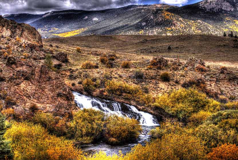
Tarryall Falls Near Jefferson, Colorado
The Tarryall Falls Trail is a short, 1/4 -mile hike across a small canyon to a waterfall that pours into Tarryall Creek. The slopes of snow-capped peaks along Boreas pass make for a majestic backdrop against the contrasting sage grasslands of surrounding South Park.Tarryall Falls draws its waters from the Tarryall Reservoir, a popular camping and fishing destination here in the high-plains. Explore the full Tarryall Falls hike profile below for trail map, driving directions, and more tips and details to help you enjoy this adventure near Jefferson, Colorado.
Trail Snapshot: Tarryall Falls Hike
| Hike Distance | 0.4 mile Round Trip |
|---|---|
| Difficulty | Easy |
| Duration | Approx. 30 min |
| Trail Type | Out and Back |
| Starting Elevation | 8900′ |
| Elevation Gain | Less than 100′ |
| Seasons | Year Round |
| Dogs | Allowed On Leash |
| Hike Trail Map | Click for a Map of Trail to Tarryall Falls |
| Denver Drive Time | 1 hr 45 min |
| Driving Directions to Trail Parking | Click for Google Map |
| Driving Directions to Falls Viewing Parking (no hike required) | Click for Google Map |
| Town Nearest Hike | Jefferson, Colorado |
| Beauty | Waterfall, Creek, Lake |
| Activities | Hiking, fishing, photography, camping, picnic areas and grills |
Parking & Trailhead Information for Tarryall Falls Hike
From Denver, take HWY 285 South to Jefferson. In Jefferson, turn left onto CR77 and continue for about 17 miles. The parking pullout is on the southern tip of the reservoir on the right-hand side of the road. This is about 1hr 45 min drive.
From Colorado Springs, take US 24 toward Divide. At 5.4 miles west of Florissant turn right to Tarryall Road / CR 77. Continue on CR 77 for about 24 miles. This stretch makes for a beautiful drive, especially just before sunset when the Tarryalls are lit up all pink and orange. Just after mile 24, there will be a pullout parking area on the left side of the road alongside the reservoir. The hike description below begins at this parking area. This is about a 1hr 30 min drive from Colorado Springs.
The roadside viewing area is easily accessed by turning on to Turner Gulch Road. The parking area is located on the right-hand side of the road soon after turning onto Turner Gulch road.
The Hike: Tarryall Falls Hike
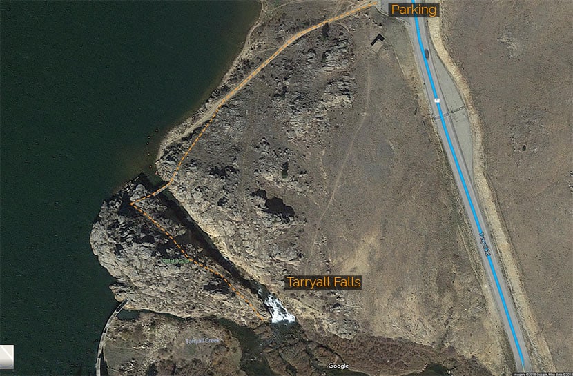
It's less than a 1/4 mile jaunt from the parking area to the waterfall, but be aware that the trail winds through some rocky and loose terrain on this unmaintained trail. The trail begins on the gravel path that heads down toward the reservoir then descends to a footbridge spanning Potato Gulch, a small canyon that serves as an overflow from the reservoir back into Tarryall Creek. I've marked the trail on the map above, but this is intended for general reference only. Take care as you navigate the trail as it winds through the rock on the other side of the footbridge. The path will lead to the top of the waterfall, then eventually down to the base of the falls. This area is not recommended for pets or children and if present should be supervised.
As mentioned in the driving directions above, the stretch of road between Tarryall Reservoir and Lake George is one of my favorites for sunsets. Like the Flatirons of Boulder, the Tarryalls have a pink and orange hue but showcase deeper reds, especially at dusk. When the sunlight hits the rock, the mountains seem to come alive.
Hikers coming from Denver can make a day of it by first visiting the trails along Kenosha Pass, then driving to Tarryall Falls. From there, drive South on CR77 to Lake George, taking in the Tarryall Mountains until you come back out to HWY 24. Follow Highway 24 South to visit Rainbow Falls in Manitou Springs. Grab a bite to eat in Manitou or Colorado Springs, then stop by and visitHelen Hunt Falls. All three waterfalls in this driving loop require very little hiking. Finally, take Interstate 25 North back to the Denver area.
Tips & Resources for Hiking Tarryall Falls Hike
- TIP: Exercise care on this short trail as it is not an officially established or maintained trail.
- TIP: All fishing requires a State of Colorado Fishing License
- Tarryall Reservoir Area Map: Tarryall Reservoir State Wildlife Area
- Packing List: Always pack the 10 Essentials. Download our Hiking Guide to get the list and dayhiking packing checklist.
- Colorado Road Conditions: Colorado Road Conditions
- Photo: We would like to express our gratitude to Michael Roberson and Christopher Rosenberg for sharing such an amazing photographs of Tarryall Falls and nearby mountains.
- After the Hike: The Shaggy Sheep in Grant, Colorado.
Weather
Map & Driving Directions
Click for Driving Directions
Ridgeline Open Space Hike
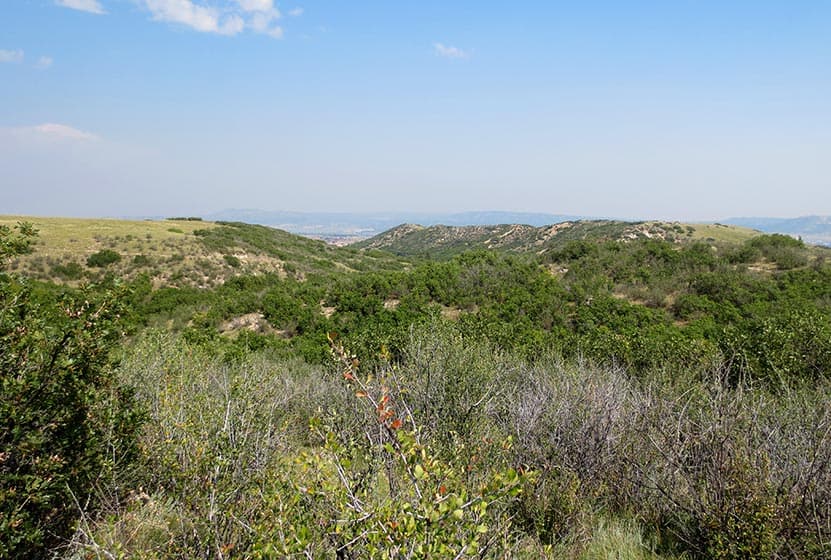
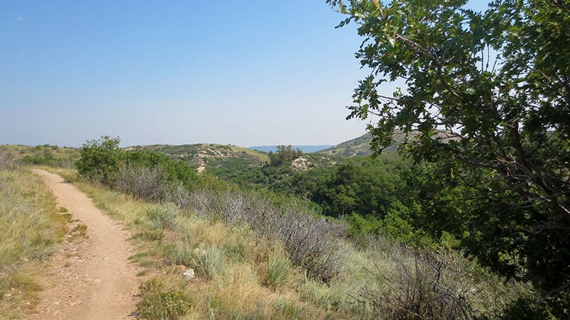
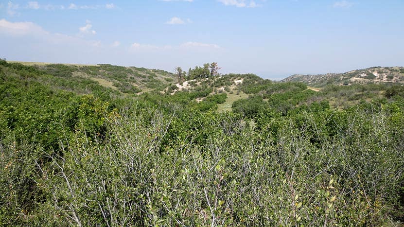
Ridgeline Open Space is nestled in the Meadows residential area of Castle Rock. This network of over 13 miles of trails winds through elevated grasslands and gamble oak with a backdrop of distant snow-capped peaks of the Front Range. Hike it or bike it for a quick escape from the work week. Explore the full Ridgeline Open Space hike profile below for trail map, driving directions, and more tips and details to help you enjoy this adventure in Castle Rock.
Trail Snapshot: Ridgeline Open Space Trail near Castle Rock, Colorado
| Hike Distance | 1 to 13.4 miles |
|---|---|
| Difficulty | Easy |
| Duration | Approx 1hr+ |
| Trail Type | Multiple Loops and Out and Back Options |
| Starting Elevation | 6600′ |
| Elevation Gain | Approx +200′ |
| Seasons | Year Round |
| Dogs | Allowed On Leash |
| Hike Trail Map | Click for a Map of Ridgeling Open Space Trails |
| Denver Drive Time | 40 min |
| Driving Directions to Meyer Homestead Trailhead | Click for Google Map |
| Town Nearest Hike | Castle Rock, Colorado |
| Beauty | grasslands, small stands of pine trees, mountain views, wildflowers, wildlife: rattlesnake, western bluebirds |
| Activities | Hiking, mountain biking, trail running |
Parking & Trailhead Information for Ridgeline Open Space
From Denver, follow Interstate 25 south to Castle Rock and take Exit 182 and go west on Wolfensberger Road. Turn right onto Coachline and follow this until to Ridgeline Open Space Trailhead (on the left-side of the road). There is a restroom and map at the trailhead. Alternatively, hikers can park at Bison Park in Castle Rock and access one of the several neighborhood access trails that lead into Ridgeline Open Space.
The Hike: Ridgeline Open Space
Ridgeline Open Space is one of our family's favorite places to hike because it's right in our backyard here in Castle Rock. The residents of Castle Rock also use the 13.4 miles of trail for trail running and mountain biking. It's quite a labyrinth of trails, but because it's located right in the heart of a residential area, it's hard to get lost (if you stay on the trail). There are maps posted at several junctions and trailheads along the network in the case you need to reorient yourself. Or print the map from the link above and bring it with you.
Our approach is usually to go up to Ridgeline for an afternoon and see where the trails take us. You'll likely encounter mountain bikers along the trail. Most are locals and are very considerate of hikers. Less considerate are the rattlesnakes. I've yet to run into one, but my neighbor was stopped short by a rattler recently while trail running. Rattlesnakes are only aggressive when threatened, but they are easy to stumble upon because they are so well camouflaged. So, keep your eyes peeled as you hike. Mountain Lions also frequent the area--like most trails along the Front Range--because of the plentiful deer population. It's wise to always keep your kids near when hiking and not running up the trail ahead on their own. This is just good practice on any trail, but I mention it because we have seen Mountain Lion prints in the mud on one of the western trail segments.
Ridgeline is aptly named because it is situated above the town and offers great views out to Longs Peak, Indian Peaks, Mt. Evans, Devil's Head to the west, and Pikes Peak to the south. Deer bed down in the grass between the gamble oak and birds flit from tree to tree along the trails.

Tips & Resources for Hiking the Ridgeline Open Space Trail
- Rattlesnakes: Keep an eye out for rattlesnakes that sun themselves on rock and the packed, warm surface of the trail.
- Hiking with Kids: As always, hike as a group, keeping small children near you. Mountain lions live in the area (as with most front-range hikes), and the sight of a small creature running alone on the trail can signal a lion's prey response.
- Sunscreen: This hike is 100% exposed to the sun's rays, so be sure to wear a hat and apply that sunscreen.
- More Hikes in Castle Rock Colorado: Castle Rock Trail, Waterfall at Castlewood Canyon, East Plum Creek Trail.
- Trail Map for Ridgeline Open Space Trail near Castle Rock: Trail Map Link
- Packing List: Always pack the 10 Essentials. Download our Hiking Guide to get the list and dayhiking packing checklist.
- Colorado Road Conditions: Colorado Road Conditions
- After the Hike: Crave Burgers
Weather
Map & Driving Directions
Click for Driving Directions
Bear Canyon Loop Hike at NCAR
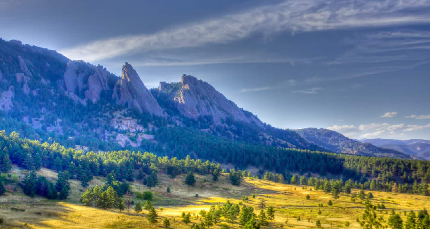
The Bear Canyon Loop Hike near Boulder, Colorado is a beautiful trail that spans wide open spaces and meadows near National Center for Atmospheric Research. The Bear Canyon Loop is a relatively easy 3.3-mile loop that features some of the best views of the Flatirons in Boulder. Explore the full NCAR Bear Canyon Loop hike profile below for trail map, driving directions, and more tips and details to help you enjoy this adventure near Boulder.
Trail Snapshot: Bear Canyon Loop Trail in Boulder
| Hike Distance | Approx 3.5 Miles |
|---|---|
| Difficulty | Easy |
| Duration | Approx. 2 hrs |
| Trail Type | Loop |
| Starting Elevation | 6080′ |
| Elevation Gain | Approx +400+′ |
| Seasons | Year Round with Winter Closures |
| For Closure Updates: | Boulder Open Space Closures |
| Dogs | Allowed On Leash |
| Hike Trail Map: | Click for a Map of Bear Canyon Loop |
| Denver Drive Time | 40 Min |
| Driving Directions to NCAR Trailhead | Click for Google Map |
| Town Nearest Hike | Boulder, Colorado |
| Beauty | Canyon, Creek, Wildflowers, Meadows, Wildlife: Mule deer |
| Activities | Hiking, Photography, Birding, Running |
Parking & Trailhead: Bear Canyon Loop Trail
The National Center for Atmospheric Research (NCAR) Trailhead is located about 40 minutes North of Denver. From Denver, follow U.S. Route 36 to Boulder. Take the exit for Table Mesa Drive and follow it West. It will wind through a neighborhood to the end as it winds through the neighborhood and past Bear Creek Elementary School. The road will turn into the Drive for NCAR which winds up and around to a large parking area at the lab.
The Hike: NCAR Bear Canyon Loop Trail
From the NCAR Parking area, hikers can pick up the NCAR trail just West of the main entrance to the building. The trail heads West, over a small ridge, past a water tank, then to a fork in the trail. Both the left and the right fork are considered the NCAR trail and both will lead to the Table Mesa Trail--but the left fork is shorter. At approximately 0.7-mile into the hike, the NCAR Trail will intersect with the Table Mesa Trail. Straight through takes hikers up on a 0.8-mile hike up to Mallory Cave, but for this loop hike, the correct way is to go left/South onto the Table Mesa trail. This first stretch provides some incredible views of the magnificent Flatirons Formations of Boulder. This trail segment heading south goes in and out of a forest grove, then the trail comes to its second important intersection.
At the Bear Canyon Trail intersection, take a left onto the Bear Canyon Trail which follows Bear Creek as it descends East. At about 1.5 miles into the hike, you'll encounter another fork. You can cut off about 1/4 of a mile of the trail by taking the left-hand segment. But the right-hand trail provides more pleasant scenery along the creek. The trail will near a neighborhood then bend to the North. This straight 0.7-mile stretch follows along the Eastern boundary of NCAR. Eventually, it meets up with the NCAR trail, which will lead back on a 1/2 mile stretch to the parking area.
Tips & Resources for Hiking the NCAR Bear Canyon Loop
- Wildlife Aware: Like many of the trails in the Boulder area, keep alert because mountain lions and black bears frequent the area. Know what to do if you encounter a Mountain Lion or a Black Bear.
- Trail Map: NCAR Bear Canyon Loop Trail
- Packing List: Always pack the 10 Essentials. Download our Hiking Guide to get the list and dayhiking packing checklist.
- Explore More Flatirons Hikes in Boulder: First Flatiron Hike, Gregory Canyon Hike, Green Mountain, Enchanted Mesa Hike, and Royal Arch Trail.
- Colorado Road Conditions: Colorado Road Conditions
- Photo: We would like to express our gratitude to Dave Dugdale for sharing such an amazing photograph of this NCAR Bear Canyon Loop Trail with a view of the Flatirons.
- After the Hike: The Parkway Cafe
Weather
Map & Driving Directions
Click for Driving Directions